CLICK HERE TO KNOW MORE
|
|
|
- Theodore Wilkinson
- 5 years ago
- Views:
Transcription

1 CLICK HERE TO KNOW MORE


2 Digital Agriculture for Food and Soil Security Suhas P Wani Director, Regional Program Asia & Director, ICRISAT Development Center


3 A Global R&D Organization for Semi-Arid Agriculture Our locations Vision A prosperous, food-secure and resilient dryland tropics Mission To reduce poverty, hunger, malnutrition and environmental degradation in the dryland tropics


4 Challenges of the 21 st Century Water scarcity Land degradation Low water and nutrient use efficiency Low agricultural productivity Poverty 5177 m m m ha
5 Rainfed Agriculture: A Large Untapped Potential Current farmers yields are lower by 2 to 5 folds than the achievable yields Vast potential of rainfed agriculture needs to be harnessed
6 Large yield gap- Opportunity to harvest Huge untapped potential Yield Gaps in Karnataka 7000 Potential Farmers' 6000 (68) Yield (kg ha -1 ) (179) (325) (174) (276) (361) (102) (118) (88) (170) Yield potential of elite germplasm is not realized because of soil degradation 0 Kharif Sorghum Pearl millet Groundnut Pigeonpea Chickpea Rice Cotton Ragi Sunflower Maize Crop Yield Gap of Soybean in MP Potential yield Farmers' yield (kg ha -1 ) Rajgarh Ujjain Jabhua Sehore Nimuch MP
7 Why Digital Agriculture Information Generated GoI 26 States and 7 UT 15 Agroclimatic zones Four crop seasons ICAR State Agri Universities 1. Farmers' records 2. land records 3. Land and soil characteristics 4. Weather records 5. Best management practices 6. Water resources availability Bridging gap between solutions and farmer? 687 Districts Rainfed and Irrigated Agri Research Centers Key constraints 138 million >600,000 villages >100 Crops Agri Science Center 1. Water scarcity 2. Land degradation 3. Low yielding cultivars 4. Poor water management 5. Climate change 6. Lack of access to market 7....

8 Why Digital Agriculture
9 Spatial Data Infrastructure in Agriculture Land is base for all farm based activities All entities need to be mapped to land parcels A platform for developing decision support systems A tool for preparing knowledge based development plans and adopting agriculture management practices
:Soil mapping as entry")
 are")
10 Bhoochetana (Soil Rejuvenation):Soil mapping as entry point Widespread deficiencies of micronutrients (> %) are recorded in farmers fields
11 Soil Fertility Atlas: Stratified soil sampling Stratification of land Participatory approach for soil sampling Large Total geo-referenced samples were collected Black Small and marginal Parameter analyzed: ph, EC, Top Red Medium organic carbon, phosphorous, potassium, Land Middle sulfur, boron, zinc Low

12 Soil Maps


13 Soil Health Knowledge Dissemination


14

15 Farmer to Farmer Video Hadycam being used for recording the videos in field. Farmer facilitator is screening the video for group of women using battery operated portable projector
16 Farmer to Farmer Video Hadycam being used for recording the videos in field. Farmer facilitator is screening the video for group of women using battery operated portable projector
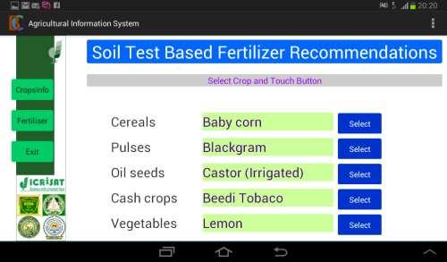


17 Applications based on soil fertility data

18 Spatial Variability (Improved vs Farmers Practice)

19 Impact Increased crop yield by 20 66% Rise in agriculture growth annually above 5% since 2009 Benefit cost ratio for the farmers 3-14:1 resulting in average gain of US$500 per ha per season Net benefits accrued in 5 years US$ 353 million

20 Great Variability in rainfall and Monsoon Setting Time Great year-to-year variability exists, making rainfed cultivation a challenge
 Current observed rainfall and predicted rainfall for the next five days Advisory is communicated thru voice mail and")
21 ICRISAT, Microsoft and awhere Developed Sowing Date App under AP Rythu Kosam Project Developed sowing date application Piloted in 2 districts based on water balance calculations taking into consideration rainfall forecast from awhere using Moisture Adequacy Index (MAI) Current observed rainfall and predicted rainfall for the next five days Advisory is communicated thru voice mail and SMS based on the Predicted Sowing Date


22 Components of Sowing app Rainfall data: Actual Forecast Soil water balance simulation Sowing period Soil properties

23 Devanakonda, Kurnool district Groundnut yields in Kharif 2016 Figures above blue bars indicate percentage increase in yield


24 Media Coverage New App Promises to Tell Indian Farmers When to Sow Crops Farmers in Andhra Pradesh can sign up for an app that shows them the weather and prime planting days By Vibhuti Agarwal Jun 17, :00 pm IST Monsoon season in India has just begun, but farmers in Andhra Pradesh, a southeastern coastal state of India, won t need to look to the skies to know when to sow their crops. A new mobile application launch earlier this month and developed by a local agricultural research institute, Microsoft India and the state government
25 Advisories based on sowing date application Date 15 Jun Jun Jun Jun Jun Jul Jul Aug Oct Oct 2016 Topics Keeping required fertilizers ready as per soil-test based recommendation, land preparation, farm yard manure application Sowing recommendation, seed treatment, optimum sowing depth, preventive weed management Weed management, maintaining proper plant density Observing Boron and Zinc deficiency in field and applying nutrients if needed Recommendation on harvesting, shade drying of harvested pods and storage


26 Need for Water Saving Technologies/ Knowledge: Water Impact Calculator Farmers have little access to new knowledge/technologies in developing countries Complex and data intensive water balance models and other technologies are used by researchers Farmer-friendly knowledge-based decision support system is urgently needed Not only water could be saved but also nutrient use efficiency productivity could be enhanced with minimal degradation of natural resources
, Decision Support System (DSS), and Land Resource Inventory (LRI) portal for effective planning, implementation and")
27 Sujala III: Digital Library (DL), Decision Support System (DSS), and Land Resource Inventory (LRI) Portal Objective: To facilitate WDD for establishing Digital Library (DL), Decision Support System (DSS), and Land Resource Inventory (LRI) portal for effective planning, implementation and monitoring of watersheds and other developmental activities

28 Components of LRI in Sujala III LRI Digital Library LRI Data Centre LRI Decision Support System S u j a l a LRI Portal LRI Clearinghouse LRI Mobile Application
29 Digital Agriculture: Upgrade Delivery Systems For effective delivery, monitoring and information dissemination for achieving the impact ICT for innovative extension systems Green SIM card distribution to farmers ICRISAT in collaboration with Microsoft piloted Climate/Weather information services & advisories in Kurnool and Kadappa (~500 farmers) Use of Satellite imageries for mapping crop area under irrigation (Nellore) Water impact calculator is developed and pilot tested.


30 Thank You