Towards integrated urban and horticultural planning in Hanoi and Nanjing
|
|
|
- Lisa Matthews
- 5 years ago
- Views:
Transcription


")
1 Towards integrated urban and horticultural planning in Hanoi and Nanjing A report of the searusyn project team Leo van den Berg, Dinh Thi Hai Van, Shi Xiaoping & Ben Kamphuis (editors) Alterra-rapport 1395, ISSN
2 Towards integrated urban and horticultural planning in Hanoi and Nanjing
3 This project is funded by the European Union under the INCO-DEV program. The project is co-sponored by the Research Programme 'International Cooperation' of the Netherlands Ministry of Agriculture, Nature Management and Food Quality 2 Alterra-rapport 1395
4 Towards integrated urban and horticultural planning in Hanoi and Nanjing A report of the searusyn project team Leo Van Den Berg Dinh Thi Hai Van Shi Xiaoping Ben Kamphuis (editors) Alterra-rapport 1395 Alterra, Wageningen, 2006
5 ABSTRACT Leo Van Den Berg, Dinh Thi Hai Van, Shi Xiaoping & Ben Kamphuis (editors), Towards integrated urban and horticultural planning in Hanoi and Nanjing. Wageningen, Alterra, Alterra-rapport blz.; 50 figs.; 41 tables.; 13 refs. In an international and interdisciplinary research project, partly funded by the European Union, the possibilities were explored of having specialized horticultural production around East Asian cities benefit from urban growth. Anywhere in the world, farmers around cities have to cope with two contradictory trends. The inhabitants of the rapidly expanding cities like Hanoi and Nanjing not only enjoy eating fresh vegetables but also eat up some of the most productive farmland where these vegetables are grown for new housing estates and other urban functions. After analysing and comparing the general speed, directions and mechanisms of physical expansion in both cities over the last decade the research team focused on one pilot area in each city. In these pilot studies it became clear that, next to many farmers who were not able to make much money from agriculture and are therefore quite happy to shift to urban jobs, there is an important group of knowledgeable and ambitious market gardeners, who do make a good living out of horticulture. How could urban planners take the skills and ambitions of these people into consideration and cooperate with agricultural planners, while designing and developing urban growth? Several workshops were held and examples from Europe and other parts of the world were discussed with all stakeholders to see how productive open spaces could become an integral part of the new urban areas. For both pilot areas different scenarios were made to make the stakeholders see the possible effect of combining urban interests with those of sustainable, specialised agricultural production that should be attractive for urban residents to encounter on a daily basis. We conclude that this project has made the planners in both cities aware of the advantages and possibilities of working together in the further expansion of Hanoi and Nanjing towards the integration of highly productive green spaces with serious farmers in the further expansion of Hanoi and Nanjing. Keywords: agro-tourism, China, green belts, horticulture, migrant farmers, migrant labour, peri-urban agriculture, productive urban open space, rural-urban interface, safe vegetables, scenario, urban green space, urban growth, urban planning, Vietnam ISSN This report is available in digital format at A printed version of the report, like all other Alterra publications, is available from Cereales Publishers in Wageningen (tel: +31 (0) ). For information about, conditions, prices and the quickest way of ordering see Alterra P.O. Box 47; 6700 AA Wageningen; The Netherlands Phone: ; fax: ; info.alterra@wur.nl No part of this publication may be reproduced or published in any form or by any means, or stored in a database or retrieval system without the written permission of Alterra. Alterra assumes no liability for any losses resulting from the use of the research results or recommendations in this report. 4 Alterra-rapport 1395 [Alterra-rapport 1395/12/2006]
6 Contents Preface 7 1 Introduction to the research project Project background and objectives Project activities and phasing Project partners Structure of the report 12 2 Hanoi, a fast growing city General introduction Population growth and urban expansion Major changes in agriculture Agricultural land use Contributions of agriculture to Hanoi s economy Hanoi land use planning 22 3 Dong Du, a village in peri-urban Hanoi Main features of Dong Du Natural conditions Economic and social conditions The impact of urbanisation on Dong Du commune Transfer of residential land use Occupation Income Opinions about the urbanisation process Difficulties faced by farmers Expectations of local people Expectations of the officials of People s Committee Plans for the future Agricultural activities under urbanisation process Animal husbandry Cultivation Marketing of herbs Agricultural conditions Infrastructure for agricultural activities Soil for agricultural activities Water for agricultural activities 48 4 Scenarios for future development of Dong Du Farmers expectations Establishment of specialising areas Infrastructure improvement: Establishment of Dong Du trademark, finding markets and price stabilisation Preservation and processing herbs Reduce environmental pollution Enhance knowledge for agricultural production Scenario s for integrated solutions 60
7 4.2.1 Starting points for the scenarios Scenarios The two scenarios under discussion: a policy context of the future Conclusions: some indications for the future development of agriculture in periurban Hanoi 72 5 Nanjing, a fast growing city Introduction Development of urban area and population Major changes in agriculture Nanjing landuse planning 82 6 Suoshi - a village of Qilin Town in peri-urban Nanjing Introduction and description of Suoshi village Impact of urbanisation on Suoshi village Urbanisation pressure Impact of urbanisation Agriculture situation in Suoshi village Land use description Farmers types and its changing process Agriculture production and sale Non-agricultural production Natural and the social environment on agricultural production Natural environment Social environment Summary Conclusion Scenarios for future development of Suoshi Introduction Farmers expectations Flower farmers expectations The vegetable farmers expectations Mushroom farmers expectations The local farmers expectations Proposed scenarios for integrated solutions Introduction Scenario One: Tourist Horticulture Scenario Two: Maximum Urbanization Scenario Three: Combined Horticulture and Urbanization The Scenarios under discussion Comparative summary, concluding remarks, discussion and recommendations Urban expansion in Hanoi and Nanjing: how much and how? Livelihoods and planning practice in two villages in the wake of urban encroachment The scope for rural-urban synergy in the planning of urban growth Recommendations 125 References Alterra-rapport 1395
8 Preface Three quotes serve well to introduce the reader to one of the final reports of the SEARUSYN project (acronym for Seeking East Asian Rural-Urban Synergy). They are from the welcoming and concluding speeches of the two policy workshops, held in Nanjing and Hanoi during spring 2006, to mark the end of this three-year research project. As is well known, China s economy is increasing dramatically. Nanjing, one of the multifunction cities in the Yangtze Delta, is becoming more and more developed, as we can see that the build-up area of Nanjing is expanding outside and the population keeps growing. Meanwhile, the economy of Nanjing is booming. In addition, the speed and scale of population migration are keeping rising significantly. The floating people and city residents are in the proportion of 1: 4. All these problems have motivated serious thinking on urban development, agricultural industry and environmental protection in Nanjing City. Practices in Europe show us that green zones inside and around metropolises not only provide necessary agricultural products but also function as ecological areas, which can promote the coordinated development between green zones, agriculture and mega-cities. Therefore, we have established this collaborative project financed by the fifth framework program of EU. The objective of this project is to make possible policies and suggestions on the balanced development of green zones, agriculture and urban expansion in metropolises like Nanjing. This project has been focusing on the interrelation between urban expansion and agriculture development since its start in In order to seek acceptable actions by all stakeholders, a series of surveys on different topics and collective participatory approach have been designed. Nanjing (China) and Hanoi (Vietnam) have been chosen as samples in face of rural development under the pressure from urban expansion. Through many serious researches we have developed a few perspectives on rural areas. What is more, a communication platform for all related stakeholders has been set up to make sure that they can meet together to exchange views on peri-urban land use, agricultural development and environmental protection. In the past three years, officers from Land Resource Management Bureau, Urban Planning Department, Agriculture Department, Environmental Protection Bureau as well as Country Councils and local villagers have been interviewed. Agricultural development and urbanization pressure which the sample areas facing have been investigated. Finally we drew a conclusion that it would be in quite a good condition to develop qualified green space in peri-urban of Nanjing. Three scenarios of Suoshi Village, as a village-level sample, have been developed after careful sample selection procedure by our researchers referring to special experiences from Europe, especially The Netherlands. The project wishes that officials from Bureau of Land Resource Management, Urban Planning Department, Agricultural Department and Environmental Protection Bureau, and experts from research institutes meet together and discuss the three scenarios, which are shown on the boards around us to give everybody here an intuitionist picture on which direction Suoshi Village Alterra-rapport
9 would go in the coming years. By this way every interest group can express itself and exchange ideas. Researchers can get feedbacks and discuss with the stakeholders. Moreover, new thinking may be inspired from the discussion and debating. We hope this conference to provide more valuable perspectives on planning and balanced development of Nanjing city and country, as well as the green space construction with our efforts. Prof. Qu Futian, Vice President of Nanjing Agricultural University * * * * * * * * * * Green urban development is an indispensable trend of the age. Thus, how to develop urban area with green belts and agro-ecological tourism in a city s heart is a problem that must be solved by all organizations and leaders. Many lessons were learned from the development of other countries, including The Netherlands in Europe and our neighbour China. I hope that the implementation experience of friendly countries will help Vietnamese scientists and planners find a more reasonable way for urban and green belt development of Hanoi in particular, and the whole country in general. In this workshop, we will receive the planning scenarios for developing Dong Du to become a green belt of Hanoi, as well as ideas of experts from planning and urban design fields, especially Dong Du farmers opinions for development of their local area in the future. Hopefully, with thanks to these valuable contributions, researchers will find out the most suitable plan for building Dong Du to become a green belt. Assoc. Prof. Tran Duc Vien, Vice Rector, Hanoi Agricultural University * * * * * * * * * * Planning for Dong Du to become a green belt of Hanoi may be a small issue for the overall and long term city planning. However, it has a great meaning because Dong Du will pioneer a green agricultural model within our city s heart. The project and this workshop were very meaningful because we had help from offices related to agriculture, planning, architecture and the attendance of Dong Du farmers who will directly make our scenarios become reality. Mr. Trinh Duy Luan, Director, Institute of Sociology, Vietnam Academy of Social Sciences 8 Alterra-rapport 1395
10 1 Introduction to the research project Ben Kamphuis 1.1 Project background and objectives The urban areas in East and Southeast Asia are expanding very fast at the expense of the rural area. Agro-ecological, social and economic considerations hardly play a role in the decision-making process about the form and the direction of the urban expansion. As a result fertile agricultural land is turned into residential and industrial areas and related infrastructure. Not only land, but also specific local expertise on agricultural production and marketing get lost. Such a process is, to a certain extent, inevitable but the allocation of land to various functions could be improved by means of an integrated approach that brings together farmers, policymakers, researchers and other stakeholders in rural and urban planning. The possibilities for such an integrated approach have been explored in a project in China and Vietnam under the title Seeking Synergy between Urban Growth, Horticulture and the Environment in Asian Metropolises. The two metropolises concerned are Nanjing and Hanoi. The overall objective of this project with the acronym SEARUSYN was: To explore the possibilities for integrating sustainable horticulture and new urban functions in the periurban areas of Nanjing and Hanoi by initiating a dialogue among rural and urban stakeholders. The specific project objectives can be summarized as follows: - to create an institutional basis for policy dialogue - to analyse the dynamics in peri-urban land use development and policies - to assess livelihood strategies in peri-urban areas - to determine opportunities for sustainable horticulture - to propose strategies for integrated solutions 1.2 Project activities and phasing The project brought together a number of scientific disciplines and fields of expertise, to conduct systems research on the rural-urban interface. Various surveys have been carried out, at both municipality and village level. The project activities were divided in three phases of about one year each (Figure 1.1). 2003/04: City level analyses During the first phase, comprehensive analyses of the developments in the peri-urban areas in Hanoi and Nanjing have been carried out in order to identify the key problems that should be addressed in the project and to select suitable case study areas: a. Analysis of peri-urban land use changes, b. Analysis of peri-urban environmental problems, c. Analysis of agricultural developments, d. Institutional and stakeholders analysis. Alterra-rapport
 were preceded by a Rapid Diagnostic Appraisal (RDA) in more than just these two periurban")
11 Figure 1.1 Project activities and phasing 2004/05: Local level analyses In the second phase, the focus of the project shifted towards the local level. The research activities in selected pilot areas (Dong Du village in Hanoi and Suoshi village in Nanjing) were preceded by a Rapid Diagnostic Appraisal (RDA) in more than just these two periurban settlements. This appraisal technique makes it possible to acquire up-to-date information based on interviews with local people in a very short period. After that, several research activities have been carried out, focused as much as possible - on the two pilot areas. These activities include: - Consultations with local stakeholders, farmers and village leaders, to jointly search for options for sustainable horticulture in the pilot area. - Consultations with planning institutions at different levels of government to discuss possibilities for integrative planning in new urban areas in general and in the pilot areas in particular. - Supporting surveys with respect to integrated pest management, water and soil quality, fertilizer and pesticide use, organic farming and market opportunities for specific crops. - Surveys with respect to the influence of urbanization on horticultural development in the peri-urban area of Hanoi and Nanjing in general and on migrant farmers in Nanjing in particular. 10 Alterra-rapport 1395


12 Nanjing Hanoi 2005/06: Integration In the third phase, the results of the various research activities and consultations have been used for designing different scenarios for the future development of rural and urban land use in the case study areas. These scenarios have been presented and discussed in policy seminars in November 2005, as examples for integrating sustainable horticulture in new Alterra-rapport
13 urban areas around Hanoi and Nanjing. During the final workshop the results of the different project activities have been discussed and integrated in various reports, which are available through the Internet: This report integrates the major results concerning the interaction between urban planning and agricultural land use in the two cities in general and in their pilot areas in particular. 1.3 Project partners Wageningen University and Research Centre, the Netherlands: - LEI (Agricultural Economics Research Institute), - ALTERRA (Green World Research Institute), and - PRI (Plant Research International) New University of Lisbon, Portugal: - Center of Studies for Geography and Regional Planning Nanjing Agricultural University, China: - College of Land Management (CLM) Hanoi Agricultural University, Vietnam: - Centre for Agricultural Research and Ecological Studies (CARES) Institute of Sociology, Vietnam (part of the Vietnam Academy of Social Sciences) 1.4 Structure of the report The main body of this report consists of two parts, one on Hanoi (Chapters 2-4) and the other on Nanjing (Chapters 5-7). This is followed by a short comparative and concluding chapter 8. Most of this final chapter could also be read as a SUMMARY of the report. Both main parts are designed in the same way. After a discussion of the city as a whole in terms of its physical and population growth over the last decade, its major agricultural changes and principles for urban planning, the focus shifts to a pilot area. After introducing this pilot area the various impacts of urbanisation on land use are discussed, followed by detailed analysis of the agricultural and environmental situation. This leads to a chapter on scenarios for the future development of these pilot areas, as constructed from interviews and working sessions with the various stakeholders, their development, explanation and policy implications. Many authors have contributed to the various sections of this report and their names are given at the beginning of each chapter. 12 Alterra-rapport 1395
, Northern region of the country and is bordered by Thai Nguyen province in the North, Bac Ninh and Bac Giang in the East,")

14 2 Hanoi, a fast growing city Dinh Thi Hai Van 2.1 General introduction Hanoi is situated in the fertile Red River Delta (RRD), Northern region of the country and is bordered by Thai Nguyen province in the North, Bac Ninh and Bac Giang in the East, Ha Tay in the southern West, and Vinh Phuc in the west (see Figure 2.1). The elevation of Hanoi is from 5 to 6 meters above sea level near the red River to a maximum of 400 meters in the North of Soc Son district. The elevation decreases from the North to the South. Hanoi is 50 km long and 30 km wide. Hanoi is one of the big cities in Viet Nam with the highest speed of urbanisation. It is considered as a centre for economics, politics and social-culture of the Country. The population is increasing rapidly, from 2.7 million in 2000 to 3.1 million in The population growth has lead to a rapid urbanisation, new residential areas and infrastructure as well, and has strongly influenced Hanoi agriculture. Source: Source: Hanoi Atlas Figure 2.1 Hanoi municipality, location and districts in 2002 Hanoi is divided into two parts, a hilly area and delta area. The hilly area in the north of Soc Son district covers about 10% of the area of Hanoi. The area is planned for forest growing. The delta area covers the rest (i.e. 90%) of the total of Hanoi, and includes both urban and peri-urban areas. The delta area is categorized into 3 different sub-areas: Sub-area 1: This is at the north of the city and gradually changes from the mountain/hill to the delta (from Soc Son to Dong Anh). It is an area that has degraded soil and is generally dry. The groundwater in the area is quite deep. Alterra-rapport
15 Sub-area 2: This is the largest area covering almost all of the Hanoi s area. The elevation of the area ranges from 3 to 10 m. Sub-area 3: This is land lying outside the banks of the biggest rivers: Red, Duong, and Ca Lo River. The elevation of this area ranges from 4 to 8 m. This alluvial area is fertilized almost every year after the rainy season. Economic Features Hanoi s economy has been developed rapidly during , mainly because of high GDP growth rates of the industrial and service sectors, which are much higher than those of the agricultural sector. The growth in industrial and service sectors in Hanoi is higher than the country s average. The following table presents the average GDP growth of Hanoi during Table 2.1 Average GDP Growth (%) of Hanoi during Sectors Industry 13.8 Services 11.0 Agriculture including forestry 4.5 Total Hanoi 11.6 Total Vietnam 7.5 Source: Planning of Socio-economic Development in Hanoi Area During (General Report). With an increasing population and rapid economic development, Hanoi will be a promising city in the near future. The promising situation, however, will then lead to other issues that need to be seriously considered such as the loss of agricultural land for urbanisation, which forces farmers who lost their land to change their traditional livelihoods and habitats and the environmental problems caused by city development. 2.2 Population growth and urban expansion Population The population of Hanoi has increased more than 40 times from the late 1910s to the early 2000s. It increased from only 70 thousand people in 1918 towards 3.1 million by The growth rate of the urban population is higher than that of the peri-urban population 1 and the difference is increasing over time. The higher urban population growth of Hanoi is mainly caused by the expansion of the urban boundary of the city to the peri-urban periphery and by migration from peri-urban Hanoi and other provinces to Hanoi s urban areas. As a result, the proportion of total population living in urban Hanoi is continuously increasing. The urban and peri-urban ratio changed from 48:52 in 1996 to 54:46 in Trends of population growth in Hanoi is presented in table Alterra-rapport 1395
16 Table 2.2 Trends of Population Growth in Hanoi 1 Population (x000 persons) Urban Annual growth rate (%) Year Urban Peri-urban Entire Hanoi in % of Total Urban Periurban Entire Hanoi , , , , , , , , , , , , , , , Source: Calculated from the Hanoi Atlas, 2002 and Report on Hanoi Landuse Planning , According to a report on Hanoi Landuse planning, population density in Hanoi was about 3,122 people/km 2 in However, it was quite different between urban and peri-urban areas: the urban average was 18,220 people/km 2 (especially in Dong Da district: 35,341 people/km 2 ) while the peri-urban average was only 1,600 people/km 2 (the highest place-tu Liem district: 2,841 people/km 2 ). Area and population distribution in Hanoi in 2002 are shown in the table 2.3. Table 2.3 Area and population distribution in Hanoi in 2002 Districts Area (km 2 ) Population (x1000 people) Population density (people/km 2 ) Birth rate (%) Death rate (%) Natural increase rate (%) Whole Hanoi ,875 3, I. Urban ,536 18, Ba Dinh , Tay Ho , Hoan Kiem , Hai Ba Trung , Dong Da , Thanh Xuan , Cau Giay , II. Peri - urban ,339 1, Soc Son Dong Anh Gia Lam , Tu Liem , Thanh Tri , Source: Hanoi Statistical Yearbook In November 2003, two new urban districts named Hoang Mai and Long Bien of Hanoi were established. The two districts are split from parts of Thanh Tri, Gia Lam peri-urban districts, and Hai Ba Trung urban district (Source: Vnexpress online 2003). The population and land areas of those districts - Long Bien, Hoang Mai, Thanh Tri, Gia Lam, and Hai Ba Trung - have changed accordingly. 1 Hanoi here means Hanoi province and consists of urban and peri-urban areas. The data presented in table 2.2 is considered incomplete as far as functional urban and peri-urban areas of Greater Hanoi are concerned. Soc Son is counted as part of peri-urban Hanoi, but the function of this region is purely rural. And right next to the city of Hanoi, Ha Tay and Vinh Phuc province have some cities which area really part of the agglomeration of 'Greater Hanoi'. These provinces also provide Hanoi with a lot of fresh food. Alterra-rapport
17 Urban expansion In 1991, due to the slow development of urbanisation which was caused by unpredictable difficulties that Vietnam was facing after the war, the land size of Hanoi was reduced: it was adjusted to only 91,380 ha (from the earlier 212,300 ha) with 4 urban districts (Ba Dinh, Hoan Kiem, Dong Da, and Hai Ba Trung), and only 5 suburban or peri-urban districts (Gia Lam, Dong Anh, Thanh Tri, Tu Liem, and Soc Son). A little later, after rearranging with Hung Yen province, Hanoi s land area was settled at 92,097 ha. In , Hanoi has expanded its urban area further to Tay Ho-an area of Tu Liem peri-urban district, and Thanh Tri and Tu Liem peri-urban districts. Tay Ho new urban districts, thus, were established. The urban area of Hanoi, then, was 6,725ha. In 1997, two new urban districts Thanh Xuan and Cau Giay were established. It brought the urban area to 8,278 ha and this area stayed the same until In 2000 Hanoi has taken more land of Tu Liem and Thanh Tri peri-urban districts for urban purposes resulting in an urban area of about 8,430ha. In 2004 the total area of Hanoi is ha, in which the peri-urban area occupies ha (80%) The agricultural area in 2004 is ha, but according to the urban planning of Hanoi city for 2010, a further ha of the agricultural area will be used for urban purposes. Thus, the agricultural area will be only ha in In November 2003, two new urban districts named Hoang Mai and Long Bien were established. The new Hoang Mai urban district was formed by land of Thanh Tri periurban district (of communes of Dinh Cong, Dai Kim, Hoang Liet, Thinh Liet, Thanh Tri, Vinh Tuy, Linh Nam, Tran Phu, Yen So, and Tu Hiep) and 4 wards of Hai Ba Trung urban district (Mai Dong, Tuong Mai, Giap Bat and Hoang Van Thu). While the new Long Bien urban district was formed by part of Gia Lam district s territory (the communes of Thuong Thanh, Giang Bien, Ngoc Thuy, Viet Hung, Hoi Xa, Gia Thuy, Bo De, Long Bien, Thach Ban, Cu Khoi; and three towns of Gia Lam, Duc Giang and Sai Dong). The land area of Hoang Mai is 4,104.1 ha with a population of 187,332 people; while Long Bien is 6, ha and a population of 170,706 (Source: vnexpress online, 8 Nov. 2003). In sum, from 1991 up to now 5 more urban districts have been established, which are Tay Ho, Thanh Xuan, Cau Giay, Long Bien and Hoang Mai. Those are mostly formed from taking land of peri-urban districts: Tu Liem, Thanh Tri and Gia Lam. Therefore, at the present Hanoi has 9 inner/urban districts. The number of urban districts of Hanoi has increased more than twice since 1995 with the land area increased nearly 4 times (from 4,722 ha in 1995 to 18,572 ha in 2003). Moreover, it is important to note that one of the 9 urban districts--the Long Bien district--is located in the North bank of the Red River the first urban district ever located on this side. This affirms a fact that the plan for Hanoi development will be toward both banks of the Red River; and the urbanisation process takes place in Hanoi very fast. This change also leads to the changes in land use purposes in Hanoi especially on the Hanoi fringe where the expansion or urbanisation is intensively taking place. 16 Alterra-rapport 1395

 of the whole agricultural land of the Hanoi.")
18 Source: Hanoi Atlas, The colours mark the urban districts of Hanoi in purple and the 5 peri-urban districts as follows: green = Soc Son, yellow = Dong Anh, kaki = Gia Lam, pink = Tu Liem and pale = Thanh Tri Figure 2.2 Hanoi administrative map in 1992 Figure 2.3 Hanoi administrative map in Major changes in agriculture Agricultural land use The agricultural area of Hanoi was 42,539 ha in 2002 and almost all land was located in the peri-urban districts. It occupied 42.2% of the total area of Hanoi. The total agricultural land of the 5 peri-urban districts occupies 97% (41,243ha) of the whole agricultural land of the Hanoi. This area of the seven urban districts occupied 3% (1,296ha) and the area will be changed for the special use land in the future 2 ) By 2002, the agricultural land of Thanh Tri is 3,891 ha (12%); Gia Lam: 5,975 ha (21%); Dong Anh: 8,414 ha (23%); Soc Son: 11,318 ha (30%); and Tu Liem: 3,066 ha (10%). Soc Son has the largest size of agricultural land compared to other districts. While the sown lands of paddy in Dong Anh and Soc Son are larger than others. As a result of urbanisation, including new and expanding residential and industrial and infrastructural area, the sown land of paddy of the five districts decreased from 1995 to 2000 in Gia Lam with 299 ha, Dong Anh 430 ha and Tu Liem 1,153 ha. (Hanoi DARD, 2002). 2 Although the two new urban districts have been established, the specific information of how much land in these two districts is used for agricultural, housing, or other purposes, is not accessible at the moment. Alterra-rapport
19 The major part (almost 90%) of the agricultural land is in use for annual crops. 76.8% of which is sown paddy land, and the other annual land occupies 12.4%. Compared to that of the year 1995, the sown area of other industrial crops decreased 675 ha and the vegetable land increased ha. Table 2.4 Structure of Hanoi agricultural land in 1995 and 2002 Item ha (%) ha (%) Compared with 1995 I. Agricultural land 43, , Annual crops 40, , Paddy fields 34, , Three crops/year 5, , Two crops/year 25, , One crop/year 3, , Land seed 1, Other annual crops 5, , b. Sown land of other cereals Industrial crops 3, , c. Vegetables , d. Other annual crops Garden near the house Perennial crops Industrial perennial crops Fruit crops Other perennial crops Seedlings Greenhouses Land for aquaculture 2, , Source: Hanoi Cadastral Office, The structure of agricultural land used for the last ten years ( ) has changed considerably. The land for annual crops reduces strongly from 39,947 ha to 37,526 ha while the land for permanent crops increased from 286 ha to 1,923 ha. For paddy land the reduction evened more (2,251.31ha) because part of that was changed to other permanent crops (146.65ha). However, the area of paddy fields for three crops per year was increased 1,376.4 ha compared to that of the year 1995, because farmers grew two crops of paddy and one vegetable crop (in winter season) per year. The area for fishery and garden also increased noticeable (Hanoi DARD, 2003). Hanoi DARD (2003) expects for the year of 2010 that the land for annual crops will be reduced substantially, the land for permanent crops will be increased approximate 2.5 times and grass land for feeding husbandry 7.3 times compared to that of Alterra-rapport 1395
20 Table 2.5 Agricultural land used by years (ha) Items Agricultural land 43,326 43,602 44,822 44,550 43,995 33,365 Land for Annual crops 39,947 40,040 38,454 38,127 37,526 25,180 Land for perennial Crops ,610 1,753 1,923 4,755 Grass land Water surface for agriculture* 2,961 2,830 3,234 3,229 3,096 2,790 Gardens - - 1,436 1,353 1,362 - Potential Agriculture land Agriculture land by districts: Gia Lam 8,924 9,158 9,139 9,128 9,098 5,870 Tu Liem 5,319 5,332 4,201 4,177 4,009 2,410 Thanh Tri 5,559 5,622 5,190 5,174 5,025 3,040 Quarters (urban districts) ,806 1,728 1,609 1,640 Sources: Hanoi DARD, 2003 and Hanoi Landuse Planning , * These are irrigation channels, small lakes and river. This is not including fish ponds. Agricultural land reduction also leads to the reduction of sown area of the annual crops. In the Table 2.6 we can see that after 10 years, the total area of annual crops has reduced from 88,199 ha to 84,283 ha. The change of the sown annual crops area occurred strongly in Tu Liem district with the number from 11,006 ha in 1993 to 6,663 ha in 2002 and then Thanh Tri is 9,032 ha reduces to 7,620 ha. This proves that the urbanisation process has influenced strongly the amount of agriculture in and around the urban, by taking away the agricultural land (Hanoi DARD, 2003). Most of sown area of annual crops was changed to the area for foods crops from 76,465 ha in 1993 to 61,981 ha in While vegetable, beans areas increases from 6,751 ha to 8,808 ha, the areas for industrial crops increase from 4,516 ha to 6,835 ha after 10 years. The increased sown areas of two these kinds of crops is a good opportunity to increase agricultural gross output and increase the contribution of agriculture to the economical structure of the city, because these are crops having high market values and are more suitable for intensive farming. On the other hand, the marketing demands to these crops are developing both in quantity and quality. Compared to 2002, the sown area of food crops is expected be reduced by about a half, while vegetables and beans will increase about twice in the year The annual crop sown areas reduced mainly are two kinds of food crops which are rice and maize. The sown area of the annual crops decreases but their yields increase in some last recent years that is why the rice gross output still more increasing in 2002 compared to The same comment for maize, its gross output from 25,608 tons in 1993 to 28,747 tons in These achievements can be attributed to improvement of technologies in agriculture such as corn varieties with intensive farming and higher yielding rice varieties. While the areas for food crops decrease, the area and yields are increasing for flowers and vegetables in all kinds. For ten years, the sown areas for vegetables increased from 5,423 ha in 1993 to 7,939 ha in 2002, leading to increase in its gross output from 90,304 tons to 144,626 tons (1.5 times increase). Alterra-rapport
21 Table 2.6 Sown areas of annual crops by years (ha) Year Total 88,199 86,973 87,833 83,392 84,283 - Food crops 76,465 71,111 62,271 82,667 61,981 35,850 Vegetables, beans 6,751 8,755 9,137 8,341 8,808 15,080 Industrial crops 4,516 6,475 6,074 6,354 6,835 7,400 Of which : Tu Liem 11,006 9,898 7,542 6,774 6,663 4,160 Thanh Tri 9,032 8,893 8,016 7,348 7,620 5,280 Quarters ,576 1, Sources: Hanoi DARD, 2003 and Hanoi Landuse Planning , The amount of flower planting is remarkable: its area increased 4 times and the production increased 6 times. Specifically in 7 years (from 1995 to 2002), income from flowers increased from 11,670 million dong to 79,189 million dong (Hanoi Statistical Yearbook ). This is a good indication for the growing contribution of agriculture to the City s economy replacing the agricultural production deficiency as a result of losing agricultural land by urbanisation. This growth of flower and vegetable area will be even more intensive according to our plans for Then it will have reached 3,000 ha and 12,950 ha respectively. Table 2.7 Areas, yield, and gross output of annual crops in Hanoi Years Paddy - Areas (ha) - Yield (100kg/ha) - Gross output (ton) 55, ,263 56, ,296 54, ,601 52, ,667 52, ,479 34, ,006 Maize - Area (ha) - Yield (100kg/ha) - Gross output (ton) Vegetables of all kind - Area (ha) - Yield (quintal/ha) - Gross output (ton) - Flowers area of all kind (ha) Soybean - Area (ha) - Yield (quintal/ha) - Gross output (ton) Groundnut - Area (ha) - Yield (quintal/ha) - Gross output (ton) Fruit trees - Area (ha) - Yield (quintal/ha) - Gross output (ton) 10, ,608 5, ,304 Source: Hanoi Agriculture Planning to 2010, , ,815 5, ,095 12, ,675 7, ,345 10, ,371 7, ,303 9, ,474 7, ,626 5, ,445 12, , ,562 1,423 1,641 3,000 2, ,658 3, ,152 2,346-32,323 2, ,389 3, ,290 2,533-33,560 2, ,698 3, ,589 2,662-33,062 3, ,378 4, ,417 4,862-49,900 The predicted loss of the agricultural land will be larger in the coming few years, when the urbanisation of Hanoi will be intensive. 20 Alterra-rapport 1395
22 2.3.2 Contributions of agriculture to Hanoi s economy As shown in Table 2.8 the contribution of agriculture to the economy of Hanoi is smaller than that of other sectors in the region. In the period of 1993 to 2002, agriculture - forestry and fishery sectors in Hanoi s GDP reached the highest level (6.8%) in This figure decreased to 2.4 % in 2002, while the contribution of other sectors has been increasing (Hanoi Statistical Yearbook ). The expectation of the contribution of agriculture forestry will be raised to 3.0%, day by day the area of paddy rice is deceasing and the area of vegetable is increasing. According to farmer s opinions, the benefit gained from one ha of vegetable is times of that of one ha of paddy rice. In Hanoi, the general trend of agriculture is to develop the horticulture. It not only gets higher income for producers but also satisfies the demand of Hanoi s people. Table 2.8: Contribution of different sectors to Hanoi's GDP from 1993 until 2010 by years (%) Year (estimate) 1. Agriculture-Forestry Fishery Mining Industry Manufacturing Industry Electricity, gas and water supply Total (Million VND by the price of 1994) 12,021,365 19,994,842 21,999,460 24,842,774 Source: Hanoi Statistical Yearbook The above analysis shows the role of paddy rice will be replaced by horticulture to contribute in the development of the city s economic, and the role of forestry in the development of the city s economy has been reduced over the years. The trends of this reduction are shown in Table 2.9 Table 2.9 Gross output of agriculture-forestry-fishery by years (at prices of 1994) Unit: Mill. Dongs Year * Ratio 2002/1993 Agriculture - Cultivation 562, , , , , , Animal husbandry - Services 314, , ,446 34, ,639 37, ,592 36, ,115 73, Forestry 18,479 13,470 10,418 10,670 11,976 6, Fishery 32,965 43,948 64,975 67,398 75, , (*) projection figures Source: Hanoi Statistical Yearbook and Hanoi Land use Planning , In terms of the real value, from 1993 to 2002 the gross output from forestry has dropped from VND18,479 million to VND11,976 million while the gross output of almost every agricultural component has increased considerably, e.g. The gross output of the cultivation, animal husbandry, and fishery increased 1.33; 1.63 and 2.28 times respectively; especially fishery gross output increases 2.8 times. Alterra-rapport
23 Although the gross output of agriculture increases gradually by years, its contribution to the city s economy reduces. This proves that the growth of agriculture gross output is much slower than that of other economic components of the region. Table 2.10 shows the structure change of Hanoi agricultural economic components in last ten years. The portion of most components increased from 1993 to 2002 but the portion of the animal husbandry and fishery increased more, from 33.9% to 39.2% and 3.5% to 5.12% respectively while the portion of the cultivation has decreased from 60.6% to 52.7%. It is estimated that by 2010 the agricultural gross output growth will mainly be caused by horticulture, animal husbandry and fishery. In currently situation, the area of paddy rice is replaced by horticulture, especially in Hanoi peri urban. Farmers would like to maintain horticulture because it gives higher income for them compared to paddy rice. In addition, the demand of safe vegetable is increasing when the living condition of Hanoi s people is increasing. (Hanoi Landuse Planning , 2001). Because the urbanisation process will continue up to the year of 2010, it will take more land from the agricultural sector, so in order to keep up and to increase the contribution of the agriculture to the economy, it will be necessary to increase the yield per area for both the cultivation and animal husbandry as well as fishery. Table 2.10 Gross output structure of agriculture-forestry-fishery by years (%) Year Agriculture - Cultivation - Animal husb. - Service (trade, bussiness) Forestry Fishery Hanoi land use planning Land Use in the Future According to estimates, by 2010 Hanoi s population will be some 3.2 million people in which the urban population will be 2.08 million (about 65% in total), and gross domestic product (GDP) will be between 2.4 and 2.7 times that of Such figures must influence the land use planning of Hanoi. As shown in the Hanoi Land Use Planning Report (2001), by 2010 Hanoi agricultural land and unused land will be decreased by 9,093 ha and 2,070ha, respectively. Those lands will be converted to special-use land and residential land (Figure 2.4). 22 Alterra-rapport 1395
24 Ha Agricultural land Forest land Special use land Resident land Urban land Unused land Figure 2.4 Hanoi Landuse change Specifically, due to the urbanisation progress, the changing landuse pattern of Hanoi will be as shown in Figure % 3% 23% 10% 7% Land use % Agricultural land Forest land Special use land Resident land Urban land Unused land Figure 2.5 Land use change between 2002 and % 6% 30% 8% Land use % 34% Agricultural land Forest land Special use land Resident land Urban land Unused land The agricultural land will decrease from 45% (2002) to 34% (2010); while special-use land will increase from 23% (2002) to 30% (2010). Urban Land by 2010 It is expected that Hanoi will have some 2.08 million citizens living in its urban districts by 2010 (an increase of 531,600 people or about 25% compared to 2000). To be able to provide enough housing for this added number of people, Hanoi government has decided to expand the city as follows. Alterra-rapport
25 Table 2.11 Change of residential area between 2000 and 2010 (ha) Area Current land use 2000 Planning land use Urban Urban Total urban Total urban residentia residential area area l land land 1. Seven urban districts 8,430 2,442 8,430 2, Tu Liem District , Thanh Tri District - - 1, Bac Thang Long new urban area - - 2, Gia Lam District , Co Loa new urban area Dong Anh new urban area , Trau Quy new urban area Van Dien-Tu Hiep new urban area Soc Son new urban area , Total 9,826 2,872 22,807 5,875 Source: Hanoi Landuse Planning , Note: Urban land includes such kinds of land as: agricultural land, forest land, special use land, resident land and unused land. Residential land are areas only used for house construction and house-yards. By the year 2010, the land for construction such as new and expanded industrial zones, new and/or expanded roads, stadium building, and the like will take an additional 4,592 ha compared to 2000 Land used for industrial zones, for instance, is shown in Table Table 2.12: The added areas to the existing and new Hanoi industrial zones No Name of industrial zone Additional amount of land (ha) 1 Van Dien-Phap Van Cau Buou Cau Dien-Mai Dich Duc Giang Bac Thang Long Noi Bai Gia Lam Nam Thang Long Dong Anh Thanh Tri Tu Liem Soc Son 61.5 Total 1,766.1 Source: Hanoi Landuse Planning , Of the new urban land belonging to "7 urban districts," "Thanh Tri peri-urban district," and "Gia Lam peri-urban district," part of the land has been transferred to form the two new urban districts namely Long Bien and Hoang Mai, as mentioned in an earlier section. 24 Alterra-rapport 1395


26 Figure 2.6 Map of Hanoi land use in 2000 Figure 2.7 Map of Hanoi land use in 2010 Source: Hanoi s People Committee, Source: Hanoi s People Committee, In addition, the area used for the trade and services will be ha and for other purpose will be another 479 ha. The land of peri urban districts will be become urban area in 2010 are 26.1% in Dong Anh; 16.5% in Gia Lam; 23.9 % in Tu Liem; 13.3% in Thanh Tri; and 20.5% in Soc Son. The area going to be taken up for construction in one district is different from another. In terms of percentage, however, Gia Lam and Dong Anh districts will lose the largest amount: 44% and 39% respectively (Hanoi Land use Planning , 2001). To improve infrastructure for Hanoi s and the country s economic development, some national highways will be built. If compared with 2000, the land for the transportation system will have increased by 3,131 ha in 2010, of which 630 ha is for national highways (Hanoi Land use Planning , 2001). Alterra-rapport

27 Figure 2.8 Land use map in : The Commune People s Committee Thus, because of urbanisation and demand for economic development, agricultural land and unused land will be converted to land for urban purposes, new/expanded industrial zones, the transportation system, and the like. The overall change can be observed by comparing the landuse map for the year 2000 and the proposed map for In sum, the agricultural area of Hanoi will be reduced over time: by about ha in over ten years (from approximately 44,188 ha in 1993 to 42,539 ha in 2002). Losing the land occurred mainly in Thanh Tri and Tu Liem districts, it leads to reduction of the sown area of annual crops and the agricultural population reduces too. And the increasing gross output VND of agriculture mainly is horticulture and animal husbandry in ten last years. 26 Alterra-rapport 1395
28 3 Dong Du, a village in peri-urban Hanoi Dinh Thi Hai Van and Nguyen Dinh Tien 3.1 Main features of Dong Du Natural conditions Geographic location Dong Du is a commune of Gia Lam district in the peri-urban area of Hanoi. It is located in the Northern Red River delta, 10 km of road and 1 km of river far from central of Hanoi. The commune is surrounded by: - Cu Khoi commune in the North - Bat Trang commune in the South - Da Ton in the East - Red River in the West, across the river is Thanh Tri district (since 2005 connected by the new bridge of highway number 5B) Dong Du commune is close to Highway 5 parallel to Red River connecting Hanoi with Hung Yen and the sea. Besides that, the commune has between-commune roads across Research Institute for Fruits and Vegetables to the central district. Dong Du commune has 4 villages, three villages locate inside the dyke namely: Thuong, Ha and, Thuan Phu, which are divided into 8 hamlet, and Hong Ha village locates outside the dyke. Ha village is considered a main residential area of this commune. It is located in the commune centre and lies next to the Red river and to Bat Trang commune. Thuan Phu village is located next to the Cau Bay River and to Da Ton commune (see Fig. 2.8 on page 26 and Fig on page 56). Climate Located in Red River Delta, Dong Du commune has the tropical monsoon climate with cold and dry winter and humid and hot summer. Hot season lasts from April to October and cold season lasts from November to March of the following year. According to Institute for Agricultural Technique and Science, the average temperature is between 22 0 C C, coldest is below 10 0 C and hottest is over 37 0 C. Annual average rainfall is from 1,600mm to 1,750mm, different during the year. Hard rain largely happens in June, July and August with storms. Annual average humidity is about 84%, highest is 95% in March and April and lowest is 75% in November and December. Overall, the climate is favourable for agricultural production and crop diversity. However, in flood season, the area outside the dike is covered with water, so that cultivation area reduces. Alterra-rapport
29 3.1.2 Economic and social conditions Land use Timeline of land use in Dong Du commune 2000 Thanh Tri Green Park 2010 Bridge Project Project, 5B Highway Project Agricultural Land Specific Land Residential Land Unused Land Figure 3.1 Land use in Dong Du over the time Total natural land 4 of the commune is ha, of which agricultural area is largest, accounting for over 50%. However, agricultural area is reduced from 2000 to 2005 due to the high speed of urbanisation. Under pressure of urbanisation, a part of agricultural land in Dong Du was changed to other land use such as: building Thanh Tri Bridge and setting up industrial zones. Generally, apart from the increase of unused land in anticipation of further highway construction, the change of land use suits with recent development of the commune. Population and labour Total population of Dong Du commune in 2005 is 4017 people in 1040 households (48 households or 5% higher than in 2004). Figure 3.2 presents the situation of labour use of Dong Du in 2004 and People working in agriculture are gradually reduced (143 people lower in 2005 compared with 2004). On the contrary, the number of people working on off-farm activities (industry, commerce and others) is increasing day by day. The change of occupation reflects the change of economic structure in Dong Du commune. Thus, industrialisation and urbanisation have a big impact on farmers in Dong Du selecting their occupation. 4 Natural land includes agricultural land, residential land, specific land and unused land. Specific land is used for public purposes such as cemeteries, schools, local government, recreation and health centres. 28 Alterra-rapport 1395
30 Population Agricultural LB Industrial LB Commercial LB Other LB Figure 3.2 Population and labour (LB) in Dong Du commune Table 3.1 Gross output of some economic activities in Dong Du (billion VND) 2004 Percentage (%) 2005 Percentage (%) Comparison (+,-) Total Gross Output Agriculture Crop production Livestock Fishery Industry -Construction Commerce Service Source: Department of Statistics in Dong Du Dong Du is a peri-urban commune, so gross output of agriculture plays an important role in gross output of economic activities. In 2004, gross output of agriculture accounted for 68.2%, this number in 2005 is 66.3%. Thus, even though agricultural gross output increased in absolute terms its percentage is reducing, while that of industry and commerce-service are gradually increasing. This is a sign of rapid economic development in Dong Du commune. 3.2 The impact of urbanisation on Dong Du commune Firstly, urbanisation process brings about loss of land in all villages of Dong Du commune. Because Dong Du consists of four villages, each located in a different geographical location, the manner in which land is lost to urbanisation in each of these villages differs accordingly. Alterra-rapport
31 Since 1998, when land began to be allocated to farmers according to Decree 64, land use in Thuan Phu and Ha village has not changed. However, in Thuong village, 20,000 m 2 of agricultural land initially allocated to farmers under Decree 64 has been lost since 1999 as result of the Thanh Tri Bridge Project. To date 58 households have lost land because of the Thanh Tri Bridge project, 51 of which are located in Thuong village and 7 on the other side of the Red River dyke. The amount of compensation depends on their land areas and type of lands: 18-19million VND per sao (1sao = 360sq.m) for agricultural land and much more for residential land. Thirty of these 51 households in Thuong village have been financially able to purchase land in a resettlement zone located near the Communal People s Committee office, while twenty-one of these 51 households received the compensation to buy land in another location. At present, some of the qualified households are already living in the resettlement zone, having been allotted 120 m 2 each according to the established regulations. In this zone the road and drainage system have already been constructed. In the case of agricultural land, 158 households lost land including the land for corn and vegetables. Farmers in Thuong Village have been hearing rumours about the Thanh Tri Bridge Project since Not until August 2001, however, farmers did receive information about the land acquisition and compensation, which was disseminated through a series of meetings. In reality, these meetings were organised to inform the people and to instruct them how to follow the procedures but they were not open for discussion or debate about the project. Beginning in 1996, before acquisition of land, leaders at different levels organised about 20 meetings with local people. After these meetings, the measurement of land was carried out. The land acquisition was divided into 2 stages. During the first stage, agricultural land was acquired from the end of 2001 to about March or April The purpose of the second stage was to acquire residential land, which finished by the end of Transfer of residential land use In all villages, thirty percent of residential land has been sold. In Thuan phu village, about 80% of households have sold part of their residential land in order to have money for different purposes such as building a better house. Most farmers sell a part of their residential land to get money to rebuild their houses. Therefore, the appearance of this area has changed a lot. 30 Alterra-rapport 1395


32 Picture 3.1 Difference of Landscape before and after selling land Occupation A large percentage of households in Thuong village are still involved in agriculture. Figure 3.4 shows a decrease since 1997 in the percentage of households with labour involved in agriculture. Some households have shifted from agriculture to service and trade fields. Currently, 15 households in Thuong village are vegetable traders, while they keep cultivating the land. They transport their products to Hanoi to sell. Almost every farmer is concerned about what they will do when the green park and highway 5B are implemented. At the moment, the government does not say if their future work will be guaranteed. The farmers have to find innovative ways to develop with the village (e.g. encourage their children to participate in vocational classes) Land allocation The bridge project Now 95% agriculture 93% agriculture 93% agriculture 90% agriculture Figure 3.4 Ratio of occupation This figure presents the percentage of households still working the land while members of the household could have non-agricultural jobs. Alterra-rapport
33 3.2.3 Income Income Tomato Perrila Cabbage Year Figure 3.5 Income from Vegetable Planting in Thuan Phu In Thuan Phu village, an area for vegetable production was established in 1980 to supply vegetables to the government. In 1988, following the decision number 10, land was allocated to each household and the government no longer bought vegetables. Since then most households had changed some vegetable area into rice area, because they could not find the market for their products. Since 1989, farmers have changed crop patterns from leaf-vegetables to herbs such as perilla (Perilla Frutescens) and long coriander (Eryngium foetidum L.). But many more farmers began planting vegetables in fields rather than just in their gardens. Thanks to the timely restructuring of cropping pattern, farmers incomes from agriculture production have gradually increased through the years. In 1989, the main crop planted in this village was field cabbage. In this period, farmers planted field cabbage the most therefore; the main income source was from field cabbage. In year 2000, one sao (360 m 2 ) of tomatoes could be sold for 4-5 million VND/year and the farmers main income source was from tomatoes. In 1994, long coriander was expanded in this area and household incomes slowly increased. Long coriander was cultivated more intensively since Now this is the key plant in Dong Du. Income from 1 sao of long coriander ranges from 7 to 8 million VND/ year. In 2005, long coriander is more expensive than usual (15 million VND/sao or 27,700 USD/ha. However, farmers can get the high price only during 4 to 6 months) for the lifetime of this plant, which is 1.5 years. On average, this would amount to 18,500 USD/ha/year, because there has been a lot of rain, which reduced productivity (20% less than in other years). Before 1998, many households planted apple trees. In 1998, farmers replaced apples with guava in order to get higher income. Therefore, from 1998 to 2001 farmers income increased faster than before. Guava is harvested all year round and according to local people, the benefit from guava is much higher than from apple. However, since 2001 farmers incomes have hardly increased because of lower prices for long coriander and a limited amount of land for guava planting. 32 Alterra-rapport 1395
34 Income % 5% 2% 10% 7% 3% Agriculture Hired labor Workers Servi ce 87% 80% Figure 3.6 Comparison of income over time Figure 3.6 shows the income structure of farmers through the two main milestones: 1995 and Income from agriculture plays an important part in total income of farmers. There are several reasons for the decrease of income from agriculture and the corresponding increase of income from other sectors between 1995 and In 1995, the HANEL industrial zone was established and attracted many local workers. Due to population growth, the average amount of land for each person decreased. This caused a redundancy of labour and some farmers had to find jobs in nearby areas (e.g ceramics in Bat Trang). Other families who were wealthier and lived on the edge of the road became involved in service work. There are two families in the village that had focused on animal husbandry, but because of lack of labour, had to lend their land to others: their children have to go to school. And in some households mature people are working in industrial areas. Younger villagers can easily change jobs because they are usually trained. Most of these people work as hired labour (on a day-to-day basis) in factories or in other nearby villages. Middle-aged and older people are not able to change their jobs as easily Opinions about the urbanisation process According to Dong Du farmers, as revealed in two meetings with them in April and May at which a SWOT analysis (of Strengths, Weaknesses, Opportunities and Threats of farming) was carried out, the urbanisation process has many impacts, usually negative: Alterra-rapport
35 - Land loss has detrimental effects on farmers livelihoods because they do not have land to expand their production. Consequently, agricultural production will decrease and in some cases may come to zero. Income from agriculture will decrease. - Social evils: When land acquisition was implemented, farmers received a large amount of money as compensation. Social evils occurred as the money was not spent in a sensible way. Currently, in the village there are some evils such as gambling, drugs, theft, etc. Farmers expect there will be more in the near future. Because of unemployment, these social evils also arise. - When farmers loose their land they may not be able to find another job, especially if they are middle-aged. They are skilled in agricultural production and are unable to farm when there is no more land. They are not skilled for other types of labour. Urbanisation reduces the amount of land for agricultural production and therefore increases unemployment among them. That leads to lower household incomes and difficulties in the area. Although farmers are compensated it is not enough to find other jobs. - Air and water are more polluted because of the lack of consideration for the sanitary system. Garbage is thrown near the river. In the rainy season, the water level rises and sweeps away all the garbage. This not only affects Dong Du commune negatively but also nearby areas. - Some trenches for irrigation are destroyed by heavy traffic, leading to difficulties in irrigation. - Plants cannot grow because of dust. Opinions of group leaders - Some households in Cu Khoi ward over-spend after receiving compensation. After their money has run out, their children still have no jobs. - It is miserable when the families do not have money. However, it is even more miserable when they have money. Their children rival over each other for the money which leads to damage in the family s relationship Difficulties faced by farmers - According to respondents, their greatest difficulty at the moment is the return for their products when supply is higher than demand. Farmers always fear that there will be no customers. Some households want to cut down their guava and plant other plants. Guava can be planted all year round, but is too cheap and market demand is not high. Consumers do not really understand what safe vegetables are so they buy regular vegetables instead for a lower price. - The irrigation trenches are not constructed well so there are still floods in the rainy season and droughts in the dry season. This irrigation system was built in 1980 to supply water for rice. Now it is degraded and not suitable for vegetable irrigation. Excess water in the rainy season causes some plant diseases, for example downy mildew (called bach tang by farmers in Dong Du) of Eryngium caused by Sclerophthora rayssiae var. zeae. The symptoms of this disease are: in leaf, chlorotic or yellow lesions, initially narrow, become red to purple, develope laterally, and cause severe striping and blotching. Downy growth occurs on both sides of leaves; and in ear, seed set may be reduced. Very often (like when this 34 Alterra-rapport 1395
36 survey was implemented), the water floods all the cultivated area so farmers cannot plant vegetables (Vu Trieu Man & Le Luong Te, 2001). Conversely, in November, there is no water for irrigation. - Land allocated under degree 64/CP is small and scattered. Households do not have a chance to farm a big area so they face difficulties in irrigation and pest protection. - Product transportation is constrained because roads are not well developed. - Sewage from the HANEL and Duc Giang industrial zone pollute irrigation water. Cau Bay River supplies most water for agriculture use; however, this polluted water harms plants in Dong Du commune, and Thuan Phu village in particular. - Unstable market demand - No trademarks for Dong Du vegetable - Increasing social evils directly affect local youth Some difficulties in production - Long coriander is affected by Late blight disease from August to December, called tap suong by farmers in Dong Du. Late blight is caused by the phycomycete fungus Phytophthora infestans (Mont.) de Bary. Symptoms of this disease are: The fungus attacks all aboveground parts of the plant. Leaf lesions first appear as indefinite, water soaked spots, which may enlarge rapidly into pale green to brown lesions and cover large areas of the leaf. In moist weather the undersides of small lesions may be covered with a gray to white moldy growth. Later, only a ring of moldy growth may be observed around the undersides of large brown lesions. Infected foliage becomes brown, shrivels, and soon dies. Petioles and stems are affected in a similar manner, so that the whole plant may die. This disease causes the plants leaves to partially wither and farmers must spend time cutting and washing them before selling. - Occupational disease: Rheumatism is prominent because they have to sit a lot when growing and harvesting long coriander. - Farmers cannot plant long coriander in large areas because land parcels are small. Farmers do not co-operate with each other to grow herbs in a large area. This creates large constraints on irrigation. - If long coriander is planted continuously then a grass called duoi bo will appear. Farmers rotate herbs with rice or coriander because this type of grass is indestructible. This is the main obstacle to production expansion in this area. If farmers want to develop production, they have to rent land from other places. - Iron in the soil is detrimental to the plants. - Addle or Fetid disease makes Eryngium become rotten (farmers in Dong Du call it by thoi nhun ). Both Bach tang and Thoi nhun diseases appear in long coriander from July to September. - In order to resolve water issues, households have to hire pumps for the price of 40,000 VND/ Sao or use their own pump. This increases the agricultural input cost. Future difficulties under urbanisation process - Land loss is unavoidable under the urbanisation process. For this reason, many farmers have to move to other jobs. For those who are young and well educated, this may be easy but it is a big problem for those with poor education. - Although in 90% of HH the children will go for non-agricultural employment, still 10% of the HH, mainly traders, wish their children to combine trading with herb production. Alterra-rapport
37 - In the future, more capital-intensive factories and enterprises will be established along with the development of technology. Labour needed for production might even decrease and therefore the incidence of unemployment increases. - Growth of social evils is simultaneous with growth in urbanisation. Pollution from factory drainage is extremely high. Annually, about 80-90% of pupils graduate from high school. Farmers wonder if the government will create favourable conditions for their children to find good jobs in the future Expectations of local people - There will be a government organisation acting to guarantee a safe vegetable brand of Dong Du (e.g. the Hanoi Agriculture and Rural Development Department). - They can directly export vegetables to foreign countries without using intermediary organisations. - Local people would like to be workers in foreign countries or to work in joint-venture companies. - Thuan Phu village leaders expect to maintain the five hectares of safe vegetable land planned for production. - The leaders of Thuong and Ha villages expect to use parts of the paddy field (blocks of land 1 and 2) 5 for herb production Expectations of the officials of People s Committee - The government will support local youth to go to vocational schools. - Surrounding factories will give employment and on-the-job training priority to local youth Plans for the future a. Local People s Plans for Land Acquisition - Long coriander production will be developed further. Although local farmers face many difficulties with land acquisition, they will rent outside land for herb production. Rented land may be located in Cu Khoi ward, Thach Ban ward or Da Ton commune [ Ward is the lowest level of urban administrative units]. Land of these wards is still available for herb production, but certainly not for the long term. - Local people, particularly youth, are already changing their occupations. Currently, the youth has many opportunities to seek employment. Therefore, it is very easy for them to change their occupations. On average, each household has one member working for (non-agricultural) joint venture companies or doing some other non-agricultural jobs. 5 There are 3 main blocks of land in Dong Du, the area of these are quite large compared to the remaining part. Block 3 is closest to the main residential area where the people committee of the commune has its office, next to block 3 is block 2 and next to this is block 1, which is furthest from the residential area. 36 Alterra-rapport 1395
38 - Local youth should be encouraged to attend vocational schools. - The education level will be increased for eradicating poverty. - If part of the land is acquired from them, they will use the compensation to invest in intensified agricultural production. - In case all of their land is acquired they would like to become traders. - The agricultural production structure will be changed: they will concentrate on growing high-value crops like ornamental plants in ten years. They hope this will give higher income. b. Plans of Leaders of Thuan Phu Village - Agricultural production structure will be changed: cattle raising for meat and reproduction will be developed, high-value vegetables will be planted, and some flood fields will be converted into ponds for aquaculture. - In the third quarter of 2004, Thuan Phu village was planning a safe vegetable production centre with an area of 5 hectares. Until now it is not yet started, but it will. - To encourage local people to improve their cultural and technological knowledge for a new period of development. c. Plans of Leaders of Ha Village - Instead of paddy, herbs are intended to be planted in land inside the dyke. Fruit trees will only be planted in land outside the dyke: on the banks of flood fields. Ornamental plants will be planted in gardens. - Flood fields will be changed into ponds for fish or shrimp. - Non-agricultural occupations, such as trade and services will be developed. d. Plans of Leaders of Thuong Village - Production models of households should be appropriately re-planned. Especially in land outside the dyke, plots should be exchanged among households in order to produce more efficiently. - More attention to high-value fruit trees; planning of ornamental crops, e.g. flowers and bonsai. - They will help households that are able to shift to trade or services. - They will help local children to improve their professional knowledge and to find jobs in factories or companies. e. Plans of People s Committee of Dong Du Commune - Local youths are encouraged to go to vocational schools - Plans on trade and service centre development are being made. - An ecological tourist centre project ( Green Park Project ) is planned but it is not clear how ambitious it will be and when it will be started. f. Prospective Projects Using Agricultural Land of Dong Du Commune - The Green Park Project ( ) will occupy land marked block of land 1, block of land 2 and block of land 3, these are signed T1, T2, and T3 in the map (this information is not official). If this project will be reality, Dong Du will be a very nice and attractive place for tourist purposes. - The 5B Highway Project ( ) will occupy one part of the land of Thuan Phu village (this information is not official). - A 5-hectare Safe Vegetable Project: using funds from Gia Lam District, a net house will be built in order to create a safe vegetable brand. Opmerking [l.m.1]: This map should arrive very soon! Alterra-rapport
39 - Location: Adjacent to the Cau Bay River, 2 hectares of upper land already used for cultivating vegetables perennially and 3 hectares presently used for cultivating paddy. - Implementation Process: Initially, 2 hectares will be planted with safe vegetables by a group of households. Then the production area will be extended to other households owning land in the planned centre. The project has already been approved by the Gia Lam district. - Budget: The total budget is 486 million VND ( 24,000) of which 340 million (70%) is from the district budget and the rest comes from the communal budget and from local people. Each household has to contribute 100,000 VND according to the regulation, but no household has implemented until now. - Building plan: A concrete irrigation system, a well, and 1000 m 2 of net house was to be built in August 2004 by the Gia Lam construction company. But early 2006, building has not yet started. - Crops and Product Consumption: The types of safe vegetables planted will be determined by the communal management board depending upon the demand of vegetable shops and some restaurants in Gia Lam district. - Number of households potentially losing land: 48 households in Thuan Phu village own land in the planned centre. Households are encouraged to exchange land with each other in order to set up a production group of 10 households. 3.3 Agricultural activities under urbanisation process Animal husbandry Due to land use characteristics and the market demand, some households have changed their production direction. Currently, there are 20 households specialising in raising cows instead of doing arable farming activities (6), 30 households raise poultry (chicken and ducks), and 50% of the households raise pigs. The income of these households is higher than that of arable farming households. Manure from animal husbandry is mainly used for horticultural production and for bio-gas. The feed used for animal husbandry comes mainly from maize, as well as paddy produced in the locality and industrial food Cultivation Thuong Village Agricultural land of Thuong village is divided into two parts: inside and outside the dyke. Land outside of the dyke used to be mainly cultivated with annual crops; but currently, fruit trees- (primarily guava trees) are cultivated instead in the upper land. As a result, the maize land has decreased, while the amount of land under fruit trees has risen in In the rainy season, this land is only flooded for a few days, which does not affect the growth of guava trees and is considered an advantage of Thuong village s location. Land outside the dyke, which was allocated to households under Decree 64, is used somewhat ineffectively because of its small parcels. It is rented by people from other villages with the aim of (6) the major grazing land is on the slopes of the dyke 38 Alterra-rapport 1395
40 producing fruit trees. Some people from Hung Yen province have rented land from local title-holders for apple trees, maize, and soybean since Land inside the dyke is used for rotating paddy with herbs (mainly long coriander). Along with this rotation, the amount of herb land has been relatively stable from 2002 until now. The stability of this arrangement can be explained by several reasons: the quantity of herbs produced is still sufficient to meet the market demand, and preliminary treatment of these herbs requires skilled labour, so they cannot easily hire external workers. Month Fruit trees: on higher part of flood plain Maize Flooded with water Maize Soybean Flooded with water Soybean Maize, vegetables Flooded with water Kohlrabi, Tomato Figure 3.7 Rotation Patterns in Land outside the Dyke according to the Seasonal Calendar Month Fallow Long coriander, Green-leaved Korean type of perilla, Buffalo spinach Winter Paddy Fallow Long coriander Coriander Fallow Long coriander Fallow Perilla Winter Paddy Fallow Green-leaved Korean type of perilla Winter Paddy Spring Paddy Winter Paddy Fallow Spring Paddy Winter Paddy Figure 3.8 Seasonal calendar of Land inside the Dyke As with other agricultural products, the farming area used and types of fruit trees planted change according to consumer preferences and the way in which products are sold. The types of fruit trees grown have changed since 1978 as follows: Table 3.2 Fruit Trees Cultivated from 1978 to present Fruit tree Starting year Rose-apple, apple Star fruit 1990 Guava trees in home gardens 1995 Guava trees in the fields 2004 Irrigation System: With regard to land outside the dyke, crops in winter season primarily utilise water from fluvial bogs and ponds that has been stored from the flooding season. In the spring season, crops depend entirely on rainwater because water in ponds has been almost exhausted during the winter season. Regarding the land inside the dyke, water is mainly supplied by the district irrigation system (from the Cau Bay River). The water supply according to the calendar makes households depend upon irrigated water. In order to have the priority in irrigated water, households must use their own water pumps or else use rented ones. Land inside the dyke is often flooded during the rainy season because there is low quality of the drainage system, some drainage ditches were blocked, some broken. Therefore, the Alterra-rapport
 for having part of their water pumped into Cau Bay river or whatever would be needed for using their own water pumps,")
.")
41 drainage during the rainy season is considered the main constraint. Currently, this drainage mainly depends on Cau Bay River. Around 70% of households have to pay 25,000-35,000 VND per sao (1 sao = 360 m 2 ) for having part of their water pumped into Cau Bay river or whatever would be needed for using their own water pumps, while the rest of the households use natural drainage. For this reason, long coriander is easily flooded, and this not only affects the quality but also lengthens the harvesting time (every 2-3 month). There are about 10 small Japanese water pumps in Thuong village. Each costs 3.5 million VND. The price for renting one water pump is VND per sao per one time, including irrigation and drainage. Picture 3.2a: The drainage system for a long coriander field Picture 3.2b: The use of plastic to avoid the permeation of water Ha village The increasing herb demand leads to considerable changes in land-use structure. The paddy land area decreased from 49% in 1995 to 35% in The vegetable land increased from 13% in 1995 to 20% in Land use situation in 1995 Land use situation in % 13% 49% Figure 3.9 Comparison of land use over time in Ha Village Between 1969 and 1970, outside the dyke, heart-wrapped mustard and eggplant occupied 70% and 30% of total agricultural land in Dong Du, respectively. Recently, outside the dyke herb areas rank from largest to smallest as follows: 1. perilla; 2. green-leaved Korean type of perilla; 3. Mexican spice basil (Ocimum basilicum L.); 4. long coriander. These crops have now replaced almost completely the mustard and eggplant. In 1995, long coriander began to be cultivated inside the dyke. Due to the market forces and the ongoing urbanisation process, more and more restaurants have appeared; increasing the herb needs which, in turn, has lead to the remarkable increase in long coriander land. 30% 15% 20% 35% Paddy Vegetable Maize Fruit tree 40 Alterra-rapport 1395
42 Another reason why the herb land has developed so strongly is that herbs can generate high incomes. The income from 1 sao of long coriander is ten times higher than that of 1 sao of paddy. Hence, the long coriander land inside the dyke has significantly increased, accounting for 60% of all agricultural land. The ranking of herb areas inside the dyke from largest to smallest is as follows: 1. long coriander; 2. perilla, green-leaved Korean type of perilla; 3. coriander, Mexican spice basil; 4. buffalo spinach. In Ha village, the agricultural lands inside and outside the dyke are approximately equivalent: on average 1,340 m 2 /household and 1,416 m 2 /household, respectively. It is considered advantageous to increase the fruit tree land areas outside the dyke. Currently, land outside the dyke is ineffectively used. Rotation Patterns inside the Dyke Month Long coriander, Green-leaved Korean type of perilla, Buffalo spinach Paddy Rotation Long coriander Coriander patterns Long coriander Paddy Long coriander Fish The income from coriander is three times as high as that from fishes. Labour for coriander production is much less than that needed for long coriander and paddy production. The suitable time for coriander is in the winter season. Farmers cannot grow coriander all year round. Paddy is mainly produced for household consumption. Herbs are regarded as the main source of household income. Thuan Phu village To extend their herb land, Thuan Phu villagers have to rent land in Da Ton commune. Of the total agricultural land, rented land accounts for 26%, and land allocated to households under Decree 64 (i.e. within Dong Du commune) occupies 74%. Currently, paddy is only produced for household consumption. Households main source of income comes from vegetable production. Vegetables such as tomatoes, cabbages, kohlrabies and others are all safe vegetables and are primarily cultivated in the upper land. Before 2000, local farmers had to carry their products to the market to sell. Since 2000, most people have sold products to collectors. The majority of these products are for the domestic market. 26% Owned land Rented land 74% Figure 3.10 Percentage of Owned Land and Rented Land in Thuan Phu Village Alterra-rapport
43 Rotation Patterns in Thuan Phu Village Month Fallow Long coriander Paddy Long coriander Coriander Rotation Paddy Paddy Winter Vegetable Paddy Soybean, Perilla, Patterns Tomato Soybean, Perilla, Winter vegetable Soybean Paddy Green-leaved Korean type of perilla Marketing of herbs As mentioned above, income from herbs now plays an important role in the total income from agricultural activities of households in Dong Du. Whereas in the past Dong Du was famous for mustard vegetable, the village is currently known as a good address for herbs. Dong Du herbs, in particular the long coriander, coriander, perilla, and green-leaved Korean type of perilla appear not only in the meal of Vietnamese families but also in European markets such as Germany, Czech Republic, Russia, etc. At present, there are five main agents participating in herb marketing channels: farmers (producers), collectors, wholesalers, retailers, and consumers. By surveying herb collection, sale and consumption it can be seen that herb channels are very multiform, which is illustrated by Figure Farmers (producers) 5.91% 80.91% 13.11% Collectors Wholesalers Exporter s Retailers, Street sellers Restaurants Consumers Figure 3.11 System of Herb Marketing Channels in Dong Du ( Source: data surveyed) 42 Alterra-rapport 1395
44 After harvesting the herbs, farmers in Dong Du sell them to three main categories of customers: (1) retailers, street sellers; (2) collectors; and (3) wholesalers. Percentage of herb is sold to these customers as follows: retailers, street sellers (5.98%); collectors (80.91%) and wholesalers (13.11%). Thus, collectors play an important role in herb selling in Dong Du. Buying and selling herbs of each customer in the marketing channels is described in more detail. Farmers (producers) Long Coriander is the main herb of farmers in Dong Du. In addition, farmers also grow many kinds of herb such as: perilla, green-leaved Korean type of perilla, coriander, Mexican spice basil, etc, to increase their income. The number of households growing and selling Long coriander accounts for 93.3%, perilla 36.7%, green-leaved Korean type of perilla 33.3%, coriander 23.3% and Mexican spice basil 16.7%. Table 3.5 Herb selling of producers in Dong Du Type of herb Mexican spice Basil 1. Number of selling households (n=30) 5.0 (16.7) Green-leaved Korean type of Perilla 10.0 (33.3) Long Coriander Coriander Perilla 28.0 (93.3) 7.0 (23.3) 11.0 (36.7) 2. To whom - Wholesalers Retailers Collectors Average number of big bundles (mo) sold per household per day Wholesalers Retailers Collectors Selling price (VND/bundle) average for farmers to: Wholesalers Retailers Collectors Note: Numbers between brackets are percentages of producers Source: Data surveyed Table 3.5 shows that the daily amounts sold per household of each type of herb are substantial. Of these, Long coriander is sold with the biggest amount; on average each household sells 3440 bundles per day. Amounts of other varieties of each household are as follows: Green-leaved Korean type of perilla 510 bundles per day; perilla 404 bundles per day), coriander 481 bundles per day, and Mexican spice basil 140 bundles per day. The size of a big bundle (mo) depends on the type of herb and for long coriander amounts to 20 small bundles. Most of interviewed households sell long coriander to collectors. There are 28 interviewed households selling this way, accounting for 92% of the total crop. Moreover, selling amount to collectors is of the largest (3992 bundles/day/household), followed by that to wholesalers 1900 bundles/day/household, then that to retailers only 1733 bundles/day/household. Most of the households growing ordinary coriander sell it to collectors, even though they pay lowest price. However, they sell very little to them, about 308 bundles per household per day. Although both wholesale and retail are not popular with households growing coriander, the selling amount in these two forms is 1000 bundles Alterra-rapport
45 per day. In general, selling to collectors is the main form of Mexican spice basil, Greenleaved Korean type of perilla and common perilla. There are still a few households that sell Mexican spice basil, Green-leaved Korean type of perilla and perilla in retail and wholesale. However, the amounts sold of these herbs are much higher in wholesale than in retail and collection; on average one household sells 1153 bundles of Green-leaved Korean type of perilla per day in wholesale, bundles in retail, and 270 bundles to collectors. As a whole, selling price of herbs depends on selling forms; each selling form has a different price. Retail price is highest for all kinds of herb, the second highest one is wholesale price, and the lowest price is selling to collectors. Normally, collectors come to collect herb at producers house; so that the producers can save not only time for doing other works but also travelling cost. This is the reason why collection price is the lowest. In contrast, if producers sell herb to consumers directly they can get a higher price. However, selling herb directly takes a lot of time; it also needs at least one labourer for this work every day. Therefore, only few households that have enough labour force can practise this selling form. Wholesale price is in the middle of retail price and collection price because producers have to spend relatively little time to sell their products, trading processes are performed fast with big amounts of herb. Advantages and Disadvantages of Marketing Herb in Dong Du Advantages Demand for herbs: When economic conditions are improved, people require not only full eating and warm dressing but also nice eating and dressing. Herbs make dishes more tasty and attractive. According to the survey, most people nowadays use herbs and money for herbs accounts for 10% - 50% of total expenses for vegetable. Demand for herb is increasing not only in quantity but also in quality and variety. Increasing demand is a good signal for developing herb. Of the people interviewed, 83.3% think that the large number of customers is a great advantage for selling herb. For 63.3% of them, the fact that collectors buy a large amount of herb is another advantage. Table 3.6 Advantages and Disadvantages of Herb Marketing in Dong Du No of people answering Total n = 30 (%) Advantages of Herb marketing Percentage 1. Many collectors Selling with a large amount of herbs Dong Du is near a big market (Hanoi) Quick and safe payment No advantage Disadvantages of Herb marketing 1. Unstable price Many producers Price fixed by collectors No disadvantage Source: Data surveyed 44 Alterra-rapport 1395
46 Disadvantage Herb selling in Dong Du is in small amounts, without contract and depends much on collectors. Normally, producers supply herb at a quantity required by collectors and do not know in advance how much they will be paid. Depending on market price, collectors will pay producers later. Because of this, 63.3% of producers interviewed say that the biggest problem in selling their herbs is unstable price and depending completely on collectors. In other words, producers are usually in the passive. Sometimes, they are paid at very low price. Another disadvantage is that there is no trademark of Dong Du herb. Most households wash their vegetable, remove brown or rotten leaves, make bundles and then sell. They do not pack and label. Some consumers and retailers in Hanoi do not know Dong Du produces these herbs. This influences Dong Du herb selling in Hanoi as well as in foreign markets. 3.4 Agricultural conditions Infrastructure for agricultural activities Table 3.7 Basic Infrastructure of Dong Du in 2003 Items Unit Quantity 1. Transportation system Metre 9,350 - Concrete road Metre 8,450 % compared to total % Brick road Metre Soil road Metre Irrigation system - Pump station Each 1 - Canal Metre 3, Electricity system + Brick based Metre Soil based Metre 3,000 - Transformer station Each 1 - Low tension wire Metre 7,000 Source: Department of Statistics in Dong Du Transportation: The transportation system in Dong Du is quite good. There are 9,350m of roads 8,450m (90.4%) of which are concrete. Irrigation: The commune has a pump station with 600m of brick canals and 3.000m of soil ones. This system partly ensures water for the area inside the dyke and protects the commune against flood and drought. The outside dyke area has no irrigation system. This affects much on agricultural production. Electricity: Dong Du has an electric transformer station with capacity of 320 KVA and 7000m of electric wires, supplying electricity to all families and meets the demand for living Alterra-rapport
47 and working of people in the commune. However, built long time ago, this electric system is degrading Soil for agricultural activities Soils of Gia Lam in general and of Dong Du in particular have been deposited by alluvial water of the Red river. Farmers have intensified for a long time by using various fertilisers for crops (manure and inorganic fertilisers), therefore soil physical-chemical properties of surface horizon have been improved. Soil texture Soil texture plays an important role in soil properties and crop structure arrangement as well. Most of surface soil in Dong Du has medium texture (from loamy to loamy clay). Soils with medium and heavy texture make up 89.7% and relate to regular flooding with Red river water in the past. Surface soil, which is medium texture, is suitable for herbs and vegetables. However, loam medium fraction in surface soil is high, resulting in a limited water percolation. Table 3.8 Soil areas according to texture Texture N o. Soil profile Area Ha % Loam I Loam medium II; III; IV Loam clay V; VI; VII; VIII Total Cat-ion Exchange Capacity (CEC) (Assessment of CEC Clay) Cat-ion Exchange Capacity specifies the nutrient retaining capability of soil as against losses by leaching. CEC depends mainly on soil mineral (amount and proposition), humus content, texture and ph. Degraded soil of Gia Lam is composed mainly of kaolinite, which has low cat-ion exchange capacity, high ph, humus medium, medium texture, therefore medium CEC. Most of the soils included in this research have a CEC higher than 12 meq/100 g soil. The statistical breakdown of soil areas according to CEC is shown in table 3.9. Table 3.9 Soil areas according to CEC Rating CEC clay meq/100 g Area No. Soil profile soil Ha % Low 6-12 III; IV; V; VI; VII; VIII Medium I; II Total ph The ph of soil is an important agrochemical standard to evaluate the acidity of soils. This standard is related to other soil physicochemical properties, nutrient supply from soil to plant, and soil microbiological activities. Crops are chosen based on ph, suitable techniques are employed to obtain high yield and product quality. Dong Du soils range from acid to mildly alkaline. Medium and slightly acid soil areas in Dong Du cover ha 46 Alterra-rapport 1395
48 and ha, respectively, and mildly alkaline soil areas cover ha, or 36.3 % of survey area. Table 3.10 Soil areas according to soil acidity (ph) Rating ph Number samples Area Ha % Acid ; Medium ; 12; Slightly acid ; 7; 8; 9; Neutral Mildly alkaline ; 2; 3; Total Organic Carbon (OC) Because of loam texture, the soil is quite medium porous in surface horizon, and has strong mineralization, consequently soil is medium in organic carbon. Most of soils contain organic carbon higher 1.3%. According to local soil maps all soils in Dong Du have between 1.3% and 2.5% Organic Carbon and are therefore rated medium. Medium organic carbon content in soil causes negative impacts in soil physicochemical and biological properties. In order to improve this properties and nutrient situation, organic fertilisers should be applied. Nitrogen Nitrogen is one of the basic essential elements for plant growth. Proper and effective nitrogen fertiliser applications help to increase the yield and product quality. Nitrogen in soil exists in different forms: organic nitrogen and inorganic nitrogen. Sum of nitrogen in these forms is called total nitrogen. Most of nitrogen is in organic form (>90% total nitrogen), however plants only can use organic nitrogen, which is weak acid or base hydrolysis, called hydrolysis nitrogen. Plants can take up inorganic nitrogen (NO 3-, NH 4+ ) and hydrolysis nitrogen from the soil. Sum of hydrolysis nitrogen and inorganic nitrogen is called available nitrogen. Because virtually all soil is medium in organic matter, total nitrogen is also medium in all soil. The available N ranges from very low in most of the area and extremely low at one sample site, reflecting 8.8% of the land. This is amended by the large amount of nitrogen fertiliser applied every year. Soil area according to nitrogen content is shown in Table Table 3.11 Soil area according to nitrogen content Rating Total N, % Number samples Area Medium All areas Ha Available N, mg/100 g soil Extremely low < Very low ; 2;3;4;5;6;7;8;9;10;11;13; Total Phosphorous Unlike nitrogen, phosphorous in soil mainly exists in inorganic form and comes from parent material. However, phosphorous in soil is easily fixed because of many reasons, especially by chemical fixation. Hence, degraded soil in Dong Du, which is phosphorous medium, has been supplied with high amounts of phosphorous fertiliser for a long time and some soil is often irrigated by rich phosphorous alluvial water from Red river, which Alterra-rapport
49 made the phosphorous content in soil vary strongly. In many areas, surface soil is now high in phosphorous. Available phosphorous in the surface horizon is medium and low (P 2 O 5 by Olsen method). Soil area according to phosphorous content is shown in table Table 3.12 Soil area according to phosphorous content Rating Total P 2O 5( %) Number samples Area Ha % High > ; 2; 3; 4; 5; 6; 7; Medium ; 9;11; 12; 13; 14; Total Rating Available P 2O 5, mg/100 g soil Number samples Ha % Medium ; 2; 3; 4; 6; 7; Low < 2.5 5; 8; 9; 11; 12; 13; 14; Total Potassium Potassium is also one of the major nutritious elements that is indispensable for plants. Potassium comes mainly from parent material. Potassium can be present in soils in the following main forms: - water soluble potassium, - exchangeable potassium, - non-exchange potassium and - potassium staying between crystal lattices of clay minerals. The sum of the above types of potassium is called total potassium in soil. Plants easily use water soluble potassium and exchangeable potassium, they are considered as available (both forms of potassium above). Even little, but continuous application of potassium fertiliser can increase the available potassium amount in soil. Potential potassium of degraded soil in Gia Lam is very high in general, all soils have a total K 2 O higher than 1.2%. The availability of this potassium varies between high and medium. In some areas, the available potassium content in the soil increased remarkably due to continuous application of potassium fertiliser. In this area, available K 2 O content may be higher than 15 mg/100 g soil. Soil area according to potassium content is shown in table Table 3.13 Soil area according to potassium content Rating Total K 2O (%) Number samples Area Ha % Very high > 1.20 All area Rating Available K 2O, mg/100 g Number samples soil High > 15 1; 2; 3; 4; 5; 6; 7; 8; 9; 10; 13; Medium ; 15; 12; Total Water for agricultural activities Water source Although Dong Du is located near the Red River s bank, due to its position and dyke protection regulations, Dong Du commune is not allowed to make a canal to take water 48 Alterra-rapport 1395
50 from Red River. It means that Dong Du is not able to use water from the Red River which is seen better in terms of quality compared to water from the Cau Bay River. The main water source supply for agricultural purpose in Dong Du is from the Cau Bay River. In order to supply water for the agricultural area, a pumping station was constructed 5 meters higher than the field elevation. It is important to note that Cau Bay River has two main functions: drainage and irrigation. Cau Bay River is considered as a drainage canal for two districts: Gia Lam and Long Bien. The starting point of the River is very close to the Duc Giang industrial zone. Before running through Dong Du, the River also passes the HANEL industrial zone and some other smaller industrial zones in Gia Lam district. The end of the river is at Bao Dap gate. Wastewater from industrial zones and residential areas, which are located close to Cau Bay River, is usually discharged to the river without any treatment, and this water is used for the agricultural production purposes for entire agricultural areas of the communes/towns along it. In the dry season, especially at the beginning of spring season, the water level in the Cau Bay River is quite low and insufficient for agricultural production. In order to have enough water for irrigation purpose, water from the Duong River is pumped to the Cau Bay River by the Vang pumping station (it is set up at the bank of Duong River). Water quality Nutrient Contents Figure 3.12 points out that among three elements of nutrient contents, potassium (K 2 O) content has the highest value, with the range from 4.1 to 35.9 mg/l. While in irrigation water, this range is small, from 13.6 to 18 mg/l., the highest range is in wastewater, especially in that discharged from the residential areas N P2O5 K2O NH4-N NO3-N N,P,K contents (mg/l) Mr. Hai's house (P.4) Mr. Quan's house (P.10) Pumping station (P.1) End of Irrigation Canal (P.6) Big concrete tank (P.3) Irr.&Drain Canal (P.7) Drain Canal (P.2) End point of drain canal (P.5) Sewer mouth (P.9) Wastewater collected (P.12) Fishpond (P.8) Fishpond (P.11) Drilled w ell Irrigation w ater Drainage w ater Fishpond Figure 3.12 Nitrogen, phosphorus and potassium contents Nitrogen content in underground water is not dependent on the drilled wells location; the range is from 3.5 to 3.7 mg/l in the two wells. But the nitrogen content of surface water, is Alterra-rapport
51 dependent on the water sources location (showed in Figure 3.13). For example, the nitrogen content reduces from the Cau Bay River (12.3 mg/l) to drainage canals (4.2 mg/l); or NH 4 content reduces from the residential areas (19.2 mg/l) to the drainage canal that outflows water directly from fields to the Cau Bay River (Point 2) (5.3 mg/l). It means that nutrient is absorbed by soil and plants while water flows through. Figure 3.12 shows that nitrogen total depends on the sampling taking points. The highest values are found at the sewer mouth nearby the commune market (20 mg/l) and at the wastewater collection point from residential areas of the whole commune (16 mg/l). It means that production activities affects nitrogen content in water especially cleaning of pig houses. On the other hand, water from the Cau Bay river supplies large nitrogen content for soil and crops, as nitrogen content at the Thuan Phu pumping station is 15 mg/l. Water samples were taken at different places: (i) Two samples at irrigation canals (concrete canal): one taken at the Thuan Phu pumping station (Point 1), and the other taken at the end of the canal (About 2 kilometres from the Thuan Phu pumping station) (Point 6); (ii) One sample at the end point of the drainage canal (Point 5); (iii) One sample at the canal which functions as both irrigation and drainage (Point 7); (iv) One sample at the drainage canal that outflows water directly from fields to the Cau Bay River (Point 2). Table 3.14 shows the differences between actual NPK contents and NPK requirement standards for plants. Table 3.14 Comparison of actual NPK contents to requirement standards for plants (mg/l) NPK ratio NH 4-N P 2O 5 K 2O Requirement for plants Average NPK ratio in irrigation water in Dong Du Average NPK ratio in drainage water in Dong Du The utilisation of wastewater for irrigation and the excessive use of chemical fertilisers and pesticides have caused the imbalance of the nutrient contents in agricultural production especially inorganic nitrogenous fertiliser. If this water is used for long periods without treatment, it will cause eutrophication, unbalance for soil and the productivity. The quality of agricultural products will be reduced as well. Acidity (ph) and Organic Matters The use of wastewater, which contains high value of Alkali, for irrigation and aquaculture purposes is the main reason causing alkalization in soil. The results show that ph values are and in underground water and surface water, respectively. These actual values are quite high. This has negative effects on agricultural production. 50 Alterra-rapport 1395
 has organic matter of 121.4 g/l.")
52 Figure 3.13 Water sample locations In the water samples, the range of organic matter content is mg/l). Exceptionally, one sample (sample taken at Point 9--wastewater from residential areas) has organic matter of g/l. This is the place, where a lot of organic waste from residential areas is thrown in. It implies that if there are no good solutions for organic waste, the place will cause redundant organic carbon: eutrophication. ph Mr. Hai's house (P.4) Mr. Quan's house (P.10) Pumping station (P.1) End of Irrigation Canal (P.6) Big concrete tank (P.3) Irr.&Drain Canal (P.7) Drain Canal (P.2) End point of drain canal (P.5) Sewer mouth (P.9) OM (mg/l) Wastewater collected (P.12) Fishpond (P.8) Fishpond (P.11) ph OM (mg/l) Drilled well Irrigation water Drainage water Fishpond Figure 3.14 ph value and Organic matter Heavy Metal Contents Figure 3.16 shows that: - The ranges of lead (Pb) content are mg/l; mg/l; and mg/l in drilled well water, irrigation water, and drainage water, respectively. The value in the water sample taken near the commune market (Point 9--sewer mouth) is very high (0.134 mg/l). In the fishpond using only wastewater from the residential area (Point 11), the lead content is mg/l. It is twice as high as that in the fishpond using wastewater from the residential areas and water from the Cau Bay River. Alterra-rapport
53 Herbs English name Scientific name Information Source Buffalo spinach Enydra fluctuans 06.htm Coriander Coriandrum sativum L. Perilla Perilla Frutescens Long coriander Eryngium foetidum L. Green leaved Korean type of perilla Vietnamese coriander Probably the same family as Perilla Polygonum odoratum Lour. Fig High-value cash crops in Dong Du 52 Alterra-rapport 1395
54 - Copper (Cu) content is the highest, or mg/l, in the sample taken near the commune market (Point 9--sewer mouth). This water should not be used for domestic consumption and aquaculture purposes. But it can be used for agricultural activities, since this copper content does not affect soil and crops. - Mercury (Hg) content is higher than that of the Vietnamese Standards in all samples for domestic use as well as for agricultural purposes. Specifically it is 0.014; 0.011; and mg/l in the water samples taken at the Points 9, 11 and 12, respectively Pb mg/l Cd mg/l Cu mg/l Hg mg/l Heavy metal (mg/l) Mr. Hai's house (P.4) Mr. Quan's house (P.10) Pumping station (P.1) End of Irrigation Canal (P.6) Big concrete tank (P.3) Irr.&Drain Canal (P.7) Drain Canal (P.2) End point of drain canal (P.5) Sewer mouth (P.9) Wastewater collected (P.12) Fishpond (P.8) Fishpond (P.11) Drilled well Irrigation water Drainage water Fishpond Figure 3.16 Heavy metal contents Heavy metals in irrigation water affect soil characteristics, plant maturation as well as contamination of them in agricultural products. The results are compared to the Vietnamese Standard in table Table 3.15 Comparison of actual heavy metals to Vietnamese standards (mg/l) Heavy metals For domestic use For agricultural purposes For aquaculture purposes TCVN 5502:2003 (A) Average actual value of samples TCVN 5942:1995 (B) Average actual value of samples TCVN 6986:2001 (B) Average actual value of samples 1 Pb Cd Cu Hg Notes: - (A) TCVN 5502:2003: For domestic use: only data from the two samples taken from the two drilled wells are calculated. - (B) TCVN 5942:1995: For aquaculture purposes: only data from the two samples taken from the two fishponds are calculated. - ( B) TCVN 6986:2002: For agricultural purposes: data from four samples taken from four Points: 1, 3, 6, and 7, which are at the canals whose water is used for irrigation, are calculated (not from drainage canals). (Vietnam: The standard (A) used for domestic and B used for aquaculture purpose and agricultural purposes) Alterra-rapport
55 As seen in Table 3.15, in the water for domestic use, only Cu content (0.018 mg/l) is lower than that of the Vietnamese Standards, while lead and mercury (Pb and Hg) are higher (0.076 and mg/l). In the water for agricultural and aquaculture purposes, on the other hand, only Hg content is higher than that of the Vietnamese Standards, while the rest are smaller. Biological Oxygen Demand (BOD), Chemical Oxygen Demand (COD) and Coliform COD expresses biodegradable and refractory organic matter content in water. If this value is higher than the accepted standard, it will negatively affect quality, maturation of crops as well as soil quality. Especially it will affect livestock that use this source of water. BOD is the amount of oxygen used for oxidation of organic matter by micro-organism activities. If this value is higher than the accepted standard, anaerobic degradation will strongly occur, the reaction will create harmful matter that affects crops and livestock, especially aquaculture purposes. Coliforms are a group of bacteria, which are readily found in soil, decaying vegetation, animal feces, and raw surface water. They are not normally present in deep groundwater and treated surface water. 250 BOD COD Coliform 80 BOD, COD (mg/l) Mr. Hai's house (P.4) Mr. Quan's house (P.10) Pumping station (P.1) End of Irrigation Canal (P.6) Big concrete tank (P.3) Irr.&Drain Canal (P.7) Drain Canal (P.2) End point of drain canal (P.5) Sewer mouth (P.9) Wastewater collected (P.12) Fishpond (P.8) Fishpond (P.11) Colỉform (x10^6) (MPN/100 ml) 0 Drilled well Irrigation water Drainage water Fishpond Figure 3.17 COD, BOD and Coliform - Compared to the water Vietnamese Standards for domestic use, BOD in 4 samples (taken at the points 2, 3, 4 and 10) is lower. The other samples are not safe for domestic use purpose. However, those are safe for agricultural and aquaculture purposes. BOD in all samples is less than 20 mg/l. - COD: Only the two underground water samples are less than the Vietnamese standards. All other samples have a higher value than the accepted standard. Particularly, the highest values are at the two samples taken at the Points 5 and 11: 227 and 113 mg/l, respectively. - In all samples, Coliform is much less than the Vietnamese Standard. Therefore, Coliform in water does not affect soil environment and crops. 54 Alterra-rapport 1395
")
 Average actual value of samples 1 BOD mg/l 6 3.8 <25 6.5 20 7.7 2 COD mg/l - 12.4 <35 46.")
56 Table 3.16 Comparisons of actual BOD, COD, and Coliform to Vietnamese Standards Parameters Unit For domestic use TCVN 5502:2003 (A) Average actual value of samples For agricultural purposes TCVN 5942:1995 (B) Average actual value of samples For aquaculture purposes TCVN 6984:2001 (B) Average actual value of samples 1 BOD mg/l < COD mg/l < Coliform mpn/100ml (x 10 6 ) , Picture 3.3 Housing, water and vegetables in Dong Du Alterra-rapport
57 Hanoi Land Use Development Map 2030 Dong Du Figure 3.18 Hanoi Land Use Development Map Alterra-rapport 1395
58 4 Scenarios for future development of Dong Du Dinh Thi Hai Van and Nguyen Thi Hai Ninh 4.1 Farmers expectations In two days, 28 April and 18 May 2005, the CARES/HAU research team organised two meetings with a farmer group in Dong Du commune, Gia Lam peri-urban district, Hanoi. The purpose of the meetings, following the approach of a SWOT analysis, was: (1) to find out strengths (S), weaknesses (W), opportunities (O), and threats (T) that farmers in Dong Du are facing and possessing regarding agricultural/horticultural activities, specifically herb production activities; and (2) to make a strategic plan for the development of herb production in the area, based on the information obtained from the SWOT. The members of the farmer group that the research team worked with, are all 10 inhabitants of the commune (7 males and 3 females) who really want to continuously work on their fields. In other words, they are the ones who want to live on agricultural activities and expect to keep agricultural land in the area. These members are vegetable and herb middlemen and safe vegetable (herb) producers (Nhuyen Vinh Quang et al., 2005). Agricultural areas will be reduced because of high urbanisation speed in Hanoi. Peri-urban areas of Hanoi will be affected by the necessity of development. This applies equally to Dong Du. As presented in the previous Chapter, herb production plays an important role in the agricultural production, both in term of area and income of farmers. Although urbanisation occurs day by day, farmers in Dong Du wish to maintain some of their agricultural production, especially herb production. Their ideals were presented clearly at a meeting with farmers of Dong Du held on August 16 and 17, Farmers answered a question given by researchers: What are your expectations until 2020? After the discussion, the farmers said that they learned some lessons from neighbouring communes such as Cu Khoi and Thanh Ban and they think that if agricultural areas are lost, their job will be lost too. It means that their life will be more difficult. Therefore, they are worried about losing land. This explains farmers wishes to maintain and improve herbs growing in Dong Du. The next question risen by researchers was How do you wish to maintain and improve the vegetable growing industry, especially that of herbs until 2020? The ideals of the farmers are presented as follows Establishment of specialising areas - Propagandising and encouraging farmers to understand the necessity of field land exchange among farmers. This is most difficult. Currently, each household possesses fields at different locations, which makes it difficult for them to specialise in growing vegetables on a large area. But different soil qualities at different locations are an obstacle to do the land exchange. Moreover, farmers usually do not want to exchange the land they have cultivated in their own way over a long time. Participants at the meeting suggested that it would be best if local authority could play a role as arbitrator in land exchange activity Alterra-rapport
59 in order to make individual growers of high-value crops benefit from economies of scale and organised crop rotation to maintain soil fertility. - Making plans for production: this is an important follow-up work to the land exchange. Making plans for production includes: what should be grown in what season and in what area? Currently, 50% of the herb areas in Dong Du is planted with Eryngium as it is sold with the highest amount and gains highest profits among herbs, 10% is planted with Coriander, 10% Persicaria, 20-30% Perilla Nankinensis, Marjoram and others. Farmers wish to maintain these proportions until When asked how different these proportions would be if Dong Du s agricultural land is reduced, 100% of participators said they want to keep it as present for herbs and reduce rice and maize area only. They said that the income from 1 sao of herbs is around 10 times higher than that of 1 sao of rice. Therefore they can use income from herbs to buy rice, maize and other food. On the other hand, they do experience higher input cost, more diseases, more hours of cultivation time than in rice and corn cultivation. Financial and technical support from the government, non governmental organizations, domestic and foreign enterprises as well as projects will be highly appreciated. They wish to obtain preferential loans for their investment in production. Participators also express their concern about soil fertility after long time cultivated with Eryngium. They think Eryngium productivity will be no longer as good as it is at present once the soil fertility decreases. Since farmers wish to keep growing Eryngium, they expect to have assistance from scientists to help maintain and improve soil quality through crop rotation and other means Infrastructure improvement: - Farmers wish to have a modern irrigation and drainage system in Dong Du by The system will be designed as a two-level ditch where the upper level is for irrigation and the lower for drainage. The ditch will be in the centre of the two farming blocks and covered by concrete. Therefore, it can be used as one of the interior field trails as well. - The farmers considered the provision of clean water from drilled wells for irrigation of importance. Each production area needs at least one drilled well. They would like a filter tank and standpipe with clean water to be set up aside each net house or production area. Pipes will be placed throughout this area with faucet in every 15 m in such a way that rain-like irrigation ( tuoi phun mua ) can be operated. - They also would like to set up net houses for safe herbs production. Owing to different demand of water, light, temperature, moisture of different herbs, it will be easier for care, irrigation and operation if each type of herbs is grown in a separate net house fully equipped with electricity and irrigation and drainage system. Large-scale net houses need to be built. Each group of 10 households shares a net house with the average area of 1 sao (360 m 2 ) per household. There have been 5 safe vegetable production groups. Households involved in safe vegetable production need supports from the Government and local authorities. The establishment of net houses benefits safe vegetable producers, collectors, and consumers differently. Safe vegetable producers gain economic benefits, consumers gain benefits about health, and collectors find it more convenient when collecting products. Allowing for crop rotation, there will be unification according to seasons on areas and types of crops among the households involved in vegetable production in net houses. To have that unification, each group needs to assign one 58 Alterra-rapport 1395
60 leader who is in charge of safe vegetable production. Currently each group has its leader already, who could either take up this technical responsibility himself, or delegate this to a more specialised person. Local people need to receive support to buy materials and equipment to build net houses. The amount of capital invested per sao in a net house is 6 million VND, of which 50% consists of support (loans or grants) from organisations such as ADDA (the NGO Agricultural Development of Denmark Asia ), local authority, and enterprises. - Building an electricity system in order to ensure supplying enough electricity to the net houses. This work is very necessary: once the electricity system is constructed, wells supplying clean water to all fields will also be built. - Enlarging and improving roads, especially the road inside the blocks of land: This will make it more convenient for farmers as well as collectors. - Improving farmers perception in the use and protection of the irrigation system through local means of communications. - Setting up a management committee responsible for agricultural production and finding markets for herbs. - Similar to the net houses, improvement of the infrastructure needs financial support from the government, non-government organizations, projects and enterprises as well as technical support from scientists and extension workers. Contributions from local government and village community are also recommended by the participating farmers Establishment of Dong Du trademark, finding markets and price stabilisation. - Creating a Dong Du trademark. Farmers wish that by 2020 Dong Du trademark will be well known domestically and overseas. It not only provides producers in Dong Du with a stable market but also encourages them to maintain a safe production for their credit. - Finding domestic and overseas markets. Most of the participators agree that finding markets should be conducted by trustworthy middlemen such as collectors with extra support from the government and enterprises. By having no concerns on finding markets for their products, farmers can focus on production by orders only, which probably helps them improve vegetable quality. - Stabilising prices. Farmers wish to have lower taxes and lower prices of input materials together with increasing incentives/supports for investment Preservation and processing herbs - It is of great importance to have preservation and processing facilities in Dong Du with sufficient capacity and high efficiency. Their main functions are cool rooms for keeping herbs and sale of their product by kilogram without preparing bunches. Farmers said that some households don t have enough labour, especially in harvesting time, for preparing bunches for sale. They think that the station can be a big market for herbs, so that they can grow as much as possible. At present, the market facilities for herbs in Dong Du are rather limited. The market potential for herbs is presented clearly in the herb marketing report (Nguyen Thi Hai Ninh et.al., 2006). Opmerking [l.m.2]: Deze info opnieuw aan Van gevraagd Alterra-rapport
61 - Providing job opportunities in these (small?) industries for local people once trained with technical training courses. - Disseminating production skills for the off-season. Currently only experienced households are able to produce off-season herbs. Because they fear competition, the community is facing difficulties in sharing their know-how. Solutions for this problem include: 1) Providing technical training courses by relevant organisations; and 2) Local government encouraging farmers to share experiences in order to extend and improve the production capacity of the whole community Reduce environmental pollution - Enhance local people s environmental perception. Disseminate knowledge about environmental protection through group meetings. Make regulations in production areas. - Water treatment for irrigation. More wells need to be drilled to supply enough clean water. Currently, some production areas still use polluted water from Cau Bay river. Local people have no way to treat waste. - Build stabilization pond(s). Drainage systems need to be built in order to avoid not only flooding, but also the accumulation of waste. The drainage system needs to ensure that water is drained quickly and timely. In the raining season, it is very easy to have flooding, because the drainage system is not good enough for water to run away. This flooding has bad effects on herbs such as diseases and addling (rot). It is necessary to have concerns and timely adjustments from the Agricultural Service Co-operative and Irrigation Group Enhance knowledge for agricultural production - Training courses need to be organised in order to disseminate knowledge on cultivation, the way to detect pest, the suitable use of pesticide. - Local farmers visit safe vegetable production model demonstrations in other places in groups, so that they can discuss among themselves what they observe. - Summarising meetings need to be organised every 6 months or 1 year. Firstly, group activities need to be organised, followed by activities amongst groups. The Farmers Association organises final summarising meetings (with participation of all farmers in Dong Du). 4.2 Scenario s for integrated solutions For this pilot area the research team has developed two possible scenarios. Scenarios are possible future situations (in 2020), based on an analysis of the current situation and assumptions for future trends in the society. The purpose of these scenarios is to show urban planners and policy makers why it is interesting to combine different functions in a peri-urban area and what role agriculture could play in that. The scenarios are based on scientific analyses and consultations with farmers and other stakeholders, such as government institutions in the area. In the following sections two scenarios will be described. 60 Alterra-rapport 1395
62 4.2.1 Starting points for the scenarios The scenarios that have been designed are built upon the current situation in the pilot area and on the policy context. Both are summarized below to give indications on the practical and political support for each of these scenarios. A. Policy context While designing the scenarios, the major trends in the society should be taken into account. In the scenarios for Dong Du the following trends have been taken as starting point. - Green Hanoi After having focused mainly on quantitative aspects of reconstruction and expansion of residential and industrial areas, the Hanoi government is now shifting its attention to quality. One of the aspects is to plan more green areas, green zones in the new urban areas, for recreational and environmental purposes. Indications for this new direction in urban policies can be found in the new master plan for Hanoi. See also Section 2.4 above. - Increasing awareness of environmental issues Vietnam is a fast developing country and the government policy is aimed at further strengthening the economic development. The negative side effects on the environment did not get that much attention so far, but the awareness of environmental issues is increasing fast, amongst other things because of the Kyoto protocol. - Increasing demand for safe food The performance of the Vietnamese agriculture has improved considerably over the last years. There is sufficient food on the market and the export of food and food products is increasing. In this situation the agricultural sector needs to become more market oriented, because the demand is dictating the supply. The consumers are increasingly aware of safety aspects of food products. Consequently the demand for safe food products, in particular of fresh vegetables, is increasing. The agricultural plan of Hanoi is stimulating the development of safe vegetable production not only for the domestic market, but also for export. - Increasing demand for tourism Vietnam is attracting many tourists and the government policy is to foster that development. There are many attraction points in and around Hanoi and further development of attractive sites is important to keep the tourists coming to Hanoi, not only from foreign countries but also from Vietnam itself. The increasing standard of living in Vietnam makes it possible for more and more people to spend money on leisure and tourism. In addition, the residents of Hanoi themselves, the current and new ones, need opportunities for leisure and recreation. - Peri-urban livelihood Because the city is expanding very fast, the rural communities are under heavy pressure. The agricultural sector is loosing land, more often than not with high-value crops requiring special skills, and the income of the rural population is likely to decrease accordingly. There are possibilities for off-farm jobs, but the rural population often does not have the required Alterra-rapport
63 education and skill. As a result the income development and the social fabric of the rural communities are under treat. The Hanoi government is aware of these developments and is searching for policy measures to improve the situation. - Infrastructure Highways are or will be constructed around the built-up area to connect the various new parts of Hanoi with each other, including new bridges across the Red River. One of these new bridges was recently opened next to Dong Du and new roads across farming country are on the drawing board to improve access to this bridge from the nearby districts and urban wards. The Vietnamese government intends to construct a new dyke, much closer to the Red River than the existing one, for the prevention of floods. This will open up substantial areas for various uses. B. The current conditions in Dong Du village The scenarios are built upon the current situation and the strong features of Dong Du for the different rural and urban functions. In this section the reasons why the different functions should be maintained or strengthened will be described as well as some negative points. - Agriculture Dong Du has good conditions for agriculture because: There is a growing demand in Hanoi for high quality fresh vegetables, which can efficiently be provided by nearby production bases such as Dong Du The soil quality in Dong Du is very suitable for horticulture The farmers are skilled in vegetable production, in particular in herbs There are opportunities to export vegetables, specially herbs, from Dong Du There are agricultural research and information institutions around the corner Agriculture provides employment not only for enterprising and skilled younger inhabitants but also for the older ones, who can not get easy employment in other industries Agriculture can provide productive green spaces in urban areas Farmers in Dong Du want to continue farming in the area. There are some constraints for agriculture in Dong Du: Agricultural land has been allocated in a dispersed way and in small portions, which adversely affects farmers who produce on a large scale. It is difficult to negotiate about production among households. After land is allocated to households, farmers have their own right to decide which crops to cultivate, thus in a same field area of several households, some households cultivate rice (which needs a lot of water) while other households grow eryngium or other herbs (which prefer far less water for irrigation than rice. Spraying pesticides by one household cultivating a crop will affect the other ones who planted different crops. Lack of new production techniques/skills. Difficulty in providing safe water for irrigation in herb area. Lack of local labour and great difficulty of hiring workers from outside because they do not have the appropriate skills. 62 Alterra-rapport 1395
64 - Housing Dong Du area has also good conditions for housing. There is a large demand for residential areas around Hanoi The area is easily accessible, in particular when the new highways are ready The area is attractive, because of the location near the river and the available green areas. The price for residential land in Dong Du is lower than in the inner-city of Hanoi - Tourism and recreation Dong Du has good conditions for tourism and recreation. There is an increasing demand for tourist and recreational facilities all around Hanoi. Dong Du is located along the Red River and has therefore good connections with other tourism facilities in Hanoi and the surrounding areas. It is neighbour of a ceramics village, which is already on a tourist river tour There are interesting objects for tourists in Dong Du such as historic houses, an attractive landscape and recreational facilities (fishing ponds, restaurants, etc.). The two scenarios developed by the research team have a different focus with respect to functions that the area will mainly serve. The first scenario is focused on strengthening the development of horticulture in the area, alongside some measures for housing and tourism. In the second scenario, the different functions are more evenly balanced, i.e. less space for agriculture and more space for housing and recreational activities. The scenarios are described in the following sections. C. Functions of the area Functions: Scenarios (land use categories) Horticulture Horticulture and urbanisation combined Agricultural production XXXXX XX Housing & local industry XX XXX Leisure & tourism X XXX Infrastructure XX XX This table shows the functions of Dong Du commune in these two scenarios. In both scenarios, 10 functional points were distributed over the four main land use categories. The function obtaining the most points will become the main function of this commune in the future. As to be seen, agricultural production remains the major activity of Dong Du in scenario 1, while scenario 2 focuses on developing housing and leisure. In addition, infrastructure also needs to be concerned with the aim of making better living conditions for farmers in Dong Du as well as tourists visiting in the future. Alterra-rapport
65 4.2.2 Scenarios A. Scenario 1: Horticulture Description of Dong Du as a green horticultural area in 2020 The migration of people into urban centres in search of jobs has accelerated urbanisation in developing countries. Hanoi, just like other big cities in Vietnam, is therefore expected to expand in different directions. Together with the growth of the Hanoi population, the demand for food, including fresh vegetables is likely to increase. Moreover, a bigger city means more pollution. Therefore, the formation of environmentally sound green spaces, which include vegetable production areas inside and around the city, appears to be of great importance, as these will function as a buffer: such an area will not only form an open space for a city of tall buildings and noisy, dusty streets, but can at the same time function as a productive area, supplying vegetables and herbs for the urban population. Dong Du, a peri-urban village about 11 km from central Hanoi and located in Gia Lam district, is already well-known for producing herb vegetables and most of its products are currently consumed by Hanoians. Its location and herbs production experience make it most suitable for being such a green zone. In an effort to contribute to the decision-making of relevant authorities in urban planning, a horticulture oriented scenario of Dong Du in 2020 is developed and outlined in this paper. Actions and expected results To turn this scenario into reality, the following actions need to be taken between now and 2020: 1. Develop a horticultural production area (including orchards and herbs), 2. Provide high-quality infrastructure to cater for the city in general and for the herbs production and marketing in particular, 3. Form green parks and attached services, and 4. Upgrade the residential areas. In the next pages the map of the future situation is given and each of the proposed actions is further explained. Actions: 1. Develop a horticultural production area Firstly, because horticulture is the major orientation for this area, the most critical action needed is to develop a horticultural production area including orchards and herbs. Presently, farmers still grow a lot of rice and own small pieces of land at different locations. This makes it difficult for large-scale horticultural production to be implemented. Therefore, land exchange among farmers should be facilitated to accelerate homogenous crop cultivation and simplify appropriate water provision for certain types of herbs and vegetables. Most of the agricultural area will be cultivated with herbs. The remaining small area along one side of the residential area will be cultivated with fruit trees. To protect the herbs and fruit trees from pollution, tree lines will be planted along the highways. 64 Alterra-rapport 1395
66 Figure 4.1 Horticulture scenario for Dong Du in 2020 One of the constraints the farmers in Dong Du face in vegetable production is the poor irrigation and drainage system. In response, a new irrigation system needs to be built in which canals should be designed in order to make the best use of to-be-treated water from the Cau Bay River. The production of unsafe vegetables is raising concern among consumers, especially those from the inner city of Hanoi. In order to enhance safe vegetable production, not only should the appropriate vegetable production instructions be provided but also better water management should be considered. The entire area will be supplied with clean water for both agricultural and domestic use. Water for irrigation will be treated water from the Cau Bay River and from drilled wells. Water for domestic use will be from the national water supply system. Wastewater from herbs and vegetable production in Dong Du and nearby communes (Da Ton, Cu Khoi) will be collected and treated following the international standard before being discharged into the Cau Bay River. A waste water (ww) pond will be part of the system. Waste collection facilities also need to be improved. Waste from herbs and vegetable production will be separated into organic and inorganic waste. Organic waste will be composted and inorganic waste will be collected on a daily basis by URENCO, the urban environment company. Alterra-rapport
67 Figure 4.2 Horticulture & Urbanisation Combined scenario for Dong Du in 2020 Technical training courses on farming and marketing should be provided to accelerate herbs production and selling activities. Regular seminars for experience-sharing would be supportive. Seminars should be organised by local people and by outsiders to encourage exchange of experience among farmers. 2. Provide high-quality infrastructure The second most important activity in stimulating herbs production is to build an advanced complete net house facility. Net houses are planned to occupy 50% of the total agricultural area in Dong Du. The remaining 50% will be cultivated with herbs, vegetables and flowers in the open space, owing to the need for green area and the suitability of certain types of vegetables. It is of great importance to provide high quality infrastructure to support agricultural production in Dong Du. Currently, Hong Ha village is located in the out-of-dyke area 66 Alterra-rapport 1395
68 which suffers flooding every once in a while. Consequently, land is left fallow most of the year except during the spring rice season. Banana and apple might also be cultivated on this land year-round. For this reason, a new dyke bordering the Red River bank should be established to protect Hong Ha village from flooding and to make the best use of its land. This new dyke might also be used for transporting herbs of Dong Du to the markets. Inter-village roads and roads within the area should be improved to make travelling and the transport of agricultural products more convenient. Concrete roads should be 4 m wide for inter-village roads and 7 m wide for inter-commune roads. Main roads within Dong Du commune will be shouldered by shade-providing and dust-catching trees. Herbs production and sales management can be enhanced with the set-up of a processing plant and a wholesale market. The processing plant will have capacity to process about 60% of the total amount of herbs produced in Dong Du. This is due to the increasing demand for processed vegetables in the future even though the percentage of processed vegetables and processed herb is rather low at the moment. A wholesale market will be located close to the highways and the processing plant and not far from each vegetable production area for convenient transportation. As an important part of the herbs sales management, a trademark should be created. This can be done by: (1) strictly following safe production procedures to stabilise Dong Du herbs credibility, (2) labelling the products with legal warranty, and (3) developing strategies for advertisement. Extension services should be provided to support horticultural product sales. Setting up a group of commune members responsible for surveying market information is also helpful. 3. Form Green Park and leisure area Because of the desire to keep Dong Du a green zone, additional green open space is recommended. Existing lakes will be surrounded with parks and provided with fishing services and restaurants to attract tourists. Likewise, ponds within the residential areas will be upgraded. These ponds can also be used for the purposes of aquaculture. 4. Upgrade residential areas Finally, special attention should be paid to the residential areas in an attempt to improve the farmers living conditions. Although the population of the locality is likely to increase, it is uncertain whether farmers and newcomers wish to live in apartment complexes like those found in the inner city. It is hence recommended to have houses upgraded or rebuilt following their current design. By selling parts of their residential land to people from other parts of Hanoi the farmers could generate capital to finance some of their horticultural investments. The commune leaders see to it, however, that residential densities will remain of a rural character. Within the residential areas, facilities should be completed including the water supply, public open spaces with environmental green lines around the areas and sanitation. With this scenario a reality, Dong Du becomes a location to supply safe and fresh herbs for a greater Hanoi area. Accordingly, farmers incomes are expected to increase. Most importantly, this area will become a green environmental zone and an open space for the city. Alterra-rapport
69 B. Scenario 2: Horticulture & Urbanisation combined Description of Dong Du in 2020 as a combined area In the urbanisation process, the urban area expands, usually overrunning rural activities in the peri-urban area, or pushing them further away. Such urbanisation causes the migration of people into the urban area in search of jobs and economic growth. This results in an increasing population density, as well as an increased demand for food. And if the people become wealthier they will generate an increased demand for vegetables, meat and fish. The denser and wealthier population also asks for more and better recreational opportunities. Dong Du, as well as the other peri urban villages, is affected by urbanisation. Land that used to be for agriculture will in 2020 partly be in use for urban functions such as new residential areas, new infrastructure and recreational areas. Herbs production is the specialised job of Dong Du s farmers, most of their products are supplied to Hanoians, with about 20 % for export purpose. Scenarios for Dong Du not only depend on the strong points and constraints mentioned in the SWOT analysis (see Section 4.1), but also on the urbanisation process of some periurban areas of Hanoi. Therefore, scenario 2 for Dong Du will be a combined horticultural and urban area. This scenario very much suits the urbanisation process: Dong Du is located next to Hanoi built-up area. With the current urbanisation speed, the agricultural land of some communes next to Dong Du, such as Cu Khoi, Thach Ban has already been lost for building the Thanh Tri bridge and industrial zones. Dong Du is affected by urbanisation and therefore agricultural land will be lost. But local people really would like to maintain the herbs production even though the area of agricultural land will be reduced substantially. This scenario will also need to be inclusive of horticulture for the following reasons: Some people will work in the industrial zone, but some others, such as old people (over 40 years old) and some of the young people (presently in the primary and secondary school) cannot. They will depend on income from HERBS Production. The commune has advantages of selling its vegetable products to the big city markets because of being next to Hanoi capital. Soil quality is suitable for production of HERBS. Farmers have good experience in HERBS production. Products of some households in Dong Du already are exported to some European countries such as Germany and France. This means that Dong Du has export opportunities. Dong Du is located alongside the Red River, which has high potential for tourism development. And tourists would like the contrast of a rural, horticultural atmosphere close to the hectic of Hanoi city life. For the above reasons, Dong Du should be the combined zone for horticulture and urbanisation to satisfy the current policy context of the Vietnamese government such as: - to maintain traditional occupations and create jobs for local labourers. - to develop green zones in Hanoi ( green Hanoi policy ), - to maintain a suitable proportion of agricultural land, while allowing a certain area to be urbanised, 68 Alterra-rapport 1395
70 - to develop tourism, - to satisfy the increasing demand for safe vegetables, and - to increase awareness of local people on environmental problems. - Actions and expected results In order to turn this scenario into reality, the following actions need to be taken: 1. Maintain agricultural production, 2. An area outside the present dyke will be planned into residential area, to build new good quality housing such as villas, rented houses, and upgrade the old and traditional houses, 3. Build and upgrade some places for leisure, and 4. Build a new mooring station at the new dyke for river boats carrying tourists. In the next pages and in Figure 4.2 the future situation is depicted and each of the proposed actions is further explained. 1. Agricultural production a. Water management: - Providing clean water from drilled wells for irrigation is of importance. Each production area needs at least one drilled well. A filter tank and standpipe for clean water should be set up aside each net house or production area. Pipes will be placed throughout the production area with a spout every 15 m in a way that rain-like irrigation (tuoi phun mua) can be applied. - Currently, wastewater of Dong Du is discharged directly into Cau Bay River. After that, farmers use this water for irrigation purpose. Actually, this water is not good enough for safe vegetable production. In order to improve water quality it is necessary to establish a stabilisation pond to collect wastewater from the residential areas. Biological treatment processes will be applied in this pond before discharging into Cau Bay River. - In the rainy season water causes some diseases for herbs while excess water can cause a complete crop loss. Therefore, drainage canals inside fields should be improved. b. Land exchange: - Propagandising and encouraging farmers to understand the necessity of field land exchange among each other need to be done. Currently, each household possesses fields at different locations, which makes it difficult for them to specialise in growing vegetables on a large scale. Due to different soil quality at different locations, however, it is complicated to do the land exchange. Moreover, farmers usually do not want to exchange the land they have owned over a long time. Participants suggest that it would be best if the local authority could play a role as arbitrator in the land exchange activity. Because in this scenario the total production area will be reduced substantially, a fair and efficient land exchange will be far more urgent than in the other scenario. - Net houses for off-season vegetable production such as cauliflower, cabbage, tomato should be set up. Owing to different demands of water, light, temperature, and moisture of different herbs, it will be easier for care, irrigation, and operation if herbs and vegetables with similar demands are grown in the same net house at the same time, which should be fully equipped with electricity and irrigation/drainage systems. Alterra-rapport
71 c. Fruit trees: Fruit trees (Guava, star fruit, etc.) should be grown next to the tree rows that will be grown beside the highway to limit air and noise pollution. This has a double effect as it also increases income for local people. 2. Housing a. Rich households - Households that have large residential plots and the economic capacity should be encouraged to build villas instead of subdividing their plots for high-density residential development. Each villa should have a fish pond, garden with fruit trees, and bonsai. These villas should be built beside the existing fish ponds and near the new dyke. - Some garden houses should be built on the area outside and beside the old dyke. Fruit trees will be grown such as guava, star fruit, apple, and sweet pomelo. This could be a place for tourism purposes, especially for the people from Hanoi who come to relax on the weekends. b. Middle and poor households - There are four traditional houses in Dong Du that were built more than 150 years ago. In order to increase income, these houses should be renovated for tourism purposes, while maintaining the same style. - Old houses should be upgraded. - Rented houses should be built to accommodate workers from industrial areas around Dong Du 3. Leisure - Some ponds should be improved to be a nice place for leisure. Some Eucalyptus (Lieu) trees and stone benches should be placed around these ponds. People can walk around with their children and pets. Domestic wastewater should not be discharged into these ponds. - As income increases, so does the demand for leisure. Hence, a tennis court, swimming pool, badminton court, foot paths, and bicycle paths will be made next to and between some small lakes located in the residential area and forming attractive recreational routes of different length. 4. Tourism - A new dyke should be built for protection from floods for the whole area. The area outside the old dyke can establish some ecological tourism and villas as well as fruit trees and traditional plants. - A tourist station (harbour pier) should be built on the new dyke for the tourists travelling along the Red River. Hong Ha village will be a tourist point alongside the Red River tour. Travellers can go to visit some of the new garden houses or traditional village houses, enjoy special foods in Dong Du and buy some of the local herbal delicacies as a souvenir. 70 Alterra-rapport 1395
72 4.3 The two scenarios under discussion: a policy context of the future The scenarios for planning Dong Du to become part of a green belt surrounding Hanoi are a unique idea according to the planners who attended our policy seminar and round table discussion. They confirmed that this is suitable for Hanoi s development. In the future Dong Du will thus preserve its character to become an attractive tourism area. We can not avoid urbanisation, so we must accept it and create a good chance for farmers to earn money in a variety of ways, and increase their income to improve their standard of living. The tourism model here helps the planners and policy makers to give new solutions for the Hanoi planning project. The rural suburbs of Hanoi in the future could be developed on the basis of one of the two scenarios, especially in the context of the high speed of industrialisation and urbanisation. Under the pressure of urbanisation, farmers in Dong Du have to face challenges in livelihood, food security and even environmental pollution. For these reasons, the SEARUSYN project chose Dong Du as a pilot area representing the current situation of peri-urban in Hanoi. Naturally, the need of citizens for secure, safe and diversified food increases quickly, whereas agricultural land in the whole city decreases fast. This creates favourable conditions for Dong Du to develop specialised agriculture as part of a green belt for our city, to supply fresh food and clean air, and to develop ecological tourism. There were different opinions: most of the people thought that scenario 1 (Horticulture) is not realistic, because Dong Du will be too much affected by urbanisation, the agricultural land will certainly be reduced. It will not be possible to maintain so much agricultural production in this area. The majority agreed with the combination of Horticulture and Urban Growth in Scenario 2. The Agenda-21 directed by the Government aims at developing Hanoi capital with some 14 km of green belt around the city. The Scenario 2, therefore, well suits the prevailing policy context. Participants also absolutely agree with the six points through which the project summarised the context of development policies for peri-urban areas such as Dong Du, in Vietnam in general and of the Hanoi capital in particular: - Need for consolidated green zones in Hanoi - Concern with livelihood of farmers in peri-urban areas - Growing demand for safe and high quality vegetable in general and herbs in particular - Growing demand for leisure and tourist facilities - Increasing awareness on environmental issues - Improving the infrastructure with highways and the Red River dyke. The project firmly established the strong and weak points of Dong Du regarding the functions of agricultural production, housing, tourism and entertainment. Basically, there is considerable appreciation among the planners for the scenarios that are recommended by the project team. Nevertheless, some participants seem to doubt if any of the two scenarios can be executed. They, thereby, require that the two scenarios should be experimented with in one of the three villages in Dong Du commune before applying for the whole commune. And the following actions need to be done with the highest priority: 1. Carrying out land exchange between households to create the special production areas for long coriander with paddy rice as the most appropriate way of crop rotation. As mentioned above, farmers in Dong Du normally grow long coriander and paddy rice in fields inside Alterra-rapport
73 the dyke. Cultivating long coriander (Eryngium foetidum) and paddy rice in separate production areas not only helps farmers intensive cultivation but also can maintain soil quality and keep the level of soil-borne diseases low. 2. There is also strong support for the recommendation of building the new Red River dyke to protect Hong Ha hamlet in the flood season so that the land here can be used all year round. It is necessary to carefully research the flood escape of Red River, but the construction of this dyke has the approval of the Ministry of Agricultural and Rural Development (Dykes and Dykes Maintenance Bureau). Planning Dong Du necessarily has to obey general planning for the whole city, it is also necessary to pay attention to particular features of each local area. In agreement with the researchers point of view, peri-urban Hanoi will according to the planners have beautiful landscapes in the future that are a combination of green areas, Red River natural landscape and some new residential development in communes such as Dong Du with a dense population. Besides, there are specific characters of Vietnam rural area to be maintained. In fact, Hanoi People Committee has planned Dong Du and neighbouring communes (including Thach Ban, Bat Trang, Cu Khoi) to become a Green zone of Hanoi capital in the near future. Therefore, the planners expect to combine these scenarios with each other to give a suitable solution for Dong Du in the future. It is a combination of beautiful landscape with villas, garden houses, tourism and traditional characters that will attract tourists. 4.4 Conclusions: some indications for the future development of agriculture in peri-urban Hanoi Horticultural production in Dong Du is quite developed, compared to other communes in surrounding areas. Among the herbs being currently planted in the area Long Coriander brings about the largest amount in total income for the farmers in Dong Du. It is clear that, according to the local farmers, Dong Du really has the potential to maintain and develop horticultural production in the long term, especially that of herbs. The main supporting factors are: - Many Dong Du farmers really want to continuously live on horticulture production, rather than moving to another kind of job. - Dong Du farmers possess advanced/good skills and tradition in especially producing herbs, since they have been trained in a number of training courses and they have been in horticultural production for years. - Farmers are sensitive with the fluctuation of the markets and creative in the production. These help them getting sufficient benefits from their production. - The quality of herbs and safe vegetables in Dong Du is good since soil quality in the area is good for herb production, and farmers are quite diligent. Together with the increasing demand of herbs and vegetables in markets, the production in Dong Du is very promising. 72 Alterra-rapport 1395
74 However, there are still some difficulties that the farmers are facing regarding their horticultural production. The main difficulties include: - Agricultural land is being taken away for other purposes due to urbanisation, which shrinks the cultivation area in the area and affects the livelihoods of farmers. - Irrigation water is seriously polluted due to wastewater discharging from nearby factories and industrial zones. - Farmers have a number of small and scattered field plots locating in different areas that make it difficult for them to produce on a large scale. - An unstable market and fluctuating prices of herbs will affect household income. - Crop diseases affect quality of products. By identifying the causes that bring about the difficulties for them, farmers have intended some solutions to overcome the difficulties. Hereafter are the main causes and potential solutions: - Water pollution: + Issue and enforce stricter regulations/sanctions. + Enhance perception and knowledge for local people. + Use water from drilled wells. + Develop wastewater treatment system. - Small and scattered field plots: + Exchange fields among farmers - Agricultural land loss: + Reduce paddy cultivation areas and cultivate higher economic value crops. - Unstable market and fluctuating price of herbs: + Register a trademark for the products. - Crop diseases: + Open IPM (Integrated Pest Management) training courses. + Use compost or manure in accordance with specifications of production. + Establish a technical team to advice farmers. Starting from the above current situation in Dong Du commune, two scenarios were built based on local farmers thinking, scientific information and general development policy documents of the whole city. Scenario one is that Dong Du will be developed to become a horticultural area and scenario 2 will be a combined horticultural and urban area. These scenarios were presented at a policy seminar held in Hanoi with nearly 100 participants including policy makers, planners, economists, environmentalist, and architect from different organizations, institutes and universities in Hanoi. Most of participants pointed out that it was a great idea to develop Dong Du as a specialized agricultural area. If this scenario will be developed, it not only maintains traditional jobs and increases households income in this area but also contributes to the environmental quality of Hanoi. They wished that the remaining suburbs of Hanoi would also be developed towards a growing economy and a protected environment. The suburbs of Hanoi play a very important role in the socioeconomic development of Hanoi. They occupy nearly 80% of land area and 40% of population of our city. Every year, the suburban economy supplies high quality agricultural products, many kinds of industrial products, small scale industrial products and services for Hanoi, other provinces Alterra-rapport
75 and export. Agro-forestry production in the suburbs also has an important part in protecting and improving the environment and landscape of Hanoi. The suburbs of Hanoi have special advantages over other localities of the country because of their geographical location, land, labour, capital source, technological science, and conditions of technology and material facilities. This makes it possible to: - develop agriculture and the suburban economy in the direction of ecological urban agriculture and - invest in material facilities and technology in order to develop the suburban economy. To enhance sustainable agricultural production, we must give priority to the green belt and fresh vegetables that meet people s need, protecting the environment, developing traditional trade villages; creating new seed and technology for agricultural production, and paying attention to the post-harvested preservation and process technology. We should also continuously look for new markets for agricultural products. Strengthening industrialization and modernization of agriculture can go together in the suburbs (periurban areas) of Hanoi. So can and should urbanisation go together with rural building, befitting local culture and ecology, step by step transferring the economic and labour structure in order to increase the density of industry and agricultural services, and thereby narrowing the gap between the city proper and the suburban areas. Building the Hanoi environment: green clean beautiful civilized helps us to achieve an advanced average level of the area. We should promptly set up and carry out effectively the general project for protecting the city environment, including its surroundings, and help to improve human s living standard. 74 Alterra-rapport 1395
.")
76 5 Nanjing, a fast growing city Zhu Peixin and Gu Xiang 5.1 Introduction Nanjing is located in the southern-east of China, and lower reaches of the Yangtze River. It is about 300 km from Nanjing to Shanghai city (Figure 5.1). Being the provincial capital, Nanjing is also the political, economic and cultural centre of Jiangsu Province and an important central city in the lower reaches of the Yangtze River. Lying adjacent to the coastal open area, Nanjing is at the intersection of China coastal and the Yangtze River Economic Belt. It is one of the four central cities in the Yangtze River Valley and also one of the three central cities in the Yangtze River Delta. It is playing an important role in the strategy of the open policy in China. Nanjing also is an important comprehensive transportation and communication hub in East China. Nanjing Shanghai Figure 5.1 Nanjing Location in China Alterra-rapport
77 Nanjing currently consists of 13 county-level divisions, of which 11 are urban or suburban districts and 2 are rural counties (Figure 5.2). It covers an area of 6597 km 2, about 6% of the area of Jiangsu Province. The statistical yearbook in 2004 showed the total population was 6.4 million, while the number of city residents 7 is million. The built-up area of the city, about 243 km 2 (in 2003), is well developed with completed infrastructure and buildings. Liuhe District Pukou District Nanjing City Jiangning District Lishui County Gaochun County Figure 5.2 Map of Nanjing Administrative Area in 2005 Note: The two ( rural) counties are located in the bottom end of the figure, covered with colours of purple and yellow (the blue represents Shijiu lake and belongs tolishui County 7 City area includes urban district and suburban district and rural area includes county area. City residents include registered permanent residents in urban and suburban area and rural residents include registered permanent residents in counties. 76 Alterra-rapport 1395
78 With rapid economic growth, Nanjing, the capital city of Jiangsu Province, and one of biggest cities in China has made great progress in urbanisation. As a result, the number of counties is reduced to 2 in 2003 from 5 in The year of 2004 witnessed rapid economic growth in Nanjing, which acquired a total GDP of billion Yuan 8, an increase of 17.3% as against that of 2003, showing the best record in ten years in terms of the increase. The whole city obtained an added industrial value of billion Yuanm, an increase of 22.8%. 5.2 Development of urban area and population From 1990 to 2000, the social and economic situation in Nanjing underwent a great change because of economic development, which was the driving force for Nanjing city expansion in area and population. Firstly, there was a great change in land area. Urban districts increased 124 km 2 and city area 9 (urban plus suburban districts) increased 79 km 2 in these 10 years. However, this change mainly results from the adjustment of administrative region. Therefore, built-up urban area is a better indicator to represent city expansion. The Nanjing built-up area expanded 72 km 2 in 10 years 10 (Figure 5.3) Figure 5.3 Built-up area change of Nanjing City from 1990 to 2000 Note: Data after 1997 is from land survey conducted by remote sensing. 8 The data of GDP is current value. 9 City area includes urban district and suburban district area. And rural area includes county area. Urban district area increased in 10 years but suburban district area decreased, so city increased area was less than urban district area. 10 Sources: Data of 2004 from Nanjing Construction Bureau. Alterra-rapport
79 Secondly, population distribution in Nanjing had a great change. From 1990 to 2004, total population in Nanjing increased 0.82 million 11 (Figure 5.4). One source of population increase is natural growth. Due to national population policy of one family, one child, natural growth in Nanjing is limited. Immigration is a more important source of population growth. The increased population is mainly concentrating in urban district, about 3.5 million 12. Urbanisation rate increased 20.5 % from 47.1% in 1990 to 67.6% in For proper interpretation of such figures one has to bear in mind that in China, people in suburban districts may be called city residents, but most of them are registered as agricultural residents. The urbanisation rate is a statistic from this registration system. 7 popul at i on 1 million total popul at i on ur ban popul at i on Figure 5.4 Population in Nanjing from 1990 to 2004 Note: The administrative adjustment was the sole reason for the increasing population jump in Nanjing between 2001 and That year three counties, Jiangpu, Luhe and Jiangning counties were become districts of Nanjing city. Thirdly, there were great changes in economic scale and structure in Nanjing. The GDP in Nanjing was 78.5 billion Yuan in 2004, 4.5 times that in (Figure 5.5). GDP per capita increased from 3,518 Yuan in 1990 to 13,584 Yuan in 2004 (Table 5.1). At the same time, industrial structure also changed dramatically. In 2004, the contribution rate of primary, secondary and tertiary industry was 3.6%, 52.6%, and 43.7% respectively, while it had been 9.6%, 54.4%, and 36% respectively in the The contribution of primary industry to GDP decreased while the tertiary industry became more and more important. It indicates clearly that the services industry now plays a more important role in economic development. 11 Sources: Nanjing Statistical Yearbook Sources: Nanjing Statistical Yearbook ( ); Data of 2004 from Nanjing Construction Bureau. Note: Urbanisation rate = non-agricultural population/ total population 13 Sources: Nanjing Statistical Yearbook ; Jiangsu Statistical Yearbook Alterra-rapport 1395
80 400% 350% 300% 250% 200% 150% 100% 50% 0% Figure 5.5 GDP Growth Rate in Nanjing (Real price in 1990, 1990=100%) Table 5.1 GDP Growth in Nanjing from 1990 to 2003 Real price in 1990 Year GDP Per capita GDP (billion Yuan) (Yuan ) Sources: Nanjing Statistical Yearbook ( ) and Jiangsu Statistical Yearbook Major changes in agriculture Since the 1990s, the gross value of agriculture products (GVAP) in Nanjing has increased continuously. It increases from 1.38 billion Yuan in 1990 to 6.5 billion Yuan in The increase index is 472, and the average annual increase million Yuan. Fishery products increase from 65.4 million Yuan in 1990 to 1.2 billion Yuan in 2002, the increase index is 1,777, and the average increases 91.4 million Yuan annually. The average value of planting products increases billion Yuan annually. Thus, in the sub-sectors of agricultural Alterra-rapport
81 production, the increase rate of fishery is the highest, followed by livestock, and the planting sector comes at the very last (table 5.2). Table 5.2 Change of the gross value of agricultural products in Nanjing from 1990 to 2002 Gross value 10 6 Yuan Percentage of Primary in GDP % Planting 10 6 Yuan 14 Forestry 10 6 Yuan Livestock 10 6 Yuan Fishery 10 6 Yuan Data source: The Statistical Yearbook of Nanjing (2001) and Nanjing Agriculture and Forestry (2002). Note: Data for 1990 and 1995 are from the Statistical Data of Nanjing Agriculture and Forestry, but data for 1996 to 2002 are adjusted by the data from Agricultural Sampling. All prices used are in 1990 level. Figure 5.6 presents the trends of gross value of agricultural products (GVAP) change and change of GVAP in sub-sectors from 1990 to GVAP growth seems to have become relatively stable since 1995, and after 2000, the increase rate of GVAP seems become higher. All GVAP of sub-sectors show almost the same increasing tendencies, but increase of fishery production is the highest one in terms of annual increase rate agr i cul t ur e Pl ant i ng Forestry Her di ng Fi sher y Figure 5.6 Gross values of agriculture products and sub-sectors in Nanjing from 1990 to 2002 (10 Millions Yuan) Although the volume of primary value is increasing, the contribution of primary production in GDP has decreased steadily, because of the rapid industrialisation and urbanisation in Nanjing area. As a result of urbanisation, the rural residents, cultivated land and agricultural labour are consistently reduced. Table 5.3 shows that the cultivated land is reduced from 32.9 thousand ha in 1990 to thousand ha in 2002, and agricultural labour is from 0.81 million person to 0.57 million. And the land area for each agricultural worker increased a little in the period, from 6.10 Mu to 6.93 Mu, which is not a large scale for the farming yet (table 5.3). 14 Yuan is the monetary unit in China Yuan=1 million Yuan, or about Euro 80 Alterra-rapport 1395
82 Table 5.3 Land and population situation in Nanjing rural area ( ) Rural Population 15 (10 3 persons) No. of rural labour (10 3 persons) Cultivated area (10 3 ha) Cultivated land per agr. Labour (Mu) Data sources: The statistical data of Nanjing agriculture and forestry (2002), yearbook of Nanjing ( ) The statistical yearbook of Nanjing ( ) Data for cultivated land area are from Nanjing Land Resource Bureau. The basic production unit in Nanjing is small-scale farm; however, different types of agricultural companies (agribusiness) also emerged in Nanjing. Up to 2001, there are 323 agribusinesses in Nanjing, most of them situated in various industrial zone, but not in rural area, with employment for 20,816 persons, total fixed asset being billion Yuan. Two agribusinesses in Nanjing named Yurun Group and Weigang Dairy Company are ranked among the top 151 agribusinesses in China 17 (Jiang, 2003). These agribusinesses involve not only agricultural products processing, but also agricultural products trade, agricultural production and sightseeing agriculture. Some agribusinesses have their own production base. From the nature of property, they can be categorised into township and village enterprises (TVEs), state-owned enterprises, private enterprises, enterprises which started their business from farmer associations, and joint-venture companies. There are also some agribusinesses in different industry chains of vegetable production in Nanjing. In 2005, there are 32 enterprises for vegetable processing, with a total selling value of million Yuan, and 47 vegetable production bases (of at least 2 ha each) in Nanjing. The area of vegetable production with glasshouses 18 takes one third of total vegetable land area in There are 56 vegetable selling associations, 3 wholesale markets, 182 agricultural products markets, 191 specialised vegetable trade companies. More than 80% of vegetables are sold through wholesale markets, and only 1% of them sold out by farmer. Supermarkets gradually become the major selling units of vegetables in Nanjing 19. Three wholesale markets are run by three state-owned agribusinesses. 15 Rural population means the population in counties and we could only find the statistical population data from yearbook of Nanjing ( ). The data only includes registered permanent residents ha = 15 Mu and 1Mu = 667 metre 2 17 Jiang, Y., 2003, Study on Development of Agribusiness in Nanjing, MSc Thesis of Nanjing Agricultural University. 18 Some plastic tunnels are not covered by plastic films in warm days and only sometimes covered by plastic films, so they were not included in these calculations. 19 Han, J., and Wang, K., 2001, Analysis of Nanjing Vegetable Industry Chain. Agricultural Technology Economic,Vol., 2. Alterra-rapport
83 5.4 Nanjing landuse planning According to the Land Use Master Planning for Nanjing administrative area in the period from 1995 to 2010, agricultural land and construction land will increase ha and ha respectively, which will be compensated by developing the unused land (table 5.4 and footnote 20). Although the land for settlement & independent industrial/mining sites as a whole will decrease ha, the land for city area and town area will increase ha, and the increased land for city mostly come from the consolidation of rural settlements and independent mining sites. Table 5.4 Land use pattern in 2010 according land use planning Area (ha) Percentage (%) Land use change ( ) (ha) Total Cultivated land Garden plot Forest Pasture Settlements & mining sites Incl.: City and town Rural settlement Isolated mining site Others Land for transportation Water area* Unused land * This includes larger water bodies (rivers and lakes) only. The water channels, such as on-farm irrigation and drainage ditches are calculated as construction land. Other inland water area, such as small pool area, is calculated as agricultural land. Note: The data come from the Planning Text supplied by Nanjing Land Management Bureau. Table 5.5 Land Use Change at County /District Level (unit: ha) Agr. Land Construction land Unused land 1996 (A) 2010 (B) 1996 (A) 2010 (B) 1996 (A) 2010 (B) Urban Suburban Jiangning Luhe Lishui Jiangpu Gaochun Total (B)-(A) (B)-(A) (B)-(A) Urban Suburban Jiangning Luhe Lishui Jiangpu Gaochun Total Data source: Nanjing land use planning ( , ) 20 Cultivated land increases by 1000 ha in This is the planning and actually it is difficult to reach. 21 These figures for unused land don t correspond with those in table 5.4. We checked this more than once, but it corresponds exactly with the planning text. And there were no good reasons supplied by Nanjing Land Management Bureau. 82 Alterra-rapport 1395


84 The land use change at county/district level in planning is shown in table 5.5. Construction land in urban and suburban area will increase greatly, and the agricultural land in five counties will increase. The increase of construction land or agricultural land will mainly come from the development of unused land and consolidation of rural settlements. However, because land use change in practice turned out to be different from that according to earlier plans, the land use planning has been revised in According to Nanjing city planning revision of 2001, the city growth should follow the development pattern of one core city and three new downtown areas (Figures 5.7 and 5.8). The core city is the traditional centre of the city, about 243 km 2 in area, located on the south of Yangtze River and inside the ring road of the city. Land in the core city will be used mainly for tertiary industry purpose, such as communication technology, finance, business, education and travelling. Industry without environmental pollution could be developed under control. Figure 5.7 Location of three New Downtowns (source: Nanjing city planning revision of 2001 Figure 5.8 City Expansion Pattern in Planning (source: Nanjing city planning revision of 2001 The three new downtown areas, marked red in Figure 5.7, are Dongshan town of Jiangning district, Xianlin town of Qixia district and Jiangbei or Pukou (North of Yangtze river) town for Pukou district. In 20 years, they will be developed as a new downtown each with 0.5 million of population. In this planning period Xianlin downtown will be enlarged by 20 km 2 for construction, 3.5 km 2 of which is used for industry; 6 km 2 for housing, 4 km 2 for infrastructure; 4.5 km 2 for campus and others are 2 km 2. Total area of Xianlin downtown will be km 2, about 1/3 of the core city of Nanjing administrative area. Jiangbei downtown could use 33 km 2 more land for construction, in which 15 km 2 is for industry, 6 Alterra-rapport

85 km 2 for dwelling and 6 km 2 for infrastructure and 6 km 2 is for other construction. The tertiary industry will be dominant in the 3 new downtowns and industries with pollution will be forbidden. Source: Nanjing city planning revision of Figure 5.9 Planned Town System for Nanjing Administrative Area ( ) Apart from the above three new Downtown areas, the city will expand with seven additional poles (marked orange in Figure 5.9 and after combining two of these, North of the river, into one, to be called Pukou or Jiangbei new downtown). There will be two new poles North of Yangtze River, and five to the South of it. The one core city is located in the original centre. Future city expansion will be characterised by a multi-centre structure, including an axis towards the airport and beyond, with three new downtown areas and 7 yellow town centres 22 along it. We may safely speculate that most of agricultural land 22 These 5 yellow centres constitute the second-important level of new towns in Nanjing town system. 84 Alterra-rapport 1395

86 around or inside of the initial three new downtowns will be converted to non-agricultural use in the near future, and that the most radical land conversion will occur at these three poles. City planning also includes smaller town development planning in Nanjing administrative area, where eight towns (marked yellow in Figure 5.9), along the important traffic lines, will be developed as the new downtowns with 0.3 million of population each, and will be subcentres in service industry and main space for secondary industry development. Then, another 13 smaller towns will be developed as the key towns of Nanjing administrative area. In total, the 20 important towns and other common towns in space will look like a Chinese character 干 (means important ) along both sides of Yangtze River from west to east, and the highway to the international airport in the south (Figure 5.9). Source: Nanjing planning bureau, 2005 and banqiao shilin 2003 Figure 5.10 City Development Planning of One City, Three New downtowns and Nine Towns Alterra-rapport

87 Since 2001, on the basis of the rapid economic development, Nanjing has mainly valued the improvement of environment, promoted the conception to develop along the Yangtze River instead of the old district and proposed the new city expansion framework of one core city and three new downtown areas. Figure 5.10 shows the latest city development system in Nanjing, which includes the distribution of core city, new downtown area, key towns, middle towns and small towns. Also, this new city development system will become the guideline of new land use planning ( ). Compared with Figure 5.9, Figure 5.10 is clearer and more detailed in marking the system of towns. All towns are now divided into 4 classes in their importance and size. Mengzhuang hamlet Xinzhuang hamlet North Suoshi hamlet Jiuxiang River Hu-ning expressway Yangshan Stele-material Scenery District Ning-hang national road Figure 6.1 Location and surroundings of Suoshi Village Figure 6.1 Location and surroundings of Suoshi Village 86 Alterra-rapport 1395
88 6 Suoshi - a village of Qilin Town in peri-urban Nanjing Tan Rong, Xiao Yi, Ma Xianlei, Zhao Ke 6.1 Introduction and description of Suoshi village Among the earlier selection of villages in the RDA process (see Chapter 5), Suoshi village in Qilin town administrative area was selected as the final pilot area to meet the requirements of the further step of the project for its position as a village under immediate urbanisation pressure. The project intends to find a solution to harmonise the contradiction between urbanisation, horticulture and environment, which can be accepted by all the stakeholders. The stakeholders include the policy makers on urban planning, land use planning, agriculture development and environment protection, farmers, citizens, owners of enterprises and researchers. For a serious consideration of the rural development, farmers living strategies and environmental protection confronted with the pressure of urbanisation in Suoshi village, three different scenarios for the future development of Suoshi village were designed in this project (see Chapter 7), with which to enlighten the acceptable idea for rural development under the urbanisation pressure in Asian Metropolises. This chapter shows the situation under the pressure of urbanisation in Suoshi village on the agricultural production, farmer s living strategy, farmer s vocation variety, ecological environment etc. It also discusses the probability of developing sustainable horticulture, by maintaining the current favourable environment and developing ecological agricultural tourism in Suoshi village during the process of urbanisation. Suoshi village belongs to Qilin town, Jiangning district, Nanjing. Qilin Town is located at the North end of Jiangning District, eastern suburb of Nanjing, and it is 9 km far away from Zhongshan Gate to the inner city. The village is situated between three famous scenic zones of Nanjing, the western one is Dr.Sun Yat-sen s Mausoleum, the eastern one is Tangshan mountain Scenic Zone and the northern is a Buddhism spot on Qixia mountain. Qilin belongs to the new urban area, which is in planning. One third of Nanjing Xianlin university-town is in Qilin. Ning-hang national road and Hu-ning expressway go through Qilin town. Distances between Qilin and the first ring road, Xinshengwei Harbour, Nanjing Lukou international airport and Nanjing railway station are 1 km, 12 km, 30 km and 7 km, respectively. A bus terminal in the eastern suburb has been put into use, 5 bus lines distributing here, only 30 minutes are needed to go by bus from Qilin to the centre of Nanjing city. Suoshi village is located in eastern Qilin town, 5 km away from the town centre, and it is about 15 km far away from Zhongshan Gate. It is adjacent to Dongliu village in the west part, Qixia district in the north, Tangshan town in the east, and Qinglong Mountain in the southern part. It is also near famous Yangshan Stele-material Scenery District. Hu-ning expressway, Ning-hang national road and Jiuxiang River go through the village. Suoshi village is composed of three hamlets, Mengzhuang, Xinzhuang and Suoshi (see Figure 6.1). The township government reports on their website that there are 405 households registered in Suoshi village, with a current population of The total land of Suoshi Alterra-rapport
89 village is ha, in which cultivated land is ha. Meanwhile, there are 14 rural enterprises, employing about 1040 workers. There are about 1400 local farmers, of which 120 people are engaged in agricultural planting, over 600 working on transportation, 30 dealing with commercial trade or restaurant. There are over 800 immigrants, about 300 people work in local industrial enterprise, and about 500 are engaged in agricultural production. In 1991 Suoshi village was honoured as one of the top 100 richest villages in the whole country. After that, Suoshi village received the same honour three times from 1992 to A cultural centre and library were built in that period, and also a pigeon company was established. Road and other infrastructure were built or repaired. A regular bus line picking up students between home and school also was operational. All the above efforts lead to the title of national civilised village for Suoshi village in After 2000, a dairy and an entertainment square were built in the village. For its favourite environment, Suoshi village was awarded the title of provincial ecological village by Jiangsu province in Ecological agriculture was then developed greatly, and meanwhile, an urban agricultural demonstration and tour district was built, of which the acreage is about ha according to the information on the official website. In recent years, ecological and tour agriculture was developed from normal plants into expensive and scarce ones, such as edible fungus, strawberry and rare flower. For that, the village was also awarded the title of urban agricultural science and technology garden, and excellent modern demonstration agricultural project of Nanjing by Nanjing city government in Impact of urbanisation on Suoshi village Urbanisation pressure Suoshi village was a typical agricultural village before 2000, and the majority of farmers was engaged in the production of rice. Only a few farmers were engaged in vegetable production and stockbreeding. With the gradual expansion of the Nanjing City, the pressure of urbanisation on the peri-urban area became more and more intensive. Suoshi village is at the eastern suburb area of Nanjing, the urbanisation pressure certainly caused some influence on local life and production. The local farmer s employment structure changed greatly, from agricultural to industrial, commercial etc. Correspondingly, the structure of farmers income and the agricultural planting also had been Figure 6.2 shows the situation of Nanjing s land use and land use planning. From it, Suoshi village is at the eastern edge of Nanjing, and the Hu-ning expressway which connects Shanghai and Nanjing goes across it. In fact, Suoshi village was experiencing the huge pressure of urbanisation during the building of the Hu-ning express way for the government acquired 6.7 ha farmlands in Xinzhuang hamlet At the same time, the government of Suoshi village acquired 13.3 ha farmland beside the south of the Hu-ning expressway to launch some enterprises. Since the rapid development of the rural industry of Suoshi village in 2004, ha of farmland has been converted into non-agricultural use. 88 Alterra-rapport 1395

90 Suoshi village would be located on the fringe of the projected Ringroad 2, so, with expansion of Nanjing City, the urbanisation pressure of Suoshi village is very serious. But most concretely speaking, the future urbanisation pressure of Suoshi village is from the development of the university-town in Xianlin of Nanjing. According to the development pattern called one town with three areas of Nanjing, it can be foreseen that the development of a university-town in Xianlin of Nanjing will move into the north of the Suoshi village in 2020: there is only a small hill in-between. Therefore the main source of the future urbanisation pressure of Suoshi village will be the development of the universitytown in Xianlin of Nanjing. Figure 6.2 Nanjing land use and land use planning Alterra-rapport

91 6.2.2 Impact of urbanisation Impact on the farmers livelihood In the current situation, about eighty percent of the local farmers have voluntarily transferred their use right of the farmland to the committee of Suoshi village. At different transferral time farmers obtain different quantity of rent. For example, some farmers only obtained about 600 Yuan rent per mu per year when they transferred land use right about five years ago, but the others can obtain nearly 1000 Yuan rent per mu per year at present time. Then some of 70% 60% 50% 40% these people go to find some off-farm jobs in 30% the enterprises in or outside of the village, and 20% some are engaged in transportation. Therefore, 10% the great impact on the local farmers by 0% off-farm stockbreed vegetable traditional urbanisation is that local farmer will lose land percentage 0 15% 20% 65% rent when their land is expropriated, but obtain the compensation and a better opportunity of off-farm employment, in return. The immigrant farmers of Suoshi village mainly Fig.6.3 farmer s income in % 35% rent land from the committee of Suoshi village. 30% They are engaged in planting vegetables, 25% flowers, etc. The rent is about equal to the one 20% 15% paid to local farmers whose land was acquired, 10% 600 Yuan rent per mu per year at early time and 5% 0% 1000 Yuan rent per mu per year at present time. off-farm stockbreed vegetable traditional The length of tenure is different from 3 years to 5 years. The land being lost means that these percentage 40% 20% 20% 20% farmers have to rent land in other places or Fig.6.4 farmer s income in 1999 change their career. Therefore, the main impact 60% of urbanisation on the immigrant farmers is that 50% they are forced to move to other places or 40% engage in off-farm jobs. Impact on the farmer s income 10% Before the establishment of an agricultural 0% off-farm stockbreed vegetable traditional base of Suoshi village in 1999, the farmer s percentage 60% 10% 20% 10% income was mainly from traditional grain crops planting, vegetables planting and Fig.6.5 farmer s income in 2004 stockbreeding, which made the structure of income very simple. And so, the disparity between farmers incomes was very small, the average income was about 2,000 Yuan/year. After 2000, with the changes of the farmer s jobs structure and planting structure, farmer s income structure also changed. The share of income from crops planting, especially grain planting decreased year by year and that from vegetables planting, flowers planting increased steadily. The off-farm employment income increased rapidly (see in Figures ). 30% 20% 90 Alterra-rapport 1395
92 Impact on agricultural planting structure Before 1999, the main crop in Suoshi village was rice. After establishing the modernised agriculture base in 1999, the planting area of vegetables, flowers and other economic crops largely increased. This horticultural area increased from 6.7 ha to 53.3 ha from 2000 to Figures 6.6 and 6.7 show that the planting structure of Suoshi village has obviously changed. 100% 80% 60% 40% 20% 0% vegetable and flower traditional crops percentage 2% 98% 80% 60% 40% 20% 0% vegetable and flower traditional crops percentage 75% 25% Figure 6.6 agricultural planting structure in 1999 Figure 6.7 agricultural planting structure in 2004 The main reason of the changing structure is the city s expansion towards this area, which leads to a large increase of the demand of vegetables and flowers, partly because the preexisting production areas disappeared under the built-up areas and partly by the increased numbers and total spending capacity of urban consumers. Because of the different demands for the types of vegetables, Suoshi village s vegetable variety is tremendous, including mushroom, strawberry, Guangdong false-pakchoi, josephs coat, tomato, fragrantflowered garlic, bean and so on. For the sake of convenience, we classify some common vegetables such as tomato, fragrant-flowered garlic, and bean as the normal vegetables and some expensive commodities like mushroom, strawberry, Guangdong false-pakchoi as the special vegetables. Figures 6.8 and 6.9 have drawn up separately the area proportion of them in 1999 and % 80% 60% 40% 20% 0% normal commodity vegetable percentage 82% 18% 60% 50% 40% 30% 20% 10% 0% percentage normal vegetable commodity 41% 59% Fig. 6.8 normal vegetables and commodities proportion in 1999 Fig. 6.9 normal vegetables and commodities proportion in 2004 Alterra-rapport
93 Impact of urbanisation on agricultural product market The urbanisation not only has the impact on the agricultural planting structure, but also on the agricultural product market. Before 1999, because the grain was the main planting crop, there only was the sole grain market. Since the sown area of vegetables and flowers is increasing year by year, there has already formed a vegetable and a flowers market for the producers in Suoshi. The vegetable farmers who plant the normal vegetables generally sell the vegetables to Nanjing and some peripheral cities, mainly through wholesalers. For example, they sell the vegetables to merchants directly, or will invite merchants to visit the field. Also there are a few vegetable farmers retailing their agricultural production directly in the markets of Qilin Town and Nanjing City. As a result of the cost for transportation, the quantity of this way is not much. The strawberry is mainly sold to the Nanjing city by wholesale. The fresh mushroom also generally is sold to Shanghai and Nanjing, mainly by wholesale. Small quantities of mushroom also are sold to nearby processing firms by retail where they are processed further for export. Impact of urbanisation on environment In the process of urbanisation and industrialisation, the local and nearby factories (quarries and dairy farm in particular) already had a negative impact on the environment of vegetable production. This is now mainly shown in the quality of irrigation water (see also section 6.5.1). Meanwhile, when more farmland is transferred to non-farmland through acquisition in Suoshi village, no matter whether the lost farmland is transferred to commercial, factory or residents living use, all the waste water of industry and households may bring serious environment problems to vegetable production if effective measures are not taken. 6.3 Agriculture situation in Suoshi village Land use description Land use status in Suoshi village The total area of Suoshi village is 453 ha, in which 90 ha (1300 mu) are arable lands. The land occupied by the construction of enterprises is about 27ha, and the remaining uses of the land are mainly forested hills, but also includes some residential and infrastructure land. In the 90 ha arable lands, there are about 53 ha vegetable lands which are equipped with greenhouses, in which 45 ha is rented by immigrant farmers. There are also 1.3 ha vegetable lands as open farmland, and 22 ha are rice lands. The rest of the rice veg on open veg in greenhous other crops area Fig arable lands structure in Suoshi village unit: mu (1ha equals 15 mu) 92 Alterra-rapport 1395
94 arable lands are used for planting other products, such as flowers, strawberry etc (see also Figure 6.10). Situation of land acquisition in Suoshi village Acquisitioned lands in Suoshi village were most used for expressway. When Hu-ning expressway was built in 1994, about mu farmland in Xinzhuang Hamlet was expropriated by the government. And another 40 mu of the farmland was expropriated for the widening of Hu-ning expressway in According to the local farmers own viewpoint, if the compensation is high enough, they will agree with the acquisition by the government. They think the acceptable compensation for each person is 35,000-40,000 Yuan (3,500-4,000 Euro) comparing with the compensation in other villages nearby, Otherwise, most of the local farmers in Suoshi village will not agree to loss their farmland. Some local farmers lost their land in 2004, but they only get 20,000-30,000 Yuan as the compensation. Change tendency of construction land The land for construction before 2000 was about 8 ha. With the development of Suoshi village, 4 ha new factory area was added from 2000 to 2003, and about 15.3 to ha was added from 2003 to In the future, about ha is planned by government to be expropriated, the village leader told us. Under these calculations, none of cultivated land will remain. But we asked the officials in Land Resource Bureau later, they said no such plan had been made, and perhaps it was the village leader s own viewpoint Farmers types and its changing process Farmers types In general, there are two types of farmers in Suoshi village, local farmers and immigrant farmers. Local farmers can be subdivided into four types: full-time farmers, part-time farmers, lost land farmers who are still engaging in agricultural production and former farmers who engage in non-agricultural activities according to their profession. If it is according to plant types, farmers also can be named as vegetable-growers, flower-growers, rice-growers, etc. Changing process of farmers types Before 1990, there were all local farmers in Suoshi village. With the urbanisation, since 1997 local farmers steadily began to engage in transportation or other off-farm jobs, which caused a decrease in their agricultural production. Because immigrant farmers are good at agriculture production especially vegetable production, they were invited by the village committee to continue the agriculture production in Suoshi village. Since then, the number of immigrant farmers was rising year by year. Nowadays, the number of immigrant families has reached 53 households around Suoshi hamlet alone (see Figure 6.1). In fact, immigrant farmers promote the agriculture development in Suoshi village for their ability in some vegetable and special agricultural product. At present, the majority of immigrant farmers grow vegetables, flowers and mushrooms. Alterra-rapport
95 6.3.3 Agriculture production and sale Agriculture production in Suoshi village Local farmers were engaged in agriculture production before 1999, such as rice. After the implement of the agriculture production structure adjustment policy in 1999, the village committee set up 200 mu (13.3 ha) vegetable production base and began to invite planting experts or skilled workers to grow vegetables in Suoshi village. Since 2000 the acreage of vegetable production base has been expanded gradually with the increase of the immigrant farmers. Now, the total acreage of vegetable production base has increased to 800 mu (53 ha). Local farmers support the decision of the village committee to invite immigrant farmers to grow vegetables in Suoshi village for three reasons. The first one is that the local farmers are lacking in vegetables production skill and knowledge. Secondly, because of the HRS (Household Responsibility System) and the low economic benefit of rice planting, local farmers voluntarily transfer their land use rights to the village committee in order to keep on the farmland production due to the HRS policy and stable income for themselves. The local farmers whose lands are rented to the immigrant farmers through the village committee get 600 Yuan per mu per year. Although this is lower than the income of planting rice (which was 800 Yuan per mu per year in 2004) they now have time to earn money in other ways. The third reason is that local farmers can get jobs in the village enterprises or other off-farm jobs, which also offer them a considerable salary. At present, the large-scale vegetable production in Suoshi village becomes one important driving force to promote the development of this village. Agricultural market situation The vegetables are mainly supplied to Nanjing city and other cities around here. The comparative short distance to Nanjing city provides a smooth channel for vegetables sale. Generally, the products are sold to vegetable wholesalers, and only small quantities of vegetables are sent to restaurants directly. Sometimes, when the vegetable is being harvested, the wholesalers come to the field to purchase the products. Mostly, the farmers carry the vegetables to wholesale agricultural markets with their own tractors. There are two main vegetable wholesale markets, Nanjing Kexiang Market and Jiangning Heding Bridge Market at 6 and 8 km from Suoshi, respectively. The strawberry is mainly sold to Nanjing city. The strawberry has two ways to enter the market. One is that the wholesalers come to collect, and the other is that the farmers bring them to the market themselves. The first way is the main one. Flowers are mainly sold to Nanjing city, too. Each farmer has his a fixed stall in the flower market. About 90% of flowers are sold in the market, while the other 10% is sold to some customers who come directly to the field. The main flower market is Yaohua Gate Flower Market, 6 km from Suoshi. Mushroom is mainly sold to Shanghai and Nanjing. Mushroom will be sent to market by farmers or the wholesalers will come to the village for the fresh mushroom. Some mushroom also can be supplied to some big supermarket specially. And part of the mushroom will be processed by the buyers and exported to America and Japan. 94 Alterra-rapport 1395
96 6.3.4 Non-agricultural production At present there are three main other forms of production in Suoshi village, which are industry, transportation and stockbreeding. Local industries include a little chemical factory, a constructive materials production factory, printing enterprises, stainless-steel production and disinfectant production factory. It is said that local industries have no negative impact on environment for their strict control and purifying system. Together they employ about 400 people, mainly members of the local farming households. The transportation industry began at transporting the stone in the quarrying area near the village in the five years ago. Originally the village committee helped the local farmers to buy the vehicles and handled some policy permit problems, which greatly promoted local transportation. Nowadays, there are more than 130 trucks and 30 cabs in the village. In fact, since 2000 transportation has become the main income source of local farmers. Those who are engaged in transportation can gain 120,000 Yuan (12,000 Euro) each year. Nowadays, even many households possess private cars, such as Imperial crown, Santana and Bluebird etc. As a rather special type of agricultural production, the village dairy factory and Wensha pigeon-feeding companies constitute the local stockbreeding industry. The pigeon company sells 1,000,000 pigeons to Nanjing, Jurong and other domestic places per year, and others are exported. The village invested about 3,000,000 Yuan into a cattle farm in Now, it has been equipped with some advanced installations, such as auto milkpumps etc, so that the production efficiency and quality has been improved indeed. Recently, the village committee is preparing to put the manmade firedamp pool system into use in order to recycle the excretion of the cows and decrease its pollution on the surroundings, especially to the water system. In addition, they also make organic particle fertiliser with the cow dung. At present, the majority of local farmers are engaged in non-agricultural production with a richer living condition than before, and their lands are rented by immigrant farmers for vegetable production. The survey by Nanjing agricultural university team shows it is a win-win result for the committee of Suoshi village renting arable lands to immigrant farmers. Firstly, local farmers get rents from their arable lands. At the same time, they can engage in more comfortable non-agricultural employment compared to the agricultural production and gain more incomes to improve their living condition. Secondly, the committee of Suoshi village provides convenient conditions for immigrant farmers. For example, the infrastructure of this vegetables production base is superior indeed. Greenhouses of vegetables and mushroom have been set up. A convenient transportation system to sell the product and comfortable living houses are prepared for them, free of charge. Irrigation system with piped water is convenient not only for production but also for living. Electricity allowance in production is provided by the committee. Thirdly, because of short distance to Nanjing city, the demand of vegetables, mushrooms and flowers is high. Therefore, immigrant farmers can obtain more income than in their hometown. Alterra-rapport
97 6.4 Natural and the social environment on agricultural production Natural environment The climate feature of Suoshi village is the subtropical damp monsoon one, with the latitude roughly from 30 to 31 degrees. The weather is temperate and the rainfall is moderate. Distinct four seasons can be distinguished here, with average temperature o C in spring, o C in summer, o C in autumn, and o C in winter. Suoshi village is encircled by mountains except on the south side, and it has a comparatively good geographical position for agricultural production. Sunshine is sufficient and the soil shows high quality for production. Our survey concentrates on the quality of the water and soil, which are the two essential factors of agricultural production. Following are the results. Irrigation water 23 The NAU research team has conducted a quality analysis on two sets of water samples, which are taken from the Suoshi village in March and July 2005, separately. The result demonstrated that the overall condition of the irrigation water in this village was good indeed and there was not much pollution by the industry and the utilisation of pesticide at that time. But the analysis of a few sampling points showed that effluents from industries as well as some pesticide residue have not been purified completely before they were put into the Jiuxiang River. Analysis of some samples of irrigation water did not meet the FAO standard. Tables 6.1 and 6.2 show the result of the analysis. Table 6.1 shows that the plumbum in the 3rd, 4th and 5th sample spots were all beyond the limitation of FAO, both in the rainy and the dry season. The reason was that the three sample spots were all near a pond, where the wastewater of the local factories and the sewage of the nearby village were all drained into, so the plumbum element precipitated gradually. As most of the irrigation water is coming from this pond, to control and reduce the plumbum in this pond is very important to agriculture production in Suoshi village. Excluding the plumbum, other heavy metals elements (such as cadmium, chromium, mercury, etc.) all meet the international agricultural irrigation water quality standard of FAO. Table 6.2 demonstrated that the nutrient element in the two water samples all meet the standard. We can see that the quality of the water is extremely good in the rainy season. The content of the ammonium nitrogen and the COD 24 is higher than the standard in the same water sample spots as with the heavy metal content analysis, which are the 3rd, 4th and 5th sample spots near the pond. An effective method to solve this problem is to adjust the channel, stopping the waste water of north factories and residential area within the village and also that coming from the upstream of Jujiang River, from flowing through the pond. 23 Water in the following part means the irrigation water if there is no reference. 24 COD is the abbreviation of Chemical Oxygen Demand 96 Alterra-rapport 1395
98 Table 6.1 The heavy metal content of the water sample in Suoshi village Number Plumbum (ug/l) Cadmium (ug/l) Chromium (ug/l) Mercury (mg/l) Result Standard Result Standard Result Standard Result Standard The first water sample (March) * * * ** * * The second water sample (July) * ** ** ** * * * * It means the result is higher than the standard, but not more than 50% ** It means the result exceed the standard beyond 50% Table 6.2 The nutrient content of the water sample in Suoshi village No. Ammonium condition Nitric nitrogen Chemical oxygen demand Physical oxygen nitrogen (mg/l) (mg/l) (mg/l) requirement (mg/l) Result Standard Result Standard Result Standard Result Standard the first water sample, March (the second water sample, July) * ** ** ** ** * ** * It means the result is higher than the standard within 50% ** It means the result exceed the standard beyond 50% In brief, the overall water quality is suitable for agricultural production, while some measures should be taken to resolve the problem of some contents beyond the standard. The main reason of the pollution in irrigation water is that the sewage comes from the nearby factories, and another probable reason is that the sewage comes from the upstream Alterra-rapport
99 of the Jiuxiang River. What s more, some pesticides and chemical fertiliser are the possible reasons of the heavy metal pollution. To resolve the problem, first step is to improve the purifying system of the sewage in the nearby factory and the residential sewage surrounding the pond. Secondly, we should control the vast usage of chemicals fertiliser and pesticides avoiding these concentrations above the irrigation standard. Soil The soil quality is influenced by the quality of the water flowing through, especially for the heavy metal element pollution. Chemicals utilisation also has some negative influences on the soil quality. As there was no standard for the nutrient content of the soil for different crops different need and the soil nutrient could be easily changed, we only analysed the heavy metal content of the soil sample. We used the Chinese heavy metal content standard (GB ) to compare the measured concentrations, which can be seen in table 6.3. Table 6.3 The heavy metal content of the soil sample in Suoshi village number Plumbum (mg/kg) Cadmium (mg/kg) Chromium (mg/kg) Surveys the Standard Surveys the value Standard Surveys the value Standard value ** ** ** ** ** ** ** ** **: Here the level of standards is the strictest standard which is the limitation for protecting the region s natural ecology, for maintenance of the natural background soil quality, but if the standard is set at 0.60 mg/kg, which aims at maintaining the human body health and ensuring the agricultural production, all samples pass the requirement. In table 6.3, the content of cadmium exceeds the strictest limitation. According to this strictest level of the standard, cadmium element in all the 8 spots exceeds the limitation, in which the highest spot value is nearly 3 times more than the standard. But if the second level of the standard is employed 25, which aims at only maintaining the human body health and ensuring the agricultural production, all soil samples will meet the standard. Therefore, the soil in Suoshi village is suitable to pollution-free agricultural production. Suoshi village has the potential to develop the tourism-farming because of the comparatively high quality soil to plant some special and ornamental vegetable, such as leek, mushroom, strawberry as well as some expensive vegetables. At present, 900 mu of vegetable, 63 mu of mushrooms and the milk cow factory have qualified the pollution-free certificates appraised by the Agriculture and Forestry Department of Jiangsu Province Social environment Land plot programming In Suoshi village, the farmlands are divided into two parts by the main road which leads from the entry to the residential area of Suoshi hamlet (see Figure 6.1). The individual 25 Limitation value of 0.60 mg/kg 98 Alterra-rapport 1395
100 pieces of farmland in each part (not marked on Figure 6.1) are also regular with a rectangle outline, which is longer from the south to north. The path between the farmland also goes toward from the east to the west, which is parallel with the short border of the small plots. Path, ditch and irrigation infrastructure Besides the majority of paths that are from the east to west, there are two paths from the south to north in the middle of the south part. In addition, there are also some irregular footpaths for farmers. The south irrigation channel is composed by the main channel and the branch channel. The main channel pumps water from Jiuxiang River for the branch canal irrigation every other day. The branch canal distribution is also regular, which is from south to north and a parallel with the farmland. These canals are constructed by concrete, which ensures the farmland irrigation system can prolong for a long time. The branch canal is one meter lower than the border of the field. When the field needs irrigation, a board will be laid in the branch canal, and then the water will rise to achieve the height of the land. Farmers withdraw the board after the irrigation, and the water will continue its flow along the branch canal naturally. At the end of the branch canal, a north and south canal drains the water to the Jiuxiang River. Actually, not all of the south block has been covered by the irrigation system, especially the eastern area. Therefore, those areas need to be irrigating through the running water or the pond water by the farmers themselves. The farmers employ drip irrigation equipment to finish the irrigation. Such irrigation method is advantageous in saving water as well as preventing the soil from being polluted by the residues of pesticides. Except pumping water from the main channel, because the north block is higher than the south one, the irrigation process is the same as the south one, and finally the water will flow into the channel of the south field and flow into Jiuxiang River together. There are no treatment equipments for farmland sewage in the village except for the dairy plant, which has been founded in 2004 and prevents the sewage of the plant from flowing directly into the river. The majority of sewage flows into the Jiuxiang River or the pond of the village directly, which has some negative influence on the quality of the local environment. Plastic greenhouse Over 95% of the contract farmers have plastic greenhouses on metal frames provided by the village government and paid for as part of their annual lease, which is very reasonable. These greenhouses can preserve the heat in the winter and adjust the temperature indirectly. It also can avoid the hard sunlight doing harm to the crops in summer. There are 8 large-scale mushroom houses in the village, which provide a better condition for mushroom planting. These were also provided by the village government. Other There are also a dairy plant and pigeon-breeding in the village. The animal excretion mixed water can be used for farmland after the water flow into the firedamp pool through a ditch, while the farmers should carry the water to their land themselves. Based on the whole village construction planning, the recycling of animal excretion plays an active role in the use and protection of farmland, which avoids the pollution and leads to an efficient usage of the excretion since the purification plant ( the firedamp pool) is used in Alterra-rapport
101 In Suoshi the irrigation infrastructure built by the government is free to the farmers. The farmers only pay the rent of the land, which is 600 Yuan per year per mu. As a whole, the village provides good living and production conditions and facilities for the immigrant farmers Summary According to our sample analysis in Suoshi village, the natural environment, especially the quality of the soil and the water for irrigating, is suitable to farming. The analysis results demonstrate the quality of the water and soil is good indeed. Although pollution exists, it does not affect the agricultural production much, especially horticulture. The condition in Suoshi village is suitable for the development of horticulture. The infrastructure condition in Suoshi is also suitable to the development of horticulture. The layout of the plots, the irrigation system, and plastic greenhouses are all completed and convenient. And the rent of land is also reasonable, which provides a good future for the farmers. 6.5 Conclusion This chapter mainly provides information about the agricultural production, the farmers livelihood, the change of employment, and the ecological environment under pressure of urbanisation in Suoshi village. It also shows that in Suoshi the development of sustainable horticulture is feasible, which maintains the good ecological environment, and may well include ecological agricultural tourism. Therefore, based on the existing conditions, we design three suitable development directions for Suoshi village. One will focus on tourism and ecological friendly agricultural development pattern, the second is a total urbanisation pattern for the area, and the third direction is between the two ones above and involves synergy development of the village by agricultural tourism and urbanisation. These three patterns show the possible directions that Suoshi may well follow in the future. Through these patterns we intend to show how to harmonise the rapid urban growth in Greater Nanjing with specialised agricultural production and the farmers living strategy. 100 Alterra-rapport 1395
102 7 Scenarios for future development of Suoshi Li Weiwei, Panjie and Zhu Peixin 7.1 Introduction Suoshi village is facing different choices for its future development. In this analysis, three of them have been designed and described, each of which just provided an idea but not the real plan. In fact, the potential choices are many more than these, but the idea is that the three options below show the impact of the basic choices to be made: whether or not to maintain some form of agriculture in this area which is under pressure of urbanisation, and how this could be an asset to the new urban residents. Reasonable scenarios will be based on a careful assessment of the current situation (see also Figure 6.1 on p. 86) which is summarised as follows. Labour force The total labour force is around 2235, in which 1435 are local residents, and around 800 are immigrants (Table 7.1). Table 7.1. Labour force in Suoshi Working in agriculture 120 Local residents Working in transportation, construction, etc 600 Others (commercial, service, etc) 715 Total 1435 Working in non- Agriculture 300 Immigrants Working in agriculture 500 Total 800 Total labour force Land Use In total, the village covers an area of 6800 mu (450 ha), most of which are hills covered by woodland, 1300 mu (85 ha) is being used for agricultural production, and 470 mu (30 ha) is built-up land: (Table 7.2). Table 7.2. Land use in Suoshi The pattern of land use Area Percent Vegetable 770 mu 11.3 Farmland Cereals 380 mu 5.6 Other crops 150 mu 2.2 Total 1300 mu 19.1 Enterprises land 72 mu 1.1 Housing lands 397 mu 5.8 Forestland and others 5031 mu 74 Total Area 6800 mu 100 Alterra-rapport
103 - Agricultural production Local horticulture production is mostly carried out by migrant farmers. The local residents seldom work on planting, only some older farmers (about 120) plant rice and vegetables to meet their basic food requirements. Nowadays vegetable, flower, fruit and rice production all develop very well. Vegetables account for a large percentage of planted crops and include cucumber, watermelon, tomato, eggplant, pepper, celery, water spinach, lettuce, cabbage, flowering Chinese cabbage, mustard leaf, garlic chive, mushroom etc. A Dairy farm and the Wensha pigeon-feeding company drive the local feeding industry. The pigeon company can provide 1,000,000 pigeons to Nanjing downtown area, suburbs and the other markets nearby; some of the pigeons are exported. The dairy farm is equipped with auto milk-pumps and also works efficiently. - Non-agriculture Factories are mainly located near the highway for convenient transportation. They include a chemical factory, constructive materials factory, printing plant, stainless-steel production factory and a disinfectant factory. Nowadays, the transportation industry has become the main income source. There are more than 160 trucks and cabs in the village; even many local residents possess private cars. - Infrastructure and public service Nihang highway and Huning expressway go through the village; the roads inside are narrow routes mainly for agriculture production. Besides, there are a primary school, library, a small square, and other recreational facilities. 7.2 Farmers expectations An analysis of Strengths, Weaknesses, Opportunities and Threats (SWOT) with and by the various types of farmers has led to a better insight in the opportunities and constraints for the development of horticulture in Suoshi. In order to get more specific information in Suoshi, we divided the farmers into different groups: as local farmers are seldom working at planting, they belong to a single group. For the migrant farmers who are the main strength in Suoshi s farming, we made further division, they are vegetable farmers group, horticulture farmers group and mushroom farmers group. And then we asked every farmer to give his expectations through providing them three alternatives: (1): maintain the current situation for ever, which means that the existing land contract will not change in the foreseeable period and farmers can use land like now; (2) the current situation will be changed in about ten years from now, which means that the land contract will be changed in about ten years time and farmers can t use land like now;(3) Suoshi will be urbanised next year, which means farmers will soon loose their planting land. Below is our conclusion about their expectations under these three alternatives. 102 Alterra-rapport 1395
104 7.2.1 Flower farmers expectations Table 7.3. SWOT analysis result of flower farmers Strengths Convenient infrastructure conditions The flower-farmers are innovative, with a strong background of flower planting. They are proudly self-employed. The market is nearby, with convenient transportation. For the herbaceous flowers, the yield is higher and easier for storage and transporting compared with other flowers. The fixed investment of flower production is relatively low and it is easy to move to other places if the land acquisition takes place. Opportunities The demand for the flowers is increasing. a larger demand market for the flower planter. The flower-farmers expect to pioneer the market with modern information technology such as Internet. There are more opportunities in market access, comparing with their native town. The flower-farmers want to produce high-level and precious flowers. Weakness There are obstacles for the farmers to improve skill and technology. Growing flowers is physically hard wok. The government provides little capital and technological support to farmers. The competition among the flower-farmers in Suoshi is serious, leading to lower price. Scale of flower production is not large enough; there is no special production organisation that can guild and organise large-scale flower production. Lack of up-to-date information They don t have the abilities to judge what influences will be brought by urbanisation. Presently just produce low-level flowers mostly. Threats: More flower-farmers will aggravate the competition and reduce the profits. If the current situation can be maintained, the flower-farmers want to gain more profit by choosing the high quality seed to produce the high quality flowers with higher sales price, seize good opportunity for producing and selling flowers. If the land contract won t be changed in the next ten years, the flower-farmers want to install temperature-increasing equipment to produce more flowers in winter. If the land acquisition will take place next year the flower-farmers hope to go on planting flowers in the places nearby Nanjing. But the flower-farmers want to find a place with equally satisfactory plastic-tunnels and living conditions (convenience of electricity power, water and roads, and so on) as they now have in Suoshi. Picture 7.1 Suoshi flower growing (inside and outside view) Alterra-rapport
105 7.2.2 The vegetable farmers expectations Table 7.4. SWOT analysis result of vegetable farmers Strengths 1. The infrastructure condition is satisfactory. 2. They don t worry that their products will be stolen, because of the honesty and trust of the local people. 3. The vegetable price is higher than in other farming places around and also the transportation cost is relatively low. 4. Farmers have the consciousness to learn and improve skills of planting vegetables 5. They can effectively utilise the leavings of mushroom and waste of cows and pigeons as fertiliser. Opportunities 1. There is a stable vegetable market. 2. It s convenient to transport vegetable to the market. 3. It s easy to extend vegetable marketing. 4. The system of dealing with sewage is on the agenda; the water will be purified in the near future. Weaknesses: 1. After a few years planting, the soil has been polluted seriously by the pesticides and the eggs of insects. 2. The waste that hasn t been disposed well form dairy plant and pigeon plant has polluted the water seriously; besides these the water from JiuXiang River is sandy 3. The land contraction period is not long enough and sometimes not stable. 4. The scale and the height of the greenhouse provided by the Suoshi village is fixed, so, it is not suitable to plant different varieties of crops. 5. The competition of marketing becomes severe. 6. It s difficult to enlarge the production scale because the amount of farmland left is limited. 7. The capital support from government is not enough. 8. It is difficult to rotate crops or change plots with others. 9. The pesticides are no longer effectual to the insects, especially to the wireworm. Threats 1. The huge pressure from acquisition of land 2. The water was polluted by some upriver factories 3. There is severe competition with the vegetables from other places 4. The high quality vegetables from outside, such as green, organic and pollution free vegetables impact the local marketing of normal vegetable. As for the vegetable farmers, if the current situation is maintained, they hope they can realise rotating or exchanging land for growing their crops easily, no longer limited by the contract. They also hope the quality of soil can be improved; and they intend to improve the quality of crops and optimise the planting structure. If the land contract won t be changed within the next ten years they hope to obtain more capital support from government and banks and improve the quality of current vegetables and try to develop high-level breeds. In addition, they will try to improve the effect of pesticides, especially for the wireworm, at the same time, grow high-level vegetables. If the land acquisition will take place next year, they will try to find another place to go on farming. Picture 7.2 Suoshi vegetable growing 104 Alterra-rapport 1395
106 7.2.3 Mushroom farmers expectations Table 7.5 SWOT analysis result of Mushroom Farmers Strengths: Demand of mushroom is large and the price is stable, so the farmers can earn much. Water quality meets the requirement of production of mushroom. The infrastructure is perfect and transportation is convenient. The local government gives favourable policy to the farmers. They don t worry about source of capital. Mushrooms they produce are of high quality. Opportunities Production scale still can be expanded because of the increasing demand for the mushroom. Production technology can meet the requirement at present. Market can be expanded from traditional market to modern supermarket, even international market. The farmers have connections with supermarket. Farmers have strong venture and innovation spirit. Weaknesses Farmers have not enough technology support. A lot of labourers have to be put in when harvesting. Mushrooms need high quality soil. Once soil of a plot has degenerated, they have to dig deeply on the spot because at present they are not allowed to take good soil from plots of others. Threats Limited capital and technology will hinder the production scale expansion. Some varieties are to be reaped at the same time, so market competition will be intense at that time. Sewage let off by the cattle farm affects mushroom quality more and more. For mushroom farmers, if the current situation is maintained, they hope to produce more new varieties so they can earn more, as the farmers would not need to be afraid that their land will be taken away by anyone or that they have to pay a higher fee. Secondly, farmers dream they can realise further mechanisation in mushrooms. They will also expand their market from the traditional one to modern supermarkets, even the international market. Besides, they hope that the local government can give more support on capital, production conditions, especially allowing them to take soil from other plots. Mushroom production requires high quality soil. After 2-3 years, the soil on current lands will be low-quality, and the mushroom farmers have to move to new places. Therefore, farmers in this group don t look forward to very long-term contracts. If the land acquisition will take place next year, mushroom farmers will look for a new place. They had similar experience before when they were in other cities. Picture 7.3 Suoshi mushroom barn Alterra-rapport
107 7.2.4 The local farmers expectations Table 7.6. SWOT analysis result of local farmers Strengths Possess the ownership of land use right Perfect infrastructure Competent village leaders Comfortable housing conditions Developed transport industry They master certain skills to raise livestock and have opportunity to find jobs in pigeon and cow plants. Opportunities: The expansion of the city could bring many kinds of opportunities of employment to local farmers Women and old people can do part-time jobs for the migrant farmers. The local farmers could obtain a certain rent by leasing lands to migrant farmers. The young people have more opportunities to accept higher education and skill training. They will obtain certain compensation, if their lands are required. Weakness: Lacking skills and experiences of growing vegetables, mushroom and flowers, because originally the farmers in this area only plant rice and wheat. Too worried about taking risk Cannot tolerate the painstaking physical hard work of planting vegetables Lack the necessary channel to strengthen communication and mutual understanding with migrant farmers. Threats: If their lands are acquired, the farmers will lose their life insurance The pension for the land is not enough. If their houses are removed, they have to rebuild or purchase new houses. If they move to other place, they have to spend time and energy in rebuilding new social relations. The wastes given off by local industries pollute the local environment. At present, they cannot easily find a satisfactory job as mechanisation goes on and staff are cut. On the basis of information in the interviews, we can understand local farmers expectations as follows: - If the current situation is maintained, on the one hand, they do not want to give up the current land use rights and go on getting income through renting land. On the other hand, they hope they can raise cattle, pigs or other livestock privately or find jobs in the nearby factories and farming enterprises. - If the land contract won t be changed within the next ten years, they hope they can find satisfactory non-agricultural jobs, because most of their lands have been rented to the migrant farmers. Besides, as a result of the increase of corn price in these years, they hope the rent can be increased to some extent in order to ensure their food supplies. - If the land acquisition will take place soon, they hope to obtain reasonable compensation (employment and pension) and then can find a non-agricultural job or just stay at home Proposed scenarios for integrated solutions Introduction Met opmaak: opsommingstekens en nummering On the basis of the research results about Suoshi above, we can anticipate its different development modes in the future. Both being urbanised and keeping as farmland are possible. Firstly, the Ninghang highway and Huning expressway provide a convenient traffic condition; besides, the distance to Nanjing city is only fifteen kilometres. Hence, it is possible for Suoshi to be urbanised completely and become a part of the built-up area. Secondly, Suoshi s horticulture production not only possesses high ecological value but also high economic effects, and the excellent natural conditions (soil, water, etc.) are very 106 Alterra-rapport 1395
108 suitable for agricultural production, provided that incipient pollution from local industries can soon be stopped effectively. Besides, considering the city s strategy that establishes Green Nanjing, it is also possible to develop Suoshi towards modern agriculture, which could also be very pleasant to look at. On the basis of our earlier investigations about the current condition of Suoshi village (IPM report and notes of a meeting with a group of farmers on September 19 th, 2005) and the visits to farmers and to leaders at different levels (village, township, district), we come up with three possible scenarios for Suoshi s future development, they are Tourist Horticulture Mode, Maximum Urbanisation Mode and Combined Horticulture and Urbanisation Mode Scenario One: Tourist Horticulture Generally speaking, Suoshi possesses both excellent natural and cultural conditions, surrounded by hills and vegetation, along the way from Nanjing to famous scenery spots such as Yangshan Monument (about 20 km), Tangshan Hotspring (about 15 km), and a site of ancient anthropoid heritage (about 10 km). The traffic condition is favourable and convenient for the potential development of tourism with Ninghang highway and Huning expressway going across the village. Since the adjustment of cropping structure in 1998, the vegetable, flower and other horticulture production have been making great progress. Meanwhile, the sound economic and social effects have been brought about. But, located in the fringe area of Nanjing city, this same agricultural production is also affected seriously by pressures of urbanisation and urban prosperity. One of these pressures is the demand for recreational facilities. Considering the citizen s demand of recreational sightseeing and enjoying rural culture and living style, in this scenario, maintaining agricultural production and developing tourism will be combined. Under this scenario Suoshi will be directed towards tourist horticulture with the means to develop tourism on the basis of local agriculture production. Under this option, many tourists will be attracted to enjoy Suoshi s charming scenery with rural characteristics; local people s living standard will be improved with the increase of job opportunity and diversity of income sources; and the most important is that the fertile farming land will be protected under the threat of urbanization. In order to realize this scenario the following measures may be necessary: -For Agriculture Production Firstly, develop tourist horticulture by adjusting the current productive distribution and cropping pattern on the basis of existing advantages (such as infrastructures, natural conditions, technology, marketing etc.) in such a way that they strengthen or create convenient conditions for tourists. Alterra-rapport
109 Secondly, from the perspective of the intensive cultivation and easy management, adjust parcellation and make regular distribution of vegetable, flower and mushroom lands. Besides, certain storage and handling rooms are also needed. Thirdly, strengthen the pollution treatment and environment protection of dairy plant and pigeon farm with certain workshops open to visitors, in order to cater to the development modes of tourist agriculture in the whole village. - Housing Housing is very important for tourist horticulture s development. But it is extremely difficult to count clearly the number of different houses. So the number of dwellings (households) is estimated as follows: N= R * land area / A. N denotes the number of households. R denotes the ratio of building total area to land area, which is restriction on buildings, and any real estate developer should abide by such restriction. If R is smaller than the limit, the land is not used intensively; if R is larger than the limit, the building is not very safe or uncomfortable to live. So R is controlled by the Land Management Bureau of Nanjing: for modern bungalows, R is 1.5; for normal apartments, R is 1.8. All the criteria come from the pronouncements of the Land Management Bureau of Nanjing this year when they sell the land use right of Qulin town. A denotes the building area per capita. In accordance with these rules of the Land Management Bureau of Nanjing, and making full use of local conditions, the scenario is planned as follows: On the slope fields, a few 4 floors apartment blocks will be planned for 50 households, each occupying two floors with 300 m 2, in order to cater for the housing and accommodation demands of the new residents and tourists respectively. On the basis of local people s living condition, part of current local farmers houses can be converted into restaurants (about 20 rooms), hotels (about 20 rooms) and bed & breakfast places (about 10 rooms) with rural characteristics in order to increase the local farmers jobs opportunities and meet the tourists demands of enjoying natural living style. Then because it is easy to build infrastructure near the current residences according to the Aggregation Principle, and the transportation is convenient near to the highways. The farmlands nearby the current residences in the south of Jiuxiang River and the slope area in the north of the village will be developed into 6 floors traditional apartments for 700 households, each with 110 m 2. This is to meet the demand of more citizens who want to come here to live in the long future. Finally 180 new houses for migrant farmers will be built next to their rented farmland to replace the small shacks that are now available to them. Under this scenario and its corresponding designs, the consequences will be as follows: Firstly, adjust the present rural zoning; shift the content focusing on housing construction into supporting tourist horticulture. Then, more houses can be provided to lighten the shortage of urban housing, which would probably cater to the Master plan s expectation for more urbanization in this location. For the sake of environment protection and tourist development, we have to close some mines and factories that pollute the environment seriously. Besides, it will be needed to adjust the current regional tourism plan to connect 108 Alterra-rapport 1395
110 Suoshi with scenic spots outside the village (such as Yangshan monument) using some scenic walking trails. - Scenery and Sightseeing First, plant some decorative and fruit trees in the area between the entrance and the Ninghang Highway in order to attract passers-by to the tourist horticulture. Build green noise barriers and advertisement boards along the expressway. Second is the forestation around the new bungalows and apartment blocks on the slopes. And then establish some pedestrian corridors with grapes and other shade-providing plants, some of which would also be used by small agricultural vehicles and machines. - Infrastructure Improvements For the sake of storing and managing the cars of visitors, establish two parking places mainly for the tourist buses and private cars, the one nearby the entrance is for free and another next to the dairy plants is not free. Secondly, improve and beautify the existing irrigation system through repairing and cleaning ditches in order to reduce the loss of irrigation water and strengthen the sightseeing effect. At the same time beautify the existing ponds with some water plans and maybe some animals; build some lakeshore lawns around small ponds and recreational footpaths linking ponds as well as accessing forestlands to cater for people s recreational, jogging and walking use. - Tourist Facilities Form a commercial centre of local products by establishing special product shops and restaurants along the roads from the entrance in order to attract more tourists and get high profits. Build a new recreational square around 1000 square meters between the entrance and the commercial centre, with certain resting seats and other facilities to provide rest places for tourists. Besides, if the owners like, they can change part of their houses into certain small-scale overnight accommodation (Bed & breakfast). Alterra-rapport


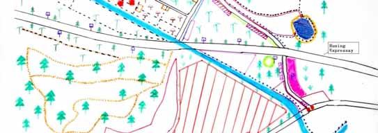
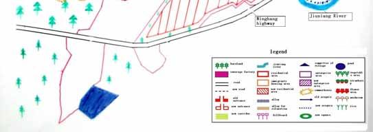
111 Figure 7.1 Tourist Horticulture Scenario 110 Alterra-rapport 1395
112 7.3.3 Scenario Two: Maximum Urbanization With the rapid progress of urbanization and gradually serious shortage of urban housing, it is unavoidable that the farmlands in fringe areas will be transformed into housing areas. Suoshi is located so near to Nanjing, around 15 kilometres away to city centre, that it will probably be urbanized in the next five or ten years. Take its neighbour Chenguang village as an example, some farmlands of Chenguang have already been occupied for housing use. And what s more, according to the Master plan, the region around Suoshi will become housing land in the future. Therefore, under this scenario, most land of Suoshi will be used for apartment blocks in order to follow the trend of urbanization and alleviate the pressure of housing shortage as much as possible. In order to realize this scenario the following measures may be necessary: - Agriculture Production As a limited area and hard to be used as high-rise residence, the triangle between Jiuxiang River and Huning expressway and the area opposite that will be planned as a small flower base without ugly tunnels and plastic, which can not only produce nice views from the new housing blocks, but also meet part of the growing flower demand of Nanjing s residents after the urban development. Apart from the few who can stay the most professional migrant farmers need assistance in finding alternative plots in nearby village slightly further away from the city. Keep the pigeon and dairy enterprises where they are, but with corresponding environmental and healthful improvement. - Housing On the whole, most of the present farmland will be used as 8 floors high-rising residences with parking for 2100 households (each 110 m 2 ) to cater for the rapidly rising demand of housing in urbanization. Around half of the current private residences will be improved into 4 floors modern apartments for 200 households if the owners like, which occupy 2 floors and 300 m 2 each. The other half will be 4 floors normal apartments for households, which each 150 m 2. This improvement may be done by two ways. One is to demolish the present old houses, and rebuild the new ones; the other is to add a floor or two onto the present old ones. Which way to choose depends on the condition of the present houses. If the present houses are very old and shabby, the former way should be chosen, otherwise, the later way should be chosen. According to our investigation, most immigrants houses may need to be rebuilt because they have worse condition than local farmers houses. Besides, new houses for 600 households will be built north of the present residential areas in order to meet the demand for houses in a maximum urbanization option. For local people s shopping and working need, the east triangle between Jiuxiang River and Huning expressway will be developed into commercial and light industrial use. Under this scenario and its corresponding measures, the final results may be as follows: firstly change the present rural land use zoning dramatically, shift the current mainly farming use into urban housing use. To a certain extent, this is in line with the municipal master plan, but with a little difference, as the small flower base will be increased. Adjust the regional tourism plan, connect Suoshi with scenic spots outside the village (such as Yangshan monument, Tangshan Hotspring, site of anthropoid, etc.) and create some scenic walking trails to realize it. New access roads will be built under the co-operation with Alterra-rapport
113 Chenguang village. Around 3400 new households / dwellings will be provided for urbanization. As for the local farmers, after getting their compensations for losing land, they will become citizens whose social security and job insurance will be considered under the whole urban population management. - Scenery and Sightseeing Firstly, Green belts will be designed along the two main roads to alleviate and avoid air and noise pollution and some reforestation and park development on hills is also needed. Build green belts (25-30 meters) along the Jiuxiang River and adjacent to the new residences, catering for residents recreational and environmental demands. - Infrastructure Improvements With the improvement of the living standard, more residents demand health and sports facilities, hence, a 3000 m 2 sport and fitness centre will be planned in the centre of the housing area. For people s recreational and jogging and walking use, around the existing small ponds, some recreational lakeshores will be built linked by small cycling routes. A new entrance will be built under the co-operation with Chenguang village, part of the old previous narrow roads will be widened and new wider roads will be opened up around the new apartments in order to provide convenience and shortcut to residents life and work. Open up some new recreational routes on the hillsides for residents recreation and exercise Scenario Three: Combined Horticulture and Urbanization Considering the contradiction of agriculture and urban expansion, this option is searching for a model to combine these two in an organic way. Firstly, certain fertile farmland needs to be protected for agriculture use especially for the horticulture, continuing to supply fresh products to the city through intensive and effective cultivation. Meanwhile, certain areas with convenient traffic and good panoramic views over this horticultural zone should be turned into housing area. The houses include not only ordinary high and low apartment blocks, but also traditional rural housing and a few modern bungalows for the high - income. Finally, a harmonious and friendly development of horticulture can be presented in the fringe area of Nanjing city. In order to realize this scenario the following measures may be considered: 112 Alterra-rapport 1395

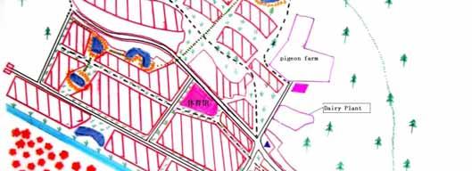
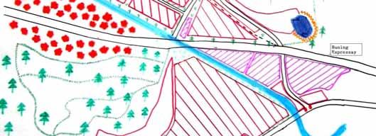
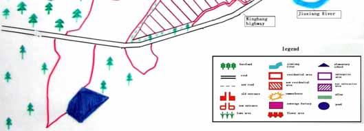
114 Figure 7.2. Maximum Urbanization Alterra-rapport


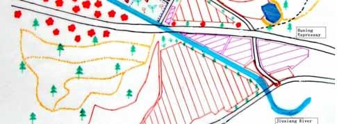
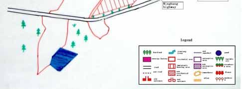
115 Figure 7.3 Combined Horticulture and Urbanization Scenario 114 Alterra-rapport 1395
116 - Agriculture Production As in the second scenario, the triangle between Jiuxiang River and Huning expressway and its opposite area will be planned as flower base without ugly tunnels and plastic. The farmland north of Jiuxiang River will be used as vegetable, fruit and mushroom base (with less than 15% tunnels and plastic). Pigeon and dairy farms will be maintained and improved towards environment and health protection. - Housing The east triangle between Jiuxiang River and Huning expressway will be developed into commercial and light industrial use with more shopping and job opportunities for local people. Individual houses supporting 100 households migrant farmers will be built in strips next to their fields. The farmland next to the current residences south of Jiuxiang River will be developed into 6 floors lower apartment blocks, certain traditional bungalows and restaurants, which will together provide houses for 850 to 900 households. Some landscape-friendly apartments will also be built, including 2 floors lower apartments for households (300 m 2 /household) and 4 floors little higher apartments for households (150 m 2 /household) on foothills of lower part of the slopes immediately North of the village. The residents there can have a birds eye view of the whole beautiful scenery at the same time of enjoying the comfortable living condition. Under this scenario and its corresponding designs, the consequences will be as follows: First, it will be needed to change the present rural land use zoning dramatically. Nearly 70 percent present farmlands will be taken away for housing use, only keeping around 30 percent of the most productive cultivated lands for horticulture. And the municipal master plan should be changed in order to make sure that some land is kept as horticulture use and to allow some hillsides to be partly used for housing purposes, taking utmost care of landscape and nature conditions. The regional tourism plan needs to be adjusted by connecting Suoshi with scenic spots outside the village (such as Yangshan monument, Tangshan Hotspring, site of anthropoid, etc.) and by creating some scenic walking trails to realize that. Connection with the outside scenic spots and the new access road will both require cooperation with neighbouring authorities. The migrant farmers housing condition will be improved a lot and coordinated with (well fitted in) the whole scenery. In total, an estimated 2000 new dwellings (households) for citizens and 100 for migrants will be provided. - Scenery and Sightseeing Promote strong forestation and scenery construction on the slopes around the new bungalows and apartment blocks as nature compensation for occupying parts of the woodland. In addition, 30 meters green belts will be designed along the main roads to alleviate and avoid air and noise pollution. - Infrastructure Improvements Improve irrigation systems through integrating some narrow channels, repairing the broken channels and cleaning ditches for intensive horticulture development. Open up some new recreational routes on the hillsides. A new west entrance road will be built linked with Chengguang village, and local access roads will be opened around the new apartments to provide convenient shortcuts to the residents life and work. Around the existing small Alterra-rapport
117 ponds, some recreational lakeshores will be built linked by small cycling routes through horticultural area to cater for people s recreational and jogging and walking use. 7.4 The Scenarios under discussion Generally speaking, the posters have conveyed our philosophies and ideas to the participants clearly and visually. During the meeting with officials, leaders and experts they were all attracted by those colourful posters and showed interest in them, their suggestions and advices towards the three different scenarios are concluded respectively as follows: - For the TOURIST HORTICULTURE MODE Firstly, under serious urbanization pressure, Suoshi s development must accord with the whole development trend of the surround area. Today, according to the strategy that establishes big Nanjing, the current built-up area will be enlarged through opening up a new city centre outside the present city. The new centre will attract more overheated development demands and finally the huge pressure nowadays the city centre is facing will be reduced. It is certain that Suoshi s future development should adapt to this trend, as far as the current situation is concerned, the north part of this pilot area will soon be turned into a university, industry park and residential area, hence we should change the scenario, especially the design in the north of the village. Secondly, if this tourist horticultural mode can be realized, there should be a self-support mechanism, which means that no governments or other outside power should need to guarantee its cost. Therefore, all the economic, social and ecological effects should be considered fully, among which the economic effect is the most important as providing the precondition and necessity to the two others. In addition, as far as the realization of this scenario depends on public investment or governmental subsidy, it s necessary to get the permission of public and fiscal authorities, or else everything is just a daydream. - The feedback results of the COMBINED MODE First, in the future real plan the terrain and physiognomy conditions should be considered fully, and then a sound distribution of agricultural and residential could be realized. Second, in their opinion, the residential location and distribution showed in our poster are not good enough and need to be improved, for example, the apartment buildings should not be so near to the highways. Third, the 30-meter s green belt is limited and may not avoid pollution effectively, may be 100 meter is possible. Fourth, if there are professional organisations or planners who can guide farmers to operate farming intensively, it will be more helpful for farmers to get high economic profits from the limited farmland left. Besides, as the dairy and pigeon farm will bring a lot of pollution and destroy the whole development model, it is suggested to remove them to the outside of the main planningarea of this scenario and change the land into flower use. Finally, if the three scenarios can be compared with each other in the advantages and disadvantages, it will be easy to provide direct information to the policymaker. 116 Alterra-rapport 1395


118 For the MAXIMUM URBANISATION MODE Firstly, when considering the problem of dairy and pigeon farms, the planner should pay much attention to two aspects: first, the environment condition if Suoshi is urbanized and transformed into a residential area completely, hence, a production process with less pollution and an effluent-treating system should be established if these farming enterprises are to be kept. Second, the issue whether the farms should be kept or removed will be decided by their future profit under this scenario. Then, under this development model, a large number of apartment buildings, infrastructures and other public services will be established and provided, such as the children s education and old peoples health and so on. Therefore, the sources of capital and other necessary supports should be thought about before making plan. The types of housing should be various in order to cater to consumers different demand and tastes. Besides, green lawns and trees can provide comfortable living condition, so the plan for the green areas will very important and should be strengthened. Finally, on the basis of current industry foundation, establish some plans and factory with less-pollution in order to provide more job opportunities and improve the economic development. These three scenarios are combining the opportunities of Suoshi s real conditions of nature, society and economy in different ways. They explore and emphasize different directions for future Suoshi. The differences are as follows (table 7.7): Table 7.7. Main differences between the three scenarios Scenario Tourist Horticulture Mode The Combined Mode The Maximum Urbanisation Mode Advantage Store a (productive) natural park and ecological zone for Nanjing citizens As a middle and transitional pattern, it is easy to be accepted and realised. Lighten the huge pressure from urbanisation by providing more housing lands Disadvantage For governments, the cost to keep it as a green zone is a real burden. It is a challenge to arrange these different land uses harmoniously. Some valuable farmlands have to be lost, and farmers will loose living insurance Picture 7.4 Suoshi horticulture landscape in winter Alterra-rapport


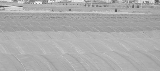

119 Picture 7.5 Suoshi leisure space in horticulture landscape Picture 7.6 Suoshi sea of plastic tunnels 118 Alterra-rapport 1395