Introduction of Spate Irrigation in Somalia/Somaliland
|
|
|
- Tyrone Reed
- 5 years ago
- Views:
Transcription

1 Introduction of Spate Irrigation in Somalia/Somaliland Abdiwahab Hamud Ahmed/Amina Muhumed Abdilahi FAO-Somalia Nairobi, Kenya 4th March 2016
2 Outline of presentation Status of climatic conditions of Somalia Ground water conditions Drainage systems in Somalia Potential areas and projects in FBFS Spate irrigation in Burao

3
4 Climatic conditions Somalia generally has a semi-arid to arid climate. The main climatic features are the existence of distinct wet and dry seasons and the absence of any large seasonal temperature change. Rainfall is the most important meteorological element affecting life in Somalia. Annual precipitation range b/w 250 to 600mm
5 The year is divided into four seasons as follows: Jilaal: a warm, sunny and dry season from December to mid-march. Gu: the main rainy season starting in mid-march and running to June. Haggai: a cool, dry and rather cloudy season starting in July and lasting until mid-september; some weather stations along the southern coast and in the northwestern regions receive significant amounts of rainfall. Deyr: the secondary rain season, from mid-september to November.

6 Seasons of Somalia
7 Ground water The main groundwater sources of Somalia are boreholes, shallow wells and springs. The depth of most boreholes in the country is in the range of 90m to 250m; but few some areas about 400m deep. The majority of the shallow wells are less than 20m deep. The water yield of these sources varies from one area to another, depending on the aquifer. Most shallow wells yield between 2.5 and 10m 3 /hr, compared to the yield for most boreholes which ranges between 5 to 20m 3 /hr.

8 Ground water cover
9 FBFS projects in Somaliland Soil conservation project (IFAD) Water shed management project (GIZ) Spate irrigation project (FAO) Irrigation consolidation and better farming sytem project (GAA) Promoting small scale irrigation systems (Islamic Relief)
10 Proposed hosting FBFS Network in Somalia Candlelight (NGO s) Amoud University Spate Irrigation project in Beer community And possible partnership with capacity building Lobby irrigation policy and water harvesting systems
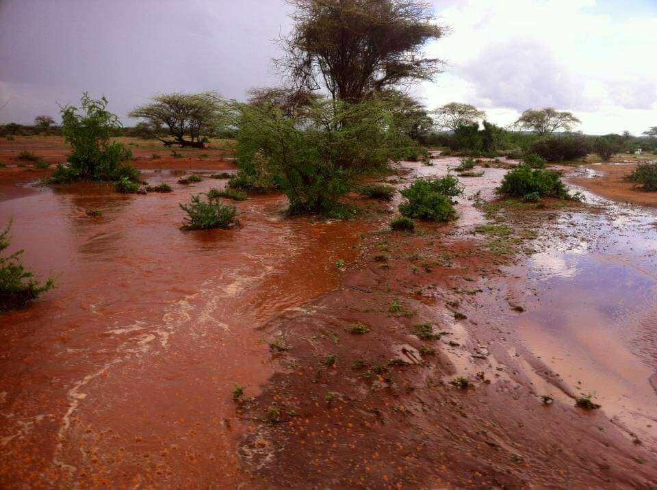
11 Spate Irrigation Project in Burao In most simple statement: - Managing flash floods coming through ephemeral rivers to command areas through simple and economical ways. AND converting disasters into blessing.

12
13


14
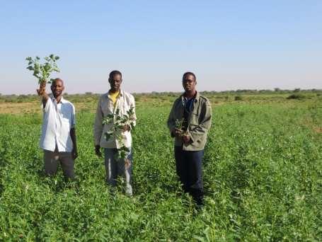
15 Table: summary of farms information/data at Beer village, Tog Dheer region in Somaliland (Obtained from MOA, Burao office) No: Name of Canal Area in ha No of Family Private / Cooperative Time of Establishment Crops Grown 1 Scheme(British one) 240, 400, , 39, 90 2 Doctor s Canal Cooperative Janaale Cooperative Qadhiidha Cooperative Wadani Cooperative Labibulsho Cooperative Caabi Cooperative Libaaxle Cooperative Dhoolayare Cooperative Xassan Bande Private Odayo xun Cooperative Jabyaro Private 13 Qodax wayn Private Ilmo siciid 60 5 Private 1959 Total for Whole Area private Cooperative 1957 Sorghum, maize, sesame, cowpeas, beans, water melon, some vegetables and fodder grass Total for present project 10 Cooperative Private 6 Cooperative
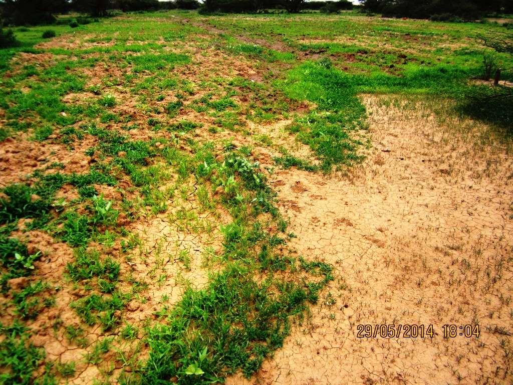
16 Spate Irrigation benefits Low Cost, local material, pro poor, low inputs Environment friendly organic farming, no chemical fertilizer or pesticide, local and indigenous varieties, drought resistant Easily manageable participatory Recharging the ground water aquifer (Wells) Last hope in this country.
17
18

19

20

21
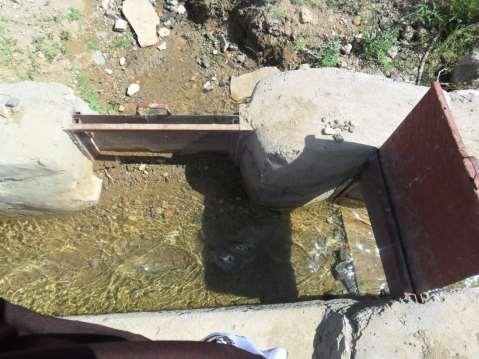
22 Togdheer/Burao In the Togdheer/Nugal drainage basin, some surface water records are available for Togdheer at Burao for six years during 1945 to During this period, an average of about 33 spates was recorded per year. About 85% of these occurred during the five months from May to September. It is estimated that an average runoff of 33 million m3 (MCM) per year (SWALIM), equivalent to about 22 mm in the 1500 km2 catchment, occurs in the area (runoff coefficient of 0.06) (Kammer,1989). The total catchment area of the drainage basin (Tog Dheer and Nugaal catchments) is about 112,231 km2
23 Project 10 canals for improvements (according to criteria, consensus and commitment of community) Water ponds Watershed management Agriculture inputs Training and extension
24 Goal To contribute to economic growth through increased economic productivity from irrigated land by reducing uncertainties of water availability and improving sustainability by farmers participation. Indicator: Uncertainties associated with water availability are reduced, incidence of poor years reduces
25 Objectives of the Scheme a) Improve existing traditional flood irrigation system to improve water availability to the scheme and allow more controlled use of the floods. b) Encourage land users to actively participate in the development of their own land and contribute to the sustainability of the scheme
26 Cont. Improve the delivery of agricultural and irrigation inputs and services to farmers and land users, improve farm practices and economic efficiency of the scheme. Extension services for MOA, FO and farmers
27 Project Activities Civil Work /Water diversion through structures low cost and reliable.through: Farmers awareness program, presentation of scheme, feedback and follow up Sedimentation control/management supervising the flow, de-silting of channels through FO Soil moisture conservation and agronomic practices - training, demonstrations, experiments, innovative ideas, mix framing, marketing, value addition, pest and disease control etc. Social organization establishment/strengthening of FO/WUA/Cooperative operation and maintenance, dispute resolving, communication, capacity building, cost recovery and management, Gender Issues, WOs Integrated approach- watershed, livestock, pastoral, agriculture, farm forestry, fuel wood, cash crops
28 Project Strategy - Community consultation for project introduction Scheme design, permanent structure, no encroachment in river, water rights, turns, and consensus, their view point. Modification, agreement of implementation and rights and obligation- work plan Water diversion, farm activities, training
29 Components Infrastructure: that includes canal intake (stone masonry work), excavation of canals to desired length, filed outlet structures, grain storage, watershed management, and drinking water ponds. Capacity Building: Trainings, study tours, exposure visits capacity building, FFS Trainings FO Strengthening, Agriculture, livestock, rangelands management Extension services master trainers, MOA, FO members Inputs provision:seeds, tools, equipment, experiment, demonstrations, and technology

30

31

32

33

34

35

36 Channel Excavation

37 Channel Excavation

38
39

40 Field Improvement

41

42 Community Consultation

43


44


45


46

47