Research on water management of rice fields in the Nile Delta, Egypt
|
|
|
- Gerard Griffin
- 5 years ago
- Views:
Transcription
1 Research on water management of rice fields in the Nile Delta, Egypt
2 i
3 Research on water management of rice fields in the Nile Delta, Egypt S. El Guindy and I.A. Risseeuw Edited by H.J. Nijland Publication 41 International Institute for Land Reclamation and Improvement/ILRI P.O. Box 45,6700 AA Wageningen, The Netherlands 1987.
4 This publication is based on research done by: The Drainage Research Institute/DRI 13 Giza Street, Giza Cairo, Egypt About the authors: Dr. S. El Guindy is a senior research officer at the Drainage Research Institute, Cairo. Mr. I.A. Risseeuw was Leader of the Dutch Resident Team at the Drainage Research Institute, Cairo, from 1977 to At present, he is Deputy Director of the Government Service for Land and Water Use, P.O. Box 20021, Utrecht, The Netherlands. Mr. H.J. Nijland was a member of the Dutch Resident Team at the Drainage Research Institute, Cairo from 1978 to At present, he is senior Coordinator of International Affairs at the IJssel Lake Polders Development Authority, P.O. Box 600, Lelystad, The Netherlands., I I, 1 I 0 International Institute for Land Reclamation and Improvement/ILRI, Wageningen, The Netherlands This book or any part thereof may not be reproduced in any form without written permission of ILRI. ISBN Printed in The Netherlands.
5 Foreword Egyptian and Dutch scientists have been co-operating on research on water management in Egypt for more than ten years. This research is carried out under the auspices of the Egyptian-Dutch Advisory Panel on Land Drainage, a group of experts from both countries that provides unique guidance. The Panel regularly reviews the results of the joint investigations of drainage technology, the re-use of drainage water for irrigation, and the economic evaluation of drainage projects. To combat waterlogging and salinization of its cultivated land, Egypt is now implementing the greatest drainage project in its history. One of the major problems of this undertaking is the water management of tile-drained rice fields. The prevalence of rice in the cropping pattern causes problems for water management and drainage. In rice fields, the presence of a subsurface drainage system that was installed for other crops causes substantial water losses through the system and leads to large applications of irrigation water. The resulting higher water duty leads to a higher drain discharge. This creates special conditions in tile-drained soils, conditions that have not been investigated elsewhere. This publication presents the results of a study that was conducted in both tile-drained and non-tile-drained rice growing areas. The findings have been used to formulate recommendations for better designs and better operation of subsurface drainage systems under these conditions. We sincerely hope that this publication will be of help to those facing the problems of water management in tile-drained rice growing areas. It is only due to the persistence of experts from both Egypt and The Netherlands that this publication could appear. We appreciate the cordial and generous co-operation among the institutes involved, i.e. the Drainage Research Institute of the Water Research Centre, Cairo, both under the Ministry of Irrigation, and the International Institute for Land Reclamation and Improvement, Wageningen, under the Dutch Ministry Óf Agriculture and Fisheries. Dr. M.H. Amer Director, Drainage Research Institute Dr. J.A.H. Hendriks Director, International Institute for Land Reclamation and Improvement
6
7 Contents Foreword Acknowledgements 1 INTRODUCTION 2 INVESTIGATIONS 2.1 Introduction 2.2 Problem identification 2.3 Objectives of the study 2.4 Method of investigation 2.5 General description of the pilot areas 3 RESULTS 3.1 Rice cultivation practices General Rice nurseries Land preparation Crop development at transplanted rice plots Crop yields 3.2 Soil salinity 3.3 Groundwater 3.4 Water management practices Subsurface drainage system Surface drainage system Irrigation Surface water layer 3.5 Water and salt balance Water balance Salt balance 3.6 Some important physical factors influencing the rice production General Statistical methods used Yield and topsoil salinity Yield and salinity of the surface water layer Yield and depth of the surface water layer Relationship between topsoil salinity and surface water salinity The relationship between Y, S,, and S, at the Anwar Hammad farm Estimated benefits of salt control 3.7 Conclusions Rice yields Levelling
8 Surface water layer Soil salinity Irrigation water applications Drainage system 4 MODIFYING THE DESIGN OF SUBSURFACE DRAINAGE SYSTEMS IN RICE GROWING AREAS 4.1 General 4.2 Design of drainage systems in rice growing areas Technical design criteria and specifications Delimitation of subcollector units Design procedure 4.3 Application of the modified layout to the Mahmudiya area General Layout costs Monitoring Results and discussions 4.4 Final conclusions BIBLIOGRAPHY
9 Acknowledgements This book contains the main results of a comprehensive study of the water management and drainage of areas with rice in the crop rotation. The study was conducted in the Egyptian Nile Delta as part of the Joint Programme of Technical Co-operation between Egypt and The Netherlands. The two executive agencies chosen by the Egyptian-Dutch Advisory Panel on Land Drainage were the Drainage Research Institute (DRI), Giza/Cairo, Egypt, and the International Institute for Land Reclamation and Improvement (ILRI), Wageningen, The Netherlands. The organizational and logistic requirements for the study were provided by DRI, or purchased with funds made available by the Directorate General of Development Co-operation (DGIS) of the Dutch Ministry of Foreign Affairs. The preparation and publication of the manuscript was co-ordinated by ILRI under the supervision of Dr. N.A. de Ridder, Head of Publication Department. His keen textual criticism and editorial insight gave the manuscript its definitive form. This book could not have been realized without the help and co-operation of many people. The authors are very grateful for the constructive remarks and support of Dr. M. Hassan Amer, Director of DRI, and for the suggestions and constructive criticism of Dr. Mustafa M. El Gabaly, Chairman of the Egyptian-Dutch Advisory Panel on Land Drainage, and Dr. Mahfoos Abdullah, Head of the Soils Department of Cairo University, during the planning and reporting stages of the study. Special acknowledgement is due to Messrs. F.M. Ramadan, Ahmed Morsi, Akmal Omara, Mohammed A. Abdel Khalik, W. van Schaik, and C.W.J. Roest, who participated in either routine observation programmes or analytical procedures at the DRI laboratories. Their assistance in collecting and processing the data is highly appreciated. Finally, the authors wish to thank Mr. Anwar Hammad, owner of the undrained rice farm, and the many farmers they met in the Nokrashi and Basal areas, for giving freely and cheerfully of their time. By explaining what they considered a good or inadequate practice, and by supplying any other information required, these people made a most important contribution towards the success of the investigation programmes. 9

10
11 Mediterranean sea Figure 1.2 Location of the Nile Delta Drainage Projects ( ) finally eliminated the Nile s seasonal floods entirely and allowed all agricultural land to be brought under perennial irrigation. This meant that rice, among other crops, could be cultivated on a much larger scale than before. Owing to the introduction of perennial irrigation, with its inherent percolation losses, the existing natural drainage gradually lost its ability to keep the watertable low enough to give good crop yields and, consequently, to maintain favourable salinity levels in the rooted soil layers. In arid climates such as Egypt s, high watertables cause. salinization of the root zone. Without adequate drainage facilities, the accumulated salts cannot be leached from the root zone. To overcome these problems, a widespread system of open main drains and pumping stations was constructed. The installation of subsurface drainage systems was begun on a large scale in the 1970 s, as the existing drainage system could no longer handle the rising watertables. Large parts of the southern and middle Delta have now already been drained (Figure 1.2). The installation of subsurface drainage systems is primarily meant to improve the growing conditions of dry foot crops such as cotton, maize, wheat, and so on. In Egypt, however, rice is grown in rotation with these crops, as a summer crop, following wheat or berseem. Rice cultivation is concentrated in the Nile Delta, with the main rice belt in the northern part; rice is the only submerged crop among the several dry foot crops.of this mixed cropping system. 11
12 The introduction of pipe drainage systems in the seasonal rice growing areas brought on water management problems. During the growing season, the water management requirements in rice fields are clearly different from those in fields under other summer crops (mainly cotton and maize). This is true for irrigation as well as drainage. Fields under other than rice require control- of the watertable, whereas rice fields are kept submerged for most of the growing season. In rice fields, the presence of a subsurface drainage system that has been installed for other crops causes substantial water losses through the system, and leads to large applications of irrigation water. If the availability of irrigation water is limited, farmers commonly plug collectors with whatever means at hand, e.g. straw, mud, grass, sods. This undesirable, but logical, practice causes pollution of the collector downstream of the plug upon its removal, while the other crops upstream of the rice fields have no subsurface drainage at all, and may suffer from waterlogging. In future, irrigation water will increasingly become a limiting factor for agricultural production. The extension of the irrigated areas in the deserts, such as West Nubariya near Alexandria, and in the Sinai near Port Said, will require extra irrigation water. Methods for a more efficient use of the water will become urgent and practical solutions are urgently needed to reduce the excessive irrigation water requirements of rice cropped land. Until quite recently, planners of tile-drainage works in other arid and semi-arid regions had not been confronted with this problem. In most tile-drained areas rice is grown only in the initial phases of the reclamation of the saline soils and without rotation with other crops (Van Alphen 1975,1984; Van de Goor 1967). Subsurface drainage systems have been installed as an integral phrt of the drainage system in some rice growing areas of countries such as Japan, Korea, and China (Ezaki 1975; Tabuchi 1985; UNDP/FAO 1979a, 1979b; Soong 1985). However, rice is the sole crop during the summer season in these countries, and the purpose of drainage is mainly to improve farming practices (mechanization), and crop growing conditions for a second dry land crop. Closing devices (regulatory valves) constructed at the end of the drain lines control the drain outflow during the rice growing season. The climatological conditions for growing rice in these countries, temperate climates with high rainfall, differ from Egypt, with its arid climate and negligible rainfall. Since there is no ready-made solution that might be applied to the Egyptian situation, the problem was tackled by conducting a study in tile-drained and non-tiledrained rice growing areas in the northern part of the Nile Delta, i.e. the Anwar Hammad farm, the Basal area (non-tile-drained), and the Nokrashi area (tile-drained). As very few quantitative data were available, investigations were directed towards gaining deeper insight into the nature and extent of the problems. The study included water management practices with respect to the water and salt balances of rice growing areas. One of the results of the study was to recommend modification of the layout of subsurface drainage systems in rice growing areas. The recommended concept of the drainage system (modified layout) was constructed and tested in a sizeable prototype area of 1700 ha, the Mahmudiya area, including the Mashtul pilot area. We present some of the results of the studies in this publication, together with solutions for the design of subsurface drainage systems in rice growing areas. 12
13 ~ 2 Investigations 2.1 Introduction Egypt has a warm and arid climate, with a short and mild winter. The mean monthly climatological data are presented in Table 2.1. Table 2.1 Mean monthly climatological data Temperature Rainfall Relative Relative Evapora- January August Humidity duration tion* of bright max. min. max. min. sunshine "C "/year % % "/day Alexandria k7.5 Giza Aswan * Open water evaporation after Penman (Eo) Source: Aboukhaled et al, The soils in the Nile Delta are fine textured, medium heavy to heavy clays, becoming heavier towards the sea. There are two major cropping seasons with diversified cropping patterns: winter (November-May) and summer (May-October), and a less important 'nil? (named after the Nile flood) or late summer season (August-October). The major winter crops are wheat, barley, Egyptian clover or berseem, broad beans, vegetables. Summer crops are cotton, rice, and maize. The general practice is a 2 or 3-year crop rotation. In either case farming is intensive. Representative cropping patterns of a 3-year rotation are shown in Figure 2.1. rotation with rice NILE DELTA 1st year 2nd year 3rd year I. bersee mlwheat I I I sh.berseem maize I rotation without rice I I I I I I I I I I Ia 2nd year wheat11 berseem I I 3rd year h.beans I 1 I I I I I Jan Febr March April May June July Aug Sept Oct Nov Dec Figure 2.1 Representative cropping patterns for the Nile Delta 13
14 The average farm unit is about 1.5 ha, with over 90% of agricultural holdings below 2.1 ha. A farm is usually divided into as many plots as there are crops grown. However, the plots of one crop of different farms are generally combined into large units. The areas planted with cotton and rice are largely controlled by the government, and they tend to be farmed in relatively large consolidated blocks. This facilitates land preparation, water distribution, and disease and insect control. The size of these cropping units varies from 2 to 80 ha, with an average size of 12 ha. In the lower Delta, in places where the irrigation network supplies enough water, and where heavy fluvio-marine clays are present, rice predominates over maize as the summer cereal because soil salinity restricts yields of other crops. A typical cropping model for the northern Delta is presented in Table 2.2. Table 2.2 Cropping model for the northern Delta Winter season Summer season Short-Berseem 25% Cotton 30% Long Berseem 45% Rice 45% Wheat 25% Maize 25% Beans 5% Average crop intensity = 200% 2.2 Problem identification The drainage system currently being installed in Egypt is a composite system; it is shown in Figure 2.2. Its main features are: - The laterals are 8 cm in diameter and approximately 200 m long. They are laid at depths between 1.20 and 1.50 m, and their spacings are 40, 50, and 60 m. The drain pipes used for laterals were previously all made of concrete. These have been gradually replaced by PVC corrugated plastic pipes, which are installed by pipelaying machines; - The collectors are concrete pipes with diameters between 15 and 40 cm. The maxi-. mum depth of their outlets is 2.5 m, Collectors can be up to 2 km long; - Concrete manholes, 0.75 to 1 m in diameter, which allow for direct visual inspection and cleaning of the system, are placed in the collectors at every third or fourth lateral. The installation of subsurface drainage systems in the Nile Delta is primarily meant to ensure proper drainage and soil conditions for such crops as cotton, maize, wheat, and so on. In large parts of the Delta, however, rice is grown in rotation with these crops. As the rice fields are commonly submerged throughout the growing season, the introduction of a subsurface drainage system in these areas gives rise to severe problems such as: - High percolation losses in rice fields to these drainage systems; if the system is left open, considerable amounts of water are lost through the tile drains, resulting in extremely high irrigation water applications; - Farmers block the drainage systems (collectors) to reduce such losses, and this often causes severe clogging of the collectors; 14
15 - Over-pressure developing in the upstream parts of the laterals/collectors, due to high discharges from downstream rice growing areas. This seriously limits watertable control in the area served by the collector, and results in poor drainage of the crops grown together with rice in the same collector area. The situation becomes worse if the rice fields are located in the downstream part of the collector area, and even more serious when the collector is blocked in order to reduce irrigation water applications for rice crops. 2.3 Objectives of the study Measures were taken to achieve the following objectives: - To obtain a better insight into the effects of the water management practices - as applied in recently subsurface drained areas by traditionally oriented farmers - on crop production and soil characteristics; - To obtain a better insight into the effect of the more or less traditional water management practices on crop production and soil characteristics - as applied to non-subsurface drained rice areas; - To determine the effects of this water management on the water and salt balance of the rice area; - To produce optimal solutions and formulate design criteria for combined surface and subsurface drainage systems in areas where rice is included in the crop rotation. 2.4 Method of investigation To achieve the above objectives three pilot areas were selected. They.are: the Anwar Hammad farm, the Nokrashi area and the Basal area, all situated in the north-western part of the Delta (Figure 2.3). Of the three, only the Nokrashi area has a subsurface drainage system. 15
16 Figure 2.3 Location of the pilot areas The investigation programmes in these areas included: - Detailed soil surveys (texture, salinity, saturated paste percentage); - Installation of piezometers; - Measurement of the depth of the watertable; Measurement of the drain discharge (surface and subsurface) and its salinity; - Determination of the depth, salinity, and temperature of the standing water layer; - Determination of quality, availability, and distribution of the irrigation water; - Collecting data on cropping techniques, crop logging, and crop production; - Collecting meteorological data. The general layout of the pilot areas and observation points are shown in Figure 2.4. The investigation programmes are conducted from 1977 until 1979, with the exception of the Basal area, where research was only carried out in General description of the pilot areas The gross and net cultivated acreages of the pilot areas are presented in Table 2.3. The soil surface of the pilot areas is relatively flat; the maximum difference in level is approximately 0.3 m. The levelled farm plots vary in size from 0.1 to 0.6 ha. These plots were not always sufficiently levelled; differences in levels of up to 6 cm occurred 16
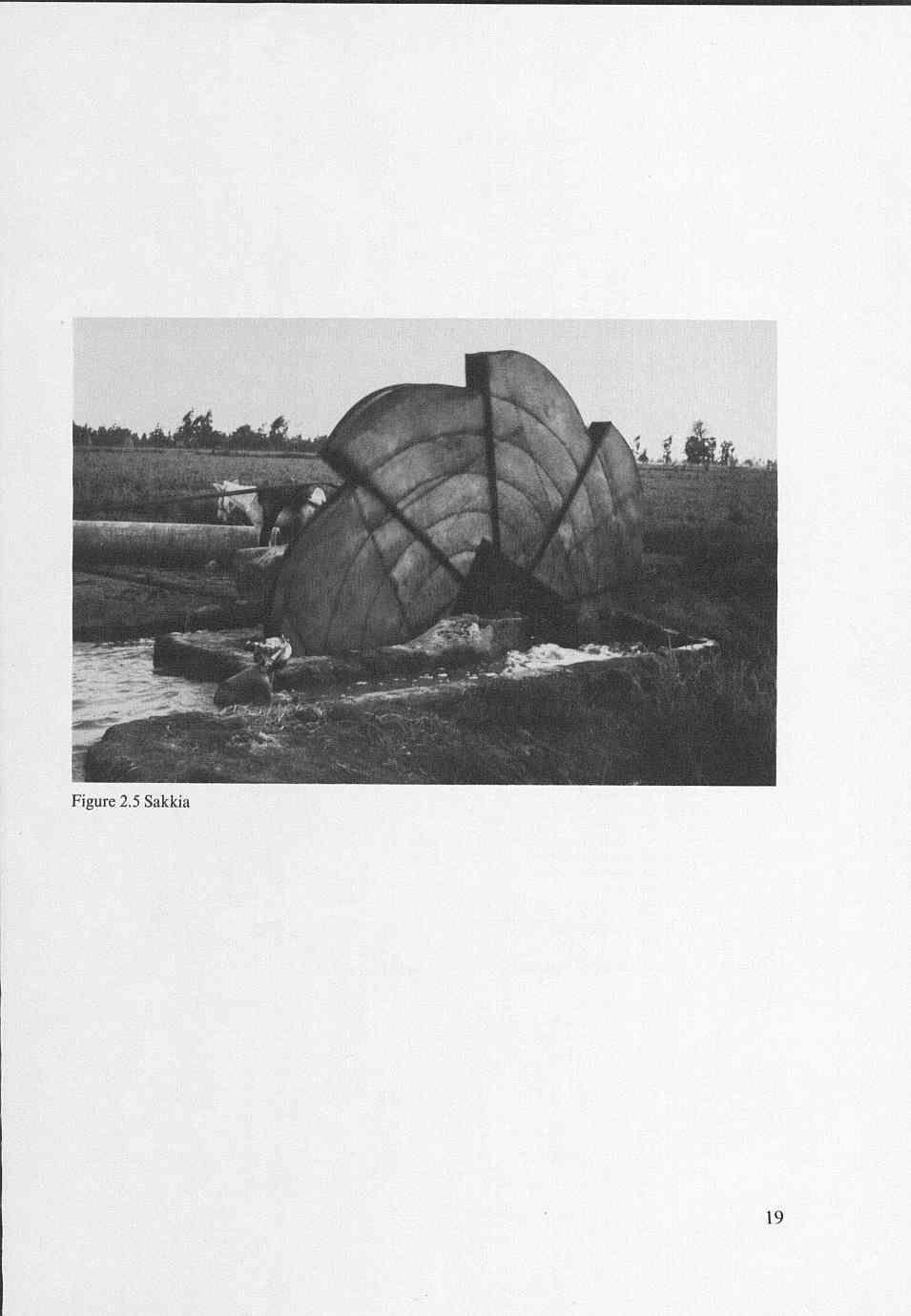
17 Table 2.3 Acreages of the pilot areas in ha. Gross area Net area Anwar Hammad Nokrashi I Nokrashi I Nokrashi Basal in some cases. The rice is irrigated from tertiary irrigation canals, in which the water level is 0.5 to 1.0 m below the soil surface. The water is lifted from these canals by sakkias, or water wheels, driven by animal traction (Figure 2.5), or by motor pumps. The water is supplied to the plots via high-lying field ditches. In the summer the tertiary canals receive water on a rotational schedule: four days on and four days off. The winter rotation is 7 days on and 7 days off. Details of the layout of the irrigation and drainage system are shown in Figure 2.6. The field drains in the surface drainage system serve all the plots. These drains remove the surface drainage water by gravity flow via open tertiary collector drains to public drains. The field drains are approximately 0.50 m deep. The laterals of the subsurface drainage system in the Nokrashi area discharge into the main collector at a depth of about 1.20 m. The average bottom depth of the collector is I.70 m. The distance between the laterals is 40 m. The soil profile at the Anwar Hammad farm consists of a layer of heavy clay, approximately 2 m thick, which overlies a low permeable layer of greyish clay, rich in carbonate, approximately 1 m thick. The upper 50 cm of the soil profile contains on average 80% clay and the rest silt. The soil salinity ranges from 4 to 10 mmhos/cm. The permeability is low, 0.03 to O. 15 m/day. The soils in the Nokrashi area are also heavy clay soils. The upper 50 cm of the profile contains on average 55% clay, 35% silt, and 10% fine and very fine sand. The soils in this area are non-saline. The average salinity level varies from 2 to 4 mmhos/cm. The permeability ranges from 0.02 to O. 15 m/day. The silty clay soils in the Basal area contain on average nearly 50% clay and the rest silt. The soil salinity in the area varies from 3 to 5 mmhos/cm. 17
18 81 LL61 I 6L _ yelp qqnd u!elp uado ---- w u! lanai an!ieial q i! awl ~ inoiuoa I (IWWWWH UWMNW
19
20 475 Ill - O 1OOm I I.-. 7 contour line with relative level in m ---_ open drain public drain - field ditch secondary irrigation canal tertiary irrigation canal o irrigation water pump tb sakkia Figure 2.6 Layout of the irrigation and drainage system in the pilot areas 20