APPLICATION OF GEO SPATIAL TECHNOLOGY IN AGRICULTURE
|
|
|
- Frederick Franklin
- 5 years ago
- Views:
Transcription

1 APPLICATION OF GEO SPATIAL TECHNOLOGY IN AGRICULTURE Dr. S.C. Moharana Senior Scientist ORSAC, Bhubaneswar Training Programme on Applications of Geo-Spatial Technology Oct 14, 2017

2 FASAL Programme Implemented States of India
3
4 CROP ACREAGE AND PRODUCTION ESTIMATION RS-BASED CROP YIELD PREDICTION CROP CONDITION/ STRESS ASSESMENT CROP DAMAGE ASSESSMENT AGRICULTURAL DROUGHT ASSESSMENT AGRICULTURAL WATER MANAGEMENT WATERSHED MANAGEMENT
5 Forecasting Agricultural output using Space, Agrometeorology and Land based observations (FASAL) Launched in Odisha during September 1997 by ISRO Objective: District wise Kharif paddy acreage estimation District wise Paddy yield Forecast using meteorological data Production at state level Decision making for supply, storage, transport and minimum support price fixation by the Central as well as State Government Project implemented in Odisha in a Pilot mode from to in technical collaboration with Space Applications Centre(SAC), ISRO, Ahmedabad being funded by Ministry of Agriculture, Govt. of India
6 FASAL Programme extended to 16 major Rice growing states and became operational from after successful pilot implementation FASAL Programme implemented in the State Remote Sensing/Space Applications Centres up to The Programme was institutionalised during 2012 with the establishment of Mahanalobis National Crop Forecast Centre(MNCFC) under Ministry of Agriculture & Farmers Welfare, Govt. of India, Pusa Campus, New Delhi FASAL technology was transferred to the State Agriculture Department for implementation from including ground truth collection Ministry of Agriculture desired the involvement of State Remote Sensing Centres for validation of result on crop forecast by participating in the digital analysis of SAR data and post classification accuracy assessment from
7
8
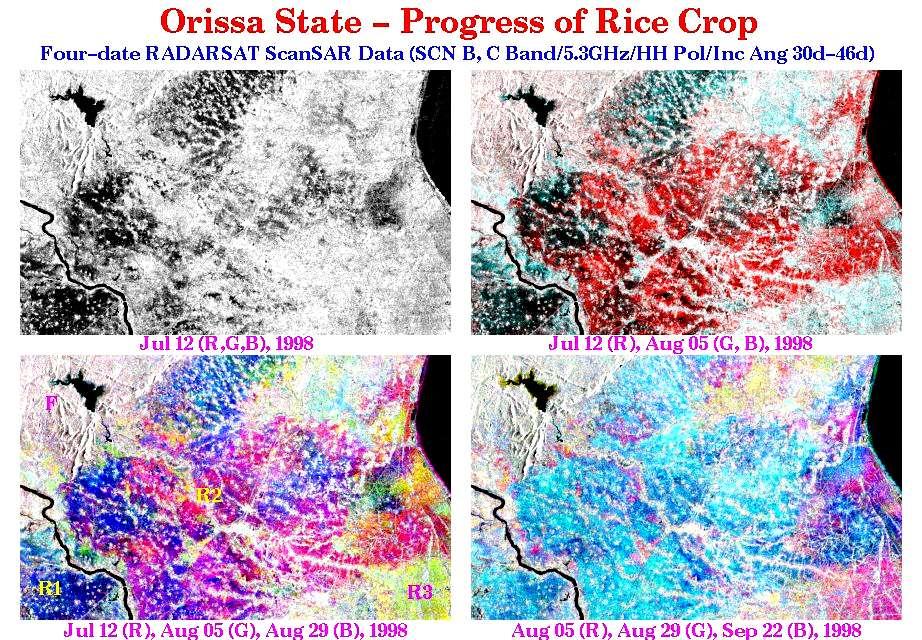
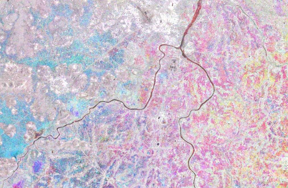
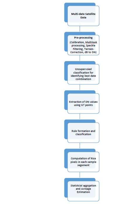
9 MNCFC is carrying out National/State/ District level Kharif Rice crop acreage estimation and production forecasting using remote sensing data in collaboration with State Remote Sensing/ Space Applications Centre (ORSAC), Directorate of Agriculture and Food Production (DAFP), Govt. of Odisha and India Meteorological Department (IMD) Three dates SAR data are being used for district wise acreage estimation using decision rule classifier. This satellite data is available once in every 25 days for the same area. Data pertaining to three such successive dates of each area has been used for acreage estimation (July- September) Ground truth data collected by the State Agriculture Department is being used for remote sensing data analysis Yield is being estimated by IMD using correlation weighted Agro-met model at district level using weather data
10 2017


11 Ground truth data collection Date, GPS location, site size, crop, growth stage, %cover, plant vigour, soil type/status ( village/dist//state)
12

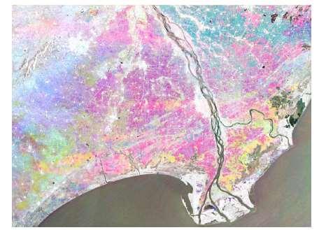
13 Field Photographs of Rice Crop in Different Parts of the Country


14 Ground Truth Sites & RISAT-1 MRS SAR 3-date Composite Image Total GT Sites : 661 Rice: 648 Other Crops GT : 13
15

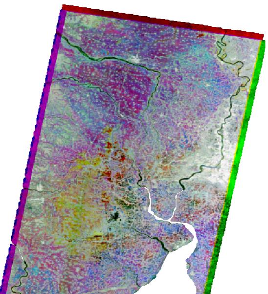
16 Jul 12, 1998 Aug 05, 1998 Aug 29, 1998 Sep 22, 1998
17


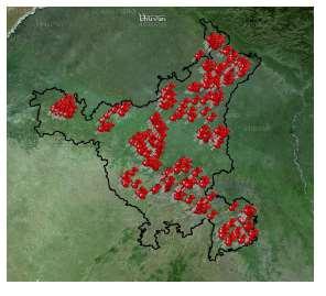
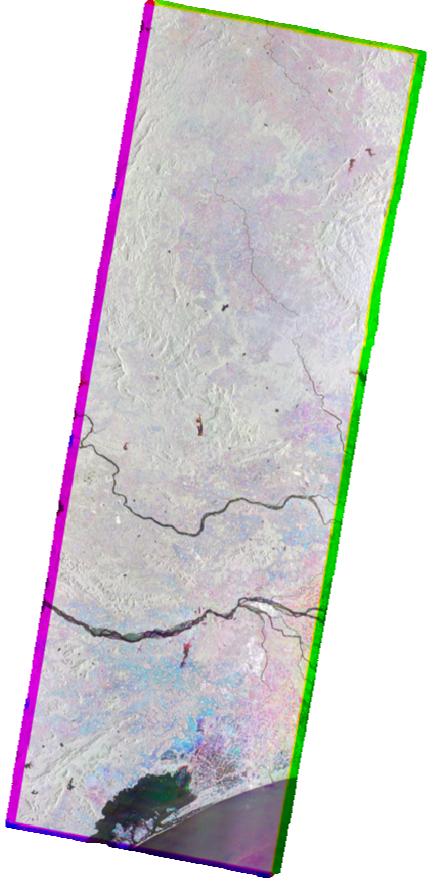
18 5-YEAR DATE COMPOSITE RAINFED LOWLAND RICE AREAS OF COASTAL ORISSA SHOWS SHIFT OF TRANSP. OF RICE AND ITS CONDITION NORMAL /DROUGHT / FLOOD Jul 15, Aug 08, Sep 01, 2002
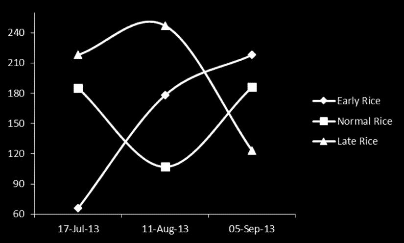

19 Backscattered value of Kharif Rice at different stages Normal Rice Early Rice Late Rice

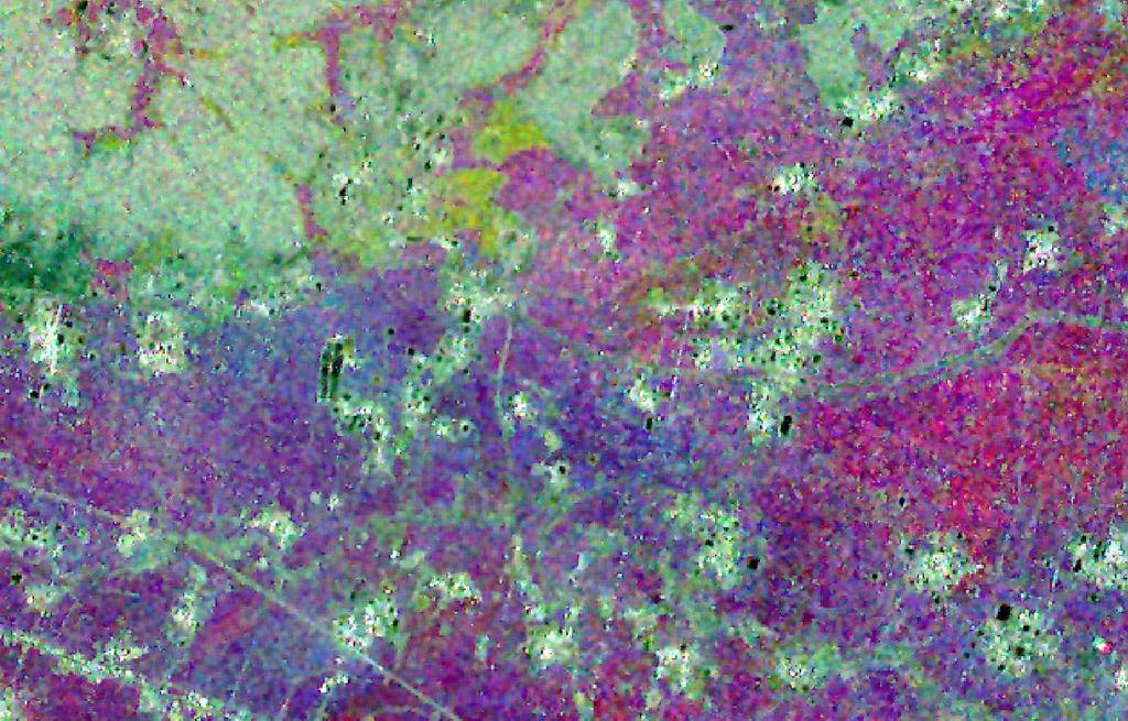
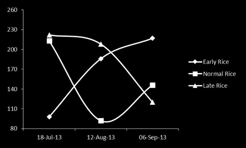
20 Backscattered value of Kharif Rice at different stages Late Rice Early Rice Normal Rice
21
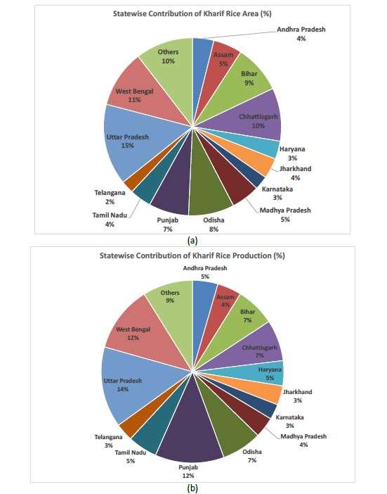
22 COMPARISON OF KHARIF RICE AREA USING SATELLITE REMOTE SENSING AND PRODUCTION FORECASTS USING METEOROLOGICAL MODELS UNDER " FASAL" PROJECT (ORSAC & SAC,ISRO ) AND FINAL ESTIMATE OF DAFP/DES Area in Mha. Production in Mt. YEAR First Forecast (F1) Second Forecast (F2) Third Forecast (F3) Fourth Forecast (F4) Final Estimate July,31 September,15 October,15 November DES / DAFP Area Production Area Production Area Production Area Production Area Production
23 COMPARISION OF KHARIF RICE AREA & PRODUCTION OF ODISHA STATE (Area in lakh ha. & Prod in lakh tonnes) YEAR AREA (RS) AREA (DAFP) DEV % PROD. (RS) PROD. (DAFP) DEV % COMPARISION OF RABI RICE AREA & PRODUCTION OF ODISHA STATE (Area in lakh ha. & Prod in lakh tonnes) YEAR AREA (RS) AREA (DAFP) DEV % PROD. (RS) PROD. (DAFP) DEV %

24 KHARIF RICE FORECAST OF ODISHA STATE, ( OCTOBER,2017 )
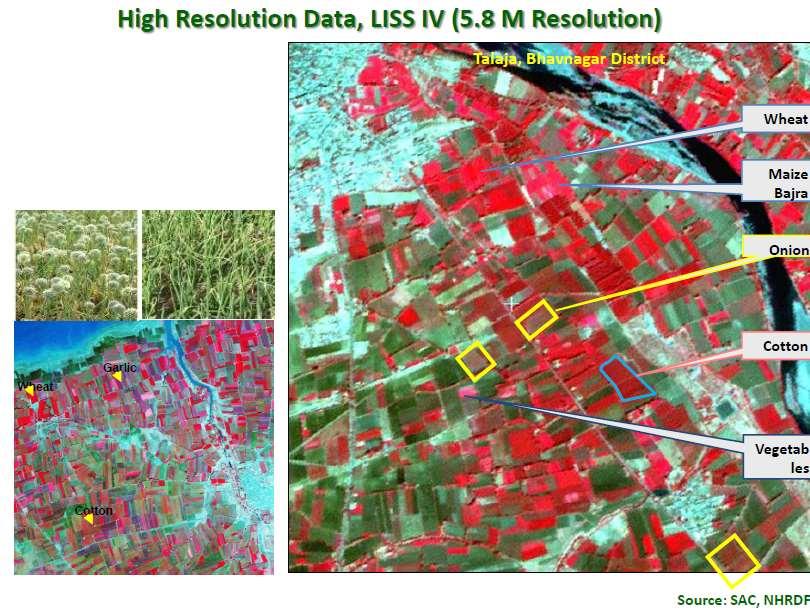
 IRS P6 LISS-III CLASSIFIED")
25 RABI RICE IN PART OF BARAGARH DISTRICT (MARCH 2009) IRS P6 LISS-III CLASSIFIED RABI RICE


26 RABI RICE IN PART OF BHADRAK DISTRICT (MARCH 2009) IRS P6 LISS-III CLASSIFIED RABI RICE

27 GROUNDNUT IN JAJPUR DISTRICT (FEBRUARY 2009)


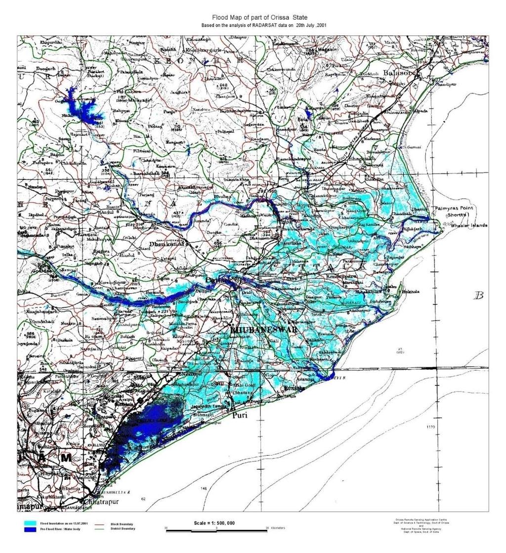
28 ANALYSIS OF POST CYCLONE SATELLITE DATA Flood Inundation derived from Radarsat Overlaid on a map
29

30
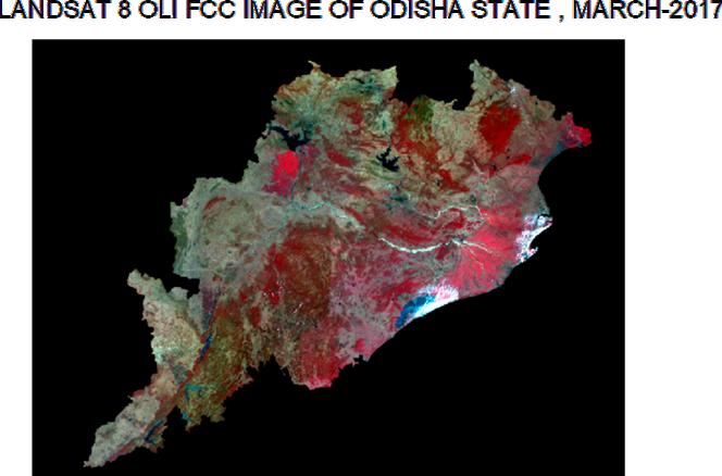
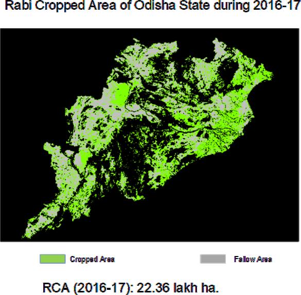
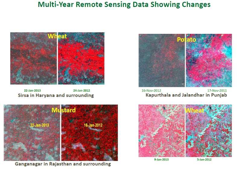
31 Crop Intensification Project Ministry of Agriculture and Farmers Welfare, Govt. of India, New Delhi has sanctioned a project on Crop Intensification mapping and monitoring of post Kharif rice fallow lands using satellite remote sensing and GIS. This project aims to expand the rabi cropped area for increase in agriculture production in the eastern Indian states. Under this programme, the Rabi cropped area for Odisha state during is mapped using October 2016 to April 2017 Landsat 8 OLI data. The suitable post kharif fallow lands will be mapped for short duration crops to increase the agriculture production.
32
33
34
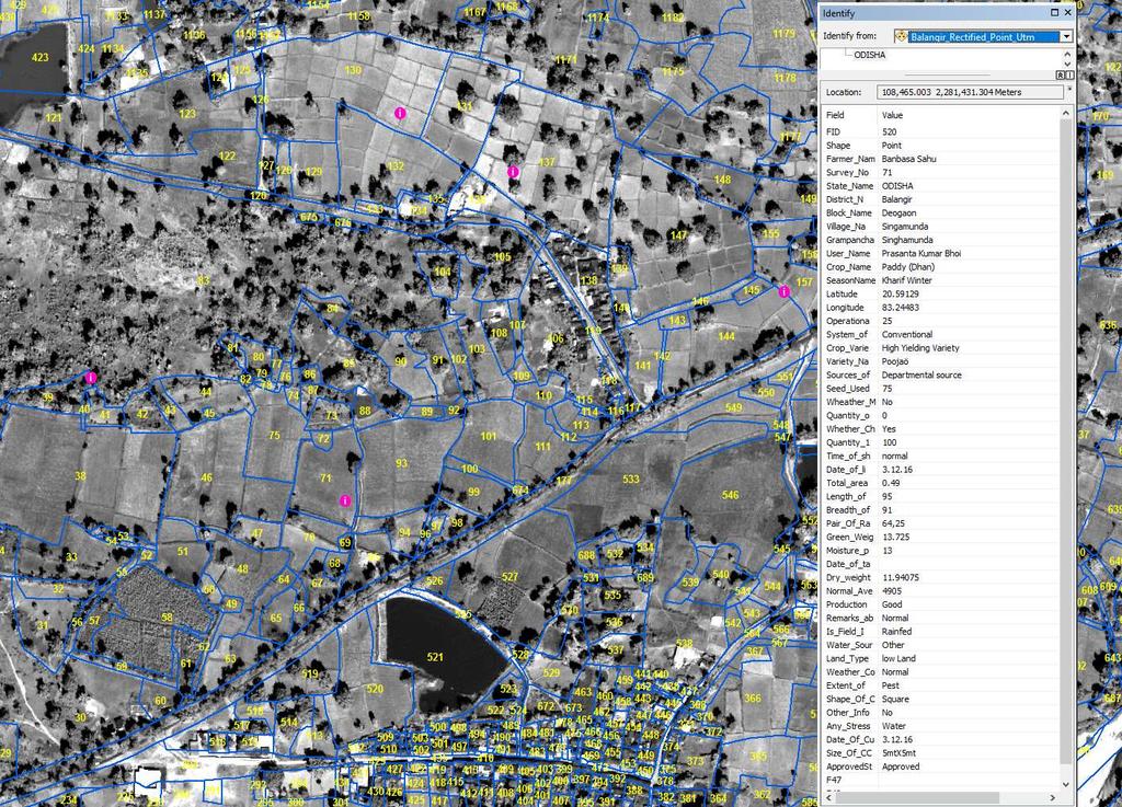
35
36
37


38 Chilli Crop at Fruit Bearing Stage in Remuna Block, Balasore District


39 Harvested Green Chilli in Rambha Block, Ganjam District

40 Tomato Crop at Fruit Bearing Stage in Anandpur Block, Keonjhar District

41 Harvested Tomato in Anandpur Block, Keonjhar District
42 TECHNOLOGY MISSION FOR GEO SPATIAL AIDED AGRICULTURAL INFORMATION SYSTEM This project has been sanctioned under RKVY Scheme of Govt. of India. Plot/ Village/ GP based information on crop condition, site suitability for different crops, fertilizer advisory and Irrigational infrastructures will be undertaken using multi temporal satellite image, soil information and other terrain based parameters. VALIDATION OF CROP CUTTING SITES UNDER PRADHAN MANTRI FASAL BIMA YOJNA (PMFBY) Crop cutting sites are validated for Kharif paddy crop in Odisha state using digital georeferenced cadastral dataset, high resolution satellite image and the geolocation of CCE plots.


43 CROP CUTTING EXPERIMENT AUTHENTICATION Mayurbhanj District- Badasahi Block, Purnachandrapur Village Mayurbhanj District- Badasahi Block CCE SITE CCE Surveyed Point Information
44

45 We are convinced that if we are to play a meaningful role nationally and in the community of nations, we must be second to none in the application of advanced technologies to the real problems of man and society which we find in our country. We should note that the application of sophisticated technologies and method of analysis of our problems should not be confused with embarking of grandiose schemes whose primary impact is for show, rather than for progress in hard economic and social items. Dr. Vikram Sarabhai ( 12 August 1919 to 31 December 1971 )

46