Ted van der Gulik, P.Eng. Stephanie Tam, P.Eng. Senior Engineer Water Management Engineer
|
|
|
- Alicia Bennett
- 5 years ago
- Views:
Transcription


1 Ted van der Gulik, P.Eng. Stephanie Tam, P.Eng. Senior Engineer Water Management Engineer


2 Agricultural irrigation is 70% of total water use in the Okanagan Landscape irrigation is estimated at 15% of total use Irrigation is estimated at a g total of 85% of total use.


3 Agricultural irrigation is the largest water user in many basins in British Columbia Agriculture is a consumptive user, unlike other sectors Competition between urban, fisheries, recreation and agriculture for water will increase Climate change will drive the need to be more efficient


4 Model calculates Farm irrigation water use Landscape irrigation use Golf Course
5 Objective: Develop a model that calculates agriculture s irrigation needs by purveyor, municipality, district and subwatershed. Methodology: Determine Property-by-Property water use Result: Planning Tools that secure water for current and future agricultural needs


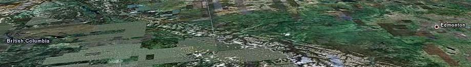
6 The Okanagan Basin The Okanagan Basin developed area is divided into 398 map sheets


7 Map sheets were developed using GIS and aerial photography. Cadastre and land use polygons were added by technicians.


8 Cadastre
9 Cadastre Crop Cover Irrigation System First Entered by GIS
10 The GIS data was verified by a windshield survey of every property


11 Data was entered into the database in the field Where polygon Data was entered into the database in the field. Where polygon changes were required notes are made on the map sheet and sent back to the GIS technician for updating


12 Cadastre Polygon 3 1. Microsprinkler on peaches 2. Microsprinkler on cherries 3. Microsprinkler on pears 4. Drip on pears 5. Residential 6. Bee hives
13 Crop Type: Apple Pasture Irrigation System Type: Sprinkler Drip House
14 There are 105,000 polygons generated 3 for the Okanagan in the farming areas Cadastre Land and Crop Polygon Soil Boundary


15 A 500 m x 500 m climate grid has been developed for the basin 32,000 grid cells Each grid cell contains daily Tmin, Tmax and Precip from 1961 till 2006 Si l b l Cli t Ch Six global Climate Change scenarios have been developed and each grid cell populated with this data
16 A climate cell gets assigned to each cadastre Climate grid 1 linked to Cadastre 1 Climate grid 2 linked to Cadastre 2 and 3 3 Cadastre Land and Crop Polygon Soil Boundary Climate Grid
17 1.2 1 Crop Coefficients i Algorithm calculates water demand from: Eto is calculated daily from Climate data Climate data also determines start and end of growing season Crop coefficients to adjust daily Eto 0 Apr May Jun Jul Aug Sep Apples Soil and rooting depth information to calculate soil water storage, percolation rates and determine soil factors Alfalfa Irrigation system efficiencies


18 Calculates daily water use on a polygon basis and adds up polygons to determine water demand for each property Allows water demand to be determined for: 81 sub basins 310 aquifer areas 60 water purveyors 12 local governments


19


20 Model has daily climate change data until the year 2100 for 6 different climate change scenarios. Allows the model to calculate present and future water demand. Management criteria can be g adjusted in the model


21 Crop Irrigated Irrigation Group Area (ha) Demand (mm) Apple 4, Berry Cherry 1, Forage 8, Fruit Golf 1, Grape 2, Landscape Turf Nursery Turf Farm Vegetables Total = 20,
 Drip 1,490 415")


22 Irrigation System Irrigated Area (ha) Irrigation Demand (mm) Drip 1, Golfsprinkler 1, Gun Handline 1, By Irrigation Landscape Sprinkler System Microspray Microsprinkler 1, Overtree Drip Overtree-microsprinkler Pivot Pivot Low Pressure SDI Sprinkler 3, Solid Set Gun Solid Set Over tree 3, Solid Set Sprinkler Solid Set Undertree 1, Travelling gun 2, Wheelline 1, Total = 20,


23 Water Source Irrigated Area (ha) Irrigation Demand (m3) Water Source Irrigated Irrigation Demand Assuming good management Water license ,455,582 Water Purveyor 14, ,930,320 Groundwater 3,394 21,695,142 Total 20, ,081,043