Improving Water Management for BC Agriculture Ted van der Gulik, P.Eng. Senior Engineer
|
|
|
- Sydney Fowler
- 5 years ago
- Views:
Transcription


1 Improving Water Management for BC Agriculture Ted van der Gulik, P.Eng. Senior Engineer B.C. Ministry of Agriculture and Lands Sustainable Agriculture Management Branch


2 The water resources of the Okanagan will be totally allocated in less than 10 years. To move toward sustainable water management requires changes in practices now.


3 Okanagan Water Use Over 85% is Used for Outdoor Purposes: ~60-70% for Agricultural Irrigation >15% for Turf Irrigation Saving water requires on the ground action
4 Why Develop a Model Agricultural irrigation is the largest water user in many basins in British Columbia Agriculture is a consumptive user, unlike other sectors Competition between urban, fisheries, recreation and agriculture for water will increase Climate change will drive the need to be more efficient


5 Irrigation Demand Model Model calculates: Farm irrigation water use Landscape irrigation water use Golf course irrigation water use

6 Objective: Develop a model that calculates agriculture s irrigation needs by purveyor, municipality, district and subwatershed. Methodology: Determine Property-by-Property water use Result: Planning Tools that secure water for current and future agricultural needs

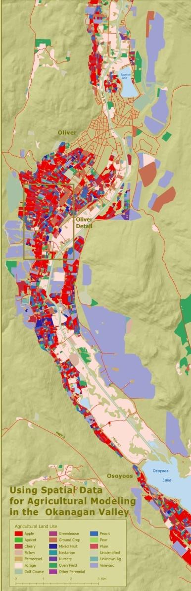
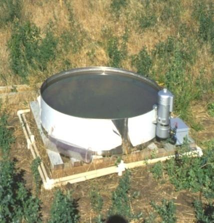
7 Example area

8 The Okanagan Basin developed area is divided into 398 map sheets Unified Cadastre


9 Map sheets were developed using GIS and aerial photography. Cadastre and land use polygons were added by technicians. Land Use Data
10 The GIS data was verified by a windshield survey of every property

11 Land Use Data Data was entered into the database in the field. Where polygon changes were required notes are made on the map sheet and sent back to the GIS technician for updating


12 Land Use Polygons Cadastre Polygon 3 1. Microsprinkler on peaches 2. Microsprinkler on cherries 3. Microsprinkler on pears 4. Drip on pears 5. Residential 6. Bee hives
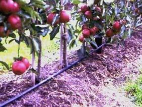
13 Crop Type: Apple Pasture Irrigation System Type: Sprinkler Drip House


14 There are 130,000 polygons generated for the Okanagan in the farming areas Cadastre Land and Crop Polygon Soil Boundary
15 Climate Data A climate cell gets assigned to each cadastre Climate grid 1 linked to Cadastre 1 Climate grid 2 linked to Cadastre 2 and 3 3 Cadastre Land and Crop Polygon Soil Boundary Climate Grid
16 Crop Coefficient Crop Coefficients Algorithm calculates water demand from: ETo calculated daily from climate data Climate data to determine start and end of growing season Crop coefficients to adjust daily Eto 0 Apr May Jun Jul Aug Sep Apples Soil and rooting depth information to calculate soil water storage, percolation rates and determine soil factors Alfalfa Irrigation system efficiencies


17 Results by Crop Crop Group Irrigated Area (ha) Irrigation Demand (mm) Apple 4, Berry Cherry 1, Forage 8, Fruit Golf 1, Grape 2, Landscape Turf 126 1,009 Nursery Turf Farm Vegetables Total = 20,

 Drip 1,490 415")


18 Irrigation System Results by Irrigation System Irrigated Area (ha) Irrigation Demand (mm) Drip 1, Golfsprinkler 1, Gun 308 1,118 Handline 1, Landscape Sprinkler Microspray Microsprinkler 1, Overtree Drip Overtree Microsprinkler Pivot Pivot Low Pressure SDI Sprinkler 3, Solid Set Gun Solid Set Over tree 3, Solid Set Sprinkler Solid Set Undertree 1, Travelling gun 2, Wheelline 1, Total = 20,

")
")


19 Results by Water Source Water Source Irrigated Area (ha) Irrigation Demand (m 3 ) Water License 1,672 11,455,582 Assuming good management Water Purveyor 14, ,930,320 Groundwater 3,394 21,695,142 Total 20, ,081,043


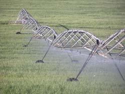
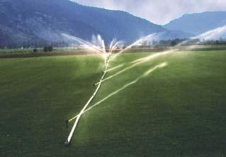
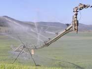
20 Steps to Improving Irrigation Management Efficiency: select the most efficient system possible Uniformity: design the system to achieve the best uniformity Scheduling: apply irrigation to match crop and soil conditions

21 Irrigation Designer Certification www. Irrigationbc.com Certification is available in: Agriculture Sprinkler Agriculture Drip
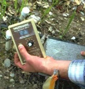
22 Irrigation Scheduling Techniques 1. Soil Moisture Monitoring 2. Climate Monitoring


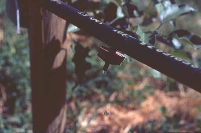
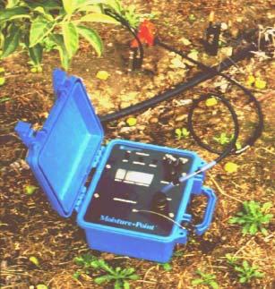
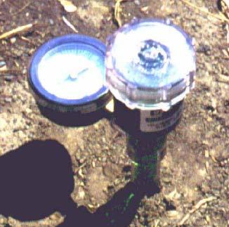
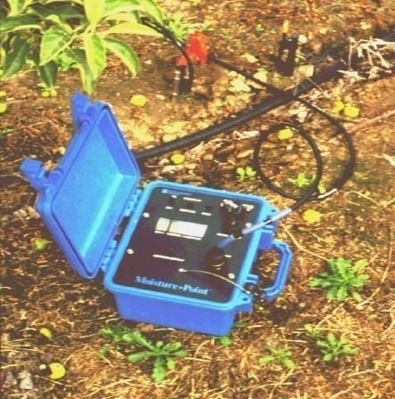
23 Soil Moisture Monitoring Electrical Resistance Block Watermark Tensiometer TDR/TDT


24 When To Irrigate? An irrigation system in a sandy loam soil with a root depth of 1 m. Is scheduled to begin irrigation when the available water has been depleted by 50% Irrigation should start when the sensor Reaches 40 centibars
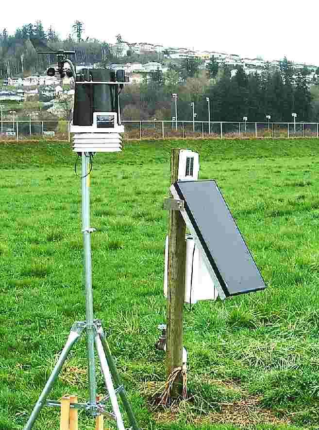
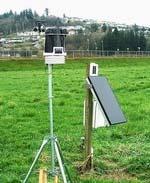
25 Climate Monitoring
26

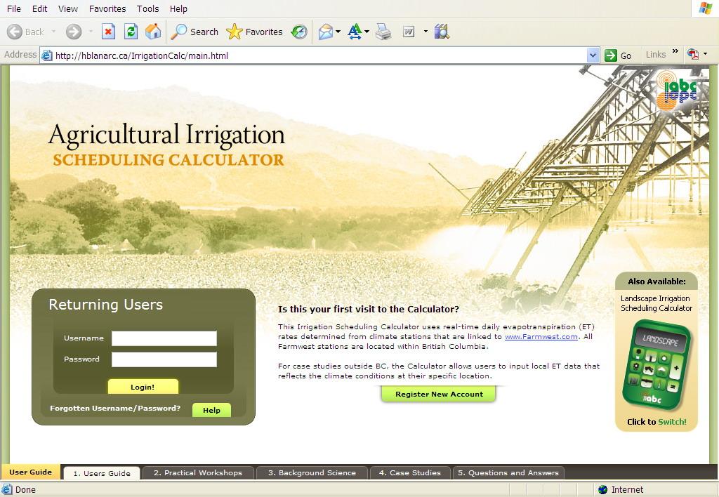
27 The calculator links to climate stations on
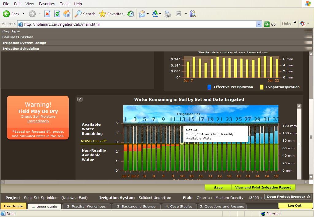
28


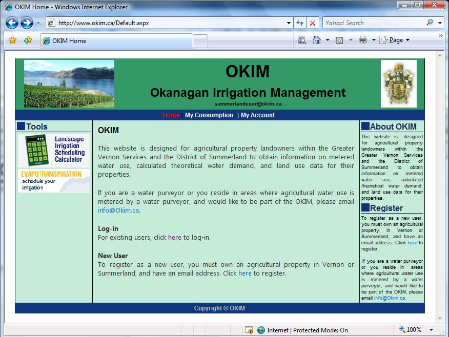
29 Managing Agricultural Water Use Meters provide a tool to help manage water Ag Water Demand Model can be used to assess water use through OKIM (Okanagan Irrigation Management program) There are six water purveyors that are now metering agricultural connections
 Anticipated demand (Calculated by the")
30 Objective of OKIM Improve Water Demand Side Management for irrigation customers by comparing and analyzing: Existing consumption (Obtain from Meter readings) Anticipated demand (Calculated by the AWDM)
31