Practical Challenges and Innovations in Integrated Landscape Approaches
|
|
|
- Lesley Young
- 5 years ago
- Views:
Transcription
 Senior Environmental Specialist Presentation at FAO Investment Days Rome, December 16,")
1 Practical Challenges and Innovations in Integrated Landscape Approaches Nagaraja Rao Harshadeep (Harsh) Senior Environmental Specialist Presentation at FAO Investment Days Rome, December 16, 2014
2 Landscapes come in various forms Basins/Watersheds Habitats/Ecosystems Floodplains Agricultural Landscapes UrbanScapes DesertScapes MountainScapes LakeScapes DeltaScapes

3 There are few landscapes that remain pristine

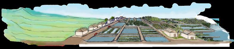
4 A Visual Journey through Global Landscapes Challenges


 Reducing")


 Reducing")


 Poverty")


5 Multiple Development Objectives in Landscapes Triple Bottom-Line Needs Economic Net benefits of env. services across sectors Commodity exports (e.g. power, agriculture) Reducing imports Fueling sustainable growth and shared prosperity Enhancing regional Cooperation Environmental Sustainability of the resource base (surface and ground water) Managing pollution and salinity Managing climate risks (floods, droughts, climate change) Reducing erosion/siltation Conserving other ecosystem services (biodiversity, wetlands, env flows) & eco-tourism opportunities Social Access to basic services (e.g. water supply, energy) Poverty Alleviation/ income growth Employment/Jobs/Livelihoods Equity/Gender/Affordability/ Vulnerable/Indigenous People Reducing Resettlement/ Migration Community preparedness and mgmt. of climate risks

6


7 Moving to a Multi-sectoral Perspective A Typical River Basin Precipitation Agriculture Department Livestock Department Forest Department Fishing Reservoir Hydropower Rainfed Agr Return Flow Industry Forest Rural WSS Runoff Urban WSS Rural Water Supply Department Urban Water Supply Department Irrigation Department River Basin Boundary Power Department Industry Department Fisheries Department Irrigation Recreation Groundwater Inflow Infiltration / Recharge Community Use Navigation Environment Department Transport Department Tourism Department Groundwater Department Base Flow / Pumping Surface Water Department Ocean Development/CZM Department Trans-boundary Water Institutions Groundwater Livestock there is a need for a shared vision of the landscape to integrate the activities of multiple actors Irrigation Groundwater Outflow Wetlands / Environment Ocean
8 Basin? Watershed? Catchments? Micro-Watershed/Micro-Catchment Sub-Watershed/Sub-Catchment Watershed/Catchment Sub-Basin River Basin


9 Innovative Solutions in an Integrated Landscape Perspective Institutions & Policy


 Analytical Tools")
 S U D A N")


 Capital city 0-0.")
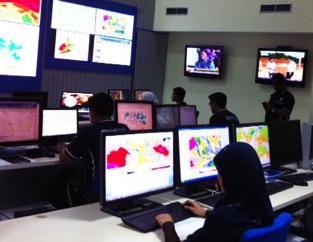
10 Monthly Blue Nile Flows at Khartoum Annual Blue Nile Flows at Khartoum Information & Analysis Resource Information Base (data rescue; monitoring; comprehensive spatial, temporal and other databases; improved use of satellite data; documents) Knowledge Products/Special Studies (maps, Atlases, interactive toolkits, surveys) Access and Outreach mechanisms (publications, web portals, Apps with public access to open data services, technical/ success stories, multi-media documentation) Analytical Tools (models/decision Support Systems for planning/operations support) S U D A N Khartoum Kusti Malakal S O U T H S U D A N Juba Jimma E T H I O P I A Data source: NOAA, 2006 E N T R O Eastern Nile Technical Regional Office Cairo E G Y P T Asyut Luxor Nasir Reservoir Wad Madani E R I T R E A Kassala Asmara Gonder Tana Lake Bahir Dar Addis Ababa GDP (million $/sq.km.) Capital city Country boundary Major river Lake/Sea ,194 Blue Nile Sub-Basin


 Lower Arun 100% Tamur-1 Sun Kosi-2 Arun")


 Burhi Gandaki Karnali-1B Sapta Gandaki")
11 Modernizing tools to support decisions In investment planning In system operations To optimize the development and management of the resource base for sustainable social, economic, and environmental benefits to current and future generations Hydropower Sensitivity to Climate Change Models (2050 A2 Scenarios) Lower Arun 100% Tamur-1 Sun Kosi-2 Arun III 50% Andhi Khola Sapt kosi 0% Kali Gandaki-1 %HP Change BCM %HP Change CMA Kulekhani-1-50% Kali Gandaki-2 %HP Change GFDL_CM2 %HP Change GISS Kamala -100% Seti-1 (Central) %HP Change MIU_ECHO %HP Change CSIRO %HP Change CNRM %HP Change UKMO %HP Change MIROC Pancheswor Marsyandi %HP Change NCARPM1 Seti-6 (West) Burhi Gandaki Karnali-1B Sapta Gandaki Chisapani Trisuli


12 Institutions & Policy Strengthening Institutions (office modernization, stakeholder participation, capacity development and training incl. distance learning, improved links with academia, internships, visiting experts, professional networks/ communities of practice; forums, competitions) Strengthening Policies (economic instruments, streamlining institutional design/policy/mandates, improving synergy, decentralization)


13 Investments & Operations Preparation of a robust on-the-ground investment pipeline (with adequate attention to technical, environmental, social, economic, and institutional aspects) Implementation facilitation, monitoring, and lessons (adequate technical assistance, ownership, M&E)
14 The Malawi Context


15 Growing Population and Demands Malawi Key Challenges

16 Shire Basin Accounts for about 97% of Malawi s electricity Has most of Malawi s irrigation Supports rainfed agriculture to millions home of most of Malawi s rural poor Provides water supply to Blantyre Has significant environmental, biodiversity, and fisheries assets


17 Transboundary Issues Water Infrastructure Mining Biodiversity Fishing Catchment Degradation Competing Water Uses Droughts Irrigation Hydropower Water Supply Flooding Inland Port
 Lake Malawi Historical")

18 Source: regionid=eafrica®ion=&reservoir_name=malawi Average of Lake Level (m) Lake Malawi Historical Time Series Jan 1900 Jan 1910 Jan 1920 Jan 1930 Jan 1940 Jan 1950 Jan 1960 Jan 1970 Jan 1980 Jan 1990 Jan 2000 Year Month The Shire outflow from the Lake dried up from


19 High Erosion Malawi Key Challenges Typical sedimentation blocking culverts downstream in a rivulet downstream of Chingale escarpment Balaka Weeds interrupt power Mangochi Erosion gullies upstream Neno Zomba Machinga Mwanza Nkula Kapichira Chiradzulu Blantyre Mulanje Sedimentation at hydropower plant downstream Chikwawa Thyolo


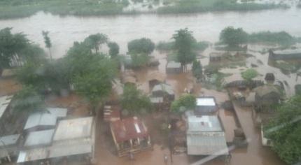
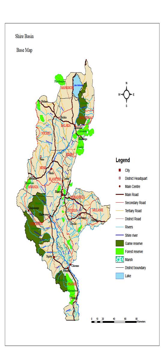

20 The Shire Basin Key Challenges Need for Infrastructure Need for modernizing monitoring systems Biodiversity Extensive Rainfed Agriculture Flooding in the Lower Shire

21 Shire River Basin Management Program Sustaining long term growth and resilience Long-term multi-sector program (15 years) to: increase sustainable social, economic and environmental benefits by effectively and collaboratively planning, developing and managing the Shire River Basin s natural resources. Key proposed results of first phase: An intersectoral institutional mechanism for Shire River Basin management A joint Shire River Basin Development Plan Improved flood management through better early warning Improved climate resilience and downstream power production through improvement land and water management practices Improved security and regulation of Shire flows for hydropower, irrigation and water supply through upgrading Kamuzu Barrage Preparation for critical water investments


22 Malawi Shire River Basin Program: Proposed Phasing Program Focus Areas: Information: Improved collation, processing, communication, and use of information for decision support Institutions: Improved capacity for modern shared-vision Basin planning & mgmt.; enhanced community adoption of improved land & water mgmt. practices Investments: Preparation and implementation of a pipeline of water-related investments Phase I US $125m IDA +$6.6m GEF/LDCF Information: Initial Basin knowledge base & real-time monitoring, Decision Support Systems for basin planning and management Institutions: Shire Basin Institution setup, Shire Basin Plan developed, Capacity-building of water and ecosystem related institutions and public awareness Investments: Kamuzu Barrage upgrading, Catchment management in selected catchments and flood management in targeted areas of Lower Shire, Preparation of new water investments Phase II US $ m Information: Continued knowledge base and hydromet improvement, improved integration into local, regional, and global networks Institutions: Shire Basin Plan implemented and updated, Continued capacity-building, Improved public-private partnerships, Disaster insurance Investments: Additional water investments undertaken and prepared (new and modernization), consolidation of catchment investments in earlier phases and work to cover remaining priority catchments Information: Continued knowledge base and hydromet improvement, detailed surveys, flood zoning, integration into national and regional hydromet networks Institutions: Strengthened Shire Basin Institution with strong legal framework, Basin Plan implementation and refinement, Continued capacity-building and public awareness Investments: Water investments undertaken and prepared (new and modernization), consolidation of Phase I catchment investments and work on additional priority catchments, rural energy investments Phase III US $ m


 Using modern")

23 The Shire Basin Information Building a comprehensive knowledge base of the Shire Basin Working with modern technology (e.g. for data sharing monitoring, operational control, flood warning, conferencing) Using modern analytical/ modeling tools (for planning decision support, forecasting, operational decision support)


24 The Shire Basin Institutions Improving multi-sectoral coordination Improving training and capacity-building Improving links with Academia (incl. sourcing interns/young professionals to work on the Shire Basin) Improving stakeholder participation and communication (e.g. Shire Basin Forum & Conference


25 The Shire Basin Investments Hydromet systems Kamuzu Barrage rehabilitation Catchment management Forest and National Parks/ Ecological management Flood management Preparation of new waterrelated infrastructure and additional catchment/ flood management investments
26 Conclusion Despite challenges (complexity, multi-sectoral institutional coordination, investment needs) critical need to go beyond project-by-project, agency-byagency approach to integrate the activities of key players in a landscape in a longer-term framework Integrated Landscape approaches offer a useful way to pursue multiple sectoral and administrative objectives (environmental, social, and economic) in a spatial context Interventions in a landscape context often include the 3Is that need to be considered in an integrated manner: Information & Analysis Institutions & Policy Investments & Operations


27 Going from Vision Mapping current situation and charting out the future Community Mapping example in Burundi


28 Humbo February 2002 to Reality Humbo March 2010 Tana& Beles Integrated Water Resources Development Project
29 Thanks! For more information, please contact: Dr. Nagaraja Rao Harshadeep (Harsh) Senior Environmental Specialist The World Bank 1818 H St NW Washington, DC harsh@worldbank.org