Feel the Pulse of the Land in the Palm of Your Hand
|
|
|
- Everett Conley
- 5 years ago
- Views:
Transcription


1 Feel the Pulse of the Land in the Palm of Your Hand
2
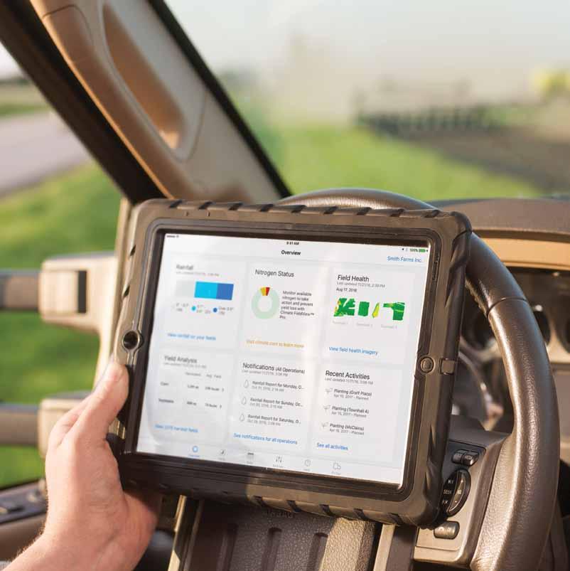
3 If your fields could talk, what would they say? Climate fieldview does the listening so you can get the most out of every acre. You know your fields Climate FieldView is your data partner to support the decisions you make every day. Seamlessly collect and store critical field information. Use digital maps to better analyze seed performance. Compare field data layers visually and generate reports, so you can measure the impact of your agronomic practices and build a plan for next year. 1
4 Get Your Data in One Pl ace Make field data management simple with Climate FieldView. Collect, store, and view your field data in one easy-to-use digital platform that you can access from the field, office, or home. Uncover Valuable field Insights Instantly visualize and analyze crop performance with imagery and field data maps so you can make the best input decisions for your fields. Optimize Your Inputs Easily create variable rate seeding prescriptions so you can get the highest yield out of your most productive field management zones. 2

5 3


6 The information you need, at your fingertips New features for 2017 HIgh-QualIty FIeld Imagery Get frequent and consistent high-quality field satellite imagery to help you identify issues early and take action to protect yield. CUSTOM VarIable rate seeding PrescrIPTIons Optimize your seed investment with easy-to-use variable rate seeding prescription tools. Yield Analysis Tools Analyze seed performance by soil type, by field, or even by field regions so you can pick the best seed for next season. 4
7 5

8 Get Your Data in One Place One MultIPle device options to simplif for y Easy data field collection. Data Collection Climate FieldView offers many options to collect, view, and store your current and historic field data. The Climate FieldView Drive allows you to see your field maps build in real-time and easily transfer that data to your account. The FieldView Drive is simple to install and currently compatible with many tractors and combines. Expanded compatibility with more equipment types is planned for the next year.* Field data connectivity also is enabled through Precision Planting 20/20 SeedSense monitors or John Deere Wireless Data Server (WDS) technology in the cab. For a complete picture of your operation, you can transfer historic data seamlessly between Climate FieldView and other agronomic software applications, or upload data stored in other places. *Visit Climate.com for machine compatibility and information on other equipment partners. 6

9 Monitor your progress in real-time as you pass through the field, tracking population rate at planting and yield at harvest. With remote viewing, you can stay in the loop, even when you re not in the cab. 7

10 Share Get Your Data critical in One Place information with Share trusted Critical advisors. Information With Climate FieldView, you can share your entire operation, one farm, or single fields with your business partners and agronomic advisors to help you make important decisions. Easily generate and send reports. 8

11 9
12 Visualize your data for a better Uncover Valuable understanding Field Insights of hybrid Use Data performance to Analyze Seed. Performance Evaluate the impact of agronomic decisions on yield this season, so you can maximize profitability next season. Use side-by-side maps to compare critical data layers in your field, including yield, soil maps, population rate, and more. Analyze yield by soil and seed type in each field, so you can make the best decisions for next season. 10
13 Field region reports help you understand specific areas in your fields and determine how different agronomic practices can impact performance, so you can build the best plan for next season. 11
14 Uncover Valuable Field Insights Use Imagery to See Your fields See like Your Never fields Before like Never Before. Find out what s happening beyond the end rows with imagery that can help identify issues early and prioritize scouting. Climate FieldView uses a proprietary process to deliver consistent, high-quality satellite images so you can identify in-season challenges and take action to protect yield. Vegetation maps help you monitor biomass over time and feature advanced color mapping to provide a higher level of image detail. The true color overlay option provides real-world images of your fields, so you can compare this view to vegetation and scouting maps. 12
15 Scout more efficiently by dropping geo-located pins with images and notes when you spot potential issues on scouting maps, and share with agronomic advisors to save valuable time. 13

16 Optimize Your Inputs Fine Use Easy Tune Seeding Your Seeding PrescrIPtion PrescrIPtions. Tools to Maximize yield With simple manual seeding prescription tools you can save time and improve your productivity by optimizing your seed investment. Customize your prescription so you can build the best plan for your fields and execute on your equipment of choice. With manual scripting, you can use multiple map layers to easily create customized seeding prescriptions. 14

17 Export your prescription to the Climate FieldView Cab App, MyJohnDeere, or download when you re ready to start planting to execute on your equipment of choice. 15

18
19 From planning in the winter to harvest in the fall, Climate FieldView helps you make more informed decisions all year long

20 spring Use customized insights to make the most of the planting season. Customize your pl anting pl an Save time and improve your productivity with customized manual seeding prescriptions. Build the best plan for your fields and execute on your equipment of choice. Connect Your Cab to The Cloud Seamlessly collect, store, and view field data using the Climate FieldView Drive and reference these digital maps through the season. 18

21 19


22 Summer Maximize your efficiency through the growing season. Monitor Your field Health Use in-season and historical field imagery to evaluate crop health, so you can identify and address potential issues before they impact yield. Prioritize Your Scouting Efforts Drop geo-located scouting pins on field health images and navigate back to those spots for a closer look, or share with agronomic partners. 20

23 21

24 Fall View real-time harvesting maps and yield evaluation tools together in one place. WATCH YOUR HARVEST maps BUILD IN REAL-TIME Capture data from your combine and stream wirelessly to your Climate FieldView account so you can immediately analyze yield results. Use field data to make decisions with confidence Better understand seed performance by comparing digital maps side-by-side. 22

25 23

26 Winter Evaluate the impact of last season s agronomic decisions, then build the best plan for the coming season with variable rate seeding prescription tools. Easily Create Scripts Tailored To Your Fields Simple seeding prescription tools help you save time and improve your productivity. CUSTOMIZE YOUR ANALYSIS Drawing specific field region reports can help you understand your fields and determine how different practices can impact results. 24

27 25
28 Climate fieldview product Features Basic Data Layers Data Inbox Field-Level Weather Scouting Notifications Field Health Manual Scripting Yield Analysis Data Connectivity In-Cab Data Visualization
29 Climate fieldview pricing Free Unlimited Subscription $ FieldView Plus Software* Day Subscription $ 299 $ Add FieldView Drive Starter Kit Additional FieldView Drive Includes one FieldView Drive and mounting kit Available in select locations *FieldView Plus requires enabling hardware, such as Precision Planting s 20/20 SeedSense or FieldView Drive. 27
30 A seamless experience from app to support team With Climate FieldView, you ll have an entire decision support team, wherever you are. Our knowledgeable customer service staff is here to help you navigate your digital tools and make the best use of your data. Join those already using Climate FieldView on millions of acres across the U.S. and make management decisions with confidence. Contact your dealer, get started at Climate.com, or let us walk you through our plan options at

31 JulIus clay Product Support Specialist
32 Climate.com Our services provide estimates or recommendations based on models. These do not guarantee results. Consult your agronomist, commodities broker and other service professionals before making financial, risk management, and farming decisions. Information and recommendations we provide do not modify your rights under insurance policies purchased through our affiliates. More information at ipad is a registered mark of Apple, Inc. John Deere and MyJohnDeere are registered trademarks of Deere & Company. 20/20 SeedSense is a registered trademark of Precision Planting, LLC. Climate FieldView is a trademark of The Climate Corporation The Climate Corporation. All Rights Reserved. 4C4Q