Land and water management. Simplicity and participation. Water streams always top down unless there is pressure.
|
|
|
- Elfreda Hunt
- 5 years ago
- Views:
Transcription
1 Land and water management Simplicity and participation. Water streams always top down unless there is pressure. People always want to cooperate unless there is pressure


2 Introduction on water management and parcellation. DLG has 80 years experiences and innovations Edo Dijkman Executive Director DLG Jan van Rheenen (Inter-)national project leader DLG


3 Content 1. Impression of rural area in The Netherlands 2. Approach via large scale land consolidation and water management 3. Modern approach of the Dutch water management and land consolidation

4 The Netherlands 1. Pictures of old situations in the Netherlands related to parcellation and water management A lecture with pictures

5 It s always for human!
 World Cultural")
6 Beemster 1612 (400 years already) World Cultural Heritage

7 New polders: before this, it was sea (5 meters above)

8

9 But it was worse in the Netherlands I m 62 years old, I have seen this myself


10 After world war II: poverty Not enough food Poor labour conditions

11 Having diner in the cowhouse

12 Pumping water by hand

13 Terrible damage after bombing sea dikes In world war II in the province Zeeland

14 Regular floodings in large areas caused by rain and rivers

15 Each Year floods of smaller rivers in the eastern part of the Netherlands

16 Very wet parcels in harvest times

17 Nostalgic but not practical

18 Disturbing of an already bad parcellation by infrastructure

19 2. Approach via large scale land consolidation and water management
20 - education, extension and training of farmers - land consolidation schemes and projects - large scale water works (Ministry of Water affairs) Most of time via separated approaches Many types of EU cofinancing

21 Approach of The Netherlands: Non-income support agr. schools on lower, middle level, University Wageningen National Schemes on Land consolidation Training and extension services Research related to agricultural practice Role of agricultural organizatons Role of cooperations Role of Banks (RABO bank) and Guarantee Funds Role of Europe
 during some decades. 40.")

22 National schemes on land consolidation Continuous National program of ha (25% of the NL) during some decades ha added each year to the national program ha finished each year Preparation phase 10 years Execution phase 15 years Start implementing plan when 50% of the necessary land is in land bank of DLG

23 Scheme of landconsolidation in 1985 red = in execution yellow = in preparation grey = finished


24 Re allotment by law Precise definition of borders of blocks for re allotment Obligated participation; Objections and appeal in several rounds on 3 levels. Each owner and tenant has the right to receive land of the same quality, potential utility and agricultural value as the land he brought in. Communication and guarantees of good process Effective instrument (30% of all parcels are exchanged)

25 Project: Grootslag Only transport by boat No roads!


26 KEY FIGURES GROOTSLAG 6115 ha Before After Nr. of farms 1, Nr. of parcels 4, Parcels per farm Parcel size 1.3 ha 5.6 ha Total cost (Million euro) 35.0

27

28 Project Eemland:Farms are concentrated behind the dikes because of floodings

29 Project Eemland 36 new Farms on new spots were allocated, thus determining the new allocation plan.

30

31 Dike Breaches Dike breaks in the Dutch river system since 1700

32 Dangerous situations in 1993 and 1995 Room for the River Programme
: 12,000 m 3 /s Discharge 1/1250 yr: 16,000")
33 The Netherlands, Western European Delta Average: 2,200 m 3 /s Highest level (1993/1995): 12,000 m 3 /s Discharge 1/1250 yr: 16,000 m 3 /s


34 deepened river bed Dike is relocated land inwards big lakes as storage for high waters Removing or modifying obstacles Strengthening dikes Realllocating a dike land inwards Lowering floodplain high-water channel as bye pass
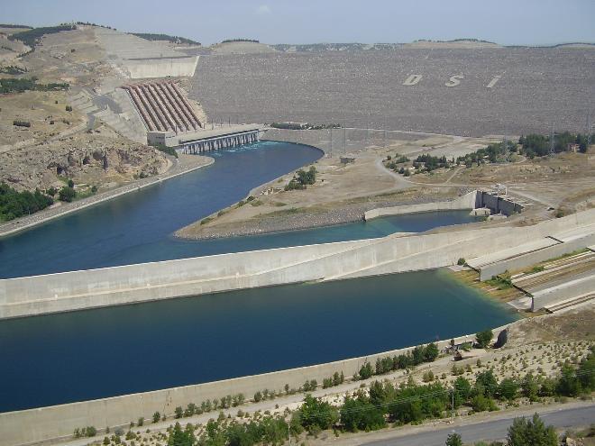
35 Main challenges and lessons learnt from the GAP area in Turkey The South Eastern Anatolia Project (GAP) covers about 10% of the surface area of Turkey ( ha) and houses a large part of the population in Turkey. The GAP project encompasses building large river dams, irrigation projects, land consolidation, village renewal and increasing the participation of women into productive employment. The project has been targeting to complete socio-economical development in the region including investment in the urban, agricultural and rural infrastructure, transportation, industry, education, health, housing, small and middle enterprise development, tourism, cultural heritage development and gender issues. Water management is part of an integrated approach. It is not the only subject, but forms an important motor within. Too big???

36


37

38 3. Modern approach This is the question: Large integrated projects or Small integrated projects Keep the people in the country side Keep the water in the country side


39 Modern approach: - research and innovation - Government / EU - entrepreneurship and business Modern themes: - participation - sustainability - climate change How to involve entrepreneurs: by development of regions/ plateau s of development


40 Participation:main principles Turbo land consolidation

41 Re-allotment area less then 2000 ha Farmers make themselves the reallotmentplan in joint working sessions, with assistance of DLG Very fast: 6 months one year Process is cheap Digitalizing and internet Public goals must be respected

42 New approach: high speed and results First experiences in Turkisch-Dutch projects: Farmers make themselves the re-allotment plan

43

44

45 Respect for historical structures
, is given its own")
46 In stead of removing the old dike (right), the new road (left), is given its own trace

47 Making wet ecological structures

48 No more technical profiles, but integrated projects on each scale

49
50 Thank you very much for your attention