JECAM and the Manitoba Super Site
|
|
|
- Leonard Matthews
- 5 years ago
- Views:
Transcription

1 JECAM and the Manitoba Super Site GEO-DRI Drought Monitoring Workshop May 10 & 11, 2010 Grant Wiseman, M.Sc. AAFC, AESB, Winnipeg, Canada
2 Joint Experiments on Crop Assessment and Monitoring JECAM is a GEOSS Agriculture Initiative with the following goals: facilitate the inter-comparison of monitoring and modeling methods product accuracy assessments, data fusion and product integration, for agricultural monitoring A network of distributed regional experiments in cropland pilot sites around the world representing a range of agricultural systems Time series datasets from a variety of earth observing satellites and in-situ data sources will be acquired for each of the sites Synthesis of the results from JECAM will enable: development of international standards for monitoring and reporting protocols a convergence of the approaches to define best practices for different agricultural systems identify requirements for future EO systems for agriculture monitoring

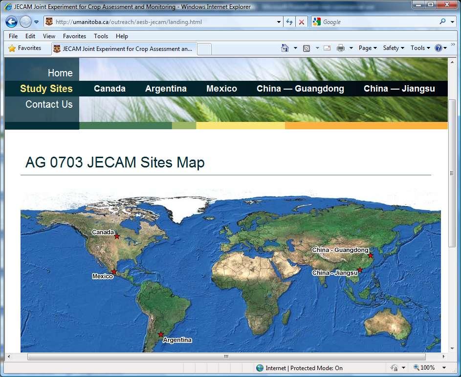
3 JECAM Study: Initial Countries Paraguay
4
5
6
7
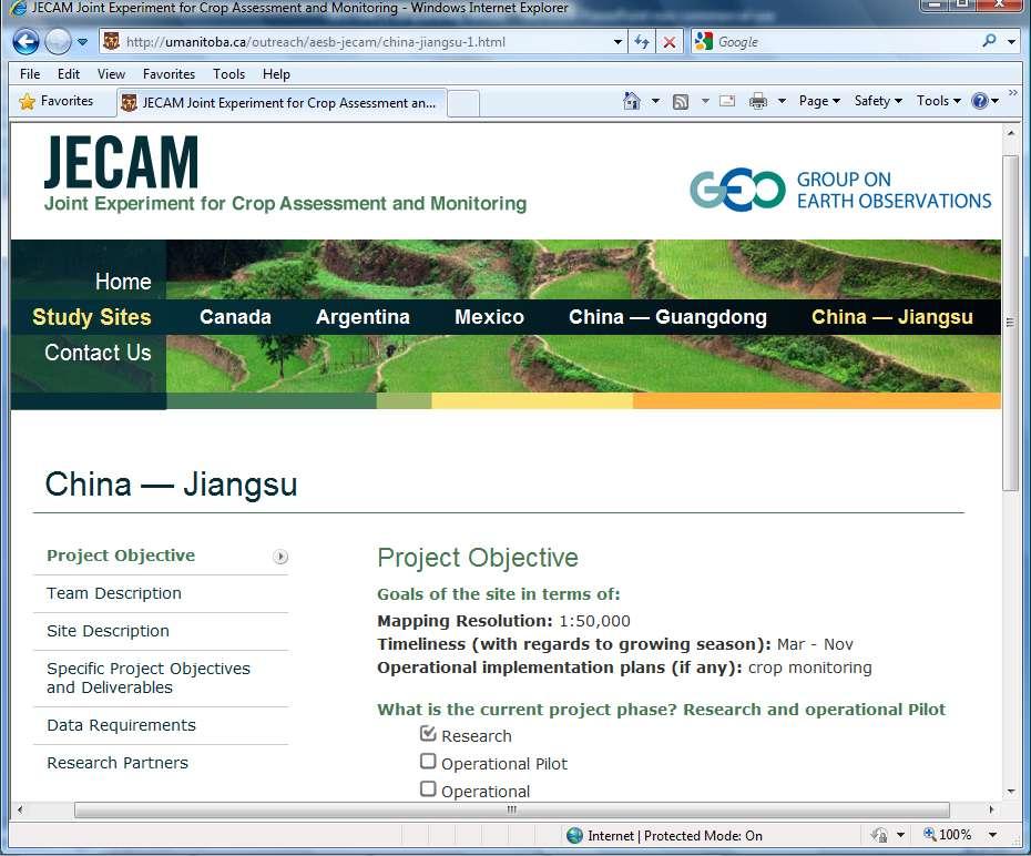
8 Site Description
9
10
11
12
13
14 Red River Basin Super site The general premise of the Red River Basin Super site is to layer and integrate as many of our Agricultural Resource monitoring efforts as practical Common data Critical mass of scientific expertise and enhanced collaboration on methods sharing Cost efficiencies Common vision for operational implementation Red River Basin is a high priority area for the GoC and in particular AAFC Environmental priority areas Important agricultural region, wide range of crops & livestock Water quality concerns Susceptible to climatic extremes (flood, drought)
15 Suitability (Most Suitable) (Least Suitable) RRB Super site Selection 3 Criteria: 1) Agriculture Intensity 2) Soil Moisture Contrast 3) Proximity to Offices Winnipeg 50 Kilometers Elm Creek " " 10 Km Morris River at Brunkild Watershed
16 RRB Super site Research Monitoring topics proposed or active: Soil Moisture, optical and radar Crop and Forage Yield Crop Type Crop Condition Biomass Land Management (Yield and Tillage) Soil Trafficability Riparian Health Status Erosion Risks Flood Risk Pest Assessment
17 RRB Super site Optical Sensors AWiFS, 56 m, Multi-spectral All cloud free data over entire Red River watershed SPOT-4/5, m, Multi-spectral All cloud free data over Brunkild sub-watershed Landsat-4/5, 30 m, Multi-spectral All cloud free data over Brunkild sub-watershed RapidEye, 6.5 m, Multi-spectral All cloud free data over Brunkild sub-watershed LISS-3, 23.5 m, Multi-spectral All cloud free data over Brunkild sub-watershed LISS-4, 5.8 m, Multi-spectral All cloud free data over Brunkild sub-watershed MB Ortho-refresh Program, 50 cm, RGB
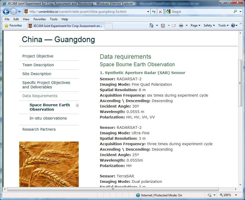
18 RRB Super site SAR Sensors Radarsat-2: C-Band, 8-50 m Quad: Crop mapping VV+VH, Tillage, Soil moisture HH+VV TerraSAR-X: X-Band, 6 M Quad, Dual-Pol: Crop mapping, Tillage ALOS PALSAR: L-Band, m Quad: Crop mapping, Tillage, Soil moisture Envisat ASAR: C-Band, 30 m Crop mapping VV+VH, Tillage, Soil moisture HH+VV AMSR-E: Passive C-Band X-Band, 60 km Soil Moisture Derived by the University of Amsterdam SMOS: Passive L-Band, 50 km Soil Moisture Derived by the European Space Agency
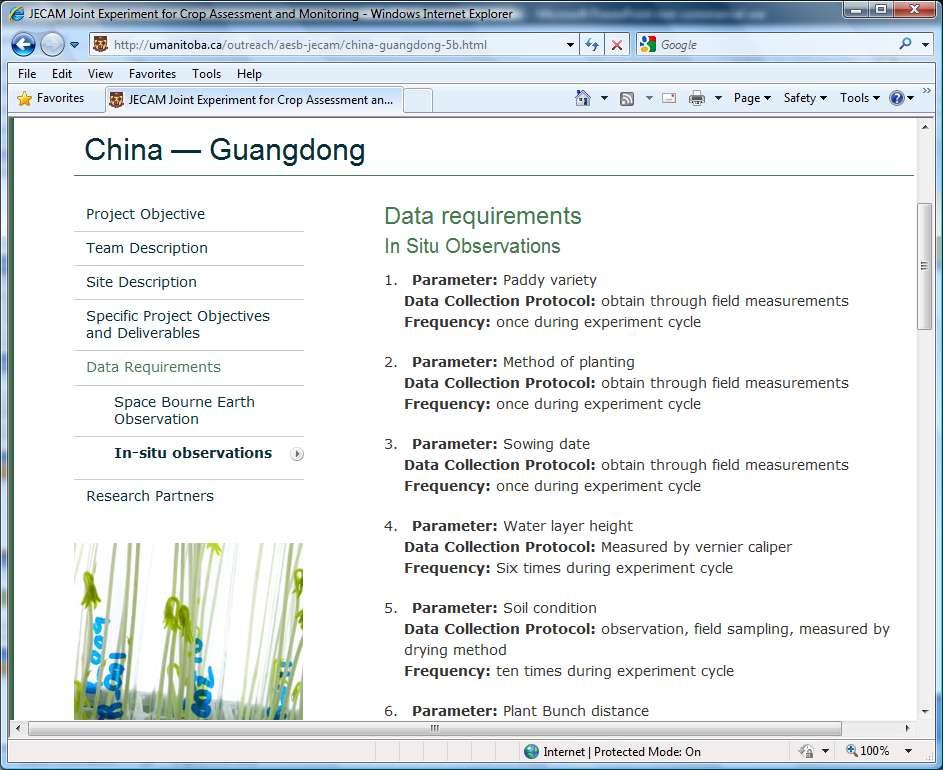
19 RRB Super site In-situ Data 9 sites: 4 Hydra Probe II Soil Moisture Sensor (SDI-12 / RS485) per site measuring soil moisture and soil temperature, 1 rain gauge per site Depths of probes: 5 cm, 20 cm, 50 cm and 1 m Solar powered Remote Telemetry Units (RTU) transmitting samples multiple times per day Sites to be located in Clay, Loam and Sand fields (avoiding tile drainage, headlands) Texture, bulk density, soil classification and characterization recorded for each site 3 Weather stations in Elm Creek, Carmen and Portage
20 USGEO and CGEO Testbed Sites USGEO and CGEO leaders agreed to develop three international, interdisciplinary water-related monitoring testbeds, building on existing initiatives, along the U.S.-Canada border: The Great Lakes: Water availability and water quality monitoring The Rocky Mountains: Cold-water processes The Prairie Region: Soil Moisture and Flood extremes

21 USGEO and CGEO Prairie Testbed Site JECAM Super site CGEO USGEO Test bed

22 Questions?