FOUNDED IN sq/ft 3
|
|
|
- Martin Norman
- 5 years ago
- Views:
Transcription

1 MATT WAITS

2 FOUNDED IN sq/ft 3 BUILDING SIZE EMPLOYEES
3 SSToolbox ECOSYSTEM
4 SST Information Lab ECOSYSTEM
5 SST Summit/FarmRite ECOSYSTEM

6
7 TODAY IN ,000 sq/ft 80 BUILDING SIZE EMPLOYEES

8 TODAY IN EMPLOYEES 30% = 10 to 20 years with SST

9 TODAY IN FIVE UNITED STATES ONE AUSTRALIA ONE BRAZIL
10 AG RETAIL ENVIRONMENT P.A. TECHNICIAN


11 N. American Footprint 110,000,000 acres 160,000 farmers


12 International Footprint

13 AG RETAIL ENVIRONMENT P.A. TECHNICIAN AGRONOMIST/SALES


14 BOUNDARIES WEATHER SOIL SAMPLING SCOUTING RECORD KEEPING VARIABLE RATE REC EDITING
15 CREATE NEW BOUNDARIES Collect accurate boundaries using extensive boundary tools DRAW TOOL Draw accurate boundaries using your finger to drop vertices. GPS TOOL Drive the perimeter of a field to create a boundary using GPS.

16 GRID SAMPLE Create square or rectangle grids on multiple polygons ZONE SAMPLE Utilize management zones to collect zone samples NAVIGATION ROUTE Create navigation routes and change during sampling LAB RESULTS View lab results on the map for each point
17 BARCODE REPORTS Generate reports and print or send directly from the field agx CONNECTIONS Set up automatic data sharing with other users of the agx Platform DATA BULLET Push operations and fields to other users of the agx Platform
18 MAP LAYERS Display national rainfall maps and real time radar. HISTORICAL PRECIPITATION View historical rainfall trends across relevant time ranges. WEATHER INFORMATION Access field level current conditions, hourly & 10-day forecast.

19 DATA COLLECTION Collect tons of information in an easy to use interface PICTURES Capture pictures directly in the field PDF REPORTS Print or share PDF reports directly from the ipad

20 TANK MIX Store commonly used tank mixes for quick recommendations REPORTS & PRODUCT TOTALS Create reports that include product totals.

21 PLANTING REC Utilize management zones to create simple variable rate recommendations SCOUTING Create zones from NDVI imagery and use for directed scouting
22 VIEW FERTILIZER & NUTRIENT FETILIZER REC EDITOR LABELS - SDS PDF LABELS - SDS Create and edit legends Edit variable rate recommendations by totals or cost Access valuable regulatory information Save and share PDF labels and SDS
23 AG RETAIL ENVIRONMENT CORPORATE P.A. TECHNICIAN AGRONOMIST/SALES


24

25 Customer Base Uses field boundaries in your company to calculate estimated market share by county.

26 Performance Compares your company s yield data to the NASS reported county averages. Compares at the county, field, grower, and hybrid level.

27 Yield by Hybrid and Soil Type Scatter Plot Uses your company s yield data to compare hybrids and their responses to soil types. Populations responses coming soon. Displays information in scatter plot form instead of bar form.

28 Yield by Soil Type Grower Level Uses the soil types for selected fields to help determine hybrid placement. Seed company lists can be filtered to the products that you supply.
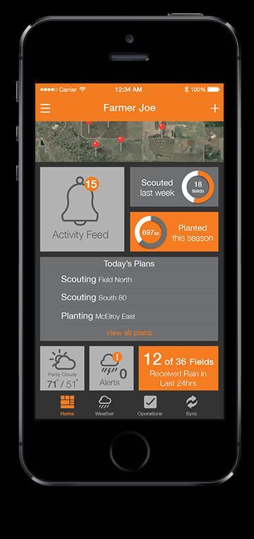
29 AG RETAIL ENVIRONMENT CORPORATE P.A. TECHNICIAN AGRONOMIST/SALES FARMER SST Viewer (iphone)

30
31 AG RETAIL ENVIRONMENT CORPORATE N Modeling/Rx P.A. TECHNICIAN Logistics AGRONOMIST/SALES Imagery Tools FARMER SST Viewer (iphone)

32 AG RETAIL ENVIRONMENT CORPORATE Adapt-N P.A. TECHNICIAN AgSync AGRONOMIST/SALES DRONE DEPLOY FARMER SST Viewer (iphone)
33 ONE COMPANY PROVIDES EVERYTHING SINGLE SOFTWARE COMPANY DATA COLLECTION NITROGEN RECS SEEDING RECS IMAGERY SERVICES ETC. SERVICE PROVIDER APPROACH ONE
34 DIRECT ONE-TO-ONE API CONNECTIONS APPROACH TWO
35 DIRECT ONE-TO-ONE API CONNECTIONS APPROACH TWO
36 DIRECT ONE-TO-ONE API CONNECTIONS APPROACH TWO
37 DIRECT ONE-TO-ONE API CONNECTIONS APPROACH TWO
38 DIRECT ONE-TO-ONE API CONNECTIONS APPROACH TWO
39 DIRECT ONE-TO-ONE API CONNECTIONS APPROACH TWO

40 FIELD BOUNDARY EXAMPLE 125 Acres APPROACH TWO
41 FIELD BOUNDARY EDITED NEW SIZE NEW GEOGRAPHY NEW GUID INFO 122 Acres APPROACH TWO
42 DIRECT ONE-TO-ONE API CONNECTIONS APPROACH TWO
43 DIRECT ONE-TO-ONE API CONNECTIONS APPROACH TWO
44 SYNCHRONIZATION NOT JUST INTEGRATION APPROACH THREE
45 CENTRAL DATA REPOSITORY APPROACH ANALYSIS DATA COLLECTION LOGISTICS NITROGEN RECS IMAGERY SEEDING RECS APPROACH THREE

46 Synchronization with a Central Hub ANALYSIS DATA COLLECTION LOGISTICS NITROGEN RECS IMAGERY SEEDING RECS APPROACH THREE