Coupling Bioenergy Production and. Distributed Modeling Approach
|
|
|
- Russell Long
- 5 years ago
- Views:
Transcription
1 Coupling Bioenergy Production and Precision Conservation: a Spatially Distributed Modeling Approach A.R. Kemanian*, R.P. Duckworth*, M.N. Meki*, D. Harmel**, and J. Williams* * Blackland Res. & Ext. Center, Temple, TX ** USDA-ARS, Temple, TX 6 October 2008 Houston, TX Improving Life through Science and Technology
2 Outline Introduction Bioenergy and Precision Conservation models in plots, watersheds, and now farms Objective Methods farm and landscape description the model APEX benchmark cropping systems Results: average and spatially distributed effects grain and biomass yield erosion, sediment yield, nitrogen losses Concluding remarks
3 Introduction Precision i Conservation encompasses a set of technologies and procedures to implement conservation management considering the spatial and temporal variability across natural and agricultural systems 1 apply conservation measures when and where needed increase the return in conservation per investment unit Bioenergy crops and bioenergy cropping systems intensification of residue extraction from current systems introduction ti of new crops re-discovery of old and design of new rotations design of landscape-based rotations 1 Berry J.R. et al., J. Soil and Water Conservation 58:
4 Introduction Homogenous, field-scale cropping systems research cropping systems models EPIC, CropSyst, RZWQM, APSIM, crop models DSSAT-group, Sirius, Sucrose other models, Roth-C, Century, SoilN River basin-scale models SWAT, Linking field- to farm- and small watershed-scales APEX
5 Objectives Estimate, using a simulation model, the productivity and environmental impact of a virtual farm with different combinations of simple cropping systems in each landscape position Provide a robust quantitative assessment of onsite and offsite environmental impacts for each system considering their spatial distribution For this presentation we focused on grain and biomass For this presentation we focused on grain and biomass yield, erosion, and to a minor extent, on N losses
 Average temperature ~19 C Precipitation ~900 mm/yr (spring / fall) ET o ~2000 mm/yr Precip or PA AW, m")
 and bermudagrass Erosion control is a priority USDA-ARS has a long-term database of this farm s hydrology and")
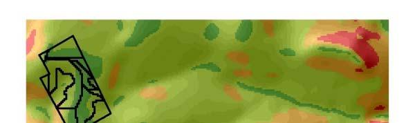
6 Methods farm description 340-ha USDA-ARS experimental farm in 150 the Blackland Prairie of Central Texas 125 (Riesel) 100 Clay soils (montmorillonitic) Average temperature ~19 C Precipitation ~900 mm/yr (spring / fall) ET o ~2000 mm/yr Precip or PA AW, m Jan Mar May Jul Sep Nov Precip RZWC Tx Tn Temperatu ure, Land use continuous cropping (corn / sorghum / wheat / oats) and bermudagrass Erosion control is a priority USDA-ARS has a long-term database of this farm s hydrology and erosion
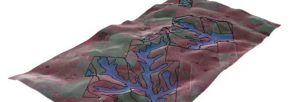
7 Methods Landscape Segmentation The Field Hydro Tool executes a sequence of processes within ArcGIS 9.2 to subdivide a farm into hydrologically connected sub-areas based on terrain attributes. It renders a spatially indexed set of parameters for upland and lowland sub-areas used as inputs in the APEX model Preprocessed GIS Input Data Field Hydro Tool WinAPEX
8 Methods simulation model APEX: a model for assessing crop and soil processes in micro-catchments or farms. It runs on a daily time-step and computes the soil water balance, the nutrients and soil carbon balance, crop growth, the removal and transport of sediments and other components in water, the export of nutrient with harvest and other net removals, and the impact of tillage practices and structural conservation practices on hydrology and soil properties
9 Methods - scenarios corn- corn continuous cropping under reduced-tillage corn-wheat continuous cropping (one crop per year) switchgrass entire farm corn-wheat upland / switchgrass in lowland switchgrass upland / corn-wheat in lowland Tillage: three operations + seeding + harvest Fertilizer: corn 110 kg N/ha 25 kg P/ha wheat 70 kg N/ha 20 kg P/ha switchgrass 70 kg N/ha Outputs provided are the average of 100 years

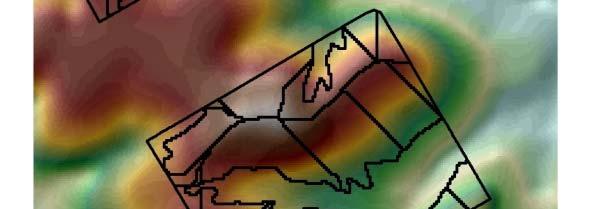


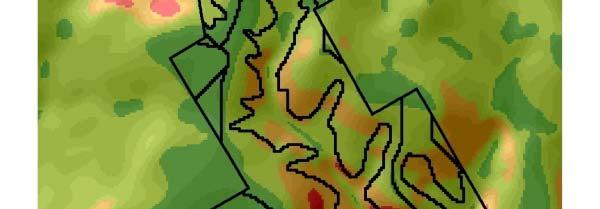
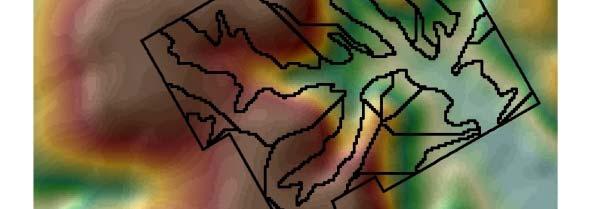

10 Results landscape segmentation Relief Slope


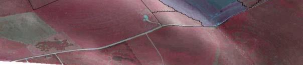
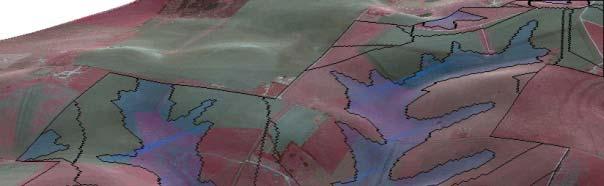
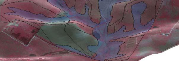
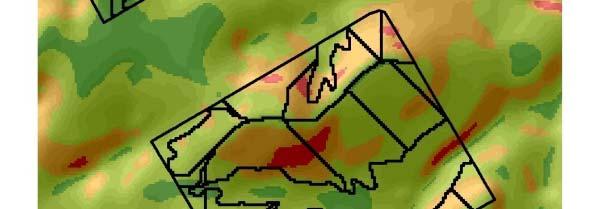
11 Results landscape segmentation Upland (63) Lowland (10)


12 Results landscape segmentation The original 338-ha were subdivided in 73 sub-areas: 10 lowland and 63 upland 30% lowland - 70% upland 30 upland sub-areas drain as edge of field (~33 ha) 33 upland sub-areas drain into the 10 lowland sub-areas (~203 ha) 10 lowland sub-areas drain as edge of field (~102 ha, with two dominant sub-areas occupying 92% of lowland)
13 Yield, biomass, carbon inputs System Grain Residue Biomass Biomass Carbon harvest harvest produced returned returned Mg ha -1 yr Corn-Corn Corn-Wheat Switchgrass SWGS/C-W C-W/SWGS
14 Runoff, erosion, sediment yield System Runoff Erosion Yield Redist. sediment Off-site yield Off-site yield mm Mg ha -1 yr % Corn-Corn Corn-Wheat Switchgrass SWGS/C-W W C-W/SWGS
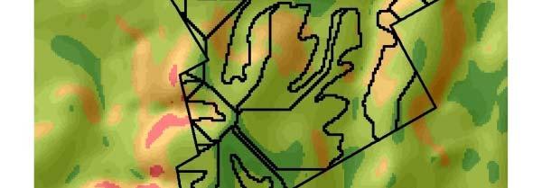
15 Erosion: Onsite Impacts Cropping systems / tillage control erosion erosion can be highly localized perennial bioenergy crops locations
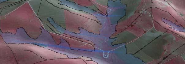
16 Sediment Yield: Onsite Impacts high erosion high yield are correlated Fractional yield depends on area size and type
17 Sediment Yield: Offsite Impacts control of offsite effects is highly localized Control of onsite and offsite effects can be coupled or decoupled
18 Whole-farm grain and sediment yield System Grain Residue Sediment ds/dg ds/db* harvest harvest yield Mg yr Mg Mg Corn-Corn Corn-Wheat Switchgrass SWGS/C-W W C-W/SWGS * biomass valued as 0.5 of grain
19 N balance components (kg N ha -1 ) C-C C-W SW gross mineralization net mineralization fertilizer input volatilization denitrification runoff percolation removed with harvest Spatial variation i of soil moisture and N cycling Initial soil C and N with depth too high
20 Concluding Remarks Modeling approach provides strong support for: spatially distributed quantification of grain and biomass yield and onsite/offsite impacts efficient application of spatially targeted conservation practices and quantitative assessment of landscape-based croppingsystems design Future work will include spatially-variable simulation (and validation) of carbon and nitrous oxide emissions, and overall system optimization
21 Acknowledgments Larry Francis provided excellent technical support to link the Field Hydro Tool and the WinAPEX interface Funding for this research provided by Texas AgriLife Research Cropping Systems Initiative 2007

22 Questions