Land For Sale ACREAGE:
|
|
|
- Anne Higgins
- 5 years ago
- Views:
Transcription


1 Land For Sale ACREAGE: Acres, m/l LOCATION: Burt County, NE Property Key Features Combination High-Quality, Income-Producing Cropland and Recreational Land Acres Planted to Cropland Acres of Irrigated Cropland REID:


2 Plat Map Acres, m/l, Burt County, NE 41 Road 43 Road E Road SUBJECT Map reproduced with permission of Farm & Home Publishers, Ltd.

3 Aerial Photo Acres Total Acres: Crop Acres: * Corn Base Acres: Bean Base Acres: *Includes acres certified as grass. Property Information Acres, m/l Location From Tekamah, 2 miles south on Highway 75 to E Road, then east approximately 5.5 miles. Subject tract on south side of E Road. Legal Description SESE and E26.65 Ac NENE of Section 1, NENE of Section 12, all in Township 20N, Range 11E; E2 W of River, N2NW, SENW, NE EX TR & S2SW EX TR of Section 6; and N2L1-2, NWNW & Pt NENW of Section 7, all in Township 20N, Range 12E (Arizona S Township) Price & Terms $3,495,000 $6,633.77/acre 10% down upon acceptance of offer; balance due in cash at closing Possession Upon closing. Open Lease for Net Real Estate Tax 2018 Net Taxes Payable 2019: $27, Net Taxable Acres: Tax per Net Taxable Acre: $51.31 Buildings/Improvements None FSA Data Farm Number 4496 Crop Acres: * Corn Base Acres: Corn PLC Yield: 191 Bu. Bean Base Acres: Bean PLC Yield: 41 Bu. Wheat Base Acres: 11.4 Wheat PLC Yield: 31 Bu. *Includes acres certified as grass. Soil Types/Productivity Primary soils are Blencoe silty clay loam, Blyburg silt loam and Haynie silt loam. See soil map for detail.

4 Soil Map Acres CRP Contracts None Land Description Nearly level, bottomland cropland. Drainage Natural Yield History (Bu./Ac.) Year Corn Beans (est.) Yield information is from scale tickets. Bottomland Disposition Cultivated cropland was not flooded during 2011 Missouri River flood.


")

 Comments Fall tillage completed for 2019 crop season.")

5 Property Photos Water, Well & Irrigation Information Irrigation Equipment included with Sale: 2013 Reinke Model E2065-G/57 7- Tower Pivot linear feet (South Pivot) 4978 feet underground pipe and wire South Well & Pump: Set up to pump 700 GPM using 30 HP U.S. Electric hollow shaft motor, 3-Phase, 2 Stage Bowls North Well & Pump: Set up to pump 700 GPM using 30 HP U.S. Electric hollow shaft motor, 3-Phase, 2 Stage bowls (Recorded permanent easement for use of well) Irrigation Equipment owned by farm operator that would need to be purchased separately: 2013 Reinke Model E2065-G Tow/57 4-Tower pivot linear feet (North Pivot) 2013 Reinke Model E2065-G Tow/57 6-tower Pivot Linear feet (East Pivot) Comments Fall tillage completed for 2019 crop season. Shredding corn stalks, chisel and dry corn fertilizer to The information gathered for this brochure is from sources deemed reliable, but cannot be guaranteed by Hertz Farm Management, Inc. or its staff. All acres are considered more or less, unless otherwise stated. All property boundaries are approximate. South Pivot South Pivot Panel South Well 7-Tower South Pivot North Pivot North Well


6 Property Photos East Pivot South Pivot/Field/Timber Quality Bench Ground Next to Timber Timber Off Bench


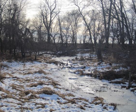
7 Property Photos
8 Make the Most of Your Farmland Investment Real Estate Sales and Auctions Professional Buyer Representation Professional Farm Management Certified Farm Appraisals