UAS In Agriculture A USDA NIFA Perspective; Appropriate Science, Possibilities, and Current Limitations
|
|
|
- Ophelia Chapman
- 5 years ago
- Views:
Transcription

1 UAS In Agriculture A USDA NIFA Perspective; Appropriate Science, Possibilities, and Current Limitations Steven J. Thomson, Ph.D National Program Leader
2 Background Faculty member at Virginia Tech for seven years With USDA ARS in Stoneville, MS for years as Lead SY Have been with USDA-NIFA for one year as National Program Leader
3 The National Institute of Food and Agriculture (NIFA) provides leadership and funding for programs that advance agriculture-related sciences. Funds Land-Grant Universities, government, private, and non-profit organizations. 3
4 USDA-NIFA Division of Agricultural Systems Agricultural Engineering Bioprocessing/Bioengineering Nanotechnology for Agricultural and Food Systems NSF NIFA Collaborations of Interest National Robotics Initiative (NRI) Cyber-Physical Systems (CPS)
5 NSF Collaboration National Robotics Initiative (NRI): example proposals Human/Robot Collaborations Plant Phenotyping Plant Health Assessment UAS-based surveying and sampling systems Vegetable Harvesting Scouting
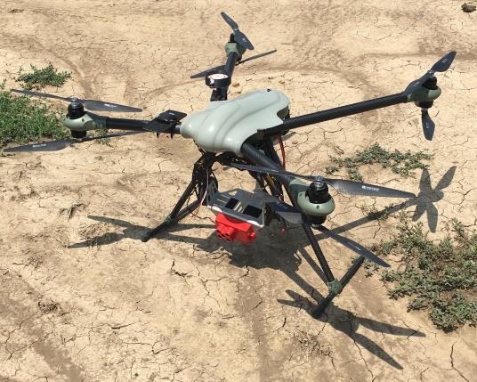
6 UAS in Agriculture


7 Examples of UAS research for agriculture Crop protection spraying systems Finding use in vineyards, small fields Yamaha RMAX has FAA approval Crop production crop stress caused by multiple factors low-altitude remote sensing
8 Advantages of UAS for remote sensing of crop fields: 1. Can fly low High resolution imaging systems have been miniaturized More pixels per unit field area 2. Have potential for decent field coverage Fixed-winged platforms can cover more area Rotary-winged platforms can hover - discover fine details where needed. Can also be used for field sampling (NRI grant). 3. Deploy when information is required very convenient Fly under the clouds (as agricultural aircraft can) Newly available turnkey systems allow rapid turnaround of information to farmer 4. Cost Initial cost is low
9 Issues of UAS for remote sensing of crop fields: 1. More pixels per unit field area but Increased computational resources required Can be circumvented by use of triggering schemes 2. Have potential for decent field coverage but Fields in US are large so many flight-hours needed Piloted aircraft may be preferable in some cases Data quality is strongly affected by light quality Limitations on altitude and range Piloted aircraft do not have this limitation Range issues are being addressed solar-powered retrofits 3. Cost Low cost systems are prone to failures during flight, but that is quickly being remedied Insurance and pilot training are not considered
10 Example Applications
11 Crop injury due to herbicide Visible-band and multispectral imaging Herbicide dose-response of plants Crop injury due to spray drift
/(Green+Red) 0.12 0.1 0.08 0.06 0.04 0.02 0 X=0.56 kg ai/ha")
12 NDPVR Yield (kg/ha) Soybean Injury from Dicamba (RGB Imaging) NDPVR NDPVR=(Green-Red)/(Green+Red) X=0.56 kg ai/ha


13 Yield (kg/ha) Yield (kg/ha) Soybean Injury from Dicamba (CIR Imaging) NDVI NDVI NDVI SAVI NDVI SAVI X=0.56 kg ae/ha X=0.56 kg ae/ha
 in each plot: CUC = NoCP NoPP where NoCP is the number")

14 Lint Yield (kg/ha) Cotton Yield Estimation (RGB Imaging with Advanced Image Processing) Imaging metric defined as a ratio for a cotton unit coverage (CUC) in each plot: CUC = NoCP NoPP where NoCP is the number of cotton boll pixels in a plot; NoPP is the number of pixels in the plot area CUC RGB image global thresholding failed with the assumption that cotton bolls are globally brighter

15 Crop Damage Due to Induced Drift of Glyphosate Crops imaged and measured 1, 2 and 3 WAT
16 Compared Vegetation Indices Normalized Difference Vegetation Index (NDVI) (NIR-Red)/(NIR+VIS) In previous example CVI had best correlation with measured plant damage. What about hyperspectral?
 are very expensive.")

17 Are hyperspectral sensors required? Shortwave infrared bands (1100 to 2500 nm) are very expensive. May have benefit for weed identification based on spectral differences. Red-edge bands extremely good for estimating chlorophyll content, but sensor makers are putting red-edge bands on multispectral sensors. c/o Dr. Ray Hunt, USDA ARS

18 Image c/o MicaSense


19 Micasense Imaging System RedEdge
20 NIFA-funded grant Dr. Bruno Basso, Michigan State University A large portion of his research with UAS centers around targeted application of fertilizer. The idea is essentially that if you cut yourself and need disinfectant, you don't drive into a pool of medicine. Rather, you apply it only where it's needed with the amount needed.
21 Data management concerns Two examples Multispectral imaging for detection of herbicide-induced plant damage Thermal imaging to detect crop canopy temperature
22 Hi-resolution multispectral image Crops imaged and measured at 1, 2 and 3 WAT
23 Size of multispectral data sets required very high capacity storage and dataintensive computing Impossible to log entire mission 25 minute run, but only a fraction over three research fields was required Solution - used camera triggering scheme DV multispectral camera (DuncanTech) Fluxdata supersedes this? Burst photo sequences (Tetracam)

24 Thermal image of center pivot irrigated field
25 30 minute run of thermal digital image data filled 3.0 GB
26 Companies are bridging the gap between UAS data acquisition and decision-making. Many companies are using best current science for their imaging and turnkey solutions There is a myriad of vegetation indices based on spectral data for different applications (nutrient stress, plant damage, water stress, disease-induced stress detection ) MANY options for image processing and analysis are thus available Proposals can be funded as sub-contract of USDA-NIFA AFRI grants OR Can be funded directly through the USDA NIFA SBIR program

27
28

29 Sensors acquire data, not information. Users want information, not data. Systems for data extraction, processing, and output are here. Spectral indices such as NDVI will be used less and less for estimating plant growth. Will the future be plant height from Structure from Motion point clouds? UAS are flexible and different sensors may be configured to detect: pests, plant diseases, weeds, irrigation efficiency, and soil erosion. *Modified from presentation by Dr. Ray Hunt, USDA-ARS, Beltsville, MD Will using UAS for precision agriculture take off?
30 Precision Ag. Priorities with respect to imaging ICPA Roundtable Differentiation between nutrient deficiencies; abiotic and biotic stress. Signatures required for that are not there. accessible multispectral imagery; hyperspectral not accessible Multispectral cameras with changeable filters? Started that way but less now. Site specific and temporal issues varying those optimal bands. commercial multispectral cameras are less flexible with regard to selection of filters.
31 In closing Panelists reviewing USDA NIFA grant proposal submissions are on these committees
32 Thank You!