CENTRAL ASIAN COUNTRIES INITIATIVE FOR LAND MANAGEMENT (CACILM) PROGRESS OF CACILM IMPLEMENTATION
|
|
|
- Primrose Anthony
- 5 years ago
- Views:
Transcription

1 CENTRAL ASIAN COUNTRIES INITIATIVE FOR LAND MANAGEMENT (CACILM) PROGRESS OF CACILM IMPLEMENTATION Kanysh Nurymgereyev Head, CACILM Multicountry Secretariat
2 Central Asian Countries Initiative for Land Management (CACILM) ( ) Period of CACILM Implementation 10-years Partnership between the International Donor Organizations and 5 Central Asian Countries CACILM Implementation Phases Inception Phase: Implementation Phase: Consolidation Phase:
3 CACILM ACTIVITIES NATIONAL PROJECTS 5 Medium Sized SLM Demonstration Projects (KAZ, KYR, TAJ, TUR, UZB) 2 Full Sized Investment Projects (TAJ, UZB) MULTICOUNTRY PROJECTS/COMPONENTS SLM RESEARCH - ICARDA SLM INFORMATION SYSTEM ADB SLM KNOWLEDGE MANAGEMENT ADB SLM CAPACITY BUILDING UNDP/GTZ
4
5 SLM-IS. Main objectives Develop MSEC SLM-IS Design Basemap and baseline GIS coverage for CAC-5 priority area on agricultural, land use and rural livelihood information Identify land degradation & other environmental hotspots/brightspots in CACILM pilot sites Assist in monitoring of CACILM National Projects & support the national institutions with reporting (National Secretariats (NSEC), National Coordination Committees (NCC), National IS Implementation Units (NSIUs))
6 Overall MSEC SLM-IS Design and Information Flows FAO-LADA Global LUS (CАС-5) - Soils 1: : Land Use / Land Cover, etc. National Coverages 1: : Soils - Land Use / Land Cover / Agricultural Systems - Agro-climate (rainfall & elevation zones) - Irrigation - Socio-Economic / Poverty data -etc. ECONET (CAC-5) (1: ) - Basemap layers - Socio-economic data (rayon level) - Eco-regions / Eco-systems / Land use - Protected areas, existing & proposed, p etc. ICARDA (CAC-5) (1: ) - Agro-Climatic layers - Agro-ecological zoning SLMIS MSEC National Statistics Agency Rayon Data - Land Use, Crop Areas - Crop Yields, Crop Production - Population - Employment, income, poverty, etc. GEF Project Area Coverages (NSIUs) - 1: (Rayon + Oblast) - 1: : (Municipalities) - 1:10.000, & monitoring data etc CACILM / MSEC / ADB Coverages (CAC-5) - Major River Basin Boundaries - Land Cover / Land Use - Dams & Water Diversion Structures - Digital Terrain Model, etc. - Hotspot / brightspot areas - Meteorological & Agro-met Stations - Hydro-met stations REMOTE SENSING IMAGES (CAC-5) - ADB, WB, EU, GTZ project locations; -MODIS - Google Earth imagery downloads - LANDSAT, etc. - photos, reports, etc.
7 SLM-IS outputs Priority Area Maps in different thematic layers 1: : CACILM Project Sites: hotspots and brightspots 1: Socio-Econ. Data for years 1990, 2000, 2006/7: Land Use, Crop Production & Rural Livelihood Information Use of Remote Sensing Images Standardized map legends, input & output formats using ADB Atlas Guidelines across CAC4

")


8 FAO-LADA Land Use System (LUS) training Bishkek, 9 13 February, 2009
9 Uzbek FAO-LADA-LUS map (version a)

10 CACILM Dominant Crops map Based on FAO-LADA-LUS methodology


11 CACILM Landuse Map 1:14,000 0


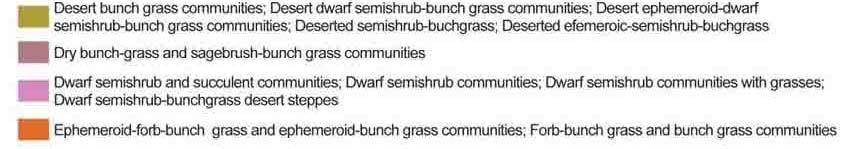
12 CACILM Vegetation Map (part 1) 1:14,000 0
13 Multicountry Socio-Economic Data The rural economies of the five countries suffered catastrophic falls over the period as the countries went from a centralized command system to a free-market system. These changes dwarf any long-term changes due to land degradation or restoration trends. Three baselines are thus were chosen as a baseline year: 1990 (end of Soviet period) ( p ) 2000 (end of the readjustment period ) 2006/7 (recent)
14 14 SLM-IS: Socio-economic analyses Chui oblast Talas oblast Naryn oblast Population income in Kyrgyzstan (in USD ) per capita in month (on oblast level) Osh oblast Issyk-Kul oblast Jalal-Abad oblast Batken oblast KYRGYZ REPUBLIC in USD Supply of arable land per capita (in rayon level) in Kyzyl-Orda oblast, Kazakhstan Kyzyl-Orda city Shiely rayon Syrdarya rayon Karmakshy rayon Kazaly rayon Janakorgan rayon Jalagash rayon Aral rayon Kyzyl-Orda oblast , hectare/ person on per 1 sq. km pers Population density in Uzbekistan (oblast level) year 2007 REPUBLIC of UZBEKISTAN Andijan oblast Dzhizak oblast Navoi oblast* Samarkand oblast Syrdarya oblast Fergana oblast s number of heads Rep. Karakalpakstan Bukhara oblast Kashkadarya oblast Namangan oblast Surkhandarya oblast Tashkent oblast Khorezm oblast Cattle breeding density per 100 hectare of pasture in Turkmenistan ( velayat level) year 2007 TURKMENISTAN Akhal velayat Balkan velayat Dashoguz velayat Lebap velayat Mary velayat
15 15 CACILM PRIORITY FOCAL AREAS FOR PHASE II Climate Change Adaptation Land Degradation Water Resource Management Food Security (wheat & meat supply, availability of arable land per capita, biomass production evaluation, etc.)
16 16 AREAS OF POTENTIAL COOPERATION WITH FAO-LADA Adoption LADA into the national LM system Assist decision makers with the new approaches Improve the LU and LM system
17 Areas of potential cooperation with FAO-LADA Multi-country, national and sub-national level Assisting with the mapping on area of Land Degradation, Climate Change Adaptation and Water Resource Management (Aral Sea basin, runoff study for Amudarya and Syrdarya River Basins, snow and glaciers studies) FAO-LADA: FAO-LADA Landuse System mapping practice LADA QM maps LADA local Assessment studies GLADIS WOCAT mapping Trainings and Field studies
18 Thank you!