EO4SDGs and Disaster Risk Reduction Virginia Burkett Chief Scientist, USGS Climate and Land Use Change
|
|
|
- Arron Hensley
- 5 years ago
- Views:
Transcription
1 EO4SDGs and Disaster Risk Reduction Virginia Burkett Chief Scientist, USGS Climate and Land Use Change U.S. Department of the Interior U.S. Geological Survey

2 United Nations (2015): Sendai Framework for Disaster Risk Reduction (From the Strategic Framework Preamble*) - Geospatial information has been widely recognized as an important aspect of DRM - Furthermore, DRM is central to sustainable development. As such, the framework contributes to the achievement of the 2030 Agenda for Sustainable Development. The human, socioeconomic and environmental risks and impacts of disasters are prevented or reduced through the use of geospatial information and services *Strategic Framework on Geospatial Information and Services for Disasters (UN GGIM, 2017)


3 Geospatial data plays an essential in reducing the risk of disasters associated with hazards such as earthquakes, volcanic eruptions, landslides, wildfires, floods, coastal storms, and tsunamis. Situational awareness in disaster response Fire perimeter map used by the National Interagency Fire Center for incident command, daily planning, and dispatch.
 Tsunami hazard assessments and")


4 Science Applications for Risk Reduction (SAFRR) Tsunami hazard assessments and evacuation maps for 73 US Pacific Coast communities; integrating land use, population and elevation data in a geospatial format. Evacuation model of a portion of Washington State s coast.
, US Alternate")
5 GEO & the SDGs A Priority Engagement Area of the Group on Earth Observations (GEO), US Alternate Principal

6 In collaboration with the UN Global Geospatial Information management Initiative (UN GGIM) initiative, GEO advocates for ensuring Earth observations and geospatial data are used in measuring and monitoring the SDGs.

7 Transforming our World: The 2030 Plan for Global Action Article 76: We will promote transparent and accountable scaling-up of appropriate public-private cooperation to exploit the contribution to be made by a wide range of data, including Earth observation and geo-spatial information, while ensuring national ownership in supporting and tracking progress. (UN General Assembly, resolution adopted 25 September 2015)
8 GEO Initiative: Earth Observations for the Sustainable Development Goals (EO4SDG) EO4SDG Initiative goals: GOAL I: Demonstrate how EO and geospatial information, with socio-economic and other data contribute in novel and practical ways to support achievement of the SDGs. GOAL II: Increase skills and capabilities in use of EO for SDG activities and their broader benefits. GOAL III: Broaden interest and awareness of EO support to the SDGs and contribution to social, environmental, and economic benefits.


9 SDG-2 ZERO HUNGER INFORMED BY CROP MONITORS By producing & openly disseminating relevant, timely and accurate information and forecasts on agricultural production GEOGLAM fully contributes to SDG Indicator 2.c

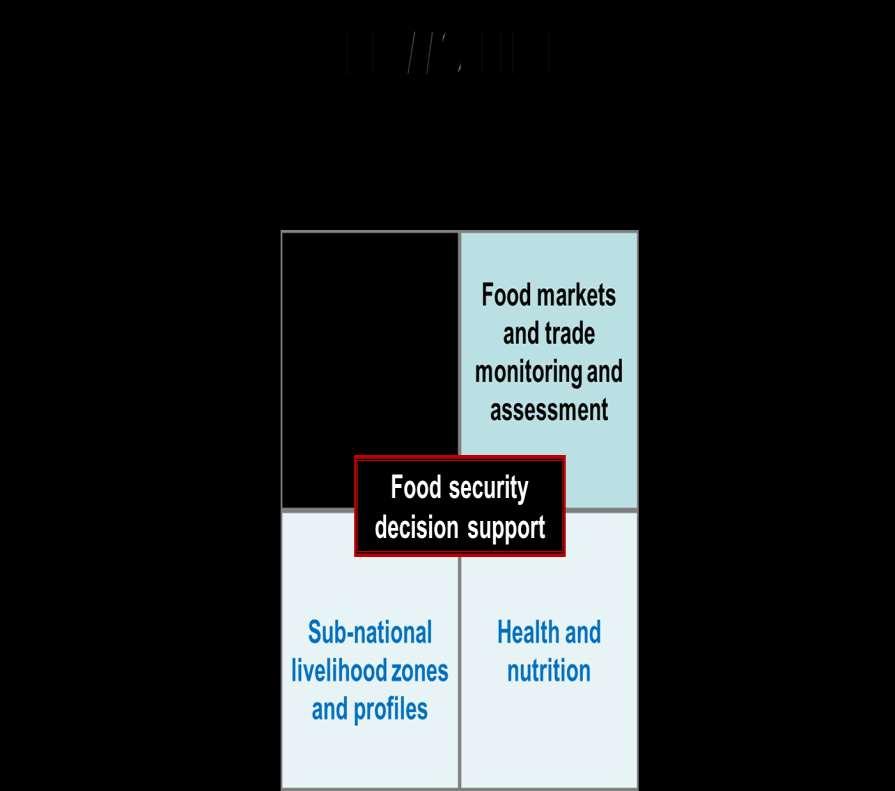
10 Famine Early Warning Systems Network An activity of the USAID Office of Food for Peace In 1986, after disastrous famines in Africa, USAID called on USGS for assistance with satellite remote sensing of drought impacts First monitoring of the African Sahel with vegetation index images began in 1987 USGS has a leadership role in agro-climatology for FEWS NET including important partnerships with NOAA, NASA, USDA, UCSB, and UMD FEWS NET gives the early warning sounds the alarm. Food for Peace uses the information to mobilize aid response.

11 The FEWS NET World
12


13
 of the situation in")
14 Scenarios of Food Insecurity Integrated Phase Classification (IPC) of the situation in Ethiopia..


15 Satellite remote sensing, climate forecasting, and land surface modeling capabilities provided the agro-climatic evidence needed by FEWS NET food security analysts to project livelihood impacts many months in advance. December 11, 2015, the Government of Ethiopia issued a worldwide appeal for over $1.4 billion in emergency needs to reach over 10 million people. Though the 2015 Ethiopian drought was even more severe than in 1984, a hunger crisis was averted.

16 Thank You!