Soil loss modeling and Forest landscape management perspectives
|
|
|
- Kristin Nicholson
- 6 years ago
- Views:
Transcription

1 Soil loss modeling and Forest landscape management perspectives Sihem Jebari National Research Institute for Rural Engineering, Water and Forestry AGORA Project Hammamet 30 th Sept. 3 rd Oct. 2010
2 CONTENTS 1- Introduction (Landscape degradation) 2- Water erosion- Tunisia 3- Objectives 4- Study area 5- Methodology 6- Expected results 7- Conclusion and perspectives

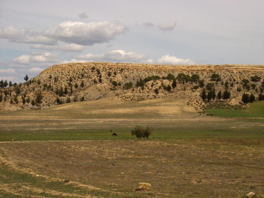
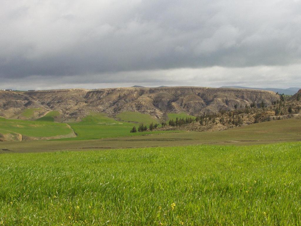
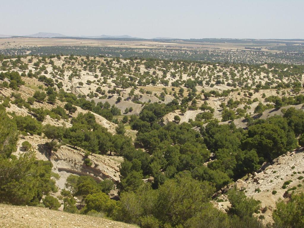
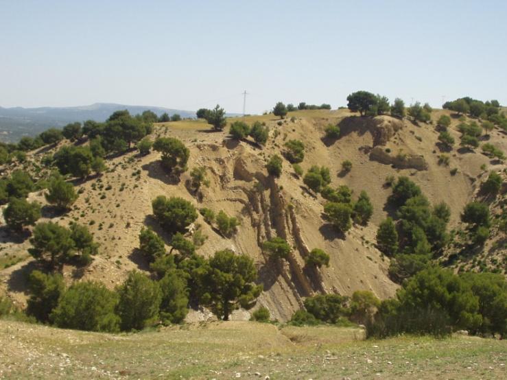
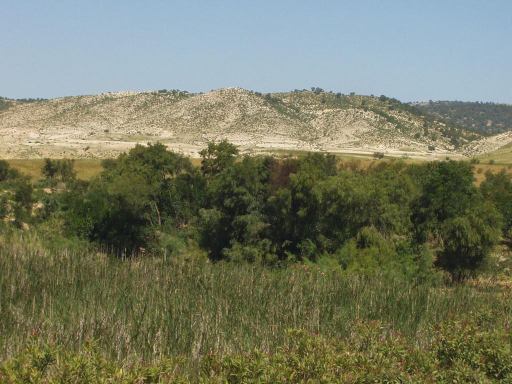
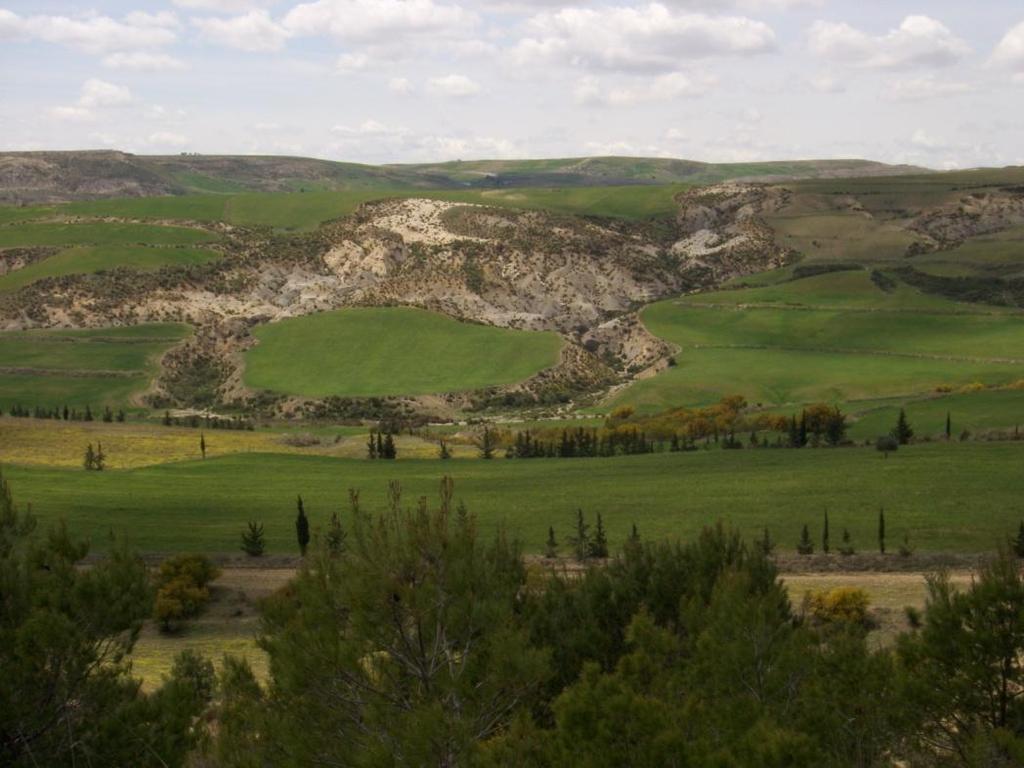
3 Views across the semiarid agricultural landscape.
4
5
6
7
8
9 The historical background of the agricultural landscape management all over 3000 years contributed to give specific shapes of land occupation, and natural resources exploitation. active erosion processes Numid (1500 B.C.) Punic (1000 B.C B.C.) Arab (700 A.C A.C.) Roman (146 B.C. 600 A.C.) Ottoman (1500 A.C A.C.) Colonial (1880 A.C A.C.) Modern (1956 A.C A.C.)


10 The Siliana and Mellegue woods were rich in pines, highly appreciated for boat building since it creates light ships. Wood was among the most valuable goods in the Mediterranean Sea trade circle. The Carthagian carpenters assembled and put afloat boats on an average of one vessel each 2 days.


11 Carthage 1 32 The nearest pine-forest to Carthage via Mejerda was that of Siliana, which underwent an even stronger pressure than the farther located Mellegue forest.
12 Water erosion -Tunisia Dorsal catchments offered since old times, good shelter, rich grazing, fertile soils, fabulous crop yield and commercial prosperity to its population Deforestation water erosion (wood trade + farming on sloping land) Rural and agricultural degradation landscape

 Affects 20% of the total land area")
13 Recent research has shown that the semiarid areas are very vulnerable to water erosion phenomenon Increases area of the arid belt (e.g., south of the Maghreb) Affects 20% of the total land area (yearly, ha are lost) Silts reservoirs (40 million m 3 /year)


14 Consequences of water erosion phenomena Declining of fertility Reservoir siltation Water pollution Unstable flows of rivers Spreading of badlands Desertification progress
15 OBJECTIVES The aim of this study is to contribute in suggesting sustainable strategies in managing natural resources. To determine the impact of the forest in preventing water erosion phenomenon and sediment yield To predict soil loss distribution at the scale of a catchments To suggest the most suitable area for forest settlement in order to limit landscape degradation.
16 Studied area The Dorsal mountains represent the last part of the Atlasic mountain ranges towards the east. Seven (7) % of the area are badly damaged by erosion and 70% of the area are moderately damaged. It plays an important role in the hydrology since it links the main wadis. It coincides with 400 mm/year isohyete. At present only 28% of the dorsal soil cover is left

17 Observed Network -28 experimental catchments along the Tunisian Dorsal range - Automatic rain gauge network was set up by the EU-funded Program HYDROMED (Research program on hill reservoirs in the semiarid Mediterranean periphery, ; SERST- IRD-DGACTA, 2000).


18 - Each catchment discharges into a small dam, where bathymetric measurements have been undertaken according to echo-sounding procedure. - Siltation data for the reservoirs are available from annually published hydrological reports (DCES/IRD, ).
19 Methodology To analyse rainfall data (temporal distribution, max. Intensities, return period etc.) using Matlab software To define the most active erosion process in forest areas To prepare various USLE model thematic maps (ARC-view) - Discretizing the studied area into small regular grid cells with the GIS tool
20 - USLE/GIS approach + multi-criteria analysis Calibration soil loss rate
21 Universal Soil Loss Equation (USLE) The USLE equation is used to determine mean annual soil loss A (t/ha/yr) as a function of six erosion factors: A = R K L S C P where R is rainfall erosivity factor (m t/ha h), K (t ha/m t) is soil erodibility factor, L is length factor (m), S is slope factor (%), C is crop management factor (unit-less) and P a conservation practice factor (unit-less).
22 EXPECTED RESULTS -Establish relationship between forest area and soil erosion rate within the catchments - Determine the spatial distribution of soil loss rates within the studied areas - Compare between observed and generated soil loss distribution -Suggest a forest settlement in order to prevent landscape degradation and reservoir siltation

23 CONCLUSION AND PERSPECTIVES To better conserve and manage forest domains where water erosion is active Scientists & Rural engineers Suitable management scenarios at watershed scale
24 - Spatial soil loss rates can be used as a management tool for water and soil conservation strategy - Promote balanced land settlements over the anthropized catchments - Soil loss estimation should be tested for other experimental watersheds


25
The BeWater project : Participatory approach
 The BeWater project : Participatory approach EFIMED WEEK 2016 Dr. Sihem JEBARI Tunisian National Research Institute for Rural Engineering, Water, and Forestry Italy 07 November, 2016 Introduction & historical
Advancing hydrological research applied to watershed management: achievements and prospects in South and East Mediterranean Countries
 Advancing hydrological research applied to watershed management: achievements and prospects in South and East Mediterranean Countries Jean Albergel Hydrologist at IRD Kenya EFIMED, Marrakech 29 and 3 April
CATCHMENT AREA TREATMENT PLAN
 CATCHMENT AREA TREATMENT PLAN 1 NEED FOR CATCHMENT AREA TREATMENT It is a wellestablished fact that reservoirs formed by dams on rivers are subjected to sedimentation. The process of sedimentation embodies
Use of GIS and Remote Sensing to assess Soil Erosion in Arid to Semiarid Basin in Jordan
 Use of GIS and Remote Sensing to assess Soil Erosion in Arid to Semiarid Basin in Jordan Ibrahim Farhan and Jawad Al Bakri Dept. Land, Water & Env. Faculty of Agriculture, University of Jordan, Amman,
Use of rainwater harvesting for alleviating poverty in rural areas
 The Arab Center for the Studies of Arid Zones and Dry Lands ACSAD Use of rainwater harvesting for alleviating poverty in rural areas ACSAD Experience in the Arab Region UNESCO G-Wadi Meeting on Water Harvesting
EROSION HAZARD MAPPING FOR MICRO-WATERSHED PRIORITIZATION USING REMOTE SENSING AND GIS TECHNIQUES
 EROSION HAZARD MAPPING FOR MICRO-WATERSHED PRIORITIZATION USING REMOTE SENSING AND GIS TECHNIQUES Dilip G. Durbude*, B. Venkatesh Hard Rock Regional Centre, National Institute of Hydrology, Hanuman Nagar,
Isfahan University of Technology. Soil erosion hazard prediction by SWAT model and fuzzy logic in a highly mountainous watershed
 Isfahan University of Technology Soil erosion hazard prediction by SWAT model and fuzzy logic in a highly mountainous watershed Introduction Challenges Soil erosion A major environmental threat to the
Africa s dry zones: feast or famine? Dr Jennifer Hill Associate Professor Geography & Environmental Management, UWE Bristol
 Africa s dry zones: feast or famine? Dr Jennifer Hill Associate Professor Geography & Environmental Management, UWE Bristol GA Bristol Branch Evening Lecture, School of Geographical Sciences, University
Sediment dynamics response under global change:
 Sediment dynamics response under global change: Technical University of Madrid, UPM Catalan Institute for Water Research, ICRA Natural Capital Project, Stanford University 1 Soil erosion in southern Europe
Hands-on Session. Adrian L. Vogl Stanford University
 Hands-on Session Adrian L. Vogl Stanford University avogl@stanford.edu Questions InVEST can answer How much water is available? Where does the water used for hydropower production come from? How much energy
CYPRUS REPORT FOR COMBATING DESERTIFICATION
 CYPRUS REPORT FOR COMBATING DESERTIFICATION CONTENTS EXECUTIVE SUMMARY 2 INTRODUCTION 3 DESERTIFICATION FACTORS IN CYPRUS CLIMATE 5 SOIL 5 WATER MANAGEMENT 5 ANTHROPOGENIC FACTORS 6 GENERAL MEASURES TO
NATURAL RESOURCES DEGRADATION IN THE RWANDA KAGERA WATERSHED: STATUS AND TRENDS, ROOT CAUSES AND POTENTIAL RESPONSES
 NATURAL RESOURCES DEGRADATION IN THE RWANDA KAGERA WATERSHED: STATUS AND TRENDS, ROOT CAUSES AND POTENTIAL RESPONSES LAND, SOILS AND CROPS Small farms (0,60 ha) in a continuous fragmentation pattern. Root
Prepared by: Hopeton Peterson & Doneika Simms of the The Planning Institute of Jamaica (PIOJ) May 10, 2012
 May 10, 2012") Prepared by: Hopeton Peterson & Doneika Simms of the The Planning Institute of Jamaica (PIOJ) May 10, 2012 Objectives Highlight expected climate risks and discuss how they will affect Jamaica s rural areas
Prepared by: Hopeton Peterson & Doneika Simms of the The Planning Institute of Jamaica (PIOJ) May 10, 2012 Objectives Highlight expected climate risks and discuss how they will affect Jamaica s rural areas
Hydrological And Water Quality Modeling For Alternative Scenarios In A Semi-arid Catchment
 Hydrological And Water Quality Modeling For Alternative Scenarios In A Semi-arid Catchment AZIZ ABOUABDILLAH, ANTONIO LO PORTO METIER Final Conference: Brussels, Belgium-4-6 November 2009 Outline Problem
State of Agriculture in the Uplands of Southern Mindanao
 State of Agriculture in the Uplands of Southern Mindanao (focused in UDP covered barangays) Aurea Christie Galvez-Lumaad, Environment Coordinator Resource Management Component Upland Development Programme
R. Srinivasan, J.H. Jacobs, J.W. Stuth, J. Angerer, R. Kaithio and N. Clarke
 Impacts of reforestation policy and agro-forestry technology on the environment and food security in the Upper Tana river basin of Kenya R. Srinivasan, J.H. Jacobs, J.W. Stuth, J. Angerer, R. Kaithio and
BAEN 673 / February 18, 2016 Hydrologic Processes
 BAEN 673 / February 18, 2016 Hydrologic Processes Assignment: HW#7 Next class lecture in AEPM 104 Today s topics SWAT exercise #2 The SWAT model review paper Hydrologic processes The Hydrologic Processes
Forests Introduction and Historical Context. International Forestry John Sessions
 Forests Introduction and Historical Context International Forestry John Sessions Overview What is a Forest? Importance of Forests Forest Classification Human Impact on Forests Historical Overview Sources:
GIS Based Analysis of Biophysical and Socio - Economic Factors for Land Degradation in Kandaketiya DS Division
 Tropical Agricultural Research Vol. 21(4): 361-367 (2010) GIS Based Analysis of Biophysical and Socio - Economic Factors for Land Degradation in Kandaketiya DS Division K.D.B.L. Jayarathne, N.D.K. Dayawansa
SPATIAL TECHNOLOGIES FOR DATA IN TRANSBOUNDARY CATCHMENTS IMRAN IQBAL
 2 ND ASIA PACIFIC WATER SUMMIT SPATIAL TECHNOLOGIES FOR DATA IN TRANSBOUNDARY CATCHMENTS IMRAN IQBAL We cant deny the importance of water in our lives, we could survive several days without food but much
10 Facts about Forest Protection
 Forests are a precious natural 1 resource Forests are dominated by trees but there are also animals, plants, soils and rocks. Forests and forestland in Laos belongs to the state, and is regulated by Lao
Conserving soil as a capital: main scientific challenges
 Conserving soil as a capital: main scientific challenges Global changes and Impacts of soil erosion in the Mediterranean context Y. Le Bissonnais & Al.* Institut National de la Recherche Agronomique, UMR
Evaluating the Reduction Effect of Nonpoint Source Pollution Loads from Upland Crop Areas by Rice Straw Covering Using SWAT
 SESSION J2 : Water Resources Applications - I New Delhi, India 2012 International SWAT Conference Evaluating the Reduction Effect of Nonpoint Source Pollution Loads from Upland Crop Areas by Rice Straw
WEPP Simulated Tillage Effects on Runoff and Sediment Losses in a Corn-Soybean Rotation
 This paper was peer-reviewed for scientific content. Pages 877-881. In: D.E. Stott, R.H. Mohtar and G.C. Steinhardt (eds). 2001. Sustaining the Global Farm. Selected papers from the 10th International
EFC Working Party on the Management of Mountain Watersheds
 EFC Working Party on the Management of Mountain Watersheds 27th Session Štrbské Pleso, Slovak Republic, 7-10 April 2010 NATIONAL REPORT OF TURKEY National Report of TURKEY 1. Introduction Turkey attended
Deforestation in India: Causes and Consequences of Deforestation in India
 Deforestation in India: Causes and Consequences of Deforestation in India Deforestation in India: Causes and Consequences of Deforestation in India! Deforestation is one of the major causes to the environmental
Land Degradation Control in North Africa
 Land Degradation Control in North Africa By Dr. Ismail Hamdi El-Bagouri Emeritus Professor Soil and Water Conservation Desert Research Center Egypt International Workshop on Climate and Land Degradation
Davood Nikkami (PhD)
") Country Report of The IR. Iran 28-30 Jan., 2009, Bangkok, Thailand Workshop on Improving Agricultural Productivity, Water Use Efficiency & Strengthening Rural Livelihoods Davood Nikkami (PhD) Soil Conservation
Country Report of The IR. Iran 28-30 Jan., 2009, Bangkok, Thailand Workshop on Improving Agricultural Productivity, Water Use Efficiency & Strengthening Rural Livelihoods Davood Nikkami (PhD) Soil Conservation
Land use type and indicators affecting land degradation and desertification. C. Kosmas Agricultural University of Athens
 Land use type and indicators affecting land degradation and desertification C. Kosmas Agricultural University of Athens Desertification The consequence of a series of important degradation processes in
Rational Management Methods. Adequate Organizational Structure. Modern Equipment and Technology
 Pr. Fouad MOUNIR Important role - Maintaining the socio-economic balances (wood and non-timber products: more then 0.4% in the national Gross Domestic Product) - Environment, Soil, and Water Protection
Mission. Selected Accomplishments from Walnut Gulch. Facilities. To develop knowledge and technology to conserve water and soil in semi-arid lands
 USDA-ARS Southwest Watershed Research Center Mission Sound Science for Watershed Decisions To develop knowledge and technology to conserve water and soil in semi-arid lands ARS Watershed Locations Selected
Coupled Control of Land Use and Topography on Suspended Sediment Dynamics in an Agriculture- Forest Dominated Watershed, Hokkaido, Japan.
 SOIL'S ROLE IN RESTORING ECOSYSTEM SERVICES March 6-9, 201, Sacramento, CA Coupled Control of Land Use and Topography on Suspended Sediment Dynamics in an Agriculture- Forest Dominated Watershed, Hokkaido,
3. Present Situation of Environmental Problems
 3. Present Situation of Environmental Problems 3.1 Natural Environment The goals, issues and programmes regarding the natural environment of the Ten Year Perspective Development Plan 2001-2011 are shown
Hayman Fire Rehabilitation Treatment Monitoring Progress Report
 Hayman Fire Rehabilitation Treatment Monitoring Progress Report Sediment yields, runoff, and ground cover in the first two years after the Hayman Fire P. Robichaud J. Wagenbrenner 7 March 2005 USD Forest
Introduction to the Cost- Benefit Framework. Highlights from presentation at Sustainable Land Management workshop in Addis, May 2006
 Introduction to the Cost- Benefit Framework Highlights from presentation at Sustainable Land Management workshop in Addis, May 2006 Rationale Land degradation leads to substantial welfare losses. Many
Open Working Group, February 2014: Australia, the Netherlands, United Kingdom Constituency Statement. Oceans and Seas, Forests and Biodiversity
 Open Working Group, February 2014: Australia, the Netherlands, United Kingdom Constituency Statement Oceans and Seas, Forests and Biodiversity Healthy ecosystems, biological diversity (biodiversity) and
Flood Analysis: Hydrologic Principles & Analysis. Charles Yearwood. Drainage Unit, Ministry of Public Works Sept 2007
 Flood Analysis: Hydrologic Principles & Analysis. Charles Yearwood Drainage Unit, Ministry of Public Works Sept 2007 Research interest: Hydrologic data collection; Early warning systems; & Integrated flood
[Suryawanshi 4(9): September 2017] ISSN DOI /zenodo Impact Factor
![[Suryawanshi 4(9): September 2017] ISSN DOI /zenodo Impact Factor](/thumbs/89/99073782.jpg "[Suryawanshi 4(9): September 2017] ISSN DOI /zenodo Impact Factor") GLOBAL JOURNAL OF ENGINEERING SCIENCE AND RESEARCHES ENVIRONMENTAL ASSESSMENT OF SOIL EROSION ON LAKNAVARAM LAKE BASIN Vijay Suryawanshi *1, D. Manaswini 2 and P.Pravalika 3 *1 Assistant Professor, KITS-Warangal,
GLOBAL JOURNAL OF ENGINEERING SCIENCE AND RESEARCHES ENVIRONMENTAL ASSESSMENT OF SOIL EROSION ON LAKNAVARAM LAKE BASIN Vijay Suryawanshi *1, D. Manaswini 2 and P.Pravalika 3 *1 Assistant Professor, KITS-Warangal,
3.2 How Humans Influence Ecosystems
 3.2 How Humans Influence Ecosystems Human intrusion has caused many BC wetlands to disappear. In the past 100 years up to 70% of the wetlands in the lower Fraser Valley have been lost. Wetlands are special
THE UNILEVER OLIVE OIL WORLD
 THE UNILEVER OLIVE OIL WORLD Olive Oil Value Chain Economic Values Agriculture Milling Selection & Blending Manufacturing & Distribution Emotional and Service Values The industry role Brand Personality
ADAPTATION TO CLIMATE CHANGE IN THE AGRICULTURE SECTOR CASE STUDIES. Dieter Prinz, Consultant to giz
 Climate Change Adaptation in Agriculture, Forestry & Fisheries by Applying Integrated Water Resources Management (IWRM) Tools ADAPTATION TO CLIMATE CHANGE IN THE AGRICULTURE SECTOR CASE STUDIES Rainwater
Evidence of global warming
 INTRODUCTION Climate Change can be attributed directly or indirectly to human activities (e.g. through burning fossil fuels, deforestation, reforestation, urbanization, desertification) that alters the
Modeling Nutrient and Sediment Losses from Cropland D. J. Mulla Dept. Soil, Water, & Climate University of Minnesota
 Modeling Nutrient and Sediment Losses from Cropland D. J. Mulla Dept. Soil, Water, & Climate University of Minnesota Watershed Management Framework Identify the problems and their extent Monitor water
SURFACE RUNOFF ESTIMATION BY SCS CURVE NUMBER METHOD USING GIS FOR RUPEN-KHAN WATERSHED, MEHSANA DISTRICT, GUJARAT
 J. Indian Water Resour. Soc., Vol. 36, No. 4, Oct., 2016 SURFACE RUNOFF ESTIMATION BY SCS CURVE NUMBER METHOD USING GIS FOR RUPEN-KHAN WATERSHED, MEHSANA DISTRICT, GUJARAT Dhvani Tailor 1 and Narendra
Soil Loss Estimation on a Local Scale for Soil Conservation Planning
 JARQ 36 (3), 157 161 (2002) http://www.jircas.affrc.go.jp Soil Loss Estimation on a Local Scale for Soil Conservation Planning Soil Loss Estimation on a Local Scale for Soil Conservation Planning Takahiro
EXECUTIVE SUMMARY. The major results and conclusions from the study are given below in three sections which focus in turn on:
 EXECUTIVE SUMMARY 1. BACKGROUND AND OBJECTIVES The current area under sugarcane production in South Africa is some 400 000 ha. There is increased need to quantify the impact of sugarcane production on
Statewide Ranking of Ecological Value of CRP and other Critical Lands
 Statewide Ranking of Ecological Value of CRP and other Critical Lands Funded by ENRTF as recommended by LCCMR 2008 2009 D. J. Mulla, S. J. Taff, G. Host, J. Galzki, T. Brown, A. Lewandowski, and J. Nelson
GIS based watershed characterizations
 Abaya-Chamo Lakes Physical and Water Resources Characteristics, including Scenarios and Impacts Lake Abaya-Chamo Research Symposium, May 7 th -11 th, 2007, Arba Minch University, Ethiopia By Seleshi Bekele
2P2R process in Macedonia
 2P2R process in Macedonia Prevent, Prepare, Respond and Recover Ljupco Ristovski, M.A. State Counsellor for policy analyses and coordination in the Government of the Republic of Macedonia 06-08/10/2010
Palestinian Hydrology Group
 Palestinian Hydrology Group Identifying Vulnerabilities and Climate Risks; Climate Change Adaptation / Implementation in Palestine Dr. Ayman Rabi Palestinian National Workshop on Climate Change 26-28 January,
Evaluation of Empirical and Nomograph Method of Predicting Erodibility Index for Selected Savannah Soils.
 Evaluation of Empirical and Nomograph Method of Predicting Erodibility Index for Selected Savannah Soils. A.I. Arab, M.Sc. 1* ; Prof. S.Z. Abubakar 1 ; and U.D. Idris, M.Sc. 2 1 National Agricultural Extension
GEOGRAPHY OF THE FERTILE CRESCENT. Chapter 3 Section 1
 MESOPOTAMIA GEOGRAPHY OF THE FERTILE CRESCENT Chapter 3 Section 1 Land Between Two Rivers The Tigris and Euphrates rivers are the most important physical features of the region sometimes known as Mesopotamia
Land use and land cover change in mountainous watersheds: Consequences for ecosystem services of water yield and water quality
 Bayreuth Center of Ecology and Environmental Research Sebastian Arnhold Land use and land cover change in mountainous watersheds: Consequences for ecosystem services of water yield and water quality Background
EVALUATION OF THE MULTIFUNCTIONALITY OF AGRICULTURAL AREAS AS PART OF AN INTEGRATED LAND USE PLANNING APPROACH Klaus Wagner 1
 EVALUATION OF THE MULTIFUNCTIONALITY OF AGRICULTURAL AREAS AS PART OF AN INTEGRATED LAND USE PLANNING APPROACH Klaus Wagner 1 1. INTRODUCTION - PROJECT OVERVIEW The INTERREG IIIB CADSES project Integrated
Module 2 Measurement and Processing of Hydrologic Data
 Module 2 Measurement and Processing of Hydrologic Data 2.1 Introduction 2.1.1 Methods of Collection of Hydrologic Data 2.2 Classification of Hydrologic Data 2.2.1 Time-Oriented Data 2.2.2 Space-Oriented
Human Environment & Interaction Around the World
 Human Environment & Interaction Around the World Human Environment and Interaction is how people adapt to, depend on, and modify their environment. Human impact on the environment can be explained in two
Comparative modelling of large watershed responses between Walnut Gulch, Arizona, USA, and Matape, Sonora, Mexico
 Variability in Stream Erosion and Sediment Transport (Proceedings of the Canberra Symposium, December 1994). IAHS Pubi. no. 224, 1994. 351 Comparative modelling of large watershed responses between Walnut
The hydrological effects of wildfire. David Scott The University of British Columbia, Kelowna, BC
 The hydrological effects of wildfire David Scott The University of British Columbia, Kelowna, BC Effects of fire on hydrology Scientific literature is full of contrasting reports Fires: little effect or
Climate change science, knowledge and impacts on water resources in South Asia
 Climate change science, knowledge and impacts on water resources in South Asia DIAGNOSTIC PAPER 1 GUILLAUME LACOMBE, PENNAN CHINNASAMY Regional Conference on Risks and Solutions: Adaptation Frameworks
ISRMUN Embracing our diversity is the first step to unity. THE UNITED NATIONS FOOD AND AGRICULTURE ORGANIZATION
 THE UNITED NATIONS FOOD AND AGRICULTURE ORGANIZATION Committee: The United Nations Food and Agriculture Organization (FAO) Topic B: Tackling Land Degradation and Desertification Written by: Daniela Martellotto
Joint Research Centre (JRC)
") Joint Research Centre (JRC) Marco Pastori and Faycal Bouraoui IES - Institute for Environment and Sustainability Ispra - Italy http://ies.jrc.ec.europa.eu/ http://www.jrc.ec.europa.eu/ CONTENT Introduction
Joint Research Centre (JRC) Marco Pastori and Faycal Bouraoui IES - Institute for Environment and Sustainability Ispra - Italy http://ies.jrc.ec.europa.eu/ http://www.jrc.ec.europa.eu/ CONTENT Introduction
Soil Treats, Gaps, and Technical Assessment. Agricultural University of Athens Costas Kosmas
 Soil Treats, Gaps, and Technical Assessment Agricultural University of Athens Costas Kosmas Identified important threats to European soils The European Commission adopted a Soil Thematic Strategy (COM(2006)
Sustainable Conservation Practices for Natural Resources
 Sustainable Conservation Practices for Natural Resources Rajdeep Mundiyara 1, Prem Kumar 2 and Mamta Bajya 3 1 Seed Officer, Rajasthan State Seeds Corporation,Mandore, Jodhpure 2 Department of Plant Philology,
Watershed Management Prof. T. I. Eldho Department of Civil Engineering Indian Institute of Technology, Bombay
 Watershed Management Prof. T. I. Eldho Department of Civil Engineering Indian Institute of Technology, Bombay Lecture No. # 06 Soil Erosion and Conservation And welcome back to the video course on watershed
Early Warning Systems in Eastern
 Early Warning Systems in Eastern and Southern Africa: by Erick Khamala Senior Remote Sensing Officer RCMRD ekhamala@rcmrd.org Our Products and Services Training: i Geoinformation and IT applications,
Detailed spatial analysis of the plausibility of surface runoff and sediment yields at HRU level in a mountainous watershed in China
 Christian-Albrechts-Universität zu Kiel Institut für Natur- und Ressourcenschutz Detailed spatial analysis of the plausibility of surface runoff and sediment yields at HRU level in a mountainous watershed
Fig: Alignment of a ridge or watershed canal (Head reach of a main canal in plains)
") SYSTEM OF IRRIGATION CANAL CHAPTER 6 Alluvial Soil and Non-Alluvial Soil The soil which is formed by transportation and deposition of silt through the agency of water, over a course of time, is called
SYSTEM OF IRRIGATION CANAL CHAPTER 6 Alluvial Soil and Non-Alluvial Soil The soil which is formed by transportation and deposition of silt through the agency of water, over a course of time, is called
PRIORITIES FOR SUSTAINABLE SOIL MANAGEMENT IN THE MOUNTAIN KINGDOM OF LESOTHO. By NTHATUOA RANTOA & DR BOTLE MAPESHOANE
 PRIORITIES FOR SUSTAINABLE SOIL MANAGEMENT IN THE MOUNTAIN KINGDOM OF LESOTHO By NTHATUOA RANTOA & DR BOTLE MAPESHOANE Brief background of Lesotho Lesotho has a total population of 1,872,721. 23.74% lived
1. Introduction. Keywords Groundwater, Vulbnerability, Aquifer, Aquitard, Vadose zone. Alsharifa Hind Mohammad
 World Environment 2014, 4(1): 22-32 DOI: 10.5923/j.env.20140401.03 New Groundwater Vulnerability Index for the Main Aquifers in Central Catchment Area in Jordan and Validation of the Results Using NO 3
Simulation of Rainfall-Runoff Using WEAP Model (Case Study: Qaraso Basin)
") AGRICULTURAL COMMUNICATIONS, 2014, 2(4): 63-68. Simulation of Rainfall-Runoff Using WEAP Model (Case Study: Qaraso Basin) BEHROOZ YAGHOBI*, SAEID SHABANLOU AND FARIBORZ YOSEFVAND Department of Water Engineering,
AGRICULTURAL COMMUNICATIONS, 2014, 2(4): 63-68. Simulation of Rainfall-Runoff Using WEAP Model (Case Study: Qaraso Basin) BEHROOZ YAGHOBI*, SAEID SHABANLOU AND FARIBORZ YOSEFVAND Department of Water Engineering,
In the Name of God. Implementation of the Convention. on Combating Desertification in I.R. Iran
 In the Name of God Implementation of the Convention on Combating Desertification in I.R. Iran 1 Islamic Republic of Iran: Iran is located in: South West of Asia Land area : 1.65 million square kilometer
Harbour Constructions
 Harbour Constructions River and Coastal morphology: They provide morphological services based on one-, two- and threedimensional computer models. These models are used to answer the questions of clients
Sustainable Cacao-based Agroforestry Development to Support Green Growth in Gorontalo
 Sustainable Cacao-based Agroforestry Development to Support Green Growth in Gorontalo COP24 Gorontalo District, INDONESIA Gobel DKM Kanematsu Corporation Dec, 2018 Supported by 2 Preserving Limboto Lake
Sedimentation Processes and Useful Life of Mosul Dam Reservoir, Iraq
 Engineering, 2013, 5, 779-784 http://dx.doi.org/10.4236/eng.2013.510094 Published Online October 2013 (http://www.scirp.org/journal/eng) Sedimentation Processes and Useful Life of Mosul Dam Reservoir,
COMBATING LAND DEGRADATION IN MALAYSIA FOR SUBMISSION AS NATIONAL REPORT FOR THE UNITED NATION CONVENTION TO COMBAT DESERTIFICATION
 COMBATING LAND DEGRADATION IN MALAYSIA FOR SUBMISSION AS NATIONAL REPORT FOR THE UNITED NATION CONVENTION TO COMBAT DESERTIFICATION INTRODUCTION Soon after the independence, Malaysia launched an aggressive
Ministry Of Environment,Natural Resources and Physical Development. Implementation status of the GGW in Sudan
 Ministry Of Environment,Natural Resources and Physical Development Implementation status of the GGW in Sudan Objectives The overall objective of the Great Green Wall in Sudan is to contribute to the fight
Name: Class key. Period: The Living Environment 14-15
 Name: Class key Period: Chapter 5 Part 1 assignments Pages/Sections Date Assigned Date Due What is Biodiversity? Objective: Describe and define the concept of biodiversity. Biological Diversity (Biodiversity)
Direct Effects of Wildfire on Soil (and Water) David F Scott The University of British Columbia, Kelowna, BC
 David F Scott The University of British Columbia, Kelowna, BC") Direct Effects of Wildfire on Soil (and Water) David F Scott The University of British Columbia, Kelowna, BC Outline of presentation Flooding & erosion after wildfire - brief overview Some observations
Direct Effects of Wildfire on Soil (and Water) David F Scott The University of British Columbia, Kelowna, BC Outline of presentation Flooding & erosion after wildfire - brief overview Some observations
 Effects of water and soil conservation works on runoff and sediment variation in the areas with high and coarse sediment yield of the middle Yellow River Wei Ying SUN, Pan ZHANG, Li LI, and Jiang Nan CHEN
Vulnerability of hydrological ecosystem services to climatic extremes in a Mediterranean river basin
 Vulnerability of hydrological ecosystem services to climatic extremes in a Mediterranean river basin Marta Terrado, Vicenç Acuña, Driss Ennaanay, Heather Tallis, Sergi Sabater CLIMATIC EXTREMES AND HYDROLOGICAL
Integrated Modeling: ENVISION
 Integrated Modeling: ENVISION Cimarron River Watershed Gehendra Kharel Oklahoma State University Cimarron River Watershed Research and Extension Symposium November 17, 2016 1 Research, Data Archiving,
UNRAVELING THE MYRAID OF STANDARDS AND TOOLS
 UNRAVELING THE MYRAID OF STANDARDS AND TOOLS HYDRO POWER DEVELOPMENT IN MEKONG REGION: CYCLING THROUGH FROM POLICY TO IMPLEMENTATION WORKSHOP SEPTEMBER 12-13, 2013 Basin Wide National regulations Project
CLIMATE INFORMATION IN HAZARD RISK ASSESSMENT JANNEKE ETTEMA, VICTOR JETTEN, DINAND ALKEMA, THEA TURKINGTON
 CLIMATE INFORMATION IN HAZARD RISK ASSESSMENT JANNEKE ETTEMA, VICTOR JETTEN, DINAND ALKEMA, THEA TURKINGTON FIRE ENSCHEDE - YESTERDAY On fire ~100 m ITC building Short rain event made the wind direction
LBS : quantifying the role of ecosystems for mitigating impacts
 www.grid.unep.ch First LBS STAC Meeting LBS : quantifying the role of ecosystems for mitigating impacts Aruba, 5-7 June 2012 Peduzzi, PhD Global Change & Vulnerability Unit UNEP/GRID-Geneva UNEP/GRID-Geneva
Reservoir age, increasing human population,
 B-6249 02/12 Eagle Mountain Watershed Management Brent Clayton, Justin Mechell, David Waidler and Clint Wolfe* Reservoir age, increasing human population, and changing land uses have prompted the development
Impacts of climate change in Europe
 Conference on Climate Change and Official Statistics Oslo, Norway, 14-16 April 2008 Impacts of climate change in Europe André Jol European Environment Agency 1 Figure 3: Key impacts as a function of increasing
Building climate resilience
 Public Disclosure Authorized Public Disclosure Authorized Public Disclosure Authorized THE NILE STORY BRIEFING NOTE 3 102249 Building climate resilience Climate change is a critical issue facing the countries
Soil and Water Conservation Research under Intensive Potato Production Systems in New Brunswick
 Agri-Food Soil and Water Conservation Research under Intensive Potato Production Systems in New Brunswick T. L. Chow 1, H.W. Rees 1, and J.-L, Daigle 2 Quebec New Brunswick Technical Exchange Workshop
Climate Change Impact to the Water Resources of Eastern Caucasus (Kura Basin) Rivers and Ways of Its Mitigation
 Rivers and Ways of Its Mitigation") Journal of Hydraulic Engineering 1 (2016) 32-37 doi: 10.17265/2332-8215/2016.01.004 D DAVID PUBLISHING Climate Change Impact to the Water Resources of Eastern Caucasus (Kura Basin) Rivers and Ways of Its
Journal of Hydraulic Engineering 1 (2016) 32-37 doi: 10.17265/2332-8215/2016.01.004 D DAVID PUBLISHING Climate Change Impact to the Water Resources of Eastern Caucasus (Kura Basin) Rivers and Ways of Its
Background paper. Desertification in the EU
 Background paper Desertification in the EU June 2018 Desertification is a form of land degradation in drylands. It results from unsustainable land management practices and climatic factors. Thirteen EU
RAMAHAVALISOA Valérie Benjamin Focal Point of the Mountain Partnership, MEEF /Madagascar Member of African Mountain Champion s Committee
 RAMAHAVALISOA Valérie Benjamin Focal Point of the Mountain Partnership, MEEF /Madagascar Member of African Mountain Champion s Committee MEEF General Secretary Environmental Mainstreaming department/focal
LAND, WATER AND ENVIRONMENT FARM AFRICA S APPROACH
 LAND, WATER AND ENVIRONMENT FARM AFRICA S APPROACH CONTENTS Farm Africa s vision Preface What s the issue? Theory of change Farm Africa s approach Methodology How to use Farm Africa s approach papers FARM
National Adaptation Program of Actions to Climate Change and Agro-biodiversity Management in Nepal
 National Adaptation Program of Actions to Climate Change and Agro-biodiversity Management in Nepal Hari Dahal Ministry of Agriculture and Cooperatives Kathmandu, Nepal 7/17/2011 1 Geography of the Country
WATER RESOURCES SHORT ANSWER TYPE QUESTIONS [3 MARKS]
![WATER RESOURCES SHORT ANSWER TYPE QUESTIONS [3 MARKS]](/thumbs/81/83970391.jpg "WATER RESOURCES SHORT ANSWER TYPE QUESTIONS [3 MARKS]") WATER RESOURCES SHT ANSWER TYPE QUESTIONS [3 MARKS] 1. Which multipurpose project is built on River Satluj How this project has led to the development of the country? The multipurpose project built over
WATER RESOURCES SHT ANSWER TYPE QUESTIONS [3 MARKS] 1. Which multipurpose project is built on River Satluj How this project has led to the development of the country? The multipurpose project built over
CPRE NW Earthy Event. Cumbria s floods and their impact on soils
 CPRE NW Earthy Event Cumbria s floods and their impact on soils Storm Desmond 5 th December 2015 Storm Desmond established new UK rainfall records over both a 24-hour (341.4mm at Honister Pass, Cumbria)
Ecology and Animal Health
 Ecosystem Health and Sustainable Agriculture 2 Ecology and Animal Health Editors: Leif Norrgren and Jeffrey M. Levengood CSD Uppsala. Centre for sustainable development Eutrophication 6 Lennart Gladh World
IV. RESULT AND DISCUSSION
 IV. RESULT AND DISCUSSION The result of forest cover change simulation during 4 years was described. This process is done by using the information of land cover condition obtained from satellite imagery
Indicators for a Nexus Assessment in Transboundary Basins
 Indicators for a Nexus Assessment in Transboundary Basins Lucia de Strasser, KTH Second meeting of the Task Force on the Water-Food-Energy-Ecosystem Nexus UNECE Geneva, September 2014 Indicators to understand..
1. Title of the Cooperation Project and Name of the Project Proponent
 Preparatory Study for Development Study Date: 6 April 2006 1. Title of the ooperation Project and Name of the Project Proponent 1-1 Title of the ooperation Project The Study on Integrated Basin Management
LAND COVER EFFECTS ON WATERSHED HYDROLOGIC MEMORY. Jason P. Julian Robert H. Gardner
 LAND COVER EFFECTS ON WATERSHED HYDROLOGIC MEMORY Jason P. Julian Robert H. Gardner Oct 14, 2013 Watershed Hydrologic Memory Runoff = Precip ET Soil Moisture Groundwater Daily Discharge (m 3 /s) Runoff