Information for File # BGO
|
|
|
- Flora Neal
- 5 years ago
- Views:
Transcription
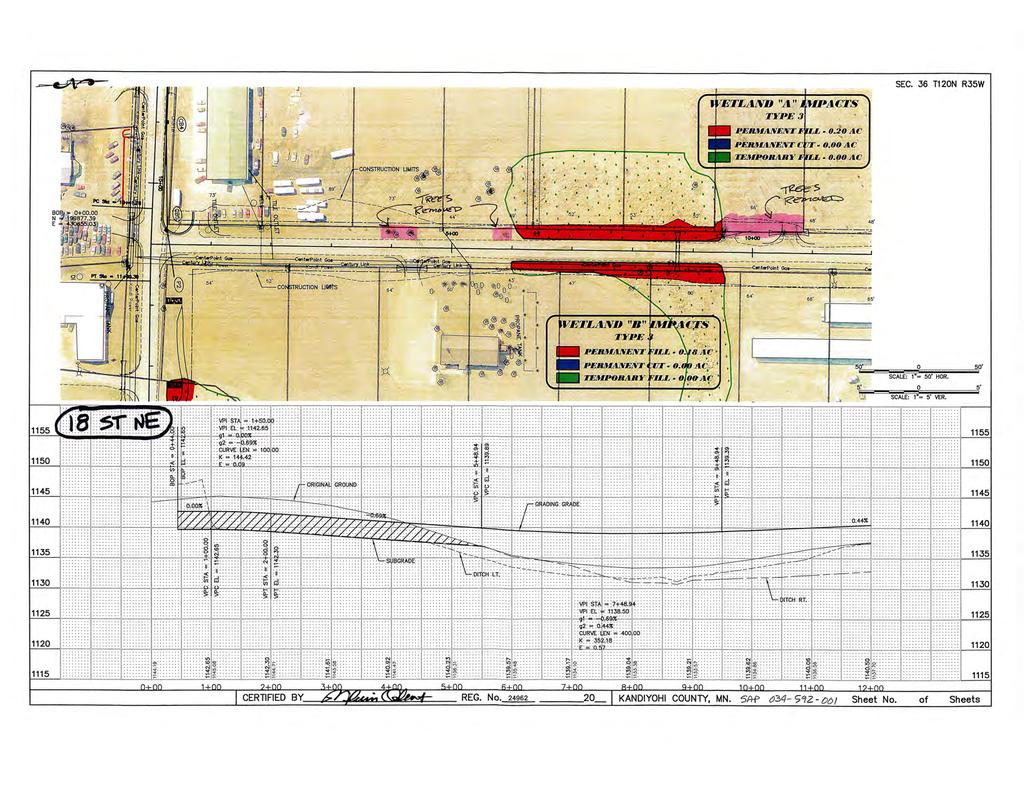
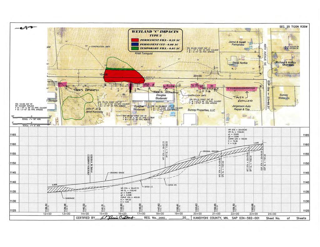
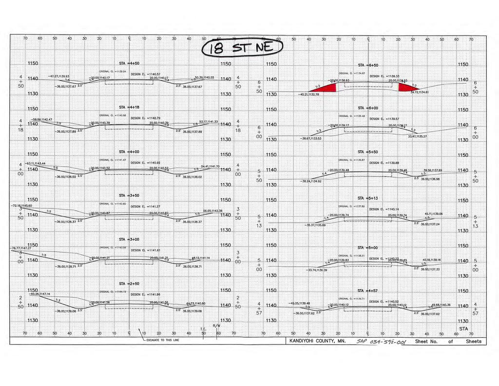
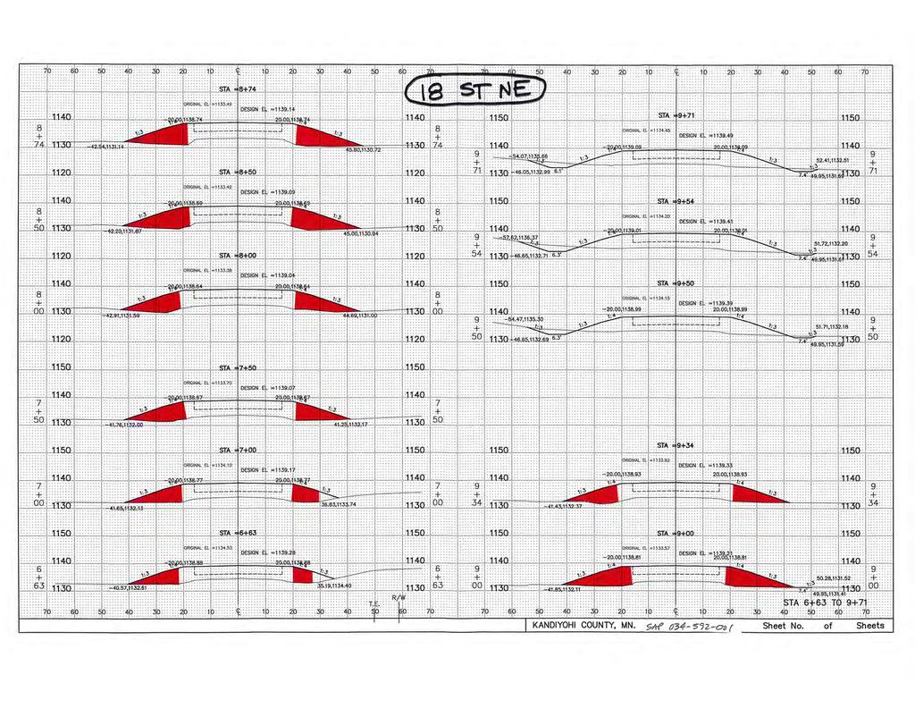
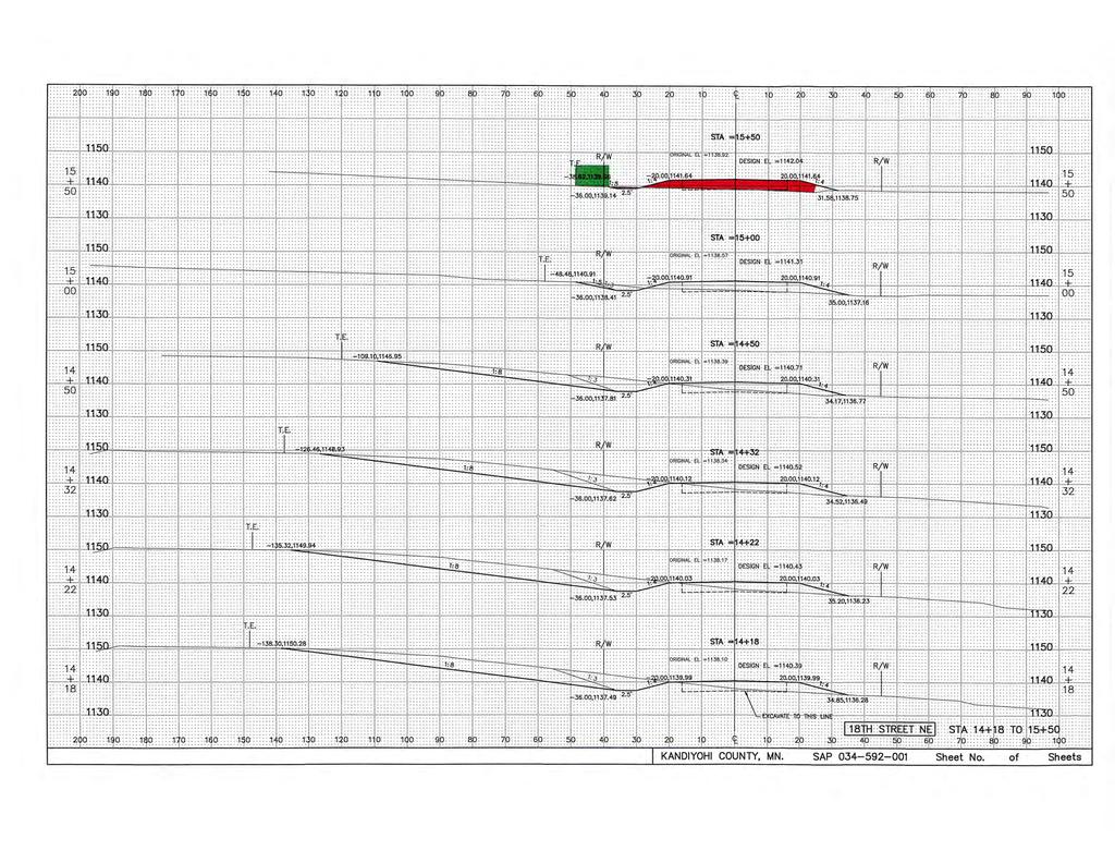
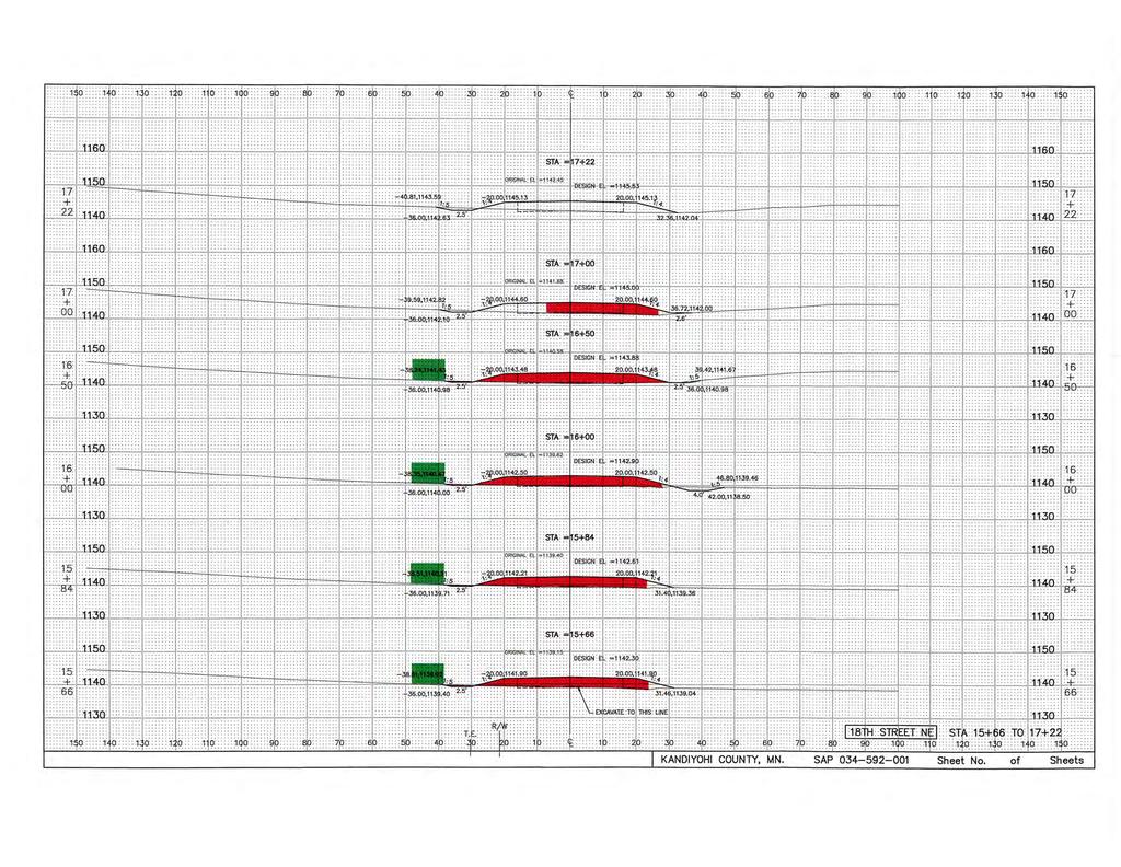
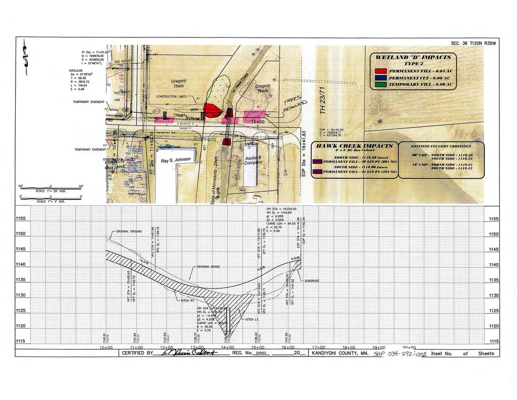
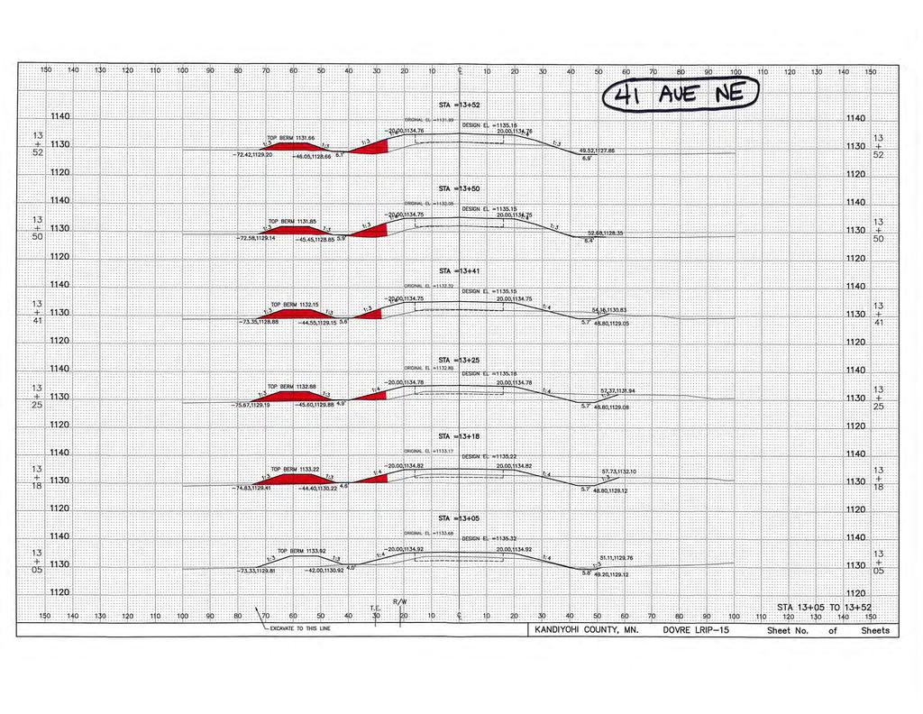
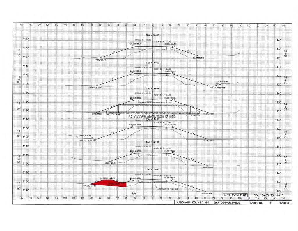
1 Information for File # BGO Applicant: Dovre Township Corps Contact: Benjamin Orne Address: 180 Fifth Street East, Suite 700, St. Paul, Minnesota Phone: (651) Primary Location: Section 25, 35, and 36, Township 120 North, Range 35 West, Kandiyohi County, Minnesota. Information Complete On: May 26, 2016 Posting Expires On: June 6, 2016 Authorization Type: LOP-05-MN This application is being reviewed in accordance with current practices for documenting Corps jurisdiction under Section(s) 9 & 10 of the Rivers and Harbor Act of 1899 and Section 404 of the Clean Water Act. We have made a preliminary determination that the aquatic resources that would be impacted by the proposed project are subject to Corps of Engineers jurisdiction under Section(s) 9 & 10 of the Rivers and Harbors Act of 1899 and/or Section 404 of the Clean Water Act. If an approved jurisdictional determination is completed as part of the review process for this application, a copy will be posted on the St. Paul District web page at the following link: Project Description: Dovre Township proposes to discharge fill material into 0.36 acre of fresh (wet) meadow (Type 2) wetlands, 0.38 acre of shallow marsh (Type 3) wetlands, and 52 linear feet (0.03 acre) of Hawk Creek. Of which, approximately 0.03 acre of fresh meadow wetland impact would result from temporary fills remaining in place for approximately 365 days. The work would be conducted in association with the reconstruction of approximately 1,630 feet of 41 st Avenue NE from 15 th Street NE to Trunk Highway 23/71 and the reconstruction of approximately 1,200 feet of 18 th Street NE and the new construction of approximately 1,100 feet of 18 th Street NE from 41 st Avenue NE to 48 th Avenue NE (SAP & SAP ). The existing 41 st Avenue NE road section consists of 12-foot-wide bituminous driving lanes and approximately 1-foot-wide aggregate shoulders. The shoulder widths are substandard and the surface and core of this road are in poor condition. The proposed typical section would include 12-foot-wide bituminous driving lanes and 4-foot-wide bituminous shoulders. The designed road slopes would be 4:1 and the back slopes would be 5:1. The existing 18 th Street NE road section consists of a 24-foot-wide gravel driving surface. The roadway widths are substandard and the core of this road is also in poor condition and is nearly impassable during the spring. The proposed typical section would include 12-foot-wide bituminous driving lanes and 4-foot-wide bituminous shoulders. The designed road slopes would be 4:1 and the back slopes would be 5:1. 18 th Street NE is currently a dead end and 1
2 would be extended to the north to improve access to businesses and increase mobility for residents and the traveling public. On-site measures to avoid and minimize impacts to aquatic resources include utilizing the existing alignments and incorporating broken back inslopes when they are practicable based on constructability. The inslopes along Wetland A, Wetland B, and Wetland D would be broken from 4:1 to 3:1 at the clear zone. The current right-of-way along this project is 66 feet wide. The proposed right-of-way would vary between 66 feet wide and 110 feet wide. The proposed project is scheduled to begin construction in August 2016 and end by July Kandiyohi County is designing the proposed project for Dovre Township and would also be inspecting and administering the project during construction. Federally Listed Threatened and Endangered Species: According to the U.S. Fish and Wildlife Service Midwest Region Website, which was checked on May 25, 2016, the northern long-eared bat (threatened) is found in Kandiyohi County, Minnesota. Historic Properties: The latest version of the National Register of Historic Places has been consulted and no listed properties (known to be eligible for inclusion, or included in the Register) are located in the project area. Mitigation: The applicant proposes to satisfy wetland compensatory mitigation requirements for the permanent fill impacts to Wetland A, Wetland B, and Wetland D by debiting wetland credits from a Corps-approved, Board of Water and Soil Resources (BWSR) Local Government Roads Wetland Replacement Program (LGRWRP) mitigation bank. The proposed impacts to Wetland C are not eligible for replacement under the BWSR LGRWRP. Therefore, the applicant proposes to satisfy wetland compensatory mitigation requirements for the permanent fill impacts to Wetland C by debiting wetland credits from a private mitigation bank. The applicant proposes to debit 0.58 fresh meadow wetland credits from Minnesota Wetland Bank account #1494 (Drummer), serving Bank Service Area 9. Drawings: See attached MVP BGO, Page 1 of 10 through Page 10 of 10. 2
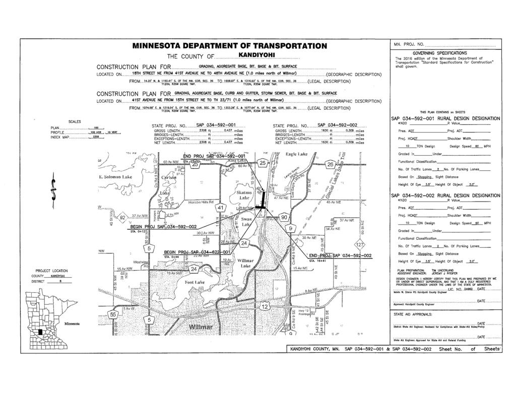
3 MVP BGO, Page 1 of 10
4 MVP BGO, Page 2 of 10
5 MVP BGO, Page 3 of 10
6 MVP BGO, Page 4 of 10
7 MVP BGO, Page 5 of 10
8 MVP BGO, Page 6 of 10
9 MVP BGO, Page 7 of 10
10 MVP BGO, Page 8 of 10
11 MVP BGO, Page 9 of 10
12 MVP BGO, Page 10 of 10