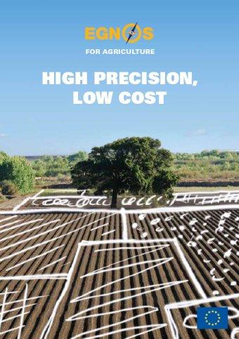
The European GNSS Applications in precision agriculture and mapping
|
|
|
- Ethel Price
- 5 years ago
- Views:
Transcription


1 The European GNSS Applications in precision agriculture and mapping Pieter De Smet European Commission DG ENTR GP3 GNSS Applications, Security and International aspects ICG6 Tokyo - 5 September 2011


2 EGNOS Services EGNOS will deliver its services on a long-term basis (>20 years). Service Characteristics Service Status Open Service accuracy ~1m, free available since October 2009 Safety of Life Service accuracy ~1m, compliant to aviation standards to be made available end of 2010 Commercial Service (EDAS) accuracy <1m, corrections are provided by terrestrial networks experimental service since 2008; official service to be made available in 2012 EDAS: EGNOS Data Access Server 5/9/2011 ICG Tokyo 2


3 The EGNOS commercial service (EDAS) will be made available in 2012 EGNOS Data Access Server - EDAS EGNOS data (real-time): RIMS raw observations SBAS messages Value-added service provider User-specific information EDAS disseminates EGNOS data in real time without relying on the signals from the three EGNOS satellites EDAS will deliver two main types of data in real time: EGNOS augmentation messages Raw GPS data End users 5/9/2011 ICG Tokyo 3

4 EGNOS accuracy improvement EGNOS improves GPS accuracy and guarantees an error limited to a certain buffer. GPS D-GPS EGNOS 5/9/2011 ICG Tokyo 4

5 5/9/2011 ICG Tokyo 5
6 5/9/2011 ICG Tokyo 6
7 Why Precision Agriculture? Agriculture challenges: Rise in the demand of crops: Population increase Chemical industry diversification Bio-fuel demand Limited resources Limited increase of the cultivable land Water shortage Energy prizes rise Precision Agriculture has an answer: Provides: Increase yield production Better management of resources Reduces: Chemical pollution Energy consumption Time 5/9/2011 ICG Tokyo 7


8 2. EGNOS has a wide range of applications for agriculture It s there, use it Application category Arable Application field High-value crop cultivation and/ or precision operations Low-value crop cultivation and low-accuracy operations Required accuracy level c.2cm EGNOS application domain c.1m Dairy Agro-logistic Management Individual livestock positioning and virtual fencing Land parcel identification/ geo-traceability, supervised tracking of livestock, etc. Field measurement and boundary mapping and updating 2-5m c.2.5m c.2.5m 5/9/2011 ICG Tokyo 8
9 and generates strong benefits for farmers EGNOS value added Traditionally, precision agriculture has been characterised by significant equipment investment and costs related to usage EGNOS can offer an affordable precision solution by enhancing the benefits of Precision Agriculture Enhance precision Eliminate waste and overapplication of fertilisers and herbicides Save time and money Reduce fatigue Optimise crop yields Increase profit margins 5/9/2011 ICG Tokyo 9
10 The number of GNSS devices is increasing and EGNOS is the preferred technology # of tractors in use in EU-27 (000 units) 2,788 2,799 2,810 2,822 Not GNSS equipped GNSS equipped 136 (5%) 166 (6%) 200 (7%) 240 (9%) EGNOS Other (RTK/DGPS) 50% 50% 44% 56% 37% 63% 30% 70% Source: Tractor & Device Manufacturers/MMFP Product characteristics Pass to pass accuracy of +/- 15 cm EGNOS-only corrections Ideal for fertilising, seeding and spraying Entry price, affordable for all farmers EGNOS effect on farmers They start with EGNOS They appreciate the benefits EZ-GUIDE 250 In few years, some of them, migrate to advanced systems to cover new functions 5/9/2011 ICG Tokyo 10
11 NPV per technology and farm s hectares The case of durum wheat RTK Example for Durum Wheat Net present value per technology and hectare DGPS (50.000) ( ) Hectares EGNOS Example for steering guidance NPV>0 (HA) EGNOS 17 DGPS 35 RTK 97 Source: GSA CBA 5/9/2011 ICG Tokyo 11
12 A practical example EGNOS is free No installation costs neither annual subscription costs are required EGNOS is widely available all over Europe EGNOS is convenient 1 on 10 tractors in Europe are equipped today with GNSS receivers, most of them are EGNOS enabled The application of EGNOS involves: 2,36% reduction in time, fuel and seed quantity 2,49% reduction in fertilize and Plant Production Products quantities EGNOS is an excellent GNSS technology that can be used for a number of applications on farms of the average European size (16 HA) 5/9/2011 ICG Tokyo 12


 servicesand")
13 R&D projects fill technical gaps and pave the way for high precision applications Evaluations for 3 rd Call currently under way I2GPS:SAR calibratorwithgnss receiver for precision studies of geodynamics FIELDFACT: Promoting the benefits and opportunitiesofgnss in agriculture. MowBySat; GNSS in domestic robots to achieve greater precision at low cost. ASPHALT:High precision applications in road construction, fleet management and logistics using EGNOS just-in-time process chain. GOLDEN-ICE: improvingthe efficiency Of salt-spreading(de-icing) servicesand emergency call management on winter professional vehicles using EGNOS 1 st Call 2 nd Call 5/9/2011 ICG Tokyo 13
14 5/9/2011 ICG Tokyo 14
.")
15 EGNOS and Mapping - providing free accuracy that is widely available GNSS provide an efficient technology for mapping and are widely used by organisations such as utility companies as well as regional and local authorities. Mapping addresses services with submeter and centimeter level accuracy. g Centimeter level applications usually require substantial investment (e.g., infrastructure, equipment, software, service). For meter and certain submeter applications EGNOS is an excellent and inexpensive solution. 5/9/2011 ICG Tokyo 15
16 Free accuracy For many mapping applications meter level accuracy is sufficient Applications such as thematic mapping for small and medium municipalities, forestry and park management as well as surveying of utility infrastructures can benefit from EGNOS. Most of the devices used for mapping are already EGNOS-ready. Thus, EGNOS also allows more and more non-professionals to access GNSS mapping technologies. 5/9/2011 ICG Tokyo 16

17 Mapping: a new promising EGNOS segment Positioning, delivering 50 cm - 1m accuracy, is well received in general (INTERGEO) Device manufacturers give positive feedback Users, i.e. Surveyors, municipalities, show strong interest SBAS is already used for sub-meter mapping (US), with similar potential in EU Jean-Yves Pirlot President of the Council of the European Geodetic Surveyors Eric Gakstatter GPS World Editor Survey & Construction We think EGNOS can play a role in the Mapping sector and are happy to help exploring this by promoting the GSAsurvey amongst our partners across Europe. GSA folks provide a dynamic and effective service in educating the community of ground users ( ) Yes, my European brethren, EGNOS can be used reliably for sub-meter mapping. 5/9/2011 ICG Tokyo 17
 providing system integrity, supplying information on the reliability of GPS signals.")
18 In summary: why EGNOS? EGNOS is an effective option for a wide range of mapping applications with meter accuracy free; it does not require installation of hardware nor ongoing subscriptions. in most of the new GNSS devices covers the majority of Europe -no white spots permitting real time positioning. thanks to EDAS, also receivable by terrestrial communication means, (e.g., internet or GPRS) providing system integrity, supplying information on the reliability of GPS signals. EGNOS is Europe s first venture into the field of GNSS and a precursor to Galileo, Europe s global satellite navigation system, currently under development. EGNOS is an open system, now operational and available for use. 5/9/2011 ICG Tokyo 18


19 It s there, use it Navigation solutions powered by the European Union Thank you for your attention! 5/9/2011 ICG Tokyo 19