GEOINFORMATION TECHOLOGY FOR HARZAD MONITORING AND DISATER RISK REDUCTION. Hussein O. Farah, PhD
|
|
|
- Gavin Doyle
- 5 years ago
- Views:
Transcription


1 GEOINFORMATION TECHOLOGY FOR HARZAD MONITORING AND DISATER RISK REDUCTION Hussein O. Farah, PhD Regional Centre for Mapping of Resources for Development Kasarani Road, P.O.Box Nairobi, Kenya rcmrd.org ; website:hptt/


2
3 Geoinformation for Societal Benefit Land Management, Agriculture, Biodiversity, Climate, Disasters, Ecosystem, Energy, Health, Water, Transportation, Infrastructure etc

4 Major Activities of RCMRD A. Advisory services B. Training C. Servicing and Calibration of Mapping Equipment D. Project implementation E. Data and information Dissemination F. Research and Development
5 Introduction People are increasingly vulnerable to hazards from natural and anthropogenic changes in climate and the land surface Monitoring of hydroclimatic hazards for early warning, is important. Early Warning Livelihood systems are highly sensitive to climate variability and trends Conventional climate station networks are sparse Satellite remote sensing and models fill the gap, Downscaling climate change scenarios provides information on impact on food security

6 Jan-60 Jan-62 Jan-64 Jan-66 Jan-68 Jan-70 Jan-72 Jan-74 Jan-76 Jan-78 Jan-80 Jan-82 Jan-84 Jan-86 Jan-88 Jan-90 Jan-92 Jan-94 Jan-96 Jan-98 Jan-00 Jan-02 Jan-04 M onth/y ear Minimum Temperature(Deg. C) Climate Change: Rainfall variability, drought, melting glaciers, sedimentation, rising sea levels and flooding, advantage to invasive species, a risk to delicate species unable to adapt to change, health, socioeconomic
, Biological (locust, epidemic diseases, etc.")

7 . Natural disasters: Hydro-meteorological (flooding, storm, drought, etc.), Biological (locust, epidemic diseases, etc.) and Geological (earthquake, landslide, volcanic eruption, etc.). 95% of natural hazards in the region are caused by droughts and flooding. These hazards are responsible for 70% of loss of life and 75% of economic loss.
8 Climate-related Challenges in the Region 1. Field data collection (climatic and non-climatic) and exchange are still both inadequate and inconsistent to support comprehensive and continuous early warning and monitoring. 2. Early warning and monitoring information packaging and dissemination is still constrained and ineffective for most vulnerable countries/communities. 3. Approaches for Early Warning and Monitoring are not fully integrated and inter-comparable; seasonal forecasts lack specificity, contextual interpretation and reliability indicators.. 4. Efficient end-user driven delivery system are lacking and do not empower vulnerable communities.

")
9 Satellite Rainfall Estimation and Monitoring Use of NOAA satellite RFE since mid-1990s (Africa) A blend of TIR, microwave, and station observations Rrainfall amounts (mm) COF Forecast


10 Monitoring of Crops and Pastures Normalized Difference Vegetation Index 250-m resolution -MODIS 10-day composites every 5 days Temporal smoothing algorithm applied Used extensively to monitor crop and pasture conditions
 model uses rainfall and specific")

11 Agricultural Drought Monitoring Water Requirement Satisfaction Index (WRSI) model uses rainfall and specific crop water needs to assess crop condition Actual ET also estimated Showing crop failure during the short rains in Somalia and Kenya 2010


12 Satellite monitoring will be increasingly important for early detection of adverse agricultural outcomes in an automated fashion Remote sensing information to monitor regions without incountry presence Rapid comparison of multiple datasets from multiple sensors Standardized anomaly maps and time series

13 Decision Support Systems Utilizes remote sensing data in an automated fashion to flag areas of drought concern. Ranks drought severity at crop zone and admin levels Data are summarized at continental and national scales to identify areas of concern.
14 Sharing and Exchange of Data and Information Discover Share Metadata authoring tools Community building tools Feedback mechanisms Reducing barriers to sharing Managed knowledge base Catalog services Directory services Notification services Browse & search function Web portal Acquire Ground receiving station Data acquisition services Data processing services Data archive Geodata services Visualization tools Decision support tools Forecasts and models Support for interoperability Support for product use Use / Create


15


16 Disaster Management /DRR Flood Potential/Forcast Forest Fires Monitoring


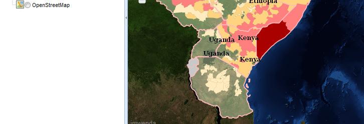
17 Flood forecast Day of this alert: 15 May UTC Current severe flooding potential areas Country Water level & Latitude/Longitude Juba region Eastern Uganda Wajir region Lower Tana river Nugaal region Lower S. coast Kenya Kenya Wajir 149mm Wajir 161mm Wajir 172mm Wajir 184mm Wajir 255mm Wajir 286mm The current forecast shows Wajir in Kenya and it s environs as areas with high flooding potential. Other areas in the region as indicated on the map have low flood potential.


18 Response for Flooding in Kenya in June 2010 Charter Activation 309, RADARSAT Image Flood Disaster Rapid Map
19 Response: Landslide


20 Acknowledgement 1. IGAD secretariat 2. Member countries DRM institutions


21 But now that we know where our hazards are, what s next? We need to know. 1. Where are people living? µ 3. What s the level of exposure, who s vulnerable? µ &: Capital cities #0 Main towns Pop. density What s the risk and what/who is at risk? &: Capital cities #0 Main towns Flood risk areas Pop. density