DS-SLM. Decision Support for Mainstreaming and Scaling out of Sustainable Land Management GCP/GLO/337/GFF
|
|
|
- Nathaniel Peters
- 5 years ago
- Views:
Transcription

1 DS-SLM Decision Support for Mainstreaming and Scaling out of Sustainable Land Management GCP/GLO/337/GFF Stefan Schlingloff Land and Water Division (FAO)
Regional Offices, FAOR) WOCAT (Center for Development and Environment, Univ.")
2 DS-SLM GEF grant: USD ~64% country implementation + Cofinancing: USD Duration: 3 years ( ) GEF Agency = FAO Executing Agencies: FAO (Land and Water Division, (Sub-)Regional Offices, FAOR) WOCAT (Center for Development and Environment, Univ. of Bern) National Lead Agencies in 15 countries: Argentina, Bosnia-Herzegovina, Bangladesh, China, Colombia, Ecuador, Lesoto, Morocco, Nigeria, Panamá, Philippines, Thailand, Tunisia, Turkey, Uzbekistan

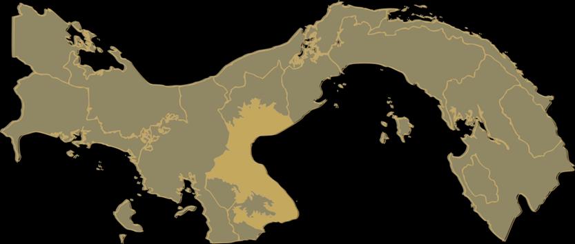
3 Panamá (Arco Seco)
4 Objetivos globales DS- SLM Global Environmental Objective: contribute to combating desertification, land degradation and drought (DLDD) worldwide through scaling up sustainable land management best practices with evidence based and informed decision making Global Development Objective: increase the provision of ecosystem goods and services and enhance food security in countries and regions affected by DLDD through the promotion of SLM, integrated management, and efficiency in the use of natural resources
5 DS- SLM delivered through 3 interlinked components: 1. national and local decision-support on combating DLDD and promoting mainstreaming and scaling up of SLM best practices 2. global DLDD and SLM knowledge management and decision-support platform 3. monitoring and evaluation and dissemination of project results

6 Outcome 1.1 SLM best practices mainstreamed into national and/or sub-national agricultural and environmental plans and investment frameworks, policies and programs to address DLDD in 15 countries. Indicators and targets: Expected Outcomes A scoring system for (sub-)national mainstreaming will be developed with the countries during project start up
7 Outcome 1.2 Up-scaling of SLM best practices catalysed in countries through targeted actions on the ground and strategic decision making from local to national levels. Indicators and targets: Expected Outcomes At least 500 ha under SLM demonstration at the end of project year, up-scaling to at least ha under SLM by project end 5 million ha SLM mainstreamed in plans for implementation during 10 years after project end; increase in vegetation cover (10% cropland, 25% pasture land, x% forest land) xx ha of productive land with increased (agro-)biodiversity (# species; share of annual to perennial species; area of forest/ razing land under regeneration) xx% carbon sequestration increase by LUS (Land Use System) 10% increase in productivity by LUS 10% increase in population with improved access to water in demonstration areas
8 Outcome 2.1 Knowledge management and decision-support system and tools used to support evidence-based strategy formulation at national level for promoting SLM and contributing to global processes to address DLDD Indicators and targets: Expected Outcomes 15 countries enabled to assess land area under SLM and the benefits generated 15 countries able to report (quantitatively and qualitatively) on progress in addressing DDLD through demonstrating, upscaling and mainstreaming SLM 45 institutions in participating country using the federated knowledge platform

 Manual for")
9 Methodology and Results Mapping Land Use Systems at Global and Regional level for Land Degradation Assessment Analysis Questionnaire for Mapping Land Degradation and SLM (QM) Manual for Local Level Assessment of Land Degradation and SLM, Part 1+2

10 LADA WOCAT Toolkit
 and expert knowledge to analyze: - Trends in the")

11 Assessment of LD and SLM with local experts (multi-disciplinary) Participatory Expert assessment workshops using LADA- WOCAT mapping method (QM) and expert knowledge to analyze: - Trends in the Land Use System (LUS) - LD types, extent, degree, rate, indirect and direct causes - SLM objectives, measures, extent, effectiveness, trends - LD and SLM impacts on ESS - future options (expert recommendations)


12 Comparison of degradation vs conservation, UG Severity of Biological degradation Effectiveness of existing SLM technologies and measures addressing biological degradation -The effectiveness of SLM practices that address biological degradation is low in vast areas - SLM practices are not so related to severity of biological degradation These maps can be used to select areas for targeted interventions


13 SLM Technologies and Approaches

14 Decision Support Framework for SLM mainstreaming and scaling out
15 Scaling up requires collaboration among multiple actors / levels River basin District Watershed Catchment Farm Farmers Community Technical National or River Basin Herders Local authorities Sectors Authority better data and information on land and water resources better governance, planning, management
 and Regional soil Partnership ISRIC (soil information &")
16 In countries International partners Actors Stakeholders Lead Ministries/Departments with other Ministries/Departments NGOs and Civil Society Organizations (CSOs) Local Land User Organizations Provincial, Regional and Local Governments in each country National academic and educational institutions Global Soil Partnership (GSP) and Regional soil Partnership ISRIC (soil information & mapping; soil databases, research, training, network) UNCCD CST-SKBP (knowledge brokering system) (SLM BP reporting; access to & use of information on DLDD and Global Mechanism of the UNCCD WOCAT consortium partners (CGIAR system wide CRPs; GIZ, SDC, ICARDA, ICIMOD, CIAT and CIAT Soils) Mountain Partnership and Mountain Societies Research Institute UNEP Economic Assessment of DLDD (ELD)
17 Actors Stakeholders (2) Regional and sub-regional partners Great Green Wall Initiative and EU/ ACP project Action against desertification for sustainable livelihoods and resilient and productive landscapes (FAO with AUC, GM/ UNCCD, Walloon region Belgium & Royal Botanic Gardens of Kew) TerrAfrica/ NEPAD/World Bank CACILM: Central Asian Countries Initiative for Land Management NGOs and Networks DRYNET CARI and Both Ends - coordinating agencies DesertNet International Landscape, People, Food and Nature Initiative (LPFN) led by EcoAgriculture Partners

")


18 Population Male Gender Female Over 65 GLOBAL (SUB) NATIONAL 1. Data bases collection input 2. Land use systems Methodology at scale LOCAL 3. Expert analysis and modeling Model International experts QM National experts Survey populations local experts 4. Land degradation assessment process/trends status/ response output


19 DS-SLM Thank you