ArcGIS Extensions: Tools for Improving Data and Map Production. Amber Bethell & Sean Granata
|
|
|
- Doris Robinson
- 5 years ago
- Views:
Transcription


1 ArcGIS Extensions: Tools for Improving Data and Map Production Amber Bethell & Sean Granata
2 No Standards


3 With Standards


4 Data and Map Production Productivity Cartography Efficiency Automation Accuracy Standardization Quality Control Quality Safety Quantity Continual Improvement Workflows... Focused on Quality, User Needs, and Innovation
5 Data and Map Production Esri Production Mapping Productivity Automation ArcGIS Data Reviewer Cartography Efficiency Standardization Accuracy ArcGIS Workflow Manager Quality Control Quality Safety Quantity Continual Improvement Workflows... Focused on Quality, User Needs, and Innovation
6 Managing Production Work ArcGIS Workflow Manager
7 What is a workflow? A workflow is a sequence of steps that a unit of work has to pass from initiation to completion. Infrastructure Repair Emergency Management Forest Management
8 Workflows - Example
9 Workflows - Example Street Light Damage Report Received
10 Workflows - Example Street Light Damage Report Received Dispatch Alerted
11 Workflows - Example Street Light Damage Report Received Dispatch Alerted Technician Notified

12 Workflows - Example Street Light Damage Report Received Dispatch Alerted Technician Notified Repair Completed?

13 Workflows - Example Street Light Damage Report Received Dispatch Alerted Technician Notified Repair Completed? YES Status Updated NO Enter Reason for Non-Repair
14 Workflows - Example Street Light Damage Report Received Dispatch Alerted Technician Notified Repair Completed? YES Status Updated NO Enter Reason for Non-Repair


15 Centralized Workflows Configure & Create Execute & Manage Evaluate and Improve Supporting GIS professionals and the entire organization
16 Configure and Create Configure Repeatable Steps Create Units of Work based on Workflows
17 Execute and Manage Manage Due Dates/Priorities Execute Workflow
18 Evaluate and Improve Measure Performance Refine Workflows Adapt


19 ArcGIS Workflow Manager Server Knowledge Workers Executive Access Public Engagement Work Anywhere Enterprise Integration GIS Professionals ArcGIS - Workflow management Expose workflow capabilities to your entire Organization
20 Demo ArcGIS Workflow Manager
21 Workflow Manager in ArcGIS Pro Currently working on equivalency


22 ArcGIS Workflow Manager in ArcGIS Pro
23 Improving Data Quality ArcGIS Data Reviewer
24 Defining Quality A business perspective Executive - Confidently make decisions - Reduce financial risk - Optimize organizational performance Manager - Effective data stewardship - Drive increased usage - Maximize productivity Knowledge worker - Increased efficiencies - Confidence in GIS
25 Defining Quality Spatial Accuracy Thematic Accuracy Completeness Logical Consistency Temporal Quality Usability ISO-19157:2013 Geographic information Data quality
26 What is ArcGIS Data Reviewer? Data Quality Management for ArcGIS Provides - Rule-based validation - Interactive tools - Track errors Validate For individuals and enterprise - Saves time/money - Less rework For multiple domains - Configurable - Extendable Summarize Review

27 Automate data validation Data quality checks - 42 configurable checks - Attributes - Spatial relationships - Feature integrity - Metadata


28 Automate data validation Define and encapsulate quality requirements Configure automated checks Design once and execute many times
29 Quality control life cycle Review Correct Verify
30 What is ArcGIS Data Reviewer for Server? Support data quality management Automate Measure data quality Validate Review Summarize


31 Data Quality Reporting Enabling transparency in data quality Better decision making by communicating data quality across stakeholders Open quality reporting Shared across ArcGIS system Tools and methods to communicate quality

32 Where to start Leveraging templates Data Reviewer Templates - Electrical utilities - Gas utilities - Local government - Topographic mapping - Water resources - Water utilities Based on Esri industry models Use as starting point solutions.arcgis.com
33 Demo ArcGIS Data Reviewer


34 ArcGIS Data Reviewer in ArcGIS Pro What s Next? Adding New Configurable Checks Each Release

35 Creating and Managing Specification Driven Maps Esri Production Mapping
36 Your organization s processes Collect Share Manage Produce
37 Your organization s needs Standardization Automation Centralization Repeatability
38 Esri Production Mapping solution Data Production Cartography Workflow Data Validation
39 Without Collection Specifications

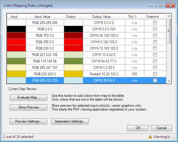
40 Feature collection specifications Must Populate Road Type Must populate Road Name for all Main Roads
41 Generalization Best Scale Data Generalization Tools Smaller Scale Data Multiscale Map Products
42 Traditional Cartography With ArcMap


43 Grids and Graticules Design Feature Based Custom Design Geographically aware - Scale - Coordinate system - Rotation

44 Visual Specifications Defining Create Symbology Define Specifications


45 Layout Providing Context Graphic Table Element - Dynamic table creation - Linked to feature layers - Include text, symbols


46 Layout Providing Context Element Placement - Layout rules


47 Output Production PDF Color Separation Transparency Overprint Etc.

48 Production Mapping Server Product on Demand Production Mapping Server
49 Demo Production Mapping Cartography and Server

50 Moving Forward to Pro Production Mapping functionality will be known as Topographic Production First functionality will be at the next release
51 Data and Map Production Esri Production Mapping Productivity Automation ArcGIS Data Reviewer Cartography Efficiency Standardization Accuracy ArcGIS Workflow Manager Quality Control Quality Safety Quantity Continual Improvement Workflows... Focused on Quality, User Needs, and Innovation


52 Please Take Our Survey on the Esri Events App! Download the Esri Events app and find your event Select the session you attended Scroll down to find the survey Complete Answers and Select Submit
53 Want to learn more this week? Wednesday, July 12 Day and Description Type Time Location ArcGIS Workflow Manager: Advanced Topics ArcGIS Workflow Manager: Integrate Tasks into your Workflow Process Esri Production Mapping: Generating High Quality Product-on- Demand Maps Over the Web ArcGIS Data Reviewer: ArcGIS Data Reviewer: An Introduction Integrating Data Validation Capabilities into Web Applications ArcGIS Workflow Manager: Integrating Geoprocessing and Python into your Business Processes Esri Production Mapping: Automate Map Production with ArcGIS Workflow Manager ArcGIS Data Reviewer: Web Thursday, July 13 Implementing Data Quality Reporting in Clients Technical Workshop Demo Theater Demo Theater Technical Workshop Demo Theater Demo Theater Demo Theater Demo Theater 10:15 11:30am SDCC Room 31 11:30am 12:15pm 1:00 1:30pm SDCC Demo Theater 06 SDCC Demo Theater 18 3:15 4:30pm Room 31B 3:30 4:15pm 3:30 4:15pm 3:30-4:15 pm 4:30 5:15pm Supporting Daily Workflows with Tools Demo Theater 3:30-4:15pm ArcGIS Data Reviewer: Advanced Data Validation ArcGIS Data Reviewer: Leveraging Geoprocessing for Data Validation Technical Workshop Demo Theater Demo Theater 8 Enterprise SDCC Demo Theater 06 SDCC Demo Theater 03 Demo Theater 8 Enterprise SDCC Demo Theater 03 8:30 9:45am Room 31A 9:30 10:15am ArcGIS Data Reviewer: Validating Linear-Referenced Events Demo Theater 10:30 11:15am Demo Theater 6 Spatial Data Mgmt Demo Theater 6 Spatial Data Mgmt


54