Maximizing the Value of Autonomous Surveys
|
|
|
- Piers Stevenson
- 5 years ago
- Views:
Transcription

1 Maximizing the Value of Autonomous Surveys IHO HSSC-7 Open Session 12 November 2015 Busan, Republic Of Korea Presented by: Matt Holland, CARIS
2 Content Introduction Survey platforms and force multiplication The data processing challenge An alternative approach Use cases Conclusions
3 Introduction The volume of autonomous survey operations have increased over the past 5 years Not only Autonomous Underwater Vehicles (AUVs), but also Unmanned Surface Vehicles (USVs) The potential benefits are clear Lower capital and operating costs, rapid deployment/recovery, and the ability to work closer to the intended target Traditionally, the platform would be sent on a pre-defined mission and gather hydrographic data Data stored internally until recovery when it would be processed As power sources improve the operating times extend But little has been done to address the data bottleneck / processing backlog


4 Survey platforms and force multiplication Becoming widely adopted survey platforms They serve as a force multiplier for survey operations


5 Mission Duration Survey platforms and force multiplication Persistent Short - term Sub Surface Surface Manned / Autonomous
6 The data processing challenge Increased number of platforms = increased data volume to be processed Data volumes are significantly increasing - Improved power sources for autonomous vessels - Multi platform/sensor survey ships - Improvements in sonar technology (watercolumn, interferometric, multi detect etc.) The traditional method for handling data is dependent on the type of acquisition platform: MANNED PLATFORM (Survey Ship / Motor Boat) 1. Acquire data 2. Process data offline (Either at sea or upon return to shore) UNMANNED PLATFORM (AUV / ASV) 1. Acquire data 2. Log data to internal HDD 3. Process data upon recovery
7 The data processing challenge This approach results in two main problems for the hydrographic surveyor: 1. The surveyor cannot make informed real-time decisions based on the quality of the data until it is processed 2. For autonomous platforms with limited or no communications, the surveyor has no way to tell if the data meets the required specification until recovery
8 An alternative approach By automating hydrographic data processing Onboard the autonomous or staffed survey platforms: Make processed results available to the surveyor during operations Available results are bandwidth dependent If no bandwidth available, an almost final dataset can be reviewed immediately after survey Obtain repeatable results and real-time QC Make decisions how to proceed with the survey in the most efficient manner Done with minimal human intervention during processing to optimize use of human resources Means to reduce data collection to product time, and processing backlogs

9 An alternative approach
10 An alternative approach CARIS Onboard will perform the automated tasks as defined by the surveyor Completing 80-90% of the processing workflow This leaves the following steps in a typical multibeam workflow: Manually review and edit navigation Apply final sound velocity Apply final tide files or post processed height (ERS surveys) Manually review sounding data / gridded surface


11 An alternative approach Traditional Workflow Platform Setup Acquire Data Download Process Data Final Product Generation AUV Dives AUV Recovered Final Product asset ready for redeployment Platform Setup Acquire Data Download Process Data Final Product Generation Time Saved Workflow


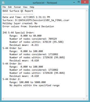
12 An alternative approach Examples of near real-time products High Bandwidth Low Bandwidth Bathymetry surface QC report HIPS Project ASCII depths DEM Mosaic Sounding Surface
 Bathymetric")

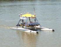
13 Use Cases Unmanned Surface Vehicles (Satellite Communications) Bathymetric Surface ASV gathering multibeam data, processing using CARIS Onboard Shore Data Centre


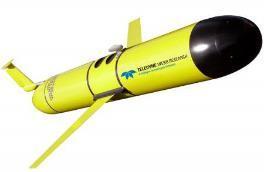
14 Use Cases Autonomous Underwater Vehicle Product(s) Deployment QA/QC Product(s) Data Files Store Process


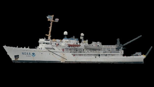
15 Use Cases Staffed Platforms / Command and Control Surveyor in Charge on Mother Ship, monitoring survey launches remotely and directing operations


16 Use Cases Trusted Crowd-Sourcing / Crowd-Sourcing Vessel with reduced staff, but equipped with survey sensors Bathymetry Surface Hydrographic Office
17 Conclusions Onboard data processing allows agencies to obtain maximum value from autonomous surveys Reduces overall collection to product time as data is ready for QC and use in deliverables at end of survey Allows for remote transfer of meaningful data from your survey platform to prevent costly errors in data acquisition, and effectively manage remote assets Allows survey personnel to focus on higher level hydrographic tasks Results seamlessly passed into optimal hydrographic workflow (i.e. Ping-to-Chart Solution)
18 Matt Holland, Deputy Marketing and Sales Manager, CARIS T: , E: E: W: All written and image content in this document not protected by the copyrights of others is Copyright 2015, CARIS. All rights reserved. Reproduction and redistribution is strictly prohibited without the express prior written consent of CARIS.