Mobility: Deploy Your Enterprise GIS to the Field. Chang Chee Leong
|
|
|
- Cory Allen
- 5 years ago
- Views:
Transcription


1 Mobility: Deploy Your Enterprise GIS to the Field Chang Chee Leong
2 What is GIS Mobility? Extends the reach of Enterprise GIS from the office to the field using Mobile Devices and Apps Bring your maps to the field Access attribute information Collect and modify geographic information Track and collaborate data captured Ease of access to dynamic information Multiple users seamlessly accessing the same information (map and attribute) 9/30/ Intergraph Corporation 2


3 GIS Solution Desktop Citrix XenApp Android Windows OS Solaris ios Windows CE Linux Mobile Devices Windows Mobile ios Client Server
4 Key Benefits of Mobile GIS Improve accuracy and efficiency of field operations Rapid data collection and seamless data integration Enable free flow of information between devices, desktops and servers Help to make informed and timely decisions Wide ranges of available devices, from rugged and precision devices to common mobile devices Ease of usage extension to non-gis users and members of public 9/30/ Intergraph Corporation 4


5 Types of Mobile Devices ios Windows OS Windows Mobile Windows CE Windows OS Android Smartphones and Tablets Rugged and Precision Devices


6 Platforms and Usage of Mobile Devices Windows 7 Windows 8 Windows 7 Windows 8 Windows Mobile 6 Windows CE 6 ios 5 ios 6 Android Android 4.1, 4.2, 4.3 Data Collection Data Collection Data Viewing Data Viewing Data Verification Data Collection Data Collection Data Modification Data Verification Data Verification Data Modification Data Modification Crowd Sourcing Crowd Sourcing
7 Platforms and Usage of Mobile Devices Windows 7 Windows 8 Windows 7 Windows 8 Windows Mobile 6 Windows CE 6 ios 5 ios 6 Android Android 4.1, 4.2, 4.3 Data Collection Data Verification Data Modification Data Collection Data Viewing Data Collection Data Verification Data Modification It is all about finding the Crowd right Sourcing device and the right application for the job Data Viewing Data Collection Data Verification Data Modification Crowd Sourcing
8 Real-Time Data Collection, Verification and Modification
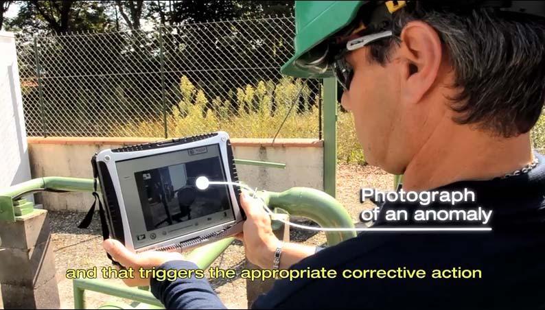
9 Real-Time Mobile Solution What are the requirements? Real-time data collection, verification and modification in the field Digitize or edit attributes, points, lines and polygons Capture photos and link them to the spatial data Search addresses, features etc. Easy to use in the field even by non-gis professionals Available for common tablet devices 9/30/ Intergraph Corporation 9

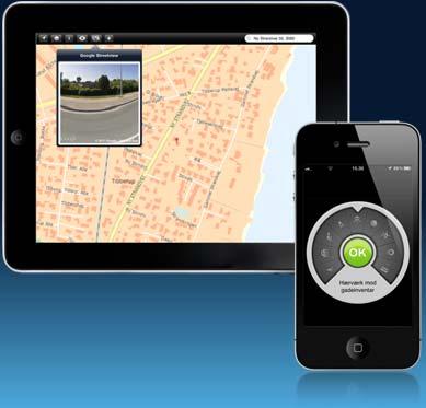
10 Intergraph Mobile Solution Field personnel can use the Mobile Solution to view, capture and modify feature attributes and geometry All updates are posted back to the GIS database in real time. Navigation of data using standard tablet gestures for zoom and panning Most importantly, the app works on the same devices that people use in their personal lives, the Apple ipad and Android tablets 9/30/ Intergraph Corporation 10
11 Technology Behind The Mobile Solution Based on a Service-oriented architecture and all communication is based on web services Integrates with Intergraph server products using OGC web services (WMS, WFS-T and TileCache) Can be integrated with any OGC-compliant infrastructure Spatial database is updated over the air - no need for data import/export 9/30/ Intergraph Corporation 11


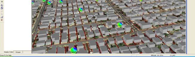
12 Mobile Solution Architecture Mobile Solution Database GIS Database Users Devices Configurations OGC Services Configuration Locator Configuration Provider Admin Console Android ios Database Server Web Server Geospatial Analyst Field Workers Use Mobile Solution configurations to confirm and correct field issues.
13 Intergraph Mobile Solution The solution can easily be configured to match a number of different purposes The solution can be used for all types of field and site inspection workflows Pole or vegetation inspection for utilities or public works Traffic light and bridge inspection for transportation authorities Cell or mobile tower site inspection for communications companies 9/30/ Intergraph Corporation 13
14 Existing Site Implementation The following purposes/registrations have already been implemented by customers; Bus stops and other road equipment City interior (benches, lamps, garbage bins etc.) Security inspections Key boxes and gate openings Fire Hydrants IT-network intersections Damage location information 9/30/ Intergraph Corporation 14
15 Existing Site Implementation The following purposes/registrations have already been implemented by customers; Bus stops and other road equipment City interior (benches, lamps, garbage bins etc.) Security inspections Key boxes and gate openings Can the data be published using OGC webserivces it can be edited using Mobile MapWorks Fire Hydrants IT-network intersections Damage location information 9/30/ Intergraph Corporation 15


16 Intergraph Mobile Solution 9/30/ Intergraph Corporation 16
17 Crowd Sourcing Solution
18 Crowd Sourcing Why do it? Engage citizens to report issues of concern Foster more citizen involvement in community improvement efforts Offers a reliable, cost-effective means of collecting actionable data from any citizen source Increase the reach and response to issues that require attention without spending more on personnel or hardware 9/30/ Intergraph Corporation 18
19 Crowd Sourcing How to do it? Provides citizens a simple tool to send information to the authorities (e.g. pot holes, grafitti, broken sign posts, missing street lights, etc.) Provides an app that works on both iphone and Android smartphones (and migrated the app to Microsoft Phone 7 if required) 9/30/ Intergraph Corporation 19
20 Crowd Sourcing How the location is captured? Determine the location of incidents based on the GPS of the devices Detect if the GPS is not accurate and asks the user to select the location on a map instead (using Open Street Map) If a nation-wide intelligent address database is available this can be integrated as an alternative to selecting the location on a map 9/30/ Intergraph Corporation 20

21 Intergraph Cloud Sourcing Solution Provides crowd-sourced incident information to subscribing organizations e.g. local governments or authorities Incidents are stored in the cloud and are available to subscribing organizations can access the information via a client portal and through WMS and WFS services 9/30/ Intergraph Corporation 21


22 History of Crowd Sourcing Solution Originally developed and released in Denmark in April 2011 as G!v et Praj Now available in 11 countries worldwide Czech Republic Denmark Spain Sweden The Netherlands France Finland New Zealand Switzerland Austria Germany 9/30/ Intergraph Corporation 22


23 Installation of Crowd Sourcing App Download for iphone via Apple itunes and for Android smartphones via Google Play 9/30/ Intergraph Corporation


24
25 Solution on a Public Cloud SQL Server Mobile Alert Database Customer Footprints Customer s Users Categories Staging Area Incidents as GeoMedia Features Azure Cloud Incident Photos Storage Service Database Server SQL Server Spatial data server WebServer GeoMedia WebMap 2013 Incident Receiver Incident Processor Dispatch Customer Portal WFS Citizens see and report issues Service (SendGrid.com) Geocode Service (BING Maps) Customer Entry Process Intergraph Personnel Customer
26 Administration Portal 2012 Intergraph Corporation 26

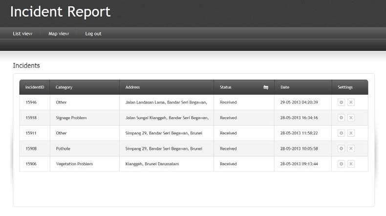
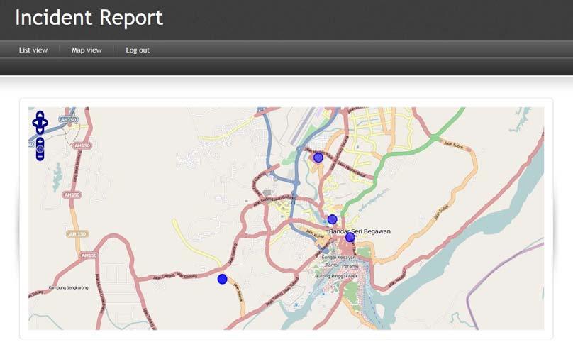
27 Download of Crowd-Sourced Data
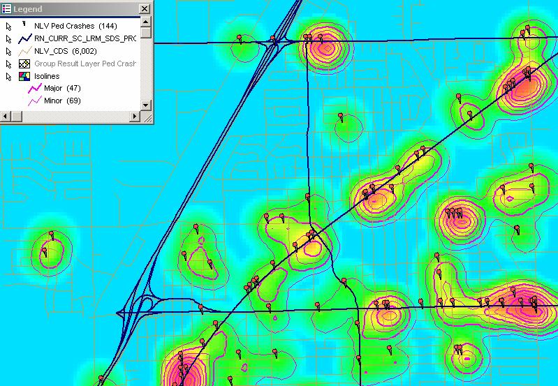
28 Statistical Analysis and Visualisation
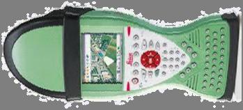
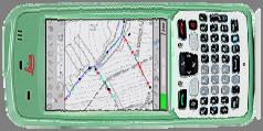
29 Statistical Analysis and Visualisation


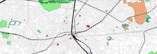
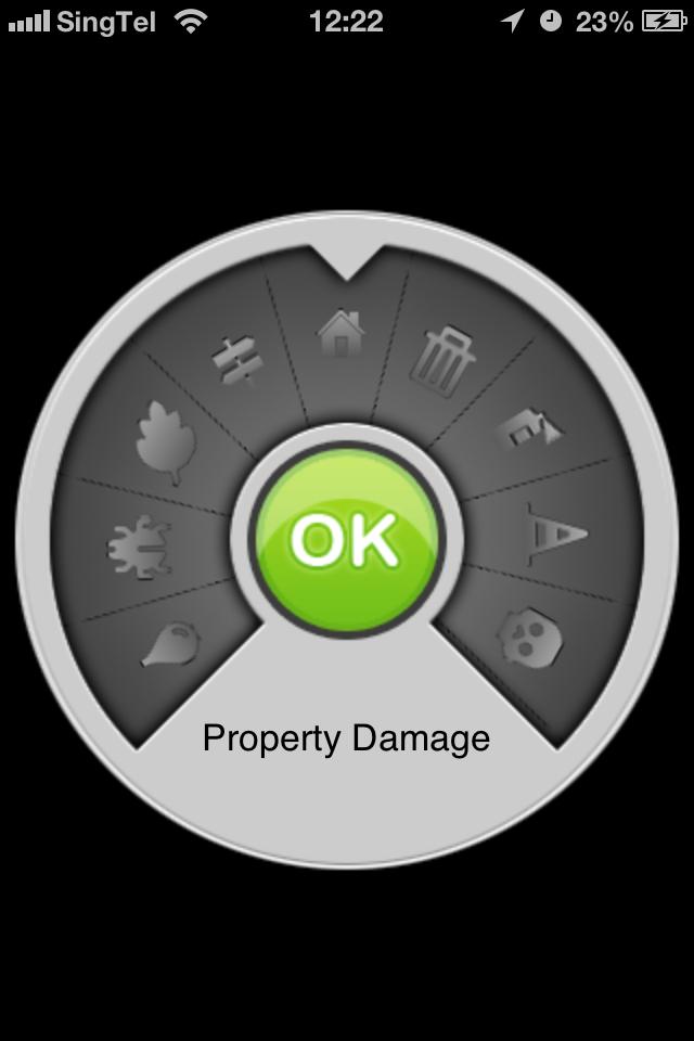
: Damage")

30 Example of Customer Solutions Aarhus Municipality: Clean City app for internal workforce Safe Road (producer of street equipment): Customer app for ordering new street signs Byggeskadefonden (building insurance company): Damage inspection app Danish Maritime Authority: Mobile Alert app for sailors 9/30/ Intergraph Corporation 30

31 Aarhus Clean City 2012 Intergraph Corporation 31


32 Aarhus Clean City The city is struggling with garbage and litter 2012 Intergraph Corporation 32


33 Aarhus Clean City The Crowd Sourcing Solution The solution is based on Intergraph s Mobile Alert app and backend The solution consists of three components; The App The administration website The GIS backend 2012 Intergraph Corporation 33
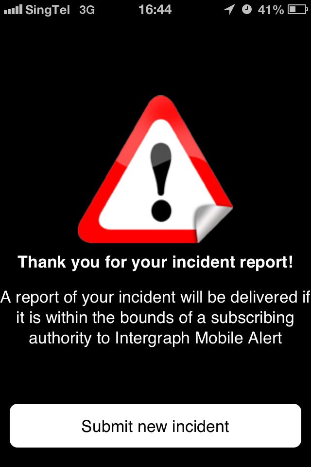
34 Aarhus Clean City How It Works The app is a customized version of the citizen Mobile Alert app 1. Open the app 2. Register (only if you are a new user) 3. Click Start 4. Take 1 3 photos of the incident 5. Choose the right category and sub-category 6. Enter an optional comment 9/30/ Intergraph Corporation 34


 10.")


35 Aarhus Clean City How It Works 7. In case of poor GPS precision the user can choose to; 8. Select an nearby address 9. Select position on a map (Open Street Map) 10. Click Send 11.Close the app or send a new report It all takes about one minute to complete 9/30/ Intergraph Corporation 35
36 Data Collection with Precision Devices
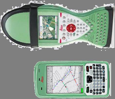
37 Data Collection with Precision Devices 9/30/ Intergraph Corporation 37


38 Leica Zeno Series Workflow myrtknet Job done
39 Questions?