North Jersey Transportation Planning Authority (NJTPA) Asset Management Data Model 2015 IHEEP CONFERENCE Pittsburg, PA September 15, 2015
|
|
|
- Augusta Gaines
- 5 years ago
- Views:
Transcription

 Asset")

1 North Jersey Transportation Planning Authority (NJTPA) Asset Management Data Model 2015 IHEEP CONFERENCE Pittsburg, PA September 15, 2015
2 NJTPA Asset Management Data Model Gabrielle Fausel (NJTPA) Presenters Principal Planner GIS and Planning Tools Nick Hutton (Baker) Senior Project Manager Geospatial Information Technology
3 NJTPA Asset Management Data Model Presentation Agenda 1. Project goals and tasks 2. Project workflow 3. ArcGIS Online and Reporting tool


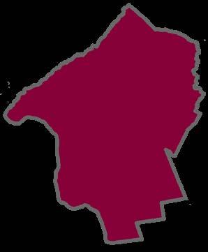

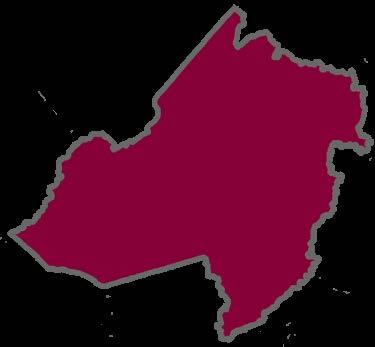


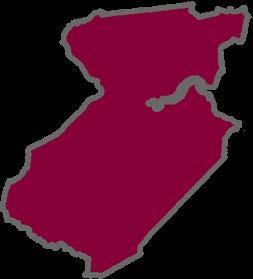


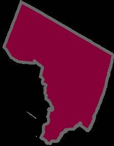


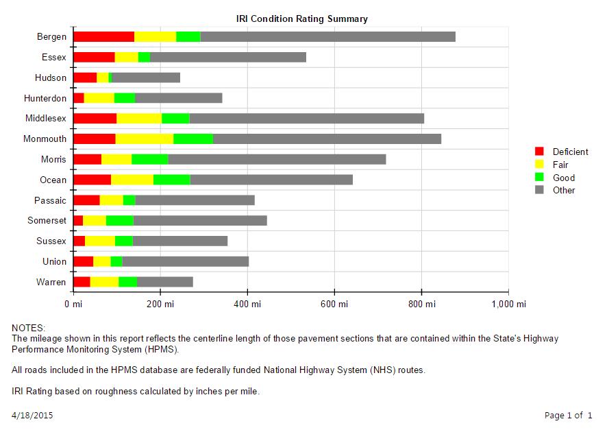
4 NJTPA Asset Management Data Model NJTPA Region Bergen Essex Hudson Hunterdon Jersey City Middlesex Monmouth Morris Newark Ocean Passaic Somerset Sussex Union Warren


5 NJTPA Asset Management Data Model North Jersey Transportation Planning Authority The Metropolitan Planning Organization for Northern New Jersey Bergen Essex Hudson Hunterdon Middlesex Monmouth Morris Ocean Passaic Jersey City Somerset Sussex Union Warren Newark NJDOT Governor Rep. Citizens Rep. Port Authority NJ Transit STANDING COMMITTEES Planning & Economic Development Committee Project Prioritization Committee Freight Initiative Committee Regional Transportation Advisory Committee
6 NJTPA Asset Management Data Model NJTPA Regional Transportation System Road Network: 147 million vehicle miles each day 26,000 miles of roads, including 177 miles of toll roads 4,800 bridges Transit Network: 732,000 trips daily 13% of commuters ride transit 250 bus routes Commuter rail: 390 miles of track, 150 stations
7 NJTPA Asset Management Data Model Primary Project Goals 1. To develop a system and process to access key asset data from within the 13 county sub regions 2. To develop a unified data model that transformed the individual county asset data layers into a singular (region wide) dataset 3. To develop a reporting tool set that would support Federal MAP-21 Reporting Requirements
8 NJTPA Asset Management Data Model Project Tasks Task 1: Data Gathering and Assessment Task 2: Design Data Model Task 3: Deploy and Refine Model Task 4: Documentation and Training
9 NJTPA Asset Management Data Model Project Tasks Task 1: Data Gathering and Assessment Gathered approximately 91 datasets (13x7) Bridge Pavement Signs Signals Inlets Outfalls Guiderails Performed detailed review of exiting data Type, format, quality, attributes, domains, commonalities, etc.
10 Identified County Data Sets Pavement Bridges Signs Guiderail Inlets Outfalls Signals Bergen County X X X X Essex County X X Hudson County X X Hunterdon County X X X X Middlesex County X X X X X Monmouth County X X X X X Morris County X X X X Ocean County X X X X X X Passaic County X X X Somerset County X X X X X Sussex County X X X X X X X Union County X X X Warren County X LEGEND County data submitted and consolidated to geodatabse - as of 6/4/14 X Denotes originally identified as available data source by County NOTE: Pavement and bridge data provided by NJDOT
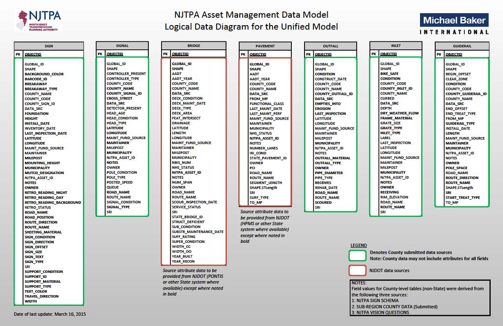
11 NJTPA Asset Management Data Model Project Tasks Task 2: Design Data Model Developed project workflow Design of unified AMDM schema Design and development of ETL scripts Design and development of reporting tools
12 NJTPA Asset Management Data Model
13
14 ETL Process NJTPA Asset Management Data Model


15 NJTPA Asset Management Data Model Reporting
16 NJTPA Asset Management Data Model Project Tasks Task 3: Deploy and Refine Model On-site installation Populated unified geodatabase ETL scripts Scheduled task Reporting tools
17 NJTPA Asset Management Data Model Project Tasks Task 4: Documentation and Training System Requirements Implementation Plan User Manuals Conduct On-Site Training Sessions
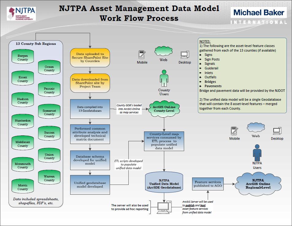
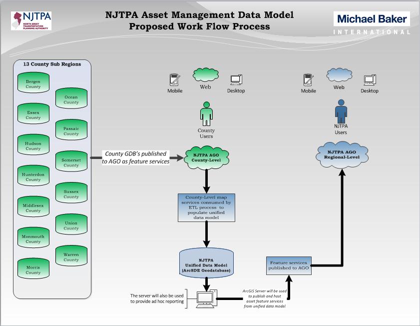
18 NJTPA Asset Management Data Model Overview of Project Workflow Workflow Steps: Step 1 Step 2 Step 3 Step 4 Step 5 Step 6 Step 7 Step 8 Step 9 Acquisition of data from county sub-regions Consolidation of county sub region data into file GDB s Publishing of county-level feature services to NJTPA s AGO Development of unified schema and geodatabase model Development of ETL data migration scripts Migration of county-level feature services to unified GBD Deployment of unified GDB and ETL to NJTPA (Alpha) Deployment of reporting tools to NJTPA (Beta Version) Publishing of unified feature services to NJTPA AGO
19 Project Workflow Steps
20 STEP 1 Acquisition of data from county sub-regions
21 STEP 2 Consolidation of county data into file GDB s
22 STEP 3 Publishing of county data to AGO

23 County Data Published to AGO STEP 2: Consolidation of County Data Data downloaded from SharePoint site by Project Team Data compiled into County-Level Geodatabases STEP 2: Convert to geodatabases STEP 3: Publish county-level feature services NJTPA ArcGIS Online County-Level
24 STEP 4 Development of unified geodatabase schema
25 STEP 5 Development of ETL data migration scripts
26 STEP 6 Migration of county data to unified GBD
27 Results of ETL Process NJTPA ArcGIS Online County-Level
28 STEP 7 Deployment of unified GDB and ETL to NJTPA
29 STEP 8 Deployment of reporting tools to NJTPA


30 STEP 9 Publishing of unified asset data to AGO
31 Project Workflow Process Baker Sharepoint

32 Project Workflow Process Baker Sharepoint
33 Project Workflow Process NJTPA ArcGIS Online County-Level
34 Project Workflow Process Mobile Web Desktop County Users NJTPA ArcGIS Online County-Level
35 Project Workflow Process Mobile Web Desktop County Users NJTPA ArcGIS Online County-Level
36 Project Workflow Process Mobile Web Desktop County Users NJTPA ArcGIS Online County-Level NJTPA ArcGIS Online Regional-Level
37 Project Workflow Process Web Web Mobile Desktop Mobile Desktop County Users NJTPA Users NJTPA ArcGIS Online County-Level NJTPA ArcGIS Online Regional-Level

38 Project Workflow Process Web Web Mobile Desktop Mobile Desktop County Users NJTPA Users NJTPA ArcGIS Online County-Level NJTPA ArcGIS Online Regional-Level
39
40
41 NJTPA Asset Management Data Model Lesson Learned County data schemas were variable and inconsistent (except for signs) Build consensus early and often Need common workflow from counties to maintain integrity of unified data base
42 Questions? NJTPA Asset Management Data Model

43 NJTPA ArcGIS Online Organization
44 Asset Management: Using ArcGIS Online

45 Using ArcGIS Online

46 AGO Operations Dashboard

47 AGO Operations Dashboard

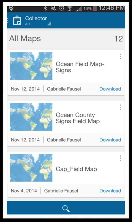
48 Using ArcGIS Collector

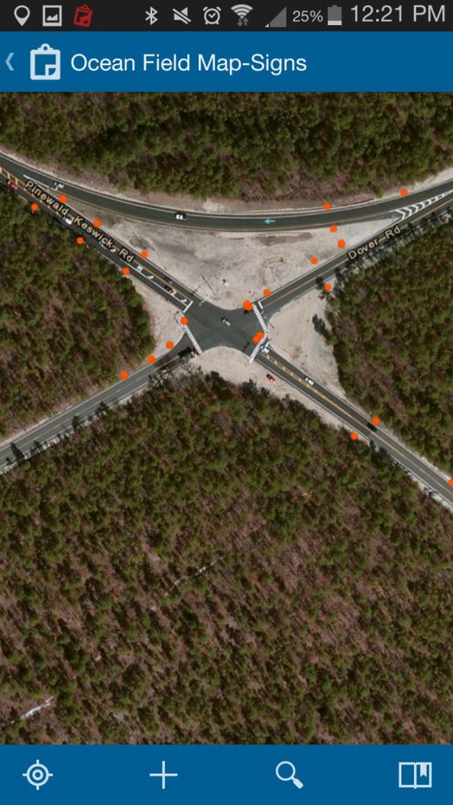
49 Using ArcGIS Collector

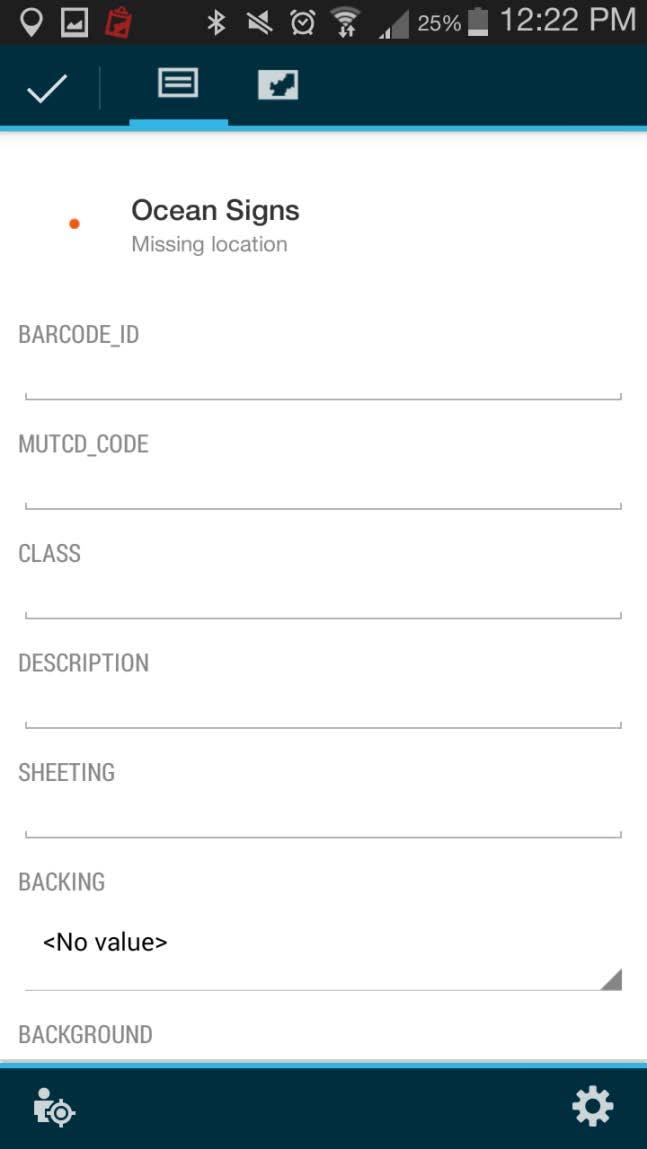
50 Using ArcGIS Collector

51 Using ArcGIS Collector

52 Reporting Tool

53 Reporting Tool
54 Reporting Tool
55 Reporting Tool
56 Reporting Tool
57 Reporting Tool
58 Reporting Tool

59 Reporting Tool
60
61
62
63
64
65
66
67
68
69
70

71 Questions? NJTPA Asset Management Data Model