Predicting dangerous road segments using in-vehicle telematics.
|
|
|
- Kerrie Clarke
- 5 years ago
- Views:
Transcription


1 Predicting dangerous road segments using in-vehicle telematics. Waycare + Geotab AI Driven Mobility Solutions for Smart Cities
2 Contents Overview 1 Key findings 2 Waycare & Geotab 3 Las Vegas Case Study 4 The Data 4 Methodology 4 Results 5 Crash prediction 5 Points for further research 5 Actionable Insights 5 Summary 6 Learn more 7 About Waycare 7 About Geotab 7
3 1 Overview Traffic crashes remain one of the leading causes of fatalities in the US and despite many safety features and improvements the number of fatalities on the roads have been increasing. To combat this epidemic government and transportation authorities must shift the way they manage traffic safety from a reactive to a proactive approach. New advancements in Artificial Intelligence combined with contextual in-vehicle data can help illuminate areas that are at risk of an incident, before they occur. Waycare, which provides a comprehensive smart mobility platform for cities and public agencies, and Geotab, an industry leading open connected-vehicle platform, have partnered to showcase the impact of leveraging in-vehicle data for AI driven crash prediction solutions. This white paper will examine results of a study in which Waycare harnessed Geotab historic safety events to predict crashes throughout the day in Southern Nevada. In turn, allowing law enforcement and emergency services to proactively and strategically prevent traffic crashes by allocating resources and additionally respond to ongoing incidents faster and more efficiently.
4 2 Key findings 59.5% + 83% = 360 crash prediction accuracy of crashes recorded a safety event within an hour possible avoided crashes A historical safety-events based model is able to predict crashes with a 59.5% accuracy. Additionally, a safety-event was recorded within an hour of 83% of crashes. Providing an indication of road hazards in real-time and enabling faster response times.
5 3 identification along with predictive analytics for identifying crash prone segments in the next 24 hours. + Waycare is an Artificial Intelligence driven traffic and crash management solution for government agencies. The platform integrates vast amounts of real-time and historical data from in-vehicle data partners including global navigation providers, mapping providers, and telematics solutions. This data is then combined with the city s existing database consisting of loop sensors, cameras, and other traffic management systems. The combined data is synthesized and integrated by Waycare s algorithms to provide automated real-time incident Waycare s solution is intended for various public agencies such as Traffic Operations, Traffic Engineering, Law Enforcement, and Emergency Services & Freeway Service Patrol, enabling seamless cross-agency communication, efficient incident mitigation, and resource allocation. Through its partnership with Geotab, Waycare receives anonymized contextual driving behavior and safety information which is then processed through Waycare s system. This data is supplemented by a multitude of inputs including city infrastructure and ecosystem data such as weather, events, and seasonality deriving insights which are transmitted to different agencies throughout the day. These insights include but are not limited to, hazardous intersections and road segments, emissions hot spots, roadside temperature maps, traffic/congestion information, and more, enabling cities to respond in real-time to situations on the road and improve overall safety and driving conditions.
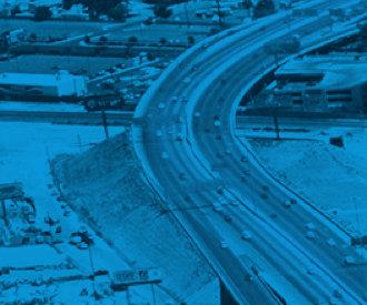
6 4 Las Vegas Case Study The Data To examine the accuracy of the crash predictions, the Waycare algorithim processed historical safety-events between Jan to Dec 2017 on I-15 NB, between Sahara and Charleston. Crashes Safety A Safety B Safety C Events The anonymized events, transmitted from Geotab-connected vehicles were aggregated by time of occurrence and location, and show contextual driving behaviors such as: Acceleration Events (Safety A) Harsh Breaking Events (Safety B) Swerving Events (Safety C) Time-slots with positive values Average events per time-slot Methodology Based on this data, Waycare modeled an intelligent predictive algorithm and evaluated its performance compared to actual crashes. The analysis ran from Jan to Dec 2017 on I-15 NB, between Sahara and Charleston. Throughout the period 2,016 timeslots where sampled in the granularity of the hour and the day of the week. Step 1 Using the Spearman s rank correlation coefficient we analyzed the safety-events thresholds correlated to actual crash occurrences (#crashes > 0). Step 2 In a similar flow, the decision tree is trained to provide a classification based on the label identified in Step 1: {Safety A>1}. The best hyperparameters are set according to the validation set. Step 3 A test was created which included 605 samples, this time the label for testing was the true crashes recorded during specific time periods. The highest calculated correlation: {Safety A > 1} while Safety B and Safety C values are ignored, with a calculated correlation of
7 5 Results Crash prediction From the 605 time-slots tested, the algorithm predicted accidents with a 59.5% accuracy. This means 360 potential crashes might have been prevented with proactive warnings to drivers regarding hazardous road segments or intersections. Additionally, in more than 83% of crashes, a safety event was recorded registering a potential hazard and possibly enabling a faster response time. These early indicators provide law enforcement and traffic management centers adequate information to respond to calls quickly and without the need for human intervention. Points for further research This model, which was trained solely on historical safety data, produced promising initial results. As data is supplemented, we expect even higher accuracy with additional factors such as; day of the week, seasonality, a longer period of model training through machine learning and extending the geographic scope. Actionable Insights The results translate into meaningful and actionable insights that enable cities to take control of their roads through data. The Waycare platform continually processes vast amounts of historical and real-time data from multiple sources, in addition to ecosystem data (weather, seasonality, events, etc.) to provide an accurate representation of hazardous driving areas. This information can then be transmitted to traffic authorities, law enforcement authorities, emergency service, and even the driver, all to prevent crashes and fatalities on the road.
8 6 Summary Through this project, we ve seen that safety events are good predictors of crashes occurring in a specific time slot on a particular road segment, and demonstrates the value of in-vehicle data and AI-based transportation operation systems. Also, the results in traffic safety and response time are early indicators to the additional progress that will be made as the partnership expands and increased amounts of data are transmitted to the machine learning based system enabling the platform to learn and improve even more. In-vehicle data and machine learning based transportation solutions have the potential to transform not only the current model of traffic operations management but also provide the foundation for the future of traffic management in a connected and autonomous vehicle world. Transportation agencies around the country are searching for ways to shift congestion and traffic safety management from reactive to proactive prevention. Predictive analytics and Neural network-enabled technologies are the keys to unlocking insights from past and current road behavior for forwardlooking insights and action. This will become more critical in the coming years as more connected vehicles hit the road.
9 7 Learn more For further details and to hear more about Waycare and how to bring this technology to your city please contact To learn more about Geotab s smart city data sets and how they can they can provide critical insights to your smart city applications, contact smartcity@geotab.com. Waycare s cloud-based platform is shaping the future of city mobility, enabling cities to take full control of their roads by harnessing in-vehicle information and municipal traffic data for predictive insights and proactive traffic management optimization. The company has offices in Tel Aviv, Israel, and Silicon Valley, and is backed by leading venture capital funds in the U.S., Europe, and Israel. With the advancements of next-gen wireless communications, cities can now realize the full benefits of IoT technologies. Leveraging one of the world s largest telematics-based data-sets, Geotab s dynamic-insights and urban-analytics can be used to drastically improve city-wide safety and efficiency. Discover key infrastructure challenges and deploy automated solutions for issues such as congestion, parking, and poor road conditions.
10 Palo Alto 550 California Avenue, Palo Alto, CA (617) Tel-Aviv Shevah Street 7, Tel Aviv, Israel