BAYFRONT CANAL AND ATHERTON CHANNEL PROJECT DESCRIPTION
|
|
|
- Hugo Kristian Quinn
- 5 years ago
- Views:
Transcription
1 APPENDIX I BAYFRONT CANAL AND ATHERTON CHANNEL PROJECT DESCRIPTION South Bay Salt Pond Restoration Project Phase 2 July 2015 Draft Environmental Impact Statement/Report
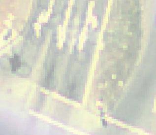
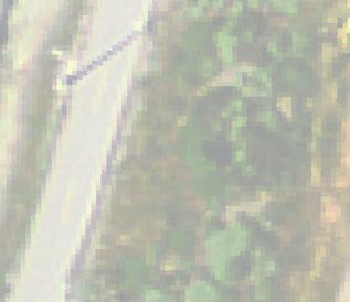
2 2185 N. California Blvd., Suite 500 Walnut Creek, CA (925) Fax (925) MEMORANDUM To: From: David Halsing (URS) Chris Potter, Megan Bordelon Date: Subject: Bayfront Canal Flood Improvements Project Description M&N Job No.: Project Description The Bayfront Canal Flood Improvements Project contains four components: open channel improvements, culvert installation, Caltrans stormwater pipe temporary removal, and water control structure installations (Figure 1.1). The primary work will be installing a culvert to direct water from the Bayfront Canal to the Ravenswood Ponds. Open channel improvements will be made upstream and downstream of the proposed culvert installation to enhance flow to and from the culvert. The proposed culvert alignment crosses beneath existing Caltrans stormwater pipes; therefore, the Caltrans pipes will be temporarily removed and replaced during the culvert installation. Lastly, water control structures will be installed in three different locations within and around the Ravenswood Ponds to allow the freshwater outflow from the culvert to move between ponds, and ultimately to the Bay, and also to manage water quality in the ponds during the dry season. As shown in Figure 1.2, the construction disturbance area will be approximately 2 acres for the open channel improvements, culvert installation, and Caltrans pipe relocation. Approximately 4,600 square feet of pavement will be removed and replaced. The following sections summarize the construction methods and proposed sequence of work. 1.1 Open Channel Improvements Open channel improvements will be conducted on the existing vegetated channels both immediately upstream and downstream of the proposed culvert. The existing channels will be cleared and grubbed. An excavator will remove approximately 1,100 cubic yards of material while grading the upstream channel cross section to a 2H:1V side slope. An excavator will remove approximately 1,100 cubic yards of material while grading the downstream channel cross section to a 1.5H:1V side slope. The vegetation debris will be recycled or disposed of at an approved offsite recycling or disposal facility. The material excavated from the channel will be trucked on dirt roads approximately 1 mile to the All American Canal, located between the Ravenswood Ponds R3 and R4. Material delivery will be coordinated with the South Bay Salt Pond Restoration Project (SBSP) team. The upstream inlet of the open channel at the Bayfront Canal will be stabilized. Approximately 700 square feet of articulating concrete block mat or rock riprap will be placed at a 2H:1V slope at the
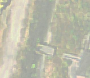
3 channel inlet. Geotextile fabric will be placed underneath the rock slope protection. The open channel side slopes will be re vegetated, and may also be lined with ground stabilizers such as turf reinforcement mats (instead of rock) to restrict tree growth and minimize future maintenance costs. 1.2 Culvert Installation A culvert consisting of four (4) 63 inch diameter high density polyethylene (HDPE) pipes will connect the upstream open channel to the downstream open channel, which then connects to the Ravenswood Pond S5 Forebay (Figure 1.2). The HDPE pipe will be specified as DR21 with a wall thickness of 3 inches (outside diameter 63 inches). A trash rack and operational sluice gates will be incorporated into the inlet headwall structure for the culvert. The outlet headwall structure for the culvert will be fitted with flap gates. The construction area will initially be cleared and the asphalt removed for disposal at an approved disposal facility. Approximately 6,800 cubic yards of material will be excavated for the pipe installation. Temporary excavation slopes shall be at 1H:1V, beginning near the inlet and proceeding eastward towards the downstream outlet. A cast in place concrete headwall will be constructed for the inlet and outlet structures, and estimated at 62 and 56 cubic yards of concrete, respectively. Approximately 120 cubic yards of 1.5 ft thick rock will be placed at the outlet of the culvert to prevent erosion in the open channel. The rock apron will cover approximately 2,100 square feet. Excavated material will be stockpiled immediately adjacent to the excavation slope, as space allows. Water will be removed from the trench with pumps as needed. The culvert pipes will be placed on bedding material and fused in place. The excavated material will be used for backfill and compacted with a vibratory roller once the pipes are installed. Marsh Road will be re paved and vegetation will be re planted at the completion of the project. To enhance outflow from the culvert, the Ravenswood Pond S5 Forebay will also be excavated and the material will be placed in the All American Canal, similar to the material removed from the upstream open channel. Approximately 4.3 acres will be excavated, about 24,600 cubic yards of material. During construction of the inlet headwall for the culvert, public vehicle access to the Bedwell Bayfront Park will be maintained. After completion of the inlet headwall however, excavation will continue eastward and all public vehicle access to the park will temporarily cease. The construction site will be fenced to allow public foot traffic only to proceed to Bedwell Bayfront Park until excavation of the culvert outlet begins, at which point public safety concerns will terminate all public access until the completion of the project (approximately 1.5 months). The contractor will provide traffic safety control throughout the duration of the project. 1.3 Caltrans Stormwater Pipe Relocations The proposed culvert will cross underneath existing Caltrans double 48 diameter stormwater pipes. In order to install the culvert, the Caltrans reinforced concrete pipes (RCPs) will be removed. (This work will occur during the summer months to avoid stormwater flow; otherwise a temporary bypass will be constructed.) Initially, the area around the Caltrans RCPs will be excavated, allowing approximately 70 2
4 linear feet (LF) of the pipes to be removed. The removed pipes shall be disposed of at an approved offsite disposal facility. The contractor will lay bedding material and the HDPE culverts, followed with construction of a concrete encasement for the HDPE pipe culverts. The concrete encasement shall have a half saddle constructed on top to support the replacement Caltrans pipes. The replacement Caltrans stormwater pipes shall either be HDPE or RCPs. The area will be filled with the excavated material, compacted, re paved and re planted to restore the area to existing conditions. 1.4 Water Control Structure Installations Three water control structures are proposed at the following locations: between Ravenswood Ponds R4 and R5, between Pond S5 and R3, and between the Pond S5 Forebay and Flood Slough Pond R4/R5 Tide Gate Structure The tide gate structure between Ravenswood Ponds R4 and R5 will be comprised of two to five 4 x4 box culverts. The structure will be prefabricated concrete or steel, trucked to the site, lifted off the trucks with a crane and set into place. The construction work will begin by excavating and stockpiling the existing material in the work area. Due to subsidence concerns in the soft marsh mud, piles will most likely be driven to support the tide gate structure using a crawler crane pile driver. Once the piles are inplace, bedding material and the structure will be installed. A pump will remove ponded water in the excavated tide gate location to an adjacent pond or channel if needed. Once the tide gate structure is in place and secured to the piles, it will be covered with the excavated material. The outlet of the tide gate will potentially be protected from erosion with riprap Pond S5/R3 Water Circulation Culvert A water circulation culvert will be installed between Pond S5 and Pond R3 to manage water quality in the ponds during the dry season. A trench will be excavated, the bedding material will be placed, and an HDPE pipe ranging from 24 to 36 diameter will be installed. The trench will be backfilled and replanted to restore to existing conditions Pond S5 Forebay/Flood Slough Water Circulation Culvert A water circulation culvert will be installed between the Pond S5 Forebay and Flood Slough to manage water quality in the ponds during the dry season. A trench will be excavated, the bedding material will be placed, and an HDPE pipe ranging from 24 to 36 diameter will be installed. The area will be backfilled and replanted to restore to existing conditions. 3
5 2.0 Wetland delineation In October 2013, the presence of USACE and US EPA jurisdictional waters were investigated in the project area. The results are summarized below in Table 1 and in Figure 3. Waters Potentially Subject to Section 404 of CWA and Section 10 of the RHA (Huffman Broadway Group, 2013). Habitat Type Table 1. Wetland Delineation Summary Subject to Section 404 of the CWA Subject to Section 10 of the RHA Acreage Non Tidal Wetlands Yes No 0.04 Tidal Wetlands Waters Yes No 0.27 Non Tidal Other Yes No 0.08 Tidal Other Waters Yes Yes 0.12 CWA = Clean Water Act RHA = Rivers and Harbors Act 3.0 Easement Assessment An easement assessment was completed in March 2014 for the project area (Bohley Consulting 2014). The results can be found in Attachment Construction Equipment and Materials Table 2 and Table 3 summarize the anticipated equipment and materials during this project. Table 2. Construction Equipment Dozer Excavator Front end Loader Backhoe Crane Trucks Vibratory Roller Summary of Equipment Asphalt paver Crawler Crane Pile Driver Trash Pump Diesel Generator Water Truck Hydro seeder 4
6 Table 3. Estimated Material Quantity Summary of Materials Type Quantity Concrete (Culvert Inlet) 62 yd 3 Concrete (Culvert Outlet) 56 yd 3 Concrete (Culvert Encasement) 50 yd 3 Total Concrete 168 yd 3 Rock (Open Channel Inlet Banks) 50 yd 3 (675 ft 2 ) Rock (Culvert Inlet) 60 yd 3 (810 ft 2 ) Rock (Culvert Outlet) 120 yd 3 (2,100 ft 2 ) Rock (Water Control Structures) 45 yd 3 (1,200 ft 2 total) Total Rock 275 yd 3 Geotextile Fabric (Beneath rock) 4,800 ft 2 Ground Stabilizer Mats (Open Channel) 9,400 ft 2 Asphalt 28 yd 3 Four (4) HDPE Pipes (Culvert) 236 linear ft. (Each) 944 linear ft. (Total) The equipment and materials will enter the site near the intersection of Bayfront Expressway (Hwy 84) and Marsh Road. The contractor will likely mobilize the equipment from their source location to the site via Highway 101 and Marsh Road. As previously mentioned; the excess material excavated from the open channel improvements will be transported by truck from the project site along Marsh Road and on dirt roads to be deposited in the All American Canal (located between the Ravenswood Ponds R3 and R4). The contractor will perform dust control with a water truck during construction. 4.1 Construction Sequencing The work will be performed ideally during the dry summer months to avoid weather delays and stormwater management in and around the excavations. The project is expected to be completed in approximately 4 months. After mobilization, the open channel improvements will be constructed, followed by the culvert inlet construction. The work will proceed eastward towards the culvert outlet structure, in a stepwise fashion as much as possible in order to maintain public access to Bedwell Park. As previously mentioned, all public access will be restricted for approximately 1.5 months when the work progresses to the outlet structure. The construction of the three water control structures is likely to occur during or immediately following the culvert installation. The final tasks near the completion of the project will be re paving Marsh Road and hydroseeding or planting where necessary. 5
7 FIGURES 6
8 Proposed Culvert Alignment Open Channel Improvements Atherton Channel Caltrans Culvert Bayfront Canal $ S5 Forebay Notes: *CASIL aerial photo dated Feet 600 Figure 1.1 Project Description Map Flood Slough Bayfront Canal and Atherton Channel Flood Improvement and Habitat Restoration Project City of Redwood City Pond R4/R5 TideGate Structure R4 Open Channel Improvements Proposed Culvert Alignment Pond S5 Forebay Water Control Structure R5 S5 Forebay Caltrans Stormwater Pipe Relocation Open Channel Improvements S5 R3 Pond S5/R3 Water Control Structure

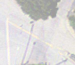
9 Flood Slough Open Channel Bayfront Canal 4x 63" dia. HDPE Pipes Open Channel Flap Gates at Outlet Structure Sluice Gates and Trash Rack at Inlet Structure S5 Forebay Caltrans Stormwater Pipes Legend 0 Proposed New Pipes Proposed Concrete Structures Staging Areas Notes: *CASIL aerial photo dated Feet 100 Figure 1.2 Proposed Project Alignment and Staging Areas Proposed Grading Boundary Caltrans Culvert 25 $ Bayfront Canal and Atherton Figure 1.2 Proposed Project Channel Flood Improvement Alignment Staging Project Areas and Habitat and Restoration City of Redwood City
10 ATTACHMENT 1 Easement Assessment Bohley Consulting, Inc. Draft March


11
12 ATTACHMENT 2 Investigation of the Presence of USACE and US EPA Jurisdictional Waters For the Redwood City Bayfront Canal and Atherton Channel Flood Improvement and Habitat Restoration Project, Redwood City, San Mateo County, California. Huffman Broadway Group, Inc. Draft November
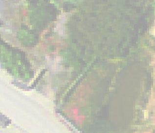
13 Legend E Sample Point Study Area F l o o d S l o u g h Subject to Section 404 of the CWA Non-Tidal Other Waters (0.08 AC) Non-Tidal Wetlands (0.04 AC) Tidal Wetlands (0.27 AC) Subject to Section 404 of the CWA and Section 10 of the RHA E E sp5 Tidal Other Waters (0.12 AC) B a y f r o n t C a n a l E sp3 sp2 sp4 E sp1 E E sp6 M a r s h R o a d sp Feet B a y f r o n t E x p y Figure 3. Waters Potentially Subject to Section 404 of CWA and Section 10 of the RHA Redwood City Bayfront Canal and Atherton Channel Flood Improvement and Habitat Restoration Project Redwood City, San Mateo County, California E USGS HRO Aerial, April 2011