GEOTEK ENGINEERING & TESTING SERVICES, INC. 909 East 50 th Street North Sioux Falls, South Dakota Phone Fax
|
|
|
- Thomas Chambers
- 5 years ago
- Views:
Transcription
1 GEOTEK ENGINEERING & TESTING SERVICES, INC. 909 East 50 th Street North Sioux Falls, South Dakota Phone Fax September 8, 2016 City of Viborg 101 N. Main Street Attn: Steve Bendt, Mayor Subj: Geotechnical Exploration Proposed Street & Utility Improvements Maple Street & Agnes Street This correspondence presents our written report of the geotechnical exploration program for the referenced project. Our work was performed in accordance with your authorization. We are transmitting an electronic copy of our report for your use. An additional copy is also being sent as noted below. We thank you for the opportunity of providing our services on this project and look forward to continued participation during the design and construction phases. If you have any questions regarding this report, please contact our office at (605) Respectfully Submitted, Jared Haskins Jared Haskins, PE Geotechnical Manager Cc: Banner Associates, Inc. Attn: Rich Uckert, PE
2 Proposed Street & Utility Improvements Page 2 of 14 TABLE OF CONTENTS INTRODUCTION... 3 PROJECT INFORMATION... 3 SCOPE OF SERVICES... 3 SITE & SUBSURFACE CONDITIONS... 4 SITE LOCATION & DESCRIPTION... 4 GROUND SURFACE ELEVATIONS & TEST BORING LOCATIONS... 4 EXISTING PAVEMENT CONDITIONS... 4 SUBSURFACE CONDITIONS... 4 WATER LEVELS... 5 ENGINEERING REVIEW & RECOMMENDATIONS... 5 PROJECT DESIGN DATA... 5 UTILITY EXCAVATIONS... 6 SUBGRADE SOILS... 7 STRIPPING & REMOVALS... 8 SCARIFY & COMPACT... 8 FILLING... 8 UNSTABLE SUBGRADE... 9 ASPHALT PAVEMENT SECTION THICKNESS... 9 CONSTRUCTION CONSIDERATIONS GROUNDWATER & SURFACE WATER DISTURBANCE OF SOILS COLD WEATHER PRECAUTIONS EXCAVATION SIDESLOPES OBSERVATIONS & TESTING Excavation Testing SUBSURFACE EXPLORATION PROCEDURES TEST BORINGS SOIL CLASSIFICATION WATER LEVEL MEASUREMENTS LABORATORY TESTS LIMITATIONS STANDARD OF CARE APPENDIX A FIGURE 1 TEST BORING LOCATION MAP (TEST BORINGS 1, 2 & 3) FIGURE 2 TEST BORING LOCATION MAP (TEST BORINGS 4 & 5) BORING LOGS SOIL CLASSIFICATION SHEET SYMBOLS & DESCRIPTIVE TERMINOLOGY PROCTOR DATA SHEET
3 Proposed Street & Utility Improvements Page 3 of 14 Project Information GEOTECHNICAL EXPLORATION PROPOSED STREET & UTILITY IMPROVEMENTS MAPLE STREET & AGNES STREET VIBORG, SOUTH DAKOTA GEOTEK #16-A29 INTRODUCTION This report presents the results of the recent geotechnical exploration program for the proposed street and utility improvements for Maple Street and Agnes Street in. Scope of Services Our work was performed in accordance with the authorization of Steve Bendt with the City of Viborg. The scope of work as presented in this report is limited to the following: 1. To perform five (5) standard penetration test () borings to gather data on the subsurface conditions at the project sites. 2. To perform laboratory tests that include moisture content, dry density and standard Proctor. 3. To prepare an engineering report that includes the results of the field and laboratory tests as well as our geotechnical engineering opinions and recommendations regarding the following: Underground utility excavation and backfilling; Earthwork and grading for the pavement subgrade; Subgrade strength and pavement support characteristics and potential corrective measures; Pavement section thickness; Comments regarding factors that may impact the constructability and final performance of the project; Quality control observations and testing. The scope of our work was intended for geotechnical purposes only. This scope of work did not include determining the presence or extent of environmental contamination at the sites or to characterize the sites relative to wetlands status.
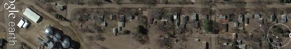
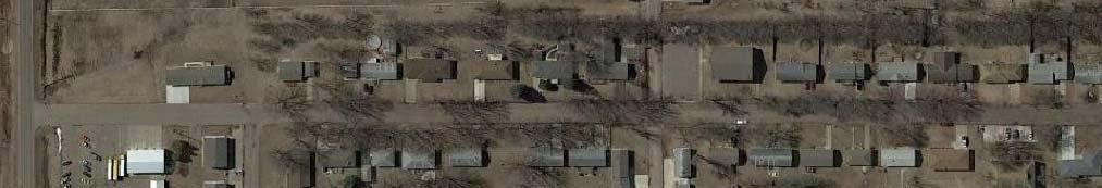
4 Proposed Street & Utility Improvements Page 4 of 14 SITE & SUBSURFACE CONDITIONS Site Location & Description The project sites are located on Maple Street from 200 feet south of Blaine Avenue to the north end of Maple Street and on Agnes Street from Park Avenue to Blaine Avenue in Viborg, South Dakota. The existing streets have asphalt surfacing. Ground Surface Elevations & Test Boring Locations We did not determine the ground surface elevations at the test boring locations. Two (2) test boring location maps are attached showing the relative location of the test borings. Existing Pavement Conditions Table 1 summarizes the thickness of the existing pavement and gravel base encountered at the respective test boring locations. Table 1. Thickness of the Existing Pavement & Gravel Base Asphalt Thickness, Test Boring Street in Gravel Base Thickness, in 1 Maple Street Maple Street Maple Street Agnes Street Agnes Street 3 6 Subsurface Conditions Five (5) test borings were performed at the project sites on August 29, The subsurface conditions encountered at the test boring locations are illustrated by means of the boring logs included in Appendix A. At the test boring locations, existing fill materials, fine alluvium soils, redeposited Niobrara Marl and glacial till soils were encountered beneath the existing pavement section. The redeposited Niobrara Marl was only encountered from 9 ½ feet to 11 feet at test boring 4. The existing fill
5 Proposed Street & Utility Improvements Page 5 of 14 materials, fine alluvium soils and redeposited Niobrara Marl consisted of lean clay soils. The glacial till soils consisted of lean clay with sand soils and sandy lean clay soils. The consistency or relative density of the soils is indicated by the standard penetration resistance ( N ) values as shown on the boring logs. A description of the soil consistency or relative density based on the N values can be found on the attached Soil Boring Symbols and Descriptive Terminology data sheet. We wish to point out that the subsurface conditions at other times and locations at the sites may differ from those found at our test boring locations. If different conditions are encountered during construction, then it is important that you contact us so that our recommendations can be reviewed. Water Levels Measurements to record the groundwater levels were made at the test boring locations. The time and level of the groundwater readings are recorded on the boring logs. Groundwater did not enter the boreholes at the test boring locations at the time of our measurements. The water levels indicated on the boring logs may or may not be an accurate indication of the depth or lack of subsurface groundwater. The limited length of observation restricts the accuracy of the measurements. Long term groundwater monitoring was not included in our scope of work. ENGINEERING REVIEW & RECOMMENDATIONS Project Design Data We understand that the project will consist of street and utility improvements for Maple Street from 200 feet south of Blaine Avenue to the north end of Maple Street and on Agnes Street from Park Avenue to Blaine Avenue in. The street improvements will consist of a new asphalt pavement section. The utility improvements will consist of installing various utilities. Grade changes are expected to be minimal.
6 Proposed Street & Utility Improvements Page 6 of 14 The information/assumptions detailed in the project design data section of the report are important factors in our review and recommendations. If there are any corrections or additions to the information detailed in this section, then it is important that you contact us so that we can review our recommendations with regards to the revised plans. Utility Excavations The subgrade soils anticipated at the invert depths for the underground utilities will likely consist of clay soils. Where soils having moderate moisture and density values are encountered at the bottom of the trench excavations, it is our opinion that the soils are considered suitable for support of the proposed utilities, provided they are adequately dewatered, and are not disturbed by construction traffic. Localized areas of wet or soft soils may be encountered at the bottom of the trench excavations. These areas will require subexcavation and trench stabilization methods and materials. Appropriate bedding materials should be used for the utility pipes. Water may enter the utility trench excavations as a result of subsurface water, precipitation or surface run off. We expect that subsurface water will enter the utility trench excavation on Agnes Street (sanitary sewer trench). Dewatering procedures may be required in order to control and remove water during the excavation for the various utilities. Where clay soils are encountered, it may be possible to remove and control water entering the excavations using normal sump pumping techniques. However, where waterbearing sand soils are encountered, extensive dewatering techniques will likely be required due to the potentially large volumes of water. Layers of waterbearing sand could be encountered within the glacial till soils. The contractor should provide appropriate dewatering methods and equipment. Any water that accumulates at the bottom of the excavations should be immediately removed and surface drainage away from the excavations should be provided during construction. All excavations must comply with the requirements of OSHA 29 CFR, Part 1926, Subpart P, Excavations and Trenches. This document states that the excavation safety is the responsibility of the contractor. Reference to this OSHA requirement should be included in the project specifications.
7 Proposed Street & Utility Improvements Page 7 of 14 It is our opinion that the fine alluvium soils, glacial till soils and the majority of the existing fill materials (excluding the existing fill materials at test boring 2) can likely be reused as trench backfill. We recommend that the trench backfill soils be placed and compacted in uniform thin lifts (6-inch maximum lifts). The trench backfill should be compacted to a minimum of 95 percent of standard Proctor density (ASTM:D698). The moisture content of the trench backfill soils should be adjusted to a moisture level that is within plus or minus 2 percent of the optimum moisture content as determined by standard Proctor (ASTM:D698). We anticipate that some moisture adjustment will be needed with the fine alluvium soils, glacial till soils and the majority of the existing fill materials (excluding the existing fill materials at test boring 2) in order to adjust the moisture content of the soils to a level that is within the recommended range. A portion of the on-site soils encountered in the utility trench excavations may not be suitable for use as trench backfill. These unsuitable soils would consist of organic soils as well as soils having high moisture content levels such that the specified compaction level cannot be reasonably achieved. It is our opinion that the existing fill materials at test boring 2 and redeposited Niobrara Marl have high moisture content levels. The organic materials should be replaced with suitable material available at the project site or with suitable off-site borrow soils. The wet soils will require significant drying in order to adjust the moisture content of the soils to a level that will facilitate the specified compaction requirement. Alternatively, the wet soils could be replaced with suitable material available at the project site or with suitable off-site borrow soils. Subgrade Soils The upper portion of the subgrade soils encountered at the test boring locations consisted of existing fill materials, fine alluvium soils and glacial till soils. These subgrade soils have a Unified Soils Classification System symbol of CL and AASHTO classifications of A-6 and A-7. In general, we estimate low California Bearing Ratio (CBR) values for the upper portion of the subgrade soils encountered at the test boring locations. We estimate CBR values varying from 1.5 to 2.5. Our opinion of the CBR values is based on the moderately high moisture content levels of the upper portion of the subgrade soils. In our opinion, subgrade reinforcement will be needed for the project. The subgrade reinforcement should consist of a geotextile fabric.
8 Proposed Street & Utility Improvements Page 8 of 14 Stripping & Removals We recommend removing the existing pavement section in order to achieve the design elevations. Low-ground-pressure construction equipment or excavators with smooth-edged buckets should be used for the stripping and removals in areas where soft/wet soils are present. We expect that low-ground-pressure equipment will be needed. We recommend observing the condition of the subgrade prior to the placement of the geotextile fabric. Depending on the condition of the existing subgrade, the thickness of the aggregate base course material, shown in Table 2, may need to be increased. Scarify & Compact After the stripping and removals have been completed, we recommend that the exposed subgrade be scarified to a minimum depth of 8 inches and adjusted to a moisture level that is 1 percent to 4 percent below the optimum moisture content as determined by standard Proctor (ASTM:D698). The scarification should be performed by a disc harrow and not a road grader with teeth. The moisture-conditioned soils should then be compacted. If shallow utilities are present and the scarification cannot be performed, then, at a minimum, we recommend that the exposed subgrade be compacted. The moisture-conditioned soils should then be compacted to a minimum density of 95 percent of standard Proctor (ASTM:D698). If it is determined during construction that the scarification and compaction will not improve a poor subgrade condition, then the scarification and compaction can be eliminated. This situation may occur in areas of the project. These areas may require additional aggregate base course material over the geotextile fabric or coarse granular subbase material over the geotextile fabric. Filling If filling is required to achieve the design subgrade elevations, then the fill materials should consist of non-organic lean clay or sandy lean clay soils having a liquid limit less than 45 and a plasticity index between 15 and 35. The moisture content of the fill soils should be 1 percent to 4 percent below the optimum moisture content. The fill soils should be placed in compacted lifts
9 Proposed Street & Utility Improvements Page 9 of 14 having a maximum thickness of 6 inches. We recommend a minimum compaction specification of 95 percent of standard Proctor (ASTM:D698) for the fill soils. Unstable Subgrade Areas of unstable subgrade may be encountered during construction. As previously stated in the section entitled Stripping & Removals, we recommend observing the condition of the subgrade prior to the placement of the geotextile fabric. Depending on the condition of the subgrade, the thickness of the aggregate base course material may need to be increased. If a very poor subgrade condition is encountered, then a coarse granular subbase material may need to be incorporated into the design. Asphalt Pavement Section Thickness We were not provided a traffic volume for the streets. We assume that the traffic will consist of mostly automobiles with occasional trucks. Table 2 summarizes the recommended asphalt pavement section thickness based on the subsurface conditions and assumed traffic loads. Table 2. Recommended Asphalt Pavement Section Thickness Location on Project Asphalt Pavement Thickness, in Aggregate Base Course Thickness, in Subgrade Reinforcement Maple Street 4 10* Yes** Agnes Street 4 10* Yes** *May need to be increased based on the existing subgrade conditions. In addition, a coarse granular subbase material may need to be incorporated into the design if a very poor subgrade condition is encountered during construction. **The geotextile fabric should consist of Mirafi HP 370, Propex Geotex 3x3 HF, Huesker Comtrac P 45/45 or approved alternative. The asphalt pavement should meet the requirements of sections 320 and 321 for Class G. We recommend that the aggregate base course materials meet the requirements of Sections 260 and 882 of the SDDOT Standard Specifications. Some reclaiming of the existing gravel base for use as aggregate base course material could be considered. Samples of the reclaimed material should be collected for analysis during construction in order to approve the material for use as aggregate base course material. If the coarse granular subbase material is needed, then it should consist of crushed quartzite, recycled concrete or a crushed pit-run material meeting the gradation
10 Proposed Street & Utility Improvements Page 10 of 14 specifications shown in Table 3. The aggregate base course material and coarse granular subbase should be compacted to a minimum of 97 percent of standard Proctor (ASTM:D698). However, compaction testing may not be practical for the coarse granular subbase due to the large aggregate. Table 3. Coarse Granular Subbase Gradation Specifications Sieve Size Percent Passing 4-inch inch # # # We recommend that routine maintenance such as crack filling, localized patching and seal coating be performed. The design sections could be reduced if the owner is willing to assume additional maintenance costs or potentially shorter pavement life. CONSTRUCTION CONSIDERATIONS Groundwater & Surface Water Water may enter the excavations due to subsurface water, precipitation or surface run off. Any water that accumulates in the bottom of the excavations should be immediately removed and surface drainage away from the excavations should be provided during construction. Disturbance of Soils The soils encountered at the test boring locations are susceptible to disturbance and can experience strength loss caused by construction traffic and/or additional moisture. Precautions will be required during earthwork activities in order to reduce the risk of soil disturbance. Where soft/wet soils are encountered, the excavations should be performed with low-ground-pressure construction equipment or an excavator (backhoe) having a smooth cutting edge on the bucket.
11 Proposed Street & Utility Improvements Page 11 of 14 Cold Weather Precautions If site preparation and construction is anticipated during cold weather, we recommend all subgrades, slabs and other improvements that may be affected by frost movements be insulated from frost penetration during freezing temperatures. If filling is performed during freezing temperatures, all frozen soils, snow and ice should be removed from the areas to be filled prior to placing the new fill. The new fill should not be allowed to freeze during transit, placement and compaction. Concrete and asphalt should not be placed on frozen subgrades. If subgrades freeze, we recommend that the frozen soils be removed and replaced, or completely thawed. The subgrade soils will likely require reworking and recompacting due to the loss of density caused by the freeze/thaw process. Excavation Sideslopes All excavations must comply with the requirements of OSHA 29 CFR, Part 1926, Subpart P, Excavations and Trenches. This document states that the excavation safety is the responsibility of the contractor. Reference to this OSHA requirement should be included in the project specifications. Observations & Testing This report was prepared using a limited amount of information for the project and a number of assumptions were necessary to help us develop our conclusions and recommendations. It is recommended that our firm be retained to review the geotechnical aspects of the final design plans and specifications to check that our recommendations have been properly incorporated into the design documents. The recommendations submitted in this report have been made based on the subsurface conditions encountered at the test boring locations. It is possible that there are subsurface conditions at the site that are different from those represented by the test borings. As a result, onsite observation during construction is considered integral to the successful implementation of the recommendations. We believe that qualified field personnel need to be on-site at the following times to observe the site conditions and effectiveness of the construction.
12 Proposed Street & Utility Improvements Page 12 of 14 Excavation We recommend that a geotechnical engineer or geotechnical engineering technician working under the direct supervision of a geotechnical engineer observe all excavations for utilities, slabs and pavements. These observations are recommended to determine if the exposed soils are similar to those encountered at the test boring locations, if unsuitable soils have been adequately removed and if the exposed soils are suitable for support of the proposed construction. Testing After the subgrade is observed by a geotechnical engineer/technician and approved, we recommend a representative number of compaction tests be taken during the placement of the backfill placed below slabs and pavements. The tests should be performed to determine if the required compaction has been achieved. As a general guideline, we recommend at least one (1) test be taken for every 10,000 square feet of embankment fill placed, at least one (1) test for every 500 feet in trench fill, and for every 2-foot thickness of fill or backfill placed. The actual number of tests should be left to the discretion of the geotechnical engineer. Samples of proposed fill and backfill materials should be submitted to our laboratory for testing to determine their compliance with our recommendations and project specifications. SUBSURFACE EXPLORATION PROCEDURES Test Borings We drilled five (5) borings on August 29, 2016 with a truck rig equipped with hollow-stem auger. Soil sampling was performed in accordance with the procedures described in ASTM:D1586. Using this procedure, a 2-inch O.D. split barrel sampler is driven into the soil by a 140-pound weight falling 30 inches. After an initial set of 6 inches, the number of blows required to drive the sampler an additional 12 inches is known as the penetration resistance, or N value. The N value is an index of the relative density of cohesionless soils and the consistency of cohesive soils. In addition, thin walled tube samples were obtained according to ASTM:D1587, where indicated by the appropriate symbol on the boring logs.
13 Proposed Street & Utility Improvements Page 13 of 14 The test borings were backfilled with on-site materials and some settlement of these materials can be expected to occur. Final closure of the holes is the responsibility of the client or property owner. Soil Classification As the samples were obtained in the field, they were visually and manually classified by the crew chief according to ASTM:D2488. Representative portions of all samples were then sealed and returned to the laboratory for further examination and for verification of the field classification. In addition, select samples were then submitted to a program of laboratory tests. Where laboratory classification tests (sieve analysis and Atterberg limits) have been performed, classifications according to ASTM:D2487 are possible. Logs of the test borings indicating the depth and identification of the various strata, the N value, the laboratory test data, water level information and pertinent information regarding the method of maintaining and advancing the drill holes are also attached in Appendix A. Charts illustrating the soil classification procedures, the descriptive terminology and the symbols used on the boring logs are also attached in Appendix A. Water Level Measurements Subsurface groundwater levels should be expected to fluctuate seasonally and yearly from the groundwater readings recorded at the test borings. Fluctuations occur due to varying seasonal and yearly rainfall amounts and snowmelt, as well as other factors. It is possible that the subsurface groundwater levels during or after construction could be significantly different than the time the test borings were performed. Laboratory Tests We performed laboratory tests on select samples to aid in determining the index properties of the soils. The tests consisted of moisture content, dry density and standard Proctor. The laboratory tests were performed in accordance with the appropriate ASTM procedures. The results of the laboratory tests are shown on the boring logs opposite the samples upon which the tests were performed or on the data sheets included in the Appendix or on the attached data sheet.
14


15


16
17 GEOTEK ENGINEERING & TESTING SERVICES, INC. 909 E. 50th St. N. Sioux Falls SD Fax GEOTECHNICAL TEST BORING LOG GEOTEK # 16-A29 BORING NO. 1 (1 of 1) PROJECT in FEET Proposed Street & Utility Improvements, Maple Street & Agnes Street, Viborg, SD DESCRIPTION OF MATERIAL LEAN CLAY: dark brown, wet, firm, 4" of asphalt and 4" of gravel at the surface (CL) GEOLOGIC ORIGIN FINE ALLUVIUM N WL SAMPLE LABORATORY TESTS NO. TYPE WC D LL PL QU 2 4 LEAN CLAY: brown, moist, stiff, (CL) LEAN CLAY WITH SAND: a little gravel, mottled brown and gray, moist, firm, (CL) FINE ALLUVIUM GLACIAL TILL ½ Bottom of borehole at 8½ feet. 6 4 GEOTECHNICAL TEST BORING 16-A29.GPJ GEOTEKENG.GDT 9/6/16 DATE TIME 2:40 pm WATER LEVEL MEASUREMENTS SAMPLED 8.5 CASING CAVE-IN 7 WATER LEVEL none START COMPLETE METHOD 3.25" ID Hollow Stem Auger CREW CHIEF Mike Wagner :40 pm
18 GEOTEK ENGINEERING & TESTING SERVICES, INC. 909 E. 50th St. N. Sioux Falls SD Fax GEOTECHNICAL TEST BORING LOG GEOTEK # 16-A29 BORING NO. 2 (1 of 1) PROJECT in FEET 2 3½ Proposed Street & Utility Improvements, Maple Street & Agnes Street, Viborg, SD DESCRIPTION OF MATERIAL FILL, MOSTLY LEAN CLAY: a little gravel, dark brown, wet, 4" of asphalt and 4" of gravel at the surface LEAN CLAY: brown, moist, firm, (CL) LEAN CLAY WITH SAND: a little gravel, mottled brown and gray, moist, stiff, (CL) GEOLOGIC ORIGIN FILL FINE ALLUVIUM GLACIAL TILL N 11 7 WL SAMPLE LABORATORY TESTS NO. TYPE WC D LL PL QU BAG 8½ Bottom of borehole at 8½ feet GEOTECHNICAL TEST BORING 16-A29.GPJ GEOTEKENG.GDT 9/6/16 DATE TIME 2:11 pm WATER LEVEL MEASUREMENTS SAMPLED 8.5 CASING CAVE-IN 7 WATER LEVEL none START COMPLETE METHOD 3.25" ID Hollow Stem Auger CREW CHIEF Mike Wagner :10 pm
19 GEOTEK ENGINEERING & TESTING SERVICES, INC. 909 E. 50th St. N. Sioux Falls SD Fax GEOTECHNICAL TEST BORING LOG GEOTEK # 16-A29 BORING NO. 3 (1 of 1) PROJECT in FEET 2 4 Proposed Street & Utility Improvements, Maple Street & Agnes Street, Viborg, SD DESCRIPTION OF MATERIAL FILL, MOSTLY LEAN CLAY: a little gravel, brown, moist, 3" of asphalt and 5" of gravel at the surface LEAN CLAY: brown, moist, stiff, (CL) SANDY LEAN CLAY: a little gravel, mottled brown and gray, moist, firm, (CL) GEOLOGIC ORIGIN FILL FINE ALLUVIUM GLACIAL TILL N WL SAMPLE LABORATORY TESTS NO. TYPE WC D LL PL QU ½ Bottom of borehole at 8½ feet. 7 4 GEOTECHNICAL TEST BORING 16-A29.GPJ GEOTEKENG.GDT 9/6/16 DATE TIME 1:34 pm WATER LEVEL MEASUREMENTS SAMPLED 8.5 CASING CAVE-IN 7 WATER LEVEL none START COMPLETE METHOD 3.25" ID Hollow Stem Auger CREW CHIEF Mike Wagner :31 pm
20 GEOTEK ENGINEERING & TESTING SERVICES, INC. 909 E. 50th St. N. Sioux Falls SD Fax GEOTECHNICAL TEST BORING LOG GEOTEK # 16-A29 BORING NO. 4 (1 of 1) PROJECT in FEET Proposed Street & Utility Improvements, Maple Street & Agnes Street, Viborg, SD DESCRIPTION OF MATERIAL FILL, MOSTLY LEAN CLAY: a little gravel, brown, wet, 4" of asphalt and 8" of gravel at the surface GEOLOGIC ORIGIN FILL N 8 WL SAMPLE 1 25 LABORATORY TESTS NO. TYPE WC D LL PL QU 2½ LEAN CLAY WITH SAND: a little gravel, mottled brown and gray, moist, firm to stiff, (CL) GLACIAL TILL BAG ½ 11 LEAN CLAY: a little gravel, very light brown, wet, stiff, (CL) SANDY LEAN CLAY: a little gravel, brown, moist, stiff, (CL) REDEPOSITED NIOBRARA MARL GLACIAL TILL GEOTECHNICAL TEST BORING 16-A29.GPJ GEOTEKENG.GDT 9/6/16 19½ 21 DATE LEAN CLAY WITH SAND: a little gravel, gray, moist, stiff, (CL) TIME 11:37 am Bottom of borehole at 21 feet. WATER LEVEL MEASUREMENTS SAMPLED 21 CASING CAVE-IN 19 GLACIAL TILL WATER LEVEL none 11 8 START COMPLETE METHOD 3.25" ID Hollow Stem Auger CREW CHIEF Mike Wagner :25 am
 PROJECT in FEET Proposed Street & Utility Improvements, Maple Street & Agnes Street, Viborg, SD DESCRIPTION OF MATERIAL FILL, MOSTLY LEAN CLAY: a little gravel, brown, moist, 3\" of asphalt")
21 GEOTEK ENGINEERING & TESTING SERVICES, INC. 909 E. 50th St. N. Sioux Falls SD Fax GEOTECHNICAL TEST BORING LOG GEOTEK # 16-A29 BORING NO. 5 (1 of 1) PROJECT in FEET Proposed Street & Utility Improvements, Maple Street & Agnes Street, Viborg, SD DESCRIPTION OF MATERIAL FILL, MOSTLY LEAN CLAY: a little gravel, brown, moist, 3" of asphalt and 6" of gravel at the surface GEOLOGIC ORIGIN FILL N 8 WL SAMPLE 1 22 LABORATORY TESTS NO. TYPE WC D LL PL QU 103 2½ LEAN CLAY WITH SAND: a little gravel, mottled brown and gray, moist, stiff, (CL) GLACIAL TILL ½ SANDY LEAN CLAY: a little gravel, brown, moist, stiff, (CL) GLACIAL TILL GEOTECHNICAL TEST BORING 16-A29.GPJ GEOTEKENG.GDT 9/6/16 21 DATE TIME 12:26 pm Bottom of borehole at 21 feet. WATER LEVEL MEASUREMENTS SAMPLED 21 CASING CAVE-IN 19 WATER LEVEL none START BAG COMPLETE METHOD 3.25" ID Hollow Stem Auger CREW CHIEF Mike Wagner :20 pm
22 SOIL CLASSIFICATION CHART SYMBOLS MAJOR DIVISIONS GRAPH LETTER TYPICAL DESCRIPTIONS GRAVEL AND GRAVELLY SOILS CLEAN GRAVELS (LITTLE OR NO FINES) GW GP WELL-GRADED GRAVELS, GRAVEL - SAND MIXTURES, LITTLE OR NO FINES POORLY-GRADED GRAVELS, GRAVEL - SAND MIXTURES, LITTLE OR NO FINES COARSE GRAINED SOILS MORE THAN 50% OF COARSE FRACTION RETAINED ON NO. 4 SIEVE GRAVELS WITH FINES (APPRECIABLE AMOUNT OF FINES) GM GC SILTY GRAVELS, GRAVEL - SAND - SILT MIXTURES CLAYEY GRAVELS, GRAVEL - SAND - CLAY MIXTURES MORE THAN 50% OF MATERIAL IS LARGER THAN NO. 200 SIEVE SIZE SAND AND SANDY SOILS CLEAN SANDS (LITTLE OR NO FINES) SW SP WELL-GRADED SANDS, GRAVELLY SANDS, LITTLE OR NO FINES POORLY-GRADED SANDS, GRAVELLY SAND, LITTLE OR NO FINES MORE THAN 50% OF COARSE FRACTION PASSING ON NO. 4 SIEVE SANDS WITH FINES (APPRECIABLE AMOUNT OF FINES) SM SC SILTY SANDS, SAND - SILT MIXTURES CLAYEY SANDS, SAND - CLAY MIXTURES ML INORGANIC SILTS AND VERY FINE SANDS, ROCK FLOUR, SILTY OR CLAYEY FINE SANDS OR CLAYEY SILTS WITH SLIGHT PLASTICITY FINE GRAINED SOILS SILTS AND CLAYS LIQUID LIMIT LESS THAN 50 CL INORGANIC CLAYS OF LOW TO MEDIUM PLASTICITY, GRAVELLY CLAYS, SANDY CLAYS, SILTY CLAYS, LEAN CLAYS OL ORGANIC SILTS AND ORGANIC SILTY CLAYS OF LOW PLASTICITY MORE THAN 50% OF MATERIAL IS SMALLER THAN NO. 200 SIEVE SIZE SILTS AND CLAYS LIQUID LIMIT GREATER THAN 50 MH CH INORGANIC SILTS, MICACEOUS OR DIATOMACEOUS FINE SAND OR SILTY SOILS INORGANIC CLAYS OF HIGH PLASTICITY OH ORGANIC CLAYS OF MEDIUM TO HIGH PLASTICITY, ORGANIC SILTS HIGHLY ORGANIC SOILS PT PEAT, HUMUS, SWAMP SOILS WITH HIGH ORGANIC CONTENTS NOTE: DUAL SYMBOLS ARE USED TO INDICATE BORDERLINE SOIL CLASSIFICATIONS
23 BORING LOG SYMBOLS AND DESCRIPTIVE TERMINOLOGY SYMBOLS FOR DRILLING AND SAMPLING Symbol Bag CS DM FA HA HSA LS N NMR NSR SH SS WL Definition Bag sample Continuous split-spoon sampling Drilling mud Flight auger; number indicates outside diameter in inches Hand auger; number indicates outside diameter in inches Hollow stem auger; number indicates inside diameter in inches Liner sample; number indicates outside diameter of liner sample Standard penetration resistance (N-value) in blows per foot No water level measurement recorded, primarily due to presence of drilling fluid No sample retrieved; classification is based on action of drilling equipment and/or material noted in drilling fluid or on sampling bit Shelby tube sample; 3-inch outside diameter Standard penetration test (N-value) using standard split-spoon sampler Split-spoon sample; 2-inch outside diameter unless otherwise noted Water level directly measured in boring Water level symbol SYMBOLS FOR LABORATORY TESTS Symbol WC D LL PL QU Definition Water content, percent of dry weight; ASTM:D2216 Dry density, pounds per cubic foot Liquid limit; ASTM:D4318 Plastic limit; ASTM:D4318 Unconfined compressive strength, pounds per square foot; ASTM:D2166 DENSITY/CONSISTENCY TERMINOLOGY Density Consistency Term N-Value Term Very Loose 0-4 Soft Loose 5-8 Firm Medium Dense 9-15 Stiff Dense Very Stiff Very Dense Over 30 Hard Term Dry Frozen Moist Waterbearing Wet Lamination Layer Lens DESCRIPTIVE TERMINOLOGY Definition Absence of moisture, powdery Frozen soil Damp, below saturation Pervious soil below water Saturated, above liquid limit Up to ½ thick stratum ½ to 6 thick stratum ½ to 6 discontinuous stratum PARTICLE SIZES Term Particle Size Boulder Over 12 Cobble 3 12 Gravel #4 3 Coarse Sand #10 #4 Medium Sand #40 #10 Fine Sand #200 #40 Silt and Clay passes #200 sieve GRAVEL PERCENTAGES Term Range A trace of gravel 2-4% A little gravel 5-15% With gravel 16-50%
24 DRY DENSITY (pcf) GEOTEK ENGINEERING & TESTING SERVICES, INC. 909 East 50th Street North Sioux Falls, SD Fax REPORTED TO: PROJECT: 16-A29 COPIES TO: MOISTURE - DENSITY TEST REPORT City of Viborg 110 N. Main Street Viborg, SD Proposed Street & Utility Improvements Maple Street & Agnes Street Viborg, SD DATE REPORTED: 9/7/2016 SAMPLE DATA Sample No.: 1 Date Received: 8/29/2016 ASTM Test Method: D698B Date Tested: 9/2/2016 Soil Classification: Lean Clay with Sand, brown (CL) -1 Remarks: SB 4 (3' to 9') TEST DATA 140 Maximum Density, pcf: Curve for 100% saturation for specific gravity equal to 2.65 Optimum Moisture, %: Percent Passing, %: 3/4": 3/8": #4: #200: Atterberg Limits (ASTM: D4318): Liquid Limit: Plastic Limit: Plasticity Index: MOISTURE CONTENT (%) Matthew Thompson, P.E.: Project Manager