Murphy s Services Inc.
|
|
|
- Mark Lewis
- 5 years ago
- Views:
Transcription
1 Murphy s Services Inc. P.O. Box 3208 Paradise, NL A1L 3W3 Ph: (709) or (709) Fax: (709) ENVIROMENTAL ASSESSMENT REGISTRATION DOCUMENT Proposed Gravel Quarry Foxtrap, CBS Newfoundland Prepared by: Perry Murphy, CHT For Murphy s Services Inc. November 14, 2011
2 Table of Contents 1. Name of the Undertaking 2. Proponent 3. The Undertaking 4. Description of the Undertaking 5. Potential Sources of Pollution during Undertaking 6. Operations 7. Termination of Operations 8. Occupations 9. Project Related Documents 10. Approval of the Undertaking 11. Schedule 12. Funding 13. Submission List of Figures Figure 1: General Map Figure 2: Quarry Location
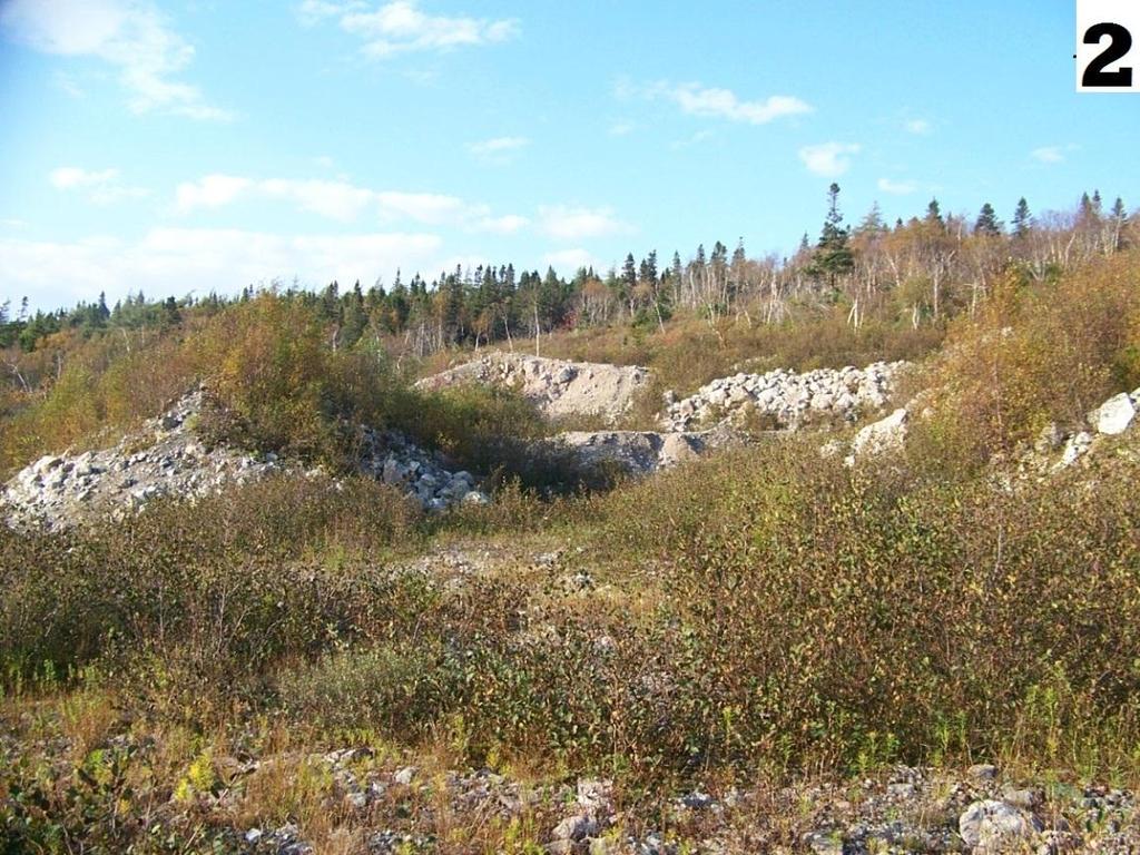
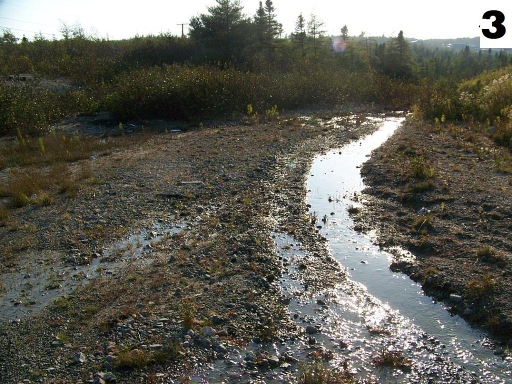
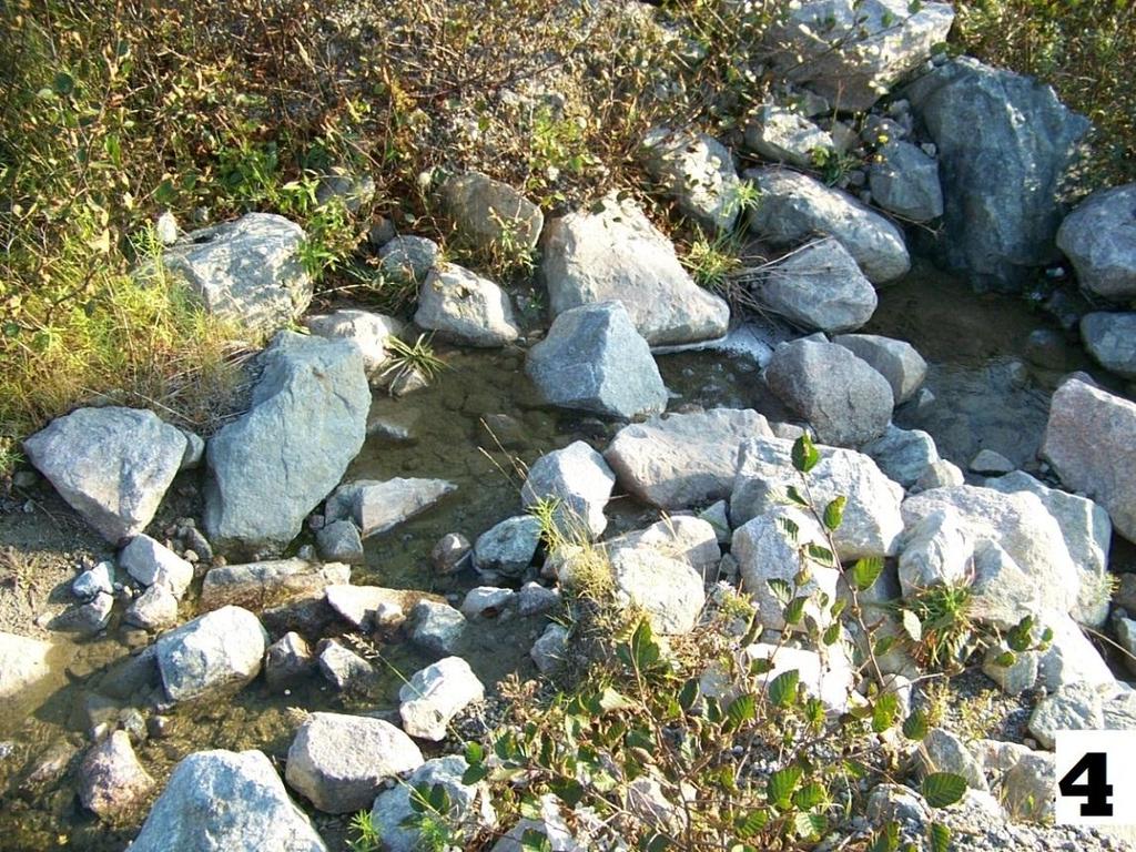
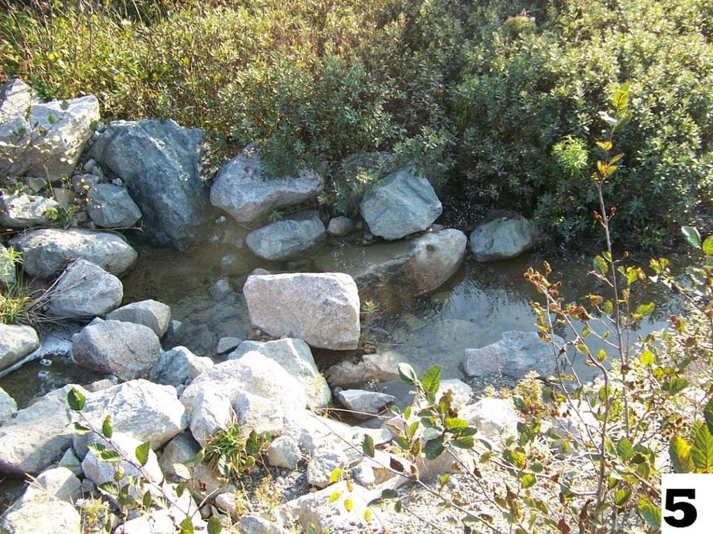
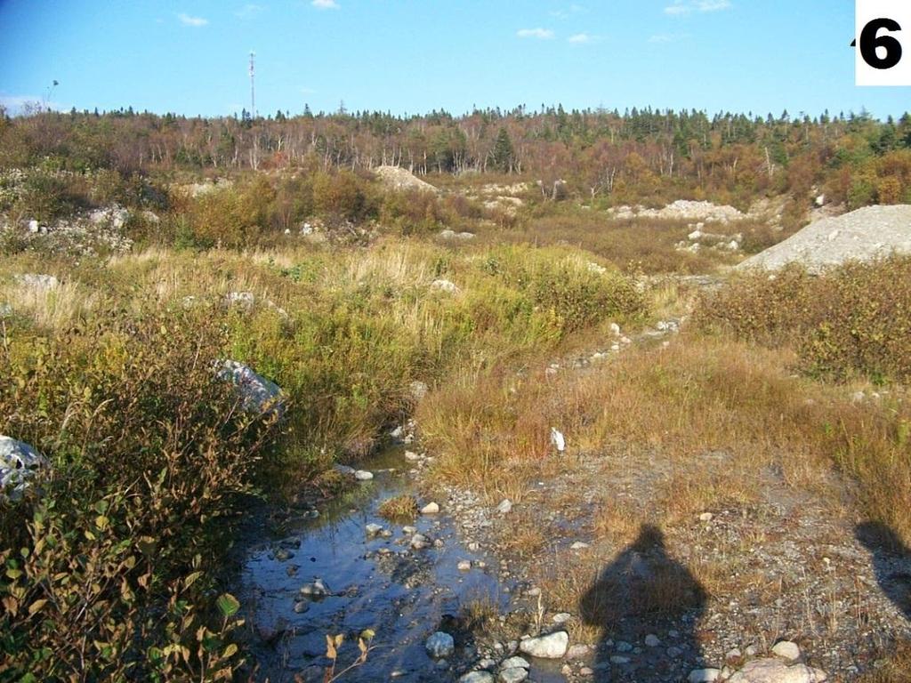
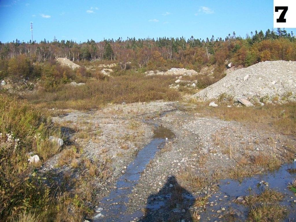
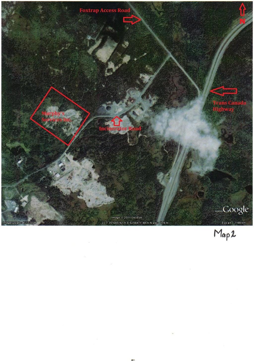
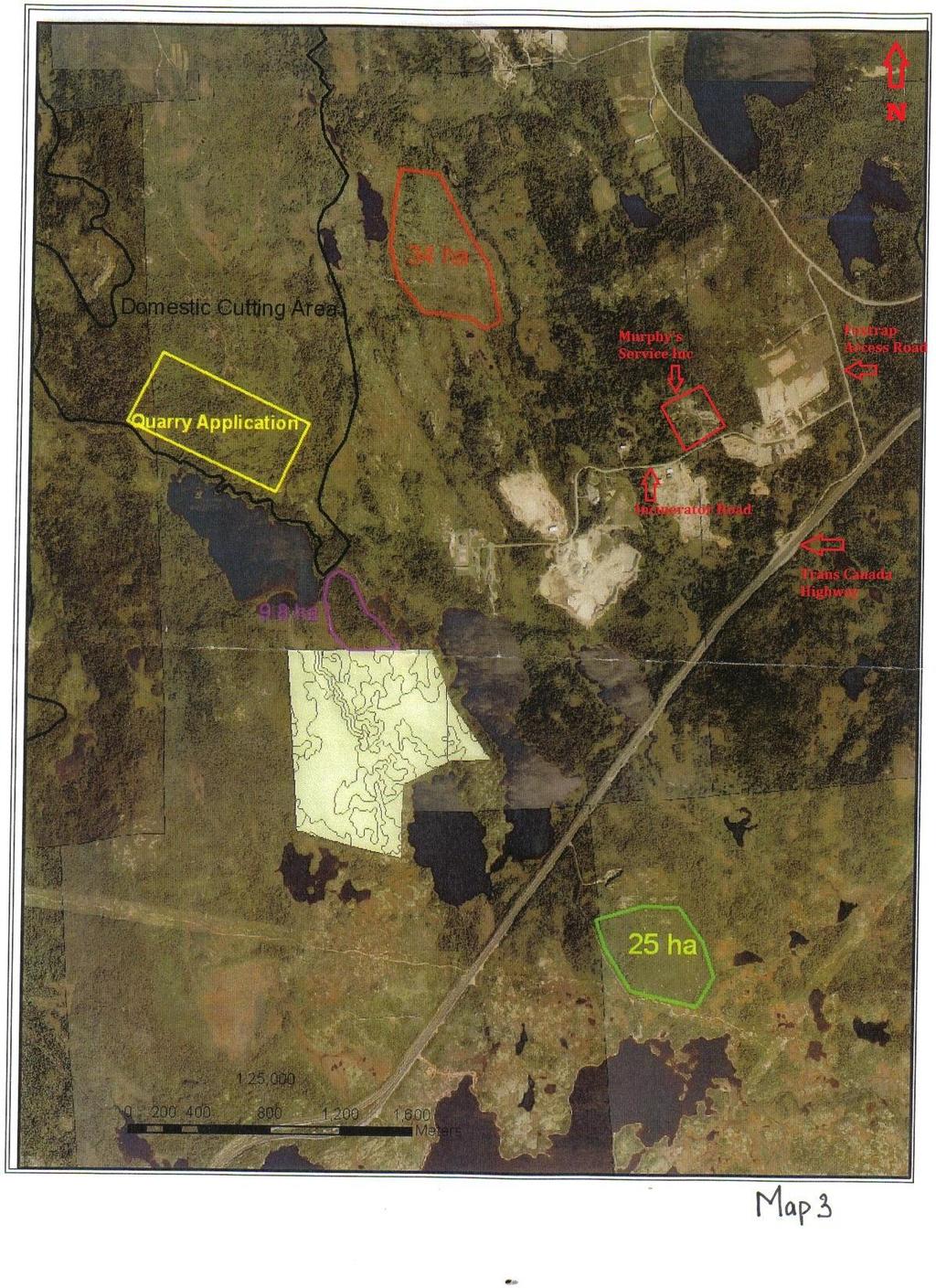
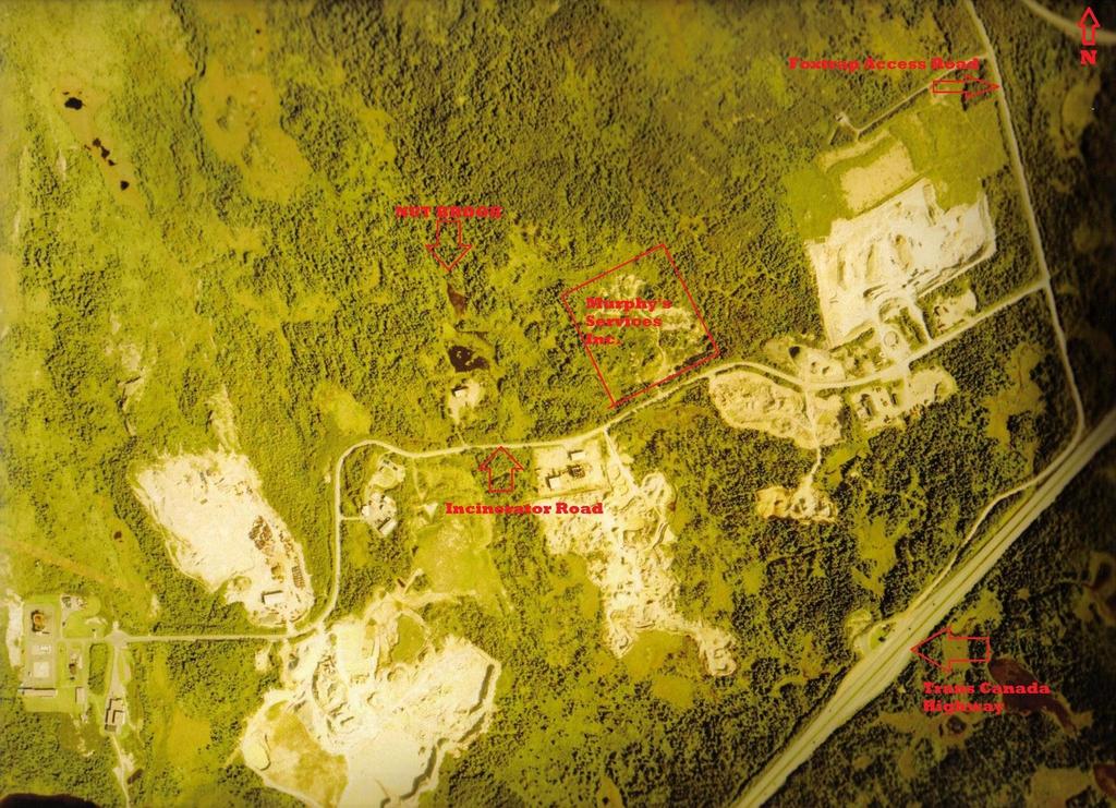
3 1. Name of undertaking: Murphy s Services Inc. 2. Proponent: Name of Corporate Body: Murphy s Services Inc. Address: P.O. Box 3208 Paradise, NL A1L 3W3 Owner/Contact Person: Perry Murphy (709) or (709) The Undertaking: a) Nature of the undertaking, The proposed project involves the development of a gravel quarry site within the town of Conception Bay South. Site is accessible via Incinerator Road. This proposal involves the existing abandoned quarry originally operated by Weirs Construction b) Purpose/Rationale/Need for undertaking The purpose of this project is to produce gravel and stone for local demand. 4. Description of the Undertaking a) Geographical Location This project is located on Incinerator Road, Foxtrap. It is near many other pits such as Pardys Waste Management and the Foxtrap Highway Depot. Refer to Maps 3 and 4 for surrounding pits in operation. See map 1 for boundaries of proposed area. b) Physical Features Project Site Description: The area is mainly cleared, a lot of gravel and rock. There are few mixed trees mainly alder bushes and some evergreen trees. See pictures 1 and 2. Existing Biophysical Environmental There are very little living organisms in this area. It was cleared and grubbed years ago when the previous quarry was operating there. There are no creeks or brooks on the proposed area. There is however a brook (Nut brook) about 300m west of the area. There is also some surface water, large puddles that run through the pit. This surface water begins and ends on the proposed area. See pictures 3-7.
4 Wildlife Occasional moose roam past this site but no other animals frequent this site. Construction The construction period will begin in early spring, late April or early May. Stage 1: Removal of all necessary bushes and trees. Estimated duration: 2 weeks. Stage 2: Preparing the pit for construction operations. Grading of the area and installing all the proper culverts or pipes that may be needed. Estimated duration: 2-3 months The proposed date of first physical construction-related activity on this site will be in August, Site Development The site covers a total of 5.5 hectares. This site is an abandoned quarry and has been since December 31, It is ready to reactivate, pending approval. 5. Potential Sources of Pollution during Undertaking The construction phase of development will consist of earth moving activities. The potential sources of pollution include site drainage, noise, air emissions, waste and litter and potential release of hydrocarbons. Site runoff will be directed to the vegetated areas which will filter suspended solids. In addition, barriers will be installed as required to prevent siltation of water bodies/streams. Domestic waste generated during construction will be collected and disposed of at the Robin Hood Bay Land fill site, as per the Waste Material Disposal Act. All equipment will have appropriate emission controls. All vehicles will follow a designated project route and be properly maintained to minimize noise. All vehicles will have regular inspections of exhaust and muffler systems to ensure proper effective operation. Petroleum products will not be stored on site. Petroleum products will be handled as per Storage and Handling of Gasoline and Associated Products Regulations, under the Environmental Protection Act. 6. Operations Typical excavation methods will be employed to collect materials at the proposed site. The operations will involve extracting gravel and rock from the exposed face and transporting the material offsite to surrounding towns. Oversized rocks and waste will be stockpiled for future use.
5 Appropriate ditching will be maintained on site to ensure silt and general site run off is controlled, and does not adversely affect the surrounding environment according to environmental health and safety standards and regulations. Equipment on site include the following: Rubber tire backhoe (digging at the site/loading trucks) Excavator (digging at the site/loading trucks) Tandem dump truck (material transportation) The quarry will operate year round in accordance to demand for the product. 7. Termination of Operations Site rehabilitation shall be in accordance with standard quarry operations. Upon completion of quarry activities, all slopes shall be graded to 30 degrees and the remaining areas will be graded to a level surface as directed by a government quarry inspector from Natural Resources and Lands. 8. Occupations Site construction and operation phase for the proposed quarry will be very simple. Usually there will be only one or two people working on site that perform multiple functions. The following occupational classification as per National Occupational Classification, 2006 will be created: Site Foreman/Supervisor (7217) Heavy Equipment Operator (7421) Quarry Manager (0811) Quarry Foreman/Supervisor (8221) Truck Driver (7411) Heavy Equipment Mechanic (offsite) (7312) 9. Project Related Documents There are no project related documents other than the attached maps. 10. Approval of the Undertaking Permit to proceed Environmental Protection Act Quarry permit Quarry Material Regulations and Acts
6 11. Schedule Registration Document Submission October 2011 Government Review and Decision November 2011 Pit Operation April Funding Funding for the project will be provided by Murphy`s Services Inc. 13. Submission Date Name: Perry Murphy

7 North West North East
8 West West
9 West East
10 East

11
12
13
14 Map 4