SACRAMENTO SUPPLEMENTAL PROJECTS OVERVIEW
|
|
|
- Dinah Booth
- 5 years ago
- Views:
Transcription

1 1 SACRAMENTO SUPPLEMENTAL PROJECTS OVERVIEW CAMERON SESSIONS SUPPLEMENTAL PROGRAM MANAGER October American River Common Features WRDA Folsom Dam Raise - Yuba River Basin Marysville Ring Levee (MRL) - Tule River Basin (Success Dam) - Isabella Dam The views, opinions and findings contained in this report are those of the authors(s) and should not be construed as an official Department of the Army position, policy or decision, unless so designated by other official documentation
2 AGENDA 2 Supplemental Program Objectives Supplemental Program Overview Project Locations Integrated Master Schedule Overview of Projects What s Next Questions/Comments
3 PROGRAM & OBJECTIVES 3 Program: Public Law Bipartisan Budget Act of 218 (BBA FY18) or Long Term Disaster Recovery Investment Program (LTDRIP) or Supplemental Program Objectives: 1. Fully fund projects to completion with the intent to reduce risk of future disasters 2. Complete projects 3. Expedite delivery

4 PROGRAM & OBJECTIVES 4 $17.3 Billion Nationally $2.1Billion to the Sacramento District
 Ongoing")
")


5 SPK SUPPLEMENTAL PROJECT LOCATIONS 5 Yuba River Basin (Marysville Ring Levee) Ongoing Supp. = $13.5M ~8% Total = $16M Tule River (Success Dam) Ongoing Supp. = $74M ~1% Total = $74M ARCF WRDA 216 New Start Supp. = $1.57B ~87% Total = $1.8B Isabella Dam Ongoing Supp. = $258M ~ 43% Total = $61M Folsom Dam Raise Ongoing Supp. = $216M ~ 59% Total = $373M 1/3/18 CLS


 and should not be")


6 AMERICAN RIVER COMMON FEATURES WRDA The views, opinions and findings contained in this report are those of the authors(s) and should not be construed as an official Department of the Army position, policy or decision, unless so designated by other official documentation. 1JUL18 KD


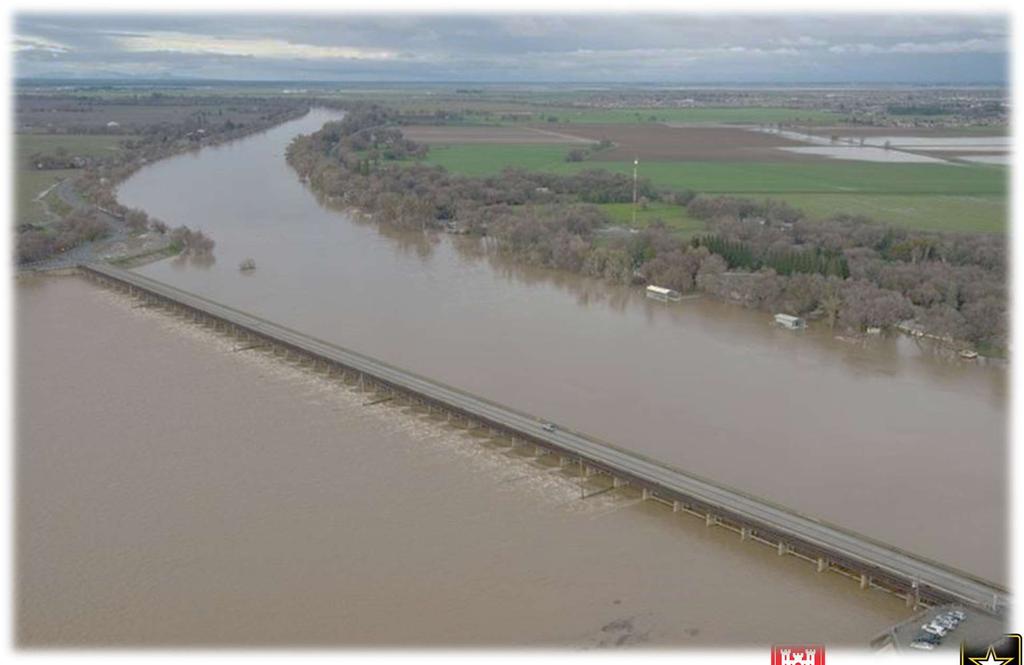
7 AMERICAN RIVER COMMON FEATURES PROJECTS 7

8 AMERICAN RIVER COMMON FEATURES (ARCF) SUPPLEMENTAL TARGET JAN 224 Features Cutoff walls Bank protection Levee stabilization Levee raises Widen Sacramento Weir and Bypass Environmental Mitigation Replant Shaded Riverine Habitat Authorized Plan 13 miles 21 miles 5 miles 5 miles 15 feet 68 acres 15.5 miles 8 Reduces Risk 5, people 125, structures $62 billion 17OCT18 CLS
 City of Sacramento, ARFCD (Access Roads and Levee Maintenance)")
9 Non Federal Partners: State of California - Central Valley Flood Protection Board (CVFPB) Sacramento Area Flood Control Agency (SAFCA) Department of Water Resources (DWR) PARTNERS - ARCF WRDA 216 ARCF WRDA 216 Partners Cost shares 35% of the Project with USACE 9 Maintaining Agencies: MA-9 (Bypass and Levee Maintenance) City of Sacramento, ARFCD (Access Roads and Levee Maintenance) Congressional Interests: Senators Feinstein and Harris Representatives Bera, Matsui, McClintock Stakeholders: Population at risk City of Sacramento, CA Recreation and Environmental Groups Railroad Owners 7/9/18 NVRM

10 SPECIFICS - WHAT IS THE SOLUTION? 1 Typical levee improvement cross section
11 FOLSOM DAM RAISE PROJECT The views, opinions and findings contained in this report are those of the authors(s) and should not be construed as an official Department of the Army position, policy or decision, unless so designated by other official documentation. 1JUL18 KD
, the State of California and the Sacramento Area Flood Control Agency (SAFCA) in")
12 Folsom Dam Raise Background 12 What is the Dam Raise? The Dam Raise is a Flood Risk Management Project implemented jointly by the US Army Corps of Engineers (USACE), the State of California and the Sacramento Area Flood Control Agency (SAFCA) in cooperation with US Bureau of Reclamation (USBR). The authorized Folsom Dam Raise per the PACR: Add a top seal bulkhead to the Main Dam s eight (8) Emergency Tainter Gates Add extension of all nine (9) piers supporting the motors and gate hoists Raise left and right wings of Main Dam by 3.5 feet Raise eight (8) reservoir dikes and Mormon Island Auxiliary Dike (MIAD) by 3.5 feet Construct a bridge (Completed) downstream from Folsom Dam Implement lower American River Ecosystem Restoration features (automated temperature control shutters and active habitat restoration at two sites along the lower American River) 1JUL18 KD
13 Facility Owner and Federal Partner USBR Non-Federal Partners: Central Valley Flood Protection Board (CVFPB) Department of Water Resources (DWR) Sacramento Area Flood Control Agency (SAFCA) Congressional Interests: Senators Feinstein and Harris Representatives Bera, Garamendi, Matsui and McClintock Stakeholders: City of Folsom, CA Water and Power Contractors Recreation and Environmental Groups Population at risk Partner Commitments: Folsom Dam Raise Partners 13 Non-Federal Partners prioritize regional flood risk management projects based on risk management provided Continue to seek acceleration opportunities if/when opportunities arise and stay within funding limits 1JUL18 KD

14 FOLSOM DAM RAISE 14 Dikes 4, 5 & 6 Dikes 1, 2 & 3 SUPPLEMENTAL TARGET OCT 221 Features Dike Raises Wing Dam Raises Auxiliary Dam Raise Authorized Plan Main Dam Gates 8 Ecosystem Restoration - Temperature Control Shutters - Off-site Mitigation 5 miles 3 miles 2 miles Not supplemental funded Left and Right Wing Dams Dikes 7, 8 & MIAD Reduces Risk 44, people 125, structures $58 billion Auxiliary Spillway 17OCT18 CLS
15 MARYSVILLE RING LEVEE 15 YUBA RIVER BASIN, CA The views, opinions and findings contained in this report are those of the authors(s) and should not be construed as an official Department of the Army position, policy or decision, unless so designated by other official documentation. 7/6/18 KJC
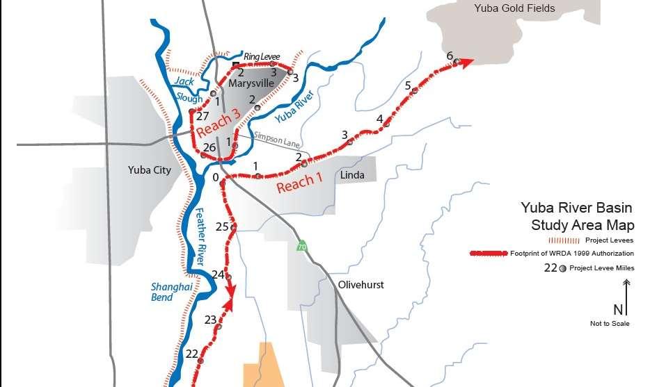
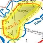
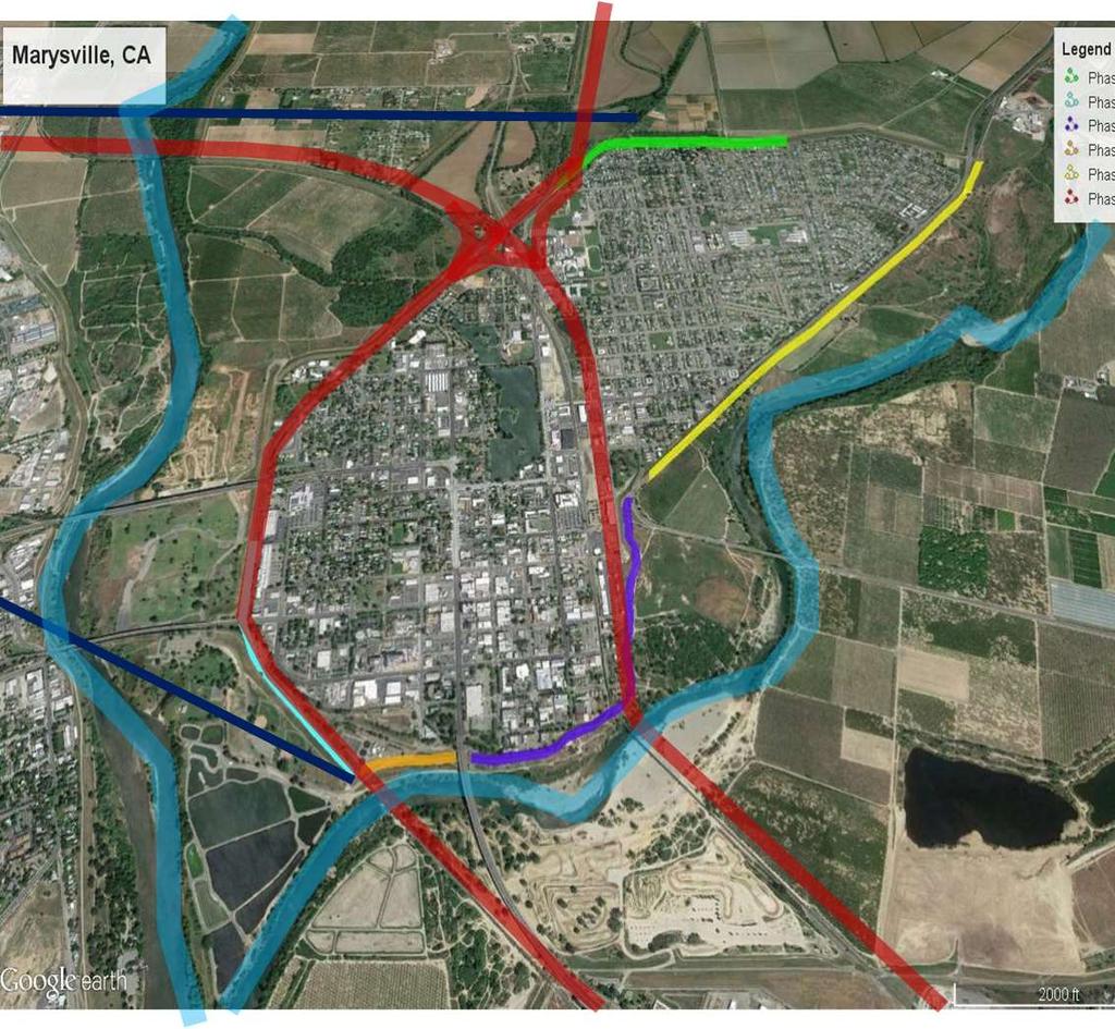
16 Marysville Ring Levee Project Location Yuba River Basin Reaches 7/6/18 KJC


 - MRL classified as a separable element of the")
17 Marysville Ring Levee Project Background Yuba River Basin had major flood events in 195, 1955, 1964, 1986, and Yuba River Basin Project: - Design water surface elevation is year+2 feet - Authorized in Water Resources Development Act of 1999 (P.L ) - MRL classified as a separable element of the Project in 8 7/6/18 KJC


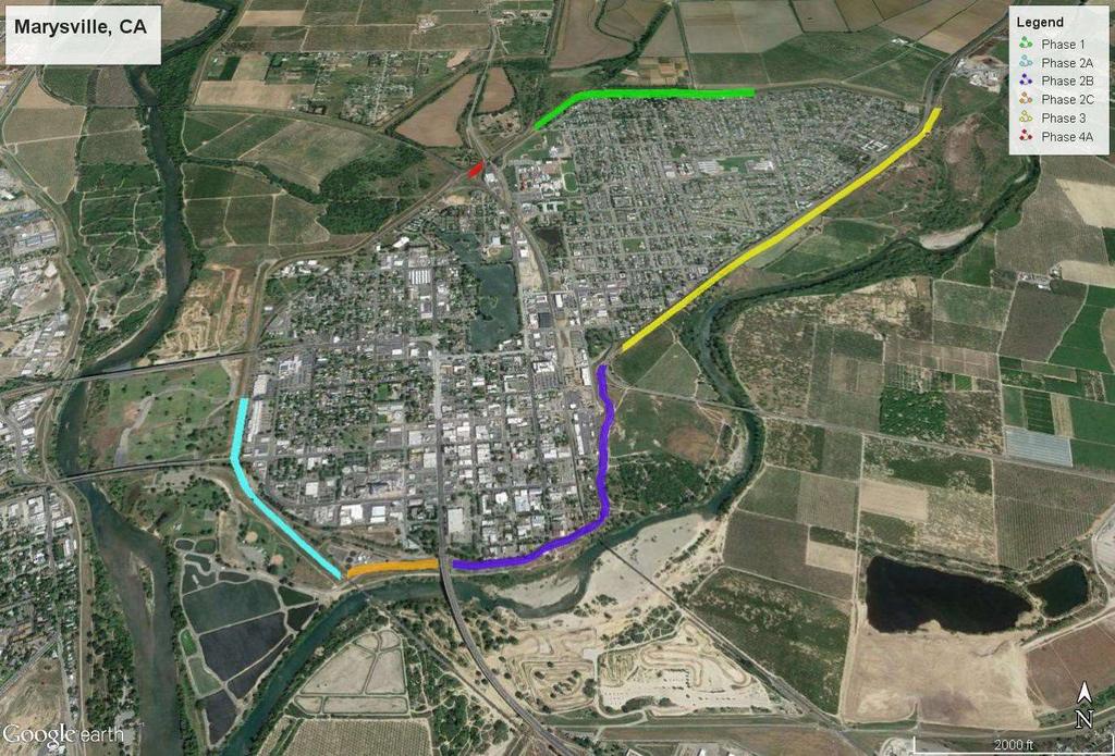
18 Marysville Levee District Project Status Phase 1 Phase 4A Phase 2A-North Phase 3 Phase 2A-South Phase 2C Phase 2B Construction Year Phase 2A North = 218 Phase 2A South = 219 Phase 2C = 22 Phase 2B = 222,223 Phase 3 = 22,221 7/6/18 KJC
19 TULE RIVER SPILLWAY ENLARGEMENT PROJECT 19 SUCCESS DAM The views, opinions and findings contained in this report are those of the authors(s) and should not be construed as an official Department of the Army position, policy or decision, unless so designated by other official documentation. 7/6/18 KJC

20 Tule River Project Location 2 7/6/18 KJC
21 Non Federal Sponsors: State of California - Central Valley Flood Protection Board (CVFPB) Department of Water Resources (DWR) Tule River Partnerships ARCF WRDA 216 Partners Cost shares 35% of the Project with USACE Lower Tule River Irrigation District (LTRID) 21 Congressional Interests: Senators Feinstein and Harris Representative McCarthy Stakeholders: Population at Risk Recreation and Environmental Groups Irrigation Districts State / Federal Agencies 7/6/18 KJC

22 Tule River Success Dam Current Condition 22 Constructed: 1961 Gross Pool: (NAVD88) Storage Capacity: 82,3 AF PMF: 157,5 CFS 7/6/18 KJC

23 Tule River Conceptual Spillway Design 23 Ogee Weir Design - 4 Feet long - 1 Feet High - 1 Foot Slab - Rock bolts - Fraizer Dike rip rap Gross Pool: (NAVD88) (~1 Feet) Storage Capacity: 11,3 AF (+28, AF) 7/6/18 KJC
24 ISABELLA DAM SAFETY MODIFICATION PROJECT (DSMP) The views, opinions and findings contained in this report are those of the authors(s) and should not be construed as an official Department of the Army position, policy or decision, unless so designated by other official documentation. 7/1/18 KD

25 Isabella DSMP General Information 25 What is the Isabella Dam Safety Modification Project (DSMP)? The Isabella DSMP is a Dam Safety project at Lake Isabella, CA to mitigate serious hydraulic, seismic, and erosion concerns associated with the existing dams and spillway Classified as a Dam Safety Action Classification (DSAC) 1 in 8 Key project features are: Full height filter and drain on the Main Dam with a 16 foot crest raise Modifications to the existing service spillway Construction of a new emergency spillway Construction of a downstream buttress including full height filter and drains on the Auxiliary Dam with a 16 foot crest raise and shallow foundation treatment Abandonment of Borel canal outlet works Modifications to the Main Dam Control Tower to accommodate the 16 foot Main Dam crest raise Modifications to State Route 155 Note: The watershed is approximately the size of Delaware. 7/1/18 KD


26 ISABELLA DAM Phase I: Relocation Utility Relocation USFS/USACE Facilities SUPPLEMENTAL TARGET OCT 222 Phase II: Dams and Spillways 16 Main Dam Raise/Control Tower 16 Aux Dam Raise/Seal Borel Conduit Downstream Filters/Drainage/Buttress Service Spillway Modifications New Emergency Spillway/Labyrinth Weir 26 USACE Ops Emergency Spillway Labyrinth Weir Service Spillway Borel Canal USFS Fire Station USFS Visitor Center USACE Permanent Ops Facility USACE Construction Offices & Temporary Lake Ops Borel Canal Original Plan - Replacement of canal Revised Plan Acquire canal easement and remove canal USFS Fire Station 1/17/18 CLS
27 WHAT S NEXT 27 Looking for Industry Feedback Industry Day or Reverse Industry Day planned for early November - November 13 th - AGC & Building Trades Informational Session - TBD Industry Day Expect Design Contracts in the next several months Expect Construction Contracts beginning in FY19
28 Project Anticipated Construction Schedule WHAT S NEXT 28 Description Natomas Reach H ~ 4 miles Levee Improvements - Cut-Off Wall Reach B ~ 2 miles Levee Improvements - Seepage berm Reach E ~ 3 miles Levee Improvements possible cut-off wall Reach A ~ 4 miles Levee Improvements possible cut-off wall Reach F&G ~ 4 miles Levee Improvements possible cut-off wall Windows Various contracts for berms, jet grout, pump stations, etc. at windows left by other contracts Mitigation Ongoing Tree cutting, planting, maintenance, etc. Folsom Dam Dike Raise ~ 5 miles of 3.5 Dike Raise and related work in various packages Main Dam Retrofit of up to 8 gates on the Main Dam Hamilton City Mitigation and Planting Tule River Spillway Raise, utility relocations, environmental mitigation ARCF-WRDA216 Sac River Levees Up to 9 miles of cut-off wall and other seepage control features Sac River Erosion Up to 1 miles of bank protection work Amr Rvr Erosion Up to 11 miles of bank protection work Sac Weir/Bypass ,5 lf expansion of existing gated weir at Sac Bypass Mitigation Tree cutting, planting, maintenance, etc. Isabella Ongoing Construction of 16 dam raise, new emergency spillway, and various improvements Site Restoration Construction of permanent operations building, site restoration and misc. construction Yuba River Basin Phase 2C ~ 1, lf DSM wall construction Phase 2B/ ~ 13, LF Cut-off wall construction Phase 4B Rock Slope Protection installation PL Various repairs in response to 217 Flood Event Sutter Basin ~ 5 miles of Levee Improvements including cut-off wall Lower San Joaquin River Unknown Project is entering design phase and may have a contract as early as 22 West Sacramento Unknown Project is seeking to enter design phase and may have a contract as early as 22
29 QUESTIONS/DISCUSSION 29