PUBLIC NOTICE LOS ANGELES DISTRICT. APPLICATION FOR PERMIT 517 & 521 Pacific Avenue Shoreline Stabilization Project
|
|
|
- Joanna Clark
- 5 years ago
- Views:
Transcription
 602-4831; Robert.R.Smith@usace.")
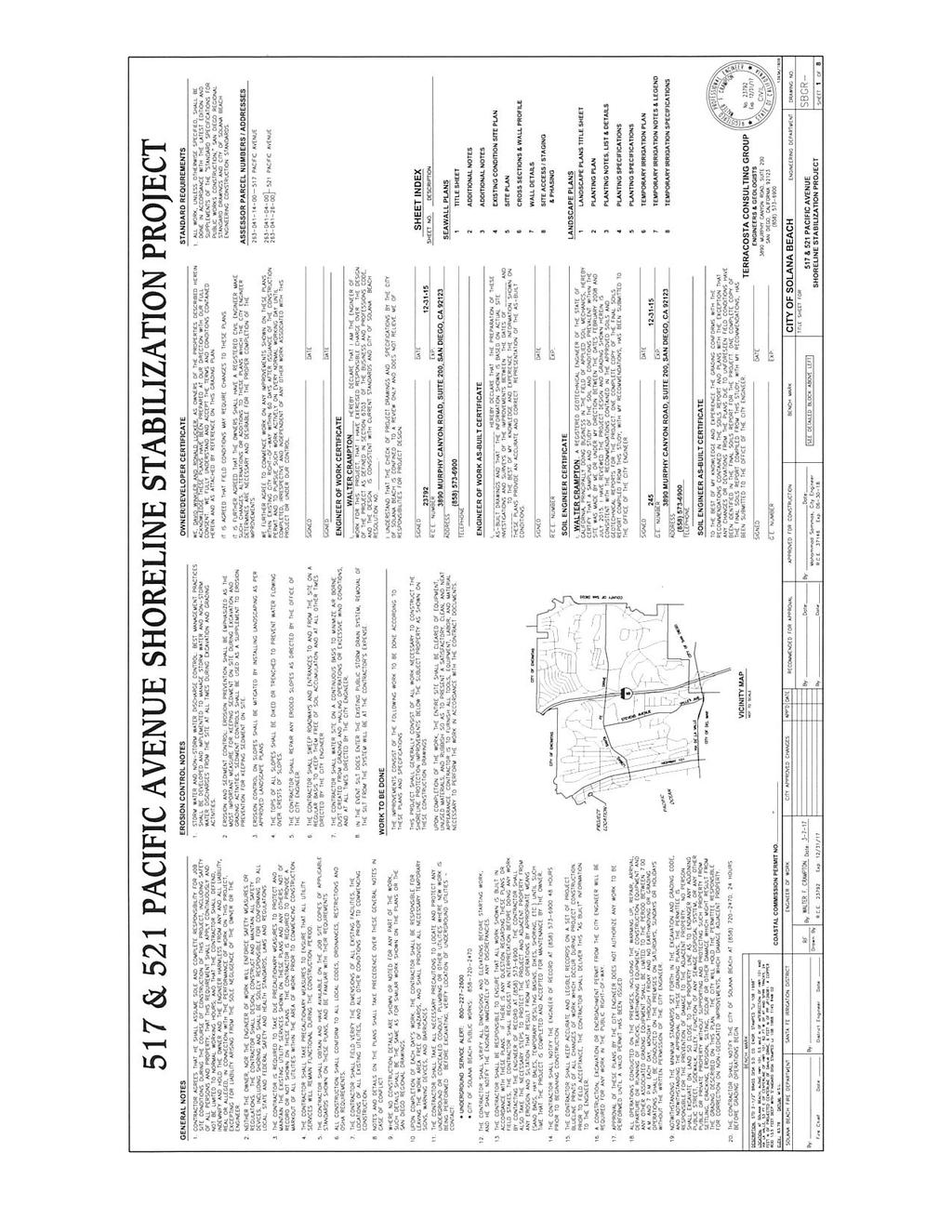
1 PUBLIC NOTICE U.S. ARMY CORPS OF ENGINEERS LOS ANGELES DISTRICT BUILDING STRONG APPLICATION FOR PERMIT 517 & 521 Pacific Avenue Shoreline Stabilization Project Public Notice/Application No.: SPL RRS Project: 517 & 521 Pacific Avenue Shoreline Stabilization Project Comment Period: June 9, 2017 through July 10, 2017 Project Manager: Robert Smith; (760) ; Co-Applicants Ron Lucker and David Winkler 517 and 521 Pacific Avenue Solana Beach, CA Contact Walter Crampton TerraCosta Consulting Group 4455 Murphy Canyon Road, Suite 200 (858) San Diego, California Location Along the bluffs and coastline in the City of Solana Beach (City), California and in the Pacific Ocean and adjacent to 517 and 521 Pacific Avenue within the county of San Diego, CA (at: North latitude, West). Activity Construct the 517 and 521 Pacific Avenue Shoreline Stabilization Project which includes a 140 foot (ft.) long by 20 ft. wide concrete seawall along the bluff in Solana Beach which extends an existing seawall built in 1997 which is also adjacent to a concrete sandbag wall. The development would protect the above residential properties and would be located on city-owned beach open to the public and the city-owned bluff face of an 80 ft.-high coastal bluff fronting two existing single family residences at 517 and 521 Pacific Avenue Shoreline Stabilization Project. The upland bluff behind the 521 residence also includes a planting plan on the bluff above the seawall. The applicant in coordination with the City shall require that the residences at 517 & 521 Pacific Avenue contribute to an In-lieu Fee Program. This contribution will address impacts to the sand volume from denial of sand to the littoral cell. Also Tide Beach Park, one of the City's primary beach parks and access ways, is located directly south of the project site. (See attached drawings). Impacts to navigable waters of the United States would be approximately 2,800 square ft. For more information see Additional Information section below. Interested parties are hereby notified an application has been received for a Department of the Army permit for the activity described herein and shown on the attached drawing(s). We invite you to review today s public notice and provide views on the proposed work. By providing substantive, sitespecific comments to the Corps Regulatory Division, you provide information that supports the Corps decision-making process. All comments received during the comment period become part of the record and will be considered in the decision.
2 This permit will be issued, issued with special conditions, or denied under Section 404 of the Clean Water Act and Section 10 of the Rivers and Harbors Act. Comments should be mailed to: DEPARTMENT OF THE ARMY LOS ANGELES DISTRICT, U.S. ARMY CORPS OF ENGINEERS REGULATORY DIVISION ATTN: Robert Smith Carlsbad Field Office 5900 La Place Ct., Suite 100 Carlsbad, CA Alternatively, comments can be sent electronically to: The mission of the U.S. Army Corps of Engineers Regulatory Program is to protect the Nation's aquatic resources, while allowing reasonable development through fair, flexible and balanced permit decisions. The Corps evaluates permit applications for essentially all construction activities that occur in the Nation's waters, including wetlands. The Regulatory Program in the Los Angeles District is executed to protect aquatic resources by developing and implementing short- and long-term initiatives to improve regulatory products, processes, program transparency, and customer feedback considering current staffing levels and historical funding trends. Corps permits are necessary for any work, including construction and dredging, in the Nation's navigable water and their tributary waters. The Corps balances the reasonably foreseeable benefits and detriments of proposed projects, and makes permit decisions that recognize the essential values of the Nation's aquatic ecosystems to the general public, as well as the property rights of private citizens who want to use their land. The Corps strives to make its permit decisions in a timely manner that minimizes impacts to the regulated public. During the permit process, the Corps considers the views of other Federal, state and local agencies, interest groups, and the general public. The results of this careful public interest review are fair and equitable decisions that allow reasonable use of private property, infrastructure development, and growth of the economy, while offsetting the authorized impacts to the waters of the United States. The permit review process serves to first avoid and then minimize adverse effects of projects on aquatic resources to the maximum practicable extent. Any remaining unavoidable adverse impacts to the aquatic environment are offset by compensatory mitigation requirements, which may include restoration, enhancement, establishment, and/or preservation of aquatic ecosystem system functions and services. Evaluation Factors The decision whether to issue a permit will be based on an evaluation of the probable impact including cumulative impacts of the proposed activity on the public interest. That decision will reflect the national concern for both protection and utilization of important resources. The benefit, which reasonably may be expected to accrue from the proposal must be balanced against its reasonably foreseeable detriments. All factors which may be relevant to the proposal will be considered including the cumulative effects thereof. Factors that will be considered include conservation, economics, aesthetics, general environmental concerns, wetlands, cultural values, fish and wildlife values, flood hazards, flood plain values, land use, navigation, shoreline erosion and accretion, recreation, water 2
3 supply and conservation, water quality, energy needs, safety, food production and, in general, the needs and welfare of the people. In addition, if the proposal would discharge dredged or fill material, the evaluation of the activity will include application of the EPA Guidelines (40 CFR Part 230) as required by Section 404 (b)(1) of the Clean Water Act. The Corps of Engineers is soliciting comments from the public; Federal, state, and local agencies and officials; Indian tribes; and other interested parties in order to consider and evaluate the impacts of this proposed activity. Any comments received will be considered by the Corps of Engineers to determine whether to issue, modify, condition or deny a permit for this proposal. To make this decision, comments are used to assess impacts on endangered species, historic properties, water quality, general environmental effects, and the other public interest factors listed above. Comments are used in the preparation of an Environmental Assessment and/or an Environmental Impact Statement pursuant to the National Environmental Policy Act. Comments are also used to determine the need for a public hearing and to determine the overall public interest of the proposed activity. Preliminary Review of Selected Factors EIS Determination- A preliminary determination has been made an environmental impact statement is not required for the proposed work. Water Quality- The applicant is required to obtain water quality certification, under Section 401 of the Clean Water Act, from the California Regional Water Quality Control Board. Section 401 requires any applicant for an individual Section 404 permit provide proof of water quality certification to the Corps of Engineers prior to permit issuance. Coastal Zone Management- The applicant has certified the proposed activity would comply with and would be conducted in a manner consistent with the approved State Coastal Zone Management Program. For those projects in or affecting the coastal zone, the Federal Coastal Zone Management Act requires that prior to issuing the Corps authorization for the project, the applicant must obtain concurrence from the California Coastal Commission the project is consistent with the State's Coastal Zone Management Plan. Essential Fish Habitat- Essential Fish Habitat (EFH), as defined by the Magnuson-Stevens Fishery Conservation and Management Act, occurs within the project area and EFH is affected by the proposed project. The Corps of Engineers preliminary determination indicates the proposed activity would adversely affect EFH. Therefore, formal consultation under Section 305(b)(2) of the Magnuson-Stevens Fishery Conservation and Management Act (Act) is required. This notice initiates the EFH consultation requirements of the Act. In order to comply with the Act, pursuant to 50 CFR (e)(3), I am providing, enclosing, or otherwise identifying the following information: 1. Description of the proposed action: See project description on page 5 of this public notice. 2. Onsite inspection information: See baseline information on page 5 of this public notice. 3. Analysis of the potential adverse effects on EFH: The existing EFH consists of an intertidal beach zone that abuts a Torrey Sandstone bluff with sea caves that is adjacent to the hard reefs just offshore and tide pools. The two residences above the project are single family residences that taper down to the steep bluff that has caves scoured out at ground level. The nearshore areas adjacent to the project area include hard reef with surf grasses and kelp. The project will not have any direct 3
4 impacts to the surfgrass or the subtidal zones just offshore. Also due to potential turbidity from the minor grading and equipment impacts, grading the temporary berm, and access grading there would be minor temporary impacts to EFH. No direct impacts to eelgrass, surfgrass, or reefs are anticipated as these areas are further out in the nearshore areas which are in the subtidal zone but monitoring will be required to ensure that such impacts do not occur. 4. Proposed minimization, conservation, or mitigation measures: The applicant s proposed project would have pre-construction and post-construction monitoring to evaluate changes to the environment. Impacts will be minimized by the use of preventive barriers, tarps, and off-site disposal and storage of equipment. In addition, an onsite contractor will be instructed to visually monitor the project area. To insure water quality, post-construction monitoring will be implemented by May 1st of each third year from the date of approval and for the life of the structure. Monitoring reports will be prepared by a licensed geologist, civil engineer, or geotechnical engineer. As part of each monitoring report an evaluation of the condition and performance of the approved shoreline protective device. This will include an assessment of whether weathering and/or damage has occurred that could adversely impact the future performance of the device and consequentially the surrounding waters in this area. Weathering and/or damage to the bluff could be experienced, so appropriate corrective procedures would be administered such as surface preparation of the existing bluff face along with coloring and texturing of the bluff to match the existing bluff. Every 5 years the shoreline protective device will be reevaluated to determine if it is still needed. See page 5 and 6 for detailed minimization and mitigation measures.. 5. Conclusions regarding effects of the proposed project on EFH: Project would have temporary adverse effects to EFH habitat due to equipment, grading, noise, and turbidity impacts. Therefore, it is my initial determination the proposed activity may adversely affect and would have an adverse impact on EFH or federally managed fisheries (Coastal pelagic and Pacific Groundfish Fishery Management Plans) in California waters. My final determination relative to project impacts and the need for mitigation measures is subject to review by and coordination with the NOAA Fisheries. If I do not receive written comments (regular mail or ) within the 30-day notification period, I may assume concurrence by NOAA Fisheries that no mitigation measures are necessary. Cultural Resources- The latest version of the National Register of Historic Places has been consulted and this site is not listed. This review constitutes the extent of cultural resources investigations by the District Engineer, and he is otherwise unaware of the presence of such resources. Endangered Species- Preliminary determinations indicate the proposed activity would not affect federally-listed endangered or threatened species, or their critical habitat. Therefore, formal consultation under Section 7 of the Endangered Species Act does not appear to be required at this time. Public Hearing- Any person may request, in writing, within the comment period specified in this notice, that a public hearing be held to consider this application. Requests for public hearing shall state with particularity the reasons for holding a public hearing. 4
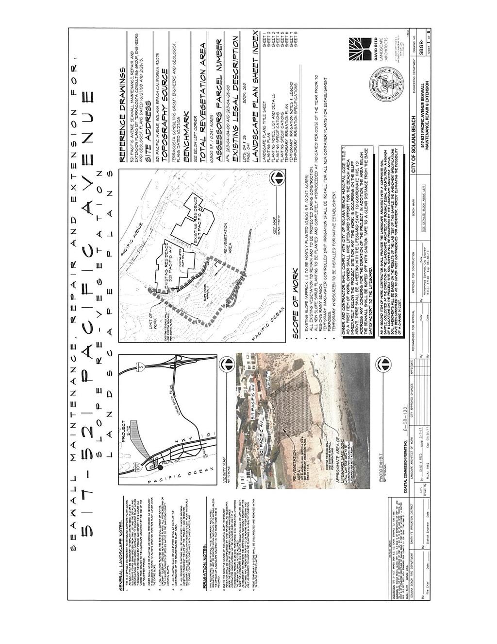
5 Proposed Activity for Which a Permit is Required The proposed 140 ft. long shotcrete seawall will be constructed, per the attached drawings, using vehicles, trucks, and grading equipment within the intertidal beach construction zone of the Pacific Ocean along and under a bluff shoreline that currently receives wave run up at various tidal cycles. The project will extend into a 40 ft. construction zone (may also include a temporary berm) that would be partially below the High Tide line of 6.91 ft. MLLW datum in some places. The project would have temporary impacts to approximately 2,800 square of navigable waters of the U.S that does not contain eelgrass, surf grass, or kelp but is adjacent to hard reefs in the nearshore environment. Proposed development will be consistent with the marine and water quality protection policies of the Coastal Act and the City of Solana Beach certified Land Use Policies to insure that all environmental impacts will be minimized to the maximum extent feasible. Best management practices (BMPs) will be employed throughout the duration of the proposed project with the following BMPs: 1) Ensuring that the color and texture of the structure shall be compatible with the existing bluff. 2) Submittal of a detailed monitoring plan of the bluff and the structures above the project using proper mean high tide line monitoring with a licensed surveyor. 3) Submittal of as-built drawings after construction. 4) Monitoring requirement for monitoring reports to be submitted each third year by a licensed geologist, civil engineer, or geotechnical engineer to document if any weathering damage has occurred and an analysis of erosion trends, annual retreat, or rate of retreat of the bluff. Basic Project Purpose- The basic project purpose comprises the fundamental, essential, or irreducible purpose of the proposed project, and is used by the Corps to determine whether the applicant's project is water dependent (i.e., requires access or proximity to or siting within the special aquatic site to fulfill its basic purpose). Establishment of the basic project purpose is necessary only when the proposed activity would discharge dredged or fill material into a special aquatic site (e.g., wetlands, pool and riffle complex, mudflats, coral reefs). Because no fills are proposed within special aquatic sites, identification of the basic project purpose is not necessary. While the project would not discharged dredged or fill material into a special aquatic site, the basic project purpose is shoreline stabilization which is considered water dependent. Overall Project Purpose- The overall project purpose serves as the basis for the Corps' 404(b)(1) alternatives analysis and is determined by further defining the basic project purpose in a manner that more specifically describes the applicant's goals for the project, and which allows a reasonable range of alternatives to be analyzed. The overall project purpose for the proposed project is to provide adequate shore protection to protect public safety and to protect adjacent private properties located on the bluffs in Solana Beach. Additional Project Information Baseline information- The project is located southwest of the street address on the bluff/beach side of the parcel in Solana Beach west of Pacific Avenue and is shown in the Existing Condition Site Plan. The project area extends +/- 140ft of exposed bluff between the existing seawalls on either side. The addition of a seawall barrier is necessary to maintain stability of the bluff by preventing further erosion of bluff material which is primarily Torrey Sandstone. If the bluff is not protected it could fail 5
6 and cause damage to residences residing on top of the bluff. Failure of the bluff could cause soil and property to slide into the adjacent navigable waters. Some failures have already occurred recently. This project is intended to cover the exposed bluff in order to prevent further erosion of supportive bluff material that could lead to bluff failure and potential public safety issues from bluff failures. The addition of this seawall will cover +/-140 ft. and serve to connect the already present seawalls on either side of the exposed bluff. The existing bluff has sea caves and some scrub vegetation along the upper slopes behind the residences and the rear yards of the two residences (517 & 521 Pacific Avenue) have ice plant, patios, block walls, bare dirt, and three stairways. The shoreline area is also used by recreational surfers and swimmers and beachcombers and is just north of a major beach access stairway where the public gains access to the beach areas and where both dogs and people frequent this area. The nearshore hard and soft reefs are westward of the project site and is also known as the Table Tops surf area and the bluffs and project site are directly adjacent to where the surfers access this surf spot. The area just south of the project site also functions as a regular beach use site for sunbathers and dog walking. Project description- The project, per the attached drawings, involves the construction of a 140 ft. long, 32 ft. high, and 30 in. thick shotcrete seawall on the beach and bluff fronting 517 and 521 Pacific Avenue in the city of Solana Beach in San Diego County, CA. The project will be built per the attached drawings as prepared by Terra Costa Consulting Group and dated December 31, 2017 and includes shotcreting, air-placed concrete with epoxy coated reinforcement for the wall construction, multistrand earthen anchors, and a top 5 ft. layer of erodible concrete fill on the top layer above the new seawall. The proposed seawall will connect to an existing tieback shotcrete seawall to the north and an existing concrete sandbag seawall to the south. The new seawall will have a wave deflector at the top of the seawall and tiebacks into the existing Torrey Sandstone bluff with wall drains, concrete infill, erodible concrete top layer, and a 30 ft. construction zone with public safety barriers. Also proposed, is the installation of hydro seed and container plantings on the geogrid slope below the northern property. Proposed Mitigation The proposed mitigation may change as a result of comments received in response to this public notice, the applicant's response to those comments, and/or the need for the project to comply with the 404(b)(1) Guidelines. In consideration of the above, the proposed mitigation sequence (avoidance/minimization/compensation), as applied to the proposed project is summarized below: Avoidance: Proposed development will be consistent with the marine and water quality protection policies of the Coastal Act and the City of Solana Beach certified Land Use Policies to insure that all environmental impacts will be minimized to the maximum extent feasible. Best Management Practices (BMP) will be employed throughout the duration of the proposed project. To prevent the discharge of concrete materials, such as shotcrete or any other construction byproducts, onto the sandy beach and/or from entering coastal waters, the contractor shall, at minimum, comply with the following BMP's. No direct eelgrass or surfgrass or reef impacts are expected. 1. Shotcrete pouring/pumping activities: During all concrete pumping activities, tarps shall be used below the concrete pump hopper to prevent accidental discharge of any spilled concrete onto the beach sands or into coastal waters. Tarps shall be of sufficient size to capture any spilled concrete material. 6
7 2. Shotcrete/concrete application: During all concrete placement activities, care shall be taken to prevent the discharge of concrete materials onto the beach sand and/or into coastal waters. Tarps of sufficient size shall be placed at the base of all shotcrete/concrete placement areas to completely capture all excess concrete and/or shotcrete rebound and prevent contact with the beach sands and/or coastal waters. 3. Off-site disposal: All concrete and/or other construction byproducts collected shall be properly contained and disposed of off-site in a legal manner. All washout of concrete pumping equipment shall be back into the concrete ready-mix truck at the completion of the concrete placement for off-site disposal. Minimization: In addition to the use of preventive barriers, tarps, and off-site disposal and storage of equipment to avoid impacts, an onsite contractor will be instructed to visually monitor the project area. In the event that preventive barriers and off-site disposal/storage of equipment does not contain the potential for environmental impacts, the contractor will be instructed to stop, slow, or modify the work effort to maintain environmental compliance. Compensation: The applicant in coordination with the City shall require that the residences at 517 & 521 Pacific Avenue contribute to an In-lieu Fee Program. This contribution will address impacts to the sand volume from denial of sand to the littoral cell. Over the course of the 20 year sand supply mitigation period, the proposed seawall extension results in the retention of about 2,489 cubic yards of beach quality sand. At estimated sand cost of $16.29 per cubic yard; this sand would have a value of $40,546. The beach area itself and degradation of public access to and along the beach that would be impacted due to encroachment (350 sq. ft.) and the area impacted by estimated passive erosion over the 20 year mitigation period (1,120 sq. ft.) will be mitigated through the City of Solana Beach interim in-lieu deposit fee, which requires the applicant to pay an interim deposit fee of $140,000. Proposed Special Conditions No special conditions are proposed at this time. 7

8 For additional information please call Robert Smith of my staff at (760) or via at This public notice is issued by the Chief, Regulatory Division. Regulatory Program Goals: To provide strong protection of the nation's aquatic environment, including wetlands. To ensure the Corps provides the regulated public with fair and reasonable decisions. To enhance the efficiency of the Corps administration of its regulatory program. DEPARTMENT OF THE ARMY LOS ANGELES DISTRICT, U.S. ARMY CORPS OF ENGINEERS Carlsbad Field Office 5900 La Place Ct., Suite 100 Carlsbad, CA
9

10
11
12
13
14
15
16
17
18