Structure Shape Comments Number of Barrels X Width (ft) X Height (ft) Projecting. At Stream Grade Box Arch Pipe Diameter. Wing wall Headwall
|
|
|
- Peregrine Terry
- 5 years ago
- Views:
Transcription
1 SDDOT Fish Passage Assessment Work Sheet (Attachment A) PRJ # PCN: Date: Year Constructed: County: Structure Location: Assessed By: Stream Name: Structure Type Structure Shape Comments Number of Barrels Inlet Type Outlet Type* X Width (ft) X Height (ft) Projecting At Stream Grade Box Arch Pipe Diameter Wing wall Headwall Apron Cascade over Riprap Free Fall into Pool Free Fall Onto Rip Rap 1 Bridge Riprap Apron 1 Bridge Deck Length X Width Other: Other: Rapid Visual Assessment: Observation Y / N N.A. 1. The structure is installed generally in accordance with plans (height, width, elevation, location, etc ) This item to be completed on initial survey only. 2. Overall structure width is wider than the average stream widths upstream and downstream. 3. Natural streambed material exists throughout structure (i.e. countersunk approximately 1 foot) 4. Stream channel is free of scour activity that may impede fish passage. 5. A natural low flow channel exists through the structure or if not the streambed surface within the structure simulates the streambed beyond the structure inlet and outlet similar to design conditions.** 6. Stream is free of channelizing along the surface of the structure.** 7. Up & downstream channel appears stable (no apparent erosion). 8. Vegetation is/has reestablished on the stream banks within the construction area. Field Measurements: Stream Depth and Velocities at Structure*** Location Left 1/4 Pt 1/2 Pt 3/4 Pt Right Thalweg Depth Vel. Depth Vel. Depth Vel. Depth Vel. Depth Vel. Depth Vel. Inlet Outlet MidStr 7xW UpStrm 7xW DwnStrm Describe observations used in making above determinations. Describe whether unusual channelizing exists within the structure or stream. Note other unique site conditions that may/may not warrant corrective actions. Document with additional photographs if needed. * Document any potential fish passage barriers. ** If 'NO' is checked for Observation 5 or 6, additional field observation & measurements may be required. Refer to section 'Stream Crossing Section' in the Monitoring Protocol for additional measurements and evaluation procedures. Figs 1-4 are included for ease of reference. *** Velocities are to be taken 0.6 times the total depth measured from the water's surface. Refer to Figure 5. Revision Date: 10/4/2012
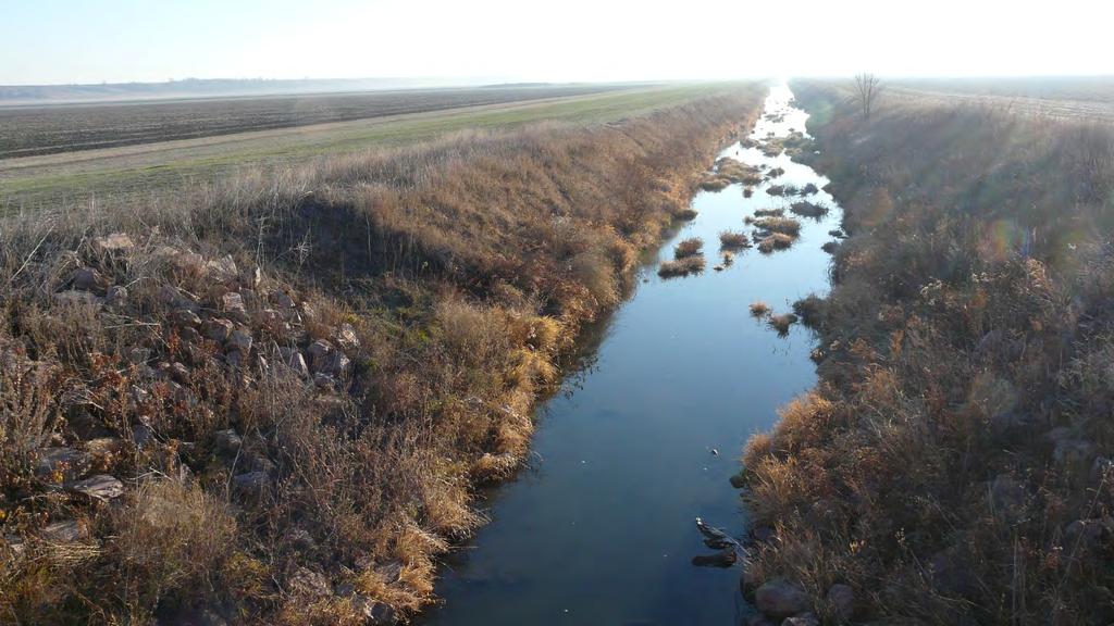
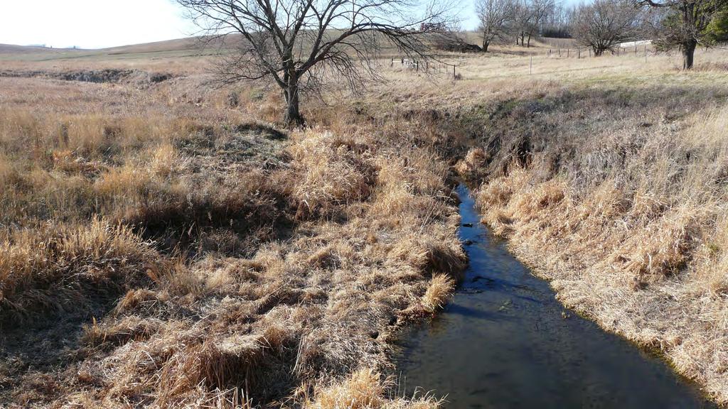
2 SDDOT Fish Passage Assessment Work Sheet (Attachment A) Photos Latitude Upstream Downstream Other (optional) Location Description (optional) Include description of photograph location for future reference. Longitude Photos should include: approximately 7xW upstream/downstream from structure in the direction of the structure showing undisturbed channel beyond the construction limits, the upstream/downstream channel disturbed by the project, and the structure inlet and outlet. REPORT FINDINGS Figures 1-5 Revision Date: 10/4/2012

3
4

5

6

7

8
9 SDDOT Fish Passage Assessment Work Sheet (Attachment A) PRJ # PCN: Date: Year Constructed: County: Structure Location: Assessed By: Stream Name: Structure Type Structure Shape Comments Number of Barrels Inlet Type Outlet Type* X Width (ft) X Height (ft) Projecting At Stream Grade Box Arch Pipe Diameter Wing wall Headwall Apron Cascade over Riprap Free Fall into Pool Free Fall Onto Rip Rap 1 Bridge Riprap Apron 1 Bridge Deck Length X Width Other: Other: Rapid Visual Assessment: Observation Y / N N.A. 1. The structure is installed generally in accordance with plans (height, width, elevation, location, etc ) This item to be completed on initial survey only. 2. Overall structure width is wider than the average stream widths upstream and downstream. 3. Natural streambed material exists throughout structure (i.e. countersunk approximately 1 foot) 4. Stream channel is free of scour activity that may impede fish passage. 5. A natural low flow channel exists through the structure or if not the streambed surface within the structure simulates the streambed beyond the structure inlet and outlet similar to design conditions.** 6. Stream is free of channelizing along the surface of the structure.** 7. Up & downstream channel appears stable (no apparent erosion). 8. Vegetation is/has reestablished on the stream banks within the construction area. Field Measurements: Stream Depth and Velocities at Structure*** Location Left 1/4 Pt 1/2 Pt 3/4 Pt Right Thalweg Depth Vel. Depth Vel. Depth Vel. Depth Vel. Depth Vel. Depth Vel. Inlet Outlet MidStr 7xW UpStrm 7xW DwnStrm Describe observations used in making above determinations. Describe whether unusual channelizing exists within the structure or stream. Note other unique site conditions that may/may not warrant corrective actions. Document with additional photographs if needed. * Document any potential fish passage barriers. ** If 'NO' is checked for Observation 5 or 6, additional field observation & measurements may be required. Refer to section 'Stream Crossing Section' in the Monitoring Protocol for additional measurements and evaluation procedures. Figs 1-4 are included for ease of reference. *** Velocities are to be taken 0.6 times the total depth measured from the water's surface. Refer to Figure 5. Revision Date: 10/4/2012
10 SDDOT Fish Passage Assessment Work Sheet (Attachment A) Photos Latitude Upstream Downstream Other (optional) Location Description (optional) Include description of photograph location for future reference. Longitude Photos should include: approximately 7xW upstream/downstream from structure in the direction of the structure showing undisturbed channel beyond the construction limits, the upstream/downstream channel disturbed by the project, and the structure inlet and outlet. REPORT FINDINGS Figures 1-5 Revision Date: 10/4/2012

11

12
13

14

15

16
17 SDDOT Fish Passage Assessment Work Sheet (Attachment A) PRJ # PCN: Date: Year Constructed: County: Structure Location: Assessed By: Stream Name: Structure Type Structure Shape Comments Number of Barrels Inlet Type Outlet Type* X Width (ft) X Height (ft) Projecting At Stream Grade Box Arch Pipe Diameter Wing wall Headwall Apron Cascade over Riprap Free Fall into Pool Free Fall Onto Rip Rap 1 Bridge Riprap Apron 1 Bridge Deck Length X Width Other: Other: Rapid Visual Assessment: Observation Y / N N.A. 1. The structure is installed generally in accordance with plans (height, width, elevation, location, etc ) This item to be completed on initial survey only. 2. Overall structure width is wider than the average stream widths upstream and downstream. 3. Natural streambed material exists throughout structure (i.e. countersunk approximately 1 foot) 4. Stream channel is free of scour activity that may impede fish passage. 5. A natural low flow channel exists through the structure or if not the streambed surface within the structure simulates the streambed beyond the structure inlet and outlet similar to design conditions.** 6. Stream is free of channelizing along the surface of the structure.** 7. Up & downstream channel appears stable (no apparent erosion). 8. Vegetation is/has reestablished on the stream banks within the construction area. Field Measurements: Stream Depth and Velocities at Structure*** Location Left 1/4 Pt 1/2 Pt 3/4 Pt Right Thalweg Depth Vel. Depth Vel. Depth Vel. Depth Vel. Depth Vel. Depth Vel. Inlet Outlet MidStr 7xW UpStrm 7xW DwnStrm Describe observations used in making above determinations. Describe whether unusual channelizing exists within the structure or stream. Note other unique site conditions that may/may not warrant corrective actions. Document with additional photographs if needed. * Document any potential fish passage barriers. ** If 'NO' is checked for Observation 5 or 6, additional field observation & measurements may be required. Refer to section 'Stream Crossing Section' in the Monitoring Protocol for additional measurements and evaluation procedures. Figs 1-4 are included for ease of reference. *** Velocities are to be taken 0.6 times the total depth measured from the water's surface. Refer to Figure 5. Revision Date: 10/4/2012
18 SDDOT Fish Passage Assessment Work Sheet (Attachment A) Photos Latitude Upstream Downstream Other (optional) Location Description (optional) Include description of photograph location for future reference. Longitude Photos should include: approximately 7xW upstream/downstream from structure in the direction of the structure showing undisturbed channel beyond the construction limits, the upstream/downstream channel disturbed by the project, and the structure inlet and outlet. REPORT FINDINGS Figures 1-5 Revision Date: 10/4/2012

19

20

21

22

23

24
25 SDDOT Fish Passage Assessment Work Sheet (Attachment A) PRJ # PCN: Date: Year Constructed: County: Structure Location: Assessed By: Stream Name: Structure Type Structure Shape Comments Number of Barrels Inlet Type Outlet Type* X Width (ft) X Height (ft) Projecting At Stream Grade Box Arch Pipe Diameter Wing wall Headwall Apron Cascade over Riprap Free Fall into Pool Free Fall Onto Rip Rap 1 Bridge Riprap Apron 1 Bridge Deck Length X Width Other: Other: Rapid Visual Assessment: Observation Y / N N.A. 1. The structure is installed generally in accordance with plans (height, width, elevation, location, etc ) This item to be completed on initial survey only. 2. Overall structure width is wider than the average stream widths upstream and downstream. 3. Natural streambed material exists throughout structure (i.e. countersunk approximately 1 foot) 4. Stream channel is free of scour activity that may impede fish passage. 5. A natural low flow channel exists through the structure or if not the streambed surface within the structure simulates the streambed beyond the structure inlet and outlet similar to design conditions.** 6. Stream is free of channelizing along the surface of the structure.** 7. Up & downstream channel appears stable (no apparent erosion). 8. Vegetation is/has reestablished on the stream banks within the construction area. Field Measurements: Stream Depth and Velocities at Structure*** Location Left 1/4 Pt 1/2 Pt 3/4 Pt Right Thalweg Depth Vel. Depth Vel. Depth Vel. Depth Vel. Depth Vel. Depth Vel. Inlet Outlet MidStr 7xW UpStrm 7xW DwnStrm Describe observations used in making above determinations. Describe whether unusual channelizing exists within the structure or stream. Note other unique site conditions that may/may not warrant corrective actions. Document with additional photographs if needed. * Document any potential fish passage barriers. ** If 'NO' is checked for Observation 5 or 6, additional field observation & measurements may be required. Refer to section 'Stream Crossing Section' in the Monitoring Protocol for additional measurements and evaluation procedures. Figs 1-4 are included for ease of reference. *** Velocities are to be taken 0.6 times the total depth measured from the water's surface. Refer to Figure 5. Revision Date: 10/4/2012
26 SDDOT Fish Passage Assessment Work Sheet (Attachment A) Photos Latitude Upstream Downstream Other (optional) Location Description (optional) Include description of photograph location for future reference. Longitude Photos should include: approximately 7xW upstream/downstream from structure in the direction of the structure showing undisturbed channel beyond the construction limits, the upstream/downstream channel disturbed by the project, and the structure inlet and outlet. REPORT FINDINGS Figures 1-5 Revision Date: 10/4/2012

27

28

29

30

31

32