SP Old Florida Investment Resources, LLC SMR Aggregates SR 64 Borrow Pit (DTS # )
|
|
|
- Baldric Watson
- 6 years ago
- Views:
Transcription
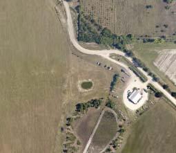
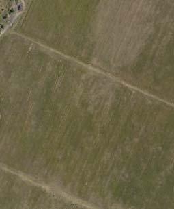
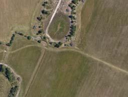
1 H.O. 03/24/14 SP Old Florida Investment Resources, LLC SMR Aggregates SR 64 Borrow Pit (DTS # ) Request: Approval of a Special Permit for major earthmoving in the A (General Agriculture) zoning district. The site is located south of SR 64 between Lorraine Road and CR 675 at S.R. 64 East, Bradenton, Florida (± acres). Hearing Officer: March 24, 2014
2 Page 2 of 10 SMR Aggregates SR 64 Borrow Pit - SP DTS# PROJECT SUMMARY CASE#: SP DTS # PROJECT NAME: APPLICANT(S): REQUEST: SMR Aggregates SR 64 Borrow Pit Old Florida Investment Resources, LLC Special Permit for Major Earthmoving CASE PLANNER: Margaret C. Tusing STAFF RECOMMENDATION: APPROVAL WITH STIPULATIONS SITE CHARACTERISTICS AND SURROUNDING AREA ADDRESS: SR 64 East, Bradenton, Florida GENERAL LOCATION: SIZE: EXISTING USE(S): PREVIOUS APPROVAL(S): ZONING: FLOOR AREA RATIO (FAR): FUTURE LAND USE CATEGORY: OVERLAY DISTRICT(S): South of SR 64 between Lorraine Road and CR 675 ± acres Agriculture NA A (Agriculture) NA AG-R (Agriculture Rural) NA
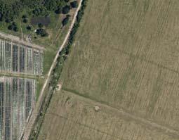
3 Page 3 of 10 SMR Aggregates SR 64 Borrow Pit - SP DTS# SURROUNDING USES & ZONING NORTH SOUTH EAST WEST Agriculture and Residential Agriculture Agriculture Agriculture SETBACKS: BUFFERS: SITE DESIGN DETAILS North: 1,400-feet South: 8,000-feet East: 1,900-feet West: 3,100-feet Roadway and perimeter buffers are not required; wetland buffers are provided as required ACCESS: Internal farming road located on site to SR 64 WETLAND ACREAGE & IMPACTS FLOOD ZONE(S) AREA OF KNOWN FLOODING UTILITY CONNECTIONS No wetland impacts Zone C per FIRM Panel B, revised 3/15/84. Zone X per D-FIRMS, effective 3/17/2014. No N/A POSITIVE ASPECTS Earthmoving operations are temporary in nature and will ultimately result in the creation of a large lake on this site after reclamation is completed. The borrow pit is compatible with the surrounding agricultural uses. The minimum setback from the borrow pit to the property line is approximately feet.
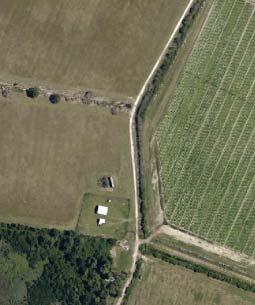
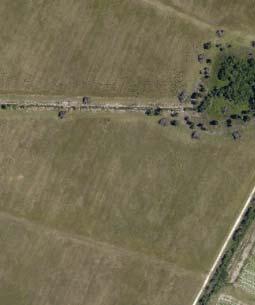
4 Page 4 of 10 SMR Aggregates SR 64 Borrow Pit - SP DTS# NEGATIVE ASPECTS A borrow pit will increase noise and truck traffic in the immediate area. MITIGATING MEASURES Staff recommends a stipulation limiting the hours of operation from 7:00 a.m. to 4:30 p.m, Monday through Friday. No borrow pit activity shall occur on Saturday, Sundays or holidays. On-site maintenance may occur on Saturday. STAFF SUMMARY The borrow pit site is part of a larger parent tract (2,142 acres) that is currently used for agricultural purposes (tomatoes). Approximately 7 million cubic yards of dirt will be excavated. The pit is approximately 167 acres and the project area is approximately 189 acres. Once completed and reclaimed, the pit area will be a large lake. The borrow pit is considered a short-term agricultural use in the Comprehensive Plan and is consistent with the range of potential uses of the AG-R Future Land Use Category. The borrow pit site is located south of SR 64. The site is not located within the Lake Manatee Watershed. In accordance with LDC 604.2, the Applicant submitted historical aerial maps and records indicating that the extent of the watershed (WPM) district is different than what is indicated on the Manatee County overlay maps. County staff has reviewed and compared the Applicant s data with the 2013 LIDAR (used to determine watershed delineation) and have determined that the project area drains into the Mill Creek Watershed and not into the Lake Manatee or Braden River Watersheds. Access to this site is from SR 64 to an internal farm road. This interior roadway will accommodate two-way truck traffic. The existing farm road is a 22-feet wide shell road; the applicant will increase the roadway width to 25-feet. There is an existing eastbound left turn lane on SR 64 for access to the Lake Manatee Recreation Area. The Applicant will provide an eastbound right turn lane into the site and a westbound left turn lane into the site. The Applicant has submitted a driveway permit applicant to the FDOT on December 30, The existing farm road is of sufficient length to allow trucks in-waiting to queue on site. The Applicant is requesting a maximum of 700 haul trips per day in association with the borrow pit with the average number of trips estimated at 230 trips. Fugitive dust from earthmoving activities will be controlled by having a water truck on site to water the interior farm road. Following the approval of the Special Permit, the applicant is required to obtain an Operating Permit before commencing with any earthmoving activities within the approved area. The applicant is required to furnish, as part of the Operating Permit application, evidence of financial responsibility in accordance with Section of the LDC.
5 Page 5 of 10 SMR Aggregates SR 64 Borrow Pit - SP DTS# STAFF RECOMMENDED STIPULATIONS A. DESIGN AND LAND USE STIPULATIONS 1. The Applicant is required to record a notice of the approved Special Permit in the official records of Manatee County, Florida as maintained by the Clerk of the Circuit Court. A copy of the recorded notice shall be provided to the Building and Development Services Department. The Special Permit is not effective until this condition is satisfied. 2. Prior to commencement of earthmoving operations, an Operating Permit shall be applied for and issued, pursuant to Section of the Land Development Code. The Operating Permit shall be issued for a term not to exceed five (5) years. 3. Hours of operation shall be limited to between 7:00 a.m. to 4:30 p.m., Monday through Friday with Saturday work limited to site maintenance. No borrow pit activity shall occur on Sundays or holidays. 4. The maximum number of haul trips shall be limited to 700 per day. 5. When a school facility is planned for the School District property located on Dam Road, approximately 1.15 miles from this site, the Applicant shall work with the School District staff on trucking times and haul routes to minimize any impact on future school traffic in this area. 6. The Earthmoving Site Plan submitted with this application is part of this approval. B. ENVIRONMENTAL STIPULATIONS 1. A Well Management Plan for the proper protection and abandonment of existing wells shall be submitted to the County for review and approval prior to Operating Permit issuance. The Well Management Plan shall include the following information: Digital photographs of the well along with nearby reference structures (if existing). GPS coordinates (latitude/longitude) of the well. The methodology used to secure the well during construction (e.g., fence, tape, etc.). The final disposition of the well used, capped, or plugged. C. PUBLIC SAFETY STIPULATIONS 1. Internal haul road shall be maintained and compacted to allow for safe emergency vehicle response.
6 Page 6 of 10 SMR Aggregates SR 64 Borrow Pit - SP DTS# Internal access roadways shall not be obstructed in any manner, including obstruction by parked vehicles. 3. Gates shall a minimum clear width of 20-feet when open. 4. Any construction trailers or buildings shall meet all requirements of the Florida Fire Prevention Code (FFPC) for life safety provisions. 5. Additional water supply for firefighting operations may be required depending on the size, number and location of any proposed buildings. D. PARKS AND NATURAL RESOURCES (PNR) DEPARTMENT STIPULATIONS 1. Staff gauge/piezometer/well locations and elevations shall be surveyed and referenced to the National Geodetic Vertical Datum (NGVD). A copy of the survey shall be submitted to the County upon completion. 2. Prior to the collection of water quality measurements, please contact PNR to confirm parameters and finalize the Environmental Monitoring Plan per Section of the LDC. Monitoring locations shall be consistent with Exhibit C of the Final Order titled Staff Gauge Location Map and dated January 31, Subject to the stratigraphy, geological and radiological conditions found in the boring samples, the excavation limits may be revised during the Operating Permit application process but shall not exceed thirty (30) feet in depth. COMPLIANCE WITH LDC Standard(s) Required Roadway buffer, SR 64 Perimeter buffer (north, south, east and west) Tree replacement Design Compliance Proposal Y N BUFFERS N/A N/A N/A TREES ROADS & RIGHTS-OF-WAY Paved roadways No Y SR 64 Improvements Y Comments No roadway buffer is required or proposed No perimeter buffers are required or proposed There are no trees within the project limits, the area has been used for farming. Interior roadways exempt, exterior haul road is SR 64 Eastbound right & Westbound left turn lanes; FDOT driveway permit application submitted
7 Page 7 of 10 SMR Aggregates SR 64 Borrow Pit - SP DTS# Stormwater Exotic species removal Wetland buffer signs DRAINAGE/FLOODING ENVIRONMENTAL ISSUES N/A N/A No objections Not required for the earthmoving use Not required for the earthmoving use SPECIAL PERMIT CRITERIA PURSUANT TO SECTION 505 OF THE LAND DEVELOPMENT CODE: 1. Is the proposed use consistent with the Comprehensive Plan? Major earthmoving is consistent with the AG-R Future Lane Use Category. Major earthmoving is defined as a short-term agricultural use and is within the range of potential uses for the AG-R category. Additionally, the major earthmoving use is consistent with the following Comprehensive Plan policies: Policy: Intent: To identify, textually in the Comprehensive Plan's goals, objectives, and policies, or graphically on the Future Land Use Map, areas which have a long term Agricultural or Rural Residential character, such areas primarily located east of the "Future Development Area Boundary" (FDAB). Refer to the TSD, Land Use Element for location of the FDAB. Policy: Range of Potential Uses (see Policies , , and Obj ): Farms, ranches, agro-industrial uses, agricultural service establishments, agriculturallycompatible residential uses, farmworker housing, rural residential uses, neighborhood retail uses, mining, miningrelated uses, low intensity recreational facilities, rural recreational facilities, public or semi-public uses, schools, and appropriate water-dependent uses (see also Objectives 4.2.1, and ). Policy: Range of Potential Density/Intensity: Maximum Gross Residential Density: 0.2 dwelling units per acre Maximum Net Residential Density: 2 dwelling unit per acre (except within WO and CHHA Overlay Districts pursuant to Policies , and )
8 Page 8 of 10 SMR Aggregates SR 64 Borrow Pit - SP DTS# Policy: Other Information: A borrow pit is a mining-related use. Maximum Floor Area Ratio: 0.23 Maximum Square Footage for Neighborhood Retail Uses: Small (30,000sf) a) Mining-related uses, agro-industrial uses, and agricultural service establishments are exempt from the requirement for 0.23 maximum Floor Area Ratio, but may be limited in intensity by the application of other goals, objectives, or policies in this Comprehensive Plan or by other applicable development regulations. b) All mixed, multiple use and rural recreational use projects require special approval, as defined herein, and as further defined in any land development regulations developed pursuant to , F.S. c) Where established in a manner consistent with applicable land development regulations, farmworker housing may exceed densities specified in Policy Is the establishment, maintenance, or operation of the proposed use detrimental to, or will it endanger, the public health, safety, or general welfare? The establishment, maintenance, or operation of the borrow pit will not endanger the public health, safety, or general welfare. The site is surrounded on three sides by agricultural uses and residential/agricultural to the north. The borrow pit is located a minimum of 1400-feet to the closest property line. SR 64 will provide access to the site. 3. Will the establishment of the use impede the normal and orderly development and improvement of surrounding properties for uses permitted in the zoning district? Uses surrounding the site are primarily agricultural uses with a limited number of single family homes to the north. Staff recommends a stipulation limiting the hours of operation to 7:00 a.m. to 4:30 p.m. Monday through Friday.
9 Page 9 of 10 SMR Aggregates SR 64 Borrow Pit - SP DTS# Has the applicant complied with the requirements for Level of Service review? Yes, the Traffic Impact Statement (TIS) has been reviewed and approved. The Applicant has addressed the Comprehensive Plan requirements and provided appropriate traffic-related information to substantiate the findings. In conjunction with this outcome, the Transportation Planning Division recommends transportation concurrency approval. The TIS did not identify any off-site concurrency-related improvements which are directly attributable to the project impacts. Thus, no off-site improvements are required for this project. 5. Do adequate measures exist, or will they be taken, to provide ingress and egress to the proposed use in a manner that minimizes traffic congestion on public street? The Applicant has met with FDOT and will be constructing an eastbound right turn lane into the site and a westbound left turn lane into the site. The Applicant submitted an FDOT driveway permit application on 12/30/2013. The internal haul route is of sufficient length to provide on-site queuing so that trucks will not back up onto SR Is the proposed use consistent with the community character of the immediate neighborhood of this proposed development? Yes, given the temporary nature of the use and the agricultural character of the surrounding area, the proposed use is consistent with the character of the immediate vicinity. 7. Will development of the proposed use have a substantial adverse affect on a known archaeological, historical, or cultural resource located on or off the parcel proposed for this development? There are no known archaeological, historical, or cultural resources located on or off the parcel. There will be no wetland impacts. 8. Will the design of the proposed use minimize adverse effects, including visual impacts, of the proposed use on adjacent property? Yes, the borrow pit location and design limits any adverse effects on the adjacent properties. The borrow pit is within a larger piece of land (±2000 acres) and the nearest earthmoving activity will be approximately 1,400-feet from the borrow pit project area to the adjacent property to the north. Staff recommends limiting the hours of operation from 7:00 a.m. to 4:30 p.m. Monday through Friday; with Saturday work limited to site maintenance.
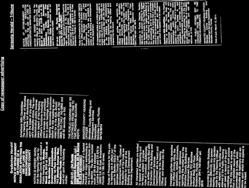
10 Page 10 of 10 SMR Aggregates SR 64 Borrow Pit - SP DTS# Have the adequate provisions been made, or will they be made, for buffers, landscaping, public open space, or other improvements associated with the use? The site is currently used for agricultural purposes. The applicant proposes no wetland impacts. The earthmoving project is setback a minimum of 1,400-feet from the north; 8,000 to the south, 1,900-feet to the east; and 3,100-feet to the west. Due to the significant setbacks and temporary nature of this use, landscaping is not proposed within the perimeter areas for the earthmoving use. 10. Does the proposed use meet all other standards or requirements set forth in the Land Development Code, which apply to the use in the zoning district for which this development seeks approval? The site is in compliance with all provisions of the Land Development Code Section which addresses standards for major earthmoving uses. In accordance with Section , a reclamation plan has been provided. Upon approval of the Special Permit, the Applicant will apply for an Operating Permit. CONDITIONAL USE CRITERIA PURSUANT TO SECTION 704 OF THE LAND DEVELOPMENT CODE Section , Earthmoving Uses, states that earthmoving uses shall be regulated by Section 732 of the Land Development Code. The project has been reviewed pursuant to this criteria and is found in compliance with Section 732.4, Major Earthmoving Requirements of the Land Development Code. In accordance with Section , a reclamation plan has been provided. Upon approval of the Special Permit, the Applicant is required to apply for an Operating Permit. REMAINING ISSUES OF CONCERN NOT RESOLVED OR STIPULATED None ATTACHMENTS 1. Earthmoving Site Plan 2. Potential Haul Routes 3. Staff Gauge Location Map dated 01/31/ Copy of Newspaper Advertising
11
12 PROPERTY OWNER: OLD FLORIDA INVESTMENTS, INC. CLIENT & CONTRACTOR: SMR AGGREGATES, INC.
13
14
15
181 State Road 415, New Smyrna Beach. Railey Harding & Allen, P.A. Barcelo Developments, Inc. Scott Ashley, AICP, Planning Manager
 GROWTH AND RESOURCE MANAGEMENT DEPARTMENT PLANNING AND DEVELOPMENT SERVICES DIVISION CURRENT PLANNING ACTIVITY 123 W. Indiana Avenue, Room 202, DeLand, FL 32720 (386) 943-7059 PUBLIC HEARING: CASE NO:
REQUIRED INFORMATION Please check the following boxes that apply to your lot or parcel and complete the other requested information.
 MARTIN COUNTY EXCAVATION AND FILL PERMIT APPLICATION This application to be used only for excavating or filling activities not associated with a building permit or development review and for projects requiring
DRAFT CH 10 & CH 11 October 7, 2015 From: SLDCProposedAmendmentsBCCPacket part3-1Nsm
 DRAFT CH 10 & CH 11 October 7, 2015 From: SLDCProposedAmendmentsBCCPacket10-13-2015part3-1Nsm 10.19. SMALL SCALE SAND AND GRAVEL EXTRACTION. 10.19.1. Applicability. This section applies to any mineral
PERMITTED USES: Within the MX Mixed Use District the following uses are permitted:
 6.24 - MX - MIXED USE DISTRICT 6.24.1 INTENT: The purpose of the MX Mixed Use District is to accommodate the development of a wide-range of residential and compatible non-residential uses (including major
3 August 13, 2014 Public Hearing
 3 August 13, 2014 Public Hearing APPLICANT: PAUL BRADLEY / BRADLEY MARINE, L.L.C. PROPERTY OWNER: CILOU L.L.C. REQUEST: Conditional Use Permit (boat and vessel repair and bulk storage yard) ADDRESS / DESCRIPTION:
Chapter MINERAL EXTRACTION AND MINING OPERATIONS
 Chapter 17.31 MINERAL EXTRACTION AND MINING OPERATIONS Sections: 17.31.010 Purpose 17.31.020 Procedure for Extraction and Rehabilitation Requests 17.31.030 Operation and Rehabilitation Standards for all
El Dorado Avenue
 A t t a c h m e n t 1 F i n d i n g s a n d C o n d i t i o n s 1995-1999 El Dorado Avenue Use Permit #08-10000055 JULY 10, 2008 CEQA FINDINGS 1. The project is categorically exempt from the provisions
COUNTY OF ALBEMARLE PLANNING STAFF REPORT SUMMARY. Acreage: 5.99 acres Special Use Permit: Section TMP:
 COUNTY OF ALBEMARLE PLANNING STAFF REPORT SUMMARY Project Name: SP201700030 Willow River Veterinary Services Staff: JT Newberry, Senior Planner Planning Commission Public Hearing: March 6, 2018 Owner:
Planning and Zoning Staff Report Triple Crown Development, CU
 Applicant: Triple Crown Development, LLC Representative: Dave Cockrum 208-283-2100 Staff: Deb Root droot@canyonco.org Tax ID, Acres: R36078 (80.97 acres) Current Zone: A (Agriculture) Hearing Date: November
R-M MANUFACTURED HOME RESIDENCE DISTRICT.
 18-0213 R-M MANUFACTURED HOME RESIDENCE DISTRICT. (1) Statement of intent. It is the intent of this section to increase the supply of housing and variety of housing types available to the public by establishing
7 April 11, 2012 Public Hearing APPLICANT:
 7 April 11, 2012 Public Hearing APPLICANT: PROPERTY OWNER: DIAMOND SPRINGS SHOPPES ASSOCIATES LLD STAFF PLANNER: Leslie Bonilla/Faith Christie REQUEST: Conditional Use Permit for Truck and Trailer Rental
MOUNTAIN VIEW COUNTY BYLAW NO. 14/16 TO AMEND BYLAW NO. 15/1
 MOUNTAIN VIEW COUNTY BYLAW NO. 14/16 TO AMEND BYLAW NO. 15/1 /15 Mountain View County Province of Alberta Bylaw No. 14/16 A BYLAW OF MOUNTAIN VIEW COUNTY IN THE PROVINCE OF ALBERTA TO AMEND LAND USE BYLAW
STREET ADDRESS OF EVENT: Description of Event:
 TEMPORARY USE PERMIT STREET ADDRESS OF EVENT: Description of Event: To Run from: (Date) (Hour) AM PM To: (Date) (Hour) AM PM Applicant: (Print) Applicant address: (Print) City, State Zip: Phone: Fax: Email:
Phone Fax Phone Fax. Owner/Agent Signature (Agents must provide written proof of authorization) OFFICE USE ONLY
 OFFICE USE ONLY") www.appleton.org APPLICATION FOR SPECIAL USE PERMIT FOR TAVERNS AND RESTAURANTS WITH ALCOHOL Community and Economic Development Department 100 N. Appleton St. PH: 920-832-6468 Appleton, WI 54911 FAX: 920-832-5994
www.appleton.org APPLICATION FOR SPECIAL USE PERMIT FOR TAVERNS AND RESTAURANTS WITH ALCOHOL Community and Economic Development Department 100 N. Appleton St. PH: 920-832-6468 Appleton, WI 54911 FAX: 920-832-5994
Planning Commission Agenda Item
 Planning Commission Agenda Item TO: THRU: FROM: Chair Gladson and Members of the Planning Commission Anna Pehoushek Assistant Community Development Director Monique Schwartz Assistant Planner SUBJECT PUBLIC
PLANNING COMMISSION STAFF REPORT. Utah Crew Rowing Dock Conditional Use 830 S. Delong Street September 8, 2010 Petition #PLNPCM
 PLANNING COMMISSION STAFF REPORT Utah Crew Rowing Dock Conditional Use 830 S. Delong Street September 8, 2010 Petition #PLNPCM2010-00449 Planning Division Department of Community and Economic Development
PLANNED UNIT DEVELOPMENT & PLANNING APPROVAL STAFF REPORT Date: February 7, 2013
 PLANNED UNIT DEVELOPMENT & PLANNING APPROVAL STAFF REPORT Date: February 7, 2013 NAME LOCATION MAWSS Shelton Beach Road East side of Shelton Beach Road Extension, 2/10± mile North of Moffett Road CITY
Traffic Study Guidelines
 Traffic Study Guidelines March 2015 Manatee County Public Works Transportation Planning Division 1022 26 th Avenue East Bradenton, FL 34208 Phone: (941) 708-7450 Fax: (941) 708-7503 TABLE OF CONTENTS
Request Modification of Conditions (Modification of conditions of existing Conditional Use Permit approved on March 22, 2011 to expand a borrow pit)
") Applicant/Property Owner Public Hearing March 9, 2016 City Council Election District Beach Agenda Item 4 Request Modification of Conditions (Modification of conditions of existing Conditional Use Permit
Applicant/Property Owner Public Hearing March 9, 2016 City Council Election District Beach Agenda Item 4 Request Modification of Conditions (Modification of conditions of existing Conditional Use Permit
COLLIER COUNTY Growth Management Department
 COLLIER COUNTY Growth Management Department June 11, 2015 Steve Coleman Barraco and Associates, Inc. 2271 McGregor Blvd. Fort Myers, FL 33901 EMAIL - stevec@barraco.net, julied@barraco.net RE: Excavation
MINUTES OF MEETING INDIAN HILL PLANNING COMMISSION MAY 17, 2011
 MINUTES OF MEETING INDIAN HILL PLANNING COMMISSION MAY 17, 2011 The regular meeting of the Indian Hill Planning Commission was held on Tuesday, May 17, 2011 at 7:00 p.m. in the Council Chambers of the
Attachment 1 Findings and Conditions
 2451 Ridge Road Use Permit #04-10000066 Attachment 1 Findings and Conditions APRIL 10, 2008 CEQA FINDINGS 1. The project is categorically exempt from the provisions of the California Environmental Quality
a. The following regulations shall apply to all guest ranches:
 SECTION 15 GENERAL DEVELOPMENT STANDARDS 15.1 Guest Ranches. a. The following regulations shall apply to all guest ranches: (1) Individual guest ranch quarters shall not contain Kitchen or cooking facilities.
Hillsborough County Future Land Use 160
 RURAL-AGRICULTURE LAND USE CLASSIFICATION Agricultural/Mining -1/20 (AM-1/20) RESIDENTIAL GROSS DENSITY TYPICAL USES MAXIMUM FLOOR AREA RATIO OR Up to 1 dwelling unit per 20 gross acres. Alternative methods
Article 16 Traffic Impact Analysis
 Article 16 Traffic Impact Analysis Table of Contents... 16-1 Chapter 16.1 Purpose and Intent... 16-2 Chapter 16.2 Applicability... 16-2 Chapter 16.3 Exemptions... 16-2 Chapter 16.4 Trip Generation Data...
2025 Comprehensive Plan
 CITY OF OVIEDO, FLORIDA 2025 Comprehensive Plan Future Land Use Map Amendment 17-0346 CPA Ordinance No. 1661 Supporting Data & Analysis LPA Public Hearing November 28, 2017 City Council Transmittal Public
All of the following must be submitted before the Planning Department can process the application:
 CITY OF WEST COVINA PLANNING DEPARTMENT Instructions for Filing for a Variance All of the following must be submitted before the Planning Department can process the application: 1. Application Sheet, with
B-2 COMMUNITY COMMERCIAL BUSINESS DISTRICT. Uses allowed in the B-2 Community Commercial Business District are subject to the following conditions:
 SECTION 46-53.1 B-2 COMMUNITY COMMERCIAL BUSINESS DISTRICT A. PURPOSE The B-2 Community Commercial Business District is oriented toward retail, service businesses and multi-family residential development.
ADMINISTRATIVE HEARING STAFF REPORT
 ADMINISTRATIVE HEARING STAFF REPORT Lucency Corp Recycling Processing Center 1875 West 1500 South CONDITIONAL USE Case #PLNPCM2013-00502 September 26, 2013 Planning and Zoning Division Department of Community
Item 5.01 STAFF REPORT JANUARY 9, 2014
 Item 5.01 STAFF REPORT JANUARY 9, 2014 TO: FROM SUBJECT: RECOMMENDATION Planning Commission Jenny Liaw, Senior Planner 1748 WEST FREMONT STREET; APPLICATION NO. P13-204; USE PERMIT FOR THE CONSTRUCITON
MONTGOMERY COUNTY PLANNING DEPARTMENT THE MARYLAND-NATIONAL CAPITAL PARK AND PLANNING COMMISSION
 MONTGOMERY COUNTY PLANNING DEPARTMENT THE MARYLAND-NATIONAL CAPITAL PARK AND PLANNING COMMISSION McLean School Mandatory Referral-MR 2018002 MCPB Item No.: 11 Date: 10-12-2017 Elsabett Tesfaye, Planner
Chair Thiesse and Planning Commission Members Dour Reeder, Interim City Administrator. Jeremy Barnhart, Community Development Director
 Date Application Received: April 18, 2017 Date Application Considered as Complete: April 18, 2017 60 Day Review Period Expires: June 18, 2017 To: From: Chair Thiesse and Planning Commission Members Dour
Franklin County Communique to the Planning Board
 Franklin County Communique to the Planning Board PETITIONER(S): Name of Petitioner: Carolina Solar Energy II, LLC Address: 400 W. Main St. Suite 503 City/State/Zip: Durham, NC 27701 LOCATION: REQUEST FOR
REPORT TO PLANNING AND DESIGN COMMISSION City of Sacramento
 REPORT TO PLANNING AND DESIGN COMMISSION City of Sacramento 915 I Street, Sacramento, CA 95814-2671 www.cityofsacramento.org 9 To: Members of the Planning and Design Commission PUBLIC HEARING April 16,
STAFF REPORT TOMMER SHORT TERM MINERAL EXTRACTION
 STAFF REPORT TOMMER SHORT TERM MINERAL EXTRACTION TO: Douglas County Hearing Examiner FROM: Douglas County Land Services Staff RE: Tommer, CUP-2017-05 DATE: August 16, 2018 I. GENERAL INFORMATION Requested
Marion County Planning & Zoning Commission
 Marion County Planning & Zoning Commission Date: 9/16/25 P&Z: 9/28/25 BCC: 10/20/25 Item Number 151006SU Type of Application Special Use Permit Request Special Use Permit to establish a: - Pork & Lamb
GRADING PERMIT CITY OF RAPID CITY 300 SIXITH STREET RAPID CITY, SD ID NO: (605) PIN NO:
 PIN NO:") PERMIT NUMBER: GRADING PERMIT CITY OF RAPID CITY 300 SIXITH STREET RAPID CITY, SD 57701 ID NO: (605) 394-4157 PIN NO: APPLICATION DATE: DATE ISSUED: PROPERTY INFORMATION CONTRACTOR INFORMATION LOT ADDRESS
PERMIT NUMBER: GRADING PERMIT CITY OF RAPID CITY 300 SIXITH STREET RAPID CITY, SD 57701 ID NO: (605) 394-4157 PIN NO: APPLICATION DATE: DATE ISSUED: PROPERTY INFORMATION CONTRACTOR INFORMATION LOT ADDRESS
DR-15-11/LLA Staff Presentation for ConAM Properties LLC applications for Design Review and Lot Line Adjustment
 DR-15-11/LLA-15-01 Staff Presentation for ConAM Properties LLC applications for Design Review and Lot Line Adjustment Existing Zoning and Land Uses Enter footer information 2 Office Business Center (OBC)
COUNTY OF ALBEMARLE PLANNING STAFF REPORT SUMMARY
 COUNTY OF ALBEMARLE PLANNING STAFF REPORT SUMMARY Project Name: SP 2010-00006, Baugh Auto Body; SP 2010-00011 Baugh Rental Car Outdoor Storage Planning Commission Public Hearing: July 27, 2010 Owners:
CITY OF FREDERICK PLANNING COMMISSION PROJECT STAFF REPORT August 8, 2016
 PROJECT INFORMATION CITY OF FREDERICK PLANNING COMMISSION PROJECT STAFF REPORT August 8, 2016 AGENDA ITEM: H. NAME OF PROJECT: MMI-2, Frederick Research Park, Lot 7B TYPE OF PROJECT: Final Site Plan CASE
KANKAKEE COUNTY PLANNING DEPARTMENT APPLICATION FOR CLASS I & II GRADING AND DRAINAGE/STOMRWATER PERMIT APPLICATION
 KANKAKEE COUNTY PLANNING DEPARTMENT APPLICATION FOR CLASS I & II GRADING AND DRAINAGE/STOMRWATER PERMIT APPLICATION Michael J. Van Mill, AICP Planning Director 189 East Court Street Kankakee, IL 60901
Delaware Street
 A t t a c h m e n t 1 F i n d i n g s a n d C o n d i t i o n s 2004-06 Delaware Street Use Permit #09-10000052 APRIL 22, 2010 CEQA FINDINGS 1. The project is categorically exempt from the provisions of
Section 7.25 REGULATION OF SOLAR FARMS AND SOLAR PANELS
 Section 7.25 REGULATION OF SOLAR FARMS AND SOLAR PANELS This amendment Solar Energy is hereby added to the Montcalm Township Zoning Ordinance to state as follows: A. INTENT AND PURPOSE This section is
Traffic Impact Study Requirements
 [TYPE THE COMPANY NAME] Traffic Impact Study Requirements County of San Mateo Department of Public Works Roadway Services 9/1/2013 I. Introduction The County of San Mateo (County), Department of Public
ARTICLE III: LAND USE DISTRICTS EXCLUSIVE FOREST AND CONSERVATION DISTRICT (EFC)
") ARTICLE III: LAND USE DISTRICTS III-129 342 EXCLUSIVE FOREST AND CONSERVATION DISTRICT (EFC) 342-1 Intent and Purpose The Exclusive Forest and Conservation District is intended to provide for forest uses
ARTICLE III: LAND USE DISTRICTS III-129 342 EXCLUSIVE FOREST AND CONSERVATION DISTRICT (EFC) 342-1 Intent and Purpose The Exclusive Forest and Conservation District is intended to provide for forest uses
Traffic Impact Analysis Guidelines. Town of Queen Creek
 Traffic Impact Analysis Guidelines Town of Queen Creek January 2016 1. INTRODUCTION The purpose of this document is to outline the procedures and requirements for preparing a Transportation Impact Analysis
Applicant s Request: 1. Annex the subject property. 2. Assign the Office Low Intensity future land use designation. 3. Initial zoning of O-1/AN.
 Staff Report to the Municipal Planning Board October 20, 2015 A N X 2 0 1 5-0 0 0 1 8 G M P 2 0 1 5-0 0 0 3 5 Z O N 2 0 1 5-0 0 0 3 1 I TEM #7 6440 NARCOOSSEE ROAD Location Map S U M M A RY Owner/Applicant
914. "I-1", LIGHT INDUSTRIAL DISTRICT
 914. "I-1", LIGHT INDUSTRIAL DISTRICT 914.010. PURPOSE. The purpose of the "I-1", Light Industrial District is to provide for the establishment of warehousing and light or limited industrial development
Exhibit G. Construction Mitigation Plan
 Exhibit G Construction Mitigation Plan Construction Period Mitigation 1. A construction period mitigation plan shall be prepared by the applicant for approval by the Public Works Department prior to issuance
Delaware Street
 A t t a c h m e n t 1 F i n d i n g s a n d C o n d i t i o n s 2004-06 Delaware Street Use Permit #09-10000052 JULY 22, 2010 CEQA FINDINGS 1. The project is categorically exempt from the provisions of
# 5 ) UN THREE CUPS YARD NORTH AMERICA CULTIVATION FACILITY SPECIAL USE PERMIT PUBLIC HEARING
 UN THREE CUPS YARD NORTH AMERICA CULTIVATION FACILITY SPECIAL USE PERMIT PUBLIC HEARING") # 5 ) UN-74-16 THREE CUPS YARD NORTH AMERICA CULTIVATION FACILITY SPECIAL USE PERMIT PUBLIC HEARING STAFF REPORT To: Planning Commission Meeting date: November 9, 2016 Item: UN-74-16 Prepared by: Marc
# 5 ) UN-74-16 THREE CUPS YARD NORTH AMERICA CULTIVATION FACILITY SPECIAL USE PERMIT PUBLIC HEARING STAFF REPORT To: Planning Commission Meeting date: November 9, 2016 Item: UN-74-16 Prepared by: Marc
#4) UN NUVEDA - CULTIVATION SPECIAL USE PERMIT PUBLIC HEARING
 UN NUVEDA - CULTIVATION SPECIAL USE PERMIT PUBLIC HEARING") #4) UN-60-16 NUVEDA - CULTIVATION SPECIAL USE PERMIT PUBLIC HEARING STAFF REPORT To: Planning Commission Meeting date: September 14, 2016 Item: UN-60-16 Prepared by: Robert Eastman GENERAL INFORMATION:
#4) UN-60-16 NUVEDA - CULTIVATION SPECIAL USE PERMIT PUBLIC HEARING STAFF REPORT To: Planning Commission Meeting date: September 14, 2016 Item: UN-60-16 Prepared by: Robert Eastman GENERAL INFORMATION:
MOBILE HOME DISTRICT OR "MH" DISTRICT AND MOBILE HOMES EXCLUSIVE OF MOBILE HOME DISTRICTS (Ord.No )
") Page 1 of 6 SECTION 27 MOBILE HOME DISTRICT OR "MH" DISTRICT AND MOBILE HOMES EXCLUSIVE OF MOBILE HOME DISTRICTS (Ord.No.315-450) A. GENERAL DESCRIPTION: The purpose of this Zoning District is to provide
Page 1 of 6 SECTION 27 MOBILE HOME DISTRICT OR "MH" DISTRICT AND MOBILE HOMES EXCLUSIVE OF MOBILE HOME DISTRICTS (Ord.No.315-450) A. GENERAL DESCRIPTION: The purpose of this Zoning District is to provide
Beck Street single family home rebuild Conditional Use PLNPCM North Beck Street June 26, 2013
 PLANNING COMMISSION STAFF REPORT Administrative Item Beck Street single family home rebuild Conditional Use PLNPCM2013-00222 1653 North Beck Street June 26, 2013 Planning and Zoning Division Department
ADMINISTRATIVE HEARING STAFF REPORT
 ADMINISTRATIVE HEARING STAFF REPORT Salt Lake City Water Treatment Facility 1365 West 2300 North CONDITIONAL USE Case #PLNPCM2013-00762 December 12, 2013 Planning and Zoning Division Department of Community
DESIGN REVIEW COMMITTEE AGENDA ITEM
 DESIGN REVIEW COMMITTEE AGENDA ITEM AGENDA DATE: MAY 1, 2013 TO: THRU: FROM: SUBJECT: Chair Fox and Members of the Design Review Committee Leslie Aranda Roseberry, Planning Manager Jennifer Le, Senior
6440 NARCOOSSEE ROAD
 Staff Report to the Municipal Planning Board June 21, 2016 GMP2016-00010 ZON2016-00011 I TEM # 7A & B 6440 NARCOOSSEE ROAD Location Map S UMMARY Owner/Applicant Michael Oliver BMR Immobilien 1, LLC Project
Attachment 1. Ordinance
 Attachment 1 Ordinance AN ORDINANCE Of THE CITY OF BEVERLY HILLS REVISING REGULATIONS RELATED TO BASEMENTS IN SINGLE FAMILY AREAS OF THE CITY AND GRADING AND RETAINING WALLS IN THE HILLSIDE AREA Of THE
If you have any questions, feel free to contact the office of the Planning Commission at
 Attention: Enclosed, is an application for a zoning permit for the Townships of Amboy, Franklin, Fulton & York. You may return your application and check made payable to: ZONING FEES Fulton County Regional
RURAL BASE ZONES. Zones Applicable to Land outside an Urban Growth Boundary
 RURAL BASE ZONES Zones Applicable to Land outside an Urban Growth Boundary This is a summary of the most common zones in the rural areas. Because it is a summary, the exceptions to the parcel size and
Hardee County Comprehensive Plan
 Hardee County 2030 Comprehensive Plan Amended through November 2014 Hardee County 2030 Comprehensive Plan Amended through November 2014 Updated August 2014 HARDEE COUNTY 2030 COMPREHENSIVE PLAN TABLE OF
Village Mixed Use Land Use Designation. Village Mixed Use Zoning District
 Vi l l a g e o f P a l m e t t o B a y Village Mixed Use Land Use Designation and Village Mixed Use Zoning District Staff Presentation 19 March 2018 VMU Update O r d i n a n c e t o r e v e r t t o V M
STAFF REPORT FOR PLANNING COMMISSION MEETING OF MARCH 28, 2018 FILE NO: SUP AGENDA ITEM: E.2
 STAFF REPORT FOR PLANNING COMMISSION MEETING OF MARCH 28, 2018 FILE NO: SUP-18-022 AGENDA ITEM: E.2 STAFF CONTACT: Kathe Green, Assistant Planner AGENDA TITLE: For Possible Action: To consider a request
DRH / 1909 N.
 February 28, 2017 David Benoit Syringa Construction 5839 Yaquina Head Garden City, ID 83714 dhbenoit@yahoo.com RE: DRH16-00473 / 1909 N. 15 th Street Dear Applicant: This letter is to inform you of the
SANTA BARBARA COUNTY ZONING ADMINISTRATOR STAFF REPORT June 26, 2012
 SANTA BARBARA COUNTY ZONING ADMINISTRATOR STAFF REPORT June 26, 2012 PROJECT: Winant-Sanders SFD Demo-Rebuild HEARING DATE: July 16, 2012 STAFF/PHONE: J. Ritterbeck, (805) 568-3509 GENERAL INFORMATION
ITEM: LA-SCRAP, RECYCLING DISTRIBUTION CENTER, AP (UP, DR) ORIGINATED BY: Jin Ho Huh, 7621 Commonwealth Avenue, Buena Park, CA 9062
 ORIGINATED BY: Jin Ho Huh, 7621 Commonwealth Avenue, Buena Park, CA 9062") CITY OF PITTSBURG PLANNING COMMISSION STAFF REPORT ITEM: LA-SCRAP, RECYCLING DISTRIBUTION CENTER, AP-12-815 (UP, DR) ORIGINATED BY: Jin Ho Huh, 7621 Commonwealth Avenue, Buena Park, CA 9062 SUBJECT: This
CITY OF PITTSBURG PLANNING COMMISSION STAFF REPORT ITEM: LA-SCRAP, RECYCLING DISTRIBUTION CENTER, AP-12-815 (UP, DR) ORIGINATED BY: Jin Ho Huh, 7621 Commonwealth Avenue, Buena Park, CA 9062 SUBJECT: This
OFFICIAL MUNICIPALITY OF MURRYSVILLE, WESTMORELAND COUNTY, PENNSYLVANIA ORDINANCE NO. -16
 OFFICIAL MUNICIPALITY OF MURRYSVILLE, WESTMORELAND COUNTY, PENNSYLVANIA ORDINANCE NO. -16 AN ORDINANCE OF THE MUNICIPALITY OF MURRYSVILLE AMENDING CHAPTER 201, SECTIONS 54, 71, 101 AND 141 OF THE MUNICIPAL
DRAFT AIR QUALITY TECHNICAL MEMORANDUM
 AIR QUALITY TECHNICAL MEMORANDUM PROJECT DEVELOPMENT AND ENVIRONMENT STUDY STATE ROAD 60 GRADE SEPARATION OVER CSX RAILROAD Polk County, Florida Financial Project ID: 436559-1-22-01 Prepared for: Florida
Zoning Permit Application
 Columbia County Zoning Permit Application Planning & Zoning Department Pursuant to Columbia County Ordinance 16-150-080 Phone: (608) 742-9660 Fax: (608) 742-9817 www.co.columbia.wi.us 112 E. Edgewater
(DC2) SITE SPECIFIC DEVELOPMENT CONTROL PROVISION
 SITE SPECIFIC DEVELOPMENT CONTROL PROVISION") (DC2) SITE SPECIFIC DEVELOPMENT CONTROL PROVISION 1. General Purpose To accommodate the development of a mid rise residential building that supports a broad mix of dwelling types and provides a commitment
(DC2) SITE SPECIFIC DEVELOPMENT CONTROL PROVISION 1. General Purpose To accommodate the development of a mid rise residential building that supports a broad mix of dwelling types and provides a commitment
Legal Description Part of the Southwest Quarter of the Southeast Quarter of Section 17, Decoria Township
 PC 32-16 Eric & Rande Baker Cut/Fill in Bluff Impact Zone CUP 12/07/2016 Applicants Eric & Rande Baker 17898 578 th Avenue Mankato, MN 56001 Request Request for review and approval of a Conditional Use
REQUEST FOR ACTION CHASKA CITY COUNCIL AUGUST 1, 2016
 REQUEST FOR ACTION CHASKA CITY COUNCIL AUGUST 1, 2016 Agenda Item No. 10 Subject: Applicant: Location: CUP for Goodwill Easter Seals Donation Drive Thru - 312 Lake Hazeltine Drive Goodwill Easter Seals
Daniel H. Eakins (PLN020044)
") MIKE NOVO ZONING ADMINISTRATOR COUNTY OF MONTEREY STATE OF CALIFORNIA RESOLUTION NO. 020044 A. P 261-031-010-000 In the matter the application Daniel H. Eakins (PLN020044) FINDINGS & DECISION to allow
MIKE NOVO ZONING ADMINISTRATOR COUNTY OF MONTEREY STATE OF CALIFORNIA RESOLUTION NO. 020044 A. P 261-031-010-000 In the matter the application Daniel H. Eakins (PLN020044) FINDINGS & DECISION to allow
PROJECT NARRATIVE CONDITIONAL USE REQUEST FOR C ROAD GRAVEL PIT PARKERSON CONSTRUCTION, INC.
 PROJECT NARRATIVE CONDITIONAL USE REQUEST FOR C ROAD GRAVEL PIT PARKERSON CONSTRUCTION, INC. I. INTRODUCTION- The accompanying narrative statements, maps and other attached information is provided in support
# 7 ) UN MY PLACE HOTEL SPECIAL USE PERMIT PUBLIC HEARING
 UN MY PLACE HOTEL SPECIAL USE PERMIT PUBLIC HEARING") # 7 ) UN-53-16 MY PLACE HOTEL SPECIAL USE PERMIT PUBLIC HEARING STAFF REPORT To: Planning Commission Meeting date: September 14, 2016 Item: UN-53-16 Prepared by: Marc Jordan GENERAL INFORMATION: Applicant:
# 7 ) UN-53-16 MY PLACE HOTEL SPECIAL USE PERMIT PUBLIC HEARING STAFF REPORT To: Planning Commission Meeting date: September 14, 2016 Item: UN-53-16 Prepared by: Marc Jordan GENERAL INFORMATION: Applicant:
3 February 12, 2014 Public Hearing
 3 February 12, 2014 Public Hearing APPLICANT AND OWNER: STAFF PLANNER: Kristine Gay REQUEST: Conditional Use Permit (Home Occupation) ADDRESS / DESCRIPTION: 2173 Old Pungo Ferry Road GPIN: 23094353090000
January 13, Planning and Land Development Regulation Commission (PLDRC)
") Page 1 of 42 GROWTH AND RESOURCE MANAGEMENT DEPARTMENT PLANNING AND DEVELOPMENT SERVICES DIVISION CURRENT PLANNING ACTIVITY 123 W. Indiana Avenue, Room 202, DeLand, FL 32720 (386) 943-7059 PUBLIC HEARING:
Page 1 of 42 GROWTH AND RESOURCE MANAGEMENT DEPARTMENT PLANNING AND DEVELOPMENT SERVICES DIVISION CURRENT PLANNING ACTIVITY 123 W. Indiana Avenue, Room 202, DeLand, FL 32720 (386) 943-7059 PUBLIC HEARING:
Proposed Southampton Substation Microwave Tower May 31, 2017
 Proposed Southampton Substation Microwave Tower May 31, 2017 Summary: Dominion Virginia Energy is seeking approval for a Conditional Use Permit and a setback variance to install a wireless communication
STAFF REPORT. About percent depending on how much is added in the outdoor storage area (max allowed where storm sewer exists is 90 percent).
.") STAFF REPORT Application: Conditional use permit for the operation of a light repair (small engine repair) business with retail sales and outdoor storage in a fenced area. Applicant: Matthew L Rezac Property
STAFF REPORT Application: Conditional use permit for the operation of a light repair (small engine repair) business with retail sales and outdoor storage in a fenced area. Applicant: Matthew L Rezac Property
V. MITIGATION MONITORING PLAN
 V. MITIGATION MONITORING PLAN A. INTRODUCTION The mitigation monitoring plan (MMP) contained herein satisfies the requirements of CEQA pursuant to Section 15097(a) of the State CEQA Guidelines as they
Hayden Hemp Industrial Site Plan Review
 Hayden Hemp Industrial Site Plan Review ACTIVITY #: HEARING DATES: PETITIONER: PETITION: LOCATION: PL-17-114 Planning Commission (PC): 05/18/2017 at 6:00pm John Emery, Hayden Hemp, LLC Site Plan Review
SECTION 6.0 Alternatives to the Proposed Project
 SECTION 6.0 Alternatives to the Proposed Project 6.0 ALTERNATIVES TO THE PROPOSED PROJECT CEQA requires that an EIR include an analysis of a range of project alternatives that could feasibly attain most
Archuleta County Development Services Department REPORT TO THE ARCHULETA COUNTY BOARD OF COUNTY COMMISSIONERS
 Archuleta County Development Services Department REPORT TO THE ARCHULETA COUNTY BOARD OF COUNTY COMMISSIONERS REQUEST: Review a Conditional Use Permit application for At Your Disposal pursuant to the C.U.P.
Request Conditional Use Permit (Automobile Repair Garage) Staff Planner Jimmy McNamara
 Staff Planner Jimmy McNamara") Applicant & Property Owner Public Hearing April 13, 2016 City Council Election District Rose Hall Agenda Item 5 Request Conditional Use Permit (Automobile Repair Garage) Staff Planner Jimmy McNamara Location
Applicant & Property Owner Public Hearing April 13, 2016 City Council Election District Rose Hall Agenda Item 5 Request Conditional Use Permit (Automobile Repair Garage) Staff Planner Jimmy McNamara Location
# 17 ) UN DESERT GREEN FARMS SPECIAL USE PERMIT EXTENSION OF TIME PUBLIC HEARING
 UN DESERT GREEN FARMS SPECIAL USE PERMIT EXTENSION OF TIME PUBLIC HEARING") # 17 ) UN-101-14 DESERT GREEN FARMS SPECIAL USE PERMIT EXTENSION OF TIME PUBLIC HEARING STAFF REPORT To: Planning Commission Meeting date: December 9, 2015 Item: UN-101-14 Prepared by: Robert Eastman GENERAL
# 17 ) UN-101-14 DESERT GREEN FARMS SPECIAL USE PERMIT EXTENSION OF TIME PUBLIC HEARING STAFF REPORT To: Planning Commission Meeting date: December 9, 2015 Item: UN-101-14 Prepared by: Robert Eastman GENERAL
Northern States Power Company 414 Nicollet Mall 211 N. Broadway, Suite 211 Minneapolis, MN Green Bay, WI 54303
 PC 02-18 Lab USA CUP Ash Processing Facility 02/07/18 Property Owner Applicant Northern States Power Company Lab USA 414 Nicollet Mall 211 N. Broadway, Suite 211 Minneapolis, MN 55401 Green Bay, WI 54303
# Teckler Boulevard Self Storage Preliminary PUD Project Review for Planning and Zoning Commission
 #2014-13 Teckler Boulevard Self Storage Preliminary PUD Project Review for Planning and Zoning Commission Meeting Date: March 19, 2014 and April 2, 2014 Requests: 1. Special Use Permit to allow a Preliminary
ORDINANCE NO. An ordinance amending Section of the Los Angeles Municipal Code by amending the zoning map.
 ORDINANCE NO. An ordinance amending Section 12.04 of the Los Angeles Municipal Code by amending the zoning map. THE PEOPLE OF THE CITY OF LOS ANGELES DO ORDAIN AS FOLLOWS: Section. Section 12.04 of the
ARTICLE 5 RESIDENTIAL MANUFACTURED HOME DISTRICT. Description and Purpose CHARTER TOWNSHIP OF BRIGHTON ZONING ORDINANCE
 ARTICLE RESIDENTIAL MANUFACTURED HOME DISTRICT This Article was reviewed and approved by the Michigan Department of Consumer and Industry Services, Corporation and Securities Bureau, Manufactured Home
The TIS is to be signed and sealed by a Florida Registered Professional Engineer.
 CHAPTER 900. SECTION 901. DEVELOPMENT STANDARDS INFRASTRUCTURE STANDARDS 901.5. Transportation Impact Study A. Intent and Purpose The intent and purpose of the Traffic Impact Study (TIS) is to identify
OVERVIEW ORDINANCE: ORD # APPLICATION: 2014C-002
 PROPOSED SMALL-SCALE FUTURE LAND USE MAP (FLUM) AMENDMENT OVERVIEW ORDINANCE: ORD # 2014-191 APPLICATION: 2014C-002 APPLICANT: PAUL M. HARDEN PROPERTY LOCATION: 8101 Southside Boulevard Acreage: 1.76 Acres
2. PROJECT DESCRIPTION
 2. PROJECT DESCRIPTION This chapter presents the Proposed Project location and surrounding uses, project history, project description, and the estimated construction schedule and phasing. Briefly, the
# Banquet Puebla Banquet Hall Special Use Permit Project Review for Planning and Zoning Commission
 #2014-14 Banquet Puebla Banquet Hall Special Use Permit Project Review for Planning and Zoning Commission Meeting Date: April 2, 2014 Request: Location: Acreage: Existing Zoning: Special Use Permit to
APPROVAL/INTENT TO ISSUE A DISCRETIONARY APPEALABLE COASTAL DEVELOPMENT PERMIT (CDP)
") APPROVAL/INTENT TO ISSUE A DISCRETIONARY APPEALABLE COASTAL DEVELOPMENT PERMIT (CDP) Case No.: 06CDH-00000-00046 Planner: Nicole Mashore Project Name: Dorn Demolition Project Address: 6671 Del Playa Dr.
APPROVAL/INTENT TO ISSUE A DISCRETIONARY APPEALABLE COASTAL DEVELOPMENT PERMIT (CDP) Case No.: 06CDH-00000-00046 Planner: Nicole Mashore Project Name: Dorn Demolition Project Address: 6671 Del Playa Dr.
5 February 12, 2014 Public Hearing APPLICANT AND PROPERTY OWNER: ERIK HOMES, L.L.C.
 5 February 12, 2014 Public Hearing APPLICANT AND PROPERTY OWNER: ERIK HOMES, L.L.C. STAFF PLANNER: Kristine Gay REQUEST: Special Exception for Alternative Compliance to the Oceanfront Resort District Form-Based
Conditional Uses 815
 Title 33, Planning and Zoning Chapter 33.815 7/9/18 Conditional Uses 33.815 Conditional Uses 815 Sections: General 33.815.010 Purpose 33.815.020 How to Use this Chapter 33.815.030 Automatic Conditional
STAFF REPORT. To: Planning Commission Meeting date: December 14, 2016 Item: UN Prepared by: Robert Eastman. To allow a vehicle impound yard
 # 6 ) UN-79-16 ABC TOWING, TITAN TOWING, AND TOW GUY TOWING SPECIAL USE PERMIT PUBLIC HEARING STAFF REPORT To: Planning Commission Meeting date: December 14, 2016 Item: UN-79-16 Prepared by: Robert Eastman
Industrial Space for Lease Minutes to Major Thoroughfares in Milford, CT
 Industrial Space for Lease Minutes to Major Thoroughfares in Milford, CT Milford, Connecticut 06460 For Lease at $10.25/SF Gross + Utilities u u u u u 4,941 SF of industrial space for lease with an 8'
20.2 Issue 1 - Protecting the amenity within Business Zones and in areas adjoining Business Zones.
 20. Business Zones 20.1 Introduction Kaikoura township is the principal commercial and service centre of the District, containing a wide range of retail outlets, offices, mixed industry, travellers accommodation,
Chapter 9.39 Temporary Uses and Structures
 Chapter 9.39 Temporary Uses and Structures Sections: 9.39.010- Purpose and Intent 9.39.020- Applicability 9.39.030- Exempt Temporary Structures and Uses 9.39.040- Structures and Uses Allowed with Temporary