August 13, Geotechnical Recommendations, New Physical Education Building, Chabot College, Hayward, California
|
|
|
- Dominick Allison
- 5 years ago
- Views:
Transcription
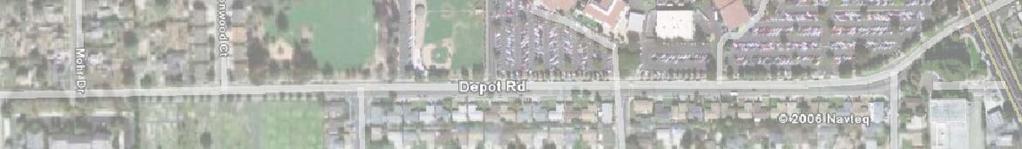
1 August 13, Douglas Horner, AIA Chabot Las Positas Community College District Hesperian Boulevard Hayward, California Subject: Geotechnical Recommendations, New Physical Education Building, Chabot College, Hayward, California Dear Mr. Horner: This letter updates LFR Inc. s (LFR s) Geotechnical Investigation and Design Report, Chabot College Expansion, Hayward, California, dated August 11, 2006 ( the August 2006 Report ). The purpose of this letter is to affirm that the recommendations contained in the August 2006 Report are appropriate for the new Physical Education (PE) Building (Building 4100, the Site ) to be constructed in the parking lot directly northeast of the campus swimming pool (Figure 1) and to provide updated seismic design parameters in conformance with the 2007 California Building Code. This letter supplements the August 2006 Report; it does not replace it. Project Description It is our understanding that the new building will be a two-story, approximately 7,900-square-foot (footprint) building. The structure will contain large-span open spaces for strength and fitness training and men s and women s locker rooms. The current design calls for supporting the building on spread footings. Subsurface Exploration and Existing Data The existing subsurface data for the building vicinity consist of two Cone Penetration Test (CPT) probes installed during LFR s subsurface exploration program conducted in June 2006 and Borings 17 and 20, installed by Woodward-Clyde in 1963 (see Appendix B of the August 2006 Report). As part of this effort, two CPT probes were advanced into the subsurface at the Site, one to 28 feet below ground surface (bgs) and one to 50 feet bgs. The CPT work was conducted on July 31, 2008 by LFR subcontractor, John Sarmiento and Associates. Logs of the CPT probes and the previous data applicable to the project are included as Appendix A. The locations of the subsurface explorations are shown on Figure 2 along with the proposed location of the building.
2 The subsurface conditions in the vicinity of the proposed PE Building are typical of conditions at Chabot College. The conditions generally consist of stiff to very stiff interbedded strata of clays and silts down to approximately 15 feet bgs overlying looser/softer clayey silts and silty clays. The Woodward Clyde borings show a similar soil profile (stiff to very stiff silty clay down to the water table at about 15 feet bgs overlying looser clayey silts). The water table was encountered at approximately 16 feet bgs on July 31, A 1-foot-thick stratum of fairly clean sands was encountered in the CPT probes between approximately 13 and 14 feet bgs. This stratum will likely be below the groundwater table at times during the year and could liquefy during a significant earthquake. The expected differential settlement due to liquefaction of this stratum is estimated to be less than 0.25 inch between column lines at the site surface. The clayey silt below 25 feet from ground surface has a Robertson soil behavior index (IC) greater than 2.6. An IC greater than 2.6 indicates these clayey silts are non-liquefiable (Robertson and Wride 1998). Recommendations 2007 California Building Code Seismic Design Parameters for Chabot College are presented in Table 1. Table California Building Code Seismic Parameters, Chabot College Physical Education Building (Building 4100), Hayward, California Parameters Longitude/Latitude SS S1 Value ºW by ºN g g Fa 1.0 Fv 1.5 Site Class D Allowable bearing capacities for spread footings are the same as those provided in the August 2006 Report. They are presented below for reference. ltr-geo_rpt_update-aug draft.doc:a 2
3 Table 2 - Allowable Bearing Capacities Chabot College, Physical Education Building (Building 4100), Hayward, California Loading Dead Dead + Live Dead + Live + Seismic or Wind Allowable Bearing Pressure 2000 psf 3000 psf 4000 psf The bearing surface for the footings should be at least 2 feet below the bottom of the adjacent soil surface. All footings should be a minimum of 18 inches wide. Footing concrete should be poured neat against undisturbed native soil. Any disturbed or softened material encountered at the bottom of the footing excavations should be removed to expose firm bearing material. Overexcavated areas should be backfilled with imported fill (see Section 7.8 of the August 2006 Report). The imported fill should be placed in lifts no thicker than 8 inches loose. The loose lifts should then be compacted to at least 95% of the maximum dry density as determined from the Modified Proctor Test (ASTM D 1557 latest version) at ±2% of the optimum water content. Footing excavations should be kept moist before concrete placement. Subgrade Preparation Uncontrolled fill below the asphalt parking lot should be excavated to native soils. If the excavated soils are not suitable for moisture conditioning and recompaction (if they have too many organics/foreign matter or too high a clay content for example), then the excavated soil should be replaced with imported fill. The imported fill should meet the requirements of Section of the August 2006 Report. There are a number of existing trees within the footprint of the new building. The trees should be removed, including the root balls, such that no root left in the building footprint is greater than 0.75 inch in diameter. The resulting excavation should be backfilled in accordance with Section of the August 2006 Report. Following excavation to the required grades, soil subgrades in areas to receive slabs should be scarified to a depth of at least 6 inches, all lumps greater than 3 inches in any dimension removed, moisture conditioned to slightly above optimum moisture content, and compacted to minimum 90% relative compaction 1 at a water content at least 3% greater than the subgrade s optimum water 1 Optimum moisture content determined using the methodology documented in the latest version of ASTM Method D ltr-geo_rpt_update-aug draft.doc:a 3
4 content. The compacted surface should be firm and unyielding and should be protected from damage caused by traffic or weather. Soil subgrades should be kept moist during construction. If the subgrade is allowed to become dry, it should be moisture conditioned to eliminate shrinkage cracks and recompacted. In order to achieve satisfactory compaction of the subgrade and fill materials, it may be necessary to adjust the water content at the time of construction. This may require that water be added to soils that are too dry, or that scarification and aeration be performed in soils that are too wet. There are a number of recommendations in the August 2006 Report for mitigating potential differential movements due to expansive clays potentially present at the Site. The recommendations include: Native soils receiving foundation elements should be compacted at least 3% wet of optimum to between 90 and 93% of the maximum dry density of the soil. Landscape plantings and irrigation systems should be planned so that watering of beds or lawns does not introduce water to the building foundation and drying of the foundation due to withdrawal of water by roots from large plants near the building perimeter does not occur. Plant trees a distance greater than their mature height from the foundation. All utility trenches that extend below building slabs should be backfilled with a low permeability plug of clay to reduce the chances of the utility backfill channeling water under the building. The clay plugs can be composed of compacted clayey soil, compacted bentonite, or a bentonite-cement or sand-cement slurry mixture. Each plug should be at least 2 feet thick (one foot on either side of the foundation) and should extend at least 2 feet beyond the edges and bottom of the trench to key in. The plugs should also extend to within 1 foot of the lowest adjacent grade and should extend below the curb and gutter. Efforts should be made to prevent water from infiltrating the subsurface next to the buildings. Precipitation onto the buildings must be collected and channeled from the buildings to storm drains. Any landscaping areas adjacent to the buildings should be sloped at least 2% away from the buildings (2.5 inches in 10 feet). The geotechnical engineer should observe and approve the subgrade. Moisture Barrier: Capillary Break/Vapor Retarder LFR recommends that moisture-sensitive foundations in direct contact with the subsurface be underlain by a moisture barrier. A typical moisture barrier should include a capillary moisture break consisting of at least 4 inches of clean, free-draining gravel or crushed rock (1/2- to 3/4-inch gradation) overlain by a moisture-proof membrane (the vapor retarder) at least 10 mils thick. The vapor retarder should be covered with 2 inches of sand to aid in curing the concrete and to protect the vapor retarder during slab construction. Water should not be allowed to accumulate in the capillary break or sand before the slab is cast. ltr-geo_rpt_update-aug draft.doc:a 4
5 The vapor retarder should meet the requirements for Class C vapor retarders as given in ASTM Standard E The vapor retarder should be installed in general accordance with the methodology documented in ASTM Standard E These requirements include overlapping seams by at least 6 inches, taping seams, and sealing any penetrations through the vapor barrier. The particle size of the gravel/crushed rock and sand should meet the gradation requirements presented in Table 3. Table 3 - Gradation Requirements of Capillary Moisture Break, Chabot College Physical Education Building (Building 4100), Hayward, California Sieve Size Percentage Passing Sieve Gravel or Crushed Rock 1 inch /4 inch /2 inch /8 inch 0-6 Sand No No The sand overlying the membrane should be moist at the time when the concrete is placed. There should be no free liquid in the sand. If the sand has been placed and there is a possibility of precipitation, the sand should be covered with plastic and measures be made available to collect the precipitation and remove it from the excavation. Limitations The opinions and recommendations presented in this report are based upon the scope of services, information obtained through the performance of the services, and the schedule as agreed upon by LFR and the party for whom this report was originally prepared. This report is an instrument of professional service and was prepared in accordance with the generally accepted standards and level of skill and care under similar conditions and circumstances established by the geotechnical consulting industry. No representation, warranty, or guarantee, express or implied, is intended or given. To the extent that LFR relied upon any information prepared by other parties not under contract to LFR, LFR makes no representation as to the accuracy or completeness of such information. This report is expressly for the sole and exclusive use of the party for whom this report was originally prepared for a particular purpose and only in its entirely. Only the party for whom this report was originally prepared and/or other specifically named parties have the right to ltr-geo_rpt_update-aug draft.doc:a 5
6 make use of and rely upon this report. Reuse of this report or any portion thereof for other than its intended purpose, or if modified, or if used by third parties, shall be at the user s sole risk. Furthermore, nothing contained in this report shall relieve any other party of its responsibility to abide by contract documents and applicable laws, codes, regulations, or standards. Subsurface Explorations and Testing Results of any observations, subsurface exploration or testing, and any findings presented in this report apply solely to conditions existing at the time when LFR s exploratory work was performed. It must be recognized that any such observations and exploratory or testing activities are inherently limited and do not represent a conclusive or complete characterization. Conditions in other parts of the Site may vary from those at the locations where data were collected and conditions can change with time. LFR s ability to interpret exploratory and test results is related to the availability of the data and the extent of the exploratory and testing activities. The findings and recommendations submitted in this report are based, in part, on data obtained from subsurface CPT probes at specific, discrete sampling locations. The nature and extent of variation between these test locations, which may be widely spaced, may not become evident until construction. If variations are subsequently encountered, it will be necessary to reevaluate the conclusions and recommendations of this report. Correlations and descriptions of subsurface conditions presented in boring logs, test pit logs, subsurface profiles, and other materials are approximate only. Subsurface conditions may vary significantly from those encountered in borings and sampling locations and transitions between subsurface materials may be gradual or highly variable. Conditions at the time water-level measurements and other subsurface observations were made are presented in the boring logs or other sampling forms. These field data have been reviewed and interpretations are provided in this report. However, groundwater levels may be variable and may fluctuate due to variations in precipitation, temperature, and other factors. Therefore, groundwater levels at the Site at any time may be different than stated in this report. Review In the event that any change in the nature, design, or location of the proposed structure(s) is planned, the conclusions and recommendations in this report shall not be considered valid nor relied upon unless the changes are reviewed and the conclusions and recommendations of this report are modified or verified in writing. LFR should be provided the opportunity for a general review of final design plans and specifications to assess that our recommendations have been properly interpreted and included in the design and construction documents. ltr-geo_rpt_update-aug draft.doc:a 6

7 Construction To verify conditions presented in this report and modify recommendations based on field conditions encountered in the field, LFR should be retained to provide geotechnical engineering services during the construction phase of the project. This is to observe compliance with design concepts, specifications, and recommendations contained in this report, and to verify and refine our recommendations as necessary in the event that subsurface conditions differ from those anticipated prior to the start of construction. Closure If you have questions or comments regarding this letter or the results of the analyses, feel free to call me at any time at (510) Thank you for selecting LFR to perform these analyses. Sincerely, Jeffery R. Raines, PE (51120) GE (2762) Principal Geotechnical Engineer Enclosures Attachments Figures 1-2 Appendix A References LFR Inc. (LFR) Geotechnical Investigation and Design Report, Chabot College Expansion, Hayward, California. August 11. NAVFAC Design Manual 7.02, Foundations and Earth Structures. Table 1, Page 63. Robertson, Paul, and CE (Fear) Wride Evaluating cyclic liquefaction potential using the cone penetration test. Canadian Geotechnical Journal. Vol.35 No. pp Woodward-Clyde Soil Investigation for the Proposed Chabot College, Hesperian Boulevard and Depot Road. July 25. ltr-geo_rpt_update-aug draft.doc:a 7
8 This Page Intentionally Left Blank for Double-Sided Copying Purposes


9
10 This Page Intentionally Left Blank for Double-Sided Copying Purposes
11
12 This Page Intentionally Left Blank for Double-Sided Copying Purposes
13 APPENDIX A CPT Probe Logs and Boring Logs
14 Page intentionally left blank for double-sided copying purposes
15 LFR 2008 CPT Probe Logs
16 This Page Intentionally Left Blank for Double-Sided Copying Purposes
17
18 This Page Intentionally Left Blank for Double-Sided Copying Purposes
19
20 This Page Intentionally Left Blank for Double-Sided Copying Purposes
21 LFR, Inc. cpts by John Sarmiento & Associates
22 LFR, Inc. cpts by John Sarmiento & Associates
23 LFR, Inc. cpts by John Sarmiento & Associates
24 LFR, Inc. cpts by John Sarmiento & Associates
25 LFR, Inc. cpts by John Sarmiento & Associates
26 LFR, Inc. cpts by John Sarmiento & Associates
27 LFR 2006 CPT Probe Logs
28 This Page Intentionally Left Blank for Double-Sided Copying Purposes
29
30 This Page Intentionally Left Blank for Double-Sided Copying Purposes
31
32 This Page Intentionally Left Blank for Double-Sided Copying Purposes
33
34 This Page Intentionally Left Blank for Double-Sided Copying Purposes
35
36 This Page Intentionally Left Blank for Double-Sided Copying Purposes
37 Woodward Clyde 1963 Soil Boring Logs
38 This Page Intentionally Left Blank for Double-Sided Copying Purposes

39
40 This Page Intentionally Left Blank for Double-Sided Copying Purposes

41

42