REPORT TO THE CHIEF ADMINISTRATIVE OFFICER FROM THE DEVELOPMENT AND ENGINEERING SERVICES DEPARTMENT
|
|
|
- Hubert Wood
- 5 years ago
- Views:
Transcription
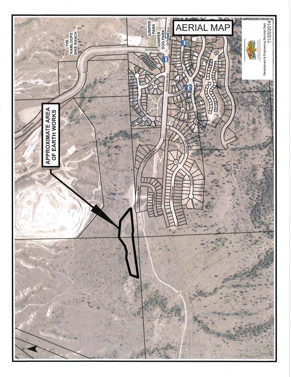
1 November 26, 2014 REPORT TO THE CHIEF ADMINISTRATIVE OFFICER FROM THE DEVELOPMENT AND ENGINEERING SERVICES DEPARTMENT ON DEVELOPMENT PERMIT APPLICATION NO. DPM QU'APPELLE BOULEVARD OWNER: JUNIPER WEST DEVELOPMENTS APPLICANT: TRUE CONSULTING PURPOSE To issue a Development Permit to allow the earthworks necessary for a residential subdivision in the South Thompson Silt Bluffs Red Zone Development Permit Area. SUMMARY The subject property comprises portions of two very large parcels of land, approximately 2.5 ha in area, located near the west end of Juniper Ridge. On September 30, 2014, Council approved bylaws to amend the Official Community Plan designation of the subject property from Agricultural and Special Development Area to Urban, and to rezone the property from FD (Future Development) and A-1 (Agricultural) to RS-1S (Single Family Residential - Suite). As the property is located in the Backset zone of the South Thompson Silt Bluffs Red Zone (Attachment "A"), a Development Permit is required prior to undertaking the earthworks necessary for the creation of a new residential subdivision. The South Thompson Silt Bluffs Red Zone has been identified as possessing significant and extensive silts in and adjacent to the bluffs bordering the South Thompson River. As substantial harm and/or damage could result from development in the area, the South Thompson Silt Bluffs Red Zone Development Permit Area was established to regulate development in the area so as to protect it from the identified hazardous condition. Development Permits are to be issued in accordance with a geotechnical report that defines the surficial, geologic materials, and groundwater regime; defines the hazard zones; and recommends criteria for development, such that potential hazards are eliminated or accommodated. In this instance, the applicant has submitted a geotechnical report by Telford Geotechnical Ltd. (Attachment "B"). The soil on the subject properties is described as topsoil over glacio-fluvial sand and gravel, then glacial till with loose silt. According to the geotechnical report, groundwater was not encountered in on-site test pits, but may develop during the wetter months or after periods of prolonged precipitation. The slope stability hazard was identified as being extremely low, and development of the property was assessed as being feasible subject to compliance with the recommendations outlined in the report. Key recommendations to allow development on the subject properties include: Removal of any topsoil, fill, loose, and unstable soils to expose a compact subgrade and using engineered fill for any grade reinstatement beneath the site; Compaction of fills to appropriate standards, as described in the report; T:\DES\PLAN & DEV\REP\2014\DPM00510.docx 16
2 DEVELOPMENT PERMIT APPLICATION NO. DPM00510 November 26, 2014 Page 2 Provision of a polyethylene moisture barrier and 100 mm of clean gravel fill under the floor slab and appropriate compaction of grading fills under floor slab; Use of a perimeter drain for all below grade interior spaces, connected to municipal storm system or daylighted by gravity to the rear of the lots; Geotechnical approval for any reuse of excavated natural materials as engineered fill; Proof-rolling road subgrades to locate soft areas and loose zones and taking appropriate measures to obtain required density; Meeting the minimum asphalt pavement structure and construction requirements for roads described in the report; and Undertaking field reviews during phases of construction prescribed in the report. After reviewing the submitted geotechnical report (Attachment "A"), the Development and Engineering Services Department is of the opinion that the proposal meets the South Thompson Silt Bluffs Red Zone Development Permit Area Guidelines and can be safely built upon. Accordingly, staff support the application and advises Council to proceed as outlined in the recommendation. RECOMMENDATION: That Council authorize the issuance of a Development Permit for a portion of the Southeast 1/4 of Sec. 3, Twp. 20, Rge. 17, W6M, K.D.Y.D., Except Plans B5102, and EPP42057 (1920 Qu'Appelle Boulevard), and a portion of That Part of the South West 1/4 of Sec. 3, Twp. 20, Rge. 17, W6M, K.D.Y.D., outlined Red on Plan CB 2196 (no address), to allow development in accordance with the geotechnical report shown as Attachment "A". COUNCIL POLICY There is no applicable Council policy. SITE CONDITIONS AND BACKGROUND Neighbourhood - Juniper KAMPLAN Designation - Urban Current Zoning/Use - RS-1S (Single Family Residential - Suite) Proposed Variance - n/a Surrounding Uses - New residential subdivisions to south and undeveloped hillside to the west, north, and east. Application Date - October 20, 2014 Restrictive Covenant - n/a Project Evaluation Team (PET) - October 31, 2014 Parcel Size - Approximately 2.5 ha MOTI Referral - n/a T:\DES\PLAN & DEV\REP\2014\DPM00510.docx 17

3 DEVELOPMENT PERMIT APPLICATION NO. DPM00510 November 26, 2014 Page 3 M. Kwiatkowski, P.Eng. Development and Engineering Services Director Approved for Council Consideration: Author: S. Bentley, MCIP, RPP, Planner Reviewed by: E. Beach, MCIP, RPP, Planning and Development Supervisor SB/dla Attachment T:\DES\PLAN & DEV\REP\2014\DPM00510.docx 18
4 19

5 20

6 21
7 22
8 23
9 24
10 25
11 26

12 27