MONITORING LAND COVER CHANGE IN THE UPPER PART OF DONG NAI RIVER BASIN, VIETNAM BY USING REMOTE SENSING AND GIS
|
|
|
- Cody Powers
- 5 years ago
- Views:
Transcription


 Ho Chi Minh City")
1 International Meeting on Land Cover and Emissions in South and Southeast Asia Ho Chi Minh City, October 2016 MONITORING LAND COVER CHANGE IN THE UPPER PART OF DONG NAI RIVER BASIN, VIETNAM BY USING REMOTE SENSING AND GIS Pham Hung 1, Ho Quoc Bao 2, Vo Le Phu 2, Le Van Trung 2 and Nguyen Van Minh Man 2 (1) Department of Natural Resources & Environment (DONRE), Lam Dong Province (2) Ho Chi Minh City University of Technology (HCMUT) VNU

2 Dong Nai River Basin is the largest entire river basin located in the country s territory. Dramatic changes in land cover due to accelerated socioeconomic activities. Concentrated cascade hydropower and water infrastructure projects.

3 International Meeting on Land Use and Emissions on South and Southeast Asia, Ho Chi Minh City Oct 2016 La Nga River Cascade Hydropower Plants and Water Infrastructure in the main flow of the Dong Nai River Basin Be River Main Flow of Dong Nai


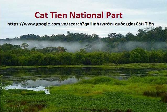
4 Cat Tien District, Lam Dong Province The Upper Dong Nai river basin 4


5 Located in the upper part of Dong Nai River basin, under the administrative boundary of Lam Dong Province. 5
6 Boundary of Lam Dong province Boundary of Study Area Study area: About 80% of areas of Lam Dong province (7,755/9,773 km 2 ) 6
7 The study area was divided into 16 sub-basins in terms of flow and topology and current land use. Sub-basin Overall topology Ave. Elevation (m) Land use Area (ha) Rate (%) Dong Nai 4 Highlands 714 Forest, annual crops Ta Pao Low mountain ran 587 Forest, industrial crops Dong Nai 6 Hill country 372 Forest, industrial crops Da Tam Highlands 1321 Forest, annual crops Dong Nai 5 Highlands 637 Forest, industrial crops Dong Nai 2 Highlands 907 Industrial crops, settlement, forest Dong Nai 3 Highlands 847 Forest, industrial crops Don Duong Highlands 1141 Forest, annual crops Cat Tien Hill country 285 Forest, industrial crops Da Quyn Highlands 978 Forest, annual crops Da Teh Low mountain ran 414 Forest, industrial crops Da Nhim Highlands 1500 Forest Da Huoai Low mountain ran 592 Forest, industrial crops Dai Nga High plateau 811 Industrial crops, forest Da Dang Highlands 987 Forest, industrial crops Others More than 5 sub-basins of which area has less than 5000 ha Total
8 The northeast: High mountains, belonging Langbiang plateau ( >1000 m) The middle: The low mountains belonging Di Linh plateau ( 700m -1000m) The southeast: Transition zone between the highlands and the plains (200m - 500m) 8
9 There are two seasons, the rainy season (May November) and dry season (December April) of the following year Tropical monsoon climate, affected by altitude The mean annual precipitation was 2,500 mm, and humidity was 83% (from ) 9

10 1. Acquisition of satellite images: Characteristics of Landsats Year Image Landsat_Scene_DI Resolution Date_Acquired 2001 Landsat-7 ETM LE SGS00 30x30m Landsat-5 TM LT BKT00 30x30m Landsat-5 TM LT BKT00 30x30m Landsat-8 OLI/TIRS LC LGN00 30x30m


11 2. Image classification processing: Geometric correction Sampling design Image classification (MLC - maximum likelihood classification) Post-classification change detection technique Sampling based Google Earth images by integrating ArcGoogle Tool with ArcGis
 types of land")
12 Image classification: Sixteen (16) types of land cover 12
13 Class I Class II Description Water Water bodies_turbidity and bodies Water bodies_clear Residential area Post-Classification: Combined classes Residential area Natural (lakes, rivers, etc) or man-made water bodies (e.g. reservoirs). Urban and settlement areas; Roads and built-up (roads, built-up areas and other transport, industrial and commercial infrastructures); Mining (Land used for extractive subsurface and surface mining activities). 13
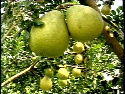
14 Class I Class II Description Agricultural land_ Others Forest Post-Classification: Combined classes Agricultural _Coffee, Agricultural _Opened Land, Agricultural _Plastic House, and Bareland Bamboo Forest, Coniferous Forests, Evergreen_Broadleaf Forests, Mixed Broadleaf & Coniferous Forests, Mixed Wood Bamboo Forest; Clouds, Cloud shadows Mix of agricultural rand uses; Land under cultivation; Miscellaneous tree crops (e.g. coffee, tea trees), orchards and pasture); Bare land (exposed soil, sand, or rocks). All types of forests (Evergreen Broadleaf Forests, Coniferous Forests, Mixed Forests, Bamboo Forests, etc.). Clouds, Cloud shadows (almost areas where were covered by clouds, cloud shadows were stable forests). 14
15 Post-Classification: Combined classes Kala Reservoir Type of Land cover 2001 Water bodies Residential area Agricultural_ Other land Forest Total Area (ha) Per. (%) Type of Land cover 2007 Water bodies Residential area Agricultural_ Other land Forest Total Area (ha) Per. (%)
 10276 28832 371375 365113 775596 Per. (%) 1.32 3.72 47.88 47.08 100.")
16 Post-Classification: Combined classes Dong Nai-3 HP (340 MW, operated in 2011); Da Dang HP (34 MW, operated in 2011); Dai Ninh HP (300 MW, operated in 2008); DamBri HP (75 MW, operated in 2013); Type of Land cover 2011 Water bodies Residential area Agricultural_ Other land Forest Total Area (ha) Per. (%) Type of Land cover 2016 Water bodies Residential area Agricultural_ Other land Forest Total Area (ha) Per. (%)
17 Classification Accuracy Summary of combined classification accuracies for 2001, 2007, 2011 and User (%) Prod. (%) User (%) Prod. (%) User (%) Prod. (%) User (%) Prod. (%) CLASS NAME Water bodies Residential area Agricultural land & Other land Forest OA 96.9% OA 99.1% OA 95.0% OA 96.7% Kappa Kappa Kappa Kappa
 Rate (%) Water bodies 11,862 1.")
18 Classification Accuracy Comparison of classification accuracy to statistic data of the local authority Types of Land cover 2016 Area (ha) Per. (%) Water bodies Residential area 28, Agricultural land_ Others 372, Forest 365, Total 775, Types of Land cover Area (ha) Rate (%) Water bodies 11, Beyond forest land (Agricultural, Residential land, Bare land, ) 385, Forest 378, Special forests (National Park) 41, Protective forest 121, Production forest 215,
 2015 (ha) 2020 (ha) Per. (%) 2020 Other land 503054 589654 420404 43.")
19 Classification Accuracy Comparison of classification accuracy to statistic data of the local authority Types of Land cover 2016 Area (ha) Per. (%) Water bodies Residential area Agricultural land_others Forest Total Types of Land Use 2010 (ha) 2015 (ha) 2020 (ha) Per. (%) 2020 Other land Forest Total
20 Change Detection 2016 Water bodies Residential area Agri land_ Others Forest Row Total Class Total Water bodies Residential area Agri & Other land Forest Class Total Class Changes Image Difference

 in the period 2007-2011; Stable in period 2011")
, the forest")
.")
21 Change Detection The results showed that forest areas: Decreased 37,150 ha (4.79%) in the period ; Decreased 5,765 ha (2.03%) in the period ; Stable in period (4 years): 365,113 ha/365, 266 ha. Total change in 15 years ( ), the forest area in upper part of Dong Nai basin has been reduced 52,762 ha (6.8%). Hydropower Plantation (Rubber) Plantation (Coffee) Water Infrastructure 21
22 Change Detection Dong Nai-3 Dong Nai-5 Major Change Sub-basin Total Unchanged Total Change Forest Water bodies Change (ha) Forest Residential area Forest Agricultural land_others Area (ha) Rate (%) Area (ha) Rate (%)
23 Change Detection Major Change Sub-basin Total Unchanged Change (ha) Total Forest Water Forest Forest Agricultural Change bodies Residential area land_others Da Teh Area (ha) Rate (%) Cat Tien Area (ha) Rate (%) Da Huoai Area (ha) Rate (%)


; - Dong")


24 Change Detection The causes of deforestation in these areas were due to hydropower and agricultural practices - Da Siat-3 HP (13.5 MW, operated in 2009); - Dong Nai-3 HP (340 MW, operated in 2011); - Dong Nai-4 HP (150 MW, operated in 2012); - Dong Nai-5 HP (150 MW, operated in 2015) Conversion of forests to agricultural land and rubber plantations of the Government program since
 17131 15975 1156 1 7 1149 Rate (%) 100.00 93.25 6.75 0.00 0.04 6.71 Da Nhim Area (ha) 71939 67102 4952 125 67 4645 Rate (%) 100.00 93.28 6.88 0.17 0.09 6.")
25 Change Detection Minor Change Sub-basin Total Unchanged Change (ha) Total Forest Forest Forest Agricultural Change Water bodies Residential area land_others Dong Nai-6 Area (ha) Rate (%) Da Nhim Area (ha) Rate (%)

26 Change Detection Minor Change 26
27 The accuracy of classification results was quite high, the OAs of combined classification for 2001, 2007, 2011 and 2016 were 96.90%, 99.09%, 95.00% and 96.76%, respectively. The forest area of study basin has been reduced 52,762 ha (6.8%) over the past 15 years. The highest rate of deforestation loss was in the period (6 years) with 37,150 ha (4.79%). Dong Nai-3 sub-basin had the highest deforestation rate with 32.3% compared to the others. Significant changes in land cover have taken place in some sub-basins as a result of conversion of forests to agricultural land and rubber plantations of the Government and hydropower development projects.

28 Thank You for Your Attention!