Public Notice ISSUED: July 17, 2014 EXPIRES: August 17, 2014
|
|
|
- Cameron Goodwin
- 5 years ago
- Views:
Transcription

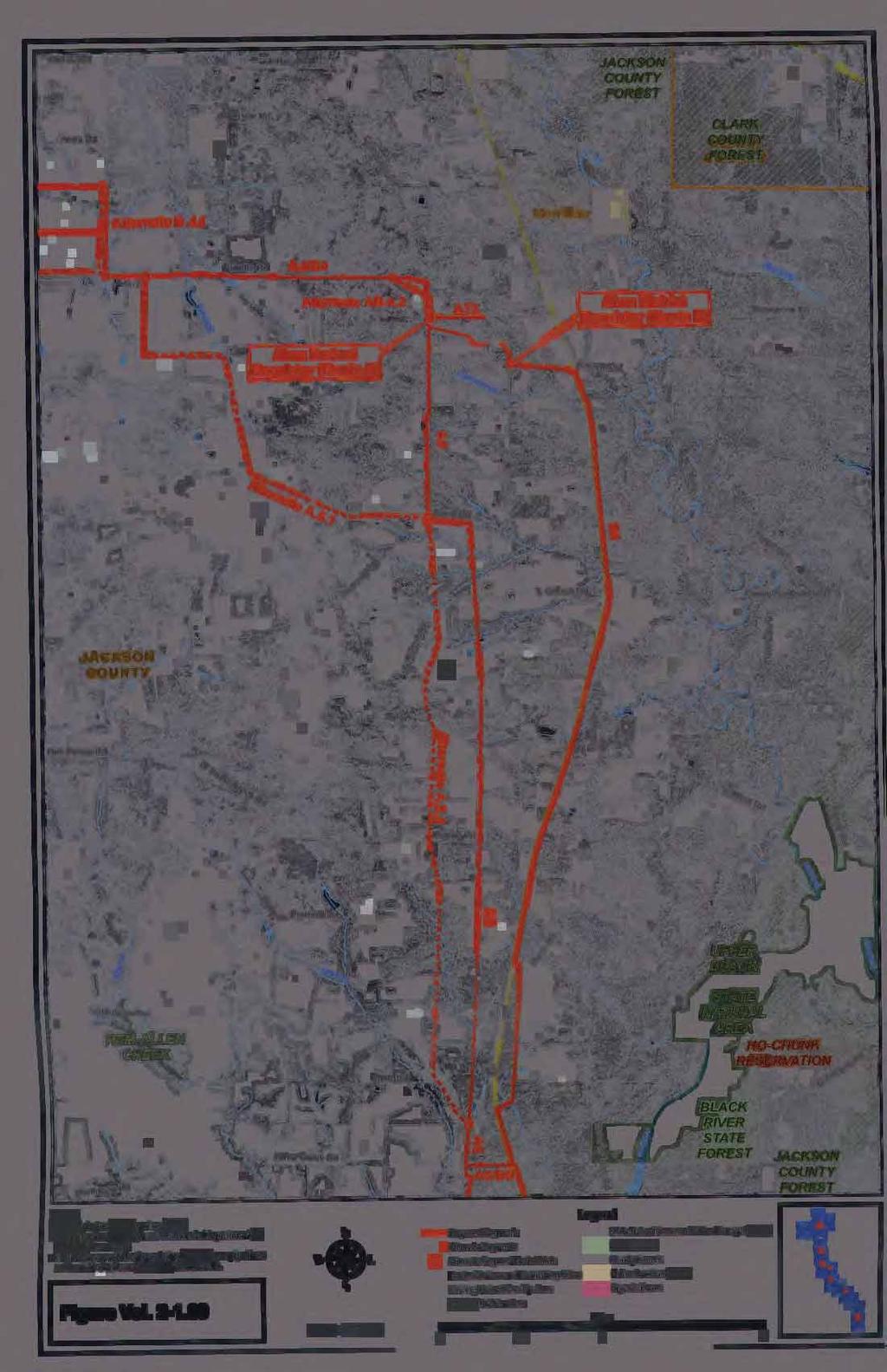
1 APPLICANT: Wisconsin Gas, LLC Public Notice ISSUED: July 17, 2014 EXPIRES: August 17, 2014 REFER TO: MVP KDZ SECTION: Clean Water Act SECTION: 10 - Rivers and Harbors Act 1. APPLICATION FOR PERMIT TO discharge dredged and fill material into approximately acres of wetlands and 168 linear feet of waterways at multiple locations in west central Wisconsin for the construction of a new underground natural gas pipeline. In addition, the project would involve a crossing beneath the Black River, a navigable water of the U.S. 2. SPECIFIC INFORMATION. APPLICANT'S ADDRESS: AGENT: Mr. Eric Parker Wisconsin Gas, LLC 333 West Everett Street, Environmental A231 Milwaukee, Wisconsin AGENT S ADDRESS: Stantec Consulting Services, Inc. 209 Commerce Parkway P.O. Box 128 Cottage Grove, Wisconsin PROJECT LOCATION: (Eau Claire, Clark, Jackson, Monroe Counties, Wisconsin) The project would begin from a proposed interconnect with the Viking Gas Transmission Company pipeline (Viking pipeline) in Eau Claire or Clark County and run south, including delivery points to Wisconsin Gas existing distribution networks in the City of Augusta, Town of Hixton, Town of Alma, City of Black River Falls, and ending at the City of Tomah. The project would also provide new natural gas service to the Village and Town of Fairchild; the Towns of Foster and Mentor (Clark County); the Towns of Cleveland, Garden Valley, Manchester, and Millston (Jackson County); and the Village of Warrens and the Towns of Grant and Lincoln (Monroe County). Please refer to the attached public notice figures for detailed project location maps. DESCRIPTION OF PROJECT: Wisconsin Gas LLC (WG) proposes to construct an underground natural gas pipeline lateral and several new district regulator stations to ensure reliability and fulfill future firm sales demand requirements to its service areas in west central Wisconsin. This project is referred to as The West Central Lateral (WCL). Within the next few years, WG anticipates a shortage of natural gas transportation capacity to fulfill the firm sales demand requirements within this service area. After investigating alternatives to meet this projected capacity shortfall, WG has determined that the proposed WCL is the best solution to enable the public utility to maintain the capacity required to meet firm sales requirements in this area.
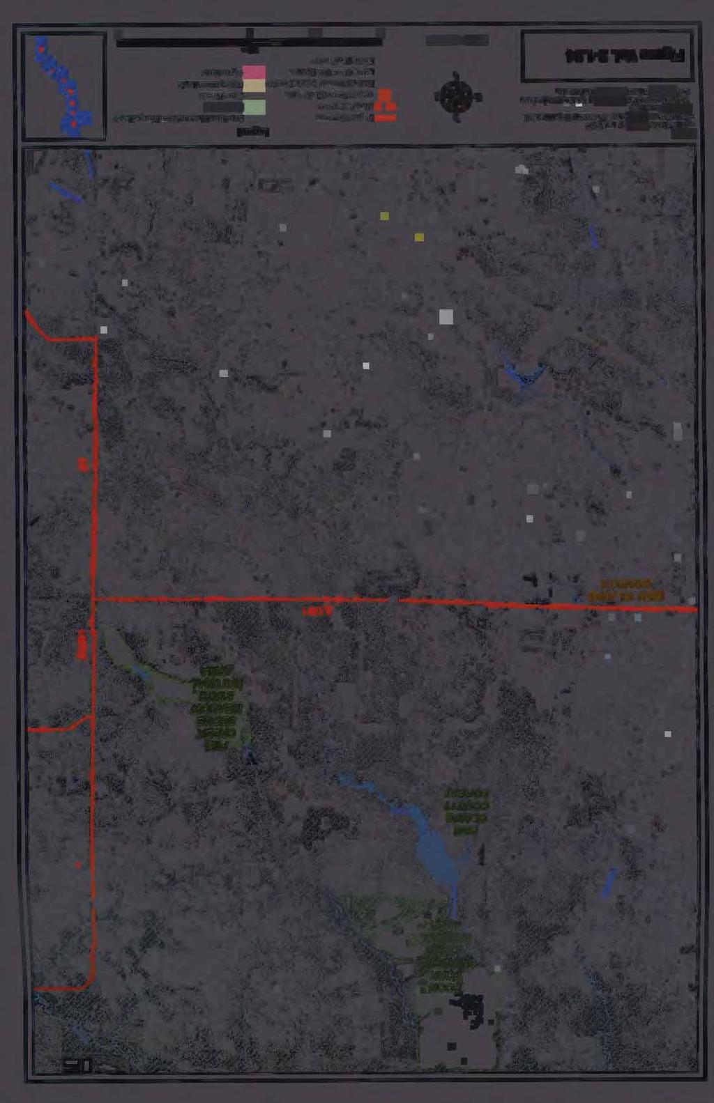
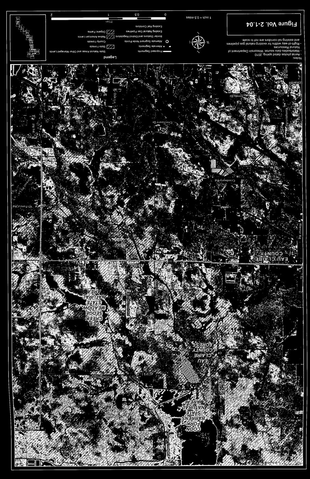
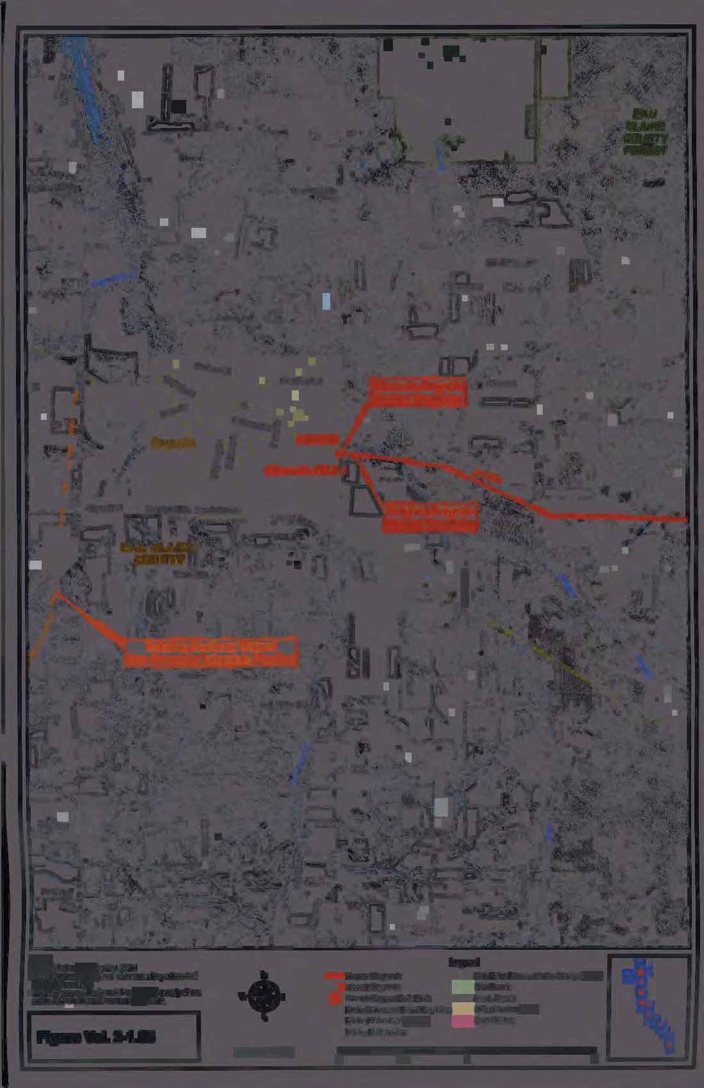
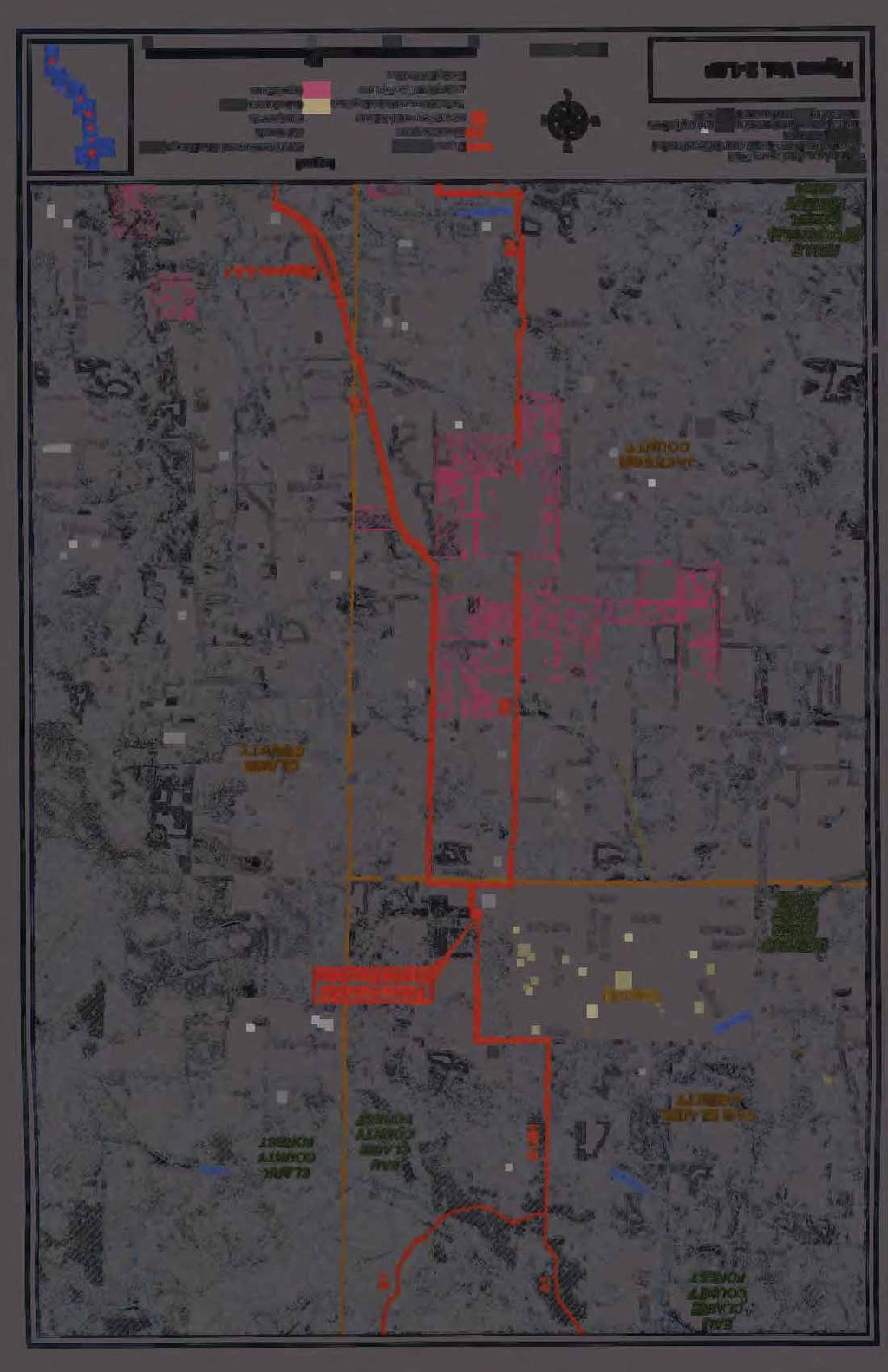
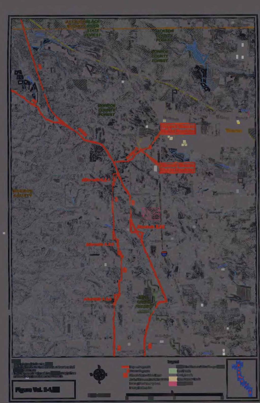
2 Operations - Regulatory ( KDZ) SUBJECT: Notice of Application for Permit WG has identified Route A as the preferred alternative for their Department of the Army permit application. However, route selection for the WCL is the responsibility of the Public Service Commission of Wisconsin (PSC) and is being evaluated for a certificate of authority (CA) to authorize construction of the WCL. Please refer to section 5 of this public notice for additional information concerning the PSC CA process. Route A of the WCL would extend from the Viking pipeline town border station (TBS) to downstream district regulator stations (DR) and is proposed to operate at a maximum allowable operating pressure of 475 psig (pound per square inch gauge) with a design pressure of 720 psig. Approximately 39.9 miles of 16-inch steel pipe would extend from the proposed Viking TBS to the proposed Black River Falls DR. Approximately 33 miles of 12-inch steel pipe would extend from the proposed Black River Falls DR to the proposed Tomah DR. In addition to the 16-inch and 12-inch steel pipe, there would also be smaller diameter branches at the same pressure extending to the proposed Augusta DR, Hixton DR, and Warrens DR. The proposed Augusta branch consists of approximately 7 miles of 6-inch steel pipe. The proposed Hixton branch consists of approximately 3 miles of 4-inch steel pipe. The proposed Warrens branch would consist of approximately 0.9 miles of 4-inch steel pipe. The 16-inch and 12-inch main is proposed to be within landowner easement. This would reduce the risk of conflict with other utilities or road improvement projects in the future. Typically, WG would seek a 50 wide permanent easement. In certain instances the permanent easement may be reduced to avoid existing above ground structures or other above ground appurtenances. There are short distances where the main is proposed to be within the road right-of-way (ROW) to avoid above ground structures that are in close proximity to the road ROW. In these cases, no permanent easement is needed. In agricultural areas, a 50 temporary easement for construction would generally be requested in addition to the permanent easement. In all other areas such as wetlands, forests, and populated/developed areas a 25 temporary easement for construction would generally be requested in addition to the permanent easement to reduce the impact to the forests, wetlands, and landowners. Where the main is adjacent to a road and the landscape is wetland or forested, it is generally proposed that the road ROW be used as temporary workspace during construction. In sum, the total project length of Route A would be approximately 86 miles. A total of 622 acres (386 acres permanent and 236 acres temporary) of new ROW would be required. Approximately 169 acres of new right-of-way would overlap with existing roadway, railroad, and utility line right-of-way. The upland communities include agricultural lands within existing and new ROW ( acres), nonagricultural uplands on existing and new ROW ( acres), upland forest on existing ROW (20.44 acres) and upland forest on new ROW ( acres). Wetland communities impacted by Route A include forested and shrub swamp wetlands within existing and new ROW (9.22 acres) and other wetland types on existing and new ROW (20.94 acres). In addition to the wetland communities, the pipeline would be installed via open-trench methods across 32 waterways utilizing 32 temporary clearspan bridges. Approximately 80 miles of the pipeline would be constructed by using the open-cut trench method and approximately 6 miles utilizing Horizontal Directional Drilling (HDD). WG proposes to avoid disturbance to 61 high quality wetland areas and 31 waterways by installing the pipeline via HDD at select locations. Segment A6 of the project would involve an HDD crossing beneath the Black River, a navigable water of the U.S. Other methods which would be used for 2
3 Operations - Regulatory ( KDZ) SUBJECT: Notice of Application for Permit crossing aquatic resources or man-made features include wet trenching, the dam and pump method, the dry flume method, or the jack and bore (auger boring) method. ALTERNATIVES CONSIDERED: Due to the size, length and linear nature of this large utility project, the applicant states that complete avoidance of impacts to wetlands and waterways would not be practicable. The following measures would be implemented to avoid and minimize impacts to wetlands and waterways to the greatest extent practicable: Project alignments and segments were designed or modified early in the planning process to avoid and minimize wetland and waterway impacts. Restore all wetland and waterways (impacted by trenching) to pre-project elevations following pipeline installation to result in no permanent loss of wetland acreage. Comprehensive restoration, seeding, invasive species, and monitoring plans have been prepared by the applicant to promote quality re-establishment of the wetlands and waterways proposed to be impacted. The construction disturbance zone would be kept to the minimum width needed to complete the work. Routes were designed with the minimum amount of permanent and temporary easement or workspace needed to install the pipeline. A 75-foot wide construction corridor with a 50- foot wide permanent easement is proposed to be used at wetland/waterway crossings. This is reduced from the standard 100-foot wide construction corridor. For the open-trench construction method, the size of the trench would be kept to the minimum dimensions needed to safely install the pipe. Typically, the size of the trench would be approximately 4 feet wide by 6 feet deep. Construction staging areas (laydown yards), access roads, and other temporary work spaced have been planned and located to avoid or minimize wetland and waterway impacts. Utilize HDD method of pipeline construction to avoid impacts high quality waterways and wetlands. Timber or composite matting, low ground-pressure vehicles and/or other acceptable methods or equipment would be used to cross wetlands when the ground is unfrozen, when wetland soils are unstable and/or seasonal conditions require (i.e., wet conditions or time of year). Utilize ice roads to cross unstable wetlands during winter construction to minimize disturbance. The following project alternatives were provided by the applicant to accomplish the project purpose: Alternative 1- Route A (Preferred): Route A, would begin at the Viking TBS just north of Fairchild and meander for 86.3 miles to the southeast to the connection point at the Tomah DR. This alternative would result in impacts to acres of wetlands and 168 linear feet of waterways along the entire 3
4 Operations - Regulatory ( KDZ) SUBJECT: Notice of Application for Permit project corridor. Route A would require a HDD pipeline crossing beneath the Black River, a navigable water of the U.S. Alternative 2- Route B: Route B would begin just east of the proposed starting location of Route A and meander southeast for 89.1 miles to the connection point at the Tomah DR. The alignment for Route B would generally fall just to the west of Route A for the majority of the project. Route B would result in approximately 53.4 acres of wetland impacts and trenching across 43 waterways totaling 179 linear feet of impact. This alternative is not the applicants preferred alternative as it results in additional cost, a longer overall project corridor and increased aquatic resource impacts. Route B would require a HDD pipeline crossing beneath the Black River, a navigable water of the U.S. Alternative 3-Route AB: Route AB would be a hybrid project route containing a combination of the individual segments of Route A and Route B to accomplish the project purpose. This alternative would be a result of the PSC ordering an overall project alignment that finds certain segments of Routes A and B are within the public s best interest and/or would further reduce environmental and individual landowner impacts. QUANTITY, TYPE, AND AREA OF FILL: Dredged and fill materials (i.e. soil, rock, sand) would be generated from native soils along the project alignment during construction activities associated with the open cut trench or HDD connection pit (depending on the specific site) method of pipeline installation. Dredged and fill materials would be temporarily side cast in wetlands during the installation of the gas pipeline, and placed back into the bore pit or trench to restore pre-project grades once the pipeline has been installed. The proposed project (route A) would result in approximately acres of temporary wetland impacts (approximately 3.62 acres of forested and shrub swamp wetlands would be permanently converted to wet meadow wetland) to the following plant communities; sedge meadow, fresh wet meadow, degraded wet meadow, shallow open water, shrub swamp (shrub-carr or alder thicket), farmed wetland, wooded swamp (coniferous or hardwood), bog (coniferous or open), and floodplain forest. VEGETATION IN AFFECTED AREA: The project would span over several landscape transitions, covering a wide variety of vegetation types. Near the Viking pipeline interconnection, the project area is heavily forested consisting of northern mixed hardwoods and large pockets of jack pine/ pin oak forests. The project area between Fairchild and Black River Falls generally consists of more agriculturally based plant species as this area is dominated by agricultural lands mixed with fewer large wooded tracts of land. Between Black River Falls and Warrens, the plant community is largely comprised of large jack pine/ pin oak forests, cranberry marshes and interspersed shallow marsh, wet meadow, shrub swamp, and forested wetlands. SOURCE OF FILL MATERIAL: Fill material would be generated along the project alignment from existing soils. Extensive use of timber construction mats would also occur. SURROUNDING LAND USE: The project would be located near the communities of Augusta, Fairchild, Alma Center, Black River Falls, Warrens, and Tomah. The land use along the project corridor is predominantly rural with scattered residences and commercial properties, undeveloped lands, county and state forest lands, and agricultural lands. 4
5 Operations - Regulatory ( KDZ) SUBJECT: Notice of Application for Permit THE FOLLOWING POTENTIALLY TOXIC MATERIALS COULD BE USED AT THE PROJECT SITE: Fuels, hydraulic fluid, lubricants, coolant and other fluids commonly used by construction equipment would be expected to be present for construction of the project. THE FOLLOWING PRECAUTIONS TO PROTECT WATER QUALITY HAVE BEEN DESCRIBED BY THE APPLICANT: The applicant would utilize standard construction best management practices, a stormwater management plan, and temporary and permanent erosion control measures to contain disturbed soils at the work site. In addition, the following methods would be used to minimize impairments to surface waters during construction: Wet trenching for crossing waterways Straw bale/filter bag dewatering structures Timber mats to reduce rutting Dam and pump for crossing waterways Dry flume for crossing waterways Horizontal directional drilling MITIGATION: No permanent loss of wetland acreage is proposed for this project. However, a permanent loss of function would occur by converting forested and shrub swamp wetland communities to wet meadow plant communities in permanently cleared right-of-way. A temporal loss of wetland function would occur within the temporary work space from clearing wooded and shrub swamp wetlands and allowing tree and shrub species to naturally re-generate. In addition, a temporal loss of wetland functions would occur during construction (trenching and wetland restoration activities). As compensation for the permanent and temporal loss of wetland functions associated with this project, the applicant is proposing to purchase in-kind wetland mitigation credits from two Corps approved wetland mitigation banks located within the same watersheds (Chippewa and Lower Wisconsin) and bank service areas as the proposed work in wetlands. 3. REPLIES/COMMENTS. Interested parties are invited to submit to this office written facts, arguments, or objections within 30 days of the date of this notice. These statements should bear upon the suitability of the location and the adequacy of the project and should, if appropriate, suggest any changes believed to be desirable. Comments received may be forwarded to the applicant. Replies may be addressed to Regulatory Branch, St. Paul District, Corps of Engineers, 1314 Contractor s Blvd., Plover, WI Or, IF YOU HAVE QUESTIONS ABOUT THE PROJECT, call Kyle Zibung at the Stevens Point (Plover) field office of the Corps, telephone number (651)
6 Operations - Regulatory ( KDZ) SUBJECT: Notice of Application for Permit To receive Public Notices by , go to: and add your information in the New Registration Box. 4. FEDERALLY-LISTED THREATENED OR ENDANGERED WILDLIFE OR PLANTS OR THEIR CRITICAL HABITAT. None were identified by the applicant or are known to exist in the permit area. However, Eau Claire, Clark, Jackson and Monroe Counties are within the known or historic range of the following Federallylisted threatened (T) and endangered (E) species: Species -Northern long-eared bat (Proposed as E) -Karner blue butterfly (E) -Kirtlands warbler (E) -Eastern massausauga (Candidate) -Northern monkshood (T) Habitat -Caves, mines, and surrounding wooded areas. -Prairie, oak savanna, and jack pine areas with wild lupine. -Young jack pine stands -Forested wetlands and adjacent uplands -North facing slopes This application is being coordinated with the U.S. Fish and Wildlife Service. Any comments it may have concerning Federally-listed threatened or endangered wildlife or plants or their critical habitat will be considered in our final assessment of the described work. 5. JURISDICTION. This application is being reviewed in accordance with the practices for documenting Corps jurisdiction under Sections 9 & 10 of the Rivers and Harbors Act of 1899 and Section 404 of the Clean Water Act identified in Regulatory Guidance Letter We have made an initial determination that the aquatic resources that would be impacted by the proposed project are regulated by the Corps of Engineers under Section 404 of the Clean Water Act and/or Section(s) 9 & 10 of the Rivers and Harbors Act. The Corps will prepare an approved or preliminary jurisdictional determination prior to making a permit decision. Approved jurisdictional determinations are posted on the St. Paul District web page at THE APPLICANT HAS STATED THAT THE FOLLOWING STATE, COUNTY, AND/OR LOCAL PERMITS HAVE BEEN APPLIED FOR/ISSUED: In March 2013, WG filed an application with the Public Service Commission of Wisconsin (PSC) under Wis. Stat and Ch. PSC 133,Wis. Admin. Code, for a certificate of authority to construct the West Central Lateral. A final environmental impact statement (EIS) has been prepared jointly by the PSC and the Wisconsin Department of Natural Resources (WDNR) to fulfill part of the requirements of the Wisconsin Environmental Policy Act (WEPA), Wis. Stat Additional 6
7 Operations - Regulatory ( KDZ) SUBJECT: Notice of Application for Permit information related to the PSC and WDNR review of the WCL project is available on the PSC website under Docket 6650-CG-233 at the following internet address: 6. STATE SECTION 401 WATER QUALITY CERTIFICATION. This Public Notice has been sent to the Wisconsin Department of Natural Resources and is considered by the District Engineer to constitute valid notification to that agency for Section 401 water quality certification. A permit will not be granted until the Wisconsin Department of Natural Resources has issued or waived Section 401 certification. 7. HISTORICAL/ARCHAEOLOGICAL. This public notice is being sent to the National Park Service and the State Archaeologist for their comments. The Corps will review information on known cultural resources and/or historic properties within and adjacent to the project area. The Corps will also consider the potential effects of the project on any properties that have yet to be identified. The results of this review and the Corps determination of effect will be coordinated with the State Historic Preservation Officer independent of this public notice. Any adverse effects on historic properties will be resolved prior to the Corps authorization, or approval, of the work in connection with this project. 8. PUBLIC HEARING REQUESTS. Any person may request, in writing, within the comment period specified in this notice, that a public hearing be held to consider this application. Requests for public hearings shall state, in detail, the reasons for holding a public hearing. A request may be denied if substantive reasons for holding a hearing are not provided or if there is otherwise no valid interest to be served. 9. PUBLIC INTEREST REVIEW. The decision whether to issue a permit will be based on an evaluation of the probable impact, including cumulative impacts, of the proposed activity on the public interest. That decision will reflect the national concern for both protection and utilization of important resources. The benefit which reasonably may be expected to accrue from the proposal must be balanced against its reasonably foreseeable detriments. All factors which may be relevant to the proposal will be considered, including the cumulative effects. Among those are conservation, economics, aesthetics, general environmental concerns, wetlands, cultural values, fish and wildlife values, flood hazards, floodplain values, land use, navigation, shoreline erosion and accretion, recreation, water supply and conservation, water quality, energy needs, safety, food and fiber production and, in general, the needs and welfare of the people. Environmental and other documents will be available for review in the St. Paul District Office. The Corps of Engineers is soliciting comments from the public; Federal, State, and local agencies and officials; Indian tribes; and other interested parties in order to consider and evaluate the impacts of this proposed activity. Any comments received will be considered by the Corps of Engineers to determine whether to issue, modify, condition, or deny a permit for this proposal. To make this decision, 7
8 Operations - Regulatory ( KDZ) SUBJECT: Notice of Application for Permit comments are used to assess impacts on endangered species, historic properties, water quality, general environmental effects, and the other public interest factors listed above. Comments are used in the preparation of an Environmental Assessment and/or an Environmental Impact Statement pursuant to the National Environmental Policy Act. Comments are also used to determine the need for a public hearing and to determine the overall public interest of the proposed activity. Jeffrey M. Olson Chief, Northeast Section Enclosures NOTICE TO EDITORS: This public notice is provided as background information and is not a request or contract for publication. 8


9 Page 1 of 22


10 Page 2 of 22


11 Page3of22


12 Page4of22


13 Page 5 of 22

14 Page 6 of 22


15 Page 7 of 22


16 Page 8 of 22


17 Page9of22


18 Page 10 of 22


19 Page 11 of 22


20 Page 12 of 22


21 Page 13 of 22


22 Page 14 of 22


23 Page 15 of 22


24 Page 16 of 22


25 Page 17 of 22

26 48 MINIMUM COVER EASEMENT EASEMENT Typical construction Right-of-Way Agricultural Full Right-of-Way topsoil stripping DETAIL KDZ Page 18 of 22

27 ROW BOUNDARY 50 PERMANENT EASEMENT PROPOSED PIPELINE TEMPORARY EASEMENT ROW BOUNDARY CONSTRUCTION ROW NOTES: 1. WHERE FEASIBLE TOPSOIL MAY BE SEGREGATED FROM SUBSOIL. Construction Right-of-Way Forested areas DETAIL KDZ Page 19 of 22

28 ROW BOUNDARY ROAD ROW 33 ROAD CENTER LINE SPOIL TOPSOIL PAVEMENT PERMANENT EASEMENT 75 CONSTRUCTION ROW Typical construction Right-of-Way adjacent to roadway DETAIL KDZ Page 20of22

29 ROW BOUNDARY PERMANENT EASEMENT TEMPORARY EASEMENT ROW BOUNDARY SILT FENCE ROAD BASE SPOIL SILT FENCE CONSTRUCTION ROW NOTES: 1. SILT FENCE MAY OR MAY NOT BE USED BASED ON SITE SPECIFIC CHARACTERISTICS. FENCING TO BE INSTALLED IN ACCORDANCE WITH CONSTRUCTION SPECIFICATIONS AND PROCEDURES. Typical construction Right-of-Way Forest Road in Wetland DETAIL KDZ Page 21 of 22

30 NOTES: 1. TIMBER MATTING WILL BE USED BASED ON SITE CHARACTERISTICS AND SPECIFIED PERMIT REQUIREMENTS. 2. SILT FENCE MAY OR MAY NOT BE USED BASED ON SITE SPECIFIC CHARACTERISTICS. FENCING TO BE INSTALLED IN ACCORDANCE WITH CONSTRUCTION SPECIFICATIONS AND PROCEDURES. Typical 75-foot wide construction Right-of-Way in wetlands DETAIL KDZ Page 22 of 22