CHAPTER THREE SECTION 3.11 HAZARD PROFILE-WILDFIRE
|
|
|
- Rudolph Miles
- 5 years ago
- Views:
Transcription
1 CHAPTER THREE SECTION 3.11 HAZARD PROFILE-WILDFIRE AFFECTED JURISDICTIONS COMMUNITIES Unincorporated Pottawatomie County Town of Asher Town of Bethel Acres Town of Brooksville Town of Earlsboro Town of Johnson City of Maud Town of Macomb City of McLoud Town of Pink City of Shawnee Town of St. Louis City of Tecumseh Town of Tribbey Town of Wanette
2 This page intentionally left blank


3 WILDFIRE A wildfire is any uncontrollable fire that occurs in combustible vegetation and quickly spreads into dry vegetation, heavily wooded areas, and residential structures. It happens most frequently in the summer and fall seasons when the brush is dry and fire can spread through wooded and heavily-grassed areas more rapidly. It may start from a campfire that was not doused properly, a tossed cigarette, burning trash or debris, lightning, or arson. During years of drought, wildfires can become a persistent problem due to the unusually dry conditions. Wildfire is a natural part of Oklahoma s ecosystem. Before the land was settled, wildfires, usually started by lightning, ran across the plains, or through the forests replenishing nutrients to the soils and controlling invasive plant species. With settlement, however, the interaction of wildfire and the environment has changed. Now, people and structures are at-risk from flames spreading across the grasslands and wooded areas. Today, communities lie alongside wild lands, creating an wildland-urban interface that is at risk of uncontrolled burns. The development of wildland-urban interfaces is part of a growing national problem. Fire losses and suppression costs have skyrocketed over the past decade. As homes and businesses have edged into valleys, woodlands, prairies and canyons, often far away from available water sources to extinguish flames, costs of fire control have increased for local fire departments. Many of the fire departments in the county are volunteer Chapter 3-Section 3.11-Wildfire-1


4 departments and equipment is expensive to keep operational. Weather plays a major role in the birth, growth and death of a wildfire. Drought leads to extremely favorable conditions for wildfires, as do humidity, temperature, and wind. The combination of wind, temperature, and humidity affects how fast wildland fires can spread. These combinations will change throughout the day and night, and the presence of fire will impact each factor, causing even greater variation. LOCATION All participating jurisdictions and the unincorporated area of Pottawatomie County has the potential of grass fires and wildfires throughout the county, particularly the areas with high density of red cedars. No participating public schools or Gordon Cooper Technology Center facilities would be affected by a wildfire event. While most of Pottawatomie County is susceptible to grass and wildfire, the southwestern part of the county is the most prone to severe wildfire. With a large red cedar population providing explosive fuels the threat is severe especially during dry weather. Chapter 3-Section 3.11-Wildfire-2
. There is no standard WUI definition.")
5 WILDLAND - URBAN INTERFACE: The term wildland-urban interface (WUI) has been used for more than two decades to suggest an area where structures (usually homes) are in or near wildlands (forests or rangelands). There is no standard WUI definition. However, the definition listed in a 2001 Federal Register notice is commonly referenced the urban-wildland interface community exists where humans and their development meet or intermix with wildland fuel. Chapter 3-Section 3.11-Wildfire-3


6 TOWN OF ASHER A small community located between Ada and Shawnee with a population in 2010 census or 393. The total land area is 0.8 square miles. ASHER Asher Public Schools are not considered at risk of wildfire. See aerial map above. The Wildland Urban Interface is represented by the red line. There are a few areas within the WUI that are heavily wooded and contain heavy fuel loads that could result in a wildfire and in some instances result in lost property such as this location at 5 th and Kickapoo Rd. Chapter 3-Section 3.11-Wildfire-4

7 TOWN OF BETHEL ACRES Bethel Acres is a small rural area with a population of nearly 3000 people but no business district or major population center. Shawnee is the primary business area for Bethel Acres. The Wildland Urban Interface is represented by the red line. BETHEL ACRES FIRE DEP # 1 BETHEL PUBLIC SCHOOLS BETHEL ACRES BETHEL ACRES FIRE DEP # 2 There are areas in Bethel Acres that are like most rural areas that have large wooded areas and high grassy pastures throughout the area with no major residential or business areas. There are mostly ranches, farms and acreages throughout the town limits. Due to this the threat of wildfire in Bethel Acres is Likely however the schools are not at threat of wildfire as shown on the following page. Chapter 3-Section 3.11-Wildfire-5


8 The Bethel Acres Public School campus shown below is not considered at threat for wildfire. BETHEL PUBLIC SCHOOLS Chapter 3-Section 3.11-Wildfire-6


9 TOWN OF BROOKSVILLE Brooksville is one of more than fifty All-Black towns of Oklahoma; Brooksville is one of only thirteen such communities still existing at the beginning of the twenty-first century. Located in Pottawatomie County four miles southwest of Tecumseh, Brooksville has a small volunteer Fire Department but also depends on Tecumseh Fire Department for assistance. The population of Brooksville in 2010 was 63. BROOKSVILLE BROOKSVILLE FIRE DEPT The general terrain around Brooksville is heavily wooded and is prime territory for wildfire to break out. There are no schools located in Brooksville Town limits. Chapter 3-Section 3.11-Wildfire-7

10 DALE PUBLIC SCHOOLS Dale is a small-unincorporated community located on State Highway 270 in Pottawatomie County. The school is a participant in this hazard mitigation plan. No school property is threatened by a wildfire threat. DALE DALE PUBLIC SCHOOLS Chapter 3-Section 3.11-Wildfire-8


11 TOWN OF EARLSBORO Earlsboro is a small farming community east of Shawnee. The population was 628 at the 2010 Census. Most of the populated area of Earlsboro is in the southern part of their town limits. The rest of their Town Limits are rural with all the problems that rural residents experience including wildfires. Some wooded and tall grass areas exist providing for the fuel for wildfires. Chapter 3-Section 3.11-Wildfire-9

12 EARLSBORO PUBLIC SCHOOLS EARLSBORO There are a few areas in the Earlsboro WUI that are covered with thick eastern red cedar growths, tall grasses, and could result in small wildfires such as the area following. Fortunately, there are no structures located within those areas and the schools are not at risk. Chapter 3-Section 3.11-Wildfire-10

13 GROVE PUBLIC SCHOOLS Grove Public Schools are a small rural school district near Shawnee. The school buildings are not considered to be at threat of wildfire. GROVE PUBLIC SCHOOLS Chapter 3-Section 3.11-Wildfire-11

14 TOWN OF JOHNSON Johnson is a small rural community in the county with a population was 247 at the 2010 census. The land area is 3.9 square miles. There is no business or populated residential area in the community as it is populated by acreages, farms and ranches. There is no populated area free from the threat of wildfire. Therefore, the entire area of Johnson is susceptible to wildfire. JOHNSON Chapter 3-Section 3.11-Wildfire-12

15 TOWN OF MACOMB Macomb is a small rural community in Pottawatomie County. The population was 32 at the 2010 census with a land area of 0.1 square miles. Macomb School campus is well maintained and a large parking lot acts as a fire break between school facilities and a heavily wooded area that is a possible wildfire threat. Fire evacuation procedures are in place. MACOMB MACOMB PUBLIC SCHOOLS Chapter 3-Section 3.11-Wildfire-13


16 CITYOF MAUD Maud is a city on the boundary between Pottawatomie and Seminole counties. The population was 1,048 at the 2010 census Land area is 1 square mile at an elevation of 968 feet. MAUD ELEMENTARY MAUD HIGH SCHOOL MAUD There are areas within the Maud WUI that are heavily wooded with high grass that are susceptible to wildfire. This area on Ballard Street near Jerry Lane is an example. Maud Public Schools are not at risk of wildfire. See aerial map above and in Appendix B. Chapter 3-Section 3.11-Wildfire-14

17 CITY OF MCLOUD The Population of McLoud was 4,044 at the 2010 census, 14.0 percent increase from 3,548 at the 2000 census. The land area for the city is 18.4 square miles. In 1949, the city was recognized as the Blackberry Capital of the World. MCLOUD MCLOUD ELEMENTARY MCLOUD HIGH SCHOOL SOUTH MCLOUD Chapter 3-Section 3.11-Wildfire-15


18 Many communities have areas in them with tall grasses and/or heavy woods where a wildfire could develop although city codes are effective in reducing the potential of this occurring. McLoud is no exception. The area at Main and Lawrence above is such an area. McLoud Public Schools are not at threat of wildfire. See aerial map above and in Appendix B-Section B.4. Chapter 3-Section 3.11-Wildfire-16


19 NORTH ROCK CREEK SCHOOL North Rock Creek School District is a rural school district in Pottawatomie County and is not considered at threat of wildfire due to the location of buildings. Chapter 3-Section 3.11-Wildfire-17

20 TOWN OF PINK The 2010 census population was 2,058, a 76.7 percent increase from 1,165 at the 2000 census. The land area is 26 square miles however the population is scattered throughout the limits and not congregated on common areas. Even though there is a lot of area in the town limits, it is mostly rural residences with occasional businesses such as grocery store/gas stations. There is not a populated area free of the threat of wildfire. The entire town limits are at threat of wildfire. PINK Chapter 3-Section 3.11-Wildfire-18

21 CITY OF SHAWNEE Shawnee is a city with a population 29,857 in the 2010 census, a 4.0 percent increase from 28,692 at the 2000 census. The city is the county seat of Pottawatomie County and the major metropolitan area in Pottawatomie County. The city s land area covers 42.3 square miles with 2.4 miles covered in water. Many areas within the WUI contain undeveloped land and wooded areas with a heavy fuel load and a risk of wildfire if ignited. Shawnee Public Schools are not considered at threat of wildfire. See Appendix B. Chapter 3-Section 3.11-Wildfire-19

22 FAR NORTHEAST SHAWNEE Chapter 3-Section 3.11-Wildfire-20

23 FAR NORTH CENTRAL SHAWNEE Chapter 3-Section 3.11-Wildfire-21

24 FAR NORTHWEST SHAWNEE Chapter 3-Section 3.11-Wildfire-22

25 . NORTHEAST SHAWNEE Chapter 3-Section 3.11-Wildfire-23

26 NORTH CENTRAL SHAWNEE Chapter 3-Section 3.11-Wildfire-24

27 NORTHWEST SHAWNEE Chapter 3-Section 3.11-Wildfire-25

28 EAST SHAWNEE Chapter 3-Section 3.11-Wildfire-26

29 SHAWNEE MIDDLE SCHOOL CENTRAL SHAWNEE Chapter 3-Section 3.11-Wildfire-27

30 FAR WEST SHAWNEE Chapter 3-Section 3.11-Wildfire-28

31 EAST CENTRAL SHAWNEE Chapter 3-Section 3.11-Wildfire-29

32 WILL ROGERS ELEMENTARY DOWNTOWN SHAWNEE Chapter 3-Section 3.11-Wildfire-30

33 WEST CENTRAL SHAWNEE Chapter 3-Section 3.11-Wildfire-31

34 SEQUOYAH ELEMENTARY SOUTHEAST CENTRAL SHAWNEE Chapter 3-Section 3.11-Wildfire-32

35 SOUTHERN DOWNTOWN SHAWNEE SHAWNEE HIGH SCHOOL JEFFERSON ELEMENTARY Chapter 3-Section 3.11-Wildfire-33

36 FAR SOUTHERN SHAWNEE Chapter 3-Section 3.11-Wildfire-34

37 SOUTHEAST SHAWNEE HORACE MANN ELEMENTARY Chapter 3-Section 3.11-Wildfire-35

38 SOUTH CENTRAL SHAWNEE Chapter 3-Section 3.11-Wildfire-36

39 FAR SOUTHWEST SHAWNEE Chapter 3-Section 3.11-Wildfire-37

40 FAR SOUTHEAST SHAWNEE Chapter 3-Section 3.11-Wildfire-38

41 FAR SOUTH CENTRAL SHAWNEE A few schools were not able to be shown on the WUI maps due to their location within the central parts of Shawnee. There is no threat of wildfire to those schools: Horace Mann Elementary; Jefferson Elementary; and Pleasant Grove. WUI maps are provided for all schools in Appendix B. Chapter 3-Section 3.11-Wildfire-39


42 SHAWNEE FIRE DEPTARTMENT FIRE STATION # 1 FIRE STATION # 2 FIRE STATION # 3 No schools in Shawnee are at threat of wildfire. Shawnee is a large community and while there is a large urban population, there are areas within the Shawnee city limits that could be affected by a wildfire event. For descriptive purposes a few of those areas are shown following: Chapter 3-Section 3.11-Wildfire-40


43 NORTH BRYANT NEAR FAITH ROAD Railroad property which runs north to south through Shawnee presents a severe problem for possible wildfire within the City of Shawnee. Chapter 3-Section 3.11-Wildfire-41


44 SOUTH ROCK CREEK PUBLIC SCHOOLS South Rock Creek schools are a small rural school district in Pottawatomie County. There is no wildfire threat for South Rock Creek school buildings. Chapter 3-Section 3.11-Wildfire-42

45 SOUTH ROCK CREEK SCHOOL Chapter 3-Section 3.11-Wildfire-43


46 TOWN OF ST. LOUIS The population of St. Louis was 158 at the 2010 census. The land area of St. Louis is.04 square miles. The small business district is along State Highway 59 however this area is not at threat of wildfire. The rest of the town limits and the population is rural in nature and the population is scattered throughout St. Louis. As in most of rural Pottawatomie County, there is ample fuel for wildfire ignition. ST. LOUIS ST. LOUIS Chapter 3-Section 3.11-Wildfire-44

47 CITY OF TECUMSEH The population in Tecumseh was 6,457 at the 2010 census, a 5.9 percent increase from 6,098 at the 2000 census. The Tecumseh land area is approximately 15.3 square miles making it the second largest community in Pottawatomie County. Undeveloped property within and around the WUI contain high grasses and cedar trees, providing a wild fire threat. NORTHERN TECUMSEH No schools in Tecumseh are at threat of wildfire. Refer to above map or map in Appendix B-Section B.4. Chapter 3-Section 3.11-Wildfire-45

48 NORTH CENTRAL TECUMSEH Chapter 3-Section 3.11-Wildfire-46

49 TECUMSEH HIGH SCHOOL NORTHWEST TECUMSEH Chapter 3-Section 3.11-Wildfire-47

50 EASTERN TECUMSEH Chapter 3-Section 3.11-Wildfire-48

51 CENTRAL TECUMSEH Chapter 3-Section 3.11-Wildfire-49

52 SOUTHERN TECUMSEH Chapter 3-Section 3.11-Wildfire-50


53 Chapter 3-Section 3.11-Wildfire-51

54 TOWN OF TRIBBEY The population was 273 at the 2000 census with an increase to 391 in Tribbey is a small rural community with no residential or business district designated in the rural town limits. There are no schools located in Tribbey. The entire community of Tribbey is heavily wooded and at risk of wildfire. TRIBBEY Chapter 3-Section 3.11-Wildfire-52

55 TOWN OF WANETTE Wanette is a small community in southern Pottawatomie County. The population was 350 at the 2010 census, a decline of 13 percent from 402 at the 2000 census. Wanette Public Schools are not at threat of wildfire. See above or map in Appendix B. Wanette has a number of areas even within the WUI that can become a wildfire problem generally due to heavy woods and tall grasses. WANETTE PUBLIC SCHOOLS Chapter 3-Section 3.11-Wildfire-53


56 Areas such as the following contribute to a major fire within the community even though it is inside the WUI. There are a number of abandoned homes in Wanette that contribute to the enhanced wildfire threat. The area between 4 th and 5 th on Miller Street is a potentially hazardous wildfire area Chapter 3-Section 3.11-Wildfire-54

57 EXTENT The Keetch-Byram Drought Index (KBDI) is a mathematical system for relating current and recent weather conditions to potential or expected fire behavior. The system was originally developed for the southeastern United States and is based primarily on recent rainfall patterns. The KBDI is the most widely used drought index system by fire managers in the south. It is also one of the only drought index systems specifically developed to equate the effects of drought with potential fire activities. The result of this system is a drought index number ranging from zero to 800 that accurately describes the amount of moisture that is missing. A rating of zero defines the point where no moisture is deficient and 800 is the maximum drought possible. A level of 400 or higher on the KBDI is considered extreme and reason for fire warnings. All officials with decision making authority representing Pottawatomie County and participating jurisdictions are concerned when fire Danger rating reaches the 400 level. No schools or Gordon Cooper Technology Center facilities are considered to be at risk from a wildfire event. Pottawatomie County experiences a variety of wildfire conditions found in the Keetch-Byram Drought Index. Spring usually centers on the rating while the July through December months are usually drier and rate in the range depending on fuel and moisture. During extreme dry conditions or drought such as 2005 and 2006 or 2011 and 2012, areas of Pottawatomie County may experience a KBDI of Officials consider this condition as a major event. Chapter 3-Section 3.11-Wildfire-55
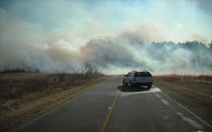
58 Table Keetch-Byram Drought Index (KBDI) Fire Danger Rating System Soil and fuel moisture are high. Most fuels will not readily ignite or burn. However, with sufficient sunlight and wind, cured grasses and some light surface fuels will burn in spots and patches. Fires more readily burn and will carry across an area with no gaps. Heavier fuels will still not readily ignite and burn. Also, expect smoldering and the resulting smoke to carry into and possible through the night. Fire intensity begins to significantly increase. Fires will readily burn in all directions exposing mineral soils in some locations. Larger fuels may burn or smolder for several days creating possible smoke and control problems. Fires will burn to mineral soils. Stumps will burn to the end of underground roots and spotting will be a major problem. Fires will burn through the night and heavier fuels will actively burn and contribute to fire intensity. The inputs for the Keetch-Byram Drought Index are weather station latitude, mean annual precipitation, maximum dry bulb temperature, and the last 24 hours of rainfall. Table 3-23 reflects the KBDI levels and their relationship to expected fire potential. PREVIOUS OCCURRENCES Pottawatomie County Fire Departments respond to wildfires on a monthly occurrence, with the majority being small fires that are quickly knocked down by the first due brush pumper. Occasionally, these wildfires require multiple fire departments to respond when terrain and weather conditions are a disadvantage to the first responding fire department. Some of these fires require assistance from state firefighting resources, such as aerial firefighting capabilities, firefighting personnel, and firefighting apparatus. The chart below lists the wildfires in Pottawatomie County that were approved for a Fire Management Assistance Grant since 2006: Chapter 3-Section 3.11-Wildfire-56

59 Table 3-29 FIRE MANAGEMENT & FM ASSISTANCE DECLARATIONS Federal Declaration # Declaration Date Incident dates Location FM-2953 FM-2872 FM-2602 FM-2140 EM-3118 August 31, 2011 March 12, 2011 January 2, 2006 March 12, 1996 February 27, 1996 August 31, 2011 March 12, 2011 to March 15, 2011 January 1, 2006 March 12, 1996 February 27, 1996 to May 31, 1996 Twin Lakes Fire Complex Shawnee Fire Bethel Acres Fire Little Axe Fire Oklahoma Fire Emergency Since 2009, Pottawatomie County has been impacted by numerous wildfires that required the coordination of multiple county fire departments and state firefighting resources to contain. In 2009 there were three major wildfires that scorched close to 3000 acres. One in St. Louis burned close to 2000 acres, another wildfire on the Pottawatomie County/Cleveland County line burned 120 acres, and one near Macomb burned nearly 400 acres. In 2011, Pottawatomie County was approved for two Fire Management Assistance Grants from two wildfires in the area around the Shawnee Twin Lakes. A fire in July 2011 that began northeast of Asher, OK charred over three square miles over a two-day period and resulted in the response of every fire department in Pottawatomie County. The drought climate that has affected the State of Oklahoma over the last two years caused a significant amount of wildfires in Pottawatomie County in One fire in Earlsboro, OK burned around 600 acres and destroyed a commercial structure. Chapter 3-Section 3.11-Wildfire-57


60 PROBABILITY OF FUTURE EVENTS The State of Oklahoma and Pottawatomie County have a wildfire hazard due to the climate, the types of fuels present and the cultural practices used. Pottawatomie County is south of the Snow Belt, leaving its grassy fuels exposed and vulnerable to fire in the dormant season. Pottawatomie County is located far enough north of the Gulf of Mexico; it is influenced by the continental climate in the winter. Summers are hot and usually dry with daytime highs in the mid-90s, and generally have less than six inches of rain in July and August. Oklahoma recognizes 10 months as fire season. Wildland fuels are prone to burning from July through April. Only May and June are not considered fire season. Most at risk are those people who make their residences in woodland settings in or near forests and the rural areas of Pottawatomie County. Pottawatomie County has residences and commercial structures located in woodland and grassy areas complicated by a lack of water supply in these areas of the county. Red Cedar trees dot the county in large groves. These trees are extremely volatile and when involved in a wildfire tend to explode spreading the fire for some distance. Since many of these trees are also near homes, they present a threat to homeowners when they are located near the structure. Chapter 3-Section 3.11-Wildfire-58

61 Wildfire also affects crops when it strikes. Millions of agricultural crops burn annually in the United States and occasionally in Oklahoma causing and major economic loss to farmers. Pasture lands are also vulnerable to wildfire throughout Pottawatomie County where horses and cattle are a major source of income. Based on past experiences; dry conditions during 10 months of the year, numerous small grass and wildfires; and the wooded areas having a significant amount of tall grasses and weeds, the potential of future grass and wildfires in Pottawatomie County including unincorporated Pottawatomie County, and participating jurisdictions, is HIGHLY LIKELY. VULNERABILITY AND IMPACT In Pottawatomie County, some critical facilities including transportation routes, pipelines, and electrical transmission lines are vulnerable to wildfires. Loss of any of these facilities could result in a critical drain on local resources, and the response and recovery capabilities of Pottawatomie County. Wildfires can damage or destroy residences and commercial structures located in wooded and high grass areas causing occupants to evacuate and possibly relocate. Businesses damaged or destroyed due to wildfires might close until the area is accessible, repairs are made, or in some instances, the building rebuilt and stock resupplied. This situation can result in loss of income for both employees and owners. At times, smoke from wildfires could affect patients in healthcare facilities and nursing homes who suffer from asthma, emphysema, or other respiratory ailment and may be forced to evacuate if the smoke becomes extreme. Chapter 3-Section 3.11-Wildfire-59

62 Loss of transportation routes in Pottawatomie County due to heavy smoke could severely effect mail delivery, school bus access, local, intrastate, interstate commerce, and tourism negatively affecting Pottawatomie County s economy. Ranches and farms located in densely wooded or grassy areas grazing livestock could suffer losses of food and even animals causing economic losses. Wildlife and the ecosystem could be devastated resulting in longer recovery to vital land used for agricultural and other purposes. CONCLUSION Pottawatomie County is susceptible to wildfires. Due to the capabilities of fire departments in Pottawatomie County and surrounding counties, property losses have been kept from being much worse. Firefighters often experience problems with accessing the fires due to the location in densely wooded areas and have difficulty maintaining a water supply due to hydrants being sporadically located in parts of the county. Public information efforts are necessary to help reduce the potential losses of residential and commercial structures in certain areas of the county. Chapter 3-Section 3.11-Wildfire-60
63 SOURCES Local Emergency Management Records FEMA Disaster Declarations The DRC Group United States Department of Agriculture Forest Service Chapter 3-Section 3.11-Wildfire-61
64 This page intentionally left blank