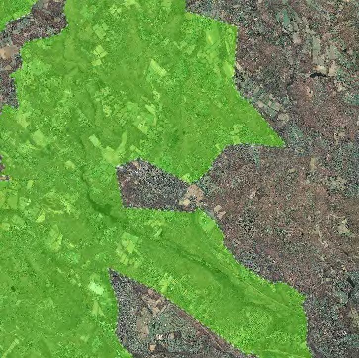
Figure 1: Preservation Area
|
|
|
- Mavis Clark
- 5 years ago
- Views:
Transcription
1 Figure 1:

2 Figure 2: Land Use Capability Map Zones Regional Master Plan Overlay Zone Designation Zone Protection Lakes Greater Than 10 acres Conservation Existing Community Sub-Zone Existing Community Environmentally Constrained Conservation Environmentally Constrained Lake Community Wildlife Management
3 Figure 3: HUC 14 Boundaries Raritan R SB Drakes Brook Lamington R Raritan R SB Burnett Brook Lamington R Raritan R NB Raritan R NB Peapack Brook Lamington R Pottersville trib Lamington R HUC 14 Subwatersheds Stream Centerlines Raritan R NB Peapack Brook Middle Brook Raritan R NB

4 Figure 4: Forest Resource Area Forest Resource Area

5 Figure 5: Total Forest Area Forested Areas

6 Figure 6: Forest Subwatersheds Forest Integrity by HUC14 Subwatershed Low Moderate High
 Streams Wetlands Lakes &")
7 Figure 7: Highlands Open Waters Highlands Open Water Buffers (300ft) Streams Wetlands Lakes & Ponds

8 Figure 8: Highlands Riparian Areas Riparian Area

9 Figure 9: Watershed Values Watershed Values by HUC14 Subwatershed Low Moderate High

10 Figure 10: Riparian Integrity Riparian Integrity by HUC14 Subwatershed Low Moderate High

11 Figure 11: Steep Slope Protection Areas Steep Slopes Moderate Severe

12 Figure 12: Critical Wildlife Habitat Critical Wildlife Habitat

13 Figure 13: Significant Natural Areas Significant Natural Areas
14 Figure 14: Vernal Pools Vernal Pools ft Buffer

15 Figure 15: Preserved Lands Preserved Lands Conservation Easements Federal Open Space Green Acres State Open Space SADC Easements County Open Space SADC Final Municipal Open Space SADC Preserved Non-Profit/Private Open Space Water Supply Watershed Lands Preserved Farmland Highlands Transfer of Development Lands

16 Figure 16: Highlands Conservation Priority Areas Conservation Prioirity Area Moderate High

17 Figure 18: Carbonate Rock Areas Carbonate Rock Area
 0.10-0.39 0.05-0.09 0.00-0.04-0.09-0.00-0.99 - -0.10-7.")
18 Figure 20: Net Water Availability Net Water Availability By HUC14 Million Gallons Per Day (MGD)
19 Figure 21: Prime Ground Water Recharge Areas Prime Groundwater Recharge Areas

20 Figure 22: HUC 14s on NJDEP Impaired Waters List Impaired Waters Overall Assessment by HUC14 Subwatershed Non Impacted Insufficient Data Available Moderate Water Quality Impaired
21 Figure 23: Wellhead Protection Areas Chester Borough Public Community Wells Public Non-Community Wells Wellhead Protection Areas 2-Year Tier 5-Year Tier 12-Year Tier

22 Figure 24: Agricultural Resource Area Agricultural Resource Area
23 Figure 25: Agricultural Priority Area Agricultural Priority Area Moderate High
24 Figure 26: Preserved Farms, SADC Easements, All Agricultural Uses SADC Easements SADC Final SADC Preserved Preserved Farmland Agriculture Uses

25 Figure 27: Important Farmland Soils Important Farmland Soils Prime Farmland Farmland of Local Importance Farmland of Statewide Importance Farmland of Unique Importance
26 Figure 28: Historic, Cultural, and Archaeological Resources Inventory Archaeological Grids (1 sqmi) NJ Historic Districts Historic Property Points Historic Property Polygons

27 Figure 29: Baseline Scenic Resources Inventory Scenic Resources
28 Figure 30: Highlands Contaminated Site Inventory ( ( ( ( ( ( ( ( ( ( ( ( ( ( ( ( ( ( Highlands Contaminated Site Inventory ( Tier 1 Sites Tier 1 Sites (Polygons) ( Tier 2 Sites
29 Figure 31: Public Community Water Systems Public Community Water Systems
30 Figure 32: Highlands Domestic Sewerage Facilities Highlands Domestic Sewerage Facilities Existing Area Served
31 Figure 33: Highlands Roadway Network Roadway Network Interstate Highways U.S. Routes State Routes County Routes Local Routes
32 Figure 34: Highlands Transit Network Rail Network Boonton Line. Rail Stations '4 Park and Ride Sites. Gladstone Main Line & Bergen County Line Morris and Essex Line Raritan Valley Line Freight Rail Lines Freight Rail Lines Private Bus Lines NJ Transit Bus Lines p Airports Abandoned Freight Rail