Forest Resources of the Uinta National Forest
|
|
|
- Spencer Jefferson
- 5 years ago
- Views:
Transcription


1 United States Department of Agriculture Forest Service Intermountain Research Station August 1997 Forest Resources of the Uinta National Forest Renee A. O Brien Dennis Collins This summary of the forest resources of the Uinta National Forest is based on a comprehensive inventory of all forested lands in Utah. The inventory was conducted in 1995 by the Interior West Resource Inventory, Monitoring, and Evaluation (IWRIME) Program of the U.S. Forest Service, Intermountain Research Station, as part of its National Forest Inventory and Analysis (FIA) duties.
2 About the authors Renee A. O Brien is Lead Ecologist with the Interior West Resources Inventory and Monitoring Project. Dennis Collins is a Forester with the Interior West Resources Inventory and Monitoring Project. Contents Page What forest resources are found on the Uinta National Forest?... 1 How does the forest change?... 5 What about damage from insects?... 6 Are aspen forests declining?... 7 How does the Uinta compare with the rest of Utah s forests?... 7 How was the inventory conducted?... 8 Scientific documentation... 9 For further information... 9 You may order additional copies of this publication by sending your mailing information in label form through one of the following media. Please specify the publication title. Telephone (801) DG message Pubs:S22A FAX (801) , Attn: Publications /s=pubs/ou1=s22a@mhs-fswa.attmail.com Mailing Address Publications Distribution Intermountain Research Station th Street Ogden, UT Intermountain Research Station th Street Ogden, UT 84401
 timberland and 32 percent (174,370 acres) woodland.")
3 What forest resources are found on the Uinta National Forest? The 883,225 acres in the Uinta National Forest encompass 552,021 acres of forest land, made up of 68 percent (377,651 acres) timberland and 32 percent (174,370 acres) woodland. The other 331,204 acres of the Uinta are nonforest (fig. 1). This report discusses forest land only. In the Uinta, 7 percent of the total area and 4 percent of the forest land is in reserved status such as Wilderness or Research Natural Areas. Unless otherwise stated, lands of both reserved and nonreserved status are included in the following statistics. Field crews sampled 258 field plots on the Uinta. Forest type Gambel oak Spruce-fir Other Pinyon-juniper Maple Percent of forest land area Figure 2 Percent of forest area by forest type, Uinta National Forest. Timberland Woodland Nonforest up 42 percent of the total number of trees; aspen 27 percent, bigtooth maple 13 percent, subalpine fir 8 percent, and white fir and Douglar-fir, each 3 percent (fig. 3). Utah juniper, Rocky Mountain maple, Engelmann spruce, curlleaf mountain mahogany, blue spruce, Rocky Mountain juniper, lodgepole pine, cottonwood, common pinyon, and limber pine contribute a total of about 4 percent. Species that are scarce may not be encountered with the sampling intensity used for this inventory. Size distribution of individual trees indicates structural diversity. Figure 4 displays the tree size distribution on the Uinta. Another stand structure variable, stand-size class, is based on the size of trees contributing to the majority of Figure 1 Area by land class, Uinta National Forest (see page 8 for definitions of timberland and woodland). Forest diversity Forest type one indicator of forest diversity refers to the predominant tree species in a stand, based on tree stocking. On the Uinta, the most common forest type in percentage of area is aspen with 32 percent, followed by Gambel oak 20 percent, 13 percent, sprucefir 10 percent, and white fir and pinyon-juniper 7 percent each (fig. 2). Other forest types that make up the remaining 11 percent are maple, limber pine, Engelmann spruce, cottonwood, and lodgepole pine. The composition of the forest by individual tree species is another measure of forest diversity. Gambel oak makes 1
4 Figure 3 Percent of total number of trees by species, Uinta National Forest. Thousand trees Oak Bigtooth maple Subalpine fir Other Tree diameter class (inches) Figure 4 Number of live trees on forest land by diameter class, Uinta National Forest. scarce, making them more valuable than smaller snags. Considering snags 11 inches in diameter or larger, an estimated 3.9 per acre occur on Uinta forest land. Of the large snags (19 inches in diameter or larger) only an average of one per every 2.6 acres occur on the Uinta. The most abundant species of snags in the 19 inch and larger category is subalpine fir, followed by limber pine. Forest successional stage Habitat types describe lands potentially capable of producing similar plant communities at successional climax. The climax plant community, which is the theoretical end result of plant succession, reflects the integration of environmental factors that affect vegetation such as soils, climate, and landform. Habitat type classifications are named for the predominant overstory and understory plant species at the time of successional climax. In Utah, habitat type classifications have been defined for most forest types traditionally considered to be timberland (Mauk and Henderson 1984). However, because well-defined successional states are not known for aspen, classification schemes for aspen are called community types instead of habitat types (Mueggler 1988). Most woodland types also remain unclassified in Utah. The use of potential vegetation to classify forests does not imply an abundance of climax vegetation in the current Utah landscape. In fact, most forest landscapes reflect some form of disturbance and various stages of succession. Fire is a natural disturbance that affects the successional stage of forests. Forest management activities do so as well. For the Uinta National Forest, figure 6 compares existing forest types with habitat type series and gives a general indication of the stocking. Figure 5 gives a breakdown of forest land by stand-size classes. This figure shows that relatively few stands are composed mostly of small trees, such as stands that have been clear cut or burned. Dead trees an important component of forest ecosystems contribute to diversity and serve a variety of functions including wildlife habitat and nutrient sinks. There are roughly 16.4 million standing dead trees (snags) on the Uinta National Forest. This number includes both hard and soft snags of all species and diameters. Many wildlife species are dependent upon these standing dead trees. The species, size, and density of snags required vary according to the species of wildlife. Large diameter snags are generally somewhat Stand size-class Large trees (>9.0") Medium trees ( ") Saplings/seedlings (<5.0") Nonstocked Thousand acres Figure 5 Forest land area by stand-size class, Uinta National Forest

5 3
6 Forest type (thousand acres) Existing forest types Lodgepole pine Limber pine Spruce-subalpine fir Engelmann spruce Cottonwood 20 0 Limber pine Subalpine fir Habitat type series (dominant tree species at successional climax) Figure 6 Area of forest type by habitat type series, Uinta National Forest. Spruce-fir Forest type Limber pine Engelmann spruce Thousand acres Figure 7 Area of mature stocking condition by forest type, Uinta National Forest. forest successional status. The use of classifications based on climax vegetation does not suggest that climax conditions should be a management goal. By summarizing inventory data by habitat type, a picture can be drawn of Uinta forests that theoretically will not change with disturbance or advancing succession. How we define and assess old growth forest is important for many reasons. To improve communication about old growth, the Forest Service produced a report on the characteristics of old growth forests in the Intermountain Region (USDA Forest Service 1993). The physical characteristics of old growth are fairly easy to quantify, inventory, and map, but determining functionality with any acceptable agreement or consistency is difficult. Consequently, we prefer to present inventory data using the term mature forest, defined as sites with stand age in excess of 100 years. For the Uinta, figure 7 shows an estimate of the area of mature forest by forest type, components of which may be candidates for the designation of old growth. 4
7 Tree biomass Total biomass of wood in live trees on the Uinta National Forest is estimated at almost 17 million tons. Biomass estimates include boles (trunk and stem), bark, branches, and foliage of all live trees including saplings and seedlings. Here is a breakdown of tree biomass by species: Species Thousand tons 4,057 Gambel oak 3,009 2,700 Subalpine fir 2,213 1,604 Engelmann spruce 1,043 Utah juniper 760 Bigtooth maple 676 Limber pine 249 Rocky Mountain maple 203 Blue spruce 92 Rocky Mountain juniper 88 Curlleaf mountain mahogany 59 Common Pinyon 31 Lodgepole pine 24 Other poplar 16 Total 16,824 Wood volume Wood produced on the Uinta National Forest is valuable. The total volume of wood in live trees is estimated to be in excess of 736 million cubic feet. This includes trees 3.0 inches in diameter and larger for woodland species and 5.0 inches and larger for timber species. Here is a breakdown of cubic-foot volume by species: Species Thousand cubic feet 207, ,719 Subalpine fir 125,603 79,167 Engelmann spruce 65,038 Utah juniper 38,960 Gambel oak 34,474 Bigtooth maple 16,109 Limber pine 13,286 Rocky Mountain maple 8,438 Blue Spruce 5,567 Rocky Mountain juniper 3,688 Common pinyon 1,857 Lodgepole pine 1,375 Curlleaf mountain mahogany 1,255 Other poplar 579 Total 736,104 Over 62 percent of this cubic foot volume is in trees 11 inches in diameter or greater. Approximately 88 percent of, 83 percent of white fir, and 76 percent of subalpine fir volume are in trees larger than 11 inches in diameter. About 29 percent of aspen volume is in trees less than 11 inches in diameter. The volume of sawtimber trees on timberland not reserved from timber harvest is estimated to be 1.7 billion board feet (Scribner rule). and subalpine fir account for 51 percent of the total sawtimber volume. Figure 8 shows percent distribution of sawtimber on nonreserved timberland by species. Subalpine fir Englemann spruce Blue spruce Other Figure 8 Percent of sawtimber volume on nonreserved timberland by species, Uinta National Forest. How does the forest change? Many factors influence the rate at which trees grow and thrive, or die. One of those factors is the stocking (relative density) of trees. Overstocking causes tree growth to slow, which makes trees more susceptible to insect attack. About 33,365 acres or 9 percent of all timberland on the Uinta is overstocked (fig. 9). This includes 18,548 acres of aspen forest type, which is about 11 percent of the aspen on the Forest. Fully stocked stands may also be susceptible to insects and disease because of decreasing tree vigor. Approximately 71,212 acres, or 19 percent of the timberland, is estimated to be fully stocked. Another measure of forest vigor is net growth. Net growth is the difference between gross growth and losses due to mortality (fig. 10). Net annual growth on all forest land of the Uinta is estimated to be 4.8 million cubic feet. Figure 10 shows that the ratio of mortality to gross growth is greater in some species than others. For example, subalpine fir has a negative net growth. More than twice as much volume was lost to mortality as was gained from tree growth. In 1992, trees containing an estimated 12.9 million cubic feet of wood died in this forest. Almost half of the mortality was estimated to be caused by disease. Weather was estimated to be the cause of another 21 percent, and insects 19 percent. About 62 percent of the mortality occurred in just one species, subalpine fir. 5
8 Thousand acres Forest types Lodgepole pine Spruce-fir Engelmann spruce Cottonwood Limber pine 10 0 Overstocked Fully Stocked Moderately Stocked Poorly Stocked Stocking class (relative density of trees) FIgure 9 Area of stocking class by predominant forest type, Uinta National Forest. What about damage from insects? Hazard ratings for risk of attack by four bark beetle species beetle, mountain pine beetle, western pine beetle, and spruce beetle were adapted for use in Utah forests from Steele and others (1996) and applied to the inventory data. Plots in spruce, spruce-fir, lodgepole pine,, and ponderosa pine forest types were assigned classes of hazard ratings, and estimates of the area at high, moderate, or low risk of attack by bark beetles were calculated for Utah forests. The area of each forest type in each insect attack risk category on High volume species Engelmann spruce Subalpine fir Million cubic feet Figure 10 Gross annual growth compared to mortality, Uinta National Forest. the Uinta is presented in table 1. Stands in the spruce and spruce-fir forest types were evaluated for hazard of attack on spruce by bark beetle if there was at least one spruce tree 10 inches in diameter or larger present. Stands in the lodgepole type were evaluated if at least one lodgepole pine tree 5 inches in diameter or larger was present. Stands in the type needed at least one tree 9 inches diameter or larger. No ponderosa pine stands were sampled on the Uinta. The table also includes the acreage of each forest type where 80 percent of the trees are already dead (and consequently now at low risk of attack) and the area of each Growth Mortality type that was not evaluated because the trees in the stands did not meet the minimum size criterion. Of the spruce/spruce-fir complex, 38 percent is at moderate to high risk of attack by bark beetles. Also, 100 percent of the lodgepole and 87 percent of the type are at moderate to high risk. Moderate to high risk conditions indicate the possibility of bark beetle population increases, which can in turn cause significant tree mortality and changes in stand structure over a short time. For forest managers, these changes could greatly affect objectives related to fire, recreation, wildlife habitat, threatened and endangered species, and water quality and quantity. 6
9 Table 1 Area at risk of attack by bark beetles by forest type and risk category, Uinta National Forest. Risk rating category 80 percent Not Forest type Low Moderate High dead evaluated Total Acres Spruce and spruce-fir 14,827 23,790 3,006 3,006 26,511 71,140 Lodgepole 2,997 2,997 8,503 18,142 43,415 70,060 Are aspen forests declining? Stands of aspen an important forest type throughout much of the Western United States provide critical habitat for many wildlife species, forage for livestock and wildlife, and protection and increased streamflow in critical watersheds. stands have great aesthetic value and enhance the diversity of the conifer-dominated forests of Utah. Information from various sources indicates that aspen is declining in much of its range (Bartos 1995; USDA Forest Service 1996). forests are unique because they reproduce primarily by suckering from the parent root system. Often a disturbance or dieback is necessary to stimulate regeneration of the stands. Because these self-regenerating stands have existed for thousands of years, even minor amounts of aspen in stands probably indicate that a site was previously dominated by aspen. Based on this assumption, an estimated 285,351 acres on the Uinta National Forest were formerly aspen forest type. By comparison, only about 174,492 acres (61 percent) currently have the required aspen stocking to be considered aspen forest type. These acreage comparisons support the hypothesis that aspen dominance in Utah forests is decreasing. How does the Uinta compare with the rest of Utah s forests? Reports summarizing the inventory data for northern Utah have been prepared by O Brien (1996) and Brown (in press). A Utah State report is also currently being prepared (O Brien, in preparation). These researchers found that an estimated 29 percent of all Utah, and 25 percent of northern Utah, is forest land. The most common forest type in northern Utah (fig. 11) and the entire state (fig. 12) is pinyon-juniper, followed by aspen. Comparing figures 11 and 12 to figure 2, the reader will see how the overall breakdown of the Uinta in terms of forest type differs from northern Utah and the rest of the State. For example, aspen is the most common forest type on the Uinta, and the Gambel oak forest type is second. Another report on the condition of Utah forests is being prepared by the Intermountain Station s Interior West Resource Inventory, Monitoring, and Evaluation Program, in conjunction with the Intermountain Region s Forest Health Protection staff (LaMadeleine and O Brien, in preparation). That report for the entire State will include estimates of area and volume that are impacted by mistletoe and root disease, and the number of acres at risk of attack by bark beetles. Forest type Forest type Pinyon-juniper Lodgepole pine Gambel oak Spruce-fir Other Eng/Blue spruce Maple Pinyon-juniper Gambel oak Spruce-fir Ponderosa pine Other Eng/Blue spruce Lodgepole pine Percent of forest land area Figure 11 Percent of forest land area by forest type, northern Utah Percent of forest land area Figure 12 Percent of forest land by forest type, entire Utah State total. 7


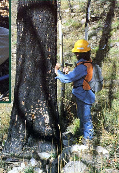
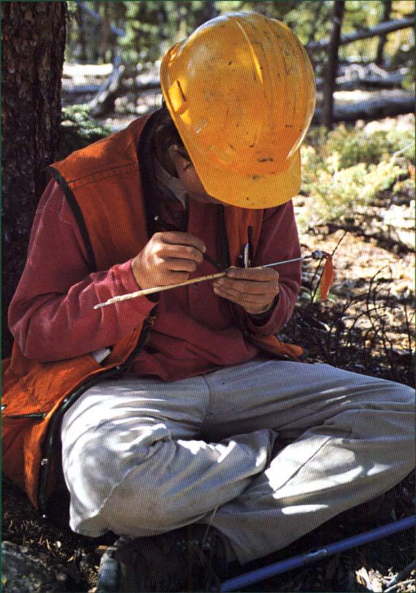
10 How was the inventory conducted? In 1995, the Interior West Resource Inventory, Monitoring, and Evaluation Program of the U.S. Forest Service, Intermountain Research Station, as part of its national Forest Inventory and Analysis duties, completed a comprehensive forest resource inventory of all forested lands in Utah. Our inventories provide a statistical-based sample of forest resources across all ownerships that can be used for planning and analyses at local, State, regional, and national levels. We have not traditionally conducted inventories on National Forest lands in the West, but in Utah, a cooperative agreement and funding from the Forest Service Intermountain Region made possible an expanded inventory that included National Forest System lands. In the past, we collected inventory data only for tree species normally favored for commercial timber harvest timber species such as ponderosa pine, lodgepole pine, and. Since the early 1980 s, we have expanded our inventory to include other tree species such as pinyon, juniper, and oak, collectively known as woodland species. In Utah, a location was classified as timberland if there existed a minimum of 5 percent crown cover of timber species. For current and future reporting, the more ecological and all-encompassing term forest land is preferred instead of timberland and woodland. However, some mensuration and silvicultural definitions and techniques that were developed for timberland species are not yet available for woodland species. Therefore, the separate terms are used occasionally in this report. We use a two-phase sampling procedure for State inventories. The first, or photo interpretive, phase is based on a grid of sample points systematically located every 1,000 meters across all lands in the State. Forestry technicians used maps and aerial photos to obtain ownership and stratification for field sampling. Field crews, made up of forestry technicians, biologists, botanists, and some college students, conducted the second, or field, phase of the inventory on a subsample of the phase one points that occurred on forest land. For this inventory, we defined forest land as land with at least 10 percent stocking (or 5 percent cover) of trees; or lands currently nonstocked but formerly having such stocking, where human activity does not preclude natural succession to forest. All conifers of any size except pinyon, juniper, and yew automatically qualify as trees, as do aspen, cottonwood, and paper birch. Other species such as pinyon, juniper, maple, mountain mahogany, and oak were classified as either trees or shrubs, depending on whether they have the capacity to produce at least one stem 3 inches or larger in diameter at root collar, and 8 feet or more in length to a minimum branch diameter of 1.5 inches. The sampling intensity on lands outside the National Forest was one field plot every 5,000 meters, or about every 3 miles. The sampling intensity on National Forest System lands was double that of outside lands. Our sample was designed to meet national standards for precision in State and regional estimates of forest attributes. Standard errors, which denote the precision of an estimate, are usually higher for smaller subsets of the data, such as National Forest summaries. Standard errors were computed for each National Forest and are available upon request (see the For further information section on the following page). 8
11 Scientific documentation Bartos, Dale problem definition. Unpublished paper on file at Logan, UT: U.S. Department of Agriculture, Forest Service, Intermountain Research Station, Forestry Sciences Laboratory. Brown, Mark. [In press]. Forest resources of northern Utah. Ogden, UT: U.S. Department of Agriculture, Forest Service, Intermountain Research Station, Forestry Sciences Laboratory. LaMadeleine, Leon; O Brien, Renee A. [In preparation]. Condition of Utah s forests. Ogden, UT: U.S. Department of Agriculture, Forest Service, Intermountain Research Station, Forestry Sciences Laboratory. (Publication available in 1998.) Mauk, Ronald L.; Henderson, Jan A Coniferous forest habitat types of northern Utah. Gen. Tech. Rep. INT-170. Ogden, UT: U.S. Department of Agriculture, Forest Service, Intermountain Forest and Range Experiment Station. 89 p. Mueggler, Walter F community types of the Intermountain Region. Gen. Tech. Rep. INT-250. Ogden, UT: U.S. Department of Agriculture, Forest Service, Intermountain Research Station. 135 p. O Brien, Renee A. [In preparation]. Forest resources of Utah. Ogden, UT: U.S. Department of Agriculture, Forest Service, Intermountain Research Station. O Brien, Renee A Forest resources of northern Utah ecoregions. Resour. Bull. INT-RB-87. Ogden, UT: U.S. Department of Agriculture, Forest Service, Intermountain Research Station. 34 p. Steele, Robert; Williams, Ralph E.; Weatherby, Julie C.; Reinhardt, Elizabeth D.; Hoffman, James T.; Thier, R. W Stand hazard rating for central Idaho forests. Gen. Tech. Rep. INT-GTR-332. Ogden, UT: U.S. Department of Agriculture, Forest Service, Intermountain Research Station. 29 p. U.S. Department of Agriculture, Forest Service Characteristics of old-growth forests in the Intermountain Region. Hamilton, Ronald C., comp. Unpublished report on file at Ogden, UT: U.S. Department of Agriculture, Forest Service, Intermountain Region. U.S. Department of Agriculture, Forest Service Properly functioning condition. Draft report on file at Ogden, UT: U.S. Department of Agriculture, Forest Service, Intermountain Region. For further information Interior West Resources, Inventory, Monitoring, and Evaluation Program c/o Program Manager th Street, Ogden, UT Phone: FAX: Uinta National Forest c/o Forest Supervisor 88 West 100 North Provo, UT Phone: FAX: The information presented here is just a small part of a national data base that houses information for much of the forest land in the United States. This data base can be accessed on the Internet at the following web site: Federal Recycling Program Printed on Recycled Paper 9


12 The Intermountain Research Station provides scientific knowledge and technology to improve management, protection, and use of the forests and rangelands of the Intermountain West. Research is designed to meet the needs of National Forest managers, Federal and State agencies, industry, academic institutions, public and private organizations, and individuals. Results of research are made available through publications, symposia, workshops, training sessions, and personal contacts. The Intermountain Research Station territory includes Montana, Idaho, Utah, Nevada, and western Wyoming. Eighty-five percent of the lands in the Station area, about 231 million acres, are classified as forest or rangeland. They include grasslands, deserts, shrublands, alpine areas, and forests. They provide fiber for forest industries, minerals and fossil fuels for energy and industrial development, water for domestic and industrial consumption, forage for livestock and wildlife, and recreation opportunities for millions of visitors. Several Station units conduct research in additional western States, or have missions that are national or international in scope. The United States Department of Agriculture (USDA) prohibits discrimination in its programs on the basis of race, color, national origin, sex, religion, age, disability, political beliefs, and marital or familial status. (Not all prohibited bases apply to all programs.) Persons with disabilities who require alternative means for communication of program information (braille, large print, audiotape, etc.) should contact the USDA s TARGET Center at (voice and TDD). To file a complaint, write the Secretary of Agriculture, U.S. Department of Agriculture, Washington, DC 20250, or call (voice) or (TDD). USDA is an equal employment opportunity employer. 10