Technology and Forest Governance in the Peruvian Amazon
|
|
|
- Carmella Chambers
- 5 years ago
- Views:
Transcription


1 Technology and Forest Governance in the Peruvian Amazon Forest Legality Week October 24, 2018


2 Forest crimes in Peruvian Amazon Well known problem, many challenges for effective response Rapid advances in satellite technology: Resolution Frequency Availability Creating accessible and actionable information Building capacity and coordination among diverse stakeholders Remote region with limited funds, technical capacity & enforcement
3 Amazon Conservation s Approach Prevent Detect Determine legality Alert & coordinate stakeholders Respond Implementing strategy at multiple spatial scales Key stakeholders: forest users, government and civil society
4 Initial detection: logging roads GLAD alerts quickly detect new logging roads Follow-up with: Near real time monitoring with satellite imagery Analysis of legality
5 Detection: Amazon-wide scale Base Map of all logging roads in Peruvian Amazon since ,365 miles (2,200 km) of logging roads constructed over last three years ( ). Roads are in red New generation of satellites allow us to monitor in near real-time: Medium resolution: Sentinel-1 (radar) High resolution: Planet microsats Prevent Detect Determine legality Alert & coordinate stakeholders Respond

6 Regional Ex: tracking logging roads around Sierra del Divisor National Park Radar allows near real-time monitoring in all weather conditions

7 Tracking logging roads around Sierra del Divisor National Park Same road in Planet imagery Daily imagery from Planet now allows real-time tracking
8 Next steps: improving detection & identify illegal activity Acquisition of detailed and upto-date information on logging concessions, permits and authorizations to verify legality of roads Zooming in with VERY HIGH- RESOLUTION satellites (DigitalGlobe, SkySat, PeruSAt-1) Prevent Detect Determine legality Alert & coordinate stakeholders Respond
 3. Logging camps 4.")
9 Logging operation activities 1. Selective logging of high-value trees 2. Construction of logging roads (access roads) 3. Logging camps 4. Storage and transport Prevent Detect Determine legality Alert & coordinate stakeholders Respond

10 1. Selective logging 1. Selective logging of high-value trees This is an example of potential legal logging in authorized area

11 1. Selective logging 1. Selective logging of high-value trees This is an example of potential legal logging in authorized area

12 2. Construction of roads 2. Construction of logging roads This is an example of potential legal logging road in authorized area

13 2. Construction of roads 2. Construction of logging roads This is an example of confirmed illegal logging path in unauthorized area

14 3. Logging camps 3. Logging camps This is an example of potential legal logging camp in authorized area

15 3. Logging camps 3. Logging camps This is example of confirmed illegal logging camp in unauthorized area
16 SIZE - SPATIAL RESOLUTION Operation Type Principal Logging Roads Secondary Logging Roads Log Yard Selective harvesting gaps Selective harvesting access Camps Medium Resolution Satellite Imagery Sentinel-1 (USGS/ESA) (Radar/ESA) m 20 m EW Alerts (30-10m) Planet (3.5 m) High Resolution Imagery DG products ( m) PeruSAT-1 (0.7 m) Drone Imagery (<0.3 cm) ads80/flir FAP (<0.3 cm) = Good 2 = Medium 1 = Poor 0 = No detection


17 Local scale: Madre de Dios, Peru Working with ~90 forestry concessionaires Concessions 30% of Madre de Dios, 2.5 million hectares Multi-faceted training, field support & ongoing legal advising Prevent Detect Determine legality Alert & coordinate stakeholders Respond


18 Local scale: Madre de Dios, Peru Patrol & monitoring protocols Technology & legal training and support Gather evidence & file legal claim

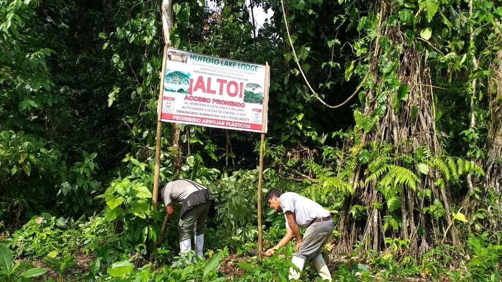
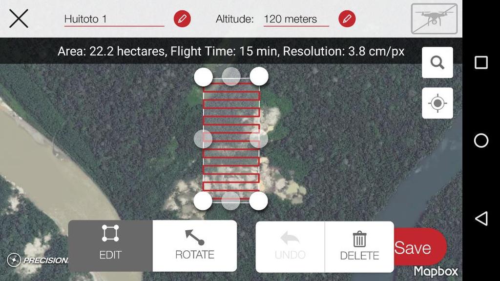
19 Lago Huitoto Ecotourism Concession


20 Coordination & Response Action required by multiple government entities with overlapping jurisdictions Limited funds & technical resources Slow response times Limited information sharing Requires coordination strategy at national and local scales Prevent Detect Determine legality Alert & coordinate stakeholders Respond
 Support interagency coordination via new National System for Control and")

21 Coordination & Response Creation of Satellite Monitoring Unit within Environmental Prosecutor Office (FEMA) Support interagency coordination via new National System for Control and Surveillance of Forests and Wildlife Regulatory changes Financing for field interventions Next steps with judiciary and environmental police Prevent Detect Determine legality Alert & coordinate stakeholders Respond

22 Verification and enforcement capacity, coordination & field resources not keeping pace with changes in technology Information must be accessible and actionable by diverse stakeholders Remote hotspots with difficult access limit prevention and detection actions Conclusions


23 Many thanks to our donors

24 THANK YOU Hannah Stutzman Executive Director