National. Forest. Francis Marion. Revised Land and Resource Management Plan. United States Department of Agriculture Forest Service Southern Region
|
|
|
- Emil Blaze Jacobs
- 5 years ago
- Views:
Transcription

1 National Francis Marion Forest Revised Land and Resource Management Plan United States Department of Agriculture Forest Service Southern Region
2 Revised Land and Resource Management Plan February 1996 Charleston and Berkeley Counties, South Carolina Lead Agency Responsible Official For Further Information United States Department of Agriculture Forest Service Francis Marion & Sumter National Forests 4931 Broad River Road Columbia, South Carolina Robert C. Joslin, Regional Forester Southern Region 1720 Peachtree Road, NW Atlanta, Georgia David W. Wilson, Forest Supervisor Francis Marion & Sumter National Forests 4931 Broad River Road Columbia, South Carolina Telephone: (803)
3 Table of Contents Introduction to the Forest Plan... 3 Management Direction Chapter 1, Forest Goals and Desired Future Condition Chapter 2, Forest Objectives Chapter 3, Standards and Guidelines Chapter 4, Management Area Prescriptions Chapter 5, Monitoring and Evaluation Strategy Supplemental Information...S-1 Appendices Appendix A, Implementation Guides... A-1 Appendix B, Monitoring Tasks... B-1 Appendix C, National Goals... C-1 Appendix D, Statutes, Regulations and Executive Orders... D-1 Appendix E, Budget... E-1 Appendix F, Glossary... F-1 Appendix G, Research Needs...G-1 1
4 2
5 Introduction to the Forest Plan 3
6 4
7 Table of Contents Understanding a Forest Plan... 7 Implementing the Forest Plan... 8 Distinctive Roles and Contributions of the Francis Marion National Forest Changes and Trends which may Affect the Francis Marion National Forest Summary of the Analysis of the Management Situation
8 Understanding a Forest Plan This Revised Land and Resource Management Plan (Forest Plan) has been prepared according to Secretary of Agriculture regulations (36 CFR 219) which are based on the Forest and Rangeland Renewable Resources Planning Act (RPA) as amended by the National Forest Management Act of 1976 (NFMA). The Forest Plan has also been developed in accordance with regulations (40 CFR 1500) for implementing the National Environmental Policy Act of 1969 (NEPA). A detailed statement (environmental impact statement) has been prepared as required by NFMA (36 CFR ). The Forest Plan represents the selected alternative as identified in the Final Environmental Impact Statement for the Revised Land and Resource Management Plan (FEIS). This document is divided into four major parts; the introduction to the Forest Plan, the Forest Plan, supplemental information, and appendices. The "Introduction to the Forest Plan" provides background information that places the Management Direction into context with other management directives or procedures and trends occurring on the Forest. This information includes the decision framework provided by the Forest Plan, an explanation of project decision making, distinctive roles of the Forest and trends which may affect the Forest and a summary of the "Analysis of the Management Situation." The "Mangement Direction" section provides the management direction for the next 10 years for the Forest. This direction is found in five chapters: "Forest Goals and Desired Future Condition," " Forest Objectives," "Standards and Guidelines," "Management Area Prescriptions" and "Monitoring and Evaluation Strategy." The "Supplemental Information" section provides a summary of land allocations and predicted levels of implementation activities and outputs. This information is not included in the Management Direction section because many of these outputs and activities are probable results of Forest Plan direction. Allocations, activities and outputs which are management direction are found in the "Management Direction" section under "Forest Objectives," "Standards and Guidelines" and "Management Area Prescriptions." The "Appendices" contain more detailed information which may be helpful in understanding or implementing the Forest Plan such as "Implementation Guides," "Monitoring Tasks," "National Goals," "Statutes, Regulations and Executive Orders," "Budget" and "Glossary." 7
9 Implementing the Forest Plan Introduction This section describes the decisions made outside the Forest Plan and those decisions made by the Forest Plan. Also, this section explains the relationship of the Forest Plan to the FEIS. Decisions The Forest Plan affects and is affected by decisions made at many levels. Decisions that are made outside the Forest Plan such as national and regional policy decisions and regulations provide parameters for decisions made in the Forest Plan. A list of these can be found in Appendix D. Forest planning occurs within a framework of Forest Service national and regional planning. The RPA sets the national direction and emphasis for the National Forest Service System Lands (NFS). The regional guide also provides planning direction for developing forest plans and developing standards and guidelines for the management of the forests. The Forest Plan is a detailed version of the selected alternative identified in the companion document, the FEIS. The planning process and the analysis procedures which were considered, are described or referenced in the FEIS. Other Environmental Impact Statements that provide management directions are: * Final Environmental Impact Statement for Suppression of Southern Pine Beetles (R8-SPB) (USDA Forest Service Southern Region, April 1987) * Final Environmental Impact Statement Vegetation Management in the Coastal Plain/Piedmont (R8-VM) (USDA Forest Service Southern Region. January 1989) * Final Environmental Impact Statement for the Management of the Red-cockaded Woodpecker and its Habitat on National Forests in the Southern Region (R8-RCW) (USDA Forest Service Southern Region, 1995) 8
10 The decisions made in the Forest Plan include: 1. Determining the multiple-use goals, objectives, and desired condition for the Forest, including estimates of the goods and services expected. 2. Determining multiple-use management area prescriptions (including associated standards) for each management area, including probable and proposed practices. 3. Identifying land that is suitable for timber production. 4. Determining the allowable sale quantity for timber and the associated sale schedule. 5. Recommending wilderness areas. 6. Determining monitoring and evaluation requirements. All of these decisions the Forest Plan, national policy, etc. are broad scale, programmatic decisions. Sitespecific decisions are the other level of decisions. Forest level management activities and projects will be planned and implemented to carry out the direction in the Forest Plan. The determination to implement these local projects is based on a site-specific analysis. This analysis will take into account site-specific data to ensure that the project implements the Forest Plan and adheres to the standards and guidelines that may apply to that area. This Plan does not make the "Land available for leasing decision," or the "leasing decision" due to low potential for oil and gas occurrence and the lack of industry interest. If either of these situations change, the Forest will conduct the required environmental evaluations and documentation required to reach a decision. (36 CFR 228E). In addition to Forest Plan direction, projects are implemented through direction found in the directive system (Forest Service Manuals and Handbooks) and other implementation guidelines. A listing of these guidelines along with a summary of a few is found in Appendix A. 9
11 10
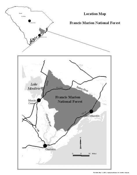
12 Distinctive Roles and Contributions of the Francis Marion National Forest The Francis Marion National Forest enjoys the reputation of having one of the largest populations of the endangered red-cockaded woodpecker (RCW) in the world. Let's take a closer look at some other features that make the Francis Marion a special part of the "Lowcountry" of South Carolina. Located along the Atlantic coast, the Forest is an extensive lowland where elevations range from 0 to 80 feet above sea level. The topography is characterized by a series of parallel ridges of sandy beach deposits with large areas of swamps, bays and upland flats between the ridges. Coastal marshes and river floodplains are also found on the Forest. Hot summers and mild winters characterize the climate. Annual rainfall averages about 48 inches with most falling during summer. Hurricanes have affected the Forest throughout history. In 1989, Hurricane Hugo struck the Forest causing the most damage suffered by a national forest to date. Found throughout the Forest are two special geological features: Carolina bays and limestone sinks. Limestone sinks are home for many rare plants such as the endangered pondberry. The poorly drained areas such as swamps, floodplains, upland flats and coastal marshes provide wintering and breeding habitat for many species of waterfowl, osprey and wading birds. These areas also provide foraging and nesting habitats for the endangered bald eagle. The northernmost established nesting population of the American swallow-tailed kite is also found in these areas. One of the most diverse ecosystems in the United States, the fire-dependent longleaf pine ecosystem, is found on the ridges and better drained areas throughout the Forest. This ecosystem supports the endangered red-cockaded woodpecker and American chaffseed. Human occupation of the forest dates back at least 15,000 years as people came to the area during the last ice age. Archeological evidence indicates centuries of human occupation, use and adaptation in the area. Over 1,100 archeological sites have been located and recorded on the Forest. Nearby, the English settled Charleston in French Huguenots settled along the Santee River, Moncks Corner and Huger in Early uses of the forest included trading, producing pitch for naval stores, grazing cattle and growing rice and indigo. The Revolutionary War brought an end to the indigo culture, and the Civil War ended the rice growing era. During the Revolutionary War, General Francis Marion, nicknamed the Swamp Fox, made life very difficult for the British as a guerilla fighter. He and his troops hid from them in the swamps and limestone sinks found in the area. About 1900, extensive railroad logging of large, old growth longleaf pine, loblolly pine and cypress timber began. By the 1930s, much of the land had been cut over. This factor, along with the great depression, led to the establishment of the Francis Marion National Forest in The Santee Experimental Forest was established in 1937 on 6,100 acres within the Forest boundary. Timber management began with a policy statement in Growing "high quality pine sawtimber as a chief crop" was the policy. The first timber sales began in 1937, when about one million board feet of sawtimber were cut. Sixty-three million board feet, the highest amount harvested in a single year except for salvage following Hugo, were harvested in 11
13 1974. In 1950, the timber management plan was the first plan in the country to prescribe even-aged silviculture for a national forest. Timber harvest from the Forest has contributed to the local economy for the past 40 years. Cooperative game management areas were established in 1937 by the Forest Service and State Wildlife Resources Department. Since 1971, most of the Forest has been cooperatively managed as the Francis Marion Wildlife Management Area (WMA). The Forest offers the largest and most consolidated area available for public hunting in the state. The Forest provided many of the wild turkeys used for restocking other areas in the state. Wild turkeys on the Forest are considered the most pure strain of eastern wild turkey found in the United States. In 1944, planned and systematic prescribed burning began. Since 1956, an average of 30,000 40,000 acres have been burned annually. This burning program has contributed significantly to the diversity of the area. The Forest offers public access to the Santee River, Cooper River and Intracoastal waterway for a variety of recreational uses such as fishing, boating and swimming. There are approximately 90 miles of trails for hiking, canoeing, horseback riding, motorcycling and ATV riding. There are four wilderness areas. Facilities for camping, picnicking and target practice are allocated. Changes and Trends which may Affect the Francis Marion National Forest Increasing interest in environmental issues and public land management is leading to greater public involvement in decision making. More partnerships between the Forest Service and other Federal agencies, as well as with state and private organizations and groups are expected. Many people are interested in visiting less developed areas, observing natural phenomena and participating in challenging experiences. The concern for endangered species has broadened to a concern for endangered ecosystems. Many see the endangered species listing as an indicator of the health of an ecosystem. The National debt is an issue that may affect management of the Forest. In order to reduce the debt, some programs may be reduced. On the other hand, job stimulus programs may increase opportunities for economic development in the Forest area. The national timber supply and demand trends, and the national, below-cost timber sale issue will affect the Forest s ability to sell and manage timber. The recent trend of more competition and higher timber prices will increase the revenues from sales and increase the market for products that may have been less desirable in the past. The FEIS for the Management of the Red-cockaded Woodpecker and its Habitat on National Forests in the Southern Region will have a major effect on the Forest. Implementation of this strategy will affect timber production levels; locations of roads, trails and facilities; and prescribed burning levels. 12
14 A large portion of the pine and hardwood trees destroyed or damaged by the hurricane were old trees. Now, most of the pine trees are under 10 years old. As this large area of regeneration grows back, wildlife habitat will change, and there will be needs and opportunities to manage this growth for diversity. The amount of timber Hurricane Hugo damaged is about twenty times the average annual harvest before Hugo. Future regeneration harvest opportunities will be limited until the growing stock recovers. There are many young, damaged pine stands which need thinning to remove the damaged trees and give the healthy trees room to grow. Locally, the lowcountry of South Carolina has experienced a substantial population growth in the last 10 years. Berkeley county experienced a high rate of population increase because of the desire to work in the Charleston area and live in outlying communities. Improvements in the state s transportation system and shortened commute time have made this growth possible. Consequently, a more urban population, less economically dependent on the community they live in, is now using the Forest. The Charleston Naval Shipyard and Base's closing will affect the area. A major visitor center near US Highway 17 to serve both the Cape Romain National Wildlife Refuge and the Francis Marion National Forest is being constructed. This facility will attract more visitors to both areas and increase the amount of tourism in the area. 13
15 Summary of the Analysis of the Management Situation Background An analysis was conducted to identify changes that have occurred since implementation of the 1985 Plan. This is a summary of the Final Draft AMS completed in September This analysis provides the basis for a decision to change management direction and guides the extent of these changes. Hurricane Hugo, the eighth named storm of the 1989 Atlantic Hurricane season struck near Sullivan's Island, South Carolina, about 11:00 p.m. eastern standard time on September 21, Estimated maximum sustained wind at landfall was 138 miles per hour. The center of the eye passed within 5 miles of the Forest. Hugo took its place in history as the largest disaster ever suffered on any National Forest in the system. Statewide, the hurricane caused 35 deaths and injured several hundred people in 23 South Carolina counties. Property damage exceeded $6 billion. About 4.4 million acres of forest land were damaged by wind and water. The amount of dead and downed wood was three times the annual harvest in the state. An estimated 6.7 billion board feet of sawtimber were damaged or destroyed (SC Forestry Commission). On the Francis Marion National Forest, 60 percent, or about 92,500 acres, of pine received heavy or moderate damage; pine age class distribution changed primarily to the 0 10 year age class; and about 43 percent of the bottomland hardwood species were broken and 43 percent were uprooted. Allowable Sale Quantity (ASQ) Before the hurricane, the Forest was offering about 46 million board feet annually. Based on estimates following the hurricane, about 1 billion board feet of pine and hardwoods were damaged. This is roughly the amount of timber the Forest would have offered in 20 years. To date, only about 300 million board feet have been salvaged. Based on the Forest Inventory and Analysis Work Unit's survey, pine and hardwood growing stock was reduced 55 and 20 percent respectively. Sawtimber was reduced by 65 percent for pine and 25 percent for hardwood estimates of pine and hardwood growing stock were 155 Million Cubic Feet (MMCF) and 140 MMCF, respectively. The 1985 ASQ can no longer be met. Impacts on Forest Revenues to Counties Counties receive 25 percent of the receipts from the sale of timber, recreation fees and royalties from mineral leasing on Federal lands within the county. Most receipts come from the sale of timber. As a result of the hurricane, receipts are estimated to be reduced by 90 percent, in the short term. Protection of Proposed, Endangered, Threatened and Sensitive Species (PETS) Before Hugo, populations of proposed, endangered, threatened and sensitive species were stable to increasing based on population monitoring done from 1986 to The hurricane affected all plants and animals to some extent. The most significant change was in the red-cockaded woodpecker populations which decreased by 63 percent. Active clusters decreased by 35 percent with 313 active clusters. The average clan size is 1.5 birds, down 60 percent from pre-hurricane time. There were two bald eagle nests, one on Forest Service land and one on private. The bald eagles rebuilt both nests after the hurricane. Swallow-tailed kites nest in mature loblolly pines located near wetlands. The hurricane damaged or destroyed the large, older trees severely impacting their habitat. Although the population is stable at 60 birds, the long-term effects are unknown. Wildlife Habitat The hurricane severely impacted much of the habitat for many wildlife species. Following the hurricane, the habitat condition for selected management indicator species was inventoried. The short and long-term effects vary by species. 14
16 1. Turkey the Forest is less suitable for turkeys because of the loss of mast and other components. There are additional nesting sites in the downed woody material now; however, as the vast area affected by Hugo begins to close canopy, nesting sites as well as brood habitat and year-round feeding areas will decline rapidly. 2. Deer the removal of the canopy continues to stimulate browse in areas impacted by Hugo. As most of the regeneration reaches crown closure, quality of habitat will decline. Hard mast production on the Forest has been reduced drastically. Losses in mast are being offset by increases in evergreen and semi-evergreen shrubs and vines. 3. Quail/bluebird the hurricane improved the quality and quantity of habitat for quail and bluebird. 4. Pine Warbler/Red-eyed Vireo the quality and quantity of habitat have declined. 5. Squirrels the quality and quantity of habitat have declined. 6. Wood Duck hard mast food supply has been reduced. Acres Classified as Wetlands The 1985 Plan classified 37,650 acres as wetlands; currently, about 140,000 acres are classified as potential wetlands. Although the definition the Forest uses for wetlands has remained the same since the last planning period, the method of inventory, or wetland delineation, has changed. We now base potential wetland inventory on hydric soils. A change in the hydric soil definition contributed to the large increase in acres. This change added several soil series to the national hydric soils list. The increase in acreage may significantly impact the degree or intensity of future management activities. Results of Monitoring The Forest Plan was monitored from 1986 until the hurricane struck in This section discusses only the monitoring done before Hugo. Forest Plan implementation was on track with some exceptions. Timber sales were only 70 percent of the volume planned for the first 4 years of implementation. This deviation was caused by three factors: 1. Hardwood markets did not develop as planned. 2. Commercial thinnings did not materialize as planned, and only 34 percent of the Forest Planned commercial thinning acres were thinned. 3. The impacts of red-cockaded woodpecker requirements were not fully anticipated causing a shortfall in regeneration of pine stands. There was a shortfall in accomplishing the wildlife targets. However, the fish habitat improvement target was exceeded because of the national initiative for fisheries. Road construction targets were exceeded by 44 percent. Road reconstruction targets were exceeded by 14 percent. Land exchange and land line location were below target levels because of a lack of funding. 15
17 Resource Potential Letters and telephone calls from the public, along with field contacts, show increased demands for developed and dispersed recreation and wilderness use. The 1985 AMS predicted this increase. Although the Forest is still offering the same recreational activities, some minor shifts in participation by recreational activity are occurring. The demand has increased for horseback riding, mountain biking, and water-related activities. Hunting on the Forest continues to be popular. However, there is a shift toward hunting big game rather than small game. The demand for fishing is increasing faster than the demand for hunting. A strong, competitive timber market still exists. Consumptive water uses on the Forest, such as municipal or industrial withdrawals are limited. Supply continues to exceed demand. 16
18 Management Direction 17
19 Table of Contents Chapter 1, Forest Goals and Desired Future Condition Forest Goals G-1 Provide for Forest Diversity G-2 Protect and Conserve Unique Areas G-3 Provide for High Quality Recreational Use G-4 Contribute to Local Community and Social Considerations G-5 Consolidate Ownership and Acquire Unique Areas G-6 Establish and Manage Trees for Present and Future Generations G-7 Protect and Manage Habitat for Sustainable Populations of Native Wildlife G-8 Incorporate an Ecological Approach in Management of the Forest Forest Desired Future Condition Air Communities, Groups and Life-styles Economy Fire Health, Safety and Energy Heritage Management Program Insects and Diseases Land Ownership and Adjustment Minerals Old Growth Proposed, Endangered, Threatened and Sensitive Animals Proposed, Endangered, Threatened and Sensitive Plants Recreation Roadless Areas Soil and Water Timber Transportation System Vegetation Visual Quality Wilderness Wildlife and Fisheries
20 Table of Contents Chapter 2, Forest Objectives Objectives Chapter 3, Forest Standards and Guidelines Air Fire Health, Safety and Energy Heritage Management Program Insects and Diseases Land Ownership and Adjustment Minerals Old Growth Proposed, Endangered, Threatened and Sensitive Animals Proposed, Endangered, Threatened and Sensitive Plants Recreation Soil and Water Special Uses Timber Transportation System Vegetation Visual Quality Wildlife and Fisheries Chapter 4, Management Area Prescriptions Management Area Management Area Management Area Management Area Management Area Management Area Management Area Management Area Chapter 5, Monitoring and Evaluation Strategy Types of Monitoring Monitoring and Evaluation Strategy
21 Chapter 1 Forest Goals and Desired Future Condition This chapter defines Forest goals and desired future conditions. A goal is a concise statement that describes an intended result normally expressed in broad, general terms without a specific time frame for achievement. Goals are often developed from issues or problem statements. That is, by meeting a particular goal, a particular issue or problem will be resolved. Goals are reached by attaining specific objectives or by adhering to certain standards and guidelines. The desired future condition (DFC) is a narrative description of the condition expected and changes expected to occur as the Forest Plan is implemented. It is a description of resource conditions, capabilities, ecosystem functions, and human interaction. It does not describe outputs, activities or effects. The desired future condition is framed in the context of the difference from current conditions. This chapter begins with Forest goal statements. The desired future condition follows and is described by various components of the environment arranged in alphabetical order. The goals and desired future conditions are specific to the Francis Marion National Forest. There are many national goals for National Forest management listed in Appendix C. These goals are not repeated in this chapter. Forest Goals and Desired Future Conditions Forest Objectives Forest Standards and Guidelines Management Area Prescriptions Monitoring and Evaluation 1-1
22 Forest Goals These goal statements form the principal basis for a desired future condition and objectives. G-1 Provide for Forest Diversity The Francis Marion National Forest is an environment similar to a puzzle in that it has many biological pieces. Our goal is to maintain and repair, where necessary, the integrity and value of these pieces especially endangered and threatened species habitat, disappearing natural communities, uncommon biological or ecological sites and other important elements of diversity. Of particular importance are red-cockaded woodpecker habitat and longleaf pine communities. We will strive to attain and sustain a recovered red-cockaded woodpecker population in accordance with the US Fish and Wildlife Service s Recovery Plan. G-2 Protect and Conserve Unique Areas Historical areas, cultural sites and areas having unique geological or other special features are all vulnerable to loss or destruction. Our goal is to manage, protect and perpetuate natural and cultural values associated with these irreplaceable resources. G-3 Provide for High Quality Recreational Use People use the Forest for a number of reasons. Our goals are to 1) develop, maintain and enhance a broad spectrum of recreational opportunities and interpretive services for Forest visitors to know and experience the Forest; 2) provide for safe, quality recreational experiences; and 3) provide barrier free recreational facilities making the Forest accessible to as many people as possible. G-4 Contribute to Local Community and Social Considerations There are increasing demands on the Francis Marion stemming from an expanding human population in counties in and neighboring the Forest. Our goal is to be sensitive to the role the Forest plays in addressing the needs of local communities by 1) contributing to the social, economic and environmental well being of local communities; 2) contributing to the long term economic stability of local communities through conservation and use of Forest resources; and 3) cooperating in the urban/rural development of the area. G-5 Consolidate Ownership and Acquire Unique Areas Goals of a National Forest ultimately depend on one characteristic the land. Our goal is to consolidate ownership through land adjustment to provide better potential for enhancing desired biological diversity, enhance recreational opportunities, maintain public access, and increase management efficiency. G-6 Establish and Manage Trees for Present and Future Generations Trees are important to the American people for scenic quality, recreation, wood for commercial and home use, wildlife habitat and watershed protection to name a few. Our goal is to manage a sustainable forest capable of producing high quality wood products in perpetuity. G-7 Protect and Manage Habitat for Sustainable Populations of Native Wildlife The Francis Marion is home to many different species of wildlife. Our goal is to provide for wildlife resource needs while servicing public interests and uses through habitat management that supports viable populations of all existing native wildlife species and where opportunities exist, to enhance habitat for populations of animals that are commonly viewed, photographed, hunted or fished. 1-2
23 G-8 Incorporate an Ecological Approach in Management of the Forest Our goals are: 1) Take care of the land by continuing to restore and sustain the integrity of its soils, air, waters, biological diversity, and ecological processes. 2) Emphasize greater environmental understanding and sensitivity in consideration of alternatives to traditional management approaches. 3) Instill public participation in the management of the Francis Marion National Forest. 4) Strengthen existing partnerships and actively pursue additional opportunities. 5) Increase utilization of research from Forest Service and other scientists in order to evaluate the feasibility of new concepts and learn from the results of their application. Forest Desired Future Condition The desired future condition is a narrative description of the landscape as it will appear when the goals have been achieved. It includes physical and biological processes, environmental settings and the human experience. This narrative, along with goals and objectives, guide the development of specific projects to achieve these conditions. Air Communities, Groups and Life-styles Economy Fire Air quality is maintained. Air quality on Forest Service lands near Cape Romain Wildlife Refuge complements the high air quality standards found at Cape Romain which is a Federal Class I area. Portions of the Forest may experience some localized and temporary reduction in air quality as a result of prescribed fire. As Charleston, Georgetown and Moncks Corner continue to grow and provide employment opportunities, people living in communities within or adjacent to the Forest are less economically dependent on the area. The Forest provides a refuge from the fast pace of the city and offers a tranquil retreat. The cultural heritage (including opportunities to hunt, fish, gather forest products, etc.) of the residents who occupy areas within and near the Forest is maintained. The Forest continues to contribute to the economic well being of local communities. As a result of the extensive hurricane damage, there is a major reduction in monetary returns to the counties from timber receipts. The economic diversity of the local economy is increased, while the economic dependency associated with wood and paper manufacturing decreases slightly. There is an increase in income and jobs related to non-timber products such as recreation and wildlife. Wildlife Management Area fees and recreational user fees comprise a larger portion of the revenue collected. Wildfires are actively suppressed in a cost efficient manner. The risk of resource damage and danger to the public as a result of wildfires decreases as a result of prescribed burning and a reduction of the fuels created from Hurricane Hugo. Prescribed fire is a common practice. There is evidence of fire in most upland pine stands. Areas associated with the longleaf ecosystem are frequently burned. Growing-season burns are also common in these areas. Fewer prescribed fires of lower intensities are found in mixed pine/hardwood stands as well as transition areas between uplands and lowlands. The evidence of fire in these areas ceases near wetter sites and areas with natural barriers to fire. Fire plays an increased role in maintaining the Forest s ecosystems. Health, Safety and Energy Public health and safety associated with the use of the Forest improve. As a result of an increase in prescribed fire, forest fuels are reduced which, therefore, reduces the risk of wildfire and the smoke generated by wildfire. High levels of safety and health standards are maintained on the Forest. Extra precautions are taken to ensure safe and successful growing-season, prescribed burns. 1-3
24 Heritage Management Program Safety factors increase as a result of restricting off-highway vehicles (OHVs) to trails and creating additional miles of trail for specific uses. The total relative energy consumption associated with the Forest decreases slightly. All facilities are well maintained. The Forest is rich in history with numerous historical sites related to early colonization. As a result of this rich history, numerous additions have been made to the National Register of Historic Places. Significant cultural and historical sights are protected, managed and interpreted. Insects and Diseases Land Ownership and Adjustment Integrated pest management continues to be used as the strategy in managing pest populations. There is some evidence of natural disturbances from insects and diseases. The incidence of fusiform rust is slightly higher due to the greater emphasis on hardwood and mixed stands. Annosum root rot may be a problem at times because of the large amount of thinning. However, both annosum and fusiform are carefully monitored and corrective action taken when visible. Insects and diseases play a role in the Forest ecosystem. They contribute to many ecological processes including nutrient recycling, plant succession and forest dynamics. A higher level of tree mortality occurs because of older aged pine stands with reduced vigor and increased susceptibility to pests. The pattern of National Forest ownership has improved as private land in-holdings have been acquired and isolated Federal tracts have been exchanged. The Forest is more consolidated, and the number of isolated tracts has decreased. Land adjustments through purchases, exchanges and donations include an array of unique plant and animal habitats, riparian areas, geologic features, cultural resources and unique recreational opportunities. The landscape of the Forest shows some signs of mineral activity. Since the potential for oil and gas resources in the Atlantic coastal plain is low, most signs of activity are from gravel and sand pits, ceramic, heavy metal and pigment operations. Minerals Old Growth Proposed, Endangered, Threatened and Sensitive Animals Most areas on the Forest exhibit some old-growth attributes. Large, old trees are found throughout the Forest. The Forest is also characterized by a wide variation in tree size and spacing, with many gaps in the canopy. A multi-layered understory of younger trees is also found in oldgrowth areas. Portions of the Forest exhibit accumulations of large, dead, standing and fallen trees. Many trees have broken or deformed tops and root decay. In many areas, old-growth stands of various forest types have been retained to provide vital components of the ecosystem. A well-distributed network of old growth is linked together throughout much of the Forest. Fragmentation of old-growth stands is limited to avoid isolating such diverse habitat. Harvest activities are carefully planned to provide landscape patterns which avoid isolating old-growth areas, and in some cases corridors are provided between blocks of old growth to avoid such isolation. The Forest contains more, larger contiguous blocks of old growth. Several old-growth core areas have been identified and serve as blueprint areas. These areas contain all the components of a functioning ecosystem for old growth. The Forest provides adequate habitat for various animals whose populations were previously threatened by dwindling population numbers. Riparian areas including stream-sides, bays, ponds, depressions, etc. support viable populations for many amphibians such as flatwoods salamander and gopher frog. Other formerly sensitive reptile populations such as the eastern glass lizard, southern hognose snake, and northern pine snake, are also maintained at viable levels. There is a thriving recovered population of red-cockaded woodpeckers. Red cockaded woodpecker habitat is managed on about 120,000 acres of pine types. Populations of formerly sensitive bird species including Bachman s sparrow, loggerhead shrike, Henslow s sparrow and American swallowtailed kite are increasing, and they are no longer considered at risk. 1-4
25 Proposed, Endangered, Threatened and Sensitive Plants Recreation As a result of maintaining and enhancing various functioning ecosystems such as the longleaf pine ecosystem, plant species which were previously in danger of becoming extinct are now thriving. American chaffseed is a common sight in the longleaf pine community as are populations of pondberry in wetter sites around ponds. All plant species which were once considered sensitive are thriving at viable levels. The Forest is a popular destination for a wide range of recreational visitors. There are more opportunities to enjoy both dispersed and developed recreational activities. Of the recreational activities offered on the Forest, about half are developed activities and half are dispersed activities. The quality of facilities is higher, and the user can expect to pay more fees for using the Forest. There are more miles and variety of trails including OHV, bicycle, canoe, hiking, and horse. Off highway vehicles travel only on designated trails. Trails are in better condition and allow for shorter routes by including loops in their design. Several new developed recreational facilities exist including boat ramps, horse camps, campgrounds, and canoe access areas. Visitors enjoy a wide diversity of recreational experiences. The physically challenged enjoy more opportunities because of the barrier-free facilities. The Forest is a primary place for the public to enjoy hunting and fishing. Nonconsumptive use has also increased, and many people come here to bird watch, photograph, and simply enjoy nature. There is a greater emphasis in areas offering semi-primitive recreational opportunities. The interpretive program is much more developed. There are increased interest and understanding of the natural environment and the coastal region of South Carolina by both visitors and residents. The Sewee Environmental Education and Visitor Center provides quality environmental education and interpretive opportunities. Roadless Areas Two roadless areas are maintained. These areas are adjacent to the wilderness and provide opportunities for isolation, solitude, and more primitive recreation. Soil and Water Soil productivity is maintained. Soil quality and nutrient cycling processes are maintained. Large woody debris, leaf litter and other organic matter are retained on many areas to fulfill an important ecological role in providing soil organic matter, plant nutrients, and energy for soil micro-organisms. Soil structure is maintained except for areas such as construction sites, roads, skid trails and some log landing areas. The streams, ponds, wetlands, and riparian areas of the Forest reflect healthy, functioning ecosystems. Natural woody debris is found in streams. This debris serves an important ecological function. It maintains channel stability, stores and routes sediment, and provides habitat requirements for anadromous and resident fish. Riparian areas with diverse stands of trees provide streamside vegetation that helps to maintain stream temperatures needed for fish habitat. High water quality is maintained and in some cases improved. Streams have little sediment because of careful management of timber harvest activities, roads, and similar soil disturbing activities. Aquatic ecosystems remain intact and serve as habitat for a variety of fish and invertebrates. Wetlands are protected and continue to serve as vital functioning ecosytems. 1-5
26 Timber About 75 percent of the Forest is classified as suitable for timber production. The Forest is capable of sustaining timber harvesting without impairing the health of ecosystems and in a manner compatible with other forest uses. However, for the upcoming decade, harvest levels will roughly be 50 percent of the past decade. For the long term, harvest levels will be closer to 75 percent of historic levels. The Forest will retain a relatively high level of sawtimber inventory. The Forest continues to produce large, quality sawtimber products; although in the short term, most volume from timber harvested is pulpwood from thinnings. The quantity and quality of hardwood products have increased, and the amount sold has also increased. Most upland pine areas show signs of even-aged management. However, some stands which are on drier sites show uneven-aged timber management. Clearcutting has dramatically decreased, usually found in those areas to be converted from loblolly to longleaf, or areas with clay soils managed for longleaf. Timber harvests associated with natural regeneration such as seed tree and shelterwood methods are common. Transportation System Vegetation The construction of new roads is minimal, and the amount of reconstruction has decreased. Road closure is emphasized in some areas of the Forest to enhance roadless area characteristics and to provide more primitive recreational experiences. The road system continues to provide adequate access for the public to enjoy the Forest. Throughout the forest landscape, there is an ecologically sound distribution of vegetative communities. Much of the vegetative patterns reflect natural disturbances as well as planned harvest activities. The longleaf pine ecosystem has been expanded and comprises almost 21 percent of the Forest. Although the acreage of longleaf has increased and is abundant on the drier sites, loblolly pine is still the dominant species on the upland sites. Bottomland and swamp hardwoods dominate the wetter sites. The amount of mixed pine and hardwood stands has increased. Natural transitions between uplands and lowlands are common. Mast-producing hardwoods are common in many areas, and the hardwood component within loblolly pine stands is increased in many areas. Growing-season burns are common in the area managed for the longleaf communities; as a result, these areas tend to have few hardwoods and a sparse understory. A diverse understory of vegetation such as grasses and forbs are found in these regularly burned areas. Portions of the Forest are influenced by their proximity to the coast. A maritime zone contains vegetation which is tolerant to wind and salt spray. Estuaries are common and are affected by tidal action and freshwater drainage from rivers and land. Freshwater, brackish, and tidal marshes and their associated plant communities are found along the coastal borders of the Forest. The landscape is diverse with different levels of structure and various sizes of even-aged and uneven-aged stands. The overstory contains different sizes, ages and densities of trees. The forested landscape includes understories varying from dense vegetation to open areas. Scattered throughout are openings in the tree canopy in a variety of shapes and sizes. The effects of natural disturbances (fire, storms, insects and diseases) and their recovery processes are common. Vegetative patterns are influenced by timber harvest but to a lesser extent than in previous decades. After several decades, large, old trees dominate the forest. Through harvest, regeneration, and natural disturbance, a mosaic of forest types and structures are spread across the landscape. Visual Quality The landscapes around most travel routes continue to be managed to reduce the visual impacts of activities that might be seen by a passer-by. Generally, visual quality has improved. A greater portion of the Forest is classified as retention or partial retention. There is less evidence of human activities to the casual visitor. Although human activity may be evident in some areas, the activities remain subordinate to the characteristic landscape. 1-6
27 Wilderness Wildlife & Fisheries The four wilderness areas continue to be managed under the provisions of the Wilderness Act. The wilderness qualities have been enhanced by a management area which links the wilderness areas together. This area of linkage is characterized by a general semi-primitive experience. Periodic fire occurs in the better-drained uplands of these areas. Both game and non-game wildlife species are abundant. Forage and cover quality and quantity have improved. A good distribution in tree age classes provides for a variety of habitat. Both early and late successional habitats are available after the first few decades. Prescribed fire maintains the early seral condition in the next 10 years. About 20 percent of the Forest is at least 90 years old at the end of the first decade. This increases to over 50 percent of the Forest in the long term ensuring adequate habitat for late successional species. As a result of prescribed fire and timber harvests which create the early seral stages of grass-forb habitat, the yellow-breasted chat, eastern bluebird, eastern kingsnake and white-eyed vireo continue to thrive in healthy populations. White-tailed deer and northern bobwhite quail populations are at levels which support harvest opportunities. Species associated with sawtimber-sized trees and over-mature stands have increased populations. Pileated woodpeckers, eastern gray squirrels, and red-eyed vireos, species associated with old hardwood, are abundant. Species associated with old pine stands such as the pine warbler, eastern wild turkey, eastern fox squirrel, and red-cockaded woodpecker have also increased. The Forest provides shelter and forage for a variety of neotropical migrants, and serves as important habitat for these birds as they migrate through or nest here. Riparian areas and other wetlands serve as suitable habitat for thriving populations of wintering waterfowl, prothonotary warblers, southern dusky salamanders, and brown water snakes. High quality aquatic habitat is maintained. Streams and ponds are relatively free from sediment. Tessellated darters and speckled madtoms are common. High populations of popular game fish such as the largemouth bass and redbreast sunfish ensure ample fishing opportunities. Both anadromous and resident fish populations are thriving. 1-7
28 1-8
29 Chapter 2 Forest Objectives This chapter describes Forest objectives. Objectives are concise statements which describe a specific result or condition desired to contribute toward achieving a goal. Objectives are measurable steps taken to accomplish a goal and may be accomplished by maintaining a desired condition or by implementing a project or activity. Objectives in this chapter are numbered consecutively. They are tied to goals, and some objectives may apply to more than one goal. Some goals have both short and long-term objectives while some goals have either a short-term or a long-term objective. Some objectives are difficult to quantify in a specific time period. This is especially true of many short-term wildlife objectives considering the condition of the Forest as a result of Hurricane Hugo. Forest planning regulations in CFR (a) states, "Each alternative shall establish objectives for the maintenance and improvement of habitat for management indicator species... to the degree consistent with overall multiple use objectives of the alternative." The relationship of goals and habitat objectives to management indicator species is found in Chapter 5, Monitoring and Evaluation, Tables 5-1 and 5-2. The Range of Acceptable Results in Table 5-1 shows desired results to achieve in the long term or when the desired future condition is met. Due to the age class distribution and condition of the Forest, habitat for early successional species is abundant. Habitat for species that use shrub-seedling habitat is also abundant. Habitat for late successional species is relatively low. Changes in forest structure and composition over time will be reflected in fluctuations in the number of animals as a result of the change in habitats. Generally, as the Forest matures, habitat for late successional species will increase, and habitat for early successional species will decrease. Setting specific population objectives would not be realistic for most of the management indicator species due to the current Forest condition, dynamics of vegetation growth from this condition and the limited options available to manipulate the vegetation. Forest Goals and Desired Future Forest Objectives Forest Standards and Guidelines Management Area Monitoring and Evaluation 2-1
30 Forest Objectives O -1 Maintain a red-cockaded woodpecker population of 450 clusters. * O-2 Have 48,000 acres (20 percent of forested acres) typed and managed as potential hard mast-producing hardwoods in the next 10 years. This can include hardwood, hardwood/pine or pine/hardwood forest types. O-3 Increase the acres greater than 1/2 mile from an open road to 24,000 acres in the next 10 years. O-4 Increase the longleaf pine forest type to 44,700 acres within the next 10 years, acres in the long term. and 53,500 O-5 Restore the role of growing-season fires on 16,000 acres of longleaf forest types in the next 10 years and on 40,000 acres in the long term by burning on a 2Ð4 year cycle. O-6 Manage recreational experiences, facilities and activities to meet the adopted Recreation Opportunity Spectrum. (See ROS map, page S-7.) O -7 Increase the developed recreational facilities capacity to 2,200 people-at-one-time (PAOTs ) within the next 10 years, and to 2,600 PAOTs in the long term. O -8 Increase the trail system to 160 miles within the next 10 years. O-9 Create conditions on 38,000 to 50,000 acres of pine stands which release overcrowded live crowns, increase residual stand growth potential, allow more sunlight to the forest floor and increase suitable habitat for the red-cockaded woodpecker. O -10 Manage visual resources to meet the adopted visual quality objective. page S-8.) (See VQO map, O-11 Increase the acres managed as mixed pine/hardwood forest types to 14,800 acres in the long term. O-12 Maintain 5,000 to 10,000 acres in early successional habitat (0-3 year age class, permanent openings, wildlife openings, road rights-of-way, utility rights-of-way) in the short and long term. O-13 Maintain or expand existing proposed, endangered, threatened and sensitive (PETS), and Management Indicator Species and communities (MIS). (For MIS population and habitat objectives, see ) O-14 Identify and maintain existing acreage in pine and pond cypress savanna, forested pond cypress/swamp tupelo ponds, southern Atlantic maritime forest, bay swamp pocosin, coastal plain calcareous mesic forest and sandhill longleaf woodland. O-15 On managed Forest ponds, sustain pounds/acre of bass and bluegill at a ratio of 1:6 bass to bluegill. O-16 Sustain the habitat capability for the following population densities of wildlife species in the long term in suitable habitat: eastern wild turkey-1 turkey/75 acres; white-tailed deer-1 deer/30-40 acres, and northern bobwhite-1 quail/10 acres. * While the red-cockaded woodpecker population on the Forest has increased dramatically since Hurricane Hugo, the population may decrease in the short term because of the mortality of existing and potential cavity trees and the time required to grow replacement cavity trees. The short-term objective is to maintain the current level (as of 7/93) of 250 or greater effective red-cockaded woodpecker groups, and the long-term objective would be to support a self-sustaining recovered population of 450 clusters. 2-2