Biomass mapping: Potential of texture analysis on optical very high spatial resolution canopy images
|
|
|
- Paul Hampton
- 5 years ago
- Views:
Transcription


1 Biomass mapping: Potential of texture analysis on optical very high spatial resolution canopy images Pierre COUTERON IRD AMAP Lab, Montpellier, France N. Barbier, J-F Bastin, V. Droissart, M. Libalah, R. Pélissier, P. Ploton, C. Proisy, B. Sonké, G. Viennois And the Forafama project consortium Land cover changes and forest biomass in Central Africa March 20-21, 2014, Libreville, Gabon
2 Mapping forest structure and A-G biomass Field plots: Biomass approached via indirect estimates (DBH) Limited representativity (costs) Limitations wrt variation at different scales Pixelwise analyses: Saturation for intermediate biomass levels : optical indices, also radar Airborne LiDAR: Cost Opportunity: Increased availability of very high spatial resolution (VHSR) pixel < ou ~ 1 m, optical imagery
3 Using VHSR canopy optical images? Where is AGB mostly located in a rain forest? trunks of large individuals What is most likely to be correlated to wood stock? crown sizes, tree heights. NOT: fpar, mean reflectance, NDVI, etc. Availabilty of VHSR spaceborne imagery Ikonos, GeoEye, Pleiades, SPOT6-7, etc.) Archives, GoogleE. Operational methodologies to be tested characterization of canopy texture (eq. to visual photointerpretation) Relating texture indices to quantify forest structure and AGB (even for saturating conditions)


4 «radial» spectrum Quantifying canopy image texture: the FOTO method 100 m Senescent Mature Adult Young Pionnier Dominant Peaks at dominant frequencies frequencies 2D Fourier spectra French Guiana, mangroves Frequencies (cycles/km) Proisy et al. RSE (2007)

, RSE - India: Ploton et al.")
 From N.")
5 Heterogeneous canopy Medium crowns Canopy texture analysis: the FOTO method Logging concession L ARGER CROWNS / GAPS S MALLER CROWNS Local maps of biomass: ,000 km² - RMSE ~ 15-20% - No saturation - Fr. Guiana: Proisy et al. (2007), RSE - India: Ploton et al. (2012), Ecol Appl - DRC: Bastin et al. (2014), Ecol Appl, rev. AGB assessed from field plots, local allometry (t DM ha -1 ) From N. Barbier, unpubl. Km
")


6 Effect of image acquisition conditions (scene geometry) Meters vz sv sz year Santarem, Brazil
 60 60 6 30 0 30 Central Africa 0")
7 Combining images in forward configuration for diachronic and/or regional studies Sun zenith = Sun zenith = GeoEye Ikonos Quickbird Sun zenith = Santarem, Brazil (diachronic) Central Africa Ikonos vs GeoEye (+10 years interval) No bias in the main FOTO index (PCA1) for matching areas between images N. Barbier, unpubl.


8 (43) Korup (Cameroon), Ikonos 2003 Stability of the textural information Korup, Ikonos 2013 Masked clouds Maps of the main FOTO index (PCA1) Hot colors, coarse-grained canopy: here, large crowns (evergreen, closed canopy)

9 8 E Towards 10 E a large 12 Escale calibration 14 E in 16 E Africa 18 E!(!(!(!(!(!(!(!(!(!(!( 6 N 6 N Niger!(!(!(!(!(!(!(!(!(!(!(!(!(!(!(!(!(!(!( Sanaga!(!( Kadéï Lobaye 4 N 4 N!(!(!(!( Mbini Ngounie Ivindo Aïna!(!(!(!(!(!(!(!(!(!(!(!( 2 N 2 N 0 0 Legend!( Plots Sonke&IRD XW Plots Bastin 2 S Plots Afritron 2 S A-LiDAR IRD THRS IRD!(!( Dja!(!(!(!(!(!(!(!(!(!(!(!(!(!(!(!(!(!(!(!( Ogooué Alima!(!(!( Sangha XWXWXWXWXWXWXWXWXWXWXWXWXWXWXWXWXWXWXWXWXWXWXWXWXWXWXWXWXWXWXW Congo Ubangi Fimi 8 E 10 E 12 E 14 E 16 E 18 E
 Samples in 3 countries Including the main forest types: - Mixed")
10 Biomass calibration All plots, R²= RMSE= Images Predicted biomass Work in progress (more plots needed) Samples in 3 countries Including the main forest types: - Mixed evergreen - Evergreen monodominant - Mixed evergreen/ deciduous - Open canopy with Marantaceae Biomass t DM /ha N. Barbier, unpubl. FORAFAMA Project
11 Conclusion Potential of VHSR optical images Canopy aspect information is relevant to predict stand structure variables (including AGB) via texture metrics Effects of varying acquisition parameters can be controlled and even mitigated (to some extent) Upscaling from stand to landscape Field -> airborne (lidar) -> VHSR -> High SR -> Moderate SR Affordability as part of nested sampling Prospects/ ongoing Better understanding of noise and bias via 3D stand/radiative transfer modelling Calibrating and cross-validating for diverse African forests, but more data (plots + images) are needed


12 A matter of team and field work Thank you! Merci! - pierre.couteron@ird.fr
13 References Bastin J-F, Barbier N, Adams B, Shapiro A, Couteron P, Bogaert J, De Cannière C 2013 Aboveground biomass mapping of African forest mosaics using canopy texture analysis from contrasted acquisitions: towards a regional approach. Ecological Applications, in review. Couteron, P., Barbier, N., Proisy, C., Pélissier, R., Vincent, G., Linking remote-sensing information to tropical forest structure: the crucial role of modelling. Earthzine, : 1-4. / Barbier, N., Couteron, P., Gastellu-Etchegorry, J. P., Proisy, C., Linking canopy images to forest structural parameters: potential of a modeling framework. Annals of Forest Science, 69 (2): Ploton, P., Pélissier, R., Proisy, C., Flavenot, T., Barbier, N., Rai, S. N., Couteron, P., Assessing above-ground tropical forest biomass using Google Earth canopy images. Ecological Applications, 22 (3): Barbier, N., Proisy, C., Vega, C., Sabatier, D., Couteron, P., Bidirectional texture function of metric resolution optical images of tropical forest: an approach using LiDAR hillshade simulations. Remote Sensing of Environment, 115 (1): Barbier, N., Couteron, P., Proisy, C., Malhi, Y., The variation of apparent crown size and canopy heterogeneity across lowland Amazonian forests. Global ecology and biogeography, 19 (1): Proisy, C., Couteron, P., Fromard, F., Predicting and mapping mangrove biomass from canopy grain analysis using Fourier-based textural ordination (FOTO) of IKONOS images. Remote Sensing of Environment, 109 (3): Couteron, P., Pélissier, R., Nicolini, E., Paget, D., Predicting tropical forest stand structure parameters from Fourier transform of very high resolution canopy images. Journal of Applied Ecology, (42):
14 Additional slides (backup)


15 RCA: GeoEye pansharpened G-NIR-B
16 Above-ground biomass prediction from FOTO canopy texture metrics FOTO estimated AGB FG (mangrove), Proisy et al. (2007), RSE DRC, Bastin et al. (2014), Ecol. Appl. In review
17 AGB prediction in the evergreen forests, Western Ghats of Karnataka (India) RMSE = 55 t DM ha -1 (< 15%) AGB assessed from field plots, local allometry (t DM ha -1 ) Références: Ploton et al. (2012) Ecol. Appl.


18 AGB Mapping from Ikonos/Google Earth images Western Ghats of Karnataka, India Ploton et al. (2012) Ecol. Appl.
19 Why does it work? Allometric relationships Dbh - AGB : main way of assessing AGB Dbh - Height : high variability Dbh crown : seems more stable (?) can a 1.27 dbh can a 1.36 dbh India (WG) Antin et al Panama (BCI) Muller-Landeau et al. Ecol. Lett. (2006) Crown size distribution tells about dbhs of canopy trees and AGB


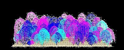


20 Simulating canopy images Measures 3D stand models Canopy images D1 D2 D3 D4 Radiative transfer (DART) D5 D6 D7 D8 3D mockup (Stretch)
21 Mitigating instrumental bias