DILLARD CREEK COMMUNITY WATERSHED Reconnaissance Channel Assessment and Summary Overview Assessment
|
|
|
- June Hill
- 5 years ago
- Views:
Transcription
1 DILLARD CREEK COMMUNITY WATERSHED Reconnaissance Channel Assessment and Summary Overview Assessment Prepared for: Weyerhaeuser Company Limited Princeton, BC Submitted by: Integrated Woods Services Ltd Hugh Allan Drive, Kamloops BC V1S 1J3 Phone: Fax: Website: Contact: Steve Henderson, FMIBC, RPF Phone: March 2, 2006
2 Table of Contents 1.0 INTRODUCTION METHODOLOGY Office Component ECA Calculations Field Component LAND-USE/TERRAIN / PHYSIOGRAPHY Water Licenses Restoration Priorities (from Restoration Plan, Forsite, 2001) RECONNAISSANCE CHANNEL ASSESSMENT Governing Conditions for Stream Channels Dillard Mainstem... 5 Dillard Creek Reach Dillard Creek Reach Dillard Creek Reach Dillard Creek Reach Dillard Creek Reach Dillard Creek Reach Table 1: Dillard Watershed Channel Data ECA Tables and Pine Beetle Impacts... 7 Table 2: ECA and Peak Flow Index CONCLUSIONS FROM RECONNAISSANCE CHANNEL ASSESSMENT RECOMMENDATIONS OVERVIEW ASSESSMENT REFERENCES APPENDICES Longitudinal Profile of Dillard Creek Dillard Creek Watershed Photos Integrated Woods Services Ltd i
3 1.0 INTRODUCTION Integrated Woods Services Ltd. was commissioned by Weyerhaeuser Company Limited to complete a channel assessment on Dillard Creek watershed. The watershed is located northeast of Princeton and has a total area of ha. The intent of the assessment is to review the current channel conditions and compare them to previous assessments, including The Overview Hydrologic Assessment of the Lamont Sub-basin (#108), prepared for Weyerhaeuser Canada Limited by Henderson Environmental Consulting, March 1999, as well as to consider the potential future impact of Mountain Pine Beetle on the channels. The objectives of the Reconnaissance Channel Assessment were to: 1) Field assess the current stream channel conditions, 2) Assess the sensitivity of the stream channels to impacts from land-use activities, 3) Identify sediment sources within the sub-basins coupled to the streams, 4) Expand on previous assessments, 5) Determine the effects of the current harvesting. 2.0 METHODOLOGY 2.1 Office Component A review of existing information included the following report: Dillard Creek Community Watershed Restoration Plan Years (Forsite Consultants Ltd., 2001) The previous review of existing information completed for the restoration plan included the following: An Assessment of Selected Stream Crossings at Barriers to Fish Passage (Snowy River Resources Ltd., 2001) Watershed Assessment of Dillard Creek (Henderson Environmental Consulting Ltd., 1999) Merritt Forest District- Interior Watershed Assessment Procedure (Middle Fork GIS, 1997) Additionally, water license data was obtained from the Ministry of Water Land and Air Protection to provide a comprehensive source of information for the project ECA Calculations The Equivalent Clearcut Area (ECA) is the area that has been harvested, cleared, or burned with consideration given to the silviculture system, regeneration, growth, and location within the watershed. The Peak Flow Index is often referred to as the weighted ECA as it multiplies the harvesting in the upper elevations by a factor. Integrated Woods Services Ltd 1
4 The Peak Flow Index (PFI) is a useful hydrologic analysis tool to establish the balance of harvesting between the upper and lower elevations. The index also accounts for the cumulative impact that results when harvesting occurs in higher elevations where increased snow accumulations are expected in BC s interior (BC Government, 1995). In a typical spring snowmelt governed watershed, low areas are usually snow-free while snow is actively melting at middle and higher elevations at the time that peak flows occur. Utilizing the PFI enables a measure of the harvested area that is contributing to snowmelt when the creeks are at their peak runoff. The PFI accounts for this by weighting disturbed openings above the H 60 line 1 by a factor of 1.5 (BC Government 1995). Weyerhaeuser Company Limited completed the calculations in January The ECA and PFI calculations include all existing cut blocks identified in Weyerhaeuser s Forest Development Plan. The results of these calculations were utilized to assist in developing the probability of a peak flow increase in each sub-basin. 2.2 Field Component The channel assessment was completed utilizing methodologies that satisfy the requirements of the Channel Assessment Procedure Guidebook (Government of British Columbia, 1996). Field assessments were conducted exclusively on the ground. The channel assessments occurred in September and October 2005, and the locations are identified on the map in the Appendix. The stream reaches assessed in the field were determined by channel characteristics, riparian condition, proximity to known or suspected sediment sources and/or accessibility. The Channel Assessment Procedure (Government of BC, 1996) and the Rosgen (1996) Classification System (see Appendix A) were utilized to classify stream channel morphology and to evaluate channel sensitivity, while the Channel Assessment Procedure (CAP) was used to classify the stream channel disturbance levels. The longitudinal profiles, watershed report cards and channel assessment maps (including any sediment source sites from the 1999 assessments) are presented in the Appendices. 3.0 LAND-USE/TERRAIN / PHYSIOGRAPHY The Dillard Creek Watershed is licensed to the village of Missezula Lake, which is located at the southern end of Missezula Lake. The major tributaries in the Dillard Creek Watershed are Vinson Creek and several unnamed tributaries. The watershed is comprised of Dillard Creek, Vinson Creek and several unnamed tributaries. The headwater of Dillard Creek is a large pond and Vinson Lake is the head of Vinson Creek. Vinson Lake is dammed at its outlet for water storage and discharge control. Dillard Creek drains into Summers Creek. 1 The H60 line is defined as that elevation above which 60% of the watershed lies Integrated Woods Services Ltd. 2
5 3.1 Water Licenses There are a total of 4 water licenses in the Dillard Creek Community Watershed that include: 1 Waterworks Local Authority, 2 Domestic, and 1 Irrigation. The Waterworks license is the largest for 17,700,000 gallons per year, the 2 domestic licenses are for only 182,500 gallons per year, and the Irrigation license is for 12.5 acre feet per year. The Waterworks license does not appear to be currently active. The annual license fees have not been paid since 1993 (pers. comm. Land and Water BC, 2006), and the concrete/steel intake structure evaluated during the channel assessment is significantly damaged (see photographs in appendix). The local community that used to rely on Dillard Creek is now believed to be using Missezula Lake and/or a well for their water supply. 3.2 Restoration Priorities (from Restoration Plan, Forsite, 2001) The Restoration Plan identified the following Surface Erosion concerns from the Dillard Creek Watershed Assessment conducted by Henderson Environmental Consulting Ltd. There were very few restoration priorities within the watershed. Forsite and Weyerhaeuser have reviewed these sites for feasibility of restoration activities. Some sites that are naturally occurring or deemed low risk were not considered for this plan. The following table identifies those impacts identified during the assessment and Forsite s office review along with potential restoration options, sediment delivery class and map reference. Integrated Woods Services Ltd. 3
6 Map Reference Description / Location Risk / Hazard Point Source Survey Landslides L1 Debris Avalanche L2 Debris Avalanche Operating Area Responsible Agent Recommendations for Rehabilitation - - N/A Natural debris avalanche 166 m upstream of Community water intake (0.15 ha) - - N/A Debris avalanche (natural), 150 m upstream of Community water intake (0.03 ha) L3, L4 Small Slumps - - N/A Natural slumps (2), m upstream of Community water intake (<0.01 ha) L5 Debris Avalanche L6 Small Debris Avalanche Sediment Source Survey Roads SS5 Raveling cutbank - - N/A Debris avalanche (road fill failure) located 350 m upstream of Community water intake (0.06 ha) - - N/A Natural debris avalanche 40 m below Community water intake M Weyerhaeu ser MoF FSR Sump in ditch, and/or reshape cutbank and seed The sites L1 to L6 are natural and no further works were completed. They continue to exist in 2005 and were identified in the field review. The previous slope instabilities at the sites have resulted in severe channel disturbance in reach 1. The site SS5 was an isolated site considered a moderate priority site, and was addressed by Weyerhaeuser. Integrated Woods Services Ltd. 4
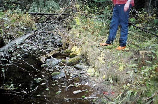
7 4.0 RECONNAISSANCE CHANNEL ASSESSMENT The point of interest for this channel assessment is identified as the first bridge downstream of the historic water intake. The channel assessment focused on the mainstem of Dillard Creek and major tributaries. The channel was assessed during a low-flow period (September and October 2005) to ensure channel morphology could be thoroughly evaluated. 4.1 Governing Conditions for Stream Channels Church (2000) identifies a number of primary conditions governing stream channel morphology. These primary conditions governing stream channel morphology are: 1) the amount and timing of water delivered to the channel, 2) the amount and caliber of sediment delivered to the channel, 3) the supply of wood to the channel (in forested ecosystems), 4) the condition of the stream banks (including riparian vegetation), and 5) the gradient over which the stream flows. Secondary factors governing stream channel morphology are streambed materials, local climate, watershed geomorphology, and land-use activities. Changes in stream channel morphology will occur over time in response to natural or human-influenced variations in bank conditions and supply of water, sediment, and/or debris. Streams are dynamic systems and change is constantly occurring, however, natural events or land-use activities can affect the rate of change. 4.2 Dillard Mainstem Dillard Creek was divided into 6 reaches based on gradient, channel morphology and tributary influence. The reach breaks are identified on the longitudinal profile and map within this report. Following is a brief description of each reach. Dillard Creek Reach 1 Reach 1 was surveyed in two sections. The channel morphology is step-pool cobble. Large Woody Debris (LWD) was not functioning in the assessed sections of this reach. The channel disturbance ranges from partially to moderately degraded and is associated with the historic mass wasting events (slides) that are coupled to the channel. The channel is composed of large cobble and boulders and has been significantly widened as a result of the input of sediment from the events. The riparian vegetation has not been harvested in this reach, however it has been reduced where the hillslopes are unstable. The old water intake between the slides is not functioning as a result of the large deposition of material from the slides. Downstream of the old water intake the channel begins to recover and more stable step-pool morphology was observed. Integrated Woods Services Ltd. 5
8 Dillard Creek Reach 2 Reach 2 was not assessed in the field. Dillard Creek Reach 3 Reach 3 was surveyed at a section on the mainstem, as well as at each of the two main tributaries from the north. The section of mainstem has a riffle pool cobble channel morphology. The LWD is functioning in the assessed section. There is some minor disturbance downstream of the confluence with the tributary from Vinson Lake. The disturbance was associated with some blowdown along the creek and a decrease in channel gradient that enables deposition of any entrained sediment. The mainstem varies between stable and partially aggraded to partially degraded. The first tributary from the north is from Vinson Lake that is dammed and has regulated flows. The channel morphology upstream of the main road is riffle pool gravel and is not disturbed (stable). The morphology of the second tributary is cascade pool gravel and is also not disturbed. The riparian vegetation is intact with functioning conifers. Dillard Creek Reach 4 Reach 4 was surveyed at two channel sections on the mainstem and two on the north tributary. The morphology of the mainstem is cascade pool cobble. The banks and the bed materials are both partially covered with moss and are stable. The LWD is functioning, the banks were undercut, and the riparian vegetation is intact. The north tributary ranges from cascade pool cobble to step pool cobble. LWD is functioning in the assessed sections of the tributary, with some slightly elevated bars behind accumulations and undercut banks. There were some sections of isolated partial disturbance in the mainstem and north tributary, but overall they were considered to be stable. Dillard Creek Reach 5 This reach was surveyed at one section. This section has a low gradient, is intermittent, and is located between two marshes. Dillard Creek Reach 6 Reach 6 was not assessed in the field. Integrated Woods Services Ltd. 6
9 Table 1: Dillard Watershed Channel Data Site Slope Depth Diameter Wb Morphology 1 Dillard Bridge Crossing on 9% 55cm 38cm 5.8m SPc D1 Simen Rd d/s of intake Reach 1 2 Dillard Bridge Crossing on Simen Rd u/s of intake Reach 1 3 Dillard reach 3 tributary d/s of Vinson Lake, upstream of road - 10% 70cm 35cm 9.5m SPc D1 to D3 2% 30cm 1cm 1.30m RPg-S 4 Dillard - reach 3 tributary 7% 9cm 7.5cm 2.5m CPg-W S 5 Dillard - reach 4 downstream of 5% 60cm 7cm 3.4m CPg-W S road 6 Dillard - reach 4 3% 50cm 6cm 3.6m RPc-W S 7 Dillard reach 4 tributary 4% 30cm 7cm 2.9m CPc-W S 8 Dillard reach 4 tributary 7% 60cm 7cm 2.3m RPc-W S 9 Dillard tributary reach 4 tributary 8% 25cm 6cm 1.5m SPc-W S 10 21km on Dillard FSR reach Dillard reach 3 tributary d/s of 5% 35cm 12cm 2.2m CPc W S Vinson Lake and road 12 Dillard Mainstem reach 3 d/s of tributary 5% 50cm 20cm 3.9m RPc-W S to A1/D1 Morphology: D2 moderately degraded D1 partially degraded S Stable A2 moderately aggraded A1 partially aggraded 4.3 ECA Tables and Pine Beetle Impacts Between 2005 and 2010 the proposed harvesting will result in the ECA increasing from 14% to 25%, and the associated Peak Flow Index (PFI) increasing from 0.19 to An ECA of 25% and PFI of 0.32 could potentially result in minor increases in peak flows that will likely not be detectable. Based on the observed channel conditions there is a low risk that a slight increase in flows would result in any increased disturbance. Table 2: ECA and Peak Flow Index Dillard Watershed ECA 2005 Dilllard Watershed ECA 2010 Watershed ECA Peak Flow Index ECA Peak Flow Index Dillard 14 % % 0.32 The GIS analysis indicates after the proposed harvesting is completed, that 50% of the residual stands in the watershed will have lodgepole pine (Pinus contorta) as a leading species. If the mountain pine beetle were to result in 80% mortality of the susceptible pine stands, (Ministry of Forests entomologists predictions, 2005), the ECA could Integrated Woods Services Ltd. 7
10 increase by 40% from the proposed 25% to near 65%. This is based on the assumption that a dead pine stand that is not harvested will have the same ability to intercept snow as a deciduous stand, or 0% (refer to research results below). Research on hydrologic effects of mountain pine beetle in the interior pine forests of British Columbia have resulted in many recent publications. In general they all indicate that peak and annual flows will increase, and the timing of peak flows may move forward a couple weeks (Unila, Guy and Pike, 2006). The results of the research also indicate there are some concerns that have answers, while others have only been addressed by theory: Changes in forest structure resulting from beetle-kill could modify key hydrologic process (MacDonald and Stednick, 2003). In the interior pine forest of BC, the annual accumulations and melt of the snowpack principally drive the hydrologic regime. This accumulation and melt are modified by hydrologic processes such as interception, evaporation, transpiration, snowpack redistribution (i.e. wind patterns) and melt (i.e. energy absorption), and groundwater storage. The effects of beetlekill on these processes, with or without salvage harvesting, is unknown (Maloney, 2005) and may mimic that of conventional timber harvesting of similar size and extent. While transpiration is expected to be similar between beetle-killed stands and recent harvested areas (since trees do not transpire), the effects of beetle-kill on hydrologic processes may be different than the effects of timber harvesting. Beetlekilled trees retain their needles and branches, stay standing, and potentially affect forest regeneration after they have been killed. Furthermore, beetle-killed stands may retain live understory vegetation and are not necessarily impacted by road development, unlike conventional harvested stands (Unila, Guy and Pike, 2006). The presence of a multi-storied stand may mitigate the hydrologic effects of beetle-kill (Schmid et al., 1991) supports the recent recommendation of BC s chief forester to increase retention levels when salvaging beetle-killed stands (Snetsinger, 2005). Retaining structure such as live trees (including understory) and standing and fallen dead trees may reduce the risks of large-scale salvage, particularly until watersheds have reached hydrologic recovery (Snetsinger, 2005; Unila, Guy and Pike, 2006). A research project on harvesting in drier climates similar to some parts of the assessed watershed indicates the following: A review of paired watersheds by Bosch and Hewlett (1982) noted that annual precipitation must exceed 450 mm in order to detect an increase in runoff as a result of removing a larger fraction of the vegetation cover in a watershed (Helie; Peters, Tattrie and Gibson, 2005). This supports the theory that harvesting drier parts of the watershed will contribute less to hydrologic change than wetter parts. Integrated Woods Services Ltd. 8
11 5.0 CONCLUSIONS FROM RECONNAISSANCE CHANNEL ASSESSMENT The Reconnaissance Channel Assessment of Dillard Creek Community Watershed included an assessment of 12 channel sections distributed through the watershed and included assessments of the three main tributaries. Water quality and quantity, and the fisheries resource were considered the primary resource values. This re-assessment has identified the channels in upper Dillard Creek Community Watershed to be generally stable with sections of partially aggraded and degraded conditions. The partial disturbance is in isolated sections and considered to be within natural variations that are expected to occur in a channel. The mass wasting sites in reach 1 had a significant impact on the channel condition, although the conditions were observed to be stabilizing downstream at the bridge crossing. The mainstem of Dillard is greater than 1.5m wide in almost all sections except the upper watershed. Under the Forest Practices Code of British Columbia Act that is being replaced by new legislation, the streams are considered S3 s or greater. This results in at least a 20 metre riparian reserve being required as well as an additional 20 metre riparian management zone. This degree of riparian management should be adequate to maintain channel conditions in Dillard Creek relative to the influence of riparian vegetation. The reaches are generally considered to have the following sensitivities: Moderately sensitive to increased peak flows, Moderately sensitive to increased sediment supply, and Highly sensitive to decreased LWD Supply. The road conditions and existing harvesting were not observed to be impacting the channel conditions in Dillard Creek. Future management needs to ensure the roads continue to be a minimal source of sediment and that the riparian buffers are maintained where recommended. The current and proposed Equivalent Clearcut levels of 14% and 25% are considered low risk levels that are unlikely to result in channel disturbance. If peak flows were to increase slightly as a result of an ECA at 25% the observed channel conditions suggest it will be resilient to impacts provided the riparian buffers remain intact. The adjacent Rampart Creek Watershed currently has an ECA of 26%, which is greater than the level proposed to occur in Dillard. The channel conditions in Rampart are similar to those identified in Dillard Creek except where the landslides exist in the lower watershed. The observed conditions in Rampart further support the conclusion that Dillard can accommodate an ECA of 25% without anticipating any additional channel disturbance from peak flows. The watershed is identified to have lodgepole pine as a leading species in 50.0% of the residual stands in the watershed following the proposed harvesting. If the mountain pine beetle were to result in 80% mortality of the susceptible pine stands the ECA could Integrated Woods Services Ltd. 9
12 increase from the proposed 25% to near 65%. The potential for the ECA to increase to 65% as a result of mountain pine beetle is a concern that could result in increased disturbance in the channel if peak flows were to increase. Potentially the hydrologic impacts of the mountain pine beetle will be reduced if they occur in the drier parts of the watershed. An increase in LWD from all the dead pine trees as a result of mountain pine beetle would not be a primary concern, as it is identified as generally assisting in channel stability. In summary, the sensitivity of the channels to existing and proposed levels of development is considered to be low if existing management strategies continue. However, if the mountain pine beetle infestation results in 80% mortality of the pine stands there would be an expected increase in channel disturbance and peak flows. Integrated Woods Services Ltd. 10
13 6.0 RECOMMENDATIONS The following recommendations should be considered when planning future forestry related activities: 1) Any new in-block roads should be a focus for deactivation where future use is unlikely or not required. Stream crossings should be deactivated and minimized where possible to reduce the potential for sediment delivery. 2) Trees in riparian areas are a source of functioning large woody debris and will assist in minimizing future channel disturbance in the watershed. Any new harvesting on streams greater than 1.5 m in width need a 20 meter riparian reserve (this is typical S3 management as per the existing Forest Practices Code). Leaving future LWD recruits should be included in the management strategy for smaller streams where a channel depends on LWD to maintain its integrity. Weyerhaeuser s current riparian strategies for smaller streams (1.5m - 3m) are appropriate. They are the following: Weyerhaeuser generally consider reserves of variable widths on the larger confirmed S4's as well as larger S6 streams (1.5m - 3m). They allow variance due to harvest method i.e. cable, but consider this acceptable as the majority of the ground adjacent to streams is conventional ground where reserves can be left. Variable width reserves are preferred as it provides more flexibility during layout in reacting to what the ground dictates. If the slope break into the riparian draw occurs at 15 m then place the reserve there and if the ground allows harvesting within 5m then take the boundary to that location. Also, Increase retention of reserve trees through the RMZ. 3) Do not remove post-harvesting large woody debris in stream channel without completing a professional assessment. 4) Channel conditions should continue to be monitored if future harvesting levels are proposed to increase. A subsequent reconnaissance channel assessment should be completed in ) Future harvesting plans need to focus on controlling the expected mountain pine beetle infestation. Yours truly, Integrated Woods Services Ltd. Stephen Henderson, FMIBC, RPF Forester and Hydrologist Integrated Woods Services Ltd. 11
14 7.0 OVERVIEW ASSESSMENT Watershed: Sub basin: Area (ha): Tenure: Area Logged (%) Equivalent Clearcut Area (ECA) % Channel Type (CAP) Width (m) Gradient (%) Watershed Type: Channel Conditions Dillard Creek Community Watershed Dillard Mainstem Majority is Crown Land. About 50% 14.3% SPc to RPg 1m to 10 m 1 to 10% The stream channel is highly coupled to the hillslope in reach 1, partially coupled in reach 2 and on a plateau in the upper reaches. Mostly no-disturbance except in reach 1 downstream of natural mass wasting events (slides). Mostly partially aggraded sections upstream. Riparian Condition Road Condition Hillslope Conditions Good, not disturbed. Good condition, not affecting downstream reaches. Natural hillslope instabilities in Reach 1 upstream of intake are resulting in severe channel disturbance in that reach. Integrated Woods Services Ltd. 12
15 8.0 REFERENCES Forsite Consultants Ltd., Dillard Creek Community Watershed Restoration Plan Years Government of British Columbia Interior Watershed Assessment Procedure Guidebook Level 1 Analysis. British Columbia Ministry of Forests. Victoria, British Columbia. Government of British Columbia Channel Assessment Procedure Guidebook. British Columbia Ministry of Forests. Victoria, British Columbia. Government of British Columbia Interior Watershed Assessment Procedure Guidebook British Columbia Ministry of Forests. Victoria, British Columbia. Henderson Environmental Consulting Ltd., Watershed Assessment of Dillard Creek. Hewlett, JD, Principles of Forest Hydrology. The University of Georgia Press: Athens Georgia, USA; 183. MacDonald, L.H. and J.D. Stednick Forests and water: a state-of-the-art review for Colorado. Colorado State University, CWRRI Completion Report No p. Maloney, D Mid-term impact of mountain pine beetle on watershed hydrology. Association of BC Forest Professionals. Forum 12(3):23. Available from: Middle Fork GIS, Merritt Forest District- Interior Watershed Assessment Procedure. Ministry of Forests Entomologist, MacLaughlan, L, 2005, pers. comm. Presentation on mountain pine beetle to the Kamloops Timber Supply Area Committee. Scherley, Ernie, 2006, pers. comm. Land and Water BC, Province of British Columbia. Schmid, J.M., S.A. Mata, M.H. Martinez, and C.A. Troendle Net precipitation within small group infestations of the mountain pine beetle. United States Department of Agriculture Forest Service, Rocky Mountain Forest and Range Experiment Station. Research Note RM-508. Snetsinger, J Guidance on landscape- and stand-level structural retention in large-scale mountain pine beetle salvage operations. BC Ministry of Forests and Range, Chief Forester. Available from: mountain_pine_beetle/stewardship/ Unila, Lars; Guy, Brian; Pike, Robin, 2005, Hydrologic Effects of Mountain Pine Beetle in the Interior Pine Forest of British Columbia: Key Questions and Current Knowledge, FOREX, in print. Integrated Woods Services Ltd. 13
16 9.0 APPENDICES Integrated Woods Services Ltd. 14
17 Longitudinal Profile of Dillard Creek Elevation (m) Reach Reach Reach Reach 1 Reach Reach Horizontal Distance (m) Longitudinal Profile of Dillard Creek Integrated Woods Services Ltd. 15


18 Dillard Creek Watershed Photos Missezula Lake Upstream of Dillard Creek s confluence Dillard - Reach 1 Dillard - Reach 1 d/s of slides exhibits some stability. Note the stonelines. Dillard - Reach 1 old intake Dillard - Reach 1 old intake 16


19 Dillard - Reach 1 Dillard - Reach 1 Dillard - Reach 1 mass wasting Dillard - Reach 1 upstream of intake Dillard - Reach 1 Dillard - Reach 1 17


20 Dillard Reach 3 tributary upstream of road Dillard Reach 3 Dillard Reach 4 Dillard Reach 4 Dillard Reach 4 Dillard Reach 4 18


21 Dillard Reach 4 Dillard Reach 4 Dillard Reach 4 Dillard Reach 4 Dillard Reach 4 Dillard Reach 4 19


22 Dillard Reach 4 north tributary Dillard Reach 4 Dillard Reach 4 north tributary Dillard Reach 4 north tributary Dillard Reach 4 south tributary Dillard Reach 4 south tributary 20

23 Dillard - Reach 5 downstream of marsh 21
24