Forest Classification. Forest Road/Trail Designations. Final Plan
|
|
|
- Erin Gaines
- 5 years ago
- Views:
Transcription

1 Forest Classification And Forest Road/Trail Designations For the Southern Minnesota State Forests Access Planning Unit Final Plan (Birch Lakes, Sand Dunes, R. J. Dorer Memorial Hardwood Forests and Scattered Lands) Minnesota Department of Natural Resources
2 DNR Southern Minnesota State Forests Access Planning Unit Road/Trail Designation Planning Team Craig Blommer, Co-Chair. Terry Helbig, Co-Chair.. Doug Rau Kevin Stauffer Don Nelson Jaime Edwards. Dean Olson... Greg Turner.. Joe Brown. Bart Richardson Michele Hanson......Trails & Waterways...Forestry...Forestry. Fish & Wildlife. Fish & Wildlife... Ecological Services...Enforcement...Enforcement Forestry, Geographic Information Systems.Geographic Information Systems......Planner

3 2008, State of Minnesota, Department of Natural Resources Equal opportunity to participate in and benefit from programs of the Minnesota Department of Natural Resources is available to all individuals regardless of race, color, creed, religion, national origin, sex, marital status, status with regard to public assistance, age, sexual orientation, or disability. Discrimination inquiries should be sent to MN DNR, 500 Lafayette Road, St. Paul, MN ; or the Equal Opportunity Office, Department of the Interior, Washington, DC
4 Table of Contents Executive Summary...5 Purpose...5 Lands Covered by This Plan...5 Motor Vehicle Use Classifications...6 Forest Route Inventory...7 Route Designations...7 Implementation and Monitoring 10 Southern Minnesota State Forests Access Planning Unit Plan...11 Background Planning Process 12 Description of Lands Covered by This Plan.13 Location, Acreage, and Ownership 13 State Administered Lands 13 Motor Vehicle Use Classification...15 Lands Covered by This Classification Review. 16 Inside State Forest Boundaries 16 Outside State Forest Boundaries...16 Classification Evaluation Process...16 Existing Motor Vehicle Use Classification...18 Adopted Classifications...18 Sand Dunes State Forest Closed...18 Birch Lakes State Forest Closed...19 Richard J. Dorer Memorial Hardwood State Forest Limited...20 Scattered State Forest Lands-20 Counties Limited Forest Route Inventory...27 Route Designation Policies and Process...28 Development of Access Proposals...29 Proposed Designations...30 Route Designation Summary...30 Forest Roads...30 System Forest Roads...32 Minimum Maintenance Forest Roads...32 Recreational Forest Trails...32 Non-Motorized Trails...32 All Terrain Vehicle (ATV) Trails...33 Off-Highway Motorcycle (OHM) Trails...33 Off Road Vehicle (ORV) Trails...33 Non-Designated Routes Implications from Classification...33 Non-Designated Routes Limited Classification...33 Non-Designated Routes Closed Classification...33 Proactive Closures...34 Southern Minnesota Forest Access Planning Unit 4 Final Version
5 Designation Maps...34 Public Review and Comment...34 Public Notices...34 Public Meetings...34 Commenting...35 Changes Between the Final Plan and the Draft Plan...36 Plan Implementation and Monitoring Adoption of the Classification and Road/Trail Designation Plan Road and Trail Development and Signing Projects Effective Date of Change in Motor Vehicle Use Classification Ongoing Monitoring and Management Appendices Maps Southern Minnesota Forest Access Planning Unit 5 Final Version September 12, 2008 September 19, 2008) Comment period ended (Extension for comments was provided to
6 EXECUTIVE SUMM ARY PURPOSE Minnesota Laws 2003, Chapter 128, Article 1, Section 167 as amended by Minnesota Laws 2005, 1s t Special Session, Chapter 1, Article 2, Section 152 directs the Commissioner of the Department of Natural Resources (DNR) to review the recreational motor vehicle use classification of all State Forest lands and to designate forest roads and trails. Following public review and comment, the Commissioner must change the status of State Forest lands subject to the review to a classification of limited or closed according to the process set forth in MN Rules Chap This plan also identifies those forest roads and trails that the DNR proposes to officially (un)designate for various motorized and non-motorized purposes within the planning area. Consistent with legislative policy direction, the future use of off-highway vehicles and motor vehicles (e.g., ATVs, OHMs, ORVs, HLVs), equestrian and bicycles in this area will henceforth be in accordance with the direction outlined in the final version of this plan, as adopted by the Commissioner. The motor vehicle use classification and road and trail designations are to be adopted and implemented through the publication of written orders in the State Register for each forest. Between 2003 and 2008, the DNR will review the motor vehicle use classification and designate forest roads and trails on all State Forest lands in Minnesota. This plan covers a portion of State Forest lands in the Southern Minnesota State Forests Access Planning Unit in southeastern and central Minnesota. LANDS COVERED BY THIS PLAN This plan proposes forest road/trail designations and motor vehicle use classifications on State Forest land within the statutorily defined boundaries of the Birch Lakes, Sand Dunes State Forests and Richard J. Dorer Memorial Hardwood Forest and on scattered DNR administered forestlands outside of state forest boundaries within the Southern Minnesota State Forests Access Planning Unit. Twenty counties are included in the expansive planning area including; Houston, Fillmore, Olmsted, Winona, Wabasha, Goodhue, Rice, Le Sueur, Dakota, Sherburne, Hennepin, Morrison, Stearns, Benton, Kandiyohi, Martin, Nicollet, Meeker, Sibley and Yellow Medicine Counties. The three State Forests and scattered lands have a gross acreage of approximately 1,032,300 acres, of which, about 60,020 acres (or about 5.81 %) are administered by the DNR Division of Forestry and were the focus of the review and management plan for the Southern Minnesota State Forests Access Planning Unit. Southern Minnesota Forest Access Planning Unit 6 Final Version
7 MOTOR VEHICLE USE CLASSIFICATIONS The State Forests and/or associated scattered State Forest lands in the Southern Minnesota State Forests Access Planning Unit are located south of US Highway 2 and must be reclassified as either limited or closed to comply with current Minnesota law; lands located north of US Highway 2 are to maintain a managed classification unless reclassified by the DNR Commissioner. The DNR Southern Minnesota State Forests Access Planning Unit Planning Team discussed alternative classification proposals and developed classification recommendations for State Forest lands in the planning area. All criteria listed in Minnesota Rules part , subpart 2 must be considered under the prescribed classification review. The Commissioner of Natural Resources classified State Forest lands within the planning area as follows: Birch Lakes State Forest Sand Dunes State Forest Richard J. Dorer Memorial Hardwood Forest Scattered DNR-administered State Forest Lands Benton Dakota Fillmore Goodhue Hennepin Houston Kandiyohi Le Sueur Martin Meeker Morrison Nicollet Olmsted Rice Sherburne Sibley Stearns Wabasha Winona Yellow Medicine Closed Closed Limited Limited Limited Limited Limited Limited Limited Limited Limited Limited Limited Limited Limited Limited Limited Limited Limited Limited Limited Limited Limited Southern Minnesota Forest Access Planning Unit 7 Final Version
8 FOREST ROUTE INVENTORY In 2003 and 2004, DNR staff made an effort to inventory the location and condition of all existing routes that show evidence of ongoing human use on state- and county-administered forestlands. The inventory identified approximately 384 miles of routes on DNR Forestryadministered lands in the Southern Minnesota Forests Access Planning Unit. Approximately 377 miles of inventoried routes are located inside the statutory boundary of the State Forests and just over 6.9 miles are located outside of State Forest boundaries. ROUTE DESIGNATIONS The planning team evaluated all inventoried forest access routes and recommended that they be designated as a road or trail, be closed to future use, or that they remain non-designated. For existing designated roads and trails, the presumption was that the current designation and uses would be maintained, unless there was a compelling reason to propose changes. State Forest Road Designations The DNR divides State Forest Roads into two classes System Forest Roads (SFRs) and Minimum Maintenance Roads (MMRs) based on their condition, intended use and planned maintenance level. State Forest Roads are generally open to use by both highway-licensed vehicles and off-highway vehicles (ATVs, OHMs, and ORVs). However, roads may be temporarily closed, at any time, to some or all vehicular use due to public safety and/or natural resource protection considerations. Minimum maintenance roads are more likely to be subjected to travel restrictions than are higher standard system forest roads. System Forest Roads (SFRs) are the major roads in the forest that provide forest management access, recreational access, and links to state, county, or township public roads. System roads are used on a daily or weekly basis, and are graveled and maintained to allow travel by highway-licensed vehicles. System roads are typically open to all motor vehicles, including OHVs, but may be closed seasonally or temporarily to address specific road or fire conditions. State Forest Roads are, by definition, not regular public roads. They are principally intended to serve state forest management and protection needs, and they do not provide legal access to private property. The planning team recommended the designation of miles of System Forest Roads within the Southern Minnesota State Forests Access Planning Unit and zero miles of SFR on scattered lands outside of the State Forests boundaries. Minimum Maintenance Roads (MMRs) are forest management access roads used on an intermittent basis. Recreational users may use them, but they are not promoted or maintained for recreational use. MMRs will be graded and graveled as needed for forest management purposes, but may not always be usable by low-clearance vehicles. MMRs are signed and may be gated and/or closed during certain times of the year. The planning team proposes designation of 1.82 miles of MMRs inside the Southern Minnesota State Forests Access Planning Unit and 0.47 miles on scattered state lands outside the forests. Recreational Trail Designations Non-motorized. The planning team has proposed the designation of 210 miles of trails for non-motorized use within the Southern Minnesota State Forests Access Planning Unit. Within Southern Minnesota Forest Access Planning Unit 8 Final Version
9 that 210 miles the team designated 166 miles to be available for equestrian trails and 133 miles available as mountain biking trails. Most of these routes have a history of such uses. Non-motorized trail users (e.g., hikers, cross-country skiers, snowshoers) may also use forest roads, trails, and most non-designated routes in the forest. Within the Richard J. Dorer Memorial Hardwood Forest, horses and bicycles may only be used on trails, which have been designated for those uses. See Minnesota Rule OHV Trails. There are miles of OHV trail designations proposed for the Richard J. Dorer Memorial Hardwood Forest. Snowmobile. This planning process does not address snowmobile trails so there are no changes proposed to the existing grant-in-aid snowmobile trail system. Proactive Route Closures. The planning team has recommended a total of 7.26 miles of unsustainable routes be closed to all vehicular, equestrian and mountain bicycle use. Non-designated Routes. The proposal is to leave a total of miles of routes as nondesignated. These routes will not be maintained for any recreational use, but may be used infrequently for natural resource management. Table 1 Southern Minnesota Forests Unit Forest Road & Trail Designation Summary summarizes the proposed designations of the inventoried forest routes on DNR managed lands within the forest boundaries and on scattered forestlands. Southern Minnesota Forest Access Planning Unit 9 Final Version
10 Table 1. Southern Minnesota State Forests Access Planning Unit Classification Review Road /Trail Designation Summary Statistics Source: Forest Access Route Unpublished Data, DNR DRS. Generated Using ArcView Extension Southern Minnesota State Forests Access Planning Unit Classification Review & Road/Trail Designations Summary Statistics for State Forests in Planning Unit Richard J. Dorer State Forest Sand Dunes State Forest Birch Lakes State Forest Other Scattered Lands Proposed Classifications Limited Closed Closed Limited Recreation Units of R. J. Dorer State Forest Snake Creek Trout Valley Zumbro Bottoms Hay Creek Kruger Bronk Tract Brightsdale Isinours Wet Bark (Oak Ridge) Total Acreages 3,480 2,375 5,068 1,500 1, ,640 2,042 3, DNR Forestry 3,480 2,375 5,068 1,500 1, ,640 2,042 3,681 * Private - Industry Private - Other County Vinegar Ridge (Money Creek) Reno Proposed Trail Designations Snake Creek Trout Valley Zumbro Bottoms Hay Creek Kruger Bronk Tract Brightsdale Isinours Wet Bark (Oak Ridge) Vinegar Ridge (Money Cr) Reno Existing Proposed Existing Proposed Existing Proposed Existing Proposed Existing Proposed Existing Proposed Existing Proposed Existing Proposed Existing Proposed Existing Proposed Existing Proposed Total Existing Proposed Rec. Units Proposed Scattered RJD Totals Existing Proposed Existing Proposed Proposed Forest Roads Total System Forest Roads Min. Maint. Roads Trails Total ATV Total Non-Motor Total Horse Mountain Bike Hike & Ski Horse - no Bike Mtn Bike-no Horse Accessible Non-Designated Routes Proactive Closures Total Routes Inventoried *Under R.J.D. the total of 48,255 ac for DNR Forestry acreage = 22,879 ac (RJD Recreation Unit acreage) + 25,376 ac (RJD Scattered Lands acreage) Under Other Scattered Lands "Existing" trail miles were unknown previous to study completed for this plan. Mileage used for "Existing" trail miles was taken from DNR published trail maps. Southern Minnesota Forest Access Planning Unit 10 Final Version
11 IMPLEMENTATION AND MONITORING The classifications of State Forest lands for motor vehicle use and the proposed road and trail designations were subject to public review and comment (July 7, 2008 through September 12, *Comments were accepted until September 19, 2008 due to the final Public Open House being held September 11, 2008.) The DNR evaluated public input received at the public open houses and written comments received in reaching final determinations. The Commissioner of Natural Resources has issued Commissioner s Orders to change the motor vehicle use classification and designate forest roads and trails. The effective date for the Commissioner s Orders is December 31, Southern Minnesota Forest Access Planning Unit 11 Final Version
12 SOUTHERN MINNESOTA FORESTS UNIT DRAFT PLAN BACKGROUND The Department of Natural Resources (DNR) manages over 4 million acres of State Forest land for the people of Minnesota. Minnesota s State Forests are managed to produce timber, protect watersheds, provide outdoor recreation, and perpetuate rare and distinctive species of native flora and fauna. State Forests are managed in a sustainable manner, in order to ensure that they remain healthy, vital, and productive for present and future generations. State Forests provide a variety of dispersed, unstructured outdoor recreation opportunities, such as hunting, trapping, berry picking, and nature observation. For more structured activities, many State Forests contain recreation facilities with campgrounds, day-use areas, and trails designated for various motorized and non-motorized purposes. Minnesota Statutes direct the Commissioner of Natural Resources to: Manage State Forests according to the principles of multiple use and sustained yield under M.S. Section , subd. 1; and Provide a system of forest roads and trails to access State Forest lands under M.S. Section , subd. 3. Prior to the mid-1980s recreational motor vehicle use was generally allowed in most State Forests. As the number of Off-Highway Vehicles (OHVs) increased, the DNR closed some forests to OHV use and began developing trails and other facilities for OHV use in other State Forests. In late 1996, the DNR began to reassess its OHV management programs. The DNR proposed classifying State Forests as managed, limited, or closed with respect to recreational motor vehicle use. In 1999 the DNR revised the rules governing recreational use of State Forests. Minnesota Laws 2003, Chapter 128, Article 1, Section 167 as amended by Minnesota Laws 2005, 1s t Special Session, Chapter 1, Article 2, Section 152 directs the Commissioner of the Department of Natural Resources to review the recreational motor vehicle use classification of all State Forest lands and to designate forest roads and trails. Following public review and comment, the Commissioner must change the status of State Forest lands subject to the review located south of US Highway 2 to a classification of limited or closed, or maintain a managed classification for State Forest lands north of US Highway 2 unless reclassified by the Commissioner. The motor vehicle use classification and road and trail designations are to be adopted and implemented through the publication of written orders in the State Register for each forest. This draft plan documents the outcome of that evaluation, and identifies the state forest classification and those forest roads and trails that DNR officially designated, or nondesignated, for various access purposes, both motorized and non-motorized, within the Southern Minnesota State Forests Access Planning Unit. When the recommendations are implemented, use of motor vehicles (e.g., All-Terrain Vehicles or ATVs, Off-highway Motorcycles or OHMs, Off-Road Vehicles or ORVs, and highway licensed vehicles or HLVs) in the Southern Minnesota State Forests Access Planning Unit will be limited to only those roads and trails that are specifically signed and/or designated for their use. The plan also identifies those routes DNR designated as non-motorized trails within the prescribed planning unit. Within the Richard J. Dorer Memorial Hardwood Forest, trails to be used for equestrian and mountain bike were also designated and signed for those uses. Southern Minnesota Forest Access Planning Unit 12 Final Version
13 NONMOTORIZED USE. Subpart 2.Horses. Within a state park and in the Richard J. Dorer Memorial Hardwood Forest, no person shall ride, lead, or have a horse except on trails and areas designated for use by horses. Horses are prohibited from using forest campgrounds unless the area has been specifically designated for use by horses or a special use permit from a forest officer has been obtained. Horses are permitted on all other forest lands except where it is posted to prohibit the use of horses. Subp. 3.Bicycles. Within a state park and in the Richard J. Dorer Memorial Hardwood Forest, people riding bicycles may travel only on designated bike trails or where motor vehicles are allowed, except in areas posted to prohibit bicycle use. Bicycles are permitted on all other forest lands except where it is posted to prohibit bicycle use. Statutory Authority: MS s ; 84.03; ; ; 85.20; 86A.05; 86A.06; ; to 89.21; History: 24 SR 208 Posted: October 11, 2007 MS VEHICLE USE ON PUBLIC LANDS; EXCEPTIONS Off trail or cross country OHV travel is not permitted in limited state forests, except pursuant to MS , which provides for certain big game hunting and trapping exceptions. These exceptions apply only to licensed individuals who operate ATVs or Highway Licensed Vehicles (HLVs) in the course of hunting or trapping activities during specified seasons. All other off trail use is illegal and subject to enforcement action. The exemptions do apply to the county scattered lands in Southern Minnesota State Forests Access Planning Unit, which are located outside the Richard J. Dorer Memorial Hardwood Forest. Within the Richard J. Dorer Memorial Hardwood Forest it is important to note that the seasonal hunting/trapping exceptions of MS do not apply. PLANNING PROCESS In March 2008, an interdisciplinary planning team with members from the DNR Divisions of Ecological Services, Enforcement, Fish & Wildlife, Forestry, Trails & Waterways and Regional Operations began working on the following tasks: 1. Collaborate with the public and other forest management agencies to develop a plan for the management of public motor vehicle use on forest lands in the planning area. 2. Consider the criteria for classification of State Forest lands (M.R. part ) and recommend an appropriate motor vehicle use classification. 3. Evaluate all inventoried forest access routes and propose non-designated of forest roads and trails for specific motorized and non-motorized uses. 4. Present the planning team s recommendations for public review, discussion and comment. The major steps in developing the road and trail designation proposals were to: 1. Compile an inventory of forest access routes, which are defined as forest roads and trails, and other routes, showing evidence of ongoing human use. Prepare maps Southern Minnesota Forest Access Planning Unit 13 Final Version
14 showing all travel routes. 2. Host a series of public open houses to alert people to the classification review and road and trail designation process, to gain an understanding of how they use these access routes, how they use state lands generally, and to solicit ideas regarding the use of the forest lands and future designation of selected routes. 3. Conduct interagency working sessions to make preliminary designation and use recommendations based on inventory data, staff knowledge, and public input from the open houses. 4. Identify routes potentially suitable for designation as motor/non-motor recreational trails. 5. Prepare designation plans and maps for internal agency and public review and comment. DESCRIPTION OF LANDS COVERED BY THIS PLAN Between 2003 and 2008, the DNR will review the motor vehicle use classification and designate forest roads and trails on all State Forest lands in Minnesota. Within the Southern Minnesota State Forests Access Planning Unit the forest classifications and road/trail designation plan covers all of the DNR Forestry-administered lands within the statutory boundaries of the Sand Dunes State Forest, Birch Lakes State forest and the Richard J. Dorer Memorial Hardwood Forest and scattered State Forest lands administered by the DNR Division of Forestry within the counties of Sherburne, Morrison, Benton, Kandiyohi, Martin, Nicollet, Meeker, Sibley, Yellow Medicine, Hennepin, Stearns, Houston, Fillmore, Olmsted, Winona, Wabasha, Goodhue, Dakota, Rice and Le Sueur. LOCATIONS, ACREAGES, AND OWNERSHIP The DNR s Southern Minnesota Forests planning unit is located in the following counties: Sherburne, Morrison, Benton, Kandiyohi, Martin, Nicollet, Meeker, Sibley, Yellow Medicine, Hennepin, Stearns, Houston, Fillmore, Olmsted, Winona, Wabasha, Goodhue, Dakota, Rice and Le Sueur Counties. The total planning unit covers just over 8,772,825 acres. There are three named State Forests with statutorily defined boundaries within the Southern Minnesota State Forests planning unit. These three State Forests have a gross acreage of about 1,032,300 acres, of which just over the DNR Division of Forestry administers just over 59,021 acres. STATE ADMINISTERED LANDS The State Forest lands located within the Southern Minnesota Forests Unit taken together encompass a gross acreage of about 1,032,300 acres. The Sand Dunes State Forest includes 11,040 acres within the statutory boundary, of which DNR s Division of Forestry administers 5,813 acres, or about 52.6%. Birch Lakes State Forest includes 630 acres within the statutory boundary, of which DNR s Division of Forestry administers 527 acres, or 83.7%. Richard J. Dorer Memorial Hardwood Forest includes 1,016,205 acres within the statutory boundary, of Southern Minnesota Forest Access Planning Unit 14 Final Version
15 which DNR s Division of Forestry administers 48,255 acres, or about 4.7%. Another 4,425 acres of forest land administered by the DNR Division of Forestry lies outside of State Forest boundaries in the Southern Minnesota Forests planning unit. Therefore, a total of 59,021 net acres were the focus of this planning exercise. See Table 2, Summary of Forest Land Ownership in Southern Minnesota State Forests Access Planning Unit. Table 2. Summary of Forest Land Ownership in Southern MN State Forests Access Planning Unit Source: Forest Access Route Unpublished Data, DNR DRS. Generated Using ArcMap Extension State Forest Richard J. Dorer Sand Dunes Birch Lakes Within-Forest Acreages & Inventory Statutory Land Administrator Acres (Acres) DNR County 1,016,205 48, ,040 5, Inventory Routes (Miles) Totals 1,016,205 54, Scattered Outside-Forest Acreage & Inventory County DNR-Administered Lands (Acres) Inventory Routes by County (Miles) Rice Le Sueur Sherburne Hennepin Morrison Benton Stearns Kandiyohi Martin Nicollet Meeker Sibley Yellow Medicine Totals Southern Minnesota Forest Access Planning Unit 15 Final Version
16 MOTOR VEHICLE USE CLASSIFICATION Minnesota Law requires the Commissioner of Natural Resources to complete a review of the classification of State Forest lands for motor vehicle use by December 31, The process and criteria for forest classification are contained in Minnesota Rules part subp. 2. The State Forest motor vehicle use classifications are characterized as follows: Managed Forest Lands. All state forest roads and trails are open to recreational motor vehicle use unless posted closed. These forest lands are characterized by a low intensity of use by OHVs, a variety of motorized and non-motorized recreational opportunities, widely dispersed use, and little competition among visitors for recreational use of the land. Signing and enforcement restrict motor vehicle use in sensitive resource areas and on designated recreational trails. ATVs may be operated on non-designated routes and off trail under the hunting and trapping exceptions except within the Richard J. Dorer Memorial Hardwood Forest. ORVs and HLVs may be operated on nondesignated routes under the hunting and trapping exceptions except within the Richard J. Dorer Memorial Hardwood Forest. When using motor vehicles on unsigned routes it is illegal to operate the vehicle in a manner that causes erosion or rutting or injures, damages, or destroys trees or growing crops. The managed classification can only be applied to forest lands north of US Highway 2. Limited Forest Lands. Forest roads are open to motor vehicle use unless posted closed. Forest trails are closed to motor vehicle use, except where designated and signed to permit specific motorized uses. These forest lands are characterized by moderate to high levels of motorized and non-motorized recreational use. It is necessary to designate OHV trails so that OHV use occurs only in suitable and sustainable locations. ATVs may be operated on non-designated routes and off trail under the hunting and trapping exceptions except within the Richard J, Dorer Memorial Hardwood Forest. ORVs and HLVs may be operated on non-designated routes under the hunting and trapping exceptions except within the Richard J. Dorer Memorial Hardwood Forest. Closed Forest Lands. Forest roads are open to motor vehicles licensed for highway use. No OHVs are permitted, except that OHVs may operate on frozen public waters (e.g., across lakes for ice fishing). Snowmobiles may operate on designated trails. These lands are characterized by high susceptibility to damage by motorized use or have a history that precludes motorized use. Areas closed to motor vehicle use by statute or regulations (e.g., State Forest lands within the BWCAW) are automatically classified as closed. The hunting and trapping exceptions do not apply in closed forests. The following criteria were considered for the classification of forest lands for motor vehicle use: A. resource sensitivity and management objectives; B. resource impact by motorized and non-motorized use, including erosion, rutting, and impacts on vegetation, wildlife, air, water, or natural habitats; C. motorized and non-motorized recreational opportunity in area; D. user needs, such as trails, parking, signs, and access; E. the degree and trend of motor vehicle use in the area; F. the degree and trend of non-motor vehicle use in the area; Southern Minnesota Forest Access Planning Unit 16 Final Version
17 G. competing interests among different user groups; and H. public safety and law enforcement concerns. LANDS COVERED BY THIS CLASSIFICATION REVIEW This motor vehicle use classification review covered State Forest lands in the Southern Minnesota State Forests Access Planning Unit. Scattered State Forest lands evaluated are located in Sherburne, Morrison, Benton, Kandiyohi, Martin, Nicollet, Meeker, Sibley, Yellow Medicine, Hennepin, Stearns, Houston, Fillmore, Olmsted, Winona, Wabasha, Goodhue, Dakota, Rice and Le Sueur Counties. The planning unit covers approximately 8,772,825 acres. INSIDE STATE FOREST BOUNDARIES There are three named State Forests with statutorily-defined boundaries within the planning unit. The Sand Dunes State Forest that has a gross acreage of about 11,040 acres, of which about 5,813 acres administered by the DNR Division of Forestry, the Birch Lakes State Forest that has a gross acreage of about 630 acres, of which about 527 acres administered by the DNR Division of Forestry and the Richard J. Dorer Memorial Hardwood Forest that has a gross acreage of about 1,016,205 acres, of which about 48,255 acres administered by the DNR Division of Forestry are each covered by this review. The motor vehicle use classification and related State Forest rules do not apply on federal, tribal, or private lands within State Forest boundaries. The classification and rules do not apply to state lands administered by DNR Divisions other than the Division of Forestry, such as State Parks, Wildlife Management Areas, Scientific & Natural Areas, or State Trails. OUTSIDE STATE FOREST BOUNDARIES The Southern Minnesota State Forests Access Planning Unit includes about 4,425 acres of scattered State Forest land administered by the DNR Division of Forestry outside of the State Forest boundaries. This land is located within: Sherburne, Morrison, Benton, Kandiyohi, Martin, Nicollet, Meeker, Sibley, Yellow Medicine, Hennepin, Stearns, Houston, Fillmore, Olmsted, Winona, Wabasha, Goodhue, Dakota, Rice and Le Sueur counties and is treated as State Forest land covered by this classification review. The motor vehicle use classification and related State Forest rules do not apply on federal, tribal, or private lands within State Forest boundaries. The classification and rules do not apply to state lands administered by DNR Divisions other than the Division of Forestry, such as State Parks, Wildlife Management Areas, Scientific & Natural Areas, or State Trails. CLASSIFICATION EVALUATION PROCESS DNR Southern Minnesota State Forests Access Planning Unit Team members reviewed the classification criteria, collected data related to classification, and gathered input from other DNR staff, and the public. Two public open houses were conducted on March 5 th and March 6 th, 2008 to kick off the planning process. DNR received written input from the public; in the form of comment forms, letters, and s. Potential options for classification schemes were discussed that resulted in the proposed classifications presented in this final plan. Preliminary Southern Minnesota Forest Access Planning Unit 17 Final Version
18 recommendations to classify Sand Dunes and Birch Lakes State Forests as closed and Richard J. Dorer Memorial Hardwood Forest and the scattered lands as limited set the stage for and intensive route-by-route evaluation exercise that followed. The planning team considered applying either a limited or closed classification for the Sand Dunes State Forest. The preliminary recommendation was to classify all State Forest lands as closed, with all DNR Forestry-administered lands south of US Highway 2 to be designated as an Area with Limitations on Off-trail and Non-designated Trail Use pursuant to M.S , subd. 5. This latter measure was considered important to protect important recreation values and sensitive resources. Previously permitted use of ATVs within the Sand Dunes State Forest had proven to be incompatible with the sensitive landscapes and unstable, highly erodable soils. Classifying the forest as closed will protect the area from impacts that may occur from off-trail travel by ATVs as permitted under the big game hunting and trapping exception provided in M.S , subd. 2. Equestrian use has become the established/traditional use for the area. This set the stage for examination of routes on DNR-administered lands and development of recommended designations of inventoried routes as forest roads and trails. The planning team considered applying either a limited or closed classification for the Birch Lakes State Forest. The preliminary recommendation was to classify all State Forest lands as closed, with all DNR Forestry-administered lands south of US Highway 2 to be designated as an Area with Limitations on Off-trail and Non-designated Trail Use pursuant to M.S , subd. 5. This latter measure was considered important to protect important recreation values and sensitive riparian areas from impacts that may occur from off-trail travel by ATVs as permitted under the big game hunting and trapping exception provided in M.S , subd. 2. This set the stage for examination of the limited miles of routes on DNR-administered lands and development of recommended designations of inventoried routes as forest roads and trails. The Birch lakes State Forest is only 630 acres in size and has had a tradition of equestrian use. The planning team considered applying either a limited or closed classification for the Richard J. Dorer Memorial Hardwood Forest. Both approaches presented management and enforcement challenges given the checkerboard, patchwork nature of public land ownership dotted throughout the forest. Consideration of the fact that several of the recreation units within the forest have established motorized uses was also a factored into the classification process. This set the stage for examination of routes on DNR-administered lands and development of recommended designations of inventoried routes as forest roads and trails. The planning team members considered and developed recommendations for forest classifications and road and trail designations over the period March 2008 to June 2008; these were provided for public review and comment over the period July 7 September 12, Draft and final recommendations for forest classifications and specific trail designation recommendations are based upon statutory criteria, an evaluation of existing conditions, and review of existing use levels and patterns. The planning team members sought to protect natural resources and further resource management objectives through these recommendations. Southern Minnesota Forest Access Planning Unit 18 Final Version
19 EXISTING MOTOR VEHICLE USE CLASSIFICATION Motor vehicle use has generally been allowed in most State Forests. As the number of OHVs increased, the DNR closed some State Forests to OHV use and began developing trails and other facilities for OHV use in other State Forests. In late 1996, the agency began to reassess its OHV management programs. The DNR proposed classifying State Forests as managed, limited, or closed with respect to motor vehicle use. In May 1998 a series of public open houses were held to discuss the proposed classifications of State Forests for motor vehicle use. On September 3, 1998 the Commissioner of Natural Resources issued a memorandum establishing interim classifications for all State Forests. The interim classifications became permanent on January 1, The classification for all DNR Division of Forestry-administered State Forest land in the Southern Minnesota State Forests Access Planning Unit was managed. ADOPTED CLASSIFICATIONS The State Forests and/or associated scattered State Forest lands in the Southern Minnesota State Forests Access Planning Unit must be reclassified as either limited or closed to comply with current Minnesota law. The DNR Southern Minnesota State Forests Access Planning Unit Team discussed alternative classification proposals and developed classification recommendations for State Forest lands in the planning area. The primary reasons supporting the classification recommendation for the State Forest lands in the planning unit are presented below. All criteria listed in Minn. Rules part , subpart 2 were considered under the final classification review. The planning team recommends that the Commissioner of Natural Resources classify State Forest lands within the planning area as described in the following text. Sand Dunes STATE FOREST CLOSED The Sand Dunes State Forest is located in central Sherburne County, about three miles west of Zimmerman and five miles north of Big Lake, MN. The forest s statutory boundary encompasses acres. The DNR Division of Forestry administers 5,813 acres of this total acreage. The balance, includes 5,223 acres is in private ownership and four acres in county ownership. The area was farmed until the drought of the Dust Bowl ( ) when the light, worn out sandy soils in the area began to drift. Concerned citizens planted a variety of tree species in an attempt to stabilize the soils. Over 2,400 acres of tree plantations are now established within the Sand Dunes State Forest. The outdoor recreation facilities in the Sand Dunes State Forest include the Bob Dunn Recreation Area, Ann Lake Day Use Area, Sand Dunes Horse Camp and includes 18 miles of trails available for horseback riding and hiking and are groomed in the winter for snowmobiling. DNR received public input at the public open houses and directly from individuals and groups until the end of the official comment period on September 12, (*Note comments were accepted until September 18 th, 2008 due to the final public open house being scheduled on September 11, 2008.) Comments were both general and forest-specific. General comments provided both support and concern for continued equestrian trails on public lands in Minnesota, Southern Minnesota Forest Access Planning Unit 19 Final Version
20 coupled with statements regarding trail: impacts, damage, sustainability, enforcement, funding, monitoring, and maintenance. Issues raised in public comments specific to the Sand Dunes State Forest are generalized below: Requests for DNR to adopt a closed classification. This forest is fragile ecosystem; sensitive nature of natural communities to impacts from motorized uses, especially in terms of soils, erosion, water quality, vegetation, wildlife. Designated trail systems needed for quality non-motorized recreational experience. Forest not suited to motorized recreation. Maintain or increase miles of equestrian opportunities and trail miles. All state land within the Sand Dunes State Forest statutory boundaries are currently classified as closed. The planning team recommends continuation of a closed classification for the Sand Dunes State Forest. The Sand Dunes State Forest soils will not support sustainable motorized use. Only non-motorized trail designations are proposed in the plan. Horse riding has a history as an established use within the forest and will be retained as a permitted use. Birch Lakes STATE FOREST CLOSED The Birch Lakes State Forest is located Stearns County about 10 miles north of Interstate 94 and the cities of Freeport and Melrose. The forest lies between Big and Little Birch Lakes and includes two hundred yards of shoreline on Big Birch Lake. The forest s statutory boundary encompasses just over 630 acres. The DNR Division of Forestry administers acres of this total acreage with the balance of acres in private ownership. Birch Lakes State Forest is managed primarily as a recreation area due to its small size. The forest, however does produce timber, provides habitat for wildlife and is used to demonstrate forest management principles. The forest includes a campground, day use area, water access, hiking and snowmobile trails. Recreational motor vehicles and horses have been prohibited from using any of the trails in the forest. DNR received public input from the open houses and directly from individuals and groups until the end of the official comment period on September 12, (*Note comments were accepted until September 18 th, 2008 due to the final public open house being scheduled on September 11, 2008.) Few public comments specific to the Birch Lakes State Forest were received. Established uses include hiking and cross country skiing and due to the small size and sensitive resources the forest is not well suited for motorized recreation. All state land within the Birch Lakes State Forest statutory boundaries are currently classified as closed. The planning team considered the appropriateness of a closed versus limited classification for the Birch Lakes State Forest. In considering the most desirable future condition, particular attention was paid to addressing what framework of public access best recognized the need to protect sensitive natural areas. The planning team recommends continuation a closed classification for the Sand Dunes State Forest for public review and comment. Only non-motorized trail designations are proposed in the plan. Southern Minnesota Forest Access Planning Unit 20 Final Version
21 Richard J. Dorer Memorial Hardwood FOREST - LIMITED The Richard J. Dorer Memorial Hardwood Forest is located in the southeast corner of Minnesota. The forest s statutory boundary encompasses 1,016,205 acres. The DNR Division of Forestry administers 48,255 acres of this total acreage with the balance of 3,012 acres owned by private forest industries, 964,678 acres in private ownership and 260 acres in county ownership. The Richard J. Dorer Memorial Harwood State Forest is unusual in that most of the land is held in private ownership and the majority is not forested. The forested lands are concentrated in eleven management units. They are Brightsdale, Bronk, Hay Creek, Isinours, Kruger, Reno, Snake Creek, Trout Valley, Vinegar Ridge (Money Creek), Wet Bark (Oak Ridge) and Zumbro Bottoms. These units provide a variety of recreational opportunities. For example, the Hay Creek Management Unit, just south of Red Wing, occupies the slopes and valley of its namesake. Hay Creek is popular with trout anglers and its 16 miles of bridle paths are a favorite with horseback riders. Zumbro Bottoms includes three campgrounds and 46 miles of bridle paths that draw up to 20,000 horseback riders a year. The Snake Creek and Trout Valley units lie on slopes facing the Mississippi River, halfway between Wabasha and Winona. They are the only units in the Dorer forest with trails open to off-road vehicles. Mountain bikers use the non-motorized trails of the Bronk unit near Winona. And hikers seeking steep, isolated trails travel to the Reno unit where they are provided with an overlook of the Mississippi River near the Iowa border. Richard J. Dorer Memorial Hardwood Forest produces high-quality hardwoods such as red and white oak. Other important trees in the southeast are various maple species and white pine and a small share of the harvest being ash, elm, cottonwood, basswood, and black walnut. DNR received considerable public input from the open houses and directly from individuals and groups throughout the designation process. Comments were both general and forest-specific. General comments ranged from strong support to strong concern for OHV, OHM and equestrian trails on public lands in Minnesota, coupled with statements regarding shared trail uses, trail impacts, damage, sustainability, enforcement, funding, monitoring, and maintenance. Issues raised in public comments specific to the Richard J. Dorer State Memorial Hardwood Forest are generalized below: The forest units are fragile ecosystems; sensitive nature of natural communities to impacts from motorized uses, especially in terms of soils, erosion, water quality, vegetation, and wildlife and therefore may not be suited to motorized recreation. Designated trail systems needed for quality motorized recreational experience. Do not mix equestrian with mountain bike use. Incompatibility of equestrian and mountain bike uses at the Hay creek Management Unit where there is heavy use by horse riders, potential safety risk and need for separation or elimination of mountain bike use at the unit. Maintain or increase equestrian opportunities and trail miles. Maintain or increase OHM event opportunities and trail miles. Maintain or increase miles and opportunities for OHV trails. Need for a facility like the Gilbert Iron Range Off-highway Vehicle Recreation Area Develop trails connecting use areas and other trails for both ATVs and Horses The planning team expended great effort considering the appropriateness of a closed versus limited classification for the Richard J. Dorer Memorial Hardwood Forest. The team recognized that the management of public access and recreation has been variable. In considering the Southern Minnesota Forest Access Planning Unit 21 Final Version
22 most desirable future condition, particular attention was paid to addressing what framework of public access best recognized the need to protect sensitive natural areas while recognizing many routes could sustain varying degrees and types of trail use. The planning team recommends a limited classification for the Richard J. Dorer Memorial Hardwood Forest. It should be noted that the cross-country travel by ATVs for big game hunting activities (i.e., M.S , subd. 4) does not apply within the Richard J. Dorer Memorial Hardwood Forest. Southern Minnesota Forest Access Planning Unit 22 Final Version
23 SCATTERED STATE FOREST LANDS / BENTON COUNTY LIMITED The Southern Minnesota Forests Access Planning Unit includes approximately 120 acres of DNR Forestry administered land in scattered tracts outside of State Forest boundaries within Benton County that are managed as State Forest land and thus need forest classification for motor vehicle use. The scattered State Forest land parcels in Benton County occur as both Minnesota School Trust Lands and other non-trust parcels. All State Forest lands within Benton County are currently classified as limited. The planning team recommends a limited classification for the scattered State Forest lands in Benton County. About 2.7 miles of inventoried routes occur on these acres, with a recommendation for all miles to retain a non-designated status. These routes were too short to warrant designated forest roads or recreational trails, including non-motorized ones. A limited classification will allow historic big game hunting and trapping access as afforded under M.S. Section , subd. 2 and 4, while protecting other resource values. Public access for other utilitarian purposes, such as berry picking, will only be possible by foot travel, or other non-motorized methods, on non-designated routes under a limited classification. The Department received no comments from the public specific to the proposed motor vehicle use classification or designations of forest roads on the DNR Forestry-administered state forest lands in Benton County during the designation planning process. SCATTERED STATE FOREST LANDS / HENNEPIN COUNTY LIMITED The Southern Minnesota State Forests Access Planning Unit includes approximately 5 acres of DNR Forestry administered land in scattered tracts outside of State Forest boundaries within Hennepin County that are managed as State Forest land and thus need forest classification for motor vehicle use. The scattered State Forest land parcels in Hennepin County occur as both Minnesota School Trust Lands and other non-trust parcels. All State Forest lands within Hennepin County are currently classified as limited. The planning team recommends a limited classification for the scattered State Forest lands in Hennepin County. There were zero miles of inventoried routes occurring on these acres. SCATTERED STATE FOREST LANDS / KANDIYOHI COUNTY LIMITED The Southern Minnesota State Forests Access Planning Unit includes approximately 200 acres of DNR Forestry administered land in scattered tracts outside of State Forest boundaries within Kandiyohi County that are managed as State Forest land and thus need forest classification for motor vehicle use. The scattered State Forest land parcels in Kandiyohi County occur as both Minnesota School Southern Minnesota Forest Access Planning Unit 23 Final Version
24 Trust Lands and other non-trust parcels. All State Forest lands within Kandiyohi County are currently classified as limited. The planning team recommends a limited classification for the scattered State Forest lands in Kandiyohi County. There were zero miles of inventoried routes occurring on these acres. SCATTERED STATE FOREST LANDS / LE SUEUR COUNTY LIMITED The Southern Minnesota State Forests Access Planning Unit includes approximately 80 acres DNR Forestry administered land in scattered tracts outside of State Forest boundaries within Le Sueur County that are managed as State Forest land and thus need forest classification for motor vehicle use. The scattered State Forest land parcels in Le Sueur County occur as both Minnesota School Trust Lands and other non-trust parcels. All State Forest lands within Le Sueur County are currently classified as limited. The planning team recommends a limited classification for the scattered State Forest lands in Le Sueur County. There were zero miles of inventoried routes occurring on these acres. SCATTERED STATE FOREST LANDS / MARTIN COUNTY LIMITED The Southern Minnesota State Forests Access Planning Unit includes approximately 51 acres DNR Forestry administered land in scattered tracts outside of State Forest boundaries within Martin County that are managed as State Forest land and thus need forest classification for motor vehicle use. The scattered State Forest land parcels in Martin County occur as both Minnesota School Trust Lands and other non-trust parcels. All State Forest lands within Martin County are currently classified as limited. The planning team recommends a limited classification for the scattered State Forest lands in Martin County. There were zero miles of inventoried routes occurring on these acres. SCATTERED STATE FOREST LANDS / MEEKER COUNTY LIMITED The Southern Minnesota State Forests Access Planning Unit includes approximately 41 acres DNR Forestry administered land in scattered tracts outside of State Forest boundaries within Meeker County that are managed as State Forest land and thus need forest classification for motor vehicle use. The scattered State Forest land parcels in Meeker County occur as both Minnesota School Trust Lands and other non-trust parcels. Southern Minnesota Forest Access Planning Unit 24 Final Version
25 All State Forest lands within Meeker County are currently classified as limited. The planning team recommends a limited classification for the scattered State Forest lands in Meeker County. There were zero miles of inventoried routes occurring on these acres. SCATTERED STATE FOREST LANDS / MORRISON COUNTY LIMITED The Southern Minnesota State forests Access Planning Unit includes approximately 2,884 acres DNR Forestry administered land in scattered tracts outside of State Forest boundaries within Morrison County that are managed as State Forest land and thus need forest classification for motor vehicle use. The scattered State Forest land parcels in Morrison County occur as both Minnesota School Trust Lands and other non-trust parcels. All State Forest lands within Morrison County are currently classified as limited. The planning team recommends a limited classification for the scattered State Forest lands in Morrison County. About 4.15 miles of inventoried routes occur on these acres, with a recommendation for 0.47 miles to be designated as Minimum Maintenance Road, 3.51 miles to be non-motorized and 0.17 miles to be all miles to retain a non-designated status. A limited classification will allow historic big game hunting and trapping access as afforded under M.S. Section , subd. 2 and 4, while protecting other resource values. Public access for other utilitarian purposes, such as berry picking, will only be possible by foot travel, or other non-motorized methods, on nondesignated routes under a limited classification. The Department received no comments from the public specific to the proposed motor vehicle use classification or designations of forest roads on the DNR Forestry-administered state forest lands in Morrison County during the planning process. SCATTERED STATE FOREST LANDS / NICOLLET COUNTY LIMITED The Southern Minnesota State forests Access Planning Unit includes approximately 47 acres DNR Forestry administered land in scattered tracts outside of State Forest boundaries within Nicollet County that are managed as State Forest land and thus need forest classification for motor vehicle use. The scattered State Forest land parcels in Nicollet County occur as both Minnesota School Trust Lands and other non-trust parcels. All State Forest lands within Nicollet County are currently classified as limited. The planning team recommends a limited classification for the scattered State Forest lands in Nicollet County. There were zero miles of inventoried routes occurring on these acres. Southern Minnesota Forest Access Planning Unit 25 Final Version
26 SCATTERED STATE FOREST LANDS / RICE COUNTY LIMITED The Southern Minnesota State Forests Access Planning Unit includes approximately 589 acres DNR Forestry administered land in scattered tracts outside of State Forest boundaries within Rice County that are managed as State Forest land and thus need forest classification for motor vehicle use. The scattered State Forest land parcels in Rice County occur as both Minnesota School Trust Lands and other non-trust parcels. All State Forest lands within Rice County are currently classified as limited. The planning team recommends a limited classification for the scattered State Forest lands in Rice County. There were zero miles of inventoried routes occurring on these acres. SCATTERED STATE FOREST LANDS / SHERBURNE COUNTY LIMITED The Southern Minnesota State Forests Access Planning Unit includes approximately 121 acres DNR Forestry administered land in scattered tracts outside of State Forest boundaries within Sherburne County that are managed as State Forest land and thus need forest classification for motor vehicle use. The scattered State Forest land parcels in Sherburne County occur as both Minnesota School Trust Lands and other non-trust parcels. All State Forest lands within Sherburne County are currently classified as limited. The planning team recommends a limited classification for the scattered State Forest lands in Sherburne County. There were zero miles of inventoried routes occurring on these acres. SCATTERED STATE FOREST LANDS / SIBLEY COUNTY LIMITED The Southern Minnesota State Forests Access Planning Unit includes approximately 40 acres DNR Forestry administered land in scattered tracts outside of State Forest boundaries within Sibley County that are managed as State Forest land and thus need forest classification for motor vehicle use. The scattered State Forest land parcels in Sibley County occur as both Minnesota School Trust Lands and other non-trust parcels. All State Forest lands within Sibley County are currently classified as limited. The planning team recommends a limited classification for the scattered State Forest lands in Sibley County. There were zero miles of inventoried routes occurring on these acres. Southern Minnesota Forest Access Planning Unit 26 Final Version
27 SCATTERED STATE FOREST LANDS / STEARNS COUNTY LIMITED The Southern Minnesota State forests Access Planning Unit includes approximately 121 acres DNR Forestry administered land in scattered tracts outside of State Forest boundaries within Stearns County that are managed as State Forest land and thus need forest classification for motor vehicle use. The scattered State Forest land parcels in Stearns County occur as both Minnesota School Trust Lands and other non-trust parcels. All State Forest lands within Stearns County are currently classified as limited. The planning team recommends a limited classification for the scattered State Forest lands in Stearns County. There were zero miles of inventoried routes occurring on these acres. SCATTERED STATE FOREST LANDS /YELLOWMEDICINE COUNTY LIMITED The Southern Minnesota State Forests Access Planning Unit includes approximately 2 acres DNR Forestry administered land in scattered tracts outside of State Forest boundaries within Yellow Medicine County that are managed as State Forest land and thus need forest classification for motor vehicle use. The scattered State Forest land parcels in Yellow Medicine County occur as both Minnesota School Trust Lands and other non-trust parcels. All State Forest lands within Yellow Medicine County are currently classified as limited. The planning team recommends a limited classification for the scattered State Forest lands in Yellow Medicine County. There were zero miles of inventoried routes occurring on these acres. Southern Minnesota Forest Access Planning Unit 27 Final Version
28 FOREST ROUTE INVENTORY In preparation for this road and trail designation process, the DNR Southern Minnesota State Forests Access Planning Unit Team compiled available information on the existing roads, trails, and routes that show evidence of continuing human use on all State Forest lands in the planning area. Geographic information system (GIS) data on public highways was obtained from the Minnesota Department of Transportation. GIS data on previously designated forest roads and recreational trails was was collected from the DNR. In 2003 and 2004, DNR staff made an effort to inventory the location and condition of all existing but previously undocumented forest access routes on state- and county-administered forest lands that show evidence of ongoing human use. Field crews inventoried most of the access routes using ATVs equipped with global positioning system (GPS) units. The location of some routes that were not passable with ATVs, for example winter use timber harvest routes, were digitized from aerial photos. Field crews recorded locations where the access routes intersected with routes that were too narrow or unsafe for ATV access. They also recorded locations where the routes ended. Inventory crews collected data such as tread width, apparent use, level of use, and surface condition. All forest route data was entered into GIS databases and was used in recommending forest road and trail designations. While reasonable efforts were made to correct the travel routes data there are inherent limitations on the completeness and accuracy of the forest route inventory data. Highway authorities are continually adding, rerouting, and abandoning highways. Public land ownership patterns change as lands are acquired, sold, or exchanged. Natural resource management activities, fires, and timber sales create or obliterate forest access routes. Unused trails and routes re-vegetate, beavers flood routes, and what is a passable route in a dry year maybe impassable in wet years. This forest route inventory showed miles of routes on State Forest lands in the Southern Minnesota State Forests Access Planning Unit. See Table 3. Summary of Forest Route Inventory by County below. Southern Minnesota Forest Access Planning Unit 28 Final Version
29 Table 3. Summary of Forest Route Inventory by County (*Routes represent every surveyed mile of trails prior to proposed designations.) Source: Forest Access Route Unpublished Data, DNR DRS. Generated Using ArcView Extension Sand Dunes Miles State Forest (Sherburne CO.) Total Birch Lakes Miles State Forest (Stearns Co.) Total 6.59 Richard J. Dorer Miles Memorial Hardwood Forest Houston Filmore Olmsted 6.99 Winona Wabasha Goodhue Dakota 0.00 Total Outside of State Forest / Miles DNR-managed Only Rice 0.00 Le Sueur 0.00 Hennepin 0.00 Morrison 4.15 Benton 2.77 Kandiyohi 0.00 Martin 0.00 Nicollet 0.00 Meeker 0.00 Sibley 0.00 Yellow Medicine 0.00 Total 6.92 ROUTE DESIGNATION POLICIES AND PROCESS Minnesota's State Forests are managed to produce timber, provide outdoor recreation, protect watersheds, and perpetuate rare and distinctive species of native flora and fauna. State Forests are managed to ensure they remain healthy, vital, and productive for the present and for future generations. State Forests provide a variety of unstructured outdoor recreation opportunities, such as hunting, trapping, berry picking, and nature observation. For more structured activities, many State Forests contain recreation facilities with campgrounds, day-use areas, and trails for Southern Minnesota Forest Access Planning Unit 29 Final Version
30 various motorized and non-motorized uses. Minnesota statutes set broad direction for management of State Forests by directing the Commissioner of Natural Resources to: Manage State Forests according to the principles of multiple use and sustained yield under M.S. Section , subd. 1; and Provide a system of forest roads and trails to access State Forest lands under M.S. Section , subd. 3. Minnesota Rules part contains policies and regulations for public use of motor vehicles on State Forest land. It also provides a process for forest classification, including public notice and review requirements. DEVELOPM ENT OF ACCESS PROPOSALS All inventoried routes on State Forest land have been proposed for designation as state forest roads, recreational trails, or left as non-designated routes. The designation determines what type of motor vehicle or non-motorized trail use is allowed and how the route will be signed and managed. The designations were developed to work within the framework provided by the proposed motor vehicle use forest classifications as described above. The proposed designations were developed using the forest route inventory data, local land managers knowledge of the routes, and data from other sources such as soils maps, wetland maps, forest inventory data, and the Natural Heritage Elements database. A planning team consisting of DNR staff from all disciplines met approximately 8 times between March 2008 and April 2008 to evaluate the entire Southern Minnesota State Forests Access Planning Unit. Public open houses were held in March 2008 to provide information and solicit input from the public as another source of information to be considered by the team. For routes that had been managed as state forest roads or recreational trails in the past, the presumption was that previous designation and uses would be continued unless there was a compelling reason to propose changes. The team produced a DRAFT Forest Access Plan that was put out for official review from July 7 th, 2008 through September 12 th, 2008 (*Note comments were accepted until September 19, 2008 due to the last public open house being held on September 11, 2008.) Two Public Open Houses were held on September 11 th in Elk River and on September 11 th in Rochester. The work team reviewed the public input and comments received and recommend changes which were incorporated into their final recommendations for this final plan. Geographic information system (GIS) tools were use to map the road and trail designations. Each inventoried route on State Forest land was coded to indicate which types of motor vehicles (ATVs, OHMs, ORVs, HLVs) or non-motorized trail uses the public would be allowed to use on the route. The primary reason for each designation was also recorded. The designations were also developed to ensure compliance with existing laws and policies, to adequately protect natural resources, and balance competing public desires for the management of and access to forest lands. Southern Minnesota Forest Access Planning Unit 30 Final Version
31 PROPOSED DESIGNATIONS DNR s Southern Minnesota State Forests Access Planning Unit Team conducted a route-byroute review of the inventory and developed a recommended future designation status for all 383 miles of routes on DNR Forestry-administered lands in the Southern Minnesota State Forests Access Planning Unit. This Plan provides the teams recommendations for forest road and trail designations for DNRmanaged lands within the statutory boundary of the Sand Dunes State Forest, Birch lakes State Forest and Richard J. Dorer Memorial Hardwood Forest. Recommendations for scattered State Forest lands are also provided for DNR Forestry-administered parcels outside the forest boundaries. All parties were committed to a trail management system that protects natural resources, serves public needs, and complies with existing laws and rules. The routes that are proposed by DNR for each type of designation are shown on the maps that are included in this Plan. ROUTE DESIGNATION SUMMARY The miles of routes proposed to receive various administrative designations are identified below. This Proposed Plan addresses miles of inventoried routes on State Forest lands within the Sand Dunes, Birch Lakes and Richard J. Dorer Memorial Hardwood Forests statutory boundaries and 6.92 miles of routes on scattered State Forest lands in the portions of Morrison and Benton Counties. The routes are also shown on the maps that accompany this Plan. See Table 4, Forest Road and Trail Designation Summary-Southern Minnesota Planning Unit. FOREST ROADS Forest roads are routes that are maintained by resource management agencies to provide access to public forest lands for resource management and public use. Forest roads range from unimproved, double track with a native soil surface to two-lane gravel roads with improved drainage. Forest roads are not considered public highways and the resource agencies are not road authorities. Each agency sets public use rules and determines the types of vehicles allowed on the forest roads it manages. Southern Minnesota Forest Access Planning Unit 31 Final Version
32 Table 4. Proposed Forest Road and Trail Designation Summary of the Southern MN State Forests Access Planning Unit Source: Forest Access Route Unpublished Data, DNR DRS. Generated Using ArcView Extension Designation Category Within-Forest Inventory (Miles) Land Administrator Total DNR Forest Roads System Forest Road MMR Trails ATV-only Trail Non-motorized Trails Accessible Trails Proactive Closures Non-designated Routes Total Inventoried Routes DNR-Managed Lands / Outside-Forest Inventory Designation Category Total Forest Roads 0.47 System Forest Road 0.00 MMR 0.47 Trails 3.51 Non-designated Routes 2.94 Total Inventoried Routes 6.92 The DNR develops and maintains State Forest Roads to access State Forest lands. Various state statutes govern the development and use of State Forest Roads. Key concepts include: 1. State forest road means a road constructed, acquired, maintained, or administered by the commissioner for the purpose of carrying out forest resource management (M.S. Section , subd.14) 2. The commissioner shall provide a system of forest roads and trails which provides access to state forest land (M.S. Section , subd. 3) 3. the commissioner is not a road authority under chapters 160 to 168, and chapters 160 to 168 do not apply to forest roads (M.S. Section 89.71, subd.7) 4. The commissioner may designate a state forest road as a minimum-maintenance forest road to be maintained at a level consistent with the intended use... (M.S. Section 89.71, subd. 5) State Forest roads are generally open to use by both highway-licensed vehicles and offhighway vehicles (ATVs, OHMs, and ORVs). However, forest roads may be temporarily closed, at any time, to some or all vehicular use due to public safety and/or natural resource protection considerations. State Forest roads may be closed seasonally or temporarily to address specific road or fire conditions. The DNR divides State Forest roads into two classes System Roads and Minimum Maintenance Roads based upon their condition, intended use, and planned maintenance level. Southern Minnesota Forest Access Planning Unit 32 Final Version
33 System Forest Roads are the major roads in the forest that provide forest management access, recreational access, and links to state, county, or township public roads. System roads are used on a daily or weekly basis, and are maintained to allow travel by highway licensed vehicles. The proposed Plan includes designation of approximately miles of System State Forest roads within the planning area. These roads will be managed by the DNR and will typically be open to HLVs and OHVs. These roads can be located on multiple ownerships. Minimum Maintenance Roads are forest management access roads used on an intermittent basis. Recreational users may use them, but they are not promoted or maintained for recreational use. While open to public use, minimum maintenance roads will not be maintained to a level where low-clearance vehicles can routinely travel on them. They are signed with a Minimum Maintenance Road sign, and may be gated and closed during certain times of the year. Minimum maintenance roads are more likely to be subjected to travel restrictions than are higher standard system forest roads. The proposed Plan includes designation of approximately 2.29 miles of Minimum Maintenance State Forest roads within the planning area. These roads will be managed by the DNR and will typically be open to HLVs and OHVs but they may not be maintained to a level where low-clearance vehicles can routinely travel on them. RECREATIONAL FOREST TRAILS M.S , subd. 2 authorizes the Commissioner of Natural Resources to designate forest trails under prescribed procedures. Designated forest trails provide access to the State Forests for a range of purposes, both recreational and utilitarian. The Commissioner may designate motorized or non-motorized trails, and may align with or include local loop systems or regional corridor trails with associated support facilities (e.g., parking or staging areas, toilets, trailhead, day-use picnic sites). These trails have designated primary uses, are well signed, monitored, and maintained, and are mapped and listed in DNR publications. This plan recommends designations for both motor and non-motor forest trails managed by DNR that are also known as unit trails. No Grant-in-Aid (GIA) trail recommendations are offered. NON-MOTORIZED TRAILS The Proposed Plan designates a total of miles of non-motorized trail in the Southern Minnesota State Forests Access Planning Unit. There are many opportunities for non-motorized recreation beyond the designated and maintained trails. Hiking is allowed on forest roads and trails that are designated for other uses. Foot travel is also allowed on non-designated routes, although these routes are not signed, mapped, or maintained for hiking or any other recreational use. Southern Minnesota Forest Access Planning Unit 33 Final Version
34 ALL-TERRAIN VEHICLE (ATV) TRAILS ATVs are permitted to operate on forest roads, and on forest trails specifically designated for ATV use subject to seasonal road and/or trail closures. This plan designates miles of routes that are to be open to ATVs on DNR Forestry-administered lands. Of this amount, miles are designated ATV-only trail on State Forest lands with the balance of miles available for ATV use being provided by system and minimum maintenance forest roads. Proposed ATV trail designations have been selected primarily to address All proposed forest roads and ATV trails will be open to Class 1 ATVs. Operation of Class 2 ATVs will be permissible on all forest roads. OFF-HIGHWAY MOTORCYCLE (OHM) TRAILS OHMs are permitted to operate on forest roads and trails specifically designated for OHM use subject to temporary and/or seasonal closures. This plan recommends a total of miles of designated routes are open to OHMs on state- managed forest lands. Existing Special Permit OHM Events will continue unchanged. OFF-ROAD VEHICLE (ORV) TRAILS ORVs are permitted to operate on forest roads and trails specifically designated for ORV use. No ORV-only trail designations are proposed under the Final Plan for DNR- forest lands. Both ORVs and HLVs may operate on state forest roads, subject to seasonal road and/or trail closures and/or weight restrictions. NON-DESIGNATED ROUTES IMPLICATIONS FROM CLASSIFICATION A total of miles of existing routes will be non-designated under this plan. These routes are open to non-motorized recreation but will not normally be signed or actively managed. Within the Richard J. Dorer Memorial Hardwood Forest equestrian and mountain bike uses are only allowed on trails specifically designated and signed for those uses. Differences between the assignments of a limited versus closed forest classification on nondesignated routes are highlighted below. Complete closure of trails is also discussed. NON-DESIGNATED ROUTES LIMITED CLASSIFICATION DNR Forestry-Administered Forest Lands. Non-designated routes are closed to motor vehicle use within the Richard J. Dorer Memorial Hardwood Forest. NON-DESIGNATED ROUTES CLOSED CLASSIFICATION No inventory is present on state forest lands classified closed. Southern Minnesota Forest Access Planning Unit 34 Final Version
35 PROACTIVE CLOSURES Those non-designated routes that are unsuited for motor vehicle use, or showing signs of damage, have been proactively closed. Closed routes will have signs, gates, or barricades to clearly indicate that trail use is not permitted miles of Proactive closures will be implemented with this Plan for the Richard J. Dorer Memorial Hardwood Forest within the Zumbro Bottoms Recreation Unit in Wabasha County. DESIGNATION MAPS The proposed forest road and trail designations for State Forest lands in the Southern Minnesota State Forests Access Planning Unit are depicted on a series of Route Designation Maps, which are incorporated by reference into this Plan. The maps are also available on the DNR website. A CD containing the maps in a Portable Document Format (PDF) is available upon request. PUBLIC REVIEW AND COMMENT 60-day Public Review Period began July 7, 2008 and ended at 4:30 PM on September 12, (*Note comments were accepted until September 19 th due to the fact the last Public Open House was held on September 11, 2008.) Comments and recommendations received were reviewed and used to make final revisions to the plan. PUBLIC NOTICES The classification of the State Forest lands for motor vehicle use and the road and trail designations in this Plan reflect the public s review and comments. A public notice announcing the availability of the proposed classification and designations was published in the State Register Volume 33, Number 1, Pages 1-36, July 7, 2008 on page 16, and the legal newspapers for the cities of St Cloud, Rochester, and Winona. A statewide DNR news release announced the availability of the draft plan for public review on July 7, PUBLIC MEETINGS Two public open house meeting were on held following the State Register notice. Public Meetings. Public meetings were held on Wednesday, September 10, 2008 from 6:00 to 8:30 PM at the Sherburne County Govt. Center, Maple Room Highway 10, Elk River and on Thursday September 10 1h, 2008 from 6:00 to 8:30 PM at the The People's Coop, 3935 Highway 14 East, Rochester DNR s Southern Minnesota State Forest Access Planning Unit Team and area staff familiar with the Sand Dunes and Birch Lakes State Forest, Richard J. Dorer Memorial Hardwood Forest and scattered State Forest lands were in attendance. The first hour of the meeting allowed attendees to informally review the draft plan, maps, and other summary materials. DNR staff was on hand to answer questions regarding motorized access planning in terms of forest classification and proposed designations for public forest Southern Minnesota Forest Access Planning Unit 35 Final Version
36 lands in these counties. Approximately 6 people attended the meeting in Elk River so the entire meeting was spent in conversation with those in attendance. During the meeting in Rochester, DNR staff made formal presentations providing information about the draft plan and process, and then spent the remainder of the time responding to questions. Written comments were accepted from the public during the public open houses and then through the mail and until September 19 th, COMMENTING Reviewers provided comment regarding the proposed: forest classifications; road/trail designations; and Non-Designated trail Uses; and other information deemed relevant to future DNR decisions. Comments were requested to be specific to individual state forests or scattered land parcels or specific routes on the maps. The DNR considered both formal and informal public input during the forest classification review and the road/trail designation process. Formal comments are documented in the Responses to Public Comments and are incorporated by reference into the Final Plan and associated classification review and designations of forest roads/trails. DNR were accepted public comment on the Draft Plan and Proposed Classification Review until 4:30 PM on September 19, Written comments were directed to: Michele Hanson MDNR Central Region Headquarters 1200 Warner Road St Paul, Minnesota Michele.hanson@dnr.state.mn.us FAX: Southern Minnesota Forest Access Planning Unit 36 Final Version
37 CHANGES BETWEEN THE FINAL PLAN AND THE DRAFT PLAN Necessary changes were made to the draft plan that are reflective of : 1) corrections to the draft plan; 2) consideration of comment(s) from the public; and/or 3) new information that became available since release of the draft plan. The planning team evaluated and made a change in the Draft Plan trails designations after receiving strong public comment. During the official Public Comment Period and at the Public Open Houses many comments were received requesting that Hay Creek trails be designated primarily for equestrian use and the proposed designation for mountain bike use be eliminated. Equestrian riders expressed concern that mixing horse with mountain bikes would create an unsafe situation on the trails. Comments were solicited from the Minnesota Off Road Cyclists (MORC) and the International Mountain Bicycling Association (IMBA) in regards to the request to eliminate the proposed mountain biking designation at Hay Creek. Mountain bike trail users agreed that mixing bikes with heavily used horse trail does pose a threat to both trail users safety. The mountain bike community stated it would be willing to give up the designation of trails at the Hay Creek Management Unit if an alternative opportunity could be identified and provided for in the future. Bronk and Snake Creek Management Units were suggested as possible locations. The planning team acknowledged that the existing high level of use by equestrian riders at Hay Creek is the reason that mixing horse and mountain bike trail uses would create unsafe conditions. The high level of equestrian use at Hay Creek is distinctly different from the lower levels of equestrian use at other units where the planning team recommends designation of both mountain bike and horse use on the same routes. Mountain bike trail users prefer a mile trail stacked trail system that provides routes for beginners, intermediate and advanced skill riders. DNR intends to work with biking groups in the future to identify and explore development of an appropriate opportunity that would provide a 10+ mile separated mountain biking opportunity within the Southern Minnesota State Forests Access Planning Unit. Plan Implementation and Monitoring ADOPTION OF THE CLASSIFICATION AND ROAD/TRAIL DESIGNATION PLAN Official public notice of this Final Forest Classification & Road/Trail Designation Plan was published in the Nov. 24, 2008 State Register and a statewide press release announcing plan completion issued. A public notice of this proposal will be published in the State Register and the public review period and public meeting date. A statewide DNR news release and paid legal notices in the Winona, Rochester and St Cloud legal newspapers announcing the adoption of this Plan will accompany the notice. Web posting of final planning documents is also underway. The planning team has compiled, synthesized and evaluated comments received during the public review period. The DNR s official response to comments and resulting changes to the final plan will be summarized and made available pursuant to plan adoption and implementation. Southern Minnesota Forest Access Planning Unit 37 Final Version
38 Once approved, the Final Plan, Maps and Commissioner s Orders will be noticed in the State Register and posted at Copies of all planning materials are available upon request by contacting the DNR. The recommendations contained in the Final Plan will be implemented through Commissioner s Orders that are published in the State Register. ROAD AND TRAIL DEVELOPMENT AND SIGNING PROJECTS After plan approval and adoption, the DNR will implement the plan by improving and signing all roads and trails. Construction permits may be required before some site-level improvement projects can begin. The DNR is committed to substantially completing the development and signing of roads and trails as proposed in the final plan prior to the effective date listed on the final Commissioner s orders. EFFECTIVE DATE OF CHANGE IN MOTOR VEHICLE USE CLASSIFICATION The effective date for the change in motor vehicle use classification of state forest lands, forest road and trail designations within the Southern Minnesota State Forests Access Planning Unit is December 31, The DNR will substantially complete the repair, improvement and signing of all roads and trails by this date. ONGOING MONITORING AND MANAGEMENT The DNR is committed to providing both motorized and non-motorized recreational opportunities on State Forest lands. A guiding principle for recreational trails is managed use on managed trails. The intent is to provide quality recreational experiences on environmentally sustainable non-motorized and motorized trails. The DNR will use approved best management practices for forest roads and trails and apply it s recently updated Forest Management Guidelines (2005) and Trail Planning, Design and Development Guidelines (2007) in planning, designing, constructing and maintaining forest roads and trails. The DNR is also committed to rigorously monitoring all designated roads and trails to ensure that they are well maintained and that trail users are complying with rules and regulations. Safety training, education and enforcement will help to ensure compliance with road and trail-use designations. The level of user satisfaction and user conflicts will be monitored and future adjustments in the motor vehicle use classification and trail use designations may be proposed. Roads and trails may be temporarily closed as warranted by weather conditions (for example, during Spring breakup, high fire hazard, after extreme storm events) or while needed repairs are made. Permanent changes to the designated road and trail system (change in allowed uses, addition or deletion of routes) will be subject to public review and comment. SouthernMN_Forest Access_Plan_ _withMaps_FINAL.doc 06 Nov. 08 Southern Minnesota Forest Access Planning Unit 38 Final Version
39 Appendices Minnesota Statutes and Rules Related to State Forest Classification Minnesota Laws 2003, Chapter 128, Article 1, Section 167 as amended by Minnesota Laws 2005, 1st Special Session, Chapter 1, Article 2, Section 152 Sec [FOREST LAND OFF-HIGHWAY VEHICLE USE RECLASSIFICATION.] Subdivision 1. [FOREST CLASSIFICATION STATUS REVIEW.] (a) By December 31, 2006, the commissioner of natural resources shall complete a review of the forest classification status of all state forests classified as managed or limited, all forest lands under the authority of the commissioner as defined in Minnesota Statutes, section , subdivision 13, and lands managed by the commissioner under Minnesota Statutes, section The review must be conducted on a forest-by-forest and area-by-area basis in accordance with the process and criteria under Minnesota Rules, part Except as provided in paragraph (d), after each forest is reviewed, the commissioner must change its status to limited or closed, and must provide a similar status for each of the other areas subject to review under this section after each individual review is completed. (b) If the commissioner determines on January 1, 2005, that the review required under this section cannot be completed by December 31, 2006, the completion date for the review shall be extended to December 31, By January 15, 2005, the commissioner shall report to the chairs of the legislative committees with jurisdiction over natural resources policy and finance regarding the status of the process required by this section. (c) Until December 31, 2010, the state forests and areas subject to review under this section are exempt from Minnesota Statutes, section , unless an individual forest or area has been classified as limited or closed. (d) Notwithstanding the restrictions in paragraph (a), and Minnesota Statutes, section , all forest lands under the authority of the commissioner as defined in Minnesota Statutes, section , subdivision 13, and lands managed by the commissioner under Minnesota Statutes, section , that are north of U.S. Highway 2 shall maintain their present classification unless the commissioner reclassifies the lands under Minnesota Rules, part The commissioner shall provide for seasonal trail closures when conditions warrant them. By December 31, 2008, the commissioner shall complete the review and designate trails on forest lands north of Highway 2 as provided in this section. Subdivision 2. [TEMPORARY SUSPENSION OF ENVIRONMENTAL REVIEW.] The requirements for environmental review under Minnesota Statutes, section 1 16D.04, and rules of the environmental quality board are temporarily suspended for each reclassification and trail designation made under subdivision 1 until the commissioner has met all requirements under subdivision 1, or December 31, 2008, if the commissioner has failed to complete those requirements as required by law. Minnesota Rules Chapter NONMOTORIZED USE. Subpart 1. On foot, ski, or snowshoe. People on foot, ski, or snowshoe may go anywhere in state parks or forest lands that is not posted to prohibit foot, ski, or snowshoe use or is not further limited by subparts 2 to 8. Southern Minnesota Forest Access Planning Unit 39 Final Version
40 Subp. 2. Horses. Within a state park and in the Richard J. Dorer Memorial Hardwood Forest, no person shall ride, lead, or have a horse except on trails and areas designated for use by horses. Horses are prohibited from using forest campgrounds unless the area has been specifically designated for use by horses or a special use permit from a forest officer has been obtained. Horses are permitted on all other forest lands except where it is posted to prohibit the use of horses. Subp. 3. Bicycles. Within a state park and in the Richard J. Dorer Memorial Hardwood Forest, people riding bicycles may travel only on designated bike trails or where motor vehicles are allowed, except in areas posted to prohibit bicycle use. Bicycles are permitted on all other forest lands except where it is posted to prohibit bicycle use. Subp. 4. Restricted sensitive areas. Hikers, skiers, and snowshoers shall not knowingly enter deer yards or other sensitive restricted areas. Subp. 5. Ski trails. On groomed and tracked ski trails, activities which tend to damage the track or interfere with and disrupt use by skiers are prohibited. Subp. 6. Dogsledding. In state parks, dogsledding is permitted only on trails designated for dogsled use, or as approved by the park manager. Any other dogsledding use in state parks is prohibited. Dogsledding is permitted on all other forest lands except where it is posted to prohibit dogsledding. Subp. 7. Speed. No person in a state park, forest campground, or forest day use area shall bicycle, ski, or ride a horse in a reckless or careless manner, at an unreasonable or out of control speed, or in any way that unnecessarily endangers the person or other users. Subp. 8. Rock climbing. In state parks, rock climbing is allowed only in designated areas and only by permit. Rock climbing is permitted on all other forest lands except where it is posted to prohibit rock climbing. Statutory Authority: MS s ; 84.03; ; ; 85.20; 86A.05; 86A.06; ; to 89.21; History: 24 SR 208 Posted: October 11, 2007 Southern Minnesota Forest Access Planning Unit 40 Final Version
41 Chapter MOTOR VEHICLES AND SNOWMOBILES IN STATE PARKS, FOREST CAMPGROUNDS, AND DAY USE AREAS. Subpart 1. Motor vehicle use. Only motor vehicles licensed for use on Minnesota highways may be operated within state parks, forest campgrounds, and forest day use areas. The operator must have a valid driver's license. Snowmobiles or other motor vehicles may operate in a forest campground or forest day use area on a trail or road that is posted and designated for that use. Operation must comply with all applicable laws and rules. Subp. 2. Designated roads. Licensed motor vehicles may be operated only on designated roads and parking areas and may be parked only in designated parking areas or parking spurs. Motor vehicles may not be driven on roads that are posted, chained, or gated. Parking in an area not designated as a parking area is prohibited and subjects the vehicle to being towed at the owner's expense. Subp. 3. Speed limit. A motor vehicle shall not be operated in excess of posted speeds or in a reckless, careless, or exhibitive manner. No person shall operate a vehicle in such a manner as to create unnecessary engine noise, tire squeals, skidding, or sliding. Subp. 4. Motor vehicle law. Minnesota Statutes, chapter 169, governing motor vehicle use on public roads and highways, applies to all roads within state parks. Subp. 5. Snowmobiles. No person shall operate a snowmobile in a state park unless on trails and areas posted and designated for snowmobile use, under conditions of snow cover considered adequate for protection of the park by the park manager. Within state parks no snowmobile shall be operated before 8:00 a.m. or after 10:00 p.m., except as otherwise posted. Statutory Authority: MS s ; 84.03; ; ; 85.20; 86A.05; 86A.06; ; to 89.21; History: 24 SR 208 Posted: October 11, 2007 Southern Minnesota Forest Access Planning Unit 41 Final Version
42 Chapter MOTOR VEHICLES AND SNOWMOBILES; FOREST LANDS. Subpart 1. Classified forest lands. The operation of motor vehicles and snowmobiles on forest lands classified by the commissioner for purposes of motor vehicle use according to subpart 2 and Minnesota Statutes, section , is regulated according to items A to C. A. Motor vehicles may operate on forest lands classified as managed on forest roads and forest trails that are not posted and designated closed, subject to the limitations and exceptions in this part. B. Motor vehicles may operate on forest lands classified as limited only on forest roads that are not posted and designated closed and on forest trails or areas that are posted and designated to allow motor vehicle use, subject to the limitations and exceptions in this part. C. C. No person shall operate a motor vehicle or snowmobile on forest lands classified as closed, unless on frozen public waters where operation is not otherwise prohibited. Motor vehicles that are licensed for use on public highways may be operated on forest roads that are not posted or gated closed. Snowmobiles may operate on designated trails. Subp. 2. Criteria for classification. The following criteria shall be considered when classifying forest lands for motor vehicle use: A. resource sensitivity and management objectives; B. resource impact by motorized and nonmotorized use, including erosion, rutting, and impacts on vegetation, wildlife, air, water, or natural habitats; C. motorized and nonmotorized recreational opportunity in area; D. user needs, such as trails, parking, signs, and access; E. the degree and trend of motor vehicle use in the area; F. the degree and trend of nonmotor vehicle use in the area; G. competing interests among different user groups; and H. public safety and law enforcement concerns. Subp. 3. Notice and public meeting. Before changing the classification of forest lands for motor vehicle use, the commissioner shall provide notice and a public meeting according to items A to C. A. A public meeting shall be held in the county where the largest portion of the forest lands are located to provide information to and receive comment from the public regarding the proposed classification change. B. Sixty days before the public meeting, notice of the proposed classification change shall be published in legal newspapers that serve the counties in which the lands are located and in a statewide Department of Natural Resources news release and in the State Register. The notice shall include a summary of the proposed action, a request for public comment, and notice of the public meeting. C. Twenty-one days before the public meeting, notice of the meeting shall be announced in a statewide Department of Natural Resources news release. Subp. 4. Commissioner ' s decision. The commissioner shall make a decision about the proposed classification change after considering the criteria listed in subpart 2 and any public comment received and explaining how the nature and magnitude of the criteria and comments relate to the classification. Subp. 5. Nonmotorized trails. No person shall operate a motor vehicle or snowmobile on forest lands on a designated nonmotorized trail, including ski, foot, horse, bike, or accessible trail, unless the trail is also posted open for a motorized use. Subp. 6. Lakes, rivers, and streams. No person shall operate a motor vehicle on forest lands on or over the beds of lakes, rivers, or streams when ice is not covering the water body, except on a bridge, culvert, or similar structure or designated low water crossing. Southern Minnesota Forest Access Planning Unit 42 Final Version
43 Subp. 7. Other prohibitions and exceptions. A. No person shall operate a motor vehicle or snowmobile on forest lands in a manner that causes erosion or rutting or injures, damages, or destroys trees or growing crops. The rutting prohibition does not apply on trails that are designated and maintained for motorized use. B. No person shall operate motor vehicles or snowmobiles on forest lands within the boundaries of an area that is posted and designated as closed to the operation of motor vehicles or snowmobiles. Southern Minnesota Forest Access Planning Unit 43 Final Version
44 C. No person shall operate a motor vehicle or snowmobile in the Richard J. Dorer Memorial Hardwood Forest, except on forest roads that are not posted and designated as closed, and on forest trails or areas that are posted and designated to allow the use of motor vehicles or snowmobiles. The exception under item D does not apply. D. Except as provided in item C, on forest lands classified as managed or limited, a person may use an ATV off forest trails in a manner consistent with this subpart when lawfully: (1) engaged in hunting big game or constructing hunting stands during October, November, and December; (2) retrieving big game during September; or (3) trapping during open seasons. E. No person shall construct an unauthorized permanent trail on forest lands. F. Subpart 1 does not apply to motor vehicles used to carry out silvicultural activities, including timber cruising, and the harvest and transport of forest products for commercial purposes. G. The commissioner may grant a variance from the requirements of subpart 1 to private landowners and leaseholders when the only reasonable access to their land is across state forest lands. Subp. 8. Forest roads. A. A motor vehicle on a forest road shall travel at a speed that is reasonable and prudent. It is a violation of this part to exceed a posted speed limit. B. All posted parking and traffic regulations, including signs designating speed limits, stop signs, one-way traffic, and do not enter, shall be obeyed on a forest road. C. No person, passenger, or operator of a motor vehicle shall travel on or along a forest road that is designated as closed with signs, barricaded, or blocked with a gate. D. Removing snow from a forest road is prohibited when the road is posted for no snow removal. E. No person shall operate, nor shall an owner permit the operation of a motor vehicle, on a forest road or trail in a manner that causes damage to the road, land, or other natural resources. Minnesota St atutes 2 005, Section Off-highway vehicle use of state lands restricted. (a) Except as otherwise allowed by law or rules adopted by the commissioner, effective June 1, 2003, notwithstanding sections to and to , the use of off-highway vehicles is prohibited on state land administered by the commissioner of natural resources, and on county-administered forest land within the boundaries of a state forest, except on roads and trails specifically designated and posted by the commissioner for use by off-highway vehicles. (b) Paragraph (a) does not apply to county-administered land within a state forest if the county board adopts a resolution that modifies restrictions on the use of off-highway vehicles on county-administered land within the forest. HIST: 2003 c 128 art 1 s 21 Southern Minnesota Forest Access Planning Unit 44 Final Version
45 Minnesota St atutes 2 008, Section VEHICLE USE ON PUBLIC LANDS; EXCEPTIONS. Subdivision 1. Exception by permit. Notwithstanding sections , subdivision 1, and , on a case by case basis, the commissioner may issue a permit authorizing a person to operate an off-highway vehicle on individual public trails under the commissioner's jurisdiction during specified times and for specified purposes. Subd. 2. All-terrain vehicles; managed or limited forests; off trail. Notwithstanding section , but subject to the commissioner's authority under subdivision 5, on state forest lands classified as managed or limited, other than the Richard J. Dorer Memorial Hardwood Forest, a person may use an all-terrain vehicle off forest trails or forest roads when: (1) hunting big game or transporting or installing hunting stands during October, November, and December, when in possession of a valid big game hunting license; (2) retrieving big game in September, when in possession of a valid big game hunting license; (3) tending traps during an open trapping season for protected furbearers, when in possession of a valid trapping license; or (4) trapping minnows, when in possession of a valid minnow dealer, private fish hatchery, or aquatic farm license. Subd. 3. All-terrain vehicles; closed forests; hunting. Notwithstanding section , the commissioner may determine whether all-terrain vehicles are allowed on specific forest roads, on state forest lands classified as closed, for the purpose of hunting big game during an open big game season. The determination shall be by written order as published in the State Register and is exempt from chapter 14. Section does not apply. Subd. 4. Off-road and all-terrain vehicles; limited or managed forests; trails. Notwithstanding section , but subject to the commissioner's authority under subdivision 5, on state forest lands classified as limited or managed, other than the Richard J. Dorer Memorial Hardwood Forest, a person may use vehicles registered under chapter 168 or section or , including class 2 allterrain vehicles, on forest trails that are not designated for a specific use when: (1) hunting big game or transporting or installing hunting stands during October, November, and December, when in possession of a valid big game hunting license; (2) retrieving big game in September, when in possession of a valid big game hunting license; (3) tending traps during an open trapping season for protected furbearers, when in possession of a valid trapping license; or (4) trapping minnows, when in possession of a valid minnow dealer, private fish hatchery, or aquatic farm license. Southern Minnesota Forest Access Planning Unit 45 Final Version
46 Subd. 5. Limitations on off-trail and undesignated trail use. The commissioner may designate areas on state forest lands that are not subject to the exceptions provided in subdivisions 2 and 4. Such designations are not subject to the rulemaking provisions of chapter 14 and section does not apply. Before designating such areas, the commissioner shall hold a public meeting in the county where the largest portion of the forest lands are located to provide information to and receive comment from the public regarding the proposed designation. Sixty days before the public meeting, notice of the proposed designation shall be published in the legal newspapers that serve the counties in which the lands are located, in a statewide Department of Natural Resources news release, and in the State Register. Subd. 6. Operation; class 2 vehicles. Except as provided in subdivision 4, operation of class 2 all-terrain vehicles on lands administered by the commissioner is limited to forest roads, minimum maintenance roads, and trails designated or signed for class 2 all-terrain vehicles. Subd. 7. Snowmobiles; closed forests; off trail. Forests classified as closed forests are open to off-trail snowmobile use unless prohibited, as determined by the commissioner by written order published in the State Register. The determination is not subject to the rulemaking provisions of chapter 14 and section does not apply. History: 1984 c 647 s 5; 1986 c 444; 2003 c 128 art 1 s 31; 1Sp2005 c 1 art 2 s 45; 2006 c 281 art 2 s 6; 2007 c 131 art 1 s 11,12 Southern Minnesota Forest Access Planning Unit 46 Final Version


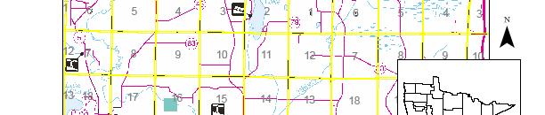

47 Southern MN Panning Unit - State Forests and Forest Land Classification Maps Southern Minnesota Forest Access Planning Unit 47 Final Version


48 Southern Minnesota Forest Access Planning Unit 48 Final Version


49 Southern Minnesota Forest Access Planning Unit 49 Final Version


50 Southern Minnesota Forest Access Planning Unit 50 Final Version


51 Southern Minnesota Forest Access Planning Unit 51 Final Version


52 Southern Minnesota Forest Access Planning Unit 52 Final Version


53 Southern Minnesota Forest Access Planning Unit 53 Final Version


54 Southern Minnesota Forest Access Planning Unit 54 Final Version


55 Southern Minnesota Forest Access Planning Unit 55 Final Version


56 Southern Minnesota Forest Access Planning Unit 56 Final Version


57 Southern Minnesota Forest Access Planning Unit 57 Final Version

58 Southern MN State Forests and Forest Lands - Road/Trail Planning Maps Southern Minnesota Forest Access Planning Unit 58 Final Version

59 Southern Minnesota Forest Access Planning Unit 59 Final Version

60 Southern Minnesota Forest Access Planning Unit 60 Final Version

61 Southern Minnesota Forest Access Planning Unit 61 Final Version

62 Southern Minnesota Forest Access Planning Unit 62 Final Version

63 Southern Minnesota Forest Access Planning Unit 63 Final Version


64 Morrison County Southern Minnesota Forest Access Planning Unit 64 Final Version


65 Morrison County Southern Minnesota Forest Access Planning Unit 65 Final Version