NEW ENGLAND COUNCIL ON FOREST ENGINEERING CASE STUDY MARCH 6, 2012
|
|
|
- Gertrude Johns
- 6 years ago
- Views:
Transcription
1 NEW ENGLAND COUNCIL ON FOREST ENGINEERING CASE STUDY MARCH 6, 2012
2 CONSTRUCTING A TEMPORARY ACCESS ROAD ACROSS AN ATLANTIC WHITE CEDAR ORGANIC BOG FOR THE PURPOSE OF MINING GRAVEL
3 TEMPORARY BOG CROSSING THE FOLLOWING SLIDES ARE OF A PROPOSED ACCESS ROAD THAT WILL CROSS SEVERAL WETLANDS TO ACCESS A GRAVEL DEPOSIT ONE OF THE WETLANDS HAS AN EXEMPLARY PLANT COMMUNITY THAT IS RARE IN MAINE AS DESIGNATED BY MNAP
4 TEMPORARY BOG CROSSING THE PROJECT HAS RECEIVED A PERMIT FROM THE DEP AND ACOE BUT AT LAST CHECK IS WAITING FOR LOCAL PERMITS AND/OR THE ECONOMY THE APPLICANT WAS HOPING TO BEGIN CONSTRUCTION OF THE ACCESS ROAD THIS WINTER OR SPRING BUT WORK HAS NOT YET STARTED
5 TEMPORARY BOG CROSSING ONE OF THE WETLANDS THAT THE ACCESS ROAD WILL CROSS IS AN ORGANIC BOG THE CROSSING IS REQUIRED TO MINIMIZE DISTURBANCE TO THE WETLAND AND ITS HYDROLOGY THE ACCESS ROAD IS PROPOSED TO BE REMOVED AFTER THE GRAVEL IS EXCAVATED
6 TEMPORARY BOG CROSSING THE APPLICANT AND THE REGULATORS SHARE ONE IMPORTANT GOAL: NEITHER WANT THE ROAD TO SINK TO ANY APPRECIABLE DEGREE
7 TEMPORARY BOG CROSSING THE SITE CONTAINS A NUMBER OF RIDGES OF GRAVEL WITH LOW WETLAND AREAS IN BETWEEN THE GRAVEL RIDGES GROUNDWATER INFILTRATES THE GRAVEL RIDGES AND SEEPS OUT AT THE INTERFACE OF A DENSER MINERAL SOIL AND THE GRAVEL ABOVE

8 SITE MAP OF ACCESS ROAD AND GRAVEL DEPOSIT

9 TOPO MAP OF THE SITE

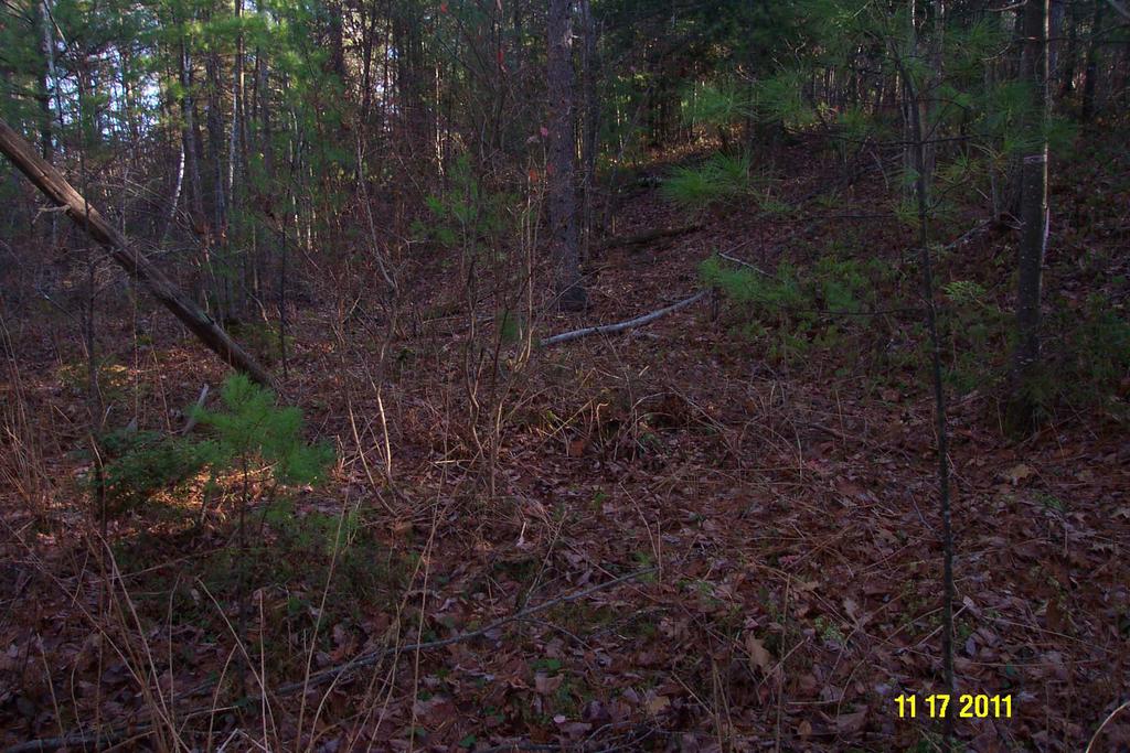
10 FIRST WETLAND CROSSING SITE
11
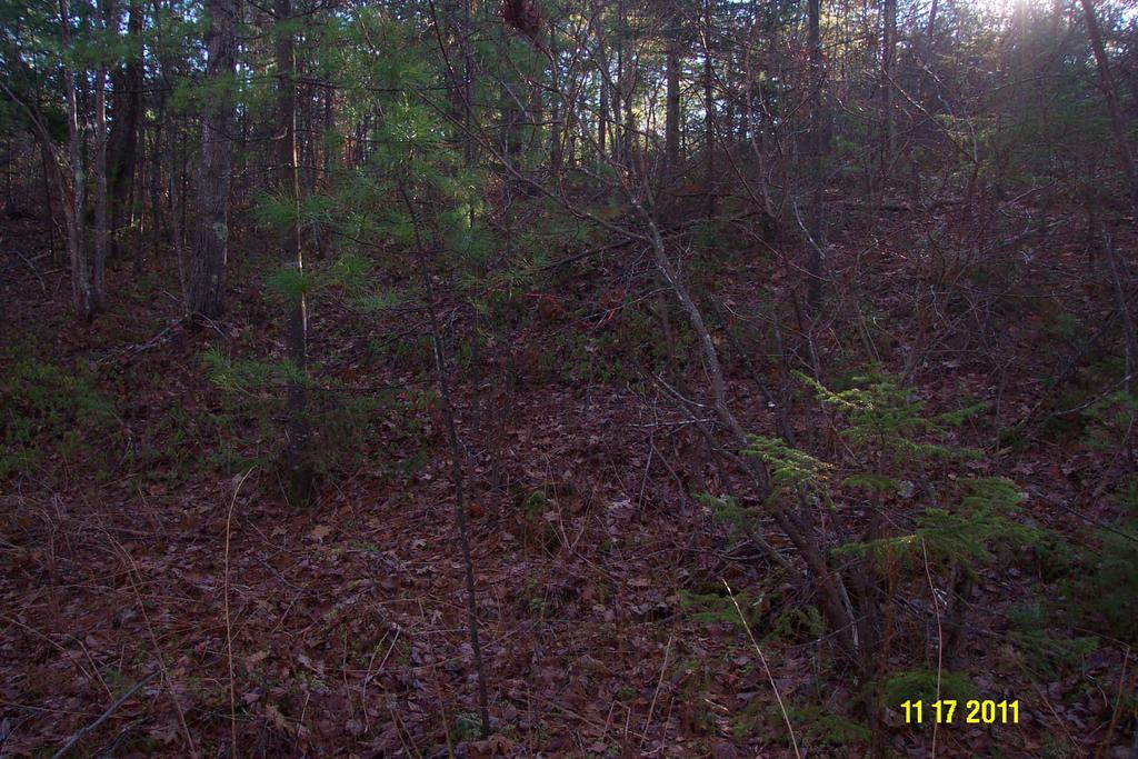
12

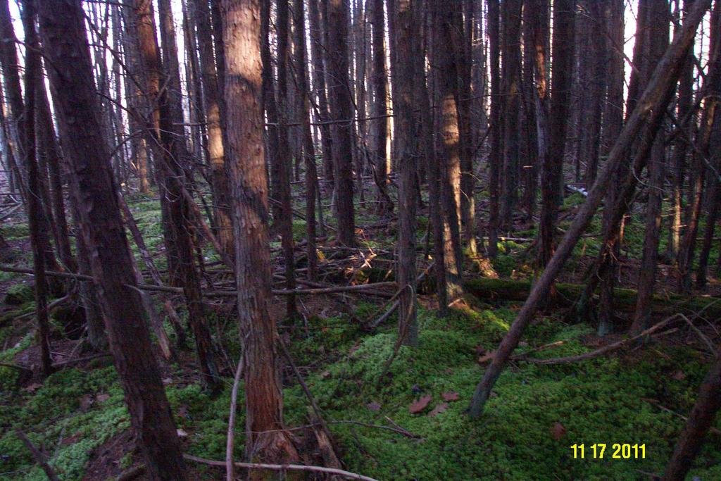
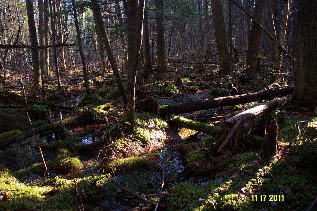
13 SECOND WETLAND CROSSING SITE ORGANIC BOG

14 NOTE LIVE SPHAGNUM MOSS ON THE GROUND SURFACE

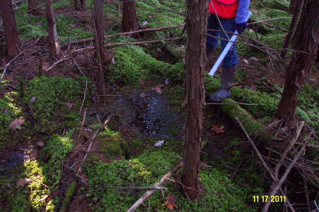
15 RUBBER TIRE OBLIGATE WETLAND SPECIES
16 LONGEST/MOST SIGNIFICANT WETLAND CROSSING THE LONGEST WETLAND CROSSING SITE IS THE MOST COMPLEX; IT CONTAINS THREE DIFFERENT CONDITIONS: 1. FIRM PEAT COVERED WITH RED MAPLE LEAVES 2. COVERED WITH LIVE SPHAGNUM MOSS WITH OPEN WATER POCKETS 3. LIVE SPHAGNUM WITH OPEN WATER POCKETS AND FLOWING WATER

17 FIRM PEAT COVERED WITH RED MAPLE LEAVES
18
19

20 LIVE SPHAGNUM WITH OPEN WATER POCKETS

21 TRANSITION FROM RED MAPLE LEAF TO LIVE SPHAGNUM TYPE
22

23 NOTE OPEN WATER POCKETS
24
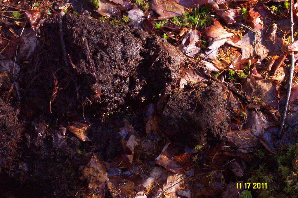
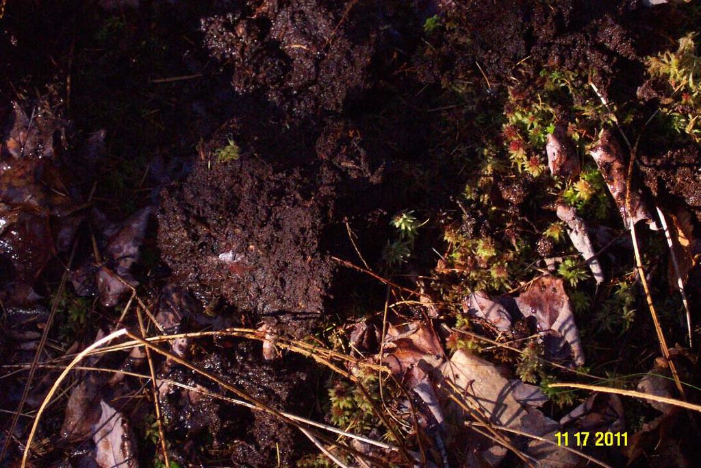
25 SHOVEL PIT EXCAVATED INTO PEAT IMMEDIATELY BENEATH THE LIVE SPHAGNUM MOSS WAS A PEAT LAYER THAT WAS FRIABLE AND SATURATED TO THE SURFACE IMMEDIATELY BELOW THE SATURATED PEAT LAYER WAS A MUCH FIRMER PEAT THAT WAS MOIST BUT NOT AS SATURATED AS THE TOP LAYER
26 PEAT PROFILE THE TOP PEAT LAYER THAT WAS SATURATED HAD GRANULAR STRUCTURE AND MANY PLANT ROOTS THE LOWER LAYER OF PEAT HAD MASSIVE OR PLATY STRUCTURE AND NO ROOTS
27 HYDROLOGY OBSERVATIONS IT APPEARD TO ME AS THOUGH WATER WAS PONDING ON THE FIRMER AND MASSIVE PEAT LAYER AND ANY MOVEMENT OF SIGNIFICANCE WAS OCCURRING IN THE TOP PEAT LAYER NO WATER MOVEMENT WAS OBSERVED IN THE OPEN WATER POCKETS OR THE SHOVEL PIT

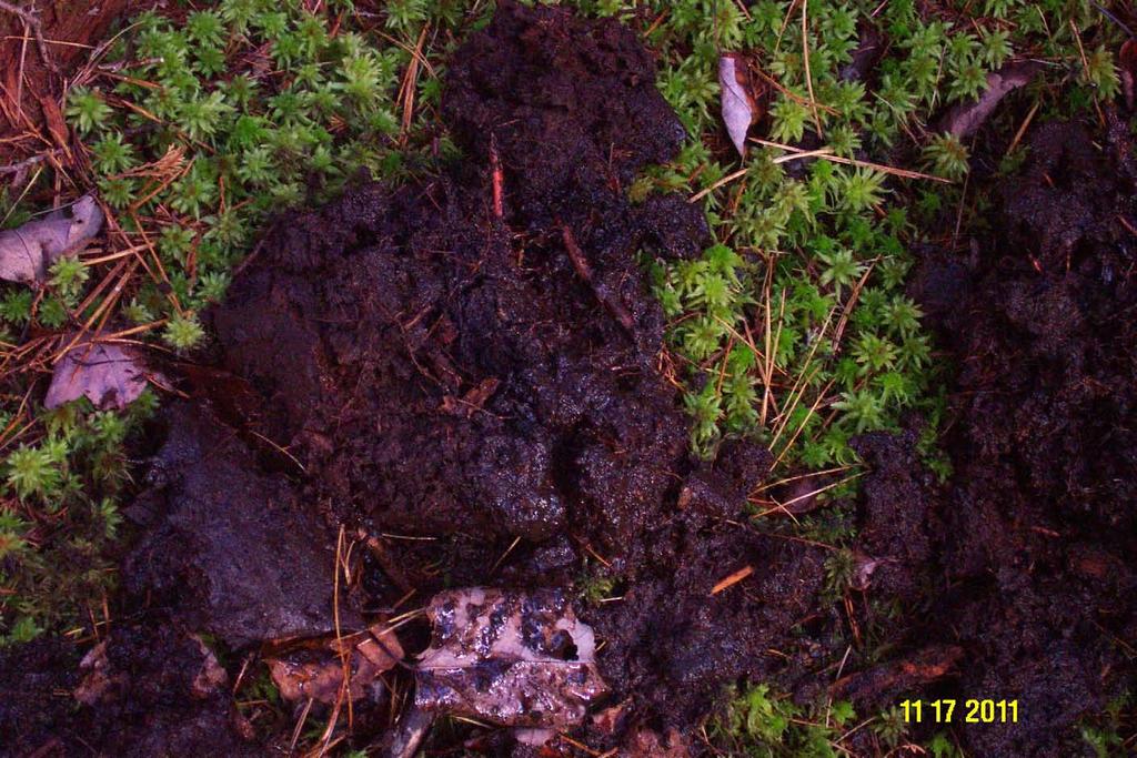
28 COMPARISON OF PEAT LAYERS SATURATION
29

30 SATURATED UPPER PEAT LAYER
31

32 MORE DENSE AND LESS SATURATED LOWER PEAT
33

34 LIVE SPHAGNUM WITH MOVING WATER

35 NOTE PICTURE PLANTS IN WATER

36 NOTE INTERCONNECTEDNESS OF OPEN WATER POCKETS
37

38 WATER MOVEMENT

39 WATER MOVEMENT

40 GRAVEL RIDGE AT WETLAND/UPLAND BOUNDARY
41 STANDARDS FOR ROADS ON ORGANIC SOILS MOST OF US HAVE VERY LITTLE EXPERIENCE WITH THE CONSTRUCTION OF ROADS OVER ORGANIC SOILS PARTICULARLY WHEN THE ROADS CAN NOT CONNECT WITH THE MINERAL SOIL BELOW AND HAVE TO BE REMOVED AFTER A FEW YEARS

42 ORGANIC SOIL UNDER ROAD TO WEST QUODDY HEAD
43 SELECTION OF CRITERIA FOR ACCESS ROAD BOG CROSSING THE CONSULTANT SEARCHED FOR INFORMATION ON HOW BEST TO CONSTRUCT SUCH AN ACCESS ROAD BUT DID NOT FIND MUCH USEFUL INFORMATION I WAS CONSULTED AND THIOUGH I HAD NO HARD DATA PROVIDED A RECOMMENDATION BASED ON KNOWLEDGE, LOGIC AND REASONING
44 ACCESS ROAD BOG CROSSING CONSTRUCTION DETAILS CUT TREES BUT LEAVE STUMPS AND ROOTS IN PLACE FOR STRUCTURAL SUPPORT IN A 36 FOOT WIDE PATH LAY SLASH DOWN BETWEEN STUMPS FOR ADDED SUPPORT-USE SLASH FROM ADJACENT UPLANDS IF NECESSARY LEVEL ROAD AND SHOULDER FOOTPRINT, TO THE TOP OF STUMPS, WITH STUMP GRINDINGS OR WOOD CHIPS - ESSENTIALLY MAKING A MATTRESS
45 ACCESS ROAD BOG CROSSING CONSTRUCTION DETAILS LAY FILTER FABRIC ON LEVELED ROAD AND SHOULDER FOOTPRINT LAY A LAYER OF 36 FOOT LONG LOGS DOWN ON FILTER FABRIC ALTERNATING BUTT AND TOPS SO THAT THE THICKNESS AND SUPPORT IS SIMILAR OVER THE ENTIRE LAYER PERPENDICULAR TO THE DIRECTION OF THE ROAD CABLE LOGS TOGETHER TO FORM A MATT OR MATTS LAY ANOTHER LAYER OF LOGS DOWN ON THE TOP OF THE FIRST LAYER OF LOGS IN A SIMILAR MANNER TO THE FIRST LAYER BUT THEY DO NOT NEED TO BE CABLED TOGETHER
46 ACCESS ROAD BOG CROSSING CONSTRUCTION DETAILS THE TWO LAYERS OF LOGS WILL PROVIDE ADDED STRENGTH TO SUPPORT THE GRAVEL ROAD SURFACE AND LOADED DUMP TRUCKS AND THE VOIDS BETWEEN THE LOGS WILL ALLOW WATER MOVEMENT THROUGH THE ROAD BASE SIMILAR TO A ROCK SANDWICH
47 ACCESS ROAD BOG CROSSING CONSTRUCTION DETAILS 36 FOOT LONG LOGS WERE CHOSEN TO PROVIDE REASONABLE SUPPORT (NO FORMULA WAS USED TO MAKE THAT DETERMINATION) AND TO GIVE 5 FEET OF CLEARANCE ALONG EACH SIDE OF THE ROAD FOR SNOW PLOWING ACCUMULATION-CABLING THE BOTTOM LAYER OF LOGS TOGETHER AS A MATT WILL PROVIDE ADDED STRENGTH
48 ACCESS ROAD BOG CROSSING CONSTRUCTION DETAILS IN THE AREA OF THE LONGEST BOG CROSSING WHERE MOVING WATER WAS OBSERVED SOME OF THE TOP LAYER OF LOGS WILL BE REPLACED BY METAL PIPES OF A SIMILAR DIAMETER TO THE LOGS TO ACT AS SMALL CULVERTS THAT WILL SPREAD OUT THE WATER OVER THE ENTIRE AREA WHERE MOVING WATER WAS OBSERVED
49 ACCESS ROAD BOG CROSSING CONSTRUCTION DETAILS THE DEP AND ACOE WANTED TO INSTALL A CULVERT(S) TO MAINTAIN THE NATURAL HYDROLOGY BUT I FIGURED THEY WOULD JUST BECOME EMBEDDED IN THE PEAT AND NOT FUNCTION AS PLANNED THIS WAS REINFORCED AFTER STUDYING HOW THE HYDROLOGY WORKED IN THE BOG
50 ACCESS ROAD BOG CROSSING CONSTRUCTION DETAILS PLACE A FILTER FABRIC ON TOP OF THE SECOND LAYER OF LOGS ADD A FOOT OF GRAVEL 24 FEET WIDE ON TOP OF THE SECOND LAYER OF FILTER FABRIC (28 WIDE AT BASE) USE STUMP GRINDINGS FOR 4 FOOT SHOULDERS ON EACH SIDE OF THE ROAD TOO PREVENT GRAVEL FROM BEING PUSHED INTO THE ORGANIC BOG-STUMP GRINDINGS WILL BE SIMILAR TO THE WOODY MATERIAL ALREADY PART OF THE NATURAL BOG
51 BOG CROSSING ACCESS ROAD CROSS-SECTION
52 PERIODIC INSPECTIONS THE DEP AND ACOE ARE CONCERNED ABOUT THE POSSIBILITY OF SIGNIFICANT SUBSIDENCE OF THE ROAD AND RESULTING ALTERATION OF THE NATURAL HYDROLOGY THEY WILL BE REQUIRING THE APPLICANT TO PERIODICALLY CHECK THE ELEVATION OF THE ROAD
53 PERIODIC INSPECTIONS SHOULD THE ROAD SUBSIDE TO A SIGNIFICANT DEGREE THE BOG CROSSING SECTION OF THE ROAD MAY BE LIMITED TO ONE VEHICLE AT A TIME AND/OR LOAD LIMITS MAY BE APPLIED
54 DOCUMENTATION I INTEND TO PRIODICALLY VISIT THE SITE, AS DO A NUMBER OF OTHERS, AND WILL TAKE LOTS OF PHOTOS THEY MIGHT MAKE AN INTERESTING PRESENTATION AT A FUTURE NERCOFE MEETING
55 QUESTIONS
56 ROCK SANDWICHES AKA PERMEABLE ROAD BASE
57
58 WHAT IS A ROCK SANDWICH? IT IS A LAYER OF STONE OR CRUSHED ROCK SANDWICHED BETWEEN 2 LAYERS OF FILTER FABRIC USED AS A ROAD BASE THOUGH THE DEP-BMP CALLS FOR A MINIMUM 12 THICK LAYER OF 3-6 STONE, ACTUAL SANDWICH THICKNESS AND STONE DIAMETER CAN BE ADJUSTED ACCORDING TO SITE SPECIFIC CONDITIONS AND AVAILABILITY OF STONE
59 WHAT IS ITS PURPOSE *MAINTAINS NATURAL HYDROLOGY *STRENGTHENS ROAD BASE *PREVENTS FROST ACTION IN ROAD *REQUIRES LITTLE MAINTENANCE *LASTS INDEFINATELY *PREVENTS SCOURING ASSOCIATED WITH CONCENTRATED FLOW
60 PURPOSE *THEY DO NOT HEAVE *THEY DO NOT RUST *THEY DO NOT COLLAPSE *THEY DO NOT FREEZE DUE TO LATENT HEAT OF GROUNDWATER *ONLY REQUIRE SHALLOW DITCHES WHICH NEED MINIMAL MAINTENANCE *PUTS COLD CLEAN GROUNDWATER BACK INTO THE GROUND
61 WHERE SHOULD ROCK SANDWICHES BE USED ROCK SANDWICHES CAN BE USED ALMOST ANYWHERE BUT ARE DESIGNED TO BE USED PRIMARILLY IN TWO LOCATIONS: WETLAND CROSSINGS & CUTS BELOW THE GROUNDWATER TABLE
62 ROCK SANDWICHES IN WETLAND CROSSINGS ROCK SANDWICHES WORK WELL IN CROSSING MOST WETLANDS EXCEPT FOR WETLANDS THAT ARE ORGANIC BOGS PROVIDES EXCELLENT STRUCTURAL SUPPORT WHEN CROSSING WETLANDS
63 ROCK SANDWICHES IN CUT SLOPE ROADS ROCK SANDWICHES CAN BE USED IN ALMOST ANY CUT BUT ARE MOST EFFECTIVE IN CUTS BELOW THE SEASONAL GROUNDWATER TABLE MOST EFFECTIVE IN SOILS THAT HAVE HIGH PERMEABILITY AND A SHALLOW RESTRICTIVE LAYER OR ARE SHALLOW TO BEDROCK
64 ROCK SANDWICHES IN CUT SLOPE ROADS THE MOST BENEFICIAL SITES FOR ROCK SANDWICHES IN CUT SLOPE ROADS ARE: *STEEP SLOPES (THE STEEPER THE MORE BENEFICIAL) *SIGNIFICANT UPSLOPE WATERSHED (THE LARGER THE MORE BENEFICIAL)
65 ROCK SANDWICHES IN CUT SLOPE ROADS *RECONNECTING GROUNDWATER SEEPS *RECONNECTING ROCK FILLED CHANNELS (USE STONE SIZE SIMILAR TO THE NATURAL STONE IN THE ROCK FILLED CHANNEL) *RECONNECTING COARSE TEXTURED SUBSOIL LAYERS WHERE PIPING IS PRESENT
66 WHERE ROCK SANDWICH USE IS QUESTIONABLE ROCK SANDWICHES DO NOT PROVIDE THE SAME VALUE FOR ROAD CUTS IN SLOWLY PERMEABLE SOILS SUCH AS LACUSTRINE SEDIMENTS OR MARINE SEDIMENTS AS THEY DO IN MORE PERMEABLE SOILS SUCH AS SANDLY LOAM TO LOAMY SAND GLACIAL TILLS
67 ROCK SANDWICH ON LEVEL GROUND
68 ROCK SANDWICH ON SLOPING GROUND WITH CUT

69 M & H Construction 3039 Main Street Route 4 North ~ P.O. Box 565 Rangeley, ME September 23, 2011 Mr. David Rocque Department of Agriculture State of Maine Dear Dave, RE: Costing information for blanket 1. I am very sorry we have no pictures of rock blankets actually being installed. I sent you some pictures but they should be at high water. If any of the pictures you could use further information please call me or x100. I will give you some general guidelines on cost of the rock blankets. For each 100 SF of the blanket at a depth of 18 rock and 6 of Type D gravel and 6 of surface gravel. Excavator 2 HR $110 HR Dump trucks 2 $65 Non-woven fabric 22 $2.00 SY Rock 6 to 12 6 $15.00 CY Del Gravel Type D 2 $10.50 CY Del ½ crushed gravel 2 $16.00 Del Sincerely, 1. Excavate and have dump truck haul of to get a base for rock blanket. 2. Place a layer of non-woven fabric, then place rip rap, then another layer of fabric, then type D gravel and then surface course of crushed. These do work very well keeping surface water from channeling but they work extremely well intercepting sub surface water and it is a big help keeping a building site dry. Kenneth J. Haley General Manager

70 ROCK SANDWICH INSTALLATION

71 ROCK SANDWICH INSTALLATION IN CUT

72 ROCK SANDWICH WETLAND CROSSING

73 ROCK SANDWICH WETLAND CROSSING

74 ROCK SANDWICH WETLAND CROSSING

75 ROCK SANDWICH WETLAND CROSSING

76 ROCK SANDWICH WETLAND CROSSING IN WINTER

77 NOTE UNSTABILIZED MINERAL SOIL UPSLOPE OF ROCKS

78 DOWNSLOPE OF ROCK SANDWICH

79 ROAD ROCK SANDWICH AT WETLAND AND STREAM

80 SEASONAL STREAM ABOVE ROCK SANDWICH

81 ROCK SANDWICH UPSLOPE SIDE OF ROAD

82 ROCK SANDWICH DOWN SLOPE SIDE OF ROAD

83 SUBDIVISION ROAD WITH ROCK SANDWICH AT CUT

84 UPSLOPE SIDE OF ROAD WITH CUT AND ROCK SANDWICH

85 OVERFLOW CULVERT AT CUT AND ROCK SANDWICH

86 OVERFLOW CULVERT AT ROCK SANDWICH AND CUT

87 DOWNSLOPE SIDE OF ROAD ST CUT AND ROCK SANDWICH

88 DOWNSLOPE SIDE OF ROAD AT CUT AND ROCK SANDWICH

89 DOWNSLOPE SIDE OF ROCK SANDWICH NOTE WATER

90 UPSLOPE SIDE OF ROCK SANDWICH

91 UPSLOPE SIDE OF ROCK SANDWICH

92 DOWNSLOPE SIDE OF ROCK SANDWICH

93 ELLIOTSVILLE TWP ROAD ROCK SANDWICH UPSLOPE

94 ELLIOTSVILLE TWP ROCK SANDWICH DOWNSLOPE
95
96 DAVID P. ROCQUE STATE SOIL SCIENTIST MAINE DEPARTMENT OF AGRICULTURE STATE HOUSE STATION #28 AUGUSTA, MAINE PHONE: (207)
WQ-08 ENHANCED DRY SWALE
 Greenville County Technical Specification for: WQ-08 ENHANCED DRY SWALE 1.0 Enhanced Dry Swale 1.1 Description An Enhanced Dry Swale is a shallow open-channel drainage way stabilized with turf grass or
Section 208. SOIL EROSION AND SEDIMENTATION CONTROL
 208.01 Section 208. SOIL EROSION AND SEDIMENTATION CONTROL 208.01. Description. This work consists of installing and maintaining erosion and sedimentation controls to minimize soil erosion and control
Oweninny Wind Farm. Oweninny Environmental Impact Statement Appendix 5B
 Oweninny Wind Farm Oweninny Environmental Impact Statement Appendix 5B Access Tracks, Hardstanding Areas, Electrical Compounds, Borrow Pit And Cable Laying Construction Method Statement Copyright ESB International
SUBSURFACE INFILTRATION SYSTEM DESCRIPTION. Alternative Names: Sump, Drywell, Infiltration Trench, Infiltration Galleries, Leach Fields
 4.1-d SUBSURFACE INFILTRATION SYSTEM Alternative Names: Sump, Drywell, Infiltration Trench, Infiltration Galleries, Leach Fields BMP DESIGN APPROACH Pollutant Source Control Hydrologic Source Control Stormwater
Maine s Land Use Regulations and Erosion Control Techniques
 Maine s Land Use Regulations and Erosion Control Techniques Protecting Maine s Air, Land and Water Colin Clark 441-7419 colin.a.clark@maine.gov Tom Gilbert 441-8031 thomas.gilbert@maine.gov Jim Rodrigue
A BETTER METHOD FOR BURYING ANIMAL CARCASSES
 A BETTER METHOD FOR BURYING ANIMAL CARCASSES by David P. Rocque, State Soil Scientist State of Maine Department of Agriculture State House Station # 28 Augusta, Maine 04333 Phone: (207) 287-2666 E-Mail:
4.8. Subsurface Infiltration
 4.8. Subsurface Infiltration Subsurface infiltration systems are designed to provide temporary below grade storage infiltration of stormwater as it infiltrates into the ground. Dry wells, infiltration
4.8. Subsurface Infiltration
 4.8. Subsurface Infiltration Subsurface infiltration systems are designed to provide temporary below grade storage infiltration of storm water as it infiltrates into the ground. Dry wells, infiltration
Best Practices for Building High-Performance Resource Roads. Road Drainage. Developed by: The Roads and Infrastructure Group
 Best Practices for Building High-Performance Resource Roads Road Drainage Developed by: The Roads and Infrastructure Group THIS GUIDE IS INTENDED FOR EQUIPMENT OPERATORS CONSTRUCTION CONTRACTORS FIELD
GRAYBACK THINNING KV PROJECT ROAD REHABILITATION AND SEDIMENT CONTROL
 Maureen Joplin, Hydrologist June 25, 2009 Background GRAYBACK THINNING KV PROJECT ROAD REHABILITATION AND SEDIMENT CONTROL Thinning and fuels reduction activities were completed in a managed stand located
Suggested Stormwater Management Practices For Individual House Lots
 Suggested Stormwater Management Practices For Individual House Lots These practices are necessary to satisfy the water quantity and water quality criteria of the Rappahannock Stormwater Ordinance. These
Mixed Conifer Working Group Meeting April 15, 2011 Water and Soil Resource Management Considerations
 Mixed Conifer Working Group Meeting April 15, 2011 Water and Soil Resource Management Considerations It is difficult to tie watershed health directly to mixed-conifer forests. Watersheds encompass a variety
Shelbyville, Kentucky Stormwater Best Management Practices (BMPs) Stormwater Pollution Treatment Practices (Structural) DRAFT
 Stormwater Pollution Treatment Practices (Structural) DRAFT") Shelbyville, Kentucky Stormwater Best Management Practices (BMPs) Stormwater Pollution Treatment Practices (Structural) Activity: Infiltration Systems PLANNING CONSIDERATIONS: Design Life: Short IS Acreage
Shelbyville, Kentucky Stormwater Best Management Practices (BMPs) Stormwater Pollution Treatment Practices (Structural) Activity: Infiltration Systems PLANNING CONSIDERATIONS: Design Life: Short IS Acreage
Appendix A (Project Specifications) Patton Mill Fuel Break Project
 Patton Mill Fuel Break Project") Appendix A (Project Specifications) Patton Mill Fuel Break Project I. Proposed Actions: A. Construct a Fuel Break (approximately 5 miles, about 120 acres): The fuel break is located along a segment of
Appendix A (Project Specifications) Patton Mill Fuel Break Project I. Proposed Actions: A. Construct a Fuel Break (approximately 5 miles, about 120 acres): The fuel break is located along a segment of
Construction Inspection Checklists
 III. Construction Inspection Checklists 33 Bioretention - Construction Inspection Checklist Project: Location: Site Status: Date: Time: Inspector: Construction Sequence Satisfactory / Unsatisfactory Comments
- Earthwork Operations & Equipments
 - Earthwork Operations & Equipments Earthwork Operations Those construction processes that involve the soil or earth in its natural form and that precede the building of the pavement structure itself Basic
Sediment Control Practices
 Sediment Control Practices SMP-05 Temporary Diversions, Berms or Ditches Symbol TD Description These temporary drains offer features such as conveyance for runoff down cut or fill slopes, subsurface drains
North Country Stormwater Conference - Porous Pavement Section
 North Country Stormwater Conference - Porous Pavement Section Sponsored by Champlain Watershed Improvement Coalition of NY (CWICNY) October 14, 2010 Presentor Daniel R. Hershberg, P.E. & L.S. Managing
General Brick Installation Instructions
 Excellent Resource for Clay Paver Installation: http://www.bia.org/resources/clay-brick-pavers/clay-paver-informational- Resources These are general guidelines only. Check your paver manufacturer's recommendations
CHARLES SOIL CONSERVATION DISTRICT COMPLIANCE AGREEMENT FOR THE STANDARD EROSION AND SEDIMENT CONTROL PLAN FOR FOREST HARVEST OPERATIONS
 CHARLES SOIL CONSERVATION DISTRICT COMPLIANCE AGREEMENT FOR THE STANDARD EROSION AND SEDIMENT CONTROL PLAN FOR FOREST HARVEST OPERATIONS I. Site Information A. Location (Include site map of harvest area)
Porous Asphalt Pavements w/ Stone Recharge Beds. Brandon Milar California Asphalt Pavement Association
 Porous Asphalt Pavements w/ Stone Recharge Beds Brandon Milar California Asphalt Pavement Association History of Porous Asphalt Pavements Porous asphalt mixes developed in 1930 s and 1940 s s by State
Appendix K: Soil Erosion and Sedimentation Control Plan Check List
 Appendix K: Soil Erosion and Sedimentation Control Plan Check List Drain Commissioner 46 February 2005 SOIL EROSION AND SEDIMENTATION CONTROL PLAN CHECK LIST Items listed below must be clearly depicted
Standards for Soil Erosion and Sediment Control in New Jersey May 2012 STANDARD FOR RIPRAP. Conditions Where Practice Applies
 STANDARD FOR RIPRAP Definition A layer of loose rock, aggregate, bagged concrete, gabions, or concrete revetment blocks placed over an erodible soil surface. Purpose The purpose of riprap is to protect
Properly constructing and maintaining a road drainage system is the most effective ways to reduce flood damage
 Mitigating Flood Damage to Vermont Local Roads Properly constructing and maintaining a road drainage system is the most effective ways to reduce flood damage Vermont Emergency Management Vermont Local
Background. AEM Tier 2 Worksheet Farmstead Water Supply Evaluation. AEM Principle: Glossary
 AEM Tier 2 Worksheet Glossary Casing: Steel or plastic pipe installed while drilling a well, to prevent collapse of the well bore hole and the entrance of contaminants, and to allow placement of a pump
Erosion and Sediment Pollution Control Guidelines for Residential Lots with soil disturbance of less than 1 acre (see exceptions)
") Adams Co. Conservation District 670 Old Harrisburg Road, Suite 201 Gettysburg, PA 17325 Telephone: 334-0636 Fax: 337-0730 www.adamscounty.us Erosion and Sediment Pollution Control Guidelines for Residential
Adams Co. Conservation District 670 Old Harrisburg Road, Suite 201 Gettysburg, PA 17325 Telephone: 334-0636 Fax: 337-0730 www.adamscounty.us Erosion and Sediment Pollution Control Guidelines for Residential
B. Base Course: Aggregate layer placed between the subbase course and hot-mix asphalt paving.
 SECTION 312000 - EARTH MOVING PART 1 - GENERAL 1.1 SUMMARY A. Section Includes: 1. Excavating and filling for rough grading the Site. 2. Preparing subgrades for walks, curbs, pavements, and turf and grasses.
SECTION EROSION CONTROL DEVICES
 SECTION 02374 PART 1 GENERAL EROSION CONTROL DEVICES 1.1 SUMMARY A. Section Includes: 1. Diversion Channels. 2. Rock Energy Dissipator. 3. Paved Energy Dissipator. 4. Rock Basin. 5. Rock Barriers. 6. Sediment
IN T R A / M IN T R A M
 SPRING MESA SUBDIVISION CONSTRUCTION PLANS A PART OF SECTION 35, TOWNSHIP 2 SOUTH, RANGELINE 70 WEST, 6th. PRINCIPAL MERIDIAN. CITY OF ARVADA, COUNTY OF JEFFERSON, STATE OF COLORADO COVER SHEET MARTIN
Environmental Resource Inventories. What are ERIs? Significance of information How to use them
 Environmental Resource Inventories What are ERIs? Significance of information How to use them Environmental Resource Inventory - ERI Compiled by the environmental commission Information about the natural
SEPA Environmental Checklist Mercer Island Center for the Arts. Attachment F Geotechnical Supplemental Memo
 SEPA Environmental Checklist Mercer Island Center for the Arts Attachment F Geotechnical Supplemental Memo January 2017 MEMORANDUM DATE: May 6, 2015 TO: FROM: RE: CC: Katie Oman, Mercer Island Center for
Roscommon County Soil Erosion and Sedimentation Control (SESC) Program Guide
 Program Guide") Roscommon County SESC Program 500 Lake Street Roscommon, Michigan 48653 Phone: 989-275-8323 Fax: 989-275-8640 Roscommon County Soil Erosion and Sedimentation Control (SESC) Program Guide INCLUDED ATTACHMENTS
Roscommon County SESC Program 500 Lake Street Roscommon, Michigan 48653 Phone: 989-275-8323 Fax: 989-275-8640 Roscommon County Soil Erosion and Sedimentation Control (SESC) Program Guide INCLUDED ATTACHMENTS
3.2 INFILTRATION TRENCH
 3.2 INFILTRATION TRENCH Type of BMP Priority Level Treatment Mechanisms Infiltration Rate Range Maximum Drainage Area LID Infiltration Priority 1 Full Retention Infiltration, Evapotranspiration (when vegetated),
Slash Water Bar Video
 Slash Water Bar Video Water Bars Advantages Low cost for materials Use on site materials Disadvantages Not for active haul roads Can be damaged by ATV s and follow up users Broad-based Dip Long enough
Stormwater Management Fact Sheet: Porous Pavement
 Stormwater Management Fact Sheet: Porous Pavement Description Porous pavement is a permeable pavement surface with an underlying stone reservoir that temporarily stores surface runoff before infiltrating
Application for On-Site Wastewater Treatment System Permit
 Application for On-Site Wastewater Treatment System Permit FEES: (Permit Fees are payable to CONEJOS COUNTY TREASURER and are Non-Refundable.) Install New System $250.00-Pre-construction Repair Tank STA/Leach/Drain
APPENDIX E. CONSTRUCTION SPECIFICATIONS FOR ACCESS ROADS (January 2005)
") APPENDIX E CONSTRUCTION SPECIFICATIONS FOR ACCESS ROADS (January 2005) i TABLE OF CONTENTS 1.0 INTRODUCTION...1 2.0 CONSTRUCTION SPECIFICATIONS FOR ACCESS ROADS................... 1 3.0 PLANNING AND LOCATION...2
APPENDIX E CONSTRUCTION SPECIFICATIONS FOR ACCESS ROADS (January 2005) i TABLE OF CONTENTS 1.0 INTRODUCTION...1 2.0 CONSTRUCTION SPECIFICATIONS FOR ACCESS ROADS................... 1 3.0 PLANNING AND LOCATION...2
Training on Roads for Water and Resilience
 Training on Roads for Water and Resilience 1 DRAINAGE FROM UNPAVED ROADS Outline 3 1. 2. 3. 4. 5. 6. 7. Introduction Important considerations Drainage management Surface drainage features Subsurface drainage
Case Study 1 Red Clover Rock Ford
 Case Study Red Clover Rock Ford Location Northeastern California. Plumas National Forest. An unnamed tributary to Red Clover Creek in McReynolds Valley, 5 miles north of Lake Davis, CA. Forest Road 25N05,
Best Management Practice (BMP) Guidance Manual
 Guidance Manual") Best Management Practice (BMP) Guidance Manual INTRODUCTION BMP examples in this guide provide ways to meet erosion and sediment control requirements. Best Management Practices are not limited to these
Best Management Practice (BMP) Guidance Manual INTRODUCTION BMP examples in this guide provide ways to meet erosion and sediment control requirements. Best Management Practices are not limited to these
Transition Zone Awareness
 Transition Zone Awareness To address road construction transition zone-related incidents on the Coast over several years, with some resulting in injury or near fatalities it is time for a refresher in
MAINE DEPARTMENT OF TRANSPORTATION BID DATE OF OPENING : CALL ORDER : CONTRACT ID : PROJECTS STP-1277(700)S
S") MAINE DEPARTMENT OF TRANSPORTATION BID DATE OF OPENING : CALL ORDER : CONTRACT ID : 012777.00 PROJECTS ------------------------------ STP-1277(700)S COUNTY : ANDROSCOGGIN CONTRACT ID : 012777.00 MAINE
MAINE DEPARTMENT OF TRANSPORTATION BID DATE OF OPENING : CALL ORDER : CONTRACT ID : 012777.00 PROJECTS ------------------------------ STP-1277(700)S COUNTY : ANDROSCOGGIN CONTRACT ID : 012777.00 MAINE
Soil Erosion and Sedimentation Control (SESC) Information and Application Packet
 Information and Application Packet") ARENAC COUNTY BUILDING DEPARTMENT SOIL EROSION & SEDIMENT CONTROL P.O. BOX 724 * 120 NORTH GROVE ST * STANDISH, MI 48658 PH. 989-846-9791 FAX: 989-846-9188 This institution is an equal opportunity provider.
ARENAC COUNTY BUILDING DEPARTMENT SOIL EROSION & SEDIMENT CONTROL P.O. BOX 724 * 120 NORTH GROVE ST * STANDISH, MI 48658 PH. 989-846-9791 FAX: 989-846-9188 This institution is an equal opportunity provider.
CITY OF URBANA CLASS 2 EROSION CONTROL PERMIT STANDARD DETAILS
 CITY OF URBANA CLASS 2 EROSION CONTROL PERMIT STANDARD DETAILS CLASS 2 EROSION CONTROL PERMIT STANDARDS TABLE OF CONTENTS EROSION CONTROL PRACTICES FLOW CHART 1 EROSION CONTROL PERMIT FORM 2 EXAMPLE EROSION
Buffer Zone = Area of Undisturbed Vegetation
 Scientific overview: Water quality functions of coastal buffers Caitlin Chaffee, Coastal Policy Analyst RI Coastal Resources Management Council November 29, 2012 Buffer Zone Setback = Minimum i Distance
HYDROLOGIC RESTORATION OF THE CASH CREEK BASIN IN TATE'S HELL STATE FOREST
 HYDROLOGIC RESTORATION OF THE CASH CREEK BASIN IN TATE'S HELL STATE FOREST CONSTRUCTION PLAN BID SET PREPARED FOR: LOCATION MAP CARRABELLE US ROUTE 319/98 EASTPOINT Prepared By Plan Design Enable CORPORATE
GRASS-LINED CHANNEL (acre) CODE 840
 CODE 840") NATURAL RESOURCES CONSERVATION SERVICE ILLINOIS URBAN MANUAL PRACTICE STANDARD GRASS-LINED CHANNEL (acre) CODE 840 (Source: NC Erosion and Sediment Control Field Manual) DEFINITION A natural or constructed
NATURAL RESOURCES CONSERVATION SERVICE ILLINOIS URBAN MANUAL PRACTICE STANDARD GRASS-LINED CHANNEL (acre) CODE 840 (Source: NC Erosion and Sediment Control Field Manual) DEFINITION A natural or constructed
No. 6 December, Wisconsin s Forestry Best Management Practices for Water Quality Forest Roads
 No. 6 December, 1995 Wisconsin s Forestry Best Management Practices for Water Quality Forest Roads Steve Holaday, Wisconsin Dept. of Natural Resources, and Jeff Martin, Dept. of Forestry, UW-Madison BMPs
Inspection Guide Permeable Pavers
 Inspection Guide Permeable Pavers Maintenance of stormwater management structures is essential for keeping nearby lakes, wetlands, and streams within the Minnehaha Creek Watershed District (MCWD) clean.
Land Use Office, PO Box 197, 6683 County Road 13, Conejos CO Phone #: Fax:
 Application to: Application for On-Site Wastewater Treatment System Permit Install New System $250.00 Repair to Tank or Leach Field $125.00 Inspect Existing system $125.00 (Permit Fees are payable to CONEJOS
Errata sheet for the Connecticut General Permits May 2, 2017
 Errata sheet for the Connecticut General Permits May 2, 2017 The Corps of Engineers, New England District, has compiled this list of corrections and clarifications for the Connecticut General Permits that
Town of Friday Harbor PO Box 219 / Friday Harbor / WA / (360) / fax (360) /
 / fax (360) /") Town of Friday Harbor PO Box 219 / Friday Harbor / WA / 98250 (360) 378-2810 / fax (360) 378-5339 / www.fridayharbor.org LAND CLEARING, GRADING, OR FILLING PERMIT APPLICATION APPLICATION DATE GRD No. APPLICANT/FRANCHISE
Town of Friday Harbor PO Box 219 / Friday Harbor / WA / 98250 (360) 378-2810 / fax (360) 378-5339 / www.fridayharbor.org LAND CLEARING, GRADING, OR FILLING PERMIT APPLICATION APPLICATION DATE GRD No. APPLICANT/FRANCHISE
METROPOLITAN UTILITIES DISTRICT No Page: 1 of 10
 Page: 1 of 10 A. GENERAL Erosion control measures such as silt fence, inlet filters and soil stabilization blankets and matting, incorporated into underground pipeline construction projects, help prevent
BMP No. 1 Access Roads, Skid Trails, and Landings
 BMP No. 1 Access Roads, Skid Trails, and Landings The purpose of this BMP is to minimize soil erosion and protect nearby water bodies from sediments from the construction, use, maintenance, and retirement
Permeable Pavement Facilities and Surfaces
 Permeable Pavement Facilities and Surfaces This checklist is intended to highlight items critical to the performance of permeable pavement facilities and surfaces that need to be addressed in the design
EROSION CONTROL AND GRADING PERMIT APPLICATION
 EROSION CONTROL AND GRADING PERMIT APPLICATION COMMUNITY DEVELOPMENT DEPARTMENT 1735 MONTGOMERY STREET OROVILLE, CA 95965 530-538-2420 FAX (530) 5382426 www.cityoforoville.org APPLICATION DATE PERMIT FEE
How & Where does infiltration work? Context: Summary of Geologic History Constraints/benefits for different geologic units
 Associated Earth Sciences, Inc. Associated Earth Sciences, Inc. Presented by: Matthew A. Miller, PE April 23, 2013 How & Where does infiltration work? Context: Summary of Geologic History Constraints/benefits
Rock Sock (RS) Rock Sock height.
 Rock Sock height.") Rock Sock (RS) SC-5 Description A rock sock is constructed of gravel that has been wrapped by wire mesh or a geotextile to form an elongated cylindrical filter. Rock socks are typically used either as
Rock Sock (RS) SC-5 Description A rock sock is constructed of gravel that has been wrapped by wire mesh or a geotextile to form an elongated cylindrical filter. Rock socks are typically used either as
NICO Tailings and Mine Rock Co-disposal Facility (CDF) Design Concept
 Design Concept") NICO Tailings and Mine Rock Co-disposal Facility (CDF) Design Concept Open pit and underground mine The project has 31 Mt of ore reserve Ore to be processed at a rate of 4,650 t/d Life of mine is 20 years
NICO Tailings and Mine Rock Co-disposal Facility (CDF) Design Concept Open pit and underground mine The project has 31 Mt of ore reserve Ore to be processed at a rate of 4,650 t/d Life of mine is 20 years
State-of-the-Practice Porous Asphalt Pavements. Kent R. Hansen, P.E. Director of Engineering National Asphalt Pavement Association
 State-of-the-Practice Porous Asphalt Pavements Kent R. Hansen, P.E. Director of Engineering National Asphalt Pavement Association Porous Pavements don t follow the rules Conventional Pavements Do every
Flood Hazard Assessment Report Falls Gulch, Larimer County, Colorado January 16, 2013
 United States Department of Agriculture Natural Resources Conservation Service Denver Federal Center Building 56, Room 2604 P.O. Box 25426 Denver, CO 80225 720-544-2818-OFFICE alton.albin@co.usda.gov Flood
SECTION 1100 GRADING 1102 MATERIALS AND DEFINITIONS.
 SECTION 1100 GRADING 1101 SCOPE. This section covers the performance of all work required for grading the project in coordination with all previous work performed at the locations shown on the contract
Common Construction-Site BMPs Quick Reference Guide
 Common Construction-Site BMPs Quick Reference Guide Installation and Inspection Requirements For more information visit the Town of Truckee Clean Water Program Website: http://www.townoftruckee.com/engineering/clean-water-program
Item Name Description Unit of Measure Mobilization Per WSDOT Lump Sum
 Page 1 of 6 DESIGN STANDARDS FOR: MEASUREMENT AND PAYMENT Where bids are utilities for construction, repair or alteration for Public Work park projects, the following bid item descriptions and units of
ACTIVITY: Silt Fence ES 14
 Targeted Constituents Significant Benefit Partial Benefit Low or Unknown Benefit Sediment Heavy Metals Floatable Materials Oxygen Demanding Substances Nutrients Toxic Materials Oil & Grease Bacteria &
Determination of Design Infiltration Rates for the Sizing of Infiltration based Green Infrastructure Facilities
 Determination of Design Infiltration Rates for the Sizing of Infiltration based Green Infrastructure Facilities 1 Introduction This document, developed by the San Francisco Public Utilities Commission
SECTION EXCAVATION AND EMBANKMENT. B. Subbase Grading A samples for gradation analysis.
 PART 1 GENERAL 1.1 DESCRIPTION A. The WORK under this Section includes providing all labor, materials, tools and equipment necessary for excavation and embankment construction to the lines, grades and
Scientific overview: Water quality functions of coastal buffers
 Scientific overview: Water quality functions of coastal buffers Caitlin Chaffee, Coastal Policy Analyst RI Coastal Resources Management Council November 21, 2013 Buffer Zone Setback = Minimum Distance
Storm Drain Inlet Protection for Construction Sites (1060)
") Storm Drain Inlet Protection for Construction Sites (1060) Wisconsin Department of Natural Resources Conservation Practice Standard I. Definition A temporary device installed in or around a storm drain
Storm Drain Inlet Protection for Construction Sites (1060) Wisconsin Department of Natural Resources Conservation Practice Standard I. Definition A temporary device installed in or around a storm drain
378 - POND NATURAL RESOURCES CONSERVATION SERVICE CONSERVATION PRACTICE SPECIFICATION I. SCOPE
 378-1 NATURAL RESOURCES CONSERVATION SERVICE CONSERVATION PRACTICE SPECIFICATION 378 - POND I. SCOPE The work shall consist of constructing an earthfill embankment and appurtenances to the lines, grades,
MOA Project # Golden View Drive Intersection & Safety Upgrades
 Appropriate transitions can include extending the insulation beyond the roadway improvements, reducing the insulation thickness, or angling the insulation downward. Use of a frost tolerant section, an
Chapter 6 Sand Filtration Treatment Facilities
 Sand Filtration Treatment Facilities 6.1 Purpose This chapter presents criteria for the design, construction and maintenance of runoff treatment sand filters. Treatment sand filters are used to collect,
Forest Recreation Management
 Forest Recreation Management 1 Forest Recreation Management Introduction...3 CONTENTS The Benefits of Guidelines...3 Considerations...4 Planning...5 Construction of Recreation Areas...6 Protecting Cultural
PART 1 GENERAL REQUIREMENTS
 PART 1 GENERAL REQUIREMENTS Contract Closeout Plan 110 Arrow diagram for project close-out...3 Erosion Control 121 Straw bale barrier... 5 122 Silt fence... 7 123 Diversion dike... 9 124 Inlet protection...
Appendix E. Coordinating Erosion and Sediment Control With Low-Impact Development Planning
 Appendix E Appendix E. Coordinating Erosion and Sediment Control With Low-Impact Development Planning E.1 Introduction It is essential to coordinate post-construction stormwater planning with the design
Ohio Department of Transportation Division of Production Management Office of Geotechnical Engineering. Geotechnical Bulletin
 Ohio Department of Transportation Division of Production Management Office of Geotechnical Engineering Geotechnical Bulletin GB 2 SPECIAL BENCHING AND SIDEHILL EMBANKMENT FILLS Geotechnical Bulletin GB2
IDEM Wetlands and Streams Regulatory Overview. An overview of IDEM permitting for work in Waters of the State
 IDEM Wetlands and Streams Regulatory Overview An overview of IDEM permitting for work in Waters of the State Who Has Jurisdiction? Adjacent wetland: USACE & IDEM Stream > 1 sq. mile drainage: IDNR, USACE
Erosion and Sedimentation Pollution Control (ESPC) Plan Narrative
 Plan Narrative") Model Poultry Burial E&S Plan (7-2-15) 1. GENERAL INFORMATION Name of project Name of person responsible Erosion and Sedimentation Pollution Control (ESPC) Plan Narrative Address Phone number Municipality
Model Poultry Burial E&S Plan (7-2-15) 1. GENERAL INFORMATION Name of project Name of person responsible Erosion and Sedimentation Pollution Control (ESPC) Plan Narrative Address Phone number Municipality
Errata sheet for the Connecticut General Permits March 26, 2019
 Errata sheet for the Connecticut General Permits March 26, 2019 The Corps of Engineers, New England District, has compiled this list of corrections and clarifications for the Connecticut General Permits
Permeable Pavement Fact Sheet
 DEPARTMENT OF THE ENVIRONMENT Rushern L. Baker, III County Executive Permeable Pavement Fact Sheet What is permeable pavement? When rainwater falls on conventional pavement, such as concrete, it accumulates
Applying landforming to reclamation: A case study in Central Appalachia
 Applying landforming to reclamation: A case study in Central Appalachia Leslie Hopkinson, John Quaranta April 12, 2017 Department of Civil and Environmental Engineering West Virginia University WEST VIRGINIA
FOR HISTORICAL REFERENCE ONLY
 SILT FENCE TYPE TB PERIMETER CONTROL OF WATERWAY STEEL FENCE POST LESS THAN /3 ANCHOR TO LAND (TYP.) THE STREAM/RIVER WIDTH STREAM BANK CARRIER FLOAT LENGTH CURTAIN FABRIC STEEL TENSION CABLE WATER SURFACE
A-2. Soils. Soil Media. Chapter Contents. Soil Media In-situ Soil Testing Separation from Seasonal High Water Table (SHWT)
") A-2. Soils Chapter Contents Soil Media In-situ Soil Testing Separation from Seasonal High Water Table (SHWT) Importance of Soil Composition in SCMs The soil composition of many stormwater SCMs also is
A-2. Soils Chapter Contents Soil Media In-situ Soil Testing Separation from Seasonal High Water Table (SHWT) Importance of Soil Composition in SCMs The soil composition of many stormwater SCMs also is
SECTION TRENCHING & BACKFILLING
 SECTION 02225 - TRENCHING & BACKFILLING 1.0 GENERAL 1.1 Work included in this Section includes trenching and backfilling for underground pipelines and related structures only. 1.2 Reference Specifications
Section Fill Placement Tender No. [ ] Page 1
![Section Fill Placement Tender No. [ ] Page 1](/thumbs/91/105424856.jpg "Section Fill Placement Tender No. [ ] Page 1") Tender No. [ ] Page 1 1.0 GENERAL 1.1 GENERAL.1 This section specifies placement requirements for fill materials specified in Section 02330 Earthwork Materials, except for [Waste Fill, Gravel Armour, Riprap,
Tender No. [ ] Page 1 1.0 GENERAL 1.1 GENERAL.1 This section specifies placement requirements for fill materials specified in Section 02330 Earthwork Materials, except for [Waste Fill, Gravel Armour, Riprap,
APPENDIX B SAND MOUND
 3701-29-15 1 I. Introduction APPENDIX B SAND MOUND All soil absorption components and technologies shall be designed and installed to meet the requirements of rule 3701-29-15 of the Administrative Code
SECTION EROSION CONTROLS
 SECTION 31 25 13 EROSION CONTROLS PART 1 GENERAL 1.1 SUMMARY A. Section Includes installing, maintaining and removing: 1. Silt Fence. 2. Temporary Construction Entrances. 3. Diversion Channels. 4. Sediment
Upland Landfill Waste Discharge Application 7295 Gold River Highway Campbell River, British Columbia
 Upland Landfill Waste Discharge Application 7295 Gold River Highway Campbell River, British Columbia Upland Excavating Ltd. Engineering Consultant: GHD Limited Presentation Agenda Project Background Site
FRST 557 Lecture 7b Cross Drainage Structures: Culverts and Bridges
 FRST 557 Lecture 7b Cross Drainage Structures: Culverts and Bridges Lesson Background and Overview: The last lesson introduced the topic of water management relative to forest roads and further explored
Chapter 5.5 Inlets, Outlets, and Flow Control
 Chapter 5.5 Inlets, Outlets, and Flow Control There are common structural elements of SCMs that are designed to safely route water. Engineered flow control devices are used to effectively route water at
November 2007 DRAFT Appendix E: Soil Testing Criteria
 November 2007 DRAFT Appendix E: Soil Testing Criteria Stormwater management design is dependent upon the changes that occur between pre and postdevelopment conditions. The impacts are assessed based on
Practices that capture and temporarily store the WQ v before allowing it to infiltrate into the soil.
 Chapter 5: Acceptable Stormwater Management Practices (SMPs) This section presents a list of practices that are acceptable for water quality treatment. The practices on this list are selected based on
Temporary Watercourse Crossing: Culverts
 Temporary Watercourse Crossing: Culverts DRAINAGE CONTROL TECHNIQUE Low Gradient Velocity Control Short Term Steep Gradient Channel Lining Medium-Long Term Outlet Control Soil Treatment Permanent Symbol
Septic Tank Soil Treatment Systems
 Bulletin 939 Septic Tank Soil Treatment Systems for Ohio Rural Homes Copyright 2009, The Ohio State University Ohio State University Extension embraces human diversity and is committed to ensuring that
AESI AESI 6/17/2015 HOW AND WHERE DOES INFILTRATION WORK? o Context: Summary of Geologic History. o Constraints/benefits for different geologic units
 PRESENTED June 17, 2014 BY Jim Brisbine, PE HOW AND WHERE DOES INFILTRATION WORK? o Context: Summary of Geologic History o Constraints/benefits for different geologic units o Key geologic and groundwater
ITEM 706 PIPE SLOPE DRAIN
 AFTER NOVEMBER 1, 2008 ITEM 706 PIPE SLOPE DRAIN 706.1 Description. This work shall consist of the installation of temporary erosion protection and sediment control pipe slope drains, utilized during construction
Ponds: planning, design, and construction
 Ponds: planning, design, and construction Ponds for many purposes: Fish Production Recreation Water Supply Esthetics Wildlife Habitat Natural ponds: Formed in natural depressions in the landscape Not man-made
General Groundwater Concepts
 General Groundwater Concepts Hydrologic Cycle All water on the surface of the earth and underground are part of the hydrologic cycle (Figure 1), driven by natural processes that constantly transform water
is a possibility of the existence of permafrost as a result
 111.2 CERTAIN ASPECTS OF ALASKA DISTRICT ENGINEERS EXPERIENCE IN AREAS OF MARGINAL PERMAFROST E. L. Long In nearly twenty years of engineering and construction experience in Alaska, the Alaska District
From the Ground Up- Field Soil Considerations
 From the Ground Up- Field Soil Considerations Ted Bilderback Nursery Extension Specialist Department of Horticulture Science North Carolina State University Ted_Bilderback@ncsu.edu http://www.ces.ncsu.edu/depts/hort/nursery/