FOREST COVER MAPPING AND GROWING STOCK ESTIMATION OF INDIA S FORESTS
|
|
|
- Randall Richardson
- 6 years ago
- Views:
Transcription

1 FOREST COVER MAPPING AND GROWING STOCK ESTIMATION OF INDIA S FORESTS GOFC-GOLD Workshop On Reducing Emissions from Deforestations April 2007 in Santa Cruz, Bolivia Devendra PANDEY Forest Survey of India, Dehradun, INDIA
2 Forests constitute a very important natural resource for India. It is a major land-use and occupy about 23% land area of the country (77 mn ha) but the actual forest cover is only about 20.64% (67.8 mn ha) India s population being more than a 1 billion the per capita forests is too low (600 m2) against world s average of 6000 m2 The pressure on forests is therefore high also because more than 70% India s population has rural based economy

3 SATELLITE IMAGERY INTERPRETATION LAB FOREST SURVEY OF INDIA, DEHRADUN
4 Forest Cover Assessments Over The Years in India Cycle Year of Assessment Satellite & Sensor Resolution Scale I 1987 LANDSAT MSS 80m x 80m 1:1million II 1989 III 1991 LANDSAT TM 30m x 30m IV 1993 V 1995 IRS-1B LISS-II 36m x 36m 1:250,000 VI 1997 VII 1999 IRS-1C LISS-III 23m x 23m VIII 2001 IRS-1C/1D LISS-III 23m x 23m 1:50, IX IRS-1D, LISS-III 23m x 23m 1:50,000
5 AGENCIES USING R.S and GIS IN FORESTRY IN INDIA Forest Survey of India (FSI)- main agency for wall to wall mapping for the entire country every 2 years Some State Forest departments NRSA and Regional Remote Sensing Centers and SAC of Deptt of Space Private agencies
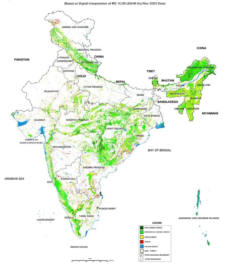
6 Forest Cover Assessment INPUTS Satellite data of the entire country from National Remote Sensing Agency (NRSA) IRS ID/IRS-P6 (23.5m spatial resolution) SOI Topographic sheets - 1: 50,000 METHODOLOGY Digital Interpretation/visual Ground Verification Minimum map able area is I ha OUTPUTS Forest cover maps on 1:50,000 scale in digital or hard copy form showing following forest cover classes: CATEGORY CANOPY DENSITY Very Dense Forest More than 70% canopy Moderately Dense Forest 40-70% Open Forest 10-40% Scrub Less than 10% in forest lands Mangroves
7 SATELLITE DATA (IRS ID/IC- LISS III) GEOMETRIC CORRECTION CONTRAST ENHANCEMENT SOI TOPOSHEETS SCENE SUBSETTING DENSITY SLICING UNSUPERVISED CLASSIFICATION / NDVI TRANSFORMATION MASKING FOREST &NON-FOREST AREAS EDITING POST CLASSIFICATION CORRECTION ACCURACY ASSESSMENT GROUND REFERENCE DATA LAND COVER MAP ( STATE WISE) OVERLAY OF BOUNDARIES FLOW CHART FOR FOREST COVER MAPPING
8
9 Forest Cover Assessment LATEST RESULTS Satellite data Resource sat-1 1 (IRS P6) LISS-III III Data period Nov/Dec 2004/ Feb 2005 Loss of Forest cover 728 Km2 Reasons of major losses - Tsunami (Dec 2004) -Diversion of forests for Irrigation project-dam and reservoir -Removal of root stock for fuelwood and charcoal - Human induced Forest fire- in the North Eastern States- slash and burn/ shifting cultivation practice
 IRS-P6 AWiFS DEC.")

10 HIT BY TSUNAMI KATCHALL-ISLAND(Andaman & Nicobar Is) IRS-P6 AWiFS DEC. 21, 2004 IRS-P6-AWiF FEB.16,2005 PRE-TSUNAMI POST-TSUNAMI Loss in Forest Cover- 2,589 ha (DF ha, OF- 22 ha)
 IRS-P6-AWiFS")


11 HIT BY TSUNAMI TRINKAT-ISLAND (Andaman & Nicobar) IRS-P6-AWiFS DEC.21, FEB.16, IRS-P6-LISS III JAN.4, 05 PRE-TSUNAMI POST-TSUNAMI POST-TSUNAMI Loss in Forest Cover- 287 ha (DF- 285 ha, OF- 2 ha
12 Accuracy assessment (Forest Cover) Accuracy assessment of forest cover is done by using Field inventory data - high resolution satellite data (5.8m) Out of the 8000 points inside forest, 3509 points were selected to provide spatial representation of the whole forest area for preparation of error matrix. Ground truth data for these points giving land use class at each points were recorded with the help of field inventory data and high resolution satellite data in an area of 1.0 ha. Over all accuracy level found is 92.03% in 2005 assessment.
13 Growing Stock estimation Inventory of forests Inventory of trees outside forests (TOF) -Inventory of trees in rural areas using high resolution satellite data (5.8 m) multi-spectral -Inventory of trees in urban area
14 Methodology of NFI since 2001 The basic goal is to estimate a national level growing stock (wood volume) on a two year cycle and improve the estimate in subsequent cycles. For this purpose, the country has been stratified into 14 physiographic zones- based on climate, vegetation, physiography Ten percent (60) districts are covered in a two year cycle. India has about 600 civil districts. The districts are selected randomly from each zone with probability proportion to size. Along with the Forest inventory, vegetation survey of herbs and shrubs is also carried out. Measurement of soil and litter carbon is also carried.
15 Physiographic Zones of India
16 Physiographic Zones on Forest Cover

17 Randomly Selected 60 Sample Districts for Inventory
 divided into 5 ' 5' Sub")
18 Topographic sheets on scale 1:50,000 (15' 15' Grid) divided into 5 ' 5' Sub Grids

19 Marking of Plots 5 X 5 QUADRANT IS DIVIDED INTO FOUR GRIDS OF 2½ X 2½ INTERVAL EACH 2½ X 2½ GRID IS FURTHER DIVIDED INTO 1¼ X 1¼ INTERVAL GRID
20 Methodology of NFI since 2001 At grid centre a plot of 0.1 ha is laid out all parameters pre-decided decided for forest inventory are measured and recorded Four sub plots of 1 sq. m are laid out at all corners of the sample plot of 0.1 ha to collect sample for litter and humus and soil carbon Nested quadrates of 3x 3 m and 1x1 m for enumeration of shrubs and herbs are laid at 30 m distance from the center of 0.1 ha plot in all four corners to assess biodiversity. On average 4000 temporary sample plots are laid out every year in forests.
21 Parameters of Forest inventory Species and diameter class wise trees Crown Diameter Soil & leaf litter for estimation of carbon Listing Herbs & Shrubs for Biodiversity Indices Regeneration status Fire incidence Grazing incidence Presence of weeds Crop injury Information on bamboo
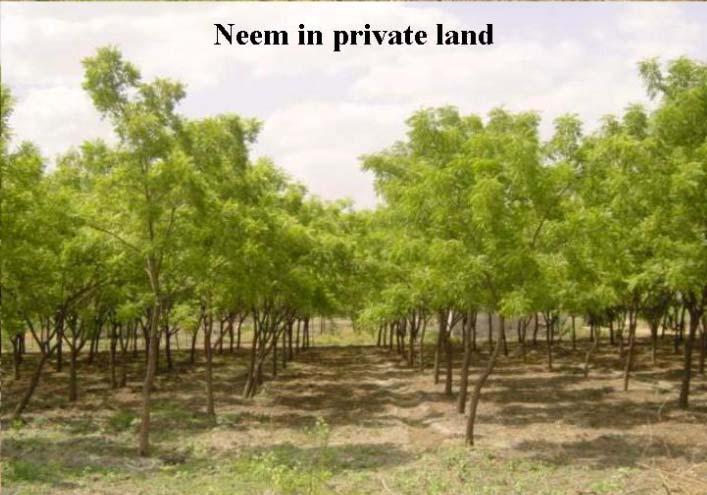
22 Inventory of Trees Outside Forests (TOF) TOF resource has become most important in today s s context in India as most of timber requirement of industries have to met from TOF In the present methodology, high resolution satellite data (5.8 m) is used to identify TOF patches and stratify the same into -block, -linear and -scattered strata After the stratification appropriate sample plots are laid on the ground for field inventory. On average 4000 sample plots are laid every year.
23

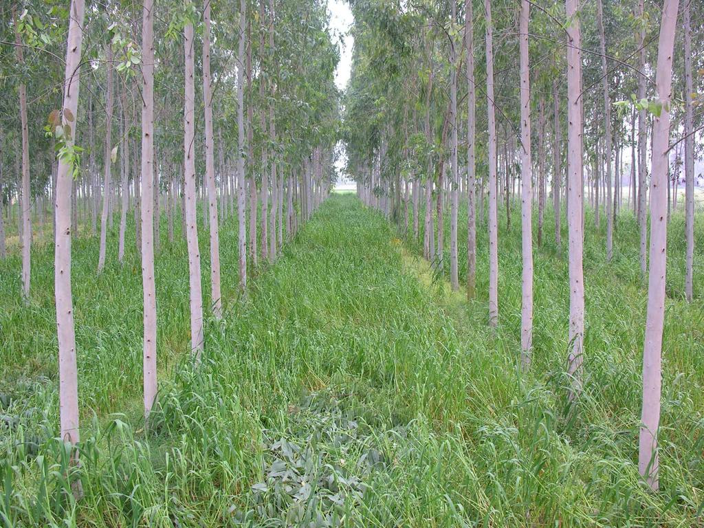
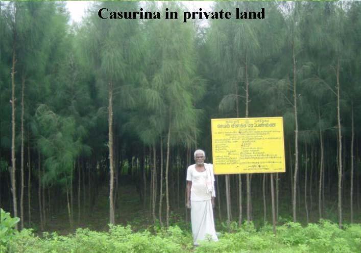
24 24 BLOCK PLANTATION OF EUCALYPTUS

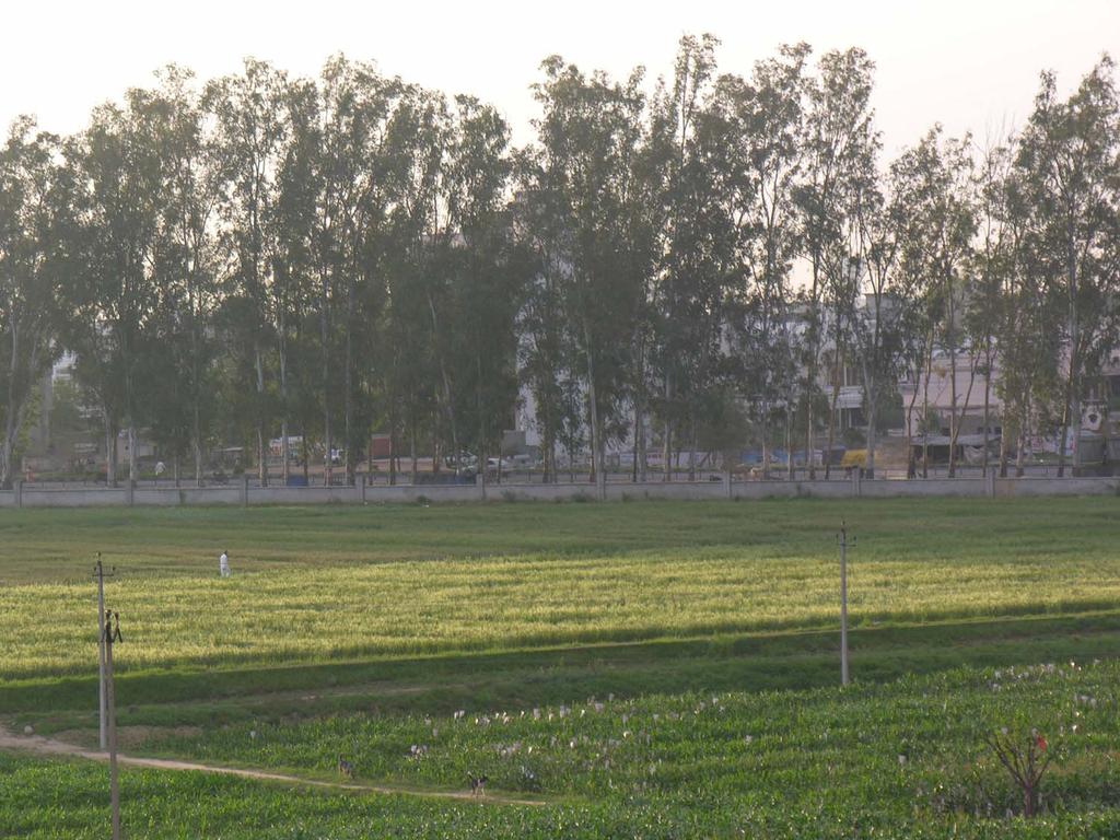
25 TREES GROWING IN AGRICULTURAL FIELDS
26
27
28

29 AILANTHUS EXCELSA & ACACIA NILOTICA ON FARM BUNDS 29

30 Tamrind cultivated with Amla


31 METHODOLOGY FOR ASSESSMENT OF TREE OUTSIDE FOREST USING REMOTE S ENSING DATA Satellite Data India Map with District boundaries LISS III Data PAN Data District Boundary Toposheets Mosaic Geometric and Radiometric Correction & fusion Digitization of Green wash Fused Data Green Wash Map Green wash Masking out of Green Wash from Fused Data Classification of fused data without Green wash Trees in Group Scattered Water Bodies Linear Block Elimination of area < 0.1 ha. Classified Map Block Linear Scattered Block Linear Field data collection Generation of Random Points Data Analysis & Report Generation Scattered
32 Plot Size & Number of Samples in rural TOF per district Strata Block Linear Scattered Scattered (Hill) Plot size No. of Samples 0.1 ha 35 10x125 m ha ha 95 - Random points for block, linear & scattered stratum along with coordinates communicated to field units for survey - Sample points in field are approached by using GPS & data recorded in prescribed formats
33 UFS Block Block No 8 UFS Block Map
 are taken as sampling units by FSI Optimum number of UFS blocks are selected in each district for the survey as follows If UFS blocks < 500 10 % selection")
34 Field Inventory of Urban TOF Urban trees have mainly environmental functions- In India urban areas are categorized into 5 classes (strata) based on population Urban Frame Survey (USF) blocks of National Sample Survey Organization (NSSO) are taken as sampling units by FSI Optimum number of UFS blocks are selected in each district for the survey as follows If UFS blocks < % selection min 20 blocks UFS blocks > % selection min 50 or max 60 blocks Data is collected on the designed formats on various parameters


35 CLASSIFIED MAP- Trees outside Forests BLOCK LINEAR SCATTERED Overall accuracy of classification = 92%
36 CONCLUDING REMARKS There exists many gaps in the methodology aspect of inventory of forests and TOF as well as forest cover assessment. One important challenge is to integrate RS data with field inventory so that reliable estimate on wood volume/ biomass/ carbon stock can be made rapidly. Capacity building and continuous skill up-gradation to adopt new methods and technology.
37 THANKS
MONITORING OF FOREST COVER IN INDIA
 MONITORING OF FOREST COVER IN INDIA Organizational Structure FSI (HQRS) DEHRADUN Regional Offices DEVENDRA PANDEY Director, Forest Survey of India, Dehradun GOFC-GOLD Symposium on Forest Land Cover Observations
Chapter Methodology
 Growing Stock Chapter 6 GROWING STOCK Growing stock (volume of wood) constitutes the most important parameter of the forest resource. Growing stock is an indicator of forest productivity. Historically
Rapid Assessment of damage to ecological resources due to Tsunami
 Rapid Assessment of damage to ecological resources due to Tsunami Background: A tsunamii (Japanese word literally meaning harbour ware which is triggered by undersea earthquake, landslide or volcanic eruption)
Assessment of Tree Resources Outside Forest Based on Remote Sensing Satellite Data
 Assessment of Tree Resources Outside Forest Based on Remote Sensing Satellite Data Dr. J.K. Rawat 1, Saibal Dasgupta 2 & Rajesh Kumar 3 Introduction Forests have gained an important place in international
Estimates of Carbon Stock of India s forests
 Estimates of Carbon Stock of India s forests GOFC-GOLD Symposium 15-19 April 2013 Wageningen University, Netherlands Devendra PANDEY Consultant/ Fmr DG, Forest Survey of India Email ID: dpandeyifs@rediffmail.com;
CHAPTER 2 FOREST COVER
 CHAPTER 2 FOREST COVER 2.1 Introduction Forest cover, as explained in the previous chapter, includes all lands more than 1 ha area having tree canopy density of 1 percent and above. The basic data for
Narration: In this presentation you will learn about various monitoring methods for carbon accounting.
 1 Narration: In this presentation you will learn about various monitoring methods for carbon accounting. 2 Narration:The presentation is divided into four sections. 3 Narration: USAID s standard climate
Country Presentation: India
 Country Presentation: India Methodological Issues for REDD Estimation and Monitoring Methodologies for Forest Carbon Stocks Dr Rekha Pai Deputy Inspector General of Forest Ministry of Environment and Forests
MONITORING LAND USE AND LAND USE CHANGES IN FRENCH GUIANA BY OPTICAL REMOTE SENSING
 MONITORING LAND USE AND LAND USE CHANGES IN FRENCH GUIANA BY OPTICAL REMOTE SENSING Photo : Valéry Gond Photo : Valéry Gond Photo Photo : Gaëlle : : Valéry VERGER Gond Gaëlle VERGER ONF, French National
Research projects of Landuse changes in Latvia
 Research projects of Landuse changes in Latvia Ilmars Krampis University of Latvia, faculty of Geography and Earth Science Juris Zariņš Latvian State Forest Research Institute "Silava" Joint NASA LCLUC
Methodology for assessing carbon stock for REDD+ project in India
 Methodology for assessing carbon stock for REDD+ project in India The Energy and Resources Institute w w w. t e r i i n. o r g Methodology for assessing carbon stock for REDD+ project in India Suresh
Remote sensing applications in natural resources mapping and management An Indian Context
 Remote sensing applications in natural resources mapping and management An Indian Context International Workshop on Operational Mapping/Monitoring of Agricultural Crops in South/Southeast Asian Countries
Generating Data from National Forest Monitoring
 Generating Data from National Forest Monitoring and Click Carbon to edit Accounting (REDD Master MRV) title style Alexander Lotsch Click to edit Master subtitle style World Bank Forest Carbon Partnership
Application of Remote Sensing in studying forest cover conditions of protected areas in Himachal Pradesh, India
 Application of Remote Sensing in studying forest cover conditions of protected areas in Himachal Pradesh, India Vandana Kumari Chauhan*, Ruchika Acharya, Amit Kumar and R.D. Singh, Council of Scientific
Status & issues of the World Forests
 Status & issues of the World Forests MCT course of IFS officers -Phase IV Indira Gandhi National Forest Academy, Dehradun 26 June 2013 Dr Devendra PANDEY Fmr DG, Forest Survey of India Fmr PCCF and Prl
EVALUATING THE ACCURACY OF 2005 MULTITEMPORAL TM AND AWiFS IMAGERY FOR CROPLAND CLASSIFICATION OF NEBRASKA INTRODUCTION
 EVALUATING THE ACCURACY OF 2005 MULTITEMPORAL TM AND AWiFS IMAGERY FOR CROPLAND CLASSIFICATION OF NEBRASKA Robert Seffrin, Statistician US Department of Agriculture National Agricultural Statistics Service
Using Imagery and LiDAR for cost effective mapping and analysis for timber and biomass inventories
 Using Imagery and LiDAR for cost effective mapping and analysis for timber and biomass inventories Mark Meade: CTO Photo Science Mark Milligan: President LandMark Systems May 2011 Presentation Outline
2. LITERATURE SURVEY
 30 2. LITERATURE SURVEY 2.1 OVER VIEW Remote Sensing, Global Positioning System, and Geographical Information System technologies have becoming very useful tools in number of applications by providing
India State of Forest Report 2009 EXECUTIVE SUMMARY. Forest Survey of India, Dehradun Ministry of Environment & Forests, Government of India
 India State of Forest Report 2009 EXECUTIVE SUMMARY Forest Survey of India, Dehradun Ministry of Environment & Forests, Government of India Fig.1: Forest Cover Map of India of 2007 India State of Forest
Remote Sensing Uses in Agriculture at NASS
 Remote Sensing Uses in Agriculture at NASS United States Department of Agriculture (USDA) National Agriculture Statistics Service (NASS) Research and Development Division Geospatial Information Branch
Afforestation/Reforestation Afforestation/Reforestation Clean Development Mechanism Projects in Uttar Pradesh State August
 Afforestation/Reforestation Clean Development Mechanism Projects in Uttar Pradesh State August 9, 2014 Suresh Chauhan TERI, New Delhi Presentation outlines 1. Guidelines for preparing Project Design Document
Crop mapping with satellite data
 Crop mapping with satellite data Dr. C.S. Murthy Head, Agricultural Sciences and Applications National Remote Sensing Centre, Hyderabad murthy_cs@nrsc.gov.in, csmurthy09@gmail.com Geospatial Technology
Development of a National Forest Resources Database under the Kyoto Protocol
 Development of a National Forest Resources Database under the Kyoto Protocol Research Institute Forestry and Forest Products Research Institute Background and Purpose In order to mitigate global warming,
Current Status of NFMIS in Myanmar & How MOLI data can Contribute to the ongoing Efforts. Myat Su Mon, Forest Department, Myanmar
 Current Status of NFMIS in Myanmar & How MOLI data can Contribute to the ongoing Efforts Myat Su Mon, Forest Department, Myanmar 26-05-2017 1 Presentation Outlines Background Information Challenges for
MAPPING OF TREE OUTSIDE FOREST IN KALESAR BLOCK (YAMUNANAGAR DISTRICT, HARYANA) USING GEO-INFORMATICS TECHNIQUES
 USING GEO-INFORMATICS TECHNIQUES") International Journal of Science, Environment and Technology, Vol. 3, No 5, 2014, 1835 1842 ISSN 2278-3687 (O) MAPPING OF TREE OUTSIDE FOREST IN KALESAR BLOCK (YAMUNANAGAR DISTRICT, HARYANA) USING GEO-INFORMATICS
International Journal of Science, Environment and Technology, Vol. 3, No 5, 2014, 1835 1842 ISSN 2278-3687 (O) MAPPING OF TREE OUTSIDE FOREST IN KALESAR BLOCK (YAMUNANAGAR DISTRICT, HARYANA) USING GEO-INFORMATICS
CATCHMENT AREA TREATMENT PLAN
 CATCHMENT AREA TREATMENT PLAN 1 NEED FOR CATCHMENT AREA TREATMENT It is a wellestablished fact that reservoirs formed by dams on rivers are subjected to sedimentation. The process of sedimentation embodies
Monitoring Deforestation and Forest Degradation on National and Local Level in Indonesia
 Monitoring Deforestation and Forest Degradation on National and Local Level in Indonesia Dr. Ir. Ruandha A. Sugardiman, M.Sc. Dr. Ir. Belinda A. Margono, M.Sc. Ministry of Environment and Forestry Indonesia
Report of the technical assessment of the proposed forest reference level of India submitted in 2018
 United Nations FCCC/TAR/2018/IND Distr.: General 29 October 2018 English only Report of the technical assessment of the proposed forest reference level of India submitted in 2018 Summary This report covers
Opportunities and challenges for monitoring tropical deforestation and forest degradation in dynamic landscapes using Sentinel-2!
 Sentinel-2 For Science Workshop 20-22 May, 2014 ESA-ESRIN Frascati Opportunities and challenges for monitoring tropical deforestation and forest degradation in dynamic landscapes using Sentinel-2 Dirk
¼ Century GIS and RS in Fiji Forestry
 ¼ Century GIS and RS in Fiji Forestry NOA VAKACEGU, MSD-FORESTRY 1991 Establishment of GIS&RS in MSD Forestry PC with 400 MB hard disk, the biggest computer in Government! Digitising table Tape drive GPS
LIVING PLANT BIOMASS
 Proposed VCS Module/Tool LIVING PLANT BIOMASS Document Prepared by: The Earth Partners LLC. Title Living Plant Biomass Version 1.0 Date of Issue 19-9-2011 Type Module Sectoral Scope AFOLU Prepared By Contact
VCS MODULE VMD0022 ESTIMATION OF CARBON STOCKS IN LIVING PLANT BIOMASS
 VMD0022: Version 1.0 VCS MODULE VMD0022 ESTIMATION OF CARBON STOCKS IN LIVING PLANT BIOMASS Version 1.0 16 November 2012 Document Prepared by: The Earth Partners LLC. Table of Contents 1 SOURCES... 2 2
Variable Method Source
 Appendix S1 Appendix S1: Table S1 Plot variables Variable Method Source COVERS % shrub cover ocular estimate of shrub cover % forb cover ocular estimate of forbs % coarse woody debris % live overhead canopy
SandYare the strata-weighted mean, and standard
 A LANDSAT STAND BASAL AREA CLASSIFICATION SUITABLE FOR AUTOMATING STRATIFICATION OF FOREST INTO STATISTICALLY EFFICIENT STRATA Emily B. Schultz a, Thomas G. Matney a, David L. Evans a, and Ikuko Fujisaki
Role and importance of Satellite data in the implementation of the COMIFAC Convergence Plan
 Plenary Meeting of the Congo Basin Forest Partnership (CBFP) Palais des Congrès, Yaoundé. Cameroon 11-12 November, 2009 Role and importance of Satellite data in the implementation of the COMIFAC Convergence
The role of remote sensing in global forest assessments. Introduction, objectives and alternative survey scenarios
 The role of remote sensing in global forest assessments Erkki Tomppo 1 and Ray Czaplewski 2 1 Finnish Forest Research Institute, National Forest Inventory Unioninkatu 40 A, FIN-00170 Helsinki, Finland
USING LIDAR AND RAPIDEYE TO PROVIDE
 USING LIDAR AND RAPIDEYE TO PROVIDE ENHANCED AREA AND YIELD DESCRIPTIONS FOR NEW ZEALAND SMALL-SCALE PLANTATIONS Cong (Vega) Xu Dr. Bruce Manley Dr. Justin Morgenroth School of Forestry, University of
Veena 1, Savita 2, Reetu Sharma 3 Sarvan 4. Haryana Space Applications Centre (HARSAC),
,") & Fruit Mapping of Adampur and Hisar-IInd Blocks of Hisar District Using On Screening Visual Interpretation Approach on WV-2 Data Veena 1, Savita 2, Reetu Sharma 3 Sarvan 4 Haryana Space Applications Centre
& Fruit Mapping of Adampur and Hisar-IInd Blocks of Hisar District Using On Screening Visual Interpretation Approach on WV-2 Data Veena 1, Savita 2, Reetu Sharma 3 Sarvan 4 Haryana Space Applications Centre
Spatio Temporal Change Analysis of Forest Density in Doodhganga Forest Range, Jammu & Kashmir
 Spatio Temporal Change Analysis of Forest Density in Doodhganga Forest Range, Jammu & Kashmir ABSTRACT Majid Farooq 1, Humayun Rashid 2 1 Image Analyst, J&K State Remote Sensing Centre, Srinagar, J&K,
National Forest and Tree Resources Assessment Bangladesh
 National Forest and Tree Resources Assessment 2005-2007 Bangladesh Funding through Ministry of Environment and Forest (MoEF), Bangladesh Food and Agriculture Organization of the United Nations (FAO) Implementing
LAND COVER CHANGE DUE TO OIL AND GAS EXPLORATION IN THE HAYNESVILLE SHALE REGION FROM 1984 TO 2011
 LAND COVER CHANGE DUE TO OIL AND GAS EXPLORATION IN THE HAYNESVILLE SHALE REGION FROM 1984 TO 2011 D A N I E L U N G E R A P R I L 2 3, 2 0 1 3 Division of Environmental Science Arthur Temple College of
Mangrove deforestation analysis in Northwestern Madagascar Stage 1 - Analysis of historical deforestation
 Mangrove deforestation analysis in Northwestern Madagascar Stage 1 - Analysis of historical deforestation Frédérique Montfort, Clovis Grinand, Marie Nourtier March 2018 1. Context and study area : The
Addressing countries reporting requirements to REDD in FAO Approach to National Forest Monitoring and Assessment
 UNFCCC workshop on Methodological Issues for REDD Tokyo, June 25 27, 2008 Addressing countries reporting requirements to REDD in FAO Approach to National Forest Monitoring and Assessment Mikko Leppanen
USING REMOTELY SENSED DATA TO MAP FOREST AGE CLASS BY COVER TYPE IN EAST TEXAS
 USING REMOTELY SENSED DATA TO MAP FOREST AGE CLASS BY COVER TYPE IN EAST TEXAS Daniel Unger 1, I-Kuai Hung, Jeff Williams, James Kroll, Dean Coble, Jason Grogan 1 Corresponding Author: Daniel Unger (unger@sfasu.edu)
Measuring Forest Carbon Stocks for REDD+
 Measuring Forest Carbon Stocks for REDD+ MCT course of IFS officers -Phase IV Indira Gandhi National Forest Academy, Dehradun 1 July 2013 Dr Devendra PANDEY Fmr DG, Forest Survey of India Fmr PCCF and
COMPARATIVE STUDY OF NDVI AND SAVI VEGETATION INDICES IN ANANTAPUR DISTRICT SEMI-ARID AREAS
 International Journal of Civil Engineering and Technology (IJCIET) Volume 8, Issue 4, April 2017, pp. 559 566 Article ID: IJCIET_08_04_063 Available online at http://www.iaeme.com/ijciet/issues.asp?jtype=ijciet&vtype=8&itype=4
Module STR-NFI: Forest Carbon Stratification Using NFI Data
 LEAF TECHNICAL GUIDANCE SERIES FOR THE DEVELOPMENT OF A NATIONAL OR SUBNATIONAL FOREST CARBON MONITORING SYSTEM FOR REDD+ Module STR-NFI: Forest Carbon Stratification Using NFI Data LEAF TECHNICAL GUIDANCE
2014REDD302_41_JCM_PM_ver01
 Joint Crediting Mechanism Proposed Methodology Form Cover sheet of the Proposed Methodology Form Form for submitting the proposed methodology Host Country Indonesia Name of the methodology proponents Mitsubishi
India s proposed Modified Submission on Forest Reference Levels for REDD+ Result based Payments under UNFCCC
 India s proposed Modified Submission on Forest Reference Levels for REDD+ Result based Payments under UNFCCC Content 1 Introduction 3 2 National Circumstances 4 2.1 Forest Resources and Pressure on forest
County- Scale Carbon Estimation in NASA s Carbon Monitoring System
 County- Scale Carbon Estimation in NASA s Carbon Monitoring System Ralph Dubayah, University of Maryland 1. Motivation There is an urgent need to develop carbon monitoring capabilities at fine scales and
Earth Observation for Sustainable Development of Forests (EOSD) - A National Project
 - A National Project") Earth Observation for Sustainable Development of Forests (EOSD) - A National Project D. G. Goodenough 1,5, A. S. Bhogal 1, A. Dyk 1, R. Fournier 2, R. J. Hall 3, J. Iisaka 1, D. Leckie 1, J. E. Luther
Earth Observation for Sustainable Development of Forests (EOSD) - A National Project D. G. Goodenough 1,5, A. S. Bhogal 1, A. Dyk 1, R. Fournier 2, R. J. Hall 3, J. Iisaka 1, D. Leckie 1, J. E. Luther
September 8 th, 2018 Sample Current Affairs
 September 8 th, 2018 Sample Current Affairs 1. The latest study on global forest cover must be taken with a pinch of salt What are the key findings of study? What are the limitations of assessment of Forests?
ASSESSMENT OF A MANGROVE REHABILITATION PROGRAMME USING REMOTE SENSING AND GIS: A CASE STUDY OF AMPHUR KHLUNG, CHANTABURI PROVINCE, EASTERN THAILAND
 ASSESSMENT OF A MANGROVE REHABILITATION PROGRAMME USING REMOTE SENSING AND GIS: A CASE STUDY OF AMPHUR KHLUNG, CHANTABURI PROVINCE, EASTERN THAILAND Korn Manassrisuksi 1 Michael Weir 2 Yousif Ali Hussin
To provide timely, accurate, and useful statistics in service to U.S. agriculture
 NASS MISSION: To provide timely, accurate, and useful statistics in service to U.S. agriculture What does NASS do? Administer USDA s Statistical Estimating Program Conduct the 5-year Census of Agriculture
ArcGIS Agricultural Land-Use Maps: The Mississippi Cropland Data Layer Fred L. Shore, Ph.D., Thomas L. Gregory, and Rick Mueller
 ESRI Federal User Conference, 1/31/06-2/02/06, Washington, D.C. ArcGIS Agricultural Land-Use Maps: The Mississippi Cropland Data Layer Fred L. Shore, Ph.D., Thomas L. Gregory, and Rick Mueller Abstract:
Introduction. Forest Cover. Land Use Pattern Of The State. Recorded forest Area in Jharkhand (Area in km 2 )
") Introduction The geographical area of the state is 79,714 Km2 which accounts for 2.42% of the country s area. The state falls between 22000 N 24037 N latitude and 83015 E 87001 E longitude. The important
Introduction The geographical area of the state is 79,714 Km2 which accounts for 2.42% of the country s area. The state falls between 22000 N 24037 N latitude and 83015 E 87001 E longitude. The important
Google Earth Engine Image Pre-processing Tool: Examples
 Google Earth Engine Image Pre-processing Tool: Kaspar Hurni, Andreas Heinimann, and Lukas Würsch Centre for Development and Environment (CDE) University of Bern 2017 Example 1: Extraction of an individual
2. DEVELOPMENT OF A FOREST MONITORING SYSTEM UTILIZING REMOTE SENSING TECHNOLOGY
 2. DEVELOPMENT OF A FOREST MONITORING SYSTEM UTILIZING REMOTE SENSING TECHNOLOGY 2. Development of a Forest Monitoring System utilizing Remote Sensing Technology 2.1. Outline of Technology Development
REMOTE SENSING BASED FOREST MAP OF AUSTRIA AND DERIVED ENVIRONMENTAL INDICATORS
 REMOTE SENSING BASED FOREST MAP OF AUSTRIA AND DERIVED ENVIRONMENTAL INDICATORS Heinz GALLAUN a, Mathias SCHARDT a, Stefanie LINSER b a Joanneum Research, Wastiangasse 6, 8010 Graz, Austria, email: heinz.gallaun@joanneum.at
Aspects of Estimating Emissions from Land:
 Aspects of Estimating Land: Issues of Data Availability for Independent Assessments Introduction Emissions (tco2e) Millions Introduction According to estimates of the GHG emissions from Agriculture, Forestry
THREE-YEAR MONITORING OF SHIFTING CULTIVATION FIELDS IN A KAREN AREA OF THE BAGO MOUNTAINS, MYANMAR
 THREE-YEAR MONITORING OF SHIFTING CULTIVATION FIELDS IN A KAREN AREA OF THE BAGO MOUNTAINS, MYANMAR TAKEDA Shinya 1, SUZUKI Reiji 1 and Hla Maung Thein 2 1 Graduate School of Asian and African Area Studies,
Module 2.1 Monitoring activity data for forests using remote sensing
 Module 2.1 Monitoring activity data for forests using remote sensing Module developers: Frédéric Achard, European Commission (EC) Joint Research Centre (JRC) Jukka Miettinen, EC JRC Brice Mora, Wageningen
A Case Study on a MRV System for REDD+ in Lao P.D.R.
 International Technical Seminar on REDD+, 16-17 February, 2011, Tokyo, Japan Session 5: R&D Trend about MRV Methods for REDD+ A Case Study on a MRV System for REDD+ in Lao P.D.R. Mitsuru NASU, Ph.D. *
Abstract. Key words: Diversity, Biomass, Carbon & Nutrients, RS & GIS techniques.
 ANALYSIS OF LAND USE, DIVERSITY, BIOMASS, C AND NUTRIENT STORAGE OF A DRY TROPICAL FOREST ECOSYSTEM OF INDIA USING SATELLITE REMOTE SENSING AND GIS TECHNIQUES T. Thakur 1 and S.L. Swamy.2 1 Mission Biofuels
Equipment. Methods. 6. Pre-treatment monitoring will take place during the growing season.
 Vegetation and Fuel Monitoring Protocols for the Long Island Pine Barrens Fire Management Demonstration Site Project Adapted from the UMass Project Managing Fuels in Northeastern Barrens Plot Selection,
Monitoring historical forest degradation (with focus on changes in carbon stocks on national level)
") Global Observation of Forest and Land Cover Dynamics Monitoring historical forest degradation (with focus on changes in carbon stocks on national level) Martin Herold GOFC-GOLD Land Cover Office, FSU Jena,
Global Observation of Forest and Land Cover Dynamics Monitoring historical forest degradation (with focus on changes in carbon stocks on national level) Martin Herold GOFC-GOLD Land Cover Office, FSU Jena,
India s Readiness for REDD+
 INDIA@COP22 India s Readiness for REDD+ Dr. T.P. Singh Sustainable Lifestyle = Positive Climate Action www.indiaatcop22.org Forests Cover in India Class Area (sq km) % of geo area Very Dense Forest 85,904
Cropland Mapping with Satellite Data
 Cropland Mapping with Satellite Data Rick Mueller Head/Spatial Analysis Research USDA/National Agricultural Statistics Service Border-Area Water Management Remote Sensing Workshop Agenda Cropland Data
A Remote Sensing Based Urban Tree Inventory for the Mississippi State University Campus
 A Remote Sensing Based Urban Tree Inventory for the Mississippi State University Campus W. H. Cooke III a and S.G. Lambert b a Geosciences Department, GeoResources Institute, Mississippi State University,
Estimation of above-ground biomass of mangrove forests using high-resolution satellite data
 Estimation of above-ground biomass of mangrove forests using high-resolution satellite data Yasumasa Hirata 1, Ryuichi Tabuchi 2, Saimon Lihpai 3, Herson Anson 3*, Kiyoshi Fujimoto 4, Shigeo Kuramoto 5,
The Washington Hardwoods Commission. Presents: A Hardwood Resource Assessment for Western Washington
 The Washington Hardwoods Commission Presents: A Hardwood Resource Assessment for Western Washington June, 2002 Abstract This project used Landsat TM images for mapping current forest distribution across
Presentation of Suriname. 10 may 2011 Quito. R. Matai, M, Playfair, C. Sanches
 Presentation of Suriname 10 may 2011 Quito R. Matai, M, Playfair, C. Sanches Location: Northeastern coast of South America, 2-6 Northern latitude and 54-58 Western longitude. Inhabitants: 480,000 Land
Digital Classification of Land Use/ Land Cover by Using Remote Sensing Techniques
 Digital Classification of Land Use/ Land Cover by Using Remote Sensing Techniques Dr. S.S. Manugula Professor, Department of Civil Engineering, Guru Nanak Institutions, Hyderabad, Telangana, India. M Sagar
Improvements in Landsat Pathfinder Methods for Monitoring Tropical Deforestation and Their Extension to Extra-tropical Areas
 Improvements in Landsat Pathfinder Methods for Monitoring Tropical Deforestation and Their Extension to Extra-tropical Areas PI: John R. G. Townshend Department of Geography (and Institute for Advanced
Integration of Alos PalSAR and LIDAR IceSAT data in a multistep approach for wide area biomass mapping
 Integration of Alos PalSAR and LIDAR IceSAT data in a multistep approach for wide area biomass mapping. Above Ground Biomass (carbon) mapping and monitoring: Importance Supporting UNFCC KP, REDD+, Monitoring
Improving Forest Inventory: Integrating Single Tree Sampling With Remote Sensing Technology
 Improving Forest Inventory: Integrating Single Tree Sampling With Remote Sensing Technology C.J. Goulding 1, M. Fritzsche 1, D.S. Culvenor 2 1 Scion, New Zealand Forest Research Institute Limited, Private
Spatio-Temporal Assessment of Delhi s Green Cover Change using RS & GIS
 Spatio-Temporal Assessment of Delhi s Green Cover Change using RS & GIS Tanvi Sharma 1, G. Areendran 2, Krishna Raj 3 Mohit Sharma 4 1 Consultant, IGCMC, WWF-India 2 Director, IGCMC, WWF-India 3 Senior
Lessons learned from CDM projects including AR-CDM and views on REDD from the private sector view point
 International Seminar on Reducing Emissions from Deforestation and Forest Degradation in Developing Countries Lessons learned from CDM projects including AR-CDM and views on REDD from the private sector
Monitoring Natural Sal Forest Cover in Modhupur, Bangladesh using Temporal Landsat Imagery during
 Monitoring Natural Sal Forest Cover in Modhupur, Bangladesh using Temporal Landsat Imagery during 1972 2015 Hasan Muhammad Abdullah *, M. Golam Mahboob, Md.Mezanur Rahman, Tofayel Ahmed * Assistant Professor,
DG of Forestry Planning
 MINISTRY OF FORESTRY Ruandha Agung Sugardiman DG of Forestry Planning Workshop on step-wise approaches for national forest monitoring and REDD+ MRV capacity development Wageningen, The Netherlands 3-5
Tools Development and Outcomes. Dave Skole Michigan State University
 Tools Development and Outcomes Dave Skole Michigan State University Background Carbon2Markets Carbon Climate Livelihoods Focus of our work is on a range of issues in Carbon Measurement Forests, woodlands,
ESTIMATING TROPICAL DEFORESTATION IN THE CONGO BASIN BY SYSTEMATIC SAMPLING OF HIGH RESOLUTION IMAGERY
 Proceedings of the 2 nd Workshop of the EARSeL SIG on Land Use and Land Cover ESTIMATING TROPICAL DEFORESTATION IN THE CONGO BASIN BY SYSTEMATIC SAMPLING OF HIGH RESOLUTION IMAGERY Gregory Duveiller 1,
Rapid Land Use and Land Cover Database Development
 Rapid Land Use and Land Cover Database Development Utility of the Land Use and Land Cover Database Socio-Economic Climate Change Water Quantity Water Quality 2 Overview of the Mapping Approach Goal: Develop
Processing Multitemporal TM Imagery to Extract Forest Cover Change Features in Cleveland National Forest, Southern California
 Processing Multitemporal TM Imagery to Extract Forest Cover Change Features in Cleveland National Forest, Southern California John Rogan and Janet Franklin San Diego State University Thanks to Lisa Levien:
Different Methods To Estimate Above. Study From Nepal
 Different Methods To Estimate Above Ground dbiomass: A Comparative Study From Nepal A Comparative Study from Nepal Data Comparing 4 different methods to extrapolate LiDAR estimated carbon to landscape
VCS MODULE VMD0024 ESTIMATION OF CARBON STOCKS IN THE DEAD WOOD POOL
 VMD0024: Version 1.0 VCS MODULE VMD0024 ESTIMATION OF CARBON STOCKS IN THE DEAD WOOD POOL Version 1.0 16 November 2012 Document Prepared by: The Earth Partners LLC. TABLE OF CONTENTS 1 SOURCES... 2 2 SUMMARY
Operational low-cost treewise forest inventory using multispectral cameras mounted on drones
 Operational low-cost treewise forest inventory using multispectral cameras mounted on drones Dr. Eugene Lopatin, Natural Resources Institute Finland, eugene.lopatin@luke.fi, +358 29 532 3002 1 Key challenges/opportunities
REGIONAL WORKSHOP ON REDD+ MRV IMPLEMENTATION AND DRIVERS OF DEFORESTATION
 REGIONAL WORKSHOP ON REDD+ MRV IMPLEMENTATION AND DRIVERS OF DEFORESTATION Guyana Forestry Commission Guyana, South America December, 2013 Outline of Presentation Background to MRV System Development Developing
Village Level REDD Accounting and Benefit Sharing Systems
 Village Level REDD Accounting and Benefit Sharing Systems REDD in Tanzania REDD in Tanzania should promote sustainable rural development, climate mitigation and adaptation To work, REDD in Tanzania must
Monitoring carbon emissions from forest degradation for REDD
 Global Observation of Forest and Land Cover Dynamics Monitoring carbon emissions from forest degradation for REDD Martin Herold GOFC-GOLD Land Cover Office, FSU Jena, Germany www.gofc-gold.uni-jena.de
VCS MODULE VMD0023 ESTIMATION OF CARBON STOCKS IN THE LITTER POOL
 VMD0023: Version 1.0 VCS MODULE VMD0023 ESTIMATION OF CARBON STOCKS IN THE LITTER POOL Version 1.0 16 November 2012 Document Prepared by: The Earth Partners LLC. Table of Contents 1 SOURCES... 2 2 SUMMARY
Satellite Technology for Mitigating Deforestation
 National Directorate of Forestry Ministry of Lands, Environment and Rural Development Mozambique Satellite Technology for Mitigating Deforestation Poland, Katowice, COP24 December 6 th 2018 Joaquim A.
GLOBAL FOREST RESOURCES ASSESSMENT UPDATE 2005 FRA 2005
 Forestry Department Food and Agriculture Organization of the United Nations GLOBAL FOREST RESOURCES ASSESSMENT UPDATE 2005 FRA 2005 PILOT STUDY FOR COUNTRY REPORTING: INDIA Rome, 2003 Forest Resources
REMOTE SENSING NEEDS FOR STATE FORESTRY AGENCIES:
 REMOTE SENSING NEEDS FOR STATE FORESTRY AGENCIES: A VIRGINIA PERSPECTIVE John A. Scrivani Research Forester Virginia Department of Forestry Presented at the LCLUC Science Team Meeting on GOFC and Disturbance,
Methodology of State Forest Inventory in the Russian Federation
 Federal Forestry Agency FSBI Roslesinforg Methodology of State Forest Inventory in the Russian Federation Head, Department of State forest inventory, FSBI Rosleinforg Aleksei Grigorev 2 SFI Legislation
Challenges for MRV in agroforestry systems using remote sensing techniques Hans Fuchs
 Challenges for MRV in agroforestry systems using remote sensing techniques Hans Fuchs DAAD Workshop Dubai and Doha 27.11 2.12.2012 Contents Agroforestry and REDD+ Classification of agroforestry systems
ISPRS Archives XXXVIII-8/W3 Workshop Proceedings: Impact of Climate Change on Agriculture
 IMPACT ASSESSMENT OF IRRIGATION DEVELOPMENT IN VEDGANGA BASIN A GEOINFORMATIC APPROACH Sachin Panhalkar a and Rucha Joshi b a Lecturer, Department of Geography, Shivaji University Kolhapur, Maharashtra,
30 Years of Tree Canopy Cover Change in Unincorporated and Incorporated Areas of Orange County,
 30 Years of Tree Canopy Cover Change in Unincorporated and Incorporated Areas of Orange County, 1986-2016 Final Report to Orange County July 2017 Authors Dr. Shawn Landry, USF Water Institute, University
Land Use/Land Cover Change Research and Management in Vietnam
 NASA-LCLUC Science Team Joint Meeting with MAIRS, GOFCGOLD and SEA START on LC/LU Change Processes in Monsoon Asia Region Jan.12-17, 2009 Land Use/Land Cover Change Research and Management in Vietnam By:
Development of Reference Level for REDD+ Result Based Implementation in Vietnam. Vu Tan Phuong Vietnam Academy of Forest Sciences
 Development of Reference Level for REDD+ Result Based Implementation in Vietnam Vu Tan Phuong Vietnam Academy of Forest Sciences Why Reference Level (RL)? is a benchmark to quantify mitigation actions