Application of PALSAR data to classify vegetation in an anthropogenically affected wetland area in Central Spain (Las Tablas de Daimiel)
|
|
|
- Poppy Singleton
- 6 years ago
- Views:
Transcription
1 Rhodes, Greece, Application of PALSAR data to classify vegetation in an anthropogenically affected wetland area in Central Spain (Las Tablas de Daimiel) Thomas Schmid 1, Magaly Koch 2, Jesús Solana 3 and Jose Gumuzzio 4 1 CIEMAT, Av. Complutense 22, 28040, Madrid, Spain. 2 Centre for Remote Sensing, Boston University, Boston, MA, USA. 3 Universidad Complutense de Madrid, Faculty of Geography and History, Madrid, Spain. 4 Universidad Autónoma de Madrid, Science Faculty, Madrid, Spain. thomas.schmid@ciemat.es Centro de Investigaciones Energéticas, Medioambientales y Tecnológicas
2 Presentation overview Problem statement Wetland project Objectives Study area Methodology Data aquisition Preliminary results Conclusion
3 Problem statement Wetlands in semi-arid regions are complex and vulnerable ecosystems and are especially important in maintaining and controlling the environmental quality and biodiversity. These areas are threatened mainly by human-induced activities causing rapid processes of degradation with loss of wetland surface. Las Tablas de Daimiel is a National Park included in the UNESCO Man and Biosphere Reserve, Special Protection Area for Birds and Ramsar Convention lists. This wetland is a refuge for endemic and threatened species of flora and fauna, but human induced changes leads to loss of characteristic vegetation and large colonies of aquatic birds. Degradation indicators include the presence of nitrophilous and invasive species; reduction in the surface area of Great Fen-Sedge; increase of halophytic vegetation and eutrophic conditions in the surface water.
4 Wetland Project This wetland project is within the framework of the Spanish National project Multidisciplinar analysis of geoindicators of degradation in protected wetlands Las Tablas de Daimiel National Park (CGL C02-02/HID). Climate and human control on the degradation of protected wetlands (Las Tablas de Daimiel National Park) PI: Dr. Rosa Mª Mediavilla López Geoindicators of wetland degradation processes in Mediterranean environments of Spain: Multisensor Remote Sensing approach. PI: Dr. Jose Gumuzzio. Applications of ALOS in Arid/Semiarid Land Studies: Land Degradation, Natural Hazards and Water Resources. Japan Aerospace Exploration Agency (JAXA) as part of the ALOS user agreement (ALOS-RA-81). PI: Dr. Magaly Koch Remote sensing of climate change effects on ecology and biogeochemistry of macrophyte communities in Las Tablas de Daimiel National Park: designing adaptative strategies and monitoring programs for environmental conservation. PI: Dr. Salvador Sánchez Carrillo.
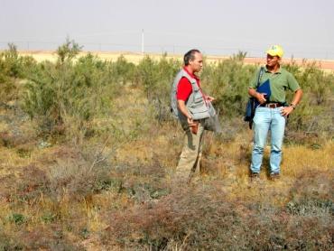
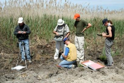
5 Integrated approach Field sampling Laboratory Field classification Field spectroradiometry Regional study


6 Multisensor Remote Sensing Optical and microvave sensors Satélite EO-1 NASA ALI Hyperion Proba1/ CHRIS ALOS AVNIR2 PALSAR Landsat 5 Landsat 7 RADARSAT-2 ASTER
7 Objective The aim of this work is to investigate the capability of ALOS PALSAR in characterizing and monitoring dynamic ecosystems by utilizing a wetland area in Central Spain for which ample information already exists. Specific objectives within the wetland area: Detection of wetland plant communities and invasive vegetation species. Mapping of open water lamina and flooded vegetated areas. Assessing the capacity of PALSAR data to determine the spatial distribution of these different components.


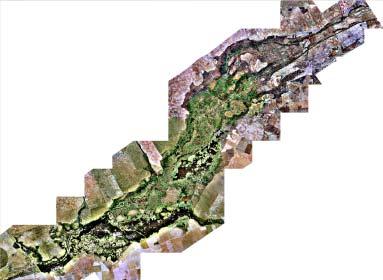
8 Study area Madrid W N S E Las Tablas de Daimiel Cigüela River Guadiana River Daimiel 0 5 km


 (2) Upwelling groundwater from underlying")

9 Las Tablas de Daimiel National Park Rhodes, Greece Climate: Temperate-cold continental The area is in a depressed basin filled with Tertiary sediments, mainly of limestone and calcareous clays. Water sources: (1) Guadiana River (freshwater) and Cigüela River (brackish) (2) Upwelling groundwater from underlying karstic aquifer. Diminishing water level. Areas with temporal flooding. Crop cultivation with intensive irrigation surrounding wetlands. Salt efflorescence.

10 Wetland vegetation Cladium mariscus Phragmatis communis Rush communities Quercus ilex Other tree species Annual vegetation Vegetation free Saline areas Island areas
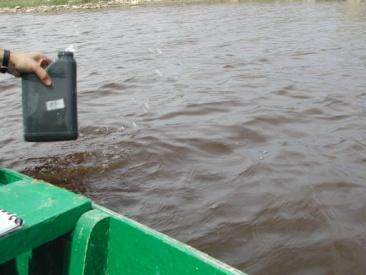
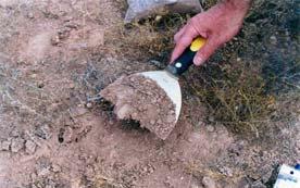
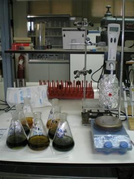
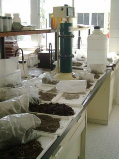
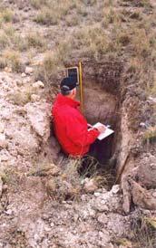
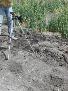
11 Methodology Data acquisition SAR, Hyperspectral and multispectral Wet (spring) and dry (autumn) season Calibration procedures System, atmospheric, radiometric and geometric Surface caracterisation Hyperspectral (endmember) SAR (polarimetric) Data processing Unsupervised classification Supervised Ground-truth data Field campaigns (spectral library) Surface sample analyses (sediment, soil, water) Monitoring SAR Multispectral (ASTER, ETM+) Database management Georeferenced (field data, EO data) Thematic maps
12 PALSAR and AVNIR2 data acquisition PALSAR Quad pol 3 May 2007 PALSAR Dual pol 11 June 2007 AVNIR2 5 November 2007


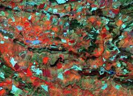
13 Preliminary results Sinclair decomposition Vegetation index classification W N S E W N S E NDVI Max Min km km
14 Preliminary results W N S E W N S E HH HV km km W N S E W N S E VH VV 0 5 km km
15 Conclusions PALSAR offers several technical advantages to better discriminate wetland features (vegetation structure and wetland conditions). Due to dry conditions at present in the wetlands, it has not been possible to study the effect of shallow water bodies or aquatic plants. Data availability during wet and dry periods. Limitations with the PALSAR mode 1.5 data. Mode 1.1 would improve the possibility to discriminate wetland features. Geocoding and mode 1.1 necessity This work is ongoing and further application of PALSAR and AVNIR2 will be carried out together with data obtained from other sensors. Monitoring the wetland by integrating ALOS data to historical EO data.
16 Acknowledgements Many thanks go to the Jaxa team for the data management and organisation of the ALOS Palsar and AVNIR2 data. Further thanks go to Dr. Santos Cirujano for the identification and distribution of the vegetation. Funding of the National Project (CGL C02-02/HID) by the Spanish Ministry of Education and Science.
Using multi-temporal ALOS PALSAR to investigate flood dynamics in semi-arid wetlands: Murray Darling Basin, Australia.
 Using multi-temporal ALOS PALSAR to investigate flood dynamics in semi-arid wetlands: Murray Darling Basin, Australia. Rachel Melrose, Anthony Milne Horizon Geoscience Consulting and University of New
Applications of SAR Polarimetry on Land: Soil Moisture and Wetlands
 Applications of SAR Polarimetry on Land: Soil Moisture and Wetlands Session Summary and Recommendations R. Touzi and S. Cloude Session Summary T. Jagdhuber et. Al.: Polarimetric Decompositions for Soil
the wheat fields is small, and as for fields of puddling and leveling in winter and other fields in similar, the difference is small. It is conclude t
 OBSERVATION OF JAPANESE PADDY RICE FIELDS USING MULTI TEMPORAL AND POLARIMETRIC PALSAR DATA PI No.365 Naoki ISHITSUKA 1, Genya SAITO 2, Fan YANG 3, Chinatsu YONEZAWA 4 and Shigeo OGAWA 5 1 National Institute
K&C Phase 4 Status report. Retrieval of forest biomass and biomass change with spaceborne SAR
 K&C Phase 4 Status report Retrieval of forest biomass and biomass change with spaceborne SAR Johan Fransson 1, Jonas Fridman 1, Ivan Huuva, Håkan Olsson 1, Henrik J. Persson 1, Jörgen Wallerman 1, Maurizio
3/1/18 USING RADAR FOR WETLAND MAPPING IMPORTANCE OF SOIL MOISTURE TRADITIONAL METHODS TO MEASURE SOIL MOISTURE. Feel method Electrical resistance
 3/1/18 USING RADAR FOR WETLAND MAPPING SOIL MOISTURE AND WETLAND CLASSIFICATION Slides modified from a presentation by Charlotte Gabrielsen for this class. Southeast Arizona: Winter wet period From C.
EO opportunities and challenges for achieving SDG 6.6
 EO opportunities and challenges for achieving SDG 6.6 Marc Paganini, European Space Agency (ESA) Sharing experiences on indicator 6.6.1 on freshwater related ecosystems, and exploring opportunities for
K&C Phase 4 Brief project essentials
 K&C Phase 4 Brief project essentials Measuring above-ground biomass and its changes over Brazilian tropical secondary forests and savanna woodlands (Cerrado) using L-band SAR data Shaun Quegan, João Carreiras
K&C Phase 4 Status report. Coupling radar-based estimates of forest information with biosphere models for improved carbon flux estimation
 K&C Phase 4 Status report Coupling radar-based estimates of forest information with biosphere models for improved carbon flux estimation Maurizio Santoro & Oliver Cartus GAMMA Remote Sensing Nuno Carvalhais
Progress Report for COMBINED SATELLITE MAPPING OF SIBERIAN LANDSCAPES: NATURAL AND ANTHROPOGENIC FACTORS AFFECTING CARBON BALANCE
 Progress Report for COMBINED SATELLITE MAPPING OF SIBERIAN LANDSCAPES: NATURAL AND ANTHROPOGENIC FACTORS AFFECTING CARBON BALANCE Submitted to : Dr. Garik Gutman, LCLUC Program Manger Dr. Waleed Ablati,
Mapping Coastal Great Lakes Wetlands and Adjacent Land use Through Hybrid Optical-Infrared and Radar Image Classification Techniques
 Mapping Coastal Great Lakes Wetlands and Adjacent Land use Through Hybrid Optical-Infrared and Radar Image Classification Techniques Laura L. Bourgeau-Chavez, Kirk Scarbrough, Mary Ellen Miller, Zach Laubach,
Satellite Earth Observation
 Satellite Earth Observation Services for Ecosystem valuation Prof Nick Veck Head of the CEO s Office Satellite Applications Catapult 17 March 2017 Outline Introduction to Earth observation and ecosystem
Impacts of water scarcity and drought on Iberian aquatic ecosystems
 Impacts of water scarcity and drought on Iberian aquatic ecosystems Dr. Carles Ibáñez Martí, carles.ibanez@irta.cat Director of the Aquatic Ecosystems Program, IRTA International Drought Symposium, UC
CROP SPECIES RECOGNITION AND DISCRIMINATION PADDY-RICE-GROWING- FIELDS FROM REAPED-FIELDS BY THE RADAR VEGETATION INDEX (RVI) OF ALOS-2/PALSAR2
 OF ALOS-2/PALSAR2") CROP SPECIES RECOGNITION AND DISCRIMINATION PADDY-RICE-GROWING- FIELDS FROM REAPED-FIELDS BY THE RADAR VEGETATION INDEX (RVI) OF ALOS-2/PALSAR2 Y. Yamada a a Institute for Rural Engineering, National Agriculture
CROP SPECIES RECOGNITION AND DISCRIMINATION PADDY-RICE-GROWING- FIELDS FROM REAPED-FIELDS BY THE RADAR VEGETATION INDEX (RVI) OF ALOS-2/PALSAR2 Y. Yamada a a Institute for Rural Engineering, National Agriculture
Expects from Sentinel-2 for, wide and small, temperate and tropical, wetlands monitoring based on 2013 and 2015 Take-Five experiment
 Expects from Sentinel-2 for, wide and small, temperate and tropical, wetlands monitoring based on 2013 and 2015 Take-Five experiment H. Yésou, Faivre R., M. Studer, G. Secatto, Lai X., Cao L.; Burnham
Remote sensing as a tool to detect and quantify vegetation properties in tropical forest-savanna transitions Edward Mitchard (University of Edinburgh)
") Remote sensing as a tool to detect and quantify vegetation properties in tropical forest-savanna transitions Edward Mitchard (University of Edinburgh) Presentation to Geography EUBAP 10 th Oct 2008 Supervisor:
Remote sensing as a tool to detect and quantify vegetation properties in tropical forest-savanna transitions Edward Mitchard (University of Edinburgh) Presentation to Geography EUBAP 10 th Oct 2008 Supervisor:
Forest Biomass Estimation, Australia
 Forest Biomass Estimation, Australia 1 Richard Lucas, 2 John Armston, 1 Peter Bunting, 1 Daniel Clewley, 2 Peter Scarth, 2 Michael Schmidt, 2 Arnon Accad, 3 Paul Siqueira and 3 Yang Lei 1 Institute of
K&C Phase 4 Brief project essentials. Asia-RiCE: Rice Crop Estimation and Monitoring. Shin-ichi Sobue Remote Sensing Technology Center of Japan
 K&C Phase 4 Brief project essentials Asia-RiCE: Rice Crop Estimation and Monitoring Shin-ichi Sobue Remote Sensing Technology Center of Japan Science Team meeting #21 Phase 4 Kick-off Kyoto Research Park,
K&C Phase 4 Status report
 K&C Phase 4 Status report Measuring above ground biomass and changes over Brazilian tropical secondary forests and savanna woodlands (Cerrado) using L-band SAR data Shaun Quegan, João Carreiras National
ANALYSIS OF ALOS/PALSAR POLARIMETRIC SIGNATURES AND SCATTERING MECHANISMS OF FOREST TYPES IN TAPAJÓS S REGION, BRAZIL
 ANALYSIS OF ALOS/PALSAR POLARIMETRIC SIGNATURES AND SCATTERING MECHANISMS OF FOREST TYPES IN TAPAJÓS S REGION, BRAZIL J. R. dos Santos 1 ; I. S. Narvaes 1.; P. M. L. A. Graça 2 ; F. G. Gonçalves 3 (1)
Malawi Multi-purpose use of ALOS PALSAR-1 data. sarmap and Forest Research Institute of Malawi (FRIM)
") Malawi Multi-purpose use of ALOS PALSAR-1 data sarmap and Forest Research Institute of Malawi (FRIM) Objective The objective is to demonstrate, at country-level, the multi-purpose use of ALOS PALSAR-1
Malawi Multi-purpose use of ALOS PALSAR-1 data sarmap and Forest Research Institute of Malawi (FRIM) Objective The objective is to demonstrate, at country-level, the multi-purpose use of ALOS PALSAR-1
Role and importance of Satellite data in the implementation of the COMIFAC Convergence Plan
 Plenary Meeting of the Congo Basin Forest Partnership (CBFP) Palais des Congrès, Yaoundé. Cameroon 11-12 November, 2009 Role and importance of Satellite data in the implementation of the COMIFAC Convergence
Forest and Land Cover Monitoring by Remote Sensing Data Analysis
 Low Carbon Asia Research Network (LoCARNet) 3rd Annual Meeting Bogor, Indonesia November 24 26, 2014 Forest and Land Cover Monitoring by Remote Sensing Data Analysis Muhammad Ardiansyah Center for Climate
I. SOIL MOISTURE, CROP AND VEGETATION STUDY USING AIRSAR DATA
 I. SOIL MOISTURE, CROP AND VEGETATION STUDY USING AIRSAR DATA Dr. Flaviana Hilario (1) and Dr. Juliet Mangera (2) (1) PAGASA (Weather Bureau), ATB 1424 Quezon Ave, Quezon City, Philippines, 1100, Philippines
LiDAR/SAR-based mapping of savannahs forests in Southern Africa
 Joint GFOI / GOFC-GOLD / CONABIO / SilvaCarbon R&D Expert and Capacity Building workshop on: Regional solutions to forest type stratification and characterising the forest state for national forest monitoring
Taikichiro Mori Memorial Research Grants Graduate Student Researcher Development Grant Report
 Taikichiro Mori Memorial Research Grants Graduate Student Researcher Development Grant Report February 2016 Research Project: Detection and delineation of water bodies using Synthetic Aperture Radar data
THE UPPER GUADIANA CASE
 THE UPPER GUADIANA CASE José Ángel Rodríguez Cabellos Jefe de la Oficina de Planificación Hidrológica GUADIANA RIVER AUTHORITY (CONFEDERACIÓN HIDROGRÁFICA DEL GUADIANA) Spain oph@chguadiana.es Introduction
K&C Phase 4 Status report. Utilising L-Band SAR Data for Natural Resource Management in the Philippines
 K&C Phase 4 Status report Utilising L-Band SAR Data for Natural Resource Management in the Philippines Mari Trix Estomata 1, Jose Don De Alban 2, Angelica Kristina Monzon 2, Patricia Sanchez 3, and Enrico
JECAM and the Manitoba Super Site
 JECAM and the Manitoba Super Site GEO-DRI Drought Monitoring Workshop May 10 & 11, 2010 Grant Wiseman, M.Sc. AAFC, AESB, Winnipeg, Canada grant.wiseman@agr.gc.ca Joint Experiments on Crop Assessment and
K&C Phase 4 Status report. Retrieval of forest biomass and biomass change with spaceborne SAR
 K&C Phase 4 Status report Retrieval of forest biomass and biomass change with spaceborne SAR Johan Fransson 1, Jonas Fridman 1, Ivan Huuva 1 Håkan Olsson 1, Henrik Persson 1, Jörgen Wallerman 1, Maurizio
Goals of the GLOWA Volta Project:
 GLOWAVolta Monitoring of Chlorophyll a and Toxic Algal Blooms in the Volta Basin Preliminary regarding potentials of CHRIS-Proba hyperspectral imagery Content: 1. Introduction 1.1 GLOWA Volta Project/
Groundwater challenges in Spain (Lessons from the Western Mancha aquifer)
") Groundwater in Spain (Lessons from the Western Mancha aquifer) Pedro Martínez-Santos Universidad Complutense de Madrid, Spain Albuquerque, NM September 25, 2013 2 Contents : a historical perspective 3.
Groundwater in Spain (Lessons from the Western Mancha aquifer) Pedro Martínez-Santos Universidad Complutense de Madrid, Spain Albuquerque, NM September 25, 2013 2 Contents : a historical perspective 3.
Asia-RiCE 2016 Implementation Report
 Asia-RiCE 2016 Implementation Report Asia-RiCE has been organised to develop the rice crop estimation and monitoring component for the GEO Global Agricultural Monitoring (GEOGLAM) initiative. GEOGLAM aims
Final Report of Activities carried out during the STM period at NIGLAS-CAS
 Programma STM - Short Term Mobility (Anno 215) -Paolo Villa [authorized with Prot. AMMCNT Num. 2422 of 9/4/215] Programma STM - Short Term Mobility (Anno 215), authorized with Prot. AMMCNT Num. 2422 of
DEVELOP National Program
 National Aeronautics and Space Administration NASA Earth Science Division Applied Sciences Program DEVELOP National Program Gulf of Mexico Oil Spill Monitoring Oil Spill and Wetlands Impact Assessment
REDDAF. Infosheet. Content. Objective and Concept. November 2012
 November 2012 REDDAF Infosheet Content Objective and Concept Objective and Concept 1 User Requirements 2 Methods Development 2 Service Development 5 Validation and Proof of Concept 6 Capacity Building/Training
An Assessment of the Pull between Landuse and Landcover in Southwestern Nigeria and the Ensuing Environmental Consequences
 An Assessment of the Pull between Landuse and Landcover in Southwestern Nigeria and the Ensuing Environmental Consequences R.O. OYINLOYE and J. OLOUKOI INTRODUCTION HYDRO SPHERE ATMO SPHERE BIO SPHERE
Seagrass Mapping in Lap An lagoon, Viet Nam by Using ALOS AVNIR - 2 Data
 Seagrass Mapping in Lap An lagoon, Viet Nam by Using ALOS AVNIR - 2 Data Supervisor: Prof. K.YOSHINO HA Nam Thang Master course, Graduate school of Environmental and Life Science GDP per capita (2010)
Monitoring Natural Sal Forest Cover in Modhupur, Bangladesh using Temporal Landsat Imagery during
 Monitoring Natural Sal Forest Cover in Modhupur, Bangladesh using Temporal Landsat Imagery during 1972 2015 Hasan Muhammad Abdullah *, M. Golam Mahboob, Md.Mezanur Rahman, Tofayel Ahmed * Assistant Professor,
GROUNDWATER AND ECOSYSTEM SERVICE VULNERABILITY AND RESILIENCE
 GROUNDWATER AND ECOSYSTEM SERVICE VULNERABILITY AND RESILIENCE The View from Europe and Spain IWMI Workshop Managing Smallholder Groundwater-dependent Agrarian Socioecologies using an Ecosystem Service
Lecture 1 Integrated water resources management and wetlands
 Wetlands and Poverty Reduction Project (WPRP) Training module on Wetlands and Water Resources Management Lecture 1 Integrated water resources management and wetlands 1 Water resources and use The hydrological
JECAM SAR Inter-Comparison Experiment. Applying Operational SAR and Optical Classification Methodologies to Multiple
 SAR Inter-Comparison Experiment Component 1: Crop Type Identification & Mapping Activity 1: Regions Applying Operational SAR and Optical Classification Methodologies to Multiple 1a. Applying Agriculture
Guidelines for the delimitation of wetland ecosystems Version 1.1
 Guidelines for the delimitation of wetland ecosystems Version 1.1 March 3, 2016 Page: 1 Contributors: Dania Abdul Malak, European Topic Centre of University of Málaga Antonio Sanchez Espinosa, European
Issues associated with wetland biodiversity and. agriculture globally. and the extent of agriculture in Ramsar wetlands.
 research for a sustainable future Issues associated with wetland biodiversity and agriculture globally and the extent of agriculture in Ramsar wetlands Max Finlayson Institute for Land, Water & Society,
Water Resources and Freshwater Ecosystems-- Madagascar
 Water Resources and Freshwater Ecosystems-- Madagascar EarthTrends Country Profiles Sub- Internal Renewable Water Resources (IRWR),1977-2001, in cubic km Madagascar Saharan Africa Surface water produced
Cool waters and atmospheric high pressure
 QU: How does human activity contribute to drought risk? AIM: To evaluate the human influence of drought events in Africa's Sahel region. ST: What part of the ENSO cycle is at work here? What does it mean
Product Delivery Report for K&C Phase 3. Francesco Holecz sarmap
 Product Delivery Report for K&C Phase 3 Francesco Holecz sarmap Science Team meeting #21 Phase 3 Result Presentations Kyoto Research Park, Kyoto, Japan, December 3-4, 2014 Project objectives The objective
GEOGLAM Asia-RiCE Team Activities Update and Accomplishments
 GEOGLAM Asia-RiCE Team Activities Update and Accomplishments Shin-ichi Sobue On behalf of the GEOGLAM Asia-RiCE team 2015/11/16 Regional Cooperation for Rice Crop Monitoring Using Space Technology in Asia
Water Resources and Freshwater Ecosystems-- China
 Water Resources and Freshwater Ecosystems-- China EarthTrends Country Profiles Internal Renewable Water Resources (IRWR),1977-2001, in cubic km China Asia (excl. Middle East) Surface water produced internally
Water Resources and Freshwater Ecosystems-- Armenia
 Water Resources and Freshwater Ecosystems-- Armenia EarthTrends Country Profiles Internal Renewable Water Resources (IRWR),1977-2001, in cubic km Armenia Asia (excl. Middle East) Surface water produced
Institute of Water and Flood Management, Bangladesh University of Engineering and Technology, Dhaka- 1000, Bangladesh. 2
 ID: EE 024 TEMPORAL VARIATION OF BIOMASS CONCENTRATION IN THE BANGLADESH SUNDARBANS USING REMOTE SENSING TECHNIQUES Ahsan Azhar Shopan 1*, G.M. Tarekul Islam 1, A.K.M. Saiful Islam 1, Md. Munsur Rahman
AGRICULTURAL CROP MAPPING USING OPTICAL AND SAR MULTI- TEMPORAL SEASONAL DATA: A CASE STUDY IN LOMBARDY REGION, ITALY
 AGRICULTURAL CROP MAPPING USING OPTICAL AND SAR MULTI- TEMPORAL SEASONAL DATA: A CASE STUDY IN LOMBARDY REGION, ITALY G. Fontanelli, A. Crema, R. Azar, D. Stroppiana, P. Villa, M. Boschetti Institute for
PERSPECTIVE NEWSLETTER OF THE GLOBAL LAND PROJECT
 ISSN 2316-3747 12 NEWSLETTER OF THE GLOBAL LAND PROJECT GLP - A joint research project of IGBP & Future Earth ISSUE Nº 12 NOVEMBER 2015 Biodiversity and Land Systems PERSPECTIVE A new focus for ecological
Tiger project #2 : Biomass evaluation of tropical dry and wet forests. Climate change impacts
 Tiger II Workshop Hartebeeshoek, South Africa, 12 13 December 2011 Tiger project #2 : Biomass evaluation of tropical dry and wet forests. Climate change impacts Laboratory Institution Partners Project
Earth observations for water resource management: Current practice and examples
 Earth observations for water resource management: Current practice and examples NEW OPPORTUNITIES IN SATELLITE AND AIRBORNE REMOTE SENSING: Hydrological and Environmental Applications DTU Environment Lyngby
K&C Phase 4 Status report
 K&C Phase 4 Status report Measuring above ground biomass and changes over Brazilian tropical secondary forests and savanna woodlands (Cerrado) using L-band SAR data Shaun Quegan, João Carreiras National
ALOS PRISM CYCLIC REPORT #18 09 MARCH 2008 TO 24 APRIL 2008
 ALOS PRISM CYCLIC REPORT #18 09 MARCH 2008 TO 24 APRIL 2008 ADEN ALOS QC Optical Team PRISM_CR_17_080309_080424 1 0 09 May 2008 Technical Note A P P R O V A L ALOS PRISM Cyclic Report Cycle 18 1 0 ADEN
Wild fires risk in Extremadura's Regional Park and archeological exploration using CHRIS imagery
 Wild fires risk in Extremadura's Regional Park and archeological exploration using CHRIS imagery Research Groups of the University of Extremadura: Archaeology (Departament of History), Neural Networks
The NISAR Mission. Paul Siqueira Emerging Technologies and Methods in Earth Observation for Agriculture Monitoring College Park, 2018
 The NISAR Mission Paul Siqueira Emerging Technologies and Methods in Earth Observation for Agriculture Monitoring College Park, 2018 Flyer A one-page paper-flyer is available with more information NISAR
RADAR for Biomass Mapping
 RADAR for Biomass Mapping Josef Kellndorfer Wayne Walker, Katie Kirsch, Greg Fiske The Woods Hole Research Center GOFC-GOLD Biomass Workshop Missoula, 15-June-2009 Outline Some Radar principles Measurements
Country profile of Sri Lanka and present status of NBSAPs
 Regional Capacity- Building workshop For Ecosystem Conservation and Restoration to Support Achievement of the Aichi Biodiversity Targets Country profile of Sri Lanka and present status of NBSAPs Hasula
Status of Soil Resources in Lebanon
 Status of Soil Resources in Lebanon By Roger FRANCIS CNRS-National Center for Remote Sensing Jordan Amman 1-5 April 2012 Status of environment and coastal ecosystem State of the art on soil studies in
Use of EO for integrated Coastal Zone Management [ICZM]
![Use of EO for integrated Coastal Zone Management [ICZM]](/thumbs/78/78380350.jpg "Use of EO for integrated Coastal Zone Management [ICZM]") Use of EO for integrated Coastal Zone Management [ICZM] Prof. George Zalidis Aristotle University of Thessaloniki, School of Agriculture Director of the Laboratory of Applied Soil Science Director of the
Use of EO for integrated Coastal Zone Management [ICZM] Prof. George Zalidis Aristotle University of Thessaloniki, School of Agriculture Director of the Laboratory of Applied Soil Science Director of the
Vegetation changes in Natura 2000 sites in Greece using remote sensing data
 15 th International Conference on Environmental Science and Technology Rhodes, Greece, 31 August to 2 September 2017 Vegetation changes in Natura 2000 sites in Greece using remote sensing data Alexandra
Remote Sensing (C) School Name: Student Name(s):
 School Name: Student Name(s):") School Name: Student Name(s): Remote Sensing (C) Nebraska Science Olympiad State Competition University of Nebraska-Lincoln Saturday, April 2 nd 2011 Question and Answer Sheet 100 points total Show all
School Name: Student Name(s): Remote Sensing (C) Nebraska Science Olympiad State Competition University of Nebraska-Lincoln Saturday, April 2 nd 2011 Question and Answer Sheet 100 points total Show all
JAXA s MRV - current status and future envision -
 JAXA s MRV - current status and future envision - Masanobu Shimada Japan Aerospace Exploration Agency Earth Observation Research Center MRV symposium at Tokyo Forum Feb. 17, 2011 Concept Satellite data
Product Delivery Report for K&C Phase 3. Maurizio Santoro. GAMMA Remote Sensing
 Product Delivery Report for K&C Phase 3 Maurizio Santoro GAMMA Remote Sensing Science Team meeting #21 Phase 3 Result Presentations Kyoto Research Park, Kyoto, Japan, December 3-4, 2014 Nuno Carvalhais,
Climate: describes the average condition, including temperature and precipitation, over long periods in a given area
 Ch. 6 - Biomes Section 6.1: Defining Biomes Biome: a group of ecosystems that share similar biotic and abiotic conditions, large region characterized by a specific type of climate, plants, and animals
Dryland monitoring in Turkmenistan using remote sensing
 Dryland monitoring in Turkmenistan using remote sensing Lea Orlovsky and Dan Blumberg Shai Kaplan, Shimrit Tirosh, Eldad Eshed, Offir Matsraffi Batyr Mamedov and Elmar Mamedov Jacob Blaustein Institutes
4.7 What happens when we divert water?
 4.7 What happens when we divert water? Many of the world s greatest lakes are shrinking, and large rivers such as the Colorado, Rio Grande, Indus, Ganges, Nile and Murray discharge very little water into
ESTIMATION OF THE RICE YIELD IN THE MEKONG DELTA USING SAR DUAL POLARISATION DATA
 ESTIMATION OF THE RICE YIELD IN THE MEKONG DELTA USING SAR DUAL POLARISATION DATA Nguyen Lam-Dao *a, Phung Hoang-Phi a, Juliane Huth b and Phung Cao-Van c a GIS and Remote Sensing Research Center, HCMC
A Study of Himreen Reservoir Water Quality Using in Situ Measurement and Remote Sensing Techniques
 A Study of Himreen Reservoir Water Quality Using in Situ Measurement and Remote Sensing Techniques Dr. Salah A. H. Saleh College of Science, Nahrain University, Baghdad - IRAQ Abstract The use of remote
Rice crop monitoring in Vietnam using radar remote sensing data
 Earth Observation Technologies for Crop Monitoring: A Workshop to Promote Collaborations among GEOGLAM/JECAM/Asia-RiCE 2018 17-20 September 2018 Taichung, Taiwan Rice crop monitoring in Vietnam using radar
Investigating ecological patterns and processes in tropical forests using GIS and remote sensing
 Investigating ecological patterns and processes in tropical forests using GIS and remote sensing Carlos Portillo-Quintero Center for Earth Observation Sciences (CEOS) Department of Earth & Atmospheric
Earth Observation in Support of Science-Driven Policy & Decision Making: GEO Global Agricultural Monitoring (GEOGLAM)
") Earth Observation in Support of Science-Driven Policy & Decision Making: GEO Global Agricultural Monitoring (GEOGLAM) Alyssa Whitcraft Program Scientist, GEOGLAM Secretariat akwhitcraft@geooglam.org on
Earth Observation in Support of Science-Driven Policy & Decision Making: GEO Global Agricultural Monitoring (GEOGLAM) Alyssa Whitcraft Program Scientist, GEOGLAM Secretariat akwhitcraft@geooglam.org on
Forest Changes and Biomass Estimation
 Forest Changes and Biomass Estimation Project Title: Comparative Studies on Carbon Dynamics in Disturbed Forest Ecosystems: Eastern Russia and Northeastern China Supported by NASA Carbon Cycle Science
Use of multi-temporal PalSAR ScanSAR data for soil moisture retrieval
 Use of multi-temporal PalSAR ScanSAR data for soil moisture retrieval Francesco Mattia (1), Giuseppe Satalino (1), Anna Balenzano (1) and Michele Rinaldi () (1) Consiglio Nazionale delle Ricerche (CNR)
METODOLOGIE E APPROCCI PER OSSERVAZIONI IPERSPETTRALI IN ACQUE COSTIERE E INTERNE
 Data Exploitation della missione PRISMA, precursore delle missioni iperspettrali nazionali Roma, 1-3 marzo 2017 METODOLOGIE E APPROCCI PER OSSERVAZIONI IPERSPETTRALI IN ACQUE COSTIERE E INTERNE Federica
Vulnerability of hydrological ecosystem services to climatic extremes in a Mediterranean river basin
 Vulnerability of hydrological ecosystem services to climatic extremes in a Mediterranean river basin Marta Terrado, Vicenç Acuña, Driss Ennaanay, Heather Tallis, Sergi Sabater CLIMATIC EXTREMES AND HYDROLOGICAL
Amazon Wetlands Applications of JERS-1 SAR and ALOS PALSAR Datasets
 Amazon Wetlands Applications of JERS-1 SAR and ALOS PALSAR Datasets Laura Hess Institute for Computational Earth System Science University of California, Santa Barbara The Large-Scale Biosphere-Atmosphere
WASA Quiz Review. Chapter 2
 WASA Quiz Review Chapter 2 Question#1 What is surface runoff? part of the water cycle that flows over land as surface water instead of being absorbed into groundwater or evaporating Question #2 What are
Hervé YESOU Claire HUBER, Henri GIRAUD, Mathias STUDER, Sadri HAOUET, Paul de FRAIPONT Maria VIRELLI & Yves Louis DESNOS
 Mapping water bodies exploited multi-sensors and multi resolution optical and SAR data: gained experience from plain flood monitoring in Western Europe and Asia Hervé YESOU Claire HUBER, Henri GIRAUD,
Rice crop monitoring using EO data in the Mekong Delta, Vietnam
 The 10th GEOSS Asia-Pacific Symposium WG5: Agriculture and Food Security Hanoi, 18-20 th, Sep. 2017 Rice crop monitoring using EO data in the Mekong Delta, Vietnam Lam Dao Nguyen, Hoang Phi Phung, Dang
Cost-Effectiveness of Water Conservation Measures: A Multi-level Analysis with Policy Implications
 1 Cost-Effectiveness of Water Conservation Measures: A Multi-level Analysis with Policy Implications Blanco I. 1, Varela-Ortega C. 2 and Flichman G. 3 1 Polytechnic University of Madrid/Department of Agricultural
Current Status of NFMIS in Myanmar & How MOLI data can Contribute to the ongoing Efforts. Myat Su Mon, Forest Department, Myanmar
 Current Status of NFMIS in Myanmar & How MOLI data can Contribute to the ongoing Efforts Myat Su Mon, Forest Department, Myanmar 26-05-2017 1 Presentation Outlines Background Information Challenges for
Olives ecosystems and biodiversity - considerations for action in the EU
 Olives ecosystems and biodiversity - considerations for action in the EU IOC Madrid 18/11/09 Guy Beaufoy EFNCP 1 How important are olive ecosystems for European biodiversity? The EU aims to stop biodiversity
Remote Sensing of Mangrove Structure and Biomass
 Remote Sensing of Mangrove Structure and Biomass Temilola Fatoyinbo 1, Marc Simard 2 1 NASA Goddard Space Flight Center, Greenbelt, MD USA 2 NASA Jet Propulsion Laboratory, Pasadena, CA USA Introdution
Ecosystem services and wetland restoration
 Ecosystem services and wetland restoration Michael Trepel 1, Jürgen Augustin 2, Bettina Holsten 1 & Dominik Zak 3 1 : Ecology-Centre, Christian-Albrecht s-university, Kiel 2 : Leibniz-Zentrum für Agrarlandschaftsforschung
Long-term forecasting of natural disasters under projected climate changes in Ukraine
 Scientific Centre for Aerospace Research of the Earth National Academy of Sciences of Ukraine 55-b, O. Honchar street, Kiev, 01601, Ukraine phone/fax: (+38 044) 486 1148 URL: www.casre.kiev.ua; Е-mail:
Valuation of ecosystem services and air pollution damage in Spain
 Valuation of ecosystem services and air pollution damage in Spain Isaura Rábago, Rocío Alonso, Victoria Bermejo, isaura.rabago@ciemat.es; rocio.alonso@ciemat.es; victoria.bermejo@ciemat.es Environment
Use of GIS and Remote Sensing to assess Soil Erosion in Arid to Semiarid Basin in Jordan
 Use of GIS and Remote Sensing to assess Soil Erosion in Arid to Semiarid Basin in Jordan Ibrahim Farhan and Jawad Al Bakri Dept. Land, Water & Env. Faculty of Agriculture, University of Jordan, Amman,
MONITORING OF CROP GROWTH AND SOIL MOISTURE RETRIEVAL USING NISAR DATA. HARI SHANKER SRIVASTAVA Indian Institute of Remote Sensing (IIRS),
,") NISAR Science Workshop 2015 Space Applications Centre MONITORING OF CROP GROWTH AND SOIL MOISTURE RETRIEVAL USING NISAR DATA HARI SHANKER SRIVASTAVA Indian Institute of Remote Sensing (IIRS), Indian Space
NISAR Science Workshop 2015 Space Applications Centre MONITORING OF CROP GROWTH AND SOIL MOISTURE RETRIEVAL USING NISAR DATA HARI SHANKER SRIVASTAVA Indian Institute of Remote Sensing (IIRS), Indian Space
Integration methods for forest degradation assessment and change monitoring
 VTT TECHNICAL RESEARCH CENTRE OF FINLAND LTD Joint GFOI / GOFC-GOLD / CONABIO / SilvaCarbon R&D Expert and Capacity Building workshop on: Regional solutions to forest type stratification and characterising
Recent cal/val activities at the REMEDHUS network (Spain)
") Centro Hispano Luso de Investigaciones Agrarias University of Salamanca (Spain) Water Resources Research Group (www.usal.es/hidrus) Recent cal/val activities at the REMEDHUS network (Spain) José Martínez-Fernández
Centro Hispano Luso de Investigaciones Agrarias University of Salamanca (Spain) Water Resources Research Group (www.usal.es/hidrus) Recent cal/val activities at the REMEDHUS network (Spain) José Martínez-Fernández
LAND AND WATER - EARTH OBSERVATION INFORMATICS FSP
 Earth Observation for Water Resources Management Arnold Dekker,Juan P Guerschman, Randall Donohue, Tom Van Niel, Luigi Renzullo,, Tim Malthus, Tim McVicar and Albert Van Dijk LAND AND WATER - EARTH OBSERVATION
PALSAR TROPICAL FOREST COVER MAPPING, MOSAICING AND VALIDATION, CASE STUDY BORNEO
 PALSAR TROPICAL FOREST COVER MAPPING, MOSAICING AND VALIDATION, CASE STUDY BORNEO Dirk H. Hoekman 1), M.J. Quiñones 2), R. Verhoeven 2), M.A.M. Vissers 2), V. Schut 2) and N. Wielaard 2) 1) Wageningen
K&C Phase 3 Brief project essentials. Measuring Effective Conservation in The Northern Andes and South Central America Conservation Program
 Science Team meeting #16 Phase 3 Kick-off JAXA TKSC/RESTEC HQ, Tsukuba/Tokyo, October 17-21, 2011 K&C Phase 3 Brief project essentials Measuring Effective Conservation in The Northern Andes and South Central
HyMeX (*) WG2: Hydrological Continental Cycle. I. Braud (1), A. Chanzy (2) *Hydrological cycle in the Mediterranean experiment
 WG2: Hydrological Continental Cycle. I. Braud (1), A. Chanzy (2) *Hydrological cycle in the Mediterranean experiment") HyMeX (*) http://www.hymex.org/ WG2: Hydrological Continental Cycle I. Braud (1), A. Chanzy (2) (1) CEMAGREF, UR HHLY, Lyon, France (2) UME EMMAH, INRA, Avignon, France *Hydrological cycle in the Mediterranean
HyMeX (*) http://www.hymex.org/ WG2: Hydrological Continental Cycle I. Braud (1), A. Chanzy (2) (1) CEMAGREF, UR HHLY, Lyon, France (2) UME EMMAH, INRA, Avignon, France *Hydrological cycle in the Mediterranean
General background Rice food demand is increasing
 1, -, General background Rice food demand is increasing o Rice food demand continues to increase due to rapid population growth o In Asia, where rice is the main crop, about additional 80 million tons
GROUNDWATER IN SPAIN. Carlos Martínez Navarrete Director del Departamento de Investigación en Recursos Geológicos IGME
 GROUNDWATER IN SPAIN Carlos Martínez Navarrete Director del Departamento de Investigación en Recursos Geológicos IGME GEOLOGIC UNITS 2 Natural water budget in the Spanish territory (km 3 /yr) 3 HIDROGEOLOGICAL
presented by Dr. Muhammad Zia ur Rahman Hashmi, Senior Scientific Officer Global Change Impact Studies Centre (GCISC)
") presented by Dr. Muhammad Zia ur Rahman Hashmi, Senior Scientific Officer Global Change Impact Studies Centre (GCISC) SDPI s Sustainable Development Conference (SDC), 9-11 Dec, 2014 Presentation layout
presented by Dr. Muhammad Zia ur Rahman Hashmi, Senior Scientific Officer Global Change Impact Studies Centre (GCISC) SDPI s Sustainable Development Conference (SDC), 9-11 Dec, 2014 Presentation layout