Monitoring Natural Sal Forest Cover in Modhupur, Bangladesh using Temporal Landsat Imagery during
|
|
|
- Ethan Hodges
- 6 years ago
- Views:
Transcription


1 Monitoring Natural Sal Forest Cover in Modhupur, Bangladesh using Temporal Landsat Imagery during Hasan Muhammad Abdullah *, M. Golam Mahboob, Md.Mezanur Rahman, Tofayel Ahmed * Assistant Professor, Remote Sensing and GIS Lab., Department of Agroforestry and Environment, Bangabandhu Sheikh Mujibur Rahman Agricultural University, Gazipur-1706 hasan.abdullah@bsmrau.edu.bd

2 Saturday, January 9, 2016 A vast swathe of Sal forest clear-cut for commercial fruit orchards in Modhupur. Locals allege that influential party people in collusion with some corrupt officials wiped out 250 acres of such forest in the last one year.
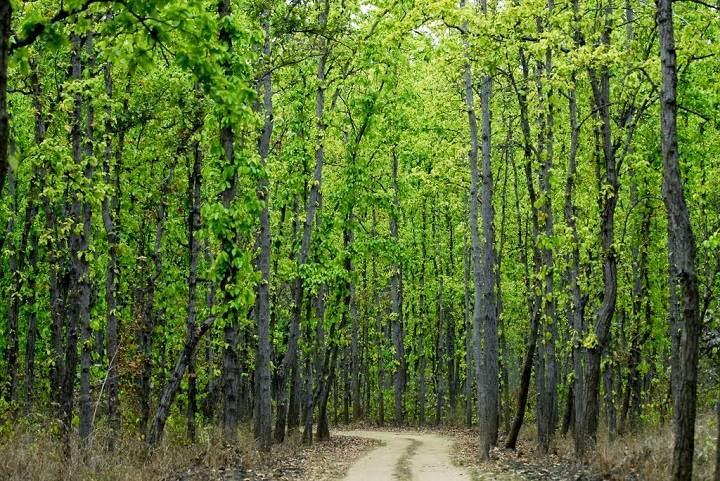
3 Introduction Modhupur Sal (Shorea robusta) forest, the largest natural Sal forest area of Bangladesh It is a threatened ecological resource situated in the central part of the country Rich in biodiversity (flora & fauna) Serve as a sink (absorbed carbon-di-oxide) linked to UN-REDD (United Nations Programme on Reducing Emissions from Deforestation and Forest Degradation) Unfortunately this forest is heavily impacted by human activities Current study investigated and quantified the destruction in areal extent of natural Sal forest using temporal Landsat satellite data
4 Composition of natural Sal forest associated flora and fauna (Green KM. 1981) Flora Fauna Species type No. Species type No. Climbers 24 Amphibians 12 Grasses 27 Reptiles 25 Palms 3 Birds 148 Herbs 105 Mammals 35 Shrubs 19 Trees 43 Total 221 Total 220
5 The main driver of natural forest loss is human activities like settlement, commercial plantation, agriculture and agroforestry practices The forest cover change causes elimination of species locally and declination of natural habitats and ecosystem functions, thus affecting, biodiversity and provision of ecosystem services Monitoring land cover changes using multi-temporal remotely-sensed data provides an effective and accurate evaluation of human impact on the forest ecosystem The satellite image is an important data for forest inventory and land use/cover change (LUCC) analysis to assess the variations at different spatiotemporal scales

6 Description of the study area Modhupur Upazilla (Sub-District) of Tangail District, Dhaka Study area (Modhupur Sub-District) Originally covered with tropical deciduous forest Lies on Plio-Pleistocene terraces. Geologically it is a terrace from 1 to 30 m above the adjacent floodplains Dhaka Division The Sal forest area consists of high lands, locally called "chala", intercepted by an intricate network of narrow depressions, called "baid", which are cultivated for agricultural crops, especially paddy
7 Materials and Methods Satellite data acquisition and preparation/pre-processing (Landsat is free from USGS) Ground truithing or forest survey using Global Positioning System (GPS) Classification of Landsat imagery using training data(n=45) and subsequent validation using(n=40) validation data DEM data were utilized to understand the topography as mentioned before Hybrid image classification techniques combining supervise and unsupervised classification algorithms were applied Image processing software (R, ErdasImagine, QGIS ) were utilized
8 Simple scheme of Remote sensing Remote sensing is the acquisition of information about an object or phenomenon without making physical contact with the object and thus in contrast to on site observation
 of Modhupur")
9 SRTM (USGS) digital elevation data (90m) of Modhupur Sub-District
10 Sensor properties of Landsat MSS, TM and OLI satellites. Landsat Multispectral Scanner (MSS) Band and Spectral Resolution (µm) Landsat Thematic Mapper (TM) Band and Spectral Resolution (µm) IFOV at nadir 79 x 79m 30 x 30m 30 x 30 m Earth coverage 18 days 16 days 16 days Altitude 919 km 705 km 705 km Swath width 185 km 185 km 185 km Inclination Landsat Operational Land Imager (OLI) Band and Spectral Resolution (µm)
11 Map of Modhupur Sal forest prepared from Landsat imagery showing remnant natural Sal forest coverage in 1972, 1989, 2010 and 2015 (latter dated map overlaid on the older) Legend:
12 Accuracy Assessment of the classified imagery Year Forest cover(km 2 ) Users accuracy % Producers accuracy % Kappa statistics
 and pineapple (right) based agroforestry system.")
13 Pictorial view of clear forest (left), converted banana (middle) and pineapple (right) based agroforestry system.

14 Land use/cover map of the Study area of For better interpretation of the legend, the online version of this article with coloredfigures can be referred. Legend: Sal forest cut and burned for plantation
15 Different Land use/cover category of the Study area at 2015 Land use category Area (Km 2 ) % of landuse Natural Sal forest Planted forest Wetland Agriculture Dry land Agriculture Agroforestry systems Settlement
16 Conclusion Monitoring natural Sal forest cover changes using multi-temporal remotely-sensed data provides an effective and accurate evaluation of human impact on the local forest ecosystem The study presented a proof of the alarming trend of drastic depletion of natural Sal forest coverage in Modhupur in spite of several attempts to protect Sal forest in Bangladesh This simple and low cost monitoring technique advantaged with freely accessible Landsat data resources would be helpful for decision maker, forest planner, natural resource manager for sustainable management of this invaluable forest and other natural resources of Bangladesh
17 Thank you.
ESTIMATION OF ABOVE GROUND CARBON STOCKS AT LAND-USE SYSTEM IN KUNINGAN REGENCY
 Journal of Forestry and Environment 01 (2018) 7-11 Journal Homepage: https://journal.uniku.ac.id/index.php/forestry-and-environment ESTIMATION OF ABOVE GROUND CARBON STOCKS AT LAND-USE SYSTEM IN KUNINGAN
IV. RESULT AND DISCUSSION
 IV. RESULT AND DISCUSSION The result of forest cover change simulation during 4 years was described. This process is done by using the information of land cover condition obtained from satellite imagery
DETERMINING LAND USE CHANGE WITHIN THE DOG RIVER WATERSHED USING LANDSAT IMAGERY
 DETERMINING LAND USE CHANGE WITHIN THE DOG RIVER WATERSHED USING LANDSAT IMAGERY Joshua M. Pritchard, Department of Earth Sciences, University of South Alabama, Mobile, AL 36688-0002. E-mail: jmp601@gmail.com.
Detection of Deforestation in China and South East Asia using GF-1 time-series Data
 Detection of Deforestation in China and South East Asia using GF-1 time-series Data Project No.10549 Dr. Tan Bingxiang, Institute of Forest Resources Information Technique, CAF, Beijing, China Mike Wooding,
25 th ACRS 2004 Chiang Mai, Thailand 551
 25 th ACRS 2004 Chiang Mai, Thailand 551 RUBBER AGROFOREST IDENTIFICATION USING OBJECT-BASED CLASSIFICATION IN BUNGO DISTRICT, JAMBI, INDONESIA Andree Ekadinata, Atiek Widayati and Grégoire Vincent World
Importance of Surface Water Bodies for Sustainable Cities: A Case Study of Rajshahi City Corporation
 Importance of Surface Water Bodies for Sustainable Cities: A Case Study of Rajshahi City Corporation Abdulla - Al Kafy GIS Analyst, Rajshahi Development Authority, Bonolota Commercial Area, Rajshahi, Bangladesh
Developing spatial information database for the targeted areas
 Developing spatial information database for the targeted areas 1 Table of Contents Jericho and Al- Auja (Palestine) 1 Background... 3 2 Monitoring the plant biomass using NDVI in Jericho and Al Auja...
An Assessment of the Pull between Landuse and Landcover in Southwestern Nigeria and the Ensuing Environmental Consequences
 An Assessment of the Pull between Landuse and Landcover in Southwestern Nigeria and the Ensuing Environmental Consequences R.O. OYINLOYE and J. OLOUKOI INTRODUCTION HYDRO SPHERE ATMO SPHERE BIO SPHERE
Investigating ecological patterns and processes in tropical forests using GIS and remote sensing
 Investigating ecological patterns and processes in tropical forests using GIS and remote sensing Carlos Portillo-Quintero Center for Earth Observation Sciences (CEOS) Department of Earth & Atmospheric
MONITORING LAND USE AND LAND USE CHANGES IN FRENCH GUIANA BY OPTICAL REMOTE SENSING
 MONITORING LAND USE AND LAND USE CHANGES IN FRENCH GUIANA BY OPTICAL REMOTE SENSING Photo : Valéry Gond Photo : Valéry Gond Photo Photo : Gaëlle : : Valéry VERGER Gond Gaëlle VERGER ONF, French National
Mapping Trees Outside of Forests Using Remote Sensing
 International Journal of Scientific and Research Publications, Volume 7, Issue 11, November 2017 27 Mapping Trees Outside of Forests Using Remote Sensing Md. Abdus Salam* 1 and Md. Abu Taleb Pramanik**
Change Detection of Forest Vegetation using Remote Sensing and GIS Techniques in Kalakkad Mundanthurai Tiger Reserve - (A Case Study)
") , Vol 9(30), DOI: 10.17485/ijst/2016/v9i30/99022, August 2016 ISSN (Print) : 0974-6846 ISSN (Online) : 0974-5645 Change Detection of Forest Vegetation using Remote Sensing and GIS Techniques in Kalakkad
, Vol 9(30), DOI: 10.17485/ijst/2016/v9i30/99022, August 2016 ISSN (Print) : 0974-6846 ISSN (Online) : 0974-5645 Change Detection of Forest Vegetation using Remote Sensing and GIS Techniques in Kalakkad
FOREST COVER MAPPING AND GROWING STOCK ESTIMATION OF INDIA S FORESTS
 FOREST COVER MAPPING AND GROWING STOCK ESTIMATION OF INDIA S FORESTS GOFC-GOLD Workshop On Reducing Emissions from Deforestations 17-19 April 2007 in Santa Cruz, Bolivia Devendra PANDEY Forest Survey of
5. ANALYSIS OF MRV SYSTEM FOR REDD+
 5. ANALYSIS OF MRV SYSTEM FOR REDD+ 5. Analysis of MRV System for REDD+ 5.1. Objectives of the MRV System The objectives of the MRV (measurement, reporting and verification) system in REDD+ are to measure
Remote sensing applications in natural resources mapping and management An Indian Context
 Remote sensing applications in natural resources mapping and management An Indian Context International Workshop on Operational Mapping/Monitoring of Agricultural Crops in South/Southeast Asian Countries
Improvements in Landsat Pathfinder Methods for Monitoring Tropical Deforestation and Their Extension to Extra-tropical Areas
 Improvements in Landsat Pathfinder Methods for Monitoring Tropical Deforestation and Their Extension to Extra-tropical Areas PI: John R. G. Townshend Department of Geography (and Institute for Advanced
Evaluating Climate Change Effects on Natural Resources Using Remote Sensing Technologies: A Case of Kazimzumbwi Forest Reserve, Kisarawe in Tanzania
 Journal of Environmental Science and Engineering B 6 (2017) 425-430 doi:10.17265/2162-5263/2017.08.003 D DAVID PUBLISHING Evaluating Climate Change Effects on Natural Resources Using Remote Sensing Technologies:
An Evaluation of Quickbird Data for Assessing Woodland Resource in Deciduous Sal Forests in Bangladesh. Sheikh Tawhidul Islam
 An Evaluation of Quickbird Data for Assessing Woodland Resource in Deciduous Sal Forests in Bangladesh. Sheikh Tawhidul Islam Supervisors: Dr. Danny Donoghue and Dr. Peter Atkins Overview of the presentation
Impact of Land Use and Land Cover Changes on Ecosystem Services in Southwest China
 Impact of Land Use and Land Cover Changes on Ecosystem Services in Southwest China Presented by HU Huabin OUTLINE Introduction Methods Results Discussion Ecosystem services refer to the conditions and
Information on human induced disturbance
 Using Landsat data for assessing forest cover change and fragmentation in Laljhadi corridor of Kanchanpur district, Nepal R.R Aryal 1*, H. L. Shrestha 2 and S. Khanal 1 The study, carried out at Laljhadi
Deforestation in the Kayabi Indigenous Territory: Simulating and Predicting Land Use and Land Cover Change in the Brazilian Amazon
 Deforestation in the Kayabi Indigenous Territory: Simulating and Predicting Land Use and Land Cover Change in the Brazilian Amazon Hugo de Alba 1, Joana Barros 2 GEDS, Birkbeck, University of London, Malet
Implementation of Forest Canopy Density Model to Monitor Forest Fragmentation in Mt. Simpang and Mt. Tilu Nature Reserves, West Java, Indonesia
 Implementation of Forest Canopy Density Model to Monitor Forest Fragmentation in Mt. Simpang and Mt. Tilu Nature Reserves, West Java, Indonesia Firman HADI, Ketut WIKANTIKA and Irawan SUMARTO, Indonesia
The GMES Forest Monitoring REDD Services Preparation of Sentinel 2 Applications
 Sentinel-2 for Science Workshop 21 May 2014, Frasacti The GMES Forest Monitoring REDD Services Preparation of Sentinel 2 Applications T. Haeusler, S.Gomez, G.Ramminger, R. Siwe Consortium led by: Project
Space Technology for Monitoring & Managing Forest in Nigeria
 Space Technology for Monitoring & Managing Forest in Nigeria Professor Ayobami T. Salami Project Coordinator, Geo-information System-Based Forest Monitoring in Nigeria (GEOFORMIN) & Dr. Joseph Akinyede
Institute of Water and Flood Management, Bangladesh University of Engineering and Technology, Dhaka- 1000, Bangladesh. 2
 ID: EE 024 TEMPORAL VARIATION OF BIOMASS CONCENTRATION IN THE BANGLADESH SUNDARBANS USING REMOTE SENSING TECHNIQUES Ahsan Azhar Shopan 1*, G.M. Tarekul Islam 1, A.K.M. Saiful Islam 1, Md. Munsur Rahman
Crop mapping with satellite data
 Crop mapping with satellite data Dr. C.S. Murthy Head, Agricultural Sciences and Applications National Remote Sensing Centre, Hyderabad murthy_cs@nrsc.gov.in, csmurthy09@gmail.com Geospatial Technology
2. DEVELOPMENT OF A FOREST MONITORING SYSTEM UTILIZING REMOTE SENSING TECHNOLOGY
 2. DEVELOPMENT OF A FOREST MONITORING SYSTEM UTILIZING REMOTE SENSING TECHNOLOGY 2. Development of a Forest Monitoring System utilizing Remote Sensing Technology 2.1. Outline of Technology Development
Using Hansen's Global Forest Cover Change Datasets to Assess Forest Loss in Terrestrial Protected Areas
 Using Hansen's Global Forest Cover Change Datasets to Assess Forest Loss in Terrestrial Protected Areas A Case Study of the Philippines Armando Apan (Prof.), L.A. Suarez, Tek Maraseni & Allan Castillo
Challenges for MRV in agroforestry systems using remote sensing techniques Hans Fuchs
 Challenges for MRV in agroforestry systems using remote sensing techniques Hans Fuchs DAAD Workshop Dubai and Doha 27.11 2.12.2012 Contents Agroforestry and REDD+ Classification of agroforestry systems
FORESTS FOR TOMORROW PILOT PROJECT FINAL SYNOPSIS
 FORESTS FOR TOMORROW PILOT PROJECT FINAL SYNOPSIS Identification and prioritization of backlog openings for incremental silviculture investment opportunities using remote sensing techniques Proponent Name:
Impact of Brackish Water Shrimp Farming on Agricultural Land and Surrounding Environment in the Southwest Coastal Zone of Bangladesh
 Impact of Brackish Water Shrimp Farming on Agricultural Land and Surrounding Environment in the Southwest Coastal Zone of Bangladesh A.F.M. Tariqul Islam 1,2, Umme Kulsum Navera 2 and M. Golam Mahboob
Code (NIC): Number of Taluks: Number of Villages: Latitude: Longitude: Area (sq.km):
: Number of Taluks: Number of Villages: Latitude: Longitude: Area (sq.km):") 01 STATE:. DISTRICT: COMPILED BY: Code (NIC): Number of Taluks: Number of Villages: Taluks list: Latitude: Longitude: Area (sq.km): DISTRICT PROFILE: 1 Population in 2001: Population Density 2001 (persons
01 STATE:. DISTRICT: COMPILED BY: Code (NIC): Number of Taluks: Number of Villages: Taluks list: Latitude: Longitude: Area (sq.km): DISTRICT PROFILE: 1 Population in 2001: Population Density 2001 (persons
ISSN: Vol. 11 No. 2
 Nature Environment and Pollution Technology An International Quarterly Scientific Journal ISSN: 0972-6268 Vol. 11 No. 2 pp. 261-269 2012 Original Research Paper Application of Remote Sensing in Detection
FANC Finnish Association for Nature Conservation Mapping forest degradation in Madagascar
 FANC Finnish Association for Nature Conservation Mapping forest degradation in Madagascar Igor Glushkov, Dmitry Aksenov, Olli Turunen, Titta Lassila, Angela Tarimy, Daulphin Razafipahatelo Team The Finnish
The application of GIS and remote sensing on icipe s R&D paradigms
 KENYATTA UNIVERSITY GIS DAY 18 th Nov. 2014 The application of GIS and remote sensing on icipe s R&D paradigms Elfatih M. Abdel-Rahman Gladys Mosomtai Tobias Landmann David Makori icipe-african Insect
To provide timely, accurate, and useful statistics in service to U.S. agriculture
 NASS MISSION: To provide timely, accurate, and useful statistics in service to U.S. agriculture What does NASS do? Administer USDA s Statistical Estimating Program Conduct the 5-year Census of Agriculture
LAND COVER CHANGE DUE TO OIL AND GAS EXPLORATION IN THE HAYNESVILLE SHALE REGION FROM 1984 TO 2011
 LAND COVER CHANGE DUE TO OIL AND GAS EXPLORATION IN THE HAYNESVILLE SHALE REGION FROM 1984 TO 2011 D A N I E L U N G E R A P R I L 2 3, 2 0 1 3 Division of Environmental Science Arthur Temple College of
Collect Earth an innovative tool
 The International Climate Initiative (IKI) Collect Earth an innovative tool Danilo Mollicone Ingredients for the success: 1) Open source software 2) Developed on technology 3) Rely of existing open source
Project Brief: Small Forestland Owner Parcel Identification and County GIS Data Compilation for Washington State WRIAs 23 & 49
 Project Brief: Small Forestland Owner Parcel Identification and County GIS Data Compilation for Washington State WRIAs 23 & 49 Prepared For: Mary McDonald Program Director Small Forest Landowner Office
A Case Study on a MRV System for REDD+ in Lao P.D.R.
 International Technical Seminar on REDD+, 16-17 February, 2011, Tokyo, Japan Session 5: R&D Trend about MRV Methods for REDD+ A Case Study on a MRV System for REDD+ in Lao P.D.R. Mitsuru NASU, Ph.D. *
Current Status of NFMIS in Myanmar & How MOLI data can Contribute to the ongoing Efforts. Myat Su Mon, Forest Department, Myanmar
 Current Status of NFMIS in Myanmar & How MOLI data can Contribute to the ongoing Efforts Myat Su Mon, Forest Department, Myanmar 26-05-2017 1 Presentation Outlines Background Information Challenges for
PALM PLANET Can we have tropical forests and our palm oil too?
 CHAPTER 12 BIODIVERSITY PALM PLANET Can we have tropical forests and our palm oil too? 12 PALM PLANET Can we have tropical forests and our palm oil too? Biodiversity on our planet is our greatest asset.
The Present Status of Protected Areas (PAs) in Bangladesh
 in Bangladesh") The Present Status of Protected Areas (PAs) in Bangladesh by Dihider Shahriar Kabir School of Environmental Science and Management Independent University, Bangladesh (IUB) Background of Study Lack of updated
The Present Status of Protected Areas (PAs) in Bangladesh by Dihider Shahriar Kabir School of Environmental Science and Management Independent University, Bangladesh (IUB) Background of Study Lack of updated
MONITORING LAND COVER CHANGE IN THE UPPER PART OF DONG NAI RIVER BASIN, VIETNAM BY USING REMOTE SENSING AND GIS
 International Meeting on Land Cover and Emissions in South and Southeast Asia Ho Chi Minh City, 17 19 October 2016 MONITORING LAND COVER CHANGE IN THE UPPER PART OF DONG NAI RIVER BASIN, VIETNAM BY USING
East Baton Rouge Parish Micro-Watershed Characterization
 26 th Annual Louisiana Remote Sensing and GIS Workshop José E. Villalobos-Enciso Warren L. Kron, Jr. April 28, 2010 Presentation Outline Objectives Warren Kron Data Warren Kron Concept José Villalobos
WATERSHED LAND COVER CHANGE IN GUAM. Yuming Wen Shahram Khosrowpanah Leroy F. Heitz
 WATERSHED LAND COVER CHANGE IN GUAM Yuming Wen Shahram Khosrowpanah Leroy F. Heitz Technical Report No. 124 March 2009 Watershed Land Cover Change in Guam by Yuming Wen Shahram Khosrowpanah Leroy F. Heitz
Mangrove deforestation analysis in Northwestern Madagascar Stage 1 - Analysis of historical deforestation
 Mangrove deforestation analysis in Northwestern Madagascar Stage 1 - Analysis of historical deforestation Frédérique Montfort, Clovis Grinand, Marie Nourtier March 2018 1. Context and study area : The
Digital Classification of Land Use/ Land Cover by Using Remote Sensing Techniques
 Digital Classification of Land Use/ Land Cover by Using Remote Sensing Techniques Dr. S.S. Manugula Professor, Department of Civil Engineering, Guru Nanak Institutions, Hyderabad, Telangana, India. M Sagar
A Report on the City of Lexington s Existing and Possible Urban Tree Canopy
 A Report on the City of Lexington s Existing and Possible Urban Tree Canopy Project Background Key Terms The analysis of Lexington s urban tree canopy (UTC) was carried out at the request of the Virginia
A COMPARISON BETWEEN NEURAL NETWORKS AND MAXIMUM LIKELIHOOD REMOTELY SENSED DATA CLASSIFIERS TO DETECT TROPICAL RAIN LOGGED-OVER FOREST IN INDONESIA
 A COMPARISON BETWEEN NEURAL NETWORKS AND MAXIMUM LIKELIHOOD REMOTELY SENSED DATA CLASSIFIERS TO DETECT TROPICAL RAIN LOGGED-OVER FOREST IN INDONESIA Anas Fauzi 1 Yousif Ali Hussin 2 Michael Weir 2 1 M.Sc.
Opportunities and challenges for monitoring tropical deforestation and forest degradation in dynamic landscapes using Sentinel-2!
 Sentinel-2 For Science Workshop 20-22 May, 2014 ESA-ESRIN Frascati Opportunities and challenges for monitoring tropical deforestation and forest degradation in dynamic landscapes using Sentinel-2 Dirk
Biophysical Indicators of Longleaf Pine Sandhill Change. Ryan R. Jensen Department of Geography, Geology, and Anthropology
 Biophysical Indicators of Longleaf Pine Sandhill Change Ryan R. Jensen Department of Geography, Geology, and Anthropology Sandhills Species Long-leaf pine Turkey oak Wiregrass Extremely rich herbaceous
The Present Status of Protected Areas (PAs) in Bangladesh
 in Bangladesh") The Present Status of Protected Areas (PAs) in Bangladesh Presented by Ripon Kumar Debnath School of Environmental Science and Management Independent University, Bangladesh (IUB) Concept of PAs A protected
The Present Status of Protected Areas (PAs) in Bangladesh Presented by Ripon Kumar Debnath School of Environmental Science and Management Independent University, Bangladesh (IUB) Concept of PAs A protected
Impact of Land Use Change on Carbon Stock and GHG Emissions in New Oil Palm Plantings - Case Studies from Musim Mas Group -
 Impact of Land Use Change on Carbon Stock and GHG Emissions in New Oil Palm Plantings - Case Studies from Musim Mas Group - By Dr Gan Lian Tiong, Musim Mas Group Head of Sustainability Introduction Over
ASSESSMENT OF A MANGROVE REHABILITATION PROGRAMME USING REMOTE SENSING AND GIS: A CASE STUDY OF AMPHUR KHLUNG, CHANTABURI PROVINCE, EASTERN THAILAND
 ASSESSMENT OF A MANGROVE REHABILITATION PROGRAMME USING REMOTE SENSING AND GIS: A CASE STUDY OF AMPHUR KHLUNG, CHANTABURI PROVINCE, EASTERN THAILAND Korn Manassrisuksi 1 Michael Weir 2 Yousif Ali Hussin
Afforestation/Reforestation Afforestation/Reforestation Clean Development Mechanism Projects in Uttar Pradesh State August
 Afforestation/Reforestation Clean Development Mechanism Projects in Uttar Pradesh State August 9, 2014 Suresh Chauhan TERI, New Delhi Presentation outlines 1. Guidelines for preparing Project Design Document
Keywords : Forest Fire Hazard, Fuel type, GIS, Soil Erosion Hazard, Land and Forest degradation
 Forest Fire Hazard Model Using Remote Sensing and Geographic Information Systems: Toward understanding of Land and Forest Degradation in Lowland areas of East Kalimantan, Indonesia Mulyanto Darmawan Graduate
Generating Data from National Forest Monitoring
 Generating Data from National Forest Monitoring and Click Carbon to edit Accounting (REDD Master MRV) title style Alexander Lotsch Click to edit Master subtitle style World Bank Forest Carbon Partnership
Natural Resource Accounting in the System of National Accounting of Bangladesh Governance issue of Bangladesh Bureau of Statistics (BBS)
") Natural Resource Accounting in the System of National Accounting of Bangladesh Governance issue of Bangladesh Bureau of Statistics (BBS) Shabnam Mustari Internship in Bangladesh Bureau of Statistics (BBS)
Natural Resource Accounting in the System of National Accounting of Bangladesh Governance issue of Bangladesh Bureau of Statistics (BBS) Shabnam Mustari Internship in Bangladesh Bureau of Statistics (BBS)
MONITORING OF FOREST COVER IN INDIA
 MONITORING OF FOREST COVER IN INDIA Organizational Structure FSI (HQRS) DEHRADUN Regional Offices DEVENDRA PANDEY Director, Forest Survey of India, Dehradun GOFC-GOLD Symposium on Forest Land Cover Observations
Increase of Flood Risk due to Urbanisation: A Canadian Example
 Natural Hazards (7) 4:25 41 Ó Springer 6 DOI 1.17/s1169-6-3- Increase of Flood Risk due to Urbanisation: A Canadian Example N. NIRUPAMA 1,w and SLOBODAN P. SIMONOVIC 2 1 Emergency Management, Atkinson
BCI Criterion 4.2. Smallholders. Conversion Risk Assessment Procedure. Version 0.1
 BCI Criterion 4.2 Conversion Risk Assessment Procedure Smallholders Version 0.1 Identification Name of producer: Name of Production Unit: Location (administrative unit, province/state and country): Area
Olives ecosystems and biodiversity - considerations for action in the EU
 Olives ecosystems and biodiversity - considerations for action in the EU IOC Madrid 18/11/09 Guy Beaufoy EFNCP 1 How important are olive ecosystems for European biodiversity? The EU aims to stop biodiversity
Earth Observation for Sustainable Development of Forests (EOSD) - A National Project
 - A National Project") Earth Observation for Sustainable Development of Forests (EOSD) - A National Project D. G. Goodenough 1,5, A. S. Bhogal 1, A. Dyk 1, R. Fournier 2, R. J. Hall 3, J. Iisaka 1, D. Leckie 1, J. E. Luther
Earth Observation for Sustainable Development of Forests (EOSD) - A National Project D. G. Goodenough 1,5, A. S. Bhogal 1, A. Dyk 1, R. Fournier 2, R. J. Hall 3, J. Iisaka 1, D. Leckie 1, J. E. Luther
Remote Sensing Uses in Agriculture at NASS
 Remote Sensing Uses in Agriculture at NASS United States Department of Agriculture (USDA) National Agriculture Statistics Service (NASS) Research and Development Division Geospatial Information Branch
GIS AND REMOTE SENSING APPLICATIONS IN SANA'A BASIN STUDY ON SATELLITE IMAGE ANALYSIS OF CROPPING AND IRRIGATION WATER USE
 Thirteenth International Water Technology Conference, IWTC 13 2009, Hurghada, Egypt GIS AND REMOTE SENSING APPLICATIONS IN SANA'A BASIN STUDY ON SATELLITE IMAGE ANALYSIS OF CROPPING AND IRRIGATION WATER
A Remote Sensing Based Urban Tree Inventory for the Mississippi State University Campus
 A Remote Sensing Based Urban Tree Inventory for the Mississippi State University Campus W. H. Cooke III a and S.G. Lambert b a Geosciences Department, GeoResources Institute, Mississippi State University,
The Amazonia Information System
 The Amazonia Information System Diógenes Salas Alves 1 Luiz Gylvan Meira Filho 2 Júlio Cesar Lima d Alge 1 Eliana Maria Kalil Mello 3 José Carlos Moreira 1 José Simeão de Medeiros 4 Instituto Nacional
multi-temporal FORMOSAT-2 images Mapping paddy rice agriculture using Kang-Tsung Chang Shou-Hao Chiang Tzu-How Chu Yi-Shiang Shiu
 Mapping paddy rice agriculture using multi-temporal FORMOSAT-2 images Yi-Shiang Shiu Shou-Hao Chiang Tzu-How Chu Kang-Tsung Chang Department of Geography, National Taiwan University Outline Introduction
Effects of land use change on the water resources of the Basoda basin using the SWAT model
 INDIAN INSTITUTE OF TECHNOLOGY ROORKEE Effects of land use change on the water resources of the Basoda basin using the SWAT model By Santosh S. Palmate* 1 (Ph.D. Student) Paul D. Wagner 2 (Postdoctoral
Available online at ScienceDirect. Procedia Environmental Sciences 24 (2015 )
") Available online at www.sciencedirect.com ScienceDirect Procedia Environmental Sciences 24 (2015 ) 184 188 The 1st International Symposium on LAPAN-IPB Satellite for Food Security and Environmental Monitoring
Available online at www.sciencedirect.com ScienceDirect Procedia Environmental Sciences 24 (2015 ) 184 188 The 1st International Symposium on LAPAN-IPB Satellite for Food Security and Environmental Monitoring
REMOTE SENSING OF EBVS TO MONITOR BIODIVERSITY. Andrew Skidmore, ITC, University Twente
 REMOTE SENSING OF EBVS TO MONITOR BIODIVERSITY Andrew Skidmore, ITC, University Twente INTRODUCTION BIODIVERSITY: THE VARIETY OF LIFE INTRODUCTION WHY BIODIVERSITY MATTERS: THE EXAMPLE OF ECOSYSTEM SERVICES
Impact of oil palm plantations on peatland conversion in Sarawak
 Impact of oil palm plantations on peatland conversion in Sarawak 2005-2010 January 2011 Commissioned by Wetlands International Cover image credit: ALOS satellite (left) EORC/JAXA, Aerial photo (right)
POND FILLING LOCATIONS IDENTIFICATION USING LANDSAT-8 IMAGES IN COMILLA DISTRICT, BANGLADESH
 Paper ID: 047 1 st National Conference on Water Resources Engineering (NCWRE 2018) 21-22 March 2018, CUET, Chittagong, Bangladesh www.cuet.ac.bd POND FILLING LOCATIONS IDENTIFICATION USING LANDSAT-8 IMAGES
GIS and Remote Sensing Analyses of Forest Plantations in Costa Rica s Atlantic Lowland Area
 GIS and Remote Sensing Analyses of Forest Plantations in Costa Rica s Atlantic Lowland Area Investigator: James Donahey 1 Advisors: Marcia Snyder 2, Ann Russell 1, Lisa Schulte 1 Affiliations: 1 Iowa State
ASSESSMENT OF TEMPORAL AND SPATIAL ALTERATION IN COASTAL LAKES - EGYPT
 ASSESSMENT OF TEMPORAL AND SPATIAL ALTERATION IN COASTAL LAKES - EGYPT ABSTRACT Hala Abayazid Coastal Research Institute, National Water Research Center, Egypt, E-mail: halazid@yahoo.com Northern region
Tropical forest degradation monitoring using ETM+ and MODIS remote sensing data in the Peninsular Malaysia
 IOP Conference Series: Earth and Environmental Science OPEN ACCESS Tropical forest degradation monitoring using ETM+ and MODIS remote sensing data in the Peninsular Malaysia To cite this article: M Hashim
Data availability for landscape level REL: Reflections
 Data availability for landscape level REL: Reflections Peter A Minang World Agroforestry Centre (ICRAF) & ASB Partnership For the Tropical Forest Margins World Bank, Washington DC, January 26 2015 What
Role and importance of Satellite data in the implementation of the COMIFAC Convergence Plan
 Plenary Meeting of the Congo Basin Forest Partnership (CBFP) Palais des Congrès, Yaoundé. Cameroon 11-12 November, 2009 Role and importance of Satellite data in the implementation of the COMIFAC Convergence
Temporal Relationship Between Landsat 8 Spectral Reflectance and Transparency in Grand Lake O' the Cherokee
 Temporal Relationship Between Landsat 8 Spectral Reflectance and Transparency in Grand Lake O' the Cherokee 37 TH Annual Oklahoma Governor s Water Conference October 11 th 12 th, 2016 Norman, Oklahoma
Estimation of area under Agroforestry practices in Modhupur Sal forest using remote sensing
 Estimation of area under Agroforestry practices in Modhupur Sal forest using remote sensing M. Golam Mahboob 1, G.M. Mujibar Rahman 2, M. Jinnahtul Islam 3, M. Abdus Salam 4 1 Scientific Officer, T&C Wing,
Forest Fire Risk Zonation Using Remote Sensing and GIS Technology in Kansrao Forest Range of Rajaji National Park, Uttarakhand, India
 Cloud Publications International Journal of Advanced Remote Sensing and GIS 2013, Volume 2, Issue 1, pp. 86-95, Article ID Tech-56 ISSN 2320-0243 Research Article Open Access Forest Fire Risk Zonation
Monitoring of Habitat Quality in Fruit Orchards a promising Example for the Application of Remote Sensing and GIS
 Monitoring of Habitat Quality in Fruit Orchards a promising Example for the Application of Remote Sensing and GIS Roland Achtziger, Cici Alexander, Ursula Nigmann, Oliver Wiche TU Bergakademie Freiberg
Urban Ecosystem Analysis Roanoke, Virginia
 June 2002 Urban Ecosystem Analysis Roanoke, Virginia Calculating the Value of Nature Report Contents 2-3 Project Overview 4 Major Findings 5 Roanoke Area Green Data Layer 6 Tree Canopy Loss Over Time 7
INTRODUCTION cont. INTRODUCTION. What is Impervious Surface? Implication of Impervious Surface
 Mapping Impervious Surface Changes In Watersheds In Part Of South Eastern Region Of Nigeria Using Landsat Data By F. I. Okeke Department of Geoinformatics and Surveying, University of Nigeria, Enugu Campus
Multi-Source National Forest Inventory
 Multi-Source National Forest Inventory Managing Forest Ecosystems Volume 18 Series Editors: Klaus Gadow Georg-August-University, Göttingen, Germany Timo Pukkala University of Joensuu, Joensuu, Finland
Estimation of above-ground biomass of mangrove forests using high-resolution satellite data
 Estimation of above-ground biomass of mangrove forests using high-resolution satellite data Yasumasa Hirata 1, Ryuichi Tabuchi 2, Saimon Lihpai 3, Herson Anson 3*, Kiyoshi Fujimoto 4, Shigeo Kuramoto 5,
K&C Phase 3 Brief project essentials. Climate-Relevant Modernization of the National Forest Policy and Piloting of REDD+ Measures in the Philippines
 K&C Phase 3 Brief project essentials Climate-Relevant Modernization of the National Forest Policy and Piloting of REDD+ Measures in the Philippines Francisco B. Tavora, Jr. 1, Jose Don T. De Alban 2, Enrico
Narration: In this presentation you will learn about the basic concepts of carbon accounting and the
 1 Narration: In this presentation you will learn about the basic concepts of carbon accounting and the different methods used in it. You will learn the general concepts, elements and approaches of carbon
Forest monitoring information needs in Canada
 Forest monitoring information needs in Canada Mike Wulder and Joanne White Canadian Forest Service Pacific Forestry Centre, Victoria GEOBIA 2008 Mandate of the Canadian Forest Service (CFS) National science-based
Google Earth Engine Image Pre-processing Tool: Examples
 Google Earth Engine Image Pre-processing Tool: Kaspar Hurni, Andreas Heinimann, and Lukas Würsch Centre for Development and Environment (CDE) University of Bern 2017 Example 1: Extraction of an individual
Module 2.1 Monitoring activity data for forests using remote sensing
 Module 2.1 Monitoring activity data for forests using remote sensing Module developers: Frédéric Achard, European Commission (EC) Joint Research Centre (JRC) Jukka Miettinen, EC JRC Brice Mora, Wageningen
2014REDD302_41_JCM_PM_ver01
 Joint Crediting Mechanism Proposed Methodology Form Cover sheet of the Proposed Methodology Form Form for submitting the proposed methodology Host Country Indonesia Name of the methodology proponents Mitsubishi
Report of the technical assessment of the proposed forest reference level of Cambodia submitted in 2017
 United Nations FCCC/TAR/2017/KHM Distr.: General 29 March 2018 English only Report of the technical assessment of the proposed forest reference level of Cambodia submitted in 2017 Summary This report covers
K&C Phase 4 Status report. Utilising L-Band SAR Data for Natural Resource Management in the Philippines
 K&C Phase 4 Status report Utilising L-Band SAR Data for Natural Resource Management in the Philippines Mari Trix Estomata 1, Jose Don De Alban 2, Angelica Kristina Monzon 2, Patricia Sanchez 3, and Enrico
Assessment and mapping of GRASSLAND ecosystems condition and their services in Bulgaria, Contr. Д-33-90/
 1 General typology of grassland ecosystems We consider Grassland ecosystem as a natural or seminatural vegetation type. It could be part of farm holdings like pastures, meadows, uncultivated lands, etc.
National Forest Monitoring System Development in Cambodia
 National Forest Monitoring System Development in Cambodia 5 th UN-REDD Regional Lesson Learn Workshop Forest Monitoring System and Reference Levels for REDD+ Hanoi, Vietnam, 20-22 October, 2014 Presented
Analysis of Environmental and Climate Change for Pyin OO Lwin using Geographic Information System (GIS)
") 2018; SP1: 45-50 E-ISSN: 2278-4136 P-ISSN: 2349-8234 JPP 2018; SP1: 45-50 Hnin Hnin Htun Htet NE OO Aye Pwint Phyu, Thett OO Eain Analysis of Environmental and Climate Change for Pyin OO Lwin using Geographic
2018; SP1: 45-50 E-ISSN: 2278-4136 P-ISSN: 2349-8234 JPP 2018; SP1: 45-50 Hnin Hnin Htun Htet NE OO Aye Pwint Phyu, Thett OO Eain Analysis of Environmental and Climate Change for Pyin OO Lwin using Geographic
The Forest Changescape: a view from above
 The Forest Changescape: a view from above Daniel J. Hayes ORNL Environmental Science Division SAMSI - Program on Mathematical and Statistical Ecology (ECOL) Workshop Wednesday, 20 August 2014 Research
Concept note. A Roadmap for Future Copernicus Service Component for REDD+
 DG Joint Research Centre Institute for Environment and Sustainability H03 - FRC Unit Doc V4-24 March 2016 Ref: http://ies-intranet.jrc.it/h03/ unregistered doc Concept note A Roadmap for Future Copernicus